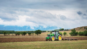
Joint venture between DroneDash and Geodnet targets oil palm, sugarcane and broad-acre operations across Southeast Asia, the United States and South America.
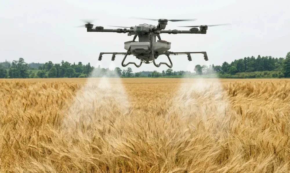
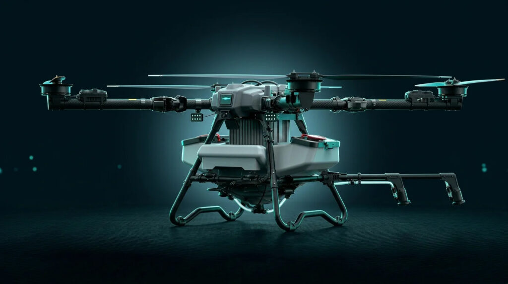
DroneDash Technologies and Geonet are forming Geodash Aerosystems Pte. Ltd. — a Singapore-incorporated joint venture to develop a new class of agricultural spraying drone for large-scale, industrial farming operations. Commercial deployment is set for Q3 2026.
Unlike conventional agriculture drones that require repeated manual pre-mapping before each deployment, Geodash Aerosystems’ platform uses real-time AI vision and centimeter-accurate RTK positioning to perceive, navigate, and adapt dynamically during flight. The result is faster deployment, lower operating costs, and continuous agronomic intelligence from the same system that does the spraying.
Credit: DroneDash
Most agricultural spraying drones in operation were adapted from general-purpose UAV platforms. Before each deployment, operators must manually survey and map the field, generate static flight plans, and repeat the entire process whenever terrain, planting patterns, or canopy profiles change. In oil palm plantations and large-scale row-crop environments, this mapping overhead directly limits how many hectares a team can cover and how quickly they can respond to emerging crop conditions.
The operational constraints are compounded the larger the estate. Manual pre-survey and field mapping is required before each deployment. Static flight plans must be recreated when terrain or canopy profiles change. Plans have limited adaptability to uneven terrain and mixed-age crops, when erosion or other changes occur.
Geodash Aerosystems’ drone architecture removes pre-mapping from the deployment workflow entirely. Using DroneDash’s proprietary AI vision system, the aircraft performs real-time perception of plantation structure, canopy height, and terrain features during flight. Geodnet’s RTK correction network delivers centimeter-level positional accuracy throughout each mission.
This combination enables:
deployment without pre-mapping or manual mission surveys
dynamic interpretation of rows, trees and operational zones
continuous altitude and spray-rate adjustment over variable terrain
rapid redeployment after replanting or field reconfiguration
tree-level and zone-specific variable-rate application.
Situational awareness is generated dynamically during flight — not through a separate pre-deployment process. Each aircraft maintains geofencing controls, safety constraints, and full operational data logging for regulatory compliance and audit traceability.
Agronomic Intelligence Layer
Each GEODASH Aerosystems drone is integrated with DroneDash’s AI Smart Farming backend, which transforms every operational flight into a continuous data-collection activity. Spraying missions generate field data used to produce:
canopy density and uniformity analysis
crop stress and anomaly detection
zone-level health scoring
spray effectiveness validation
terrain and drainage profiling
historical trend analysis across blocks and seasons.
Backend AI analytics then deliver actionable decision support to plantation managers and agronomy teams: early indicators of pest, disease, or nutrient stress; identification of underperforming zones; optimized spray timing and dosage; and data-informed planning for replanting and fertilization. The drone functions as a continuous aerial intelligence layer, not a standalone spraying machine.
Geodash Aerosystems targets industrial agriculture markets where deployment speed, terrain adaptability, and precision matter most: oil palm plantations in Southeast Asia; sugarcane, soybean and corn operations in the United States; and palm, sugar and broad-acre estates in South America.
Pilot deployments and system validation have been conducted throughout 2025 and into early 2026 in collaboration with plantation operators. Commercial deployment is targeted for Q3 2026, following completion of manufacturing readiness and regulatory approvals.
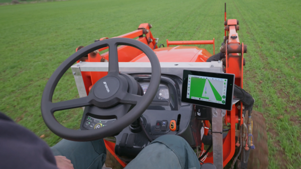
Topcon Agriculture has released its new Value Line Steering solution for farmers using mid-range tractors on small- to medium-sized farms. The new offering represents a significant step in making autosteering technology, typically used on larger machinery, accessible to a broader range of farmers.
“With the Value Line, we are opening up opportunities for farmers who have older or smaller machinery, or smaller specialty farms, to boost the value of their machinery, with autosteering technology that is based on our proven premium steering technology used for decades on larger machines,” said Antonio Marzia, executive vice president, Topcon Agriculture. “It is an integrated system designed to seamlessly work with a variety of tractors, including compliance with ISOBUS-UT functionality to offer universal compatibility and ease of use. Our goal is to provide high-quality, reliable, affordable, value-added technology that works across a wide range of applications, machinery and brands.”
The Value Line Steering solution is a comprehensive package that includes a GNSS receiver, electric steering wheel controller, touchscreen console and Horizon Lite software, compatible with front-wheel-steer tractors. Farmers also have the option to add local, satellite or RTK correction services such as Topcon’s Topnet Live for enhanced precision based on their unique needs.
Autosteering allows for more efficient use of resources, leading to reduced input costs for seeds, fertilizers, and fuel. This not only improves the farm’s bottom line but also contributes to more sustainable farming practices. The increased accuracy in field operations can also lead to improved crop yields, further enhancing profitability.
Farmers from various agricultural sectors, including commodity crops, specialty crops, and mixed farming systems, can expect significant benefits in their operations when adopting the technology.
The Value Line Steering solution is available through Topcon Agriculture’s global network of authorized dealers.
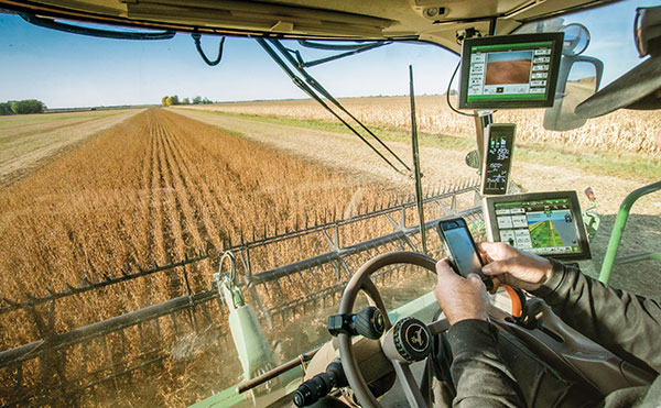
Many of us mindlessly shop for food, fuel, clothing, home goods and more without thinking much about where it all comes from, forgetting that in most cases it all started on a farm. Most people are unaware that a key component of agriculture production, besides the soil beneath our feet, is the use of critical technologies such as GPS and other GNSS contstellations. When fully leveraged, technology can be a part of the solution to many of the challenges farmers face today and be a tool in feeding a growing global population.
With technology at their fingertips, farmers across the globe can enhance their productivity through precision agriculture — a practice that uses GNSS technology to maximize agricultural outputs, while reducing farmer inputs and improving sustainability. Precision agriculture is used to till, plant and harvest crops such as corn, soybeans, cotton, peanuts, wheat, tubers and alfalfa. For example, techniques including yield mapping for fertilizer application have been used on fields across the country for more than three decades.
Social and Economic Benefits of Precision Agriculture
According to the U.S. Department of Agriculture (USDA), total U.S. farm output tripled from 1948 to 2021 largely due to advancements in technology — even as farm labor, land and other inputs declined. Farmers needed 8 million fewer acres to produce the same wheat yields in 2018 as in 1990, according to an American Farm Bureau Federation report.
A closer look at four crops commonly tilled, planted and harvested using precision agriculture techniques highlight technology’s economic benefits:
Sweet Corn: The United States is the largest producer of sweet corn at roughly 315 million tons per year, accounting for 34% of global production. There are more than 316,000 U.S. corn farms, 95% of which are family-owned. In 2021, Florida was the largest producer of sweet corn, followed by California, Washington and Michigan. The United States exports 69 million tons of sweet corn annually, yielding a value totaling $9.2 billion. China is the largest buyer of U.S. sweet corn, purchasing 31% of all U.S. exports.
Peanuts: In 2023, the United States produced roughly $1.6 billion in peanuts, led by Georgia — with 55% of total U.S. peanut production — followed by Texas (10%), Alabama (10%), and Florida (9%). In 2023, the United States exported more than $889.5 million worth of peanuts, with Mexico and Canada as top destinations. With new techniques to adjust digger conveyor speeds, yield continues to improve.
Cotton: The United States produces roughly 15 million bales of cotton each year, contributing to a $21 billion industry. Texas boasts the highest number of planted acres with 40% of the U.S. supply (6 million bales), followed by Georgia at about 2.5 million bales. The United States is the world’s leading exporter of cotton, totaling 35% of the total global supply. Farmers are increasingly using autosteer technology to help grow and harvest cotton — with the adoption of precision agriculture equipment jumping from 46% in 2008 to 86% in 2023, according to a survey conducted by Cotton Grower.
Wheat: The United States produces roughly 7% of the global wheat supply — accounting for roughly $12.7 billion — with Kansas, North Dakota, Montana, Texas and Oklahoma producing the most wheat across the country.
Precision agriculture also helps farmers work toward important conservation goals. Auto guidance capabilities and seeding sensors increase tractor and seeding efficiencies, reducing herbicide use by 9% and fossil fuel use by 6%. These small but important changes contribute to a wider effort to employ more sustainable agriculture practices, with precision agriculture and GPS technology sitting front and center.
Through it all, GNSS remains at the forefront of a strong, efficient agriculture system. Whether it’s auto-steering tractor technology or strengthened hydrology practices, new precision agriculture technologies are released every year. If broader adoption of precision agriculture technologies continues, the United States can increase its national crop production by 6%, bolstering the agriculture economy even further.
GPS Innovation Alliance (GPSIA) members Deere & Company and Trimble are at the forefront of advancing precision agriculture techniques globally, creating more opportunities for farmers to boost their productivity and reduce crop loss with innovative GPS and GNSS technologies.
Deere & Company offers several receivers that use GNSS technology to plant crops with accuracy down to the centimeter and coupled with the sensors and computer vision, allow farmers to plant at quicker speeds without damaging crops — including its fully autonomous 8R tractor unveiled in 2022. While Deere & Company had been developing new GNSS receivers for years, a critical partnership with NASA’s Jet Propulsion Laboratory (JPL) in 2004 was groundbreaking. Deere & Company modified its GNSS receivers to tap into the agency’s network of ground stations and incorporated JPL’s software. The innovation allowed them to introduce autonomous tractors worldwide, revolutionizing precision agriculture and leading to a wider acceptance of autonomous tractor technology.
Trimble has brought innovative solutions to precision agriculture since the company first began producing its agricultural GPS receivers in 1997. Since then, the company has unveiled state-of-the-art technologies to support farmers, including RTX technology which uses precise point positioning (PPP) to allow farmers to plant seeds and farm with sub-inch GNSS accuracy. Trimble also has announced several partnerships that strengthen the company’s precision agriculture capabilities from CNH and CLAAS (2011) to Horsch (2021) to AGCO (2023).
In 2022, Trimble deepened its partnership with agricultural machinery manufacturer CLAAS to integrate Trimble’s GPS PILOT system and SAT 900 GNSS receiver with CLAAS’ CEMIS 1200 display, providing farmers greater accuracy when tilling, seeding, spraying, or harvesting their fields. In April 2024, Trimble created a joint venture with AGCO to accelerate the pace of innovation and increase farmer’s access to precision agriculture technology.
Critical Role of Broadband in Precision Agriculture
Reliable broadband connectivity goes hand-in-hand with GNSS technologies and allows full use of agriculture technology and its resulting benefits. According to the USDA, more than 20% of rural households and farms do not have reliable access to broadband, limiting access to new technologies that would enhance efficiency and help farmers grow their businesses.
Industry leaders are working to ensure that farms across the country can reliably access the Internet. For example, Deere & Company, in partnership with SpaceX, is working to close the connectivity gap among farmers with satellite communications (SATCOM) services. Later this year, Deere & Company will begin to offer Starlink satellite communications technology to farmers across the United States and Brazil.
Beyond industry investment, the USDA’s Rural Development Broadband ReConnect Program provides grants and loans to strengthen broadband infrastructure and equipment in eligible rural areas. In addition, the National Telecommunications and Information Administration is overseeing the $42.5 billion Broadband Equity, Access, and Deployment program, intended to expand high-speed Internet access for communities across the country with little to no Internet connectivity. Establishing tech-neutral policies within these and similar programs as well as focusing on delivering coverage to uncovered agriculture lands to the last acre is key to improving efficient agriculture production.
Precision Ag on the Hill
Precision agriculture is also making its way into policy conversations at all levels of government as awareness around agriculture technology and its benefits are realized.
The 2018 Farm Bill established the Task Force for Reviewing the Connectivity and Technology Needs of Precision Agriculture in the United States (“Precision Ag Connectivity Task Force”) within the Federal Communications Commission. The Task Force is currently completing its third and final term this year and will have produced three comprehensive reports with related recommendations for policymakers.
The 2018 Farm Bill expired on Sept. 30, 2023, but was extended for one year to allow the U.S. Congress additional time to come to agreement on the next five-year reauthorization bill. The Farm Bill presents a key bipartisan legislative opportunity to include incentives for agriculture technology adoption. Lawmakers should consider previously introduced standalone legislation, including the PRECISE Act and the PAL Act, to accomplish this goal. Together, these bills would expand existing USDA programs to include precision agriculture technologies and create a new loan program.
Small family farms account for roughly 88% of all farms in the United States but make up less than 20% of all U.S. agricultural products sold. To increase yields and better compete with large-scale farms, farmers are increasingly turning to precision agriculture technologies — though availability remains a challenge. Understanding these statistics, efforts to promote equal access to precision agriculture enjoy bipartisan support from both chambers of Congress.
Reflection
GNSS technology’s role in precision agriculture continues to save farmers time and money, while simultaneously providing conservation-oriented solutions for farmers, consumers and the planet. GPSIA members Deere & Company and Trimble have contributed innovative solutions to precision agriculture technology for decades, enhancing efficiencies through groundbreaking partnerships and expanding opportunities for farmers to use the technology. These innovations, coupled with recent rural broadband expansion efforts, ensure farmers can access the most cutting-edge technology and continue to innovate. The focus on precision agriculture on Capitol Hill is an important reminder of the wider implications of GNSS in our everyday lives and how GNSS systems fit into the U.S. agriculture industry. GPSIA is proud to support its members as they continue to promote the use of innovative GNSS technologies in agriculture.
Trimble and Sabanto have partnered to integrate Trimble’s BX992 dual antenna with Trimble CenterPoint RTX into Sabanto’s autonomous solutions.
Farming requires a high level of uptime and reliability to avoid service disruption. By using Trimble’s BX992 GNSS receiver and satellite-delivered Trimble CenterPoint RTX corrections service, Sabanto’s autonomous solutions can now receive centimeter-level L-Band corrections across the globe. The integration aims to provide users with precise positioning, which can result in greater productivity, minimize downtime and alleviate workforce shortages through autonomous vehicles.
In addition to RTX corrections, Trimble will offer correction stream-switching enabling farmers to automatically switch from IP to satellite seamlessly, to offer the best signal in a variety of environments.
Precision agriculture (PA) — which uses electronic information to better manage spatial and temporal variability in crops, livestock, forestry and other biological systems — is profitable, as proven by the rapid and widespread adoption of GNSS guidance for mechanized agriculture. Other enablers of PA include variable rate technology (VRT), remote-sensing using satellites and unmanned aerial vehicles, geographic information systems (GIS) and soil sampling.
In my introduction to our January cover story, I requested pointers to any “independent, reliable and comprehensive study” as to PA’s return on investment. In response, Professor Won Suk Lee, of the Department of Agricultural and Biological Engineering of the University of Florida Gainesville, introduced me to Professor James Lowenberg-DeBoer, who has more than 30 years of worldwide experience in agricultural research, teaching, outreach and leadership and was the president of the International Society of Precision Agriculture. His research focuses on the economics of agricultural technology.
Dr. Lowenberg-DeBoer wrote to me that “thousands of studies of profitability of precision agriculture” using “a wide range of methods and assumptions” arrive at “a relatively consistent set of conclusions.” He detailed them in a chapter on the economics of PA he wrote for a book published in 2019 (Precision agriculture for sustainability, edited by Dr. John Stafford, Silsoe Solutions, UK and published by Burleigh Dodds Science Publishing) and pointed out to me that additional studies of the topic conducted since then have not altered its conclusions.
Lowenberg-DeBoer used adoption of PA as a proxy for its profitability, because, he wrote, “Farming is a business and technology is adopted if it provides benefits for the farmer and farm household.” He focused on PA for crops on relatively large-scale mechanized farms, but the same principles and general conclusions apply to livestock, forestry and other biological production systems and to medium and small farms.
“Since GNSS guidance was introduced for ground-based agricultural equipment in the late 1990s,” he wrote, “almost all economic studies have shown positive economic benefits which could be quantified and substantial qualitative benefits which were more difficult to measure.”
He reported that within about 10 years of the introduction of both lightbars and autosteer, GNSS was used by about 80% of the dealers. Adoption of PA sensors, on the other hand, was slower. “While GNSS guidance is being adopted quickly almost wherever agriculture is mechanized, VRT is more likely to be found in ‘hot spots’ where the profit potential and soil variability combine to motivate adoption.”
Advances in autonomous robots will further revolutionize agriculture, Lowenberg-DeBoer predicted. “Implementing cropping tasks with swarms of small robots will change agronomic practices and the geography of agriculture. For example, with robotic pesticide application, it might be possible to spray each pest individually instead of broadcast application. This could reduce the amount of pesticide applied by [more than] 90% and reduce the negative effects on beneficial species.”
Fuel and fertilizer prices are at all-time highs, as farmers the world over are scrambling to find ways to stay financially afloat. Large commercial farms have long had a leg up over smaller holdings. They already have access to artificial intelligence (AI) and cutting-edge hardware to plan their operations and automate tasks. They run broad sensor networks to monitor soil quality, operate vision-enabled drones to monitor crop health, and let autonomous tractors steer across their fields to vastly improve their productivity.
These advanced systems have been prohibitively expensive, to the point that their costs are hard to justify for smaller holdings, less than two hectares in size, which make up the vast majority of the world’s more than 570 million farms. Many of these farmers simply don’t have access to sufficient capital to invest in new equipment, and continue to rely on older machines and human labor. For them, the vast promise of the digital revolution to increase the efficiency of agricultural operations — typically lumped together as smart farming or precision agriculture — has long remained just out of reach.
But change is in the air. Over the past few years, the popularization of the internet of things (IoT) and its underlying technologies has led to the development of a new and more affordable generation of precision farming solutions. These solutions are giving smallholdings tools to increase the quantity and the quality of their production. Combining satellite-based positioning, wireless connectivity and visual sensing with advanced algorithms including machine learning (ML) and artificial intelligence, these solutions promise to help farmers produce more for less, putting them on more equal footing with their larger commercial competitors.
In this article, we take stock of key trends driving the democratization of precision agriculture. We zoom in on some of the concrete applications transforming the operations of smaller farms the world over. We start by exploring the core enabling technologies, the applications they enable, and where they are headed.
Technological evolution on all fronts
Sensor-fusion platforms
At their heart, precision agriculture solutions are sensor fusion platforms, taking in data points from a variety of sensors, using algorithms to make sense of them, and extracting insights on which their users — machine or human — can act. As they mature, these sensor fusion platforms are becoming increasingly complex, crunching more and more types of sensor data with algorithms of growing sophistication to gain ever deeper and higher value insights.
These insights are often generated using AI and ML models that run at the edge of the network near the sensors — on the tractors, sprayers, or other devices themselves — rather than in the cloud.
Equipment manufacturers looking to integrate AI/ML at the edge are weighing their options in terms of adding application processors and hardware accelerators capable of running advanced ML models needed to fuse camera and sensor inputs to make real-time decisions. To simplify the adoption of AI/ML at the edge, many vendors are starting to integrate AI accelerators into their modules and systems-on-chip (SoCs), lowering the barrier to entry.
Original equipment manufacturers (OEMs), for their part, are choosing to integrate these SoCs even if their software capabilities are still behind. For them, building solutions with future-proof hardware is a potentially lucrative strategy for generating recurring revenues through firmware updates that provide advanced functions down the road.
Despite the abundance of evaluation kits from major vendors, scaling from prototypes to production with these solutions can be expensive. While integrated sensor fusion platforms with, for example, pre-loaded dynamic vehicle models for auto-steering or computer vision models for plant health can accelerate development for OEMs and reduce the need for software investment, they can be too generic and may not solve use-case-specific needs. More focused AI/ML may require more investment in data collection and training models, which, due to their proprietary nature could come at a higher price.
Camera systems are already widely relied on by autonomous tractors, visually monitoring the surrounding environment and feeding their data into computer-vision solutions where it is parsed. Context-rich, vision-based data can help optimize the distribution of agricultural inputs such as water, seeds, fertilizers and pesticides using real-time variable spray-rate control based on plant size and other metrics to significantly improve efficiencies and reduce overall costs.
Camera systems come with a set of challenges that need to be carefully managed. Lenses can become contaminated with water, debris, dust, and snow. Even though these issues impact all vision-based applications, including mass-market applications such as automated and autonomous driving, there are still no reliable methods of keeping them clean, aside from water-spraying nozzles (that can cause buildup on the lenses) and old-fashioned manual maintenance.
Additionally, the steep price of high-resolution cameras can drive up the cost of end solutions, as can data storage and communication when the visual data is processed in the cloud.
Global navigation satellite systems
Satellite-based positioning has also become a staple in precision agriculture solutions. Autonomous and guided tractors use the technology to drive vehicles along precise paths to increase pass-to-pass efficiency and reduce overlapping rows. Crop monitoring drones use GNSS technology to patrol predefined flight paths. And fully autonomous guided vehicles such as robotic lawnmowers use it to avoid restricted no-go zones. The latter three applications typically require centimeter-level positioning accuracies.
Centimeter-level GNSS technology has been available for well over a decade, with farmers subscribing to relatively costly GNSS correction services tailored to each user. However, it was only with the advent of affordable RTK services with availability in rural areas, as well as the dramatic decrease in cost for farmers to deploy their own RTK base stations using low-cost modules, that the price point of high precision positioning has come down far enough to make the service affordable to all but the least lucrative operations.
High precision GNSS technology brings the benefits of improved pass-to-pass efficiency – a general reduction of all agricultural inputs with all the financial, environmental, and health benefits that this entails. At the same time, it requires solutions to deal with signal delays and the resulting inaccuracies of multipath effects, caused when signals bounce off buildings, mountains, or other solid structures on their way to the GNSS receiver.
When delivered via the internet, the GNSS augmentation data stream requires an IP connection to the provider’s server. This poses challenges for farms that lack infrastructures such as Wi-Fi base stations, sub-GHz RF systems, or cellular network coverage.
Photo: Avalon_Studio/E+/Getty Images
Wireless connectivity
In some way or another, all advanced precision ag use cases depend on wireless connectivity. Environmental sensors and inspection drones need it to relay data to the cloud backend. Additionally, tractors, drones, and other farm robots depend on it to upload telematics data, report their status, enable predictive maintenance tools to reduce downtime, and receive GNSS augmentation data for high precision positioning.
While cellular connectivity is the easiest to use — all it takes to upload data straight to the cloud is a mobile data subscription and a SIM card — it has two key drawbacks. The first, mentioned earlier, is that the entire farm needs robust network coverage, which is not always a given in rural areas even in the United States and other developed countries. Also, when coverage is available, the cost of data transfers can quickly add up and become prohibitive for smaller, less profitable farms, as they may not be able to negotiate affordable connectivity plans as effectively as larger operations that have much higher data usage.
One way to address the coverage issue is by choosing the right wireless communication technology. Low power wide area technologies, such as LTE-M, NB-IoT, and Cat-1 solutions offer similar coverage to traditional LTE in many countries and are available at a fraction of the cost. When higher bandwidths are required, LTE Cat 4 or higher modules offer 150 Mbps+ of throughput. 5G modules enabling gigabit connectivity are available today, but solutions may cost up to 10-times more.
As an alternative, 5G Redcap – an upcoming 3GPP technology – seeks to provide a 5G compatible, affordable solution with medium bandwidth and lower complexity, enabling affordable hardware. We will likely start to see the first RedCap offerings from mobile network operators in 2025.
Artificial intelligence and machine learning at the edge offer an additional tool to reduce bandwidth requirements, by processing sensed data near the sensors themselves. Rather than streaming vast amounts of raw sensor data to the cloud, devices leveraging edge intelligence can reduce their wireless communication bandwidth requirements and cost by uploading only relevant information.
The trends driving democratization
Progress in sensing and sensor fusion platforms, camera systems, GNSS technology, and wireless connectivity is but one of the drivers democratizing precision agriculture. The other is an ongoing ecosystem-wide transformation that is breaking down many of the barriers that have kept precision agriculture solutions the preserve of large, lucrative farming operations.
Together, they are bringing down the cost of ownership of precision ag technology. Only just a few years ago, the only available solutions from major OEMs came with a hefty price tag, comprising expensive hardware and considerable recurring subscription fees, while requiring skilled labor to implement, operate, and maintain smart equipment.
Vendor lock-in enforced by locking telematics interface ports prevented farms from adopting aftermarket solutions — justified as a way to improve safety and vehicle reliability. Ultimately, however, this limited farmers’ ability to maintain their equipment themselves and to piece together cost-optimized solutions tailored to their specific needs using components from competing solution providers.
Today, all of this is changing. Hardware costs are down dramatically due, largely, to economies of scale unleashed by the Internet of Things’ explosive growth. Farmers now have access to affordable, user-friendly aftermarket solutions to upgrade tractors and other agricultural machines they already own that depend on a new generation of more cost-effective GNSS correction services. OEMs are introducing advanced functionality in their entry- to mid-range tractors in addition to their premium product line.
At the same time, the abundance of open-source projects, module-based solutions, and pre-certified radio technologies are making the development of precision ag solutions cheaper, bringing down the cost of off-the-shelf hardware. Add to that lower subscription costs for GNSS correction services thanks to improved broadcast distribution with SSR-RTK (state space representation-real-time kinematic).
The total cost of connectivity is dropping as well. Deploying connectivity infrastructure was long a non-negligible cost point, made up of wireless infrastructure and data subscription fees. Today, thanks to the increased availability of cost- and power-optimized wireless communication technologies with broader coverage (LTE-M, NB-IoT, LTE Cat 1), farmers can reap the benefits of the overall expansion of cellular network infrastructure.
Arguably one of the most promising trends driving the democratization of precision agriculture technology comes from the farming community itself in the form of do-it-yourself solutions based on open-source hardware and software designs.
Take AgOpenGPS, also referred to as AOG, an open-source auto-steering solution created by a Canadian farmer and software developer. AOG delivers all the hardware design files, the real-time microcontroller firmware, and software required to enable auto-steering on conventional tractors, regardless of their age. Thousands of hours invested by the AOG developer community have made the solution accessible to the masses, both financially — retrofitting tractors can cost less than USD $1,000 — and in terms of prerequisite knowledge.
A growing variety of precision agriculture platforms, from high-end commercial solutions that cater to the most profitable farms to low-cost do-it-yourself solutions that can pay for themselves in a year and are accessible to smaller, less profitable operations, are transforming the impact that precision agriculture can deliver. With the global food supply under tremendous pressure, this democratization of smart farming technology could come to play an important role in feeding the world.
To learn more about how u-blox enables high-precision autonomous vehicles and other smart farming applications, visit www.u-blox.com/precision-agriculture.
JCB has launched its Fastrac iCON tractor to the public featuring the Hexagon | NovAtel’s SMART7 GNSS receiver. The tractor also offers optional TerraStar Correction Services driving the iCONNECT precision technology package and offering operators an easy-to-use customizable experience.
The SMART7-I included in the new Fastrac iCON tractor is a rugged, waterproof, all-in-one GNSS smart antenna designed and tested specifically for the agriculture industry.
Connectivity is with Wi-Fi and Ethernet. TerraStar and RTK corrections provide the centimeter-level accuracy required for any farming application. With multi-constellation and multi-frequency capabilities, it is a dependable solution for farms with treelines and obstructions that may impede satellite signals.
With the availability of TerraStar Correction Services, operators can have the highest accuracy and year-over-year repeatability globally. TerraStar offers fast, consistent positioning through the planting, spraying and harvest cycle with 99.999% uptime and availability.
“The iCON tractor is designed around the farmer. We wanted a GNSS solution farmers can rely on that stands up to harsh agriculture environments while providing the accuracy to support our precision technology,” said Greg Fitton, general manager, Fastrac Sales at JCB. “We chose NovAtel as our GNSS experts because of their demonstrated reputation for quality, cutting-edge technology and performance, and their willingness to adapt to our needs.”
Plus: UAVs in Ukraine, vineyard protection and a royally awesome light show
Taser-equipped drones
We hear of mass shootings in schools, and this week on a crowded street in Philadelphia a school adviser was among those killed. Everyone continues to be outraged, but as we wait for any sort of positive, preventive action by our leaders, an idea from a drone developer was shut down before it even got out of the company.
Axon taser drone concept. (Photo: Axon)
Axon Air supplies Tasers and body cameras to police forces, and last year someone came up with the idea of loading a drone with a Taser so that it could find and suppress a gunman in a school. There are a lot of problems with the idea, and Axon’s own internal artificial-intelligence board nixed the idea.
Doors were the board’s primary concern. What happens if something triggers a drone to Taser kids in the classroom or hallway? Could autonomous drones or even multiple intelligent cameras detect an actual weapon of any description, and set off an automated response?
We use metal detectors on entry to some schools to deter carrying weapons to class, but how about recognizing carried weapons in the school? To even attempt an automated drone response, you would need multiple Taser-equipped drones in all areas of a school, as well as time to test and verify that any autonomous response would work correctly.
Could anything along these lines be something we might consider in any way?
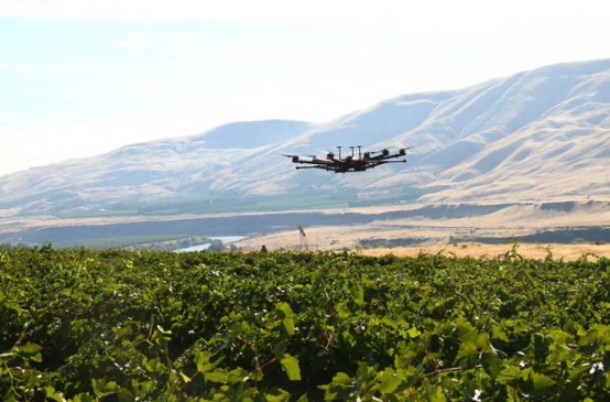
Keeping watch at vineyards
A team at Washington State University (WSU) has come up with a new twist on an old idea. Hawks have been trained effectively in the past to chase off flocks of birds on or around runways at airports or to protect crops. Now WSU has developed a system that uses intelligent cameras to detect birds, and which is then able to dispatch drones to the invaded area to chase off the birds.
The system has been tested to protect local grapevines. Bird fruit losses were actually reduced by ~50% following manual drone flights, which also reduced the number of bird invaders four-fold.
Manually flown drone patrols over vineyard. (Photo: WSU Agricultural Automation and Robotics Lab)
Nevertheless, birds can learn over time how to get round such deterrence, so WSU proposes disguising drones as predator birds and arming them with distress calls or raptor-attack behavior. WSU is looking for wine-industry support to develop this approach into a feasible, deployable solution.
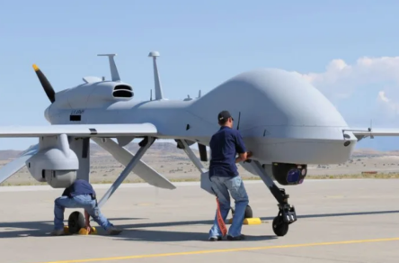
Grey Eagles might fly in Ukraine
The United States is considering providing Grey Eagle UAVs (the Army version of the Predator) to Ukraine — the first time a relatively high-tech drone with weapon-carrying capability would be supplied for the Ukrainian conflict.
The Grey Eagle can carry up to eight hellfire missiles, fly for 30 hours at relatively high altitude, and gather masses of surveillance information — a formidable, front-line weapon/reconnaissance system. Four UAVs are envisaged; missiles would not be included in the first round, but would likely come soon after.
Grey Eagle drone (Photo: General Atomics)
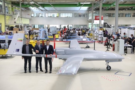
Th Grey Eagle UAV system usually requires months of advanced training, but the Ukrainian forces have already been operating the smaller missile-carrying Turkish Bayraktar-TB2, so training may be reduced to a few weeks for operational necessity. Meanwhile, the sale must first be approved by Congress, so nothing is yet certain.
Officials with a donated TB2 drone. (Photo: Baykar)
Before the war with Russia, Ukraine purchased up to 30 TB2 drone systems, and many have seen action in the current conflict. A crowdfunding effort by a TV station in Lithuania gathered enough cash to buy yet another TB2 to help Ukrainian forces stay in the fight.
However, Baykar, the Turkish manufacturer, declined the sale, instead offering to donate a TB-2 so that the Lithuanian funding could go toward humanitarian aid for the Ukrainian people.
Meanwhile, in Estonia the Internal Security Service (KAPO) arrested a man leaving the country who is suspected of supplying commercial drones to the Russian forces.
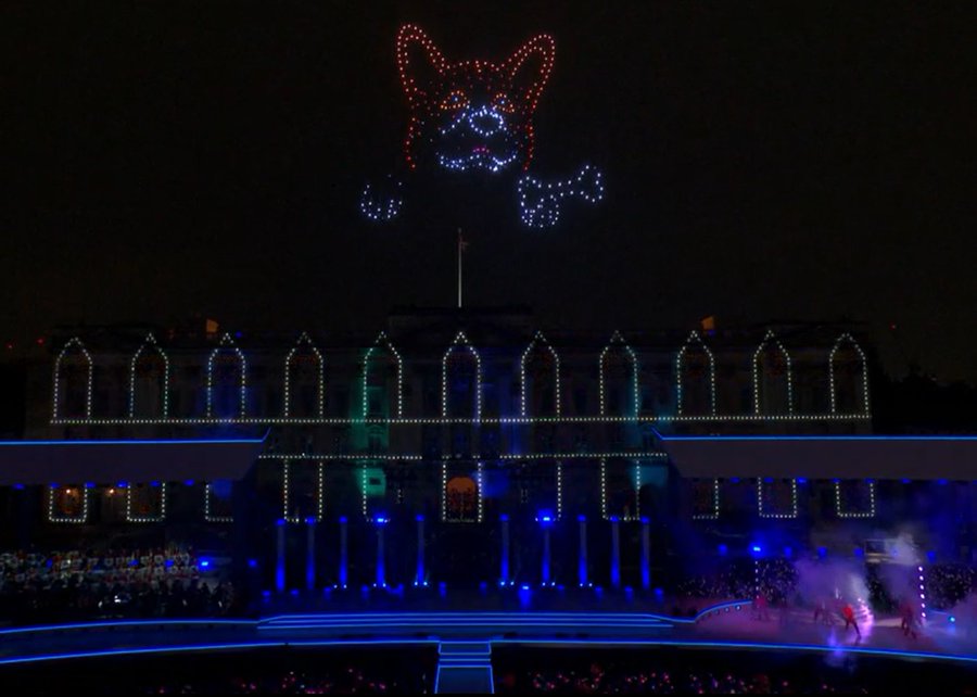
Photo: Platinum Jubilee Committee
Honoring the Queen
Finally — on a much lighter, respectful note — a drone light show was a big hit over Buckingham Palace in London on the occasion of the Platinum Jubilee concert for Queen Elizabeth II.
The queen has been on the United Kingdom’s throne for 70 years. To celebrate, the Brits hosted a major shindig. As part of a concert held outside Buckingham Palace, 400 lightshow drones from SkyMagic flew above the palace. The drones created various designs, showing the message “Thank you, ma’am”, a Corgi, a handbag, a teapot pouring into a teacup, guards in busbies, and a figurehead postage stamp — all good fun received in good spirit by a huge milling crowd.
Food for thought
To sum up, maybe it’s not such a good idea to have drones equipped with Tasers in schools, but perhaps it’s an idea we could build on to better protect our kids.
Trained, autonomous drones that take off and chase birds when they descend on vineyards — could this be a better solution than low-slung netting?
The war in Ukraine rages on. Not only the West, but also some Eastern countries pitch in with support.
Finally we saw a drone light show for the queen during the Jubilee celebration of her 70 years reign. We’re seeing a lot of smart drone potential out there.
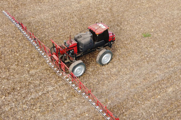
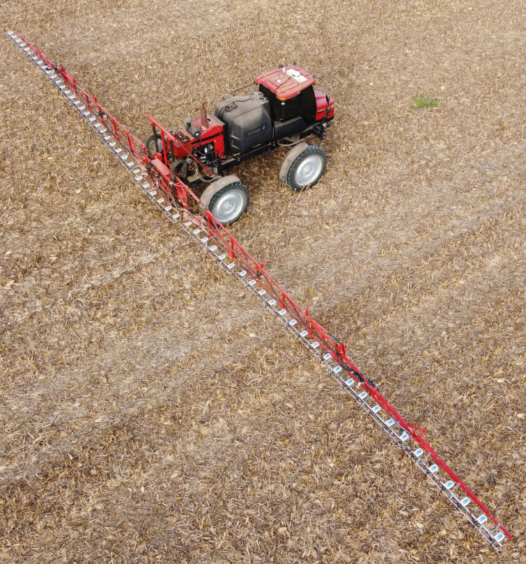
Controlling weeds is a natural challenge in agriculture. The cost of controlling these unwanted plants is also one of the most expensive line items in a farmer’s budget. For third-generation Brazilian farmer Ivan Bedin, trying to rid his 8,620-hectare soybean and corn farm of hearty weeds has been a costly challenge.
“Typically, we’ve had to blanket spray weed-killing chemicals throughout the entire farm,” Bedin said. “Even if only 15% or 20% of the area was weed-infested, we had to spray the total area. We were spending more than $145,000 a year on chemicals, and it wasn’t good for the environment.”
The Bedin family then acquired Trimble’s WeedSeeker 2 technology. This intelligent spot-spray system senses whether a weed is present and signals a spray nozzle to deliver a precise amount of chemical, spraying only the weed. By targeting resistant weeds individually, WeedSeeker 2 can reduce the amount of herbicides used by up to 90%, promoting sustainability and cost savings on the farm.
While driving 18–20 km/hr, the sprayer’s operator focuses on the WeedSeeker application while the AutoPilot system guides the sprayer. As he drives between crop rows, optical sensors distinguish the green of the crop from the green weed and release herbicide just on the weed. From inside the cab, the operator can monitor the spray system and adjust any application parameters in real time. With the reliability of the steering technology and the efficiency of WeedSeeker, Bedin has been able to reduce refueling time and cover his entire field 30% faster than with his conventional system.
Most importantly, the technology has significantly slashed his weed-chemical expense. “WeedSeeker 2 has yielded us nearly 90% savings in herbicide costs,” said Bedin. “Now we only need to spray between 10% to 30% of the farm — where the weeds actually grow — which equals a savings of about $70,000 for each 1,000 hectares sprayed. Additionally, because we use less herbicide, we impact the environment less.”
Because the spot-spray system logs and maps every weed sprayed, Bedin can also see in real time where there are weed infestations and review the detailed maps before the next spray. With the “seek and destroy” premise of WeedSeeker 2, Bedin’s formidable weeds may have finally met their match.
Farmers rely on their GNSS receivers to keep their machines on track, their maps accurate, and their rows straight in demanding environments. GNSS receivers on agricultural equipment need to continue to perform at a high level when faced with extreme weather, temperature and vibration while navigating varying terrain. In addition, farmers rely on the correction services that provide them with the high accuracy needed to keep them operating. Still, they face challenges with outages and interruptions from obstacles blocking satellite signals.
Hexagon | NovAtel’s SMART7 GNSS receiver and TerraStar Correction Services together create an accurate, robust and reliable solution for farmers. These products undergo extensive testing to ensure a high-performing and dependable solution. The SMART7 accesses all four GNSS constellations (GPS, GLONASS, BeiDou and Galileo), providing the best availability in variable terrain and environmental conditions. To compensate for the pitch and roll in the field, the receiver includes terrain compensation — keeping farmers at centimeter-level accuracy when using TerraStar-C PRO, TerraStar-X or RTK corrections.
Photo: Hexagon | Novatel
TerraStar Correction Services are based on a global network of advanced and proprietary GNSS control centers to ensure 99.999% signal availability to farmers. By delivering quality satellite corrections without the need for base stations, farmers can get the accuracy needed for their operations in a scalable format that moves with their equipment.
Jacob Van Den Borne is a potato farmer in the southern region of the Netherlands. He has been working with precision farming for more than 10 years and recently switched his Fendt tractor to NovAtel’s SMART7. Throughout his last season, Jacob noticed a substantial improvement in signal reception while passing along the edges of his heavily treed field. Previously, his GNSS equipment would lose reception, causing his rows to wander. After using a SMART7 for one season and experiencing its high precision and reliability, Van Den Borne plans to switch all receivers on his farm to the SMART7.
Evolving advanced driver-assistance systems (ADAS) and developing safe perception and positioning systems in the agriculture industry are top priorities for NovAtel. With the challenges faced by farmers, finding new ways to support a sustainable increase in their production and productivity will help ease the pressures of a growing population.
Automated steering systems have been widely deployed in advanced industrial countries and on large farms to improve agricultural productivity. However, technological and price barriers have constrained their wider adoption. Reliable RTK positioning and the expected accuracy of automated steering systems enable farmers to optimize their work efforts while reducing input costs and fuel consumption.
CHCNAV customer Niva LLC in Voronezh, Russia, was particularly interested in acquiring an automated steering system able to provide consistent high accuracy, even in scattered fields over long distances and with unstable coverage for GSM (the Global System for Mobile communication, a cell phone standard used in most of the world). Some systems Niva tested would lose GNSS RTK network correction signal reception while working in difficult terrain with gullies. A dual GNSS RTK correction source was therefore a key technical feature to ensure uninterrupted auto-steering operation in all terrain configurations.
The CHCNAV NX510 SE’s built-in connectivity modules include a 4G modem and an additional UHF radio module to allow farmers to work with RTK correction sources from local RTK networks or GNSS RTK base stations for no additional cost. As a result, the NX510 SE can receive GNSS RTK corrections from various GNSS network operators as well as from a local radio modem input to compensate for possible poor GSM coverage. The system’s combined GNSS+INS terrain-compensation technology ensures automated steering accuracy of 2.5 centimeters and offers excellent performance in ditching, seeding and harvesting applications.
Niva also wanted an auto-steering system that could be quickly and easily mounted on a variety of tractors and other farm vehicles at a price that would allow for rapid return on investment. The NX510 SE can be moved from one tractor to another in less than 40 minutes, as farming operations change. The software’s user interface for controlling field operations is designed for both experienced and casual users to allow even greater flexibility.
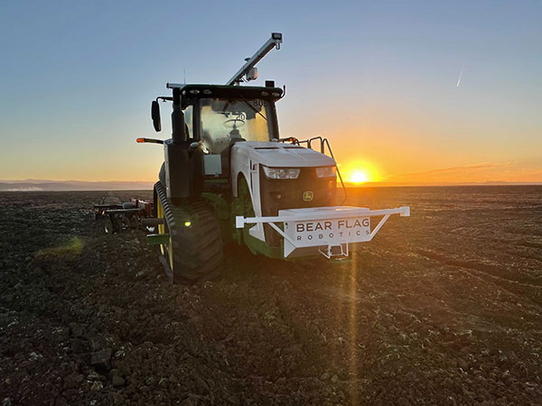
Deere & Company has signed a definitive agreement to acquire Bear Flag Robotics for $250 million USD. Founded in 2017, Bear Flag is a Silicon Valley-based startup that develops autonomous-driving technology compatible with existing machines.
The deal accelerates the development and delivery of automation and autonomy on the farm and supports John Deere’s long-term strategy to create smarter machines with advanced technology to support individual customer needs.
Deere first started working with Bear Flag in 2019 as part of the company’s Startup Collaborator program, an initiative focused on enhancing work with startup companies whose technology could add value for Deere customers. Since then, Bear Flag has successfully deployed its autonomous solution on a limited number of farms in the United States.
The Bear Flag team consists of agriculture professionals, engineers and technologists focused on autonomy, sensor fusion, vision, data, software and hardware. They will remain in Silicon Valley where they will work closely with Deere to accelerate innovation and autonomy for customers across the world.