PCTEL has launched its Trooper TRP-20INT platform, featuring models with a purpose-designed footprint to allow seamless installation on the leading 2020 police sports utility vehicles.
Photo: PCTEL
The Trooper TRP-20INT antenna platform supports the high-speed requirements of complex RF communication systems used for critical communications in FirstNet public safety and intelligent transportation systems (ITS).
These antennas feature two 5G elements compatible with leading cellular routers supporting 600-MHz to 6-GHz frequencies. In addition, PCTEL’s proprietary high-rejection multi-GNSS technology is included for high-precision tracking and asset management.
“In order to meet the communication demands of law enforcement, our Trooper TRP-20INT platform was specifically designed for installation on the raised ridges of police vehicle roofs. This method makes installation easier and optimizes RF performance,” said Rishi Bharadwaj, PCTEL’s chief operating officer.
“PCTEL brings strong RF and mechanical design capabilities to develop high-performance antenna systems for deployments in harsh environments in mission critical applications,” added Bharadwaj.
PCTEL also announced its new and improved PCTWSLMR-2 full-spectrum LMR mobile antenna, designed to support the leading OEM multi-band land mobile radios that enable interoperability among emergency management and response personnel. The new antenna incorporates a strong and ultra-flexible spring structure designed for maximum impact shock absorption, providing solid installation integrity even in low overhead-clearance situations.
PCTEL will showcase its new antenna platforms at IWCE, Aug. 24-28, at the Las Vegas Convention Center, Las Vegas, Nevada, booth 1215. Contact PCTEL for more details on product specifications and availability.
A new system, called WarLoc, makes it possible to locate warfighters and first responders in GPS-denied environments.
Created by Robotic Research, a manufacturer of autonomy and robotic technology, the system provides localization and positioning data for teams entering underground facilities and traveling inside buildings and in urban canyons.
According to the company, multiple systems — including, besides WarLoc, robotic systems, UAVs and manned vehicles equipped with its technology — collaborate to enhance accuracy and maintain the localization of teams.
Its system, the company said, is unique in that “it has very small 3D position error in such a small package” and its filtering algorithms, rather than being centralized, are “distributed and opportunistic in nature to provide the best solution given the communications available.”
In January, Robotic Research received a $16.5-million order for WarLoc from the U.S. Army Product Manager Sets, Kits, Outfits and Tools (PM SKOT) to support forward-deployed U.S. military personnel. The company will deliver the WarLoc units to equip four deployed U.S. Army Brigade Combat Teams. The first batch has been shipped. The procuring organization, PM SKOT, provides Army and Joint Services oversight of the lifecycle for all sets, kits, outfits and tools used by U.S. soldiers.
Distributed System
A self-contained localization system typically relies on GNSS signals, when available, complemented by inertial navigation. By contrast, the WarLoc is a distributed system meant to work as a team, said Alberto Lacaze, Robotic Research’s co-founder and president. The problem, he explains, is how to filter these devices. Centralized approaches, in which every device sends its information to a central computer that does all the filtering, “work very well for an incident commander with a group of first responders going into a building, where the distances are relatively small.” However, he pointed out, they do not work when communications go down.
The alternative approach is to filter the information opportunistically, in a distributed fashion, which is what WarLoc does. In GPS-denied environments, “there is a process that synchronizes all the nodes once the communications have been established,” Lacaze said. “However, if you have, for example, two team members that are each in their own radio bubble, their solutions will continue to be optimized and other team members might be in their own bubbles, so their solution is also being optimized. If these two teams get in contact, their information will get synchronized and collectively optimized.”
The system, he adds, is “heavily reliant on the inertial solution and dead reckoning.” The more units can communicate and share data, the more accurate the navigation solution is. “In a relatively small package, we can achieve better than 1% error of distance traveled for a single unit,” said Lacaze. “Once you have multiple units communicating and measuring with each other, the solution gets significantly better.”
WarLoc, which contains all the required hardware and software, connects to a system used by first responders and the Department of Defense’s Android Tactical Assault Kit (ATAK) also being used in GPS-enabled areas. “Our system can be used not only for tracking humans, but also for tracking animals and other devices, such as robotic systems or vehicles,” Lacaze said.
Relative Localization
On the commercial side, the company has created a kit for autonomous shuttles and is deploying it in about 20 cities around the world. Like WarLoc, this device also works in GPS-denied areas, such as on an underground shuttle on a university campus. “We just won a contract to automate the busses that go through the Lincoln Tunnel,” Lacaze said.
Busses or shuttles using Robotic Research’s system “learn landmarks in the area that they are traversing and use them as an aid in localization, in conjunction with inertial units,” Lacaze said. “The vehicles learn their surroundings.” They don’t care about their absolute position, he explained, only about their relative position with respect to those areas. This is similar to pre-GPS directions like “Make a left at the post office, then a right at the gas station.” They can also use a common landmark. “If the first vehicle is seeing a certain building and knows its lat/long and the second vehicle saw that building some time ago, it can measure its distance from it using its own inertial system.”
While warfighters communicate their position information via their personal tactical radios to ATAK, which then shares it through its current radio infrastructure, vehicles on the road communicate it through dedicated short-range communications (DSRC) radio, a cell network, or some other network.
Other Robotic Research Programs
Robotic Research’s technology supports a range of robotics and autonomous vehicles in GPS-denied environments, including shuttles and buses for public transportation, hybrid unmanned aerial and ground vehicles (UAVs and UGVs), and trucks in the U.S. Army Autonomous Ground Resupply (AGR) Expedient Leader-Follower program.
The company is the prime contractor on several Army programs, including AGR, which consists of robotic trucks that the Army will begin to deploy. “We have delivered close to 100 of those trucks,” said Lacaze. “So, for example, if you are in a convoy and you need to know whether your warfighters are inside or outside a truck, WarLoc can tell you.”
Robotic Research’s AutoDrive autonomy kit, which can be retrofitted to vehicles of all sizes, provides autonomous functionality on surfaces ranging from urban-improved roads to off-road terrain, while the vehicle collects and analyzes data. The technology provides automation to one of the largest international shuttle providers as well as to the largest U.S. manufacturer of commercial buses, according to the company.
In February, the company announced it will begin testing totally unmanned, fully autonomous, low-speed shuttles in the second quarter of this year. It will initially involve attendants in fixed on-site locations, then will aim to move attendants to an offsite safety-monitoring facility.
Image: 4X-image iStock / Getty Images Plus / Getty Images
Nearly 4,000 waivers granted under Part 107; about 20 percent of waivers granted to organizations received by first responders
Almost four years after the Federal Aviation Administration (FAA) established rules for the commercial operation of small unmanned aircraft systems (UAS), a new report by the Association for Unmanned Vehicle Systems International (AUVSI) found that nearly 4,000 operators across all 50 states have been granted waivers to go beyond current regulations.
First responders across the country received about 20 percent of all waivers granted to organizations (398), which demonstrates growing interest and need for public safety applications enabled by UAS, including search and rescue and firefighting at night.
Effective Aug. 29, 2016, the small UAS rule, also known as Part 107, created a uniform regulatory framework for UAS. Among the rule’s requirements, UAS must fly below 400 feet above ground level (AGL), within visual line of sight and during daylight hours.
Recognizing the need for the rule to be flexible to foster innovation, the FAA created a waiver process that allows for expanded types of operations, such as nighttime or beyond line of sight operations, with the approval of the agency.
AUVSI analyzed 3,946 of these waiver documents granted by the FAA since Part 107 went into effect. While the vast majority of waivers (3,636 or 92 percent) were granted to waive the requirement for flying only during the daytime to enable nighttime operations, the FAA has also granted waivers from other sections of the regulations to permit advanced operations, including:
Flights over people (112 waivers);
Operation in certain airspace (97 waivers);
Operating multiple UAS at the same time (55 waivers);
Visual line of sight operations (to enable beyond line of sight operations) (51 waivers).
Operators in all 50 states, as well as the District of Columbia and Puerto Rico, have received waivers. California leads the way with 451 waivers granted, followed by Texas (334), Florida (272) and New York (159). About 87 percent of all waivers were granted to small businesses with fewer than 10 employees and annual revenues of less than $1 million.
“Across the country, operators have demonstrated they are eager to harness the tremendous potential of expanded UAS operations,” said Brian Wynne, president and CEO of AUVSI. “Small businesses have been able to save time and money, and first responders and public safety agencies have used UAS technology to increasingly contribute to the greater good worldwide, supporting missions from disaster relief to humanitarian aid.”
Last month, AUVSI submitted its comments on the FAA’s Notice of Proposed Rulemaking (NPRM) for Remote Identification of UAS. In the comments, AUVSI urged the FAA to proceed concurrently with rulemaking that would allow for expanded operations rather than wait for a fully implemented remote ID rule to avoid unnecessary delays. The FAA says it hopes to issue a final rule before the end of the year.
In the interim, the FAA recently announced several initiatives to improve the waiver application process in response to a review last year of the waiver framework by a task group of the Drone Advisory Committee that was chaired by Wynne.
The FAA’s plans include expediting the waiver renewal application process, particularly in instances where there hasn’t been many changes since the original application; enabling quick administrative changes to previously granted waivers; providing more responsive feedback to applications that were not approved; streamlining the applications; implementing new regulations to obviate the need for waivers; and increasing transparency and accountability to provide support for waiver applications, disapprovals, and general UAS questions.
“The waivers that have been granted so far demonstrate that operators are safely able to conduct expanded operations, such as flights over people and beyond visual line of sight,” said Wynne. “While improvements to the waiver process are needed and welcomed, we urge the FAA to move forward rapidly with rulemakings that would enable these operations widely and provide the economic and societal benefits they offer.”
Terra Drone group company KazUAV has helped Nur-Sultan police to use drones to patrol and monitor illegal border movement and slow the spread of coronavirus in Kazakhstan
KazUAV, Kazakhstan drone service provider and a member of Japan-based Terra Drone Corporation, has been working at the frontlines to keep communities safe amid the COVID-19 pandemic outbreak.
Providing direct support to the operational headquarters set up to prevent the spread of coronavirus in Kazakhstan, KazUAV has been helping the Nur-Sultan Police Department to patrol the borders of the locked-down capital city with drones, ensuring “contactless” surveillance and fast-paced operations.
Nur-Sultan is the capital city of Kazakhstan.
The Central Asian nation closed its borders and locked down its main cities, including Nur-Sultan, after confirming the first coronavirus case on March 16. The oil-rich country that borders Russia and China also announced a state of emergency, set to last until April 15, adopting tough measures to combat the pandemic.
Some of the guidelines put forth by the Kazakh authorities include country-wide travel restrictions, suspension of public gatherings, and implementation of stringent sanitation and anti-epidemic measures.
A checkpoint on the border of Nur-Sultan. (Photo: Terra Drone)
All entrances and exits from Nur-Sultan have been completely blocked as part of these measures, mobilizing multiple law enforcement agencies of the Republic of Kazakhstan. Armored vehicles, barriers, and concrete blocks are being used to man the movement from the surrounding villages of Talapker, Karaotkel (Ilyinka), Koyandy, Kosshy and Zhibek-Zholy, on the Nur-Sultan-Petropavlovsk highway.
An additional post has been set up by the municipal government of the Akmola region in Shubary to ensure there are no cases of non-compliance by the Kazakh population.
KazUAV has been directly involved in the collection of information, operational monitoring, and coordination of actions of the Police Department and the Coronavirus Spread Prevention Operational Headquarters for all these areas.
A KazUAV drone takes off to monitor the borders of the Kazakh capital of Nur-Sultan. (Photo: Terra Drone)
Using drone-mounted cameras with both visible and infrared sensors, the KazUAV team has completed hundreds of flight hours, broadcasting all captured data, as well as the exact coordinates of objects of interest, directly to the operational headquarters command center. This has led to the authorities discovering multiple bypass roads and irregularities in the locked-down area – without which, the quarantine measures could not have proven effective.
When it comes to remote monitoring of vast areas, unmanned aerial vehicles are one of the best tools available to public safety agencies today. As a leading drone service provider in Kazakhstan, KazUAV not only gave Kazakh first responders access to cutting-edge drone technology, the company also assisted the enforcement agencies with the vast experience of its team of specialists, trained to operate day and night in the toughest of weather conditions.
The UAV ground control station at the Coronavirus Spread Prevention Operational Headquarters in Nur-Sultan. (Photo: Terra Drone)
“As international experience has shown, restrictions introduced to prevent the spread of the coronavirus are the most effective measures to fight it,” said Dmitry Ivanov, development director, KazUAV. “Of course, it’s hard for everyone now; it is a challenging time for each one of us. But the call to stay home is more relevant than ever in the context of drones. We are familiar with carrying out critical tasks like monitoring floods or patrolling important events, but this was an emergency request which needed an immediate response.”
GIS company GeoComm is partnering with Atos Public Safety LLC on its contract with the State of California to transform the state’s 9-1-1 system.
The upgrade will turn the state’s system to a broadband communication platform. The upgrade will give California — a state with a population of 40 million, more than many countries — the ability to intelligently route, manage and deliver a broad array of real-time information to 9-1-1, including text messages.
The change also allows for an exchange of information within the 9-1-1 centers to reduce response time, enhance situational awareness and increase first responder safety.
GeoComm, in partnership with Atos, will serve as the State of California’s statewide Next Generation 9-1-1 (NG9-1-1) GIS data services provider.
Reliable and up-to-date GIS data is critical in NG9-1-1 to ensure accurate routing of 9-1-1 calls in an Emergency Services IP Network (ESInet). GeoComm’s public-safety GIS solution will power the underlying GIS data quality delivered through the Atos NG9-1-1 IP network and the regional networks as the authoritative NG9-1-1 GIS data for the state.
In August 2019, Atos was awarded a five-year, $198 USD million contract with the State of California to transform the state’s 9-1-1 system to leading-edge broadband communication platforms that advance emergency services for the public, 9-1-1 professionals and first responders.
“Access to a secure, reliable NG9-1-1 IP network will have a tremendous impact on the effectiveness of communications between emergency callers and first responder resources within communities,” said Phil Rotheram, Atos. “Atos Public Safety has been entrusted to migrate some of the world’s most mission-critical environments and we are happy to partner with GeoComm in the State of California for the critical statewide GIS element,”
“GeoComm continues to be recognized throughout the country as the leader in NG9-1-1 GIS solutions and services,” said Erik Loberg, GeoComm vice president of product management. “We are honored to be working with Atos Public Safety LLC and the State of California for this exciting NG9-1-1 transformation project as the state migrates its 9-1-1 network, advancing emergency services for the public, 9-1-1 professionals, and first responders.”
Emergency response providers participating in a Design Thinking workshop organized by the ResponDrone Project have indicated that they would like to use drones to gather and distribute crucial information and provide communication networks in disaster areas.
Preliminary results from the workshop, held in Thessaloniki, Greece, in November, indicate that first responders view the constant provision of real-time information in crisis situations as one of the most valuable benefits arising from using drones in disaster management missions.
The results of the Design Thinking workshop will be presented and discussed with the ResponDrone consortium at the project’s General Assembly, which will take place on Dec. 10–12 in Paris.
ResponDrone is an international project co-funded by the EU and the Korean government, which aims to develop an integrated solution for first responders to easily operate a fleet of drones for multiple synchronized missions to enhance their situation assessment capacity and their own protection.
The workshop, attended by representatives from first-responder organizations and industry partners of the ResponDrone consortium, took place to assess the best possible system requirements.
The aim of the ResponDrone project is to develop and evaluate a situation awareness system for first responders in emergency situations. The system will provide crucial information and communication services to all relevant stakeholders in a disaster situation.
First responders said they would like the ResponDrone system to:
provide reliable and validated real-time information
be flexible and open to information from already existing data sources
be able to visualize different information layers in a customizable manner
be fast and easy to deploy
be able to provide near future predictions regarding the development of the disaster situation.
Workshop participants included regional and national authorities in charge of first response, state agencies responsible for carrying out on the ground first response actions, rescue services and fire departments from Greece, France, Armenia, The Netherlands, Latvia, Bulgaria and Israel.
According to the first responders, a disaster can initially be described as a black box, which needs to be opened. Gathering relevant and reliable information from the disaster area and combining it with already available data, as well as rapid distribution of information to all relevant stakeholders, are the top priorities in disaster management.
The deployment of drones as a means of enabling the afore-mentioned capabilities seems to be a promising approach. It is crucial that the data gathered by drones is presented to the right people as soon as possible, preferably in real time.
“The workshop clearly showed the urgent need for the constant provision of real time information,” said ResponDrone project coordinator Max Friedrich from the German Aerospace Center (DLR).
“First responders wish to receive real-time data on current occurrences in the disaster area, on the position and status of potential victims and the first response units deployed in field, as well as the status and current location of available resources.”
Friedrich added that the ResponDrone system would be designed to provide highly accurate real-time information. The flexible system would gather information from various data sources and should be designed for fast and easy deployment.
ResponDrone has already begun developing an integrated solution for first responders to easily operate a fleet of drones with multiple synchronized missions to enhance their situation assessment capacity and their own protection. This system of systems will simplify and accelerate situation assessment and sharing, decision making and operations management, while requiring only a small crew to operate it.
UAvionix is offering free pingRX unmanned aircraft system (UAS) ADS-B receivers to first responders and UAS service organizations participating in rescue and recovery efforts associated with Hurricane Dorian.
Hurricane Dorian is expected to travel along the Eastern coast of the U.S. northward at a slow pace, creating extensive damage from winds and flooding.
UAvionix is a designer and manufacturer of communications, navigation and surveillance (CNS) equipment for unmanned and manned aircraft.
The pingRX. (Photo: uAvionix)
PingRX is a dual-frequency ADS-B receiver designed for use onboard a UAS. Retailing for $249 and weighing 5 grams, pingRX can provide the operator with a digital view of ADS-B-equipped aircraft in the airspace up to hundreds of miles away.
When integrated with a compatible autopilot — such as ARDUPILOT, Pixhawk, PX4 or the Cube — local ADS-B traffic is displayed on the ground control station (GCS) display.
Image: National Weather Service
The FAA’s mandate for ADS-B OUT equipage on manned aircraft has a deadline of Jan. 1, 2020, so equipage levels are currently high. Users are cautioned, however, that equipage is not at 100%, so reliance on ADS-B as a sole means of detect and avoid (DAA) is not advised.
In 2017, in response to Hurricane Harvey’s landfall in Houston, Texas, UAS were used extensively for the first time in recovery and rescue efforts. The use of UAS has continued to grow in response to hurricane efforts ever since.
Photos: NOAA
“Over the past few years, the use of drones in hurricane and natural disaster recovery efforts has increased significantly due to the value of the real-time data collected in combination with ease of deployment,” said Christian Ramsey, uAvionix president. “First responders and recovery crews will undoubtedly work tirelessly for weeks in response to Dorian. We hope to make these efforts just a bit safer and encourage good airspace safety practices with the use of the pingRX systems.”
The FAA has published guidance for UAS operators, urging strict adherence to Notices to Airmen (NOTAMS) and Temporary Flight Restrictions (TFR). The airspace in these areas can be crowded and unpredictable.
First responders and UAS service organizations are encouraged to contact uAvionix at [email protected] for details on the offer.
Grand Bahama Island before Hurricane Dorian. (Photo: Google)
Airbus Defence and Space is celebrating the 25th anniversary of Eagle Vision, its lightweight deployable imagery downlink ground station designed to process and distribute commercial satellite imagery in near-real time to support U.S. Air Force and Air National Guard missions in homeland security, combat and disaster relief.
Eagle Vision allows downloading and processing of unclassified commercial satellite imagery directly in the field, as the satellite passes overhead, supporting military leaders, even in remote areas and non-anticipated operations. Imagery provided by this system supports wartime operations, natural disaster and relief efforts as well as Homeland Defense preparations.
“Today we celebrate an uninterrupted success since 1993,” said François Lombard, director of the intelligence business at Airbus Defence and Space. “Since then, Eagle Vision has become a valuable source for commercial imagery exploitation for the U.S. Air Force and many entities within the U.S. government, to provide fresh, near-real time satellite data for information extraction in preparation for mission critical applications.”
The system receives and processes SPOT 6 and 7, TerraSAR-X and Pléiades images, and is also capable of processing Landsat, Radarsat, RapidEye, Cartosat, Ikonos, Cosmo-SkyMed and Resurs-DK data.
The Eagle Vision Program has been a valuable asset within the U.S. Air Force for the past 25 years, the company said. The program enables warfighters, first responders and planners to have situational awareness so that they can plan, execute and deliver mission resources efficiently and effectively, Airbus said.
Five Eagle Vision systems have been developed and sustained 24/7 by Airbus Defence and Space for the last 25 years. They are assigned to:
Ramstein Air Base, Germany
San Diego Air National Guard Station, California
McEntire Joint National Guard Base, South Carolina
Public Services and Procurement Canada has awarded a contract to Ottawa-based Kongsberg Geospatial for an emergency operations airspace UAV tracking system.
Kongsberg Geospatial, an Ottawa-based developer of geospatial software technology, was awarded the contract to produce an Emergency Operations Airspace Management System (EOAMS) for evaluation by Canadian government agencies for safely managing drones at emergency and disaster scenes.
The contract was awarded via a competitive request for proposals under the Canadian Safety and Security Program in a project for Defense R&D Canada’s Centre for Security Science.
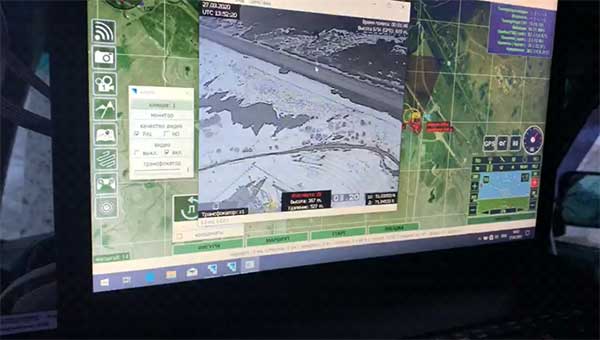
A small UAV is shown surveying the movement of a forest fire. The EOAMS would allow first responders to deploy drones at disaster scenes without endangering other emergency response aircraft or commercial flights. (Photo illustration: Kongsberg Geospatial)
The EOAMS is a portable display that interfaces with a variety of local sensors, including radar and Automatic Dependence Surveillance — Broadcast (ADS-B) receivers to give a clear picture of the airspace around disaster areas.
The system is intended to allow first responders to safely use unmanned aerial vehicles (UAVs) to survey the area, without risking collision with other emergency aircraft, including water bombers or rescue and police helicopters.
The system would also provide a warning to first responders if unapproved UAVs approach the area – providing a degree of protection against what is becoming an increasing problem with the proliferation of small consumer camera drones at fires and accident scenes.
The Government of Canada is expected to begin flight operations testing with the new Emergency Operations Airspace Management System in the summer of 2018.
“Securing and managing the airspace around disaster scenes or at big public events is becoming a real concern for all levels of government,” said Paige Cutland, IRIS program director for Kongsberg Geospatial. “Even if a drone operator isn’t acting with malicious intent, they have the potential to cause considerable harm if, for example, they fly into the path of an air ambulance. We need effective tools to help prevent this while also allowing legitimate UAV operations to be safely integrated into the emergency airspace.”
The new EOAMS will be based on Kongsberg Geospatial’s IRIS UAS airspace visualization system. The IRIS spatial awareness system evolved from technology originally developed for air traffic management display systems, and for supporting flight operations for military UAV systems like the U.S. Navy Triton Global Hawk.
The system has been developed for safely operating UAVs beyond visual line-of-sight (BVLOS), and has been adopted by the FAA ASSURE group for use in research toward developing regulations for commercial BVLOS operations in the United States.
“Kongsberg Geospatial has been pioneering innovation in airspace management for unmanned aircraft for over a decade,” said Ranald McGillis, president of Kongsberg Geospatial. “With the EOAMS project, we have the opportunity to introduce some really exciting capabilities in a portable system that will help first responders use UAVs in new and effective ways to support emergency response efforts.”
A team from Draper and the Massachusetts Institute of Technology (MIT) has developed advanced vision-aided navigation techniques for UAVs that do not rely on external infrastructure, such as GPS, detailed maps of the environment or motion capture systems.
When a firefighter, first responder or soldier operates a small, lightweight flight vehicle inside a building, in urban canyons, underground or under the forest canopy, the GPS-denied environment presents unique navigation challenges.
In many cases, loss of GPS signals can cause these vehicles to become inoperable and, in the worst case, unstable, potentially putting operators, bystanders and property in danger.
Attempts have been made to close this information gap and give UAVs alternative ways to navigate their environments without GPS. But those attempts have resulted in further information gaps, especially on UAVs whose speeds can outpace the capabilities of their onboard technologies.
For instance, scanning lidar routinely fails to achieve its location-matching with accuracy when the UAV is flying through environments that lack buildings, trees and other orienting structures.
Finding a Solution
DARPA awarded contracts to Draper and two other industry teams to create UAVs that autonomously sense and maneuver through unknown environments without external communications or GPS under the Fast Lightweight Autonomy (FLA) program. (Photo: Draper)
Working together under a contract with the Defense Advanced Research Projects Agency (DARPA), Draper and MIT created a UAV that can autonomously sense and maneuver through unknown environments without external communications or GPS under the Fast Lightweight Autonomy (FLA) program.
The team developed and implemented unique sensor and algorithm configurations, and has conducted time-trials and performance evaluations in indoor and outdoor venues.
“The biggest challenge with unmanned aerial vehicles is balancing power, flight time and capability due to the weight of the technology required to power the UAVs,” said Robert Truax, senior member of technical staff at Draper. “What makes the Draper and MIT team’s approach so valuable is finding the sweet spot of a small size, weight and power for an air vehicle with limited onboard computing power to perform a complex mission completely autonomously.”
Draper and MIT’s sensor- and camera-loaded UAV was tested in a number of environments ranging between cluttered warehouses and mixed open and tree filled outdoor environments with speeds up to 10 m/s in cluttered areas and 20 m/s in open areas.
The UAV’s missions were composed of many challenging elements, including tree dodging followed by building entry and exit and long traverses to find a building entry point, all while maintaining precise position estimates.
“A faster, more agile and autonomous UAV means that you’re able to quickly navigate a labyrinth of rooms, stairways and corridors or other obstacle-filled environments without a remote pilot,” said Ted Steiner, senior member of Draper’s technical staff. “Our sensing and algorithm configurations and unique monocular camera with IMU-centric navigation gives the vehicle agile maneuvering and improved reliability and safety — the capabilities most in demand by first responders, commercial users, military personnel and anyone designing and building UAVs.”
Draper’s contribution to the DARPA FLA program — documented in a recent research paper for the 2017 IEE Aerospace Conference — was a novel approach to state estimation (the vehicle’s position, orientation and velocity) called SAMWISE — Smoothing And Mapping With Inertial State Estimation.
SAMWISE is a fused vision and inertial navigation system that combines the advantages of both sensing approaches and accumulates error more slowly over time than either technique on its own, producing a full position, attitude and velocity state estimate throughout the vehicle trajectory.
The result is a navigation solution that enables a UAV to retain all six degrees of freedom and allows it to fly autonomously without the use of GPS or any communication with vehicle speeds of up to 45 miles per hour.
The team’s focus on the FLA program has been on UAVs, but advances made through the program could potentially be applied to ground, marine and underwater systems, which could be especially useful in GPS-degraded or denied environments.
A drone that weighs less than 50 pounds can provide fully functional 4G cellphone service.
Virginia-based Fenix Group has partnered with Martin UAV, a Texas-based manufacturer of rugged utility drones, to launch an under-55-pound drone capable of providing fully functional 4G cellphone service.
While Fenix Group plans to issue its first production units to the U.S. Department of Defense and first responders, it anticipates demand from telecommunications providers, oil and gas companies, and crisis response units worldwide.
It also could mean connectivity in remote parts of the world.
In addition to providing a coverage area on the ground, the payload is also able to stream encrypted video from the drone’s camera system to anyone on the network. In the future, soldiers, search and rescue teams, and first responders will have access to drone video from their phones.
The Fenix team also enabled Internet access so that command centers could access the feed from anywhere in the world.
DJI, maker of unmanned aerial vehicles, and DroneSAR, an Irish tech start-up for search and rescue, on Thursday announced a new search and rescue app that seamlessly integrates a drone’s unique aerial perspective on life-and-death searches into incident management software, ensuring rescue crews can use drones effectively to save lives.
DroneSAR can stream live images and video, from a regular or thermal imaging camera, to an incident command center as well as other rescue teams on the ground. The software can tag the GPS coordinates of a victim and automatically transmit them by email or SMS, enabling ground crews to reach victims more quickly. Completed search patterns are all recorded and logged for easy handover to oncoming rescue crews.
The app takes into account various types of terrain, allowing the drone to fly patterns to survey an area faster and more effectively. Flight paths can be adjusted for any terrain including hills, mountains, trees or flat land. The software allows users to choose an automatic aerial search pattern based on variables such as altitude, field of view, battery life and probability of detection. By organizing the process of data collection and providing a framework to manage and analyze it, DroneSAR ensures drones can be used methodically as part of a rescue protocol, allowing personnel to work more safely and effectively.
“From understanding on how to use the technology, to communicating findings and data, to figuring out the most appropriate tactical approach, first responders can benefit greatly from this software app on our DJI hardware,” said Romeo Durscher, director of Education at DJI. “Many of the tasks and strategies deployed during a search and rescue operation can get sped up with automation, helping to reduce the time it takes to find a victim and save lives.”
The software was developed based on research done by DJI in conjunction with the European Emergency Number Association and Ireland’s Donegal Mountain Search and Rescue team. The groups found that while a five-person rescue team on foot needs an average of two hours to find a victim in one square kilometer, a drone can do the job in 20 minutes or less while taking additional active steps to achieve a successful rescue.
“Our aim is to save lives,” said Oisin McGrath, co-founder and CEO of DroneSAR. “Our software will reduce risk to search teams and reduce search time. If we can save just one life, that is mission success for us at DroneSAR.”


 Eagle Vision allows downloading and processing of unclassified commercial satellite imagery directly in the field, as the satellite passes overhead, supporting military leaders, even in remote areas and non-anticipated operations. Imagery provided by this system supports wartime operations, natural disaster and relief efforts as well as Homeland Defense preparations.


