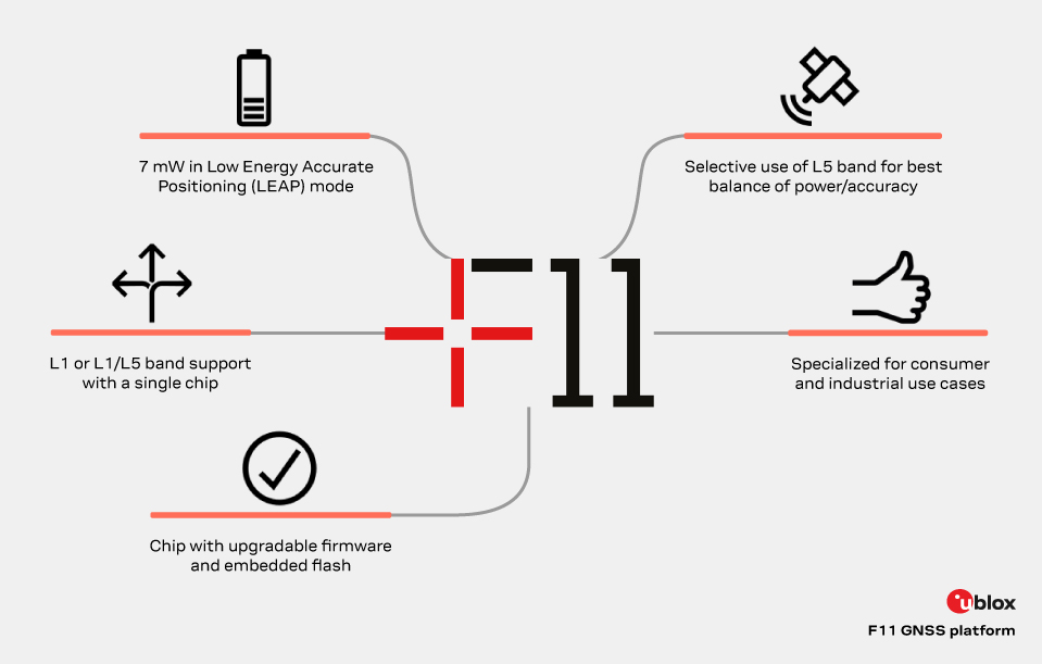
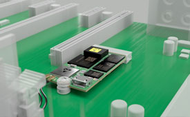
The new u-blox F11 platform provides L1/L5 dual-band standard-precision GNSS designed to significantly improve positioning accuracy while dramatically reducing power consumption to as low as 7 mW in typical configurations using low-energy accurate positioning (LEAP) mode for tracking and wearable applications.
The F11 platform marks a major step forward in meter-level GNSS positioning, the company said. It combines ultra-low power operation with intelligent signal management to meet the evolving demands of tracking, wearables, telematics and mobility applications — including micromobility solutions and drones. The platform enables device manufacturers to achieve longer battery life, faster and more reliable position fixes, and greater design flexibility, u-blox said.
Intelligent dual-band operation
Expanding power saving capabilities, the F11 platform is a new situationally aware GNSS architecture (with integrated geofencing and indoor detections) that dynamically balances accuracy and power consumption. By selectively using dual-band L1/L5 operation only when it helps maintain the positioning performance, the F11 platform reduces energy use while providing resilience and maintaining confidence in location data.
Compared to previous generations, the platform delivers up to 40% lower power consumption during signal acquisition and up to 30% lower power consumption in continuous tracking modes, while improving position accuracy by up to 30% in challenging environments such as dense urban areas. For long-life tracking applications (assets, livestock, pets and people), optimized first-fix performance further reduces GNSS on-time, enabling multi-year battery operation.
For scalable, high-volume applications
The u-blox F11 platform addresses the growing demand for GNSS solutions that are robust, power-efficient, and easy to integrate across a wide range of industries. The platform supports both single-band and dual-band operation within a single footprint, allowing device manufacturers to simplify designs and scale products across multiple market segments.
Key application areas include:
asset and fleet tracking
consumer and fitness wearables
aftermarket telematics
livestock tracking
people/pet tracking
industrial sensing and IoT
micromobility and mobility services
consumer drones and action cameras
By focusing on real-world performance rather than raw specifications, the F11 platform enables faster development cycles, improved user experience, and lower total system cost for OEMs — with form-factor compatibility and firmware upgradeability as a way to future proof designs.
Availability
The platform is being showcased at Embedded World 2026. First products will be available by the end of June 2026.
A roundup of recent products in the GNSS and inertial positioning industry from the June 2022 issue of GPS World magazine.
SURVEYING & MAPPING
Base/Rover
For survey-grade GNSS accuracy anywhere
Photo: Bad Elf
A base/rover feature built upon the Flex GNSS receiver brings affordable centimeter-level accuracy to surveyors and geospatial professionals working anywhere in the world. The solution consists of two Flex GNSS receivers and two UHF radios, allowing customers to perform high-accuracy field data collection in areas where traditional real-time kinematic (RTK) corrections or cellular coverage is not available. Existing Flex customers can upgrade by adding Flex radio kits (pictured). The Bad Elf Flex enables data collection either as a standalone receiver or paired with apps on iOS or Android phones and tablets.
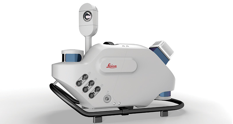
The Leica Pegasus TRK reality-capture mobile-mapping system features artificial intelligence (AI), autonomous workflows and intuitive interfaces. To comply with privacy regulations, its AI can identify and blur identifiers, such as people and vehicles, in real time. Features include advanced dynamic laser scanning and an expandable imagery system for recording, measuring and visualizing. It enables long-range mobile mapping for asset management, road construction, rail, critical infrastructure, utilities and more. The system also can create high-definition basemaps for autonomous vehicles.
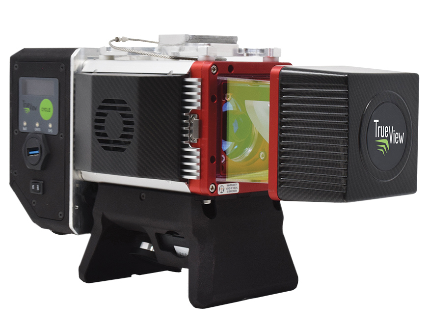
The True View 645/650 is the latest 3D Imaging System (3DIS) from GeoCue. Combined with the True View EVO data-processing software suite, it includes the full post-processing software workflow and directly integrates with Applanix POSPac. EVO supports the creation of project deliverables including ground classified point clouds, surface models, contours, digital elevation models (DEMs), volumetric analysis and wire extraction. The system delivers colorized lidar deliverables with accuracy better than 3 cm root-mean-square-error (RMSE) for the True View 645, and better than 2 cm for the True View 650.
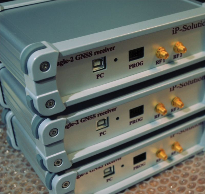
The Eagle-2 works with software-defined receivers in real time or records GNSS signals for post-processing. For post-processing, Eagle-2 supports most third-party receivers, such as MATLAB and C/C++ receivers. The front end allows a user to work with two perfectly synchronized channels connected to two antennas. The Eagle-2 supports GPS, Galileo, GLONASS , BeiDou, QZSS and SBAS.
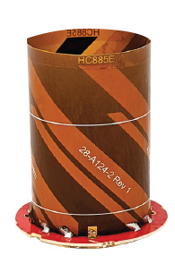
The housed HC885XF and embedded HC885EXF dual-band eXtended Filtering (XF) antennas receive GPS/QZSS L1/L5, GLONASS G1/G3, Galileo E1/ E5a/b, BeiDou B1/B2/B2a and L-band corrections services. They have been tuned to provide optimal support for the entire L1/G1/E1/B1/L-band correction and L5/G3/E5/B2 bands. The housed version, HC885XF, weighs ~42 g and is enclosed in a robust, military-grade IP67 plastic enclosure. The embedded version, HC885EXF, weighs ~8 g and is easily mounted with an embedded helical mounting ring.
Sets performance benchmarks for harsh environments
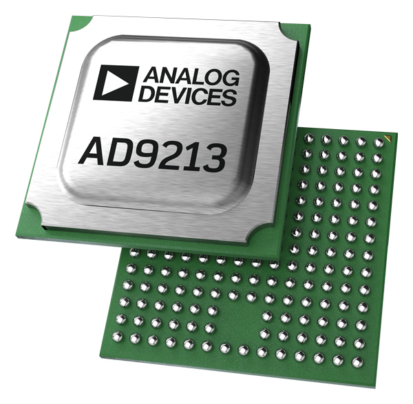
Photo: Analog Devices
The AD9213S-CSH is a highly integrated RF analog-to-digital converter that handles 12-bit, 10.25-giga-samples per second. It is the company’s fastest ADC available for the space environment. The AD9213-CSH enables the next generation of software-defined systems for satellite communications, radar and remote sensing. The high sample rate and integrated post-processing enable further performance gains for narrow-band applications.
Skyward has published a free ebook, Adding Drones to the Enterprise, to provide guidance on establishing a corporate drone program. According to Skyward, the most efficient and effective drone programs are the lowest risk and most compliant. Topics covered include how to present the business value of a drone operation to corporate executives; how risk managers can optimize the workflow to ensure maximum safety; best practices for risk mitigation and regulatory compliance; tips for collaborating with legal and compliance teams on a general operating manual; and how to provide full transparency to corporate stakeholders.
DJI’s all-in-one solution for professional drone operators includes the DJI Matrice 30 (M30) drone integrated with DJI FlightHub 2 fleet-management cloud software and DJI Dock for autonomous docking and recharging. The integrated solution is suitable for Enterprise drone users such as public safety agencies, infrastructure inspectors and energy operators. The M30 model is designed for rugged professional uses, while the fact that it fits in a backpack makes transportation and setup fast. The DJI Dock is an autonomous takeoff, landing and charging station allowing fully automatic, programmed flights with the DJI M30 Series (Dock Version). After setup, the fully charged M30 drone can take off from the dock through FlightHub 2 programmed automatic missions anywhere within a seven-kilometer radius.
The AlphaAir 1400 (AA1400) and AlphaAir 2400 (AA2400) lidar systems are lightweight, compact airborne scanners easily installed on various UAV platforms or small survey aircraft and helicopters. They are adapted to high-density point-corridor mapping applications, day or night, under leaf-on and leaf-off conditions or with dense vegetation to provide reliable results. Combined with industrial-grade GNSS receivers and high-precision inertial measurement units (IMUs), the AA1400 and AA2400 provide 2 cm to 5 cm survey-grade accuracy. They also integrate Riegl VUX lidars with waveform-lidar technology, allowing echo digitization and online waveform processing.
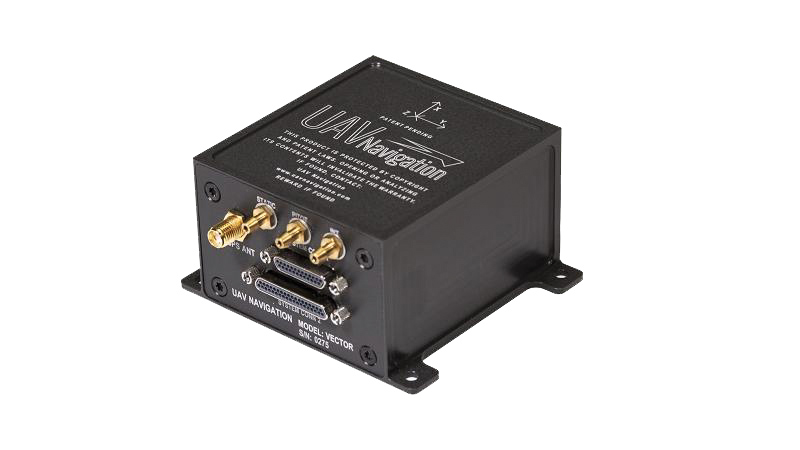
The VECTOR-600 is a robust, dependable autopilot with built-in physical and logical redundancy, allowing it to survive all individual sensor failures while maintaining accurate estimates of attitude and position. It works for fixed-wing, rotary-wing and vertical-take-off-and-landing UAVs. It provides exceptional performance in GNSS-denied environments and when there is a jamming threat. The VECTOR-600 features high quality components and an electromagnetic-resistant design tested to MIL-STD 461.
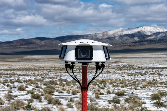
Casia G is a ground-based detect-and-avoid surveillance solution that provides 360° optical detection with alerts. It enables operators to avoid both cooperative and non-cooperative aircraft for safe beyond-visual-line-of-sight (BVLOS) flight. Casia G creates a perimeter of monitored airspace for UAVs to perform work safely, without additional payload. It is suitable for operations in fixed or temporary locations, supporting drone-in-the-box operations and augmenting or replacing human visual observers. Casia G sees the entire sky, with uniform probability and resolution, 10 times per second, covering a majority of small UAS use cases.
This month, we look at new applications that might interest even the most tech-savvy. From military Reaper unmanned vehicles being turned into civilian fire-fighters, through continuing drone flights on Mars, to e-scooters monitored by AI-system, the autonomous arena continues to grow.
Reaping Disaster-Response Benefits
The General Atomics Reaper unmanned aerial vehicle (UAV) is usually a weapon of war. Most of us picture them loaded with missiles to be fired on terrorist hideouts, with video of the impact appearing on the six-o’clock news. Soldiers in small control shacks guide these worldwide attacks, while politicians watch the outcomes remotely with their own direct TV coverage. This is how we tend to think of these destructive systems.
However, Reapers recently have been helping fight the huge fires devastating the California landscape — a more humanitarian, supportive role for a military asset.
General Atomics Reaper UAV on patrol and remote pilots (Photos: California Air National Guard)
The California Air National Guard (ANG) has been assisting firefighters for many years by using helicopters and fixed-wing aircraft to determine the intensity of large California fires and to plot their boundaries.
In the past 10 years, with the availability of large reconnaissance UAVs and assistance from the Federal Aviation Administration to develop and approve operational procedures, an approach has been formulated to employ Reapers, with the potential to reduce costs and greatly improve response times.
Having large UAVs at altitude in civilian airspace requires an accompanying chase plane to ensure safe operation. With proven onboard detect-and-avoid capability and visibility through crew monitoring, the chase aircraft only monitors the Reaper’s climb to operational altitude. Using infrared and video from onboard cameras, data is downlinked and post-processed to create fire maps. Artificial intelligence (AI) automates this procedure to provide incident commanders with a near-real-time situational overview.
Besides mapping the fire, the incident commander can keep track of firefighters on the ground and gain a clearer picture of the fire’s intensity, rate of growth and direction. With a high altitude view of the landscape, Reaper pilots also help determine the best evacuation routes. Video downlinks provide real-time fire dynamics to commanders and even to firefighters on the ground who carry handheld devices.
When equipped with long-range fuel tanks, Reapers can remain on task for up to 18 hours. The pilot and systems operator in their remote mission-control shack can hand over control to a new crew for such a long mission. The new crew can even be in a different location when it assumes control.
The experience gained in California regarding flight approvals, operations and use of data is being shared with remote UAV crews and emergency-response controllers in other U.S. jurisdictions as well as other countries. The procedures can be used not only for firefighting, but also for earthquake, flooding and hurricane response.
Our Martian Adventure
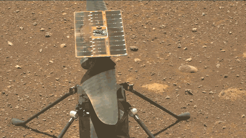
NASA has extended the mission on Mars of its Ingenuity UAV, which arrived on the planet attached to the belly of the Perseverance rover. The original mission was to establish that controlled flight on the planet’s surface was possible.
Ingenuity has now spent more than one year on the surface of Mars and has 21 flights under its belt. The diminutive copter has taken on an extended role of scouting out potential routes for its SUV-sized mother ship.
Integrity runs a “wiggle test” of its rotor blades prior to flight. (Photo: NASA/JPL-Caltech/ASU)
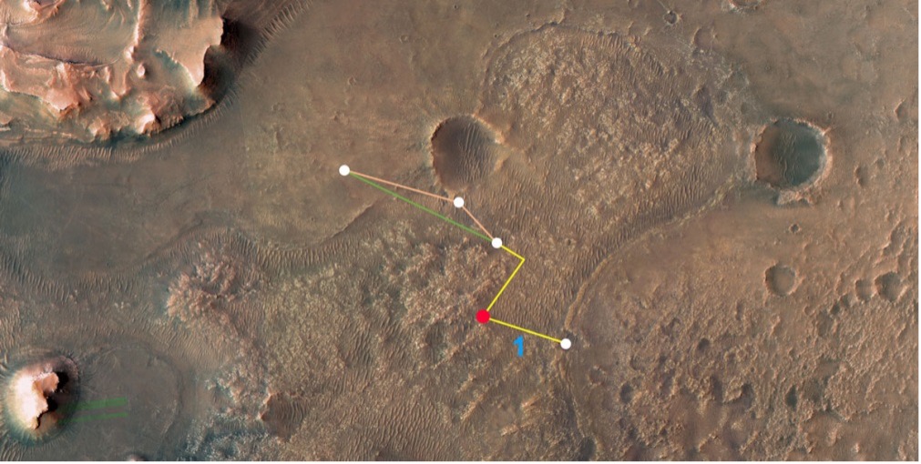
Ingenuity’s 21st flight is the first of at least three needed to transverse the Séítah region to reach its next base. From there, it will make flights to examine an old river delta. The whole relocation trip will cover about 1,150 feet as Integrity navigates around a large hill. While flying these investigative routes, the NASA team continues to gently push the drone’s capabilities to better understand improvements that can be applied to future Mars UAV designs.
Proposed route to reach river delta. (Image: NASA/JPL-Caltech/University of Arizona/USGS)
Once at the river delta, Ingenuity will encounter higher ground — up to 130 feet above the floor of the Jezero Crater, where it previously flew. The new area is expected to present significant obstacles: jagged cliffs, angled surfaces, rocky outcroppings and sand-filled traps. These obstacles could hamper the Perseverance rover or tip over the small drone on landing. But it’s also a place NASA thinks could harbor evidence of past life.
On arriving at the delta, Ingenuity’s first task will be to help decide which of two river channels Perseverance should take to climb to the delta. Data from the drone will also pick out science targets that Perseverance could investigate on the way. Once established in the delta region, NASA also hopes to fly Ingenuity to scout other features the rover might not be able to reach, but which might be accessible on future missions.
NASA has uploaded several upgrades to Ingenuity. They enabled higher, faster and longer flights and speed changes. The upgrades also have improved the drone’s perception of landing areas. Potential upgrades include adding terrain elevation maps and a hazard-avoidance capability for safer landing.
E-Scooters Adopt Pedestrian Defense
An outfit that rents e-scooters in more than 60 cities worldwide is adopting a “pedestrian defense” AI upgrade to prevent renters from abusing others around them and keep them riding within acceptable rules of operation.
LINK e-scooter. (Photo: Superpedestrian)
Previous efforts have only give riders visual and audio warnings that they should not enter a sidewalk. This new e-scooter active defense system slows the scooter to a stop and will not allow it to resume operation until it is moved outside the prohibited area.
Other unsafe behaviors — riding the wrong way up one-way streets, parking in the wrong place or aggressively swerving — also can be detected and actively deterred.
Sensors on the scooter provide data that relates location and activity to onboard stored city maps and geofenced areas. This enables application of enforcement commands within a second of them being detected.
The system provides cities and operators with visibility for the whole fleet of scooters. It shows what renters are doing within existing street safety restrictions, allowing both city and rental company officers to address perceived operational issues.
A roundup of recent products in the GNSS and inertial positioning industry from the December 2021 issue of GPS World magazine.
OEM
Satellite-cell terminal
With built-in GPS receiver
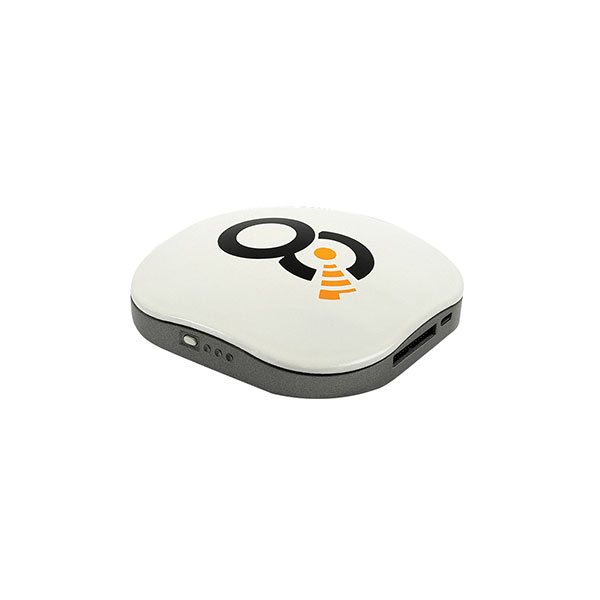
Photo: OQ
OQ Technology’s dual-mode satellite-cellular IoT modem and tracker is a plug-and-play, small, low-cost and low-power solution that can collect data from more than 1,000 sensors. It has a built-in GPS receiver and supports 5G NB-IoT, GSM, LTE-M and bi-directional satellite links. The flexible, robust and programmable dual-mode terminal has pre-paid data packages suitable for remotely monitoring and controlling fixed and mobile assets in industries such as transportation, oil and gas, utilities, and maritime.
Provides mission-critical, extended length GPS over fiber
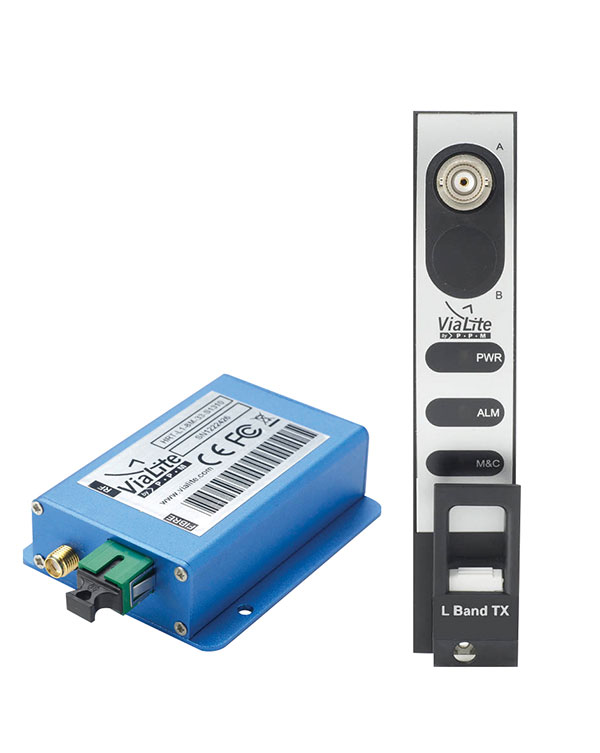
Photo: ViaLite
ViaLite’s GPS over Fiber Extension Kit for Microchip/Microsemi GPS timing servers provides mission-critical GPS timing and synchronization for systems requiring extremely accurate clock signals. Standard transmission distances for the extension kit can be up to 10 km, while solutions are available for distances as long as 50 km. The ViaLite kit was chosen for its unique performance with Microsemi’s S650 timing server. The ViaLite GPS link is designed to provide a remote GPS/GNSS signal or derived timing reference to equipment located where no signal is available, such as inside buildings or tunnels. By using optical fiber instead of traditional coaxial cable, extreme distances are possible with no radio frequency loss and zero introduction of noise.
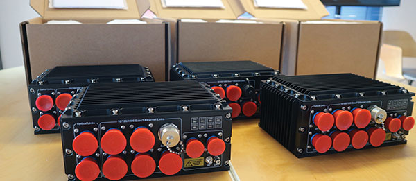
The RELY-MIL-TIME-SERVER, which complies with MIL-STD-810G and MIL-STD-461G, embeds the latest timing, networking and security technology in a single SWaP platform. The all-in-one rugged edge computing device acts as a high-performance master clock and serves secure accurate timing distribution (PTP, NTP, GNSS). The timing feature is combined with high-bandwidth and high-availability Ethernet switching and L2/L3 cybersecurity services in a unique commercial-off-the-shelf device. At its heart is a Xilinx Ultrascale+ MPSoC device powered by SoC-e hardware IP cores for PTP and high-availability low-latency Ethernet networking.
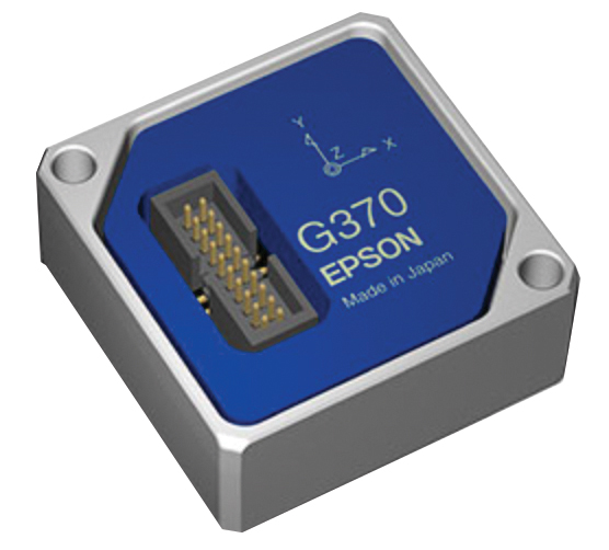
The M-G370PDS0 inertial measurement unit (IMU) is equipped with a high-performance six-axis sensor. It has an angle random walk (short-term variation in output) of 0.03°/√h, which is half that of its predecessor, and can more accurately detect very slight changes in the attitude of equipment and systems, since they do not get lost in sensor noise. The small size, light weight and low power consumption will help customers make their own products smaller and lighter. It also maintains compatibility with earlier products (the M-G370/365/364/354), making performance upgrades easy.
The OSA 5400 SyncModule enables technology suppliers to integrate precise synchronization into their hardware. Its M.2 form factor can add timing capabilities to switches, routers, open compute servers and other IT devices. The SyncModule provides GNSS, precision time protocol (PTP) and network time protocol (NTP) engines as well as comprehensive PTP and GNSS monitoring and assurance functionality. It can enable assured sub-microsecond timing in public and private networks as well as critical infrastructure. Featuring multiple interface options for easy integration, the OSA 5400 SyncModule comes with an open API. It also can be managed by ADVA’s proven Ensemble Sync Director management system.
Running on Microsoft Windows, u-center 2 offers anyone working with 10th-generation (M10) u-blox GNSS technology a highly intuitive interface to configure GNSS products, evaluate their performance, improve the quality of their software, and experience the performance boost achieved using GNSS-related services. The software is the successor to the u-center GNSS evaluation software, which has been used by design engineers for almost two decades to develop GNSS receiver applications. Compatible with u-blox M10 GNSS technology, u-center 2 is designed to offer improved performance over its predecessor. New features in u-center 2 simplify configuration, evaluation and software development of GNSS-based solutions. It is free for download.
The MEA-1227-SM is a GNSS/L1 and L2 low-profile screw-mount antenna. It has high performance suitable for maintaining constant network connectivity. The MEA-1227-SM covers all GPS/GLO/BEI/ QZSS/Galileo/SBAS/L1L2 standard frequencies. It is designed for telematics systems, remote surveillance, asset tracking and any internet of things (IoT) system applications. This screw mount antenna is easy to install, with a low profile suitable for challenging installations. It has a IP67-rated housing and anti-rotation mounting.
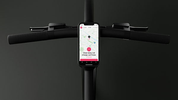
The Cowboy e-bike solution provides riders with high-performance, real-time GNSS accuracy, enabling them to map their own paths and those of the cities in which they live. It uses smart road-companion applications to ensure riders get precise information, regardless of the route they travel. The positioning component uses Taoglas’ Accura GVLB258.A, a multi-band GNSS L1/L5, high-performance stacked patch antenna, in conjunction with u-blox’s SAM-M8Q GNSS positioning module. The combination allows for extremely low power and high accuracy. The solutions works with “micromobility” services offered by Cowboy, such as Easy Rider for theft detection, bike insurance and crash detection notifications.
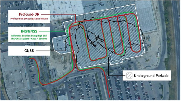
Instant decimeter-level accuracy with automotive sensors
Photo: Profound Positioning
The Profound-IVT (instant vehicle tracking) provides cost-effective vehicle navigation. Based on a firmware library, and rapidly adaptable to any navigation platform, IVT combines precise point GNSS positioning (PPP), dead reckoning and radar technologies in an integrated solution to provide decimeter-level positioning accuracy plus orientation and velocity. IVT performs in tunnels, dense urban environments, multi-level highway junctions and parking garages. With errors <1% of distance travelled, resolution is extremely rapid. Base stations are not required and there are no operating range limitations. Applications include driver assistance, mobility and taxi, autonomous vehicles, geofencing, fleet tracking, insurance, driving and safety management, and connected driving.
Off-the-shelf map data through the HxGN Content Program
Photo: Hexagon
Metro HD city data is a new offering of ultra-high-resolution 2D and 3D digital twins of major cities. Metro HD expands the data stack to include high-definition true orthophotos, obliques, digital terrain models, lidar point clouds, 3D building models (LOD2), 3D meshes and land-use maps. Cities captured in 2021 include Munich, Cologne, Vienna, Milan, Amsterdam, Stockholm, Tokyo, Dallas, New York, Stuttgart and Frankfurt. More cities will be added in early 2022. The program uses a hybrid urban mapping sensor, the Leica CityMapper-2, that concurrently collects lidar and aerial imagery. The derived products, based on the strength of each subsystem, result in superior accuracy and temporal consistency across all three data dimensions.
Bad Elf LLC and Laser Tech are providing an integrated laser offset workflow for acquiring high-accuracy field data in GNSS-challenged environments. The new workflow integrates Bad Elf and LTI hardware in collaboration with ArcGIS technology from Esri. The Bad Elf Flex GNSS receiver connects to any LTI TruPulse rangefinder over a wired or Bluetooth connection to deliver high-accuracy location data to Esri ArcGIS Field Maps. Field workers can now efficiently complete position and height data collection in access-limited situations, saving time, money and effort. The Bad Elf app workflow runs on Android and iOS.
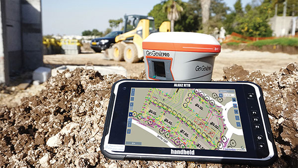
Geo-genie is a cloud-based collaborative and professional mapping and surveying platform enabling customization and creation of geocentric information systems. Teamed with Handheld’s Algiz RT8 rugged field tablet, it streamlines work and allows non-professionals to perform accurate geodetic mapping, guiding and monitoring of their data collection. The platform enables organizations to have an advanced, professional surveying and GIS platform with customized procedural workflows, management of user hierarchies, and integration with other organizational information systems. Geo-genie can connect with professional surveying equipment, such as GPS and total stations, and integrates data into a cloud-based central database with no restriction for specific data-collection hardware.
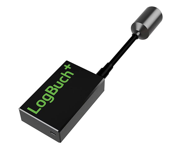
The wireless GNSS amplifier LogBuch+ increases the accuracy of location data with the cloud-based LogBuch application. The app enables voice-based digital mapping via a smartphone app, such as for the maintenance of trees. The compact device receives satellite signals on several radio frequencies, delivering significantly more precise data than a smartphone alone. Foresters can carry the GNSS amplifier in a pocket and digitally mark trees for felling using the LogBuch app.
The YellowScan Explorer lidar can be mounted on a light manned aircraft or helicopter, as well as a UAV platform such as the DJI M300. This versatility allows the end user to tackle a wide range of projects with the same unit. It uses an Applanix APX-20UAV GNSS/inertial solution and has a precision of 2.6 cm and an accuracy of 2.2 cm. Its high-power laser scanner can catch points up to 600 meters away. Flight operation speed is 5–35 m/s; it is capable of above-ground-level altitude up to 300 m. The low-weight unit (2.3 kg without battery) can be combined with YellowScan’s suite of software to extract and process point cloud data for surveying, forestry, environmental research, archaeology, industrial inspection, civil engineering and mining sectors.
The DJI Mavic 3 improves on its predecessor with better sensors, a dual-camera system, omnidirectional obstacle sensing, smarter flight modes and longer flight times. A powerful positioning algorithm improves hovering precision with signals from GPS, GLONASS and BeiDou satellites, enabling the drone to lock onto multiple satellite signals faster. The increased positioning precision also makes the drone less likely to drift in the air and more stable when shooting long exposures and time lapses. The Advanced Pilot Assistance System (APAS) 5.0 combines inputs from six fish-eye vision sensors and two wide-angle sensors to sense obstacles in all directions and plan safe flight routes.
Conduct missions, manage fleets and view video feeds
Photo: SkyGrid
SkyGrid’s autonomous remote UAV operations solution enables drone operators to remotely conduct missions, control flights, manage fleets and view live video feeds. Using artificial intelligence and airspace-related data feeds, SkyGrid enables safe remote operations, whether conducting routine inspections or generating optimal flight paths. Advanced route generation capabilities create the safest route for each drone based on the flight plan, environmental conditions, the vehicle’s performance, and the mission criteria with minimum on-site support required. SkyGrid Launch allows video feeds from drones to be consolidated to a remote central location, such as a ground station.
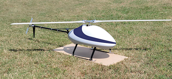
The Sicura EG-1100 is a heavy-lift, long endurance, single-rotor helicopter. Now in its third generation, the helicopter can haul 15 pounds. It cruises at 55 knots. The EG-1100 is available in both electric and gas engine configurations, with an endurance at 3.5 hours on gasoline and 1 hour on electric power. The new gas engine is the high-performing and efficient Skypower 110, tuned to the craft’s internally developed chassis and rotor blades. It offers stable performance in challenging environmental conditions, exceptionally stable flight and immediate flight response for image capture and lidar operations. Multiple payload sets can be carried in one flight.
The Spirit dual-rotor coaxial unmanned aerial system (UAS) is a versatile and durable system for mission-critical operations. Combined with a fully modular, plug-and-play payload design, the Spirit’s open architecture allows operators to easily add or upgrade software to unlock new operating capabilities without the need to design or develop a new aircraft. It has an all-weather airframe. With nearly 10 pounds available for batteries and payloads, Spirit sets the new standard for performance in its weight class. Setup is quick and easy, allowing for takeoff from any type of terrain. The highly streamlined all-weather airframe has a top speed of 60 miles per hour and can operate in high winds. Payloads and batteries can be mounted or stacked on the top or bottom point.
Telit, a global enabler of the internet of things (IoT), has launched the LE910S1-ELG, a new LTE Cat 1 module designed for IoT applications in Latin America (LATAM) that need a combination of performance, affordability, voice support and 2G fallback in a compact form factor.
With an embedded GNSS receiver, the cost-optimized LE910S1-ELG is suitable for tracking applications such as fleet management, stolen-vehicle tracking and recovery, and other mobile IoT applications that need to maintain a reliable connection when moving around in a country, region or multiple regions.
The LE910S1-ELG is the latest member of Telit’s flagship xE910 module family, whose unified form factor and electrical and programming interfaces spanning 2G, 3G and 4G products enables developers to implement a “design once, use anywhere” strategy. The module supports LTE Cat 1 with single-antenna reception, providing downlink speeds of up to 10 Mbps and uplink speeds up to 5 Mbps. Its streamlined configuration, compared to LTE Cat 1 devices with two antennas, helps significantly reduce cost and complexity.
Supporting 2G fallback, the LE910S1-ELG is suitable for applications that require full mobility throughout the LATAM regions, including areas that have not upgraded to 4G yet. It also supports both circuit-switched voice and VoLTE for those applications that require making phone calls, such as healthcare mobile personal emergency response systems (mPERS), connected elevators, alarm systems and more. The power-saving embedded GNSS receiver enables the use of GNSS positioning even when the cellular modem is switched off.
“The LE910S1-ELG is a great option for migrating customers that use legacy 2G and 3G modules in Latin America, especially where nationwide LTE-M and NB-IoT coverage does not yet exist,” said Marco Stracuzzi, head of product marketing, Telit. “Our all-in-one cellular and GNSS module covers all LATAM 4G and 2G bands, as well as mainstream bands used in Europe and Asia, which makes it well-suited particularly for high-performance tracking across intercontinental deployments.”
The LE910S1-ELG is sampling now, and will be commercially available during the first quarter of 2022.
Raven Industries has partnered with Razor Tracking, an SaaS and mobile application-based fleet tracking and management system, to provide ag retailers and enterprise farms with an expanded fleet and asset tracking suite through the company’s Slingshot platform.
As a result of this partnership, Slingshot Fleet Tracking will be available as the integrated logistics tracking component of the Raven Slingshot platform. According to Raven, Slingshot Fleet Tracking allows users to seamlessly and wirelessly connect their office to the field by providing accurate location and machine running data in real-time. This partnership gives ag retailers and growers immediate fleet information — including work, idle and transit times — to better manage their equipment, assets and operations, the companies said.
“This agreement enables Raven to quickly expand unmatched value to our growing ag retailer and grower customer base,” said Paul Welbig, director of Slingshot services & logistics for Raven Applied Technology. “From machine performance to diagnostics, and now expanded tracking of both in-field and operation support assets, users of Raven’s Connected Workflow can expect 20% efficiencies gained when using the technology delivered through the integrated Slingshot platform. This partnership continues our focus to offer efficiency-driving solutions that help reduce variability and increase profitability for our customers.”
By leveraging Razor Tracking’s capabilities, Slingshot Fleet Tracking provides users with accurate real-time data on where their vehicles and assets are located to better maintain schedules for dispatching and increase overall efficiency, the companies added. Through the partnership, users will now also be able to monitor non-Raven equipped assets, including other battery-connected equipment and non-powered equipment.
Customers will be able to subscribe to Slingshot Fleet Tracking to use it in their own operations beginning June 2020.
Teletrac Navman, a global software-as-a-service provider that leverages location-based technology for GPS tracking solutions, has launched its fully integrated Driver Safety Analytics Solution.
Part of the Teletrac Navman Director platform, the safety analytics solution combines GPS tracking data and event replays, dashboard camera technology, driver scorecards and analytics on a single platform so fleet managers have all the information needed to reduce risks and implement safe driving practices across their fleets, the company said.
“I have a full view into safety and the solution makes everything fact-based. Before I had perceptions of how my drivers behave on the road, but now I have proof,” said customer Bonnie Lantz, director at P&B Transportation. “I can see training needs and, of equal importance, our drivers’ incredible defensive driving when cars around them behave erratically. Our insurance company and drivers both wanted the cameras, and I expect it will save us money and give our whole fleet a better grasp on safety.”
The Director Safety Analytics module provides insight into driver-specific and fleet-wide behavior to create a safety-focused culture, recognize and retain great drivers, and improve the insurance claims process. Features include:
The Integrated Event Viewer lets fleets simultaneously view driving event replays and unsafe behaviors on Google Maps, using GPS tracking data, and second-by-second Dashboard Camera video footage for quick response to and resolution of incidents.
Front-Facing Dashboard Cameras continuously record HD quality video footage, with recordings of all events stored in the cloud. In addition to getting a complete picture of events, footage can be used as supporting material in the event of an insurance claim and to protect against driver fault in accidents.
Driver Scorecards track and rank driver improvements over time for personalized training, in combination with event replay and live footage, and to recognize positive driver behaviors.
Reporting & Alerts measures speeding, harsh breaking, erratic cornering and other dangerous behaviors through GPS tracking and proactively alerts fleet managers. It lets fleet managers build dashboards around safety KPIs and do in-depth evaluation on fleet-wide and individual driver safety performance to easily communicate performance trends, create targeted improvement plans and build incentive programs that encourage safe driving.
“We built this solution to give fleets absolutely everything they need to build a culture of safety,” said Daren Lauda, general manager of North America, Teletrac Navman. “The high-level fleet benchmarking is easy to drill down into to understand how individual drivers are performing. Add in the integrated telematics and corresponding video footage and fleet managers have a complete, real-life picture of safety to fuel individualized training, track progress and protect their drivers in incidents.”
By Jason Penkethman, Chief Product Officer at Spireon
Fleets looking to take their operations to the next level look to GPS solutions for the obvious benefits — driver/vehicle location tracking, driver behavior monitoring, improved efficiency — and some that are not so obvious, such as making a positive impact on the environment.
“Going green” can be an arduous task, requiring constant calculations and adjustments to ensure that a fleet’s reduced environmental impact doesn’t negatively affect normal operations.
Fortunately, GPS fleet management solutions have come a long way and go far beyond simple geolocation. We live in an age where technology empowers fleet managers to go green – both environmentally and fiscally. And with effective communication and transparency, even drivers who once may have perceived fleet tracking as “big brother” are now seeing how joining the green initiative puts green in their own pockets.
The Case for Smarter, Eco-friendly Workdays
No matter the size of the fleet, reducing unnecessary drive time saves time, gas, and reduces carbon footprint. When last minute changes or emergencies arise, fleet tracking allows managers to dispatch the nearest driver for faster, more effective resolution. Fleet tracking also allows better planning of a driver’s day with proximity as a guide.
Image: Spireon
Eliminating Paper Waste. To properly manage a fleet, there is a seemingly endless stream of logs and diagnostics for drivers, cargo, vehicles and more. Implementing GPS tracking will cut back on the paperwork for managers and drivers alike by automating what once were manual processes and making compliance with new federal regulations such as the ELD mandate and the Food Safety Modernization Act a breeze.
Cutting Unnecessary Emissions. Idling and abrupt acceleration or braking are the biggest culprits of wasting gas and producing excess emissions. Thanks to GPS logging, these can be avoided as feedback is provided to fleet managers and drivers, allowing active awareness for better driving habits.
Better Maintenance, Better Mileage. Second to employees, vehicles are a fleet’s most important asset, and both need proper attention and care to succeed! While drivers can tell a fleet manager what they need, many vehicles won’t until it’s too late. With modern GPS devices, diagnostics are constantly run, keeping fleets informed and instantly aware of upcoming maintenance or surprises to keep drivers safe and vehicles running at maximum efficiency.
Creating Driver Advocates
While the benefits of GPS fleet tracking seem clear, overcoming driver apprehension sometimes causes pause for the business owner looking to implement a solution.
However, drivers can become GPS’ greatest advocates with clear communication and transparency. It’s important to explain that GPS tracking works to a driver’s advantage when there are records of driver performance in the event of an accident, medical emergency or crime.
Fleet managers can use the data to support drivers if they are accused of wrongdoing by customers or an insurance company. Additionally, the system can be used to offer incentives including higher base pay, recognition or bonuses to the best performing drivers.
Fleets should convey that the main goal of GPS is not to point fingers at drivers or to spy on them, but rather to make the business enterprise more efficient and competitive.
Part of the process necessarily means an overall improvement in their working conditions such as not having to call them all the time to keep track of their positions, sending the closest convenient driver to a location, establishing routes and schedules that are manageable and — yes — monitoring their behavior.
This, however, is an incentive to keep drivers under the speed limit and make them feel more responsible — not least, protecting against legal and safety issues. In our experience, good employees have no problem with accountability and, in fact, welcome it as it sets them apart from less productive co-workers.
Greenery on the Scenery
Fleet tracking also helps to explain the savings in company costs made on fuel, maintenance and administration jobs.
Fleet managers should explain to drivers how the new process can generate bonus programs, reduce customer call-backs, cancellations, complaints and paperwork (for timecards) and improve upon driver training.
GPS will make for a better company with benefits everyone should realize and readily appreciate. The healthier the company, the more secure the jobs within it. Everyone benefits from a fatter bottom line, and job security is nonexistent without profitability. Helping drivers to understand why the fleet is adopting the solution will help recruit them toward a positive outcome.
Whether a fleet business is interested in going green for the environment, or for its own profitability, GPS tracking solutions — and gaining driver buy-in — create a powerful catapult to achieving goals rapidly and effectively.
Jason Penkethman is chief product officer at Spireon and is responsible for leading innovation in the company’s products and platform, and creating vehicle connectivity solutions to maximize customer value.
GPSengine, a hosted platform service provider in GNSS, telematics, IoT and tracking, named Jointech as an official Platform Connect partner.
With support built into Platform Connect for Jointech’s tracking devices, customers can take advantage of the combined offerings for fleet tracking solutions.
With a focus on personal tracking, vehicle and fleet tracking, combined with nine years of research, design and tracking device manufacture, Jointech has devices for many industry needs, including remote fuel management systems, container monitoring and fuel level sensors.
The GPS Insight Hours of Service solution has a feature set designed to streamline fleet management. Photo: GPS Insight
GPS Insight, a technology provider of GPS vehicle and asset tracking solutions for commercial and government fleets, launched a new electronic logging device (ELD) solution on Feb. 1.
The GPS Insight Hours of Service solution has a feature set designed to streamline fleet management and ensure Federal Motor Carrier Safety Administration (FMCSA) compliance.
Hours of Service bundles an Android tablet hardwired to a GPS tracking device. The ruggedized ELD tablet features an intuitive user interface to ensure ease of use for all drivers. The management portal is web-based, secure and accessible via PC, tablet and smartphone.
In addition to the functionality required by the FMCSA, GPS Insight offers key ELD features that, together, create a powerful fleet management solution:
Messaging: Drivers and dispatch can now message each other between the tablet and the web-based interface. This capability will reduce the number of phone calls made and streamline communication with individual drivers or the entire fleet.
Navigation: Navigation is built into the ELD tablet. Management can dispatch audible and visual directions for each job to drivers using designated truck-specific routes.
GPS Tracking: The ELD solution combines e-logs with the GPS monitoring, alerting and reporting solution.
The GPS Insight Hours of Service Solution offers a simple alternative to paper logs and provides many benefits beyond compliance. Although it is an easy-to-use interface, GPS Insight understands this new mandate is a paradigm shift for the industry and is offering its customers hands-on training, augmented by on-demand training videos, to make the transition from paper logs to e-logs as seamless as possible.
“Implementing the GPS Insight ELD solution was really easy,” said Richard R., GPS Insight customer and owner of Rivers Transport Services. “We just hit the road running. The training videos for the drivers made it that much easier for them. It takes the headache of paper logs away.”
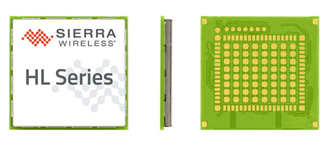
Maestro Wireless Solutions Limited, a provider of tracking devices for Internet of Things (IoT) applications globally, has announced its first LTE Cat-1 tracker based on the AirPrime HL Series from Sierra Wireless.
Maestro’s newest tracker, the ruggedized MT-44, provides fleet and asset tracking capabilities in harsh mobile environments using the LTE Cat-1 module with maximum data rates of 10 Mbps downlink and 5 Mbps uplink.
The Maestro MT-40 Series is a compact range of rugged micro-trackers for the vehicle tracking market.
“We have been integrating Sierra Wireless modules into our products for more than 15 years and we have always trusted the company to deliver on leading edge cellular technologies that improve product performance,” said Xavier Dupont, chief executive officer of Maestro. “The HL Series provides us with a single footprint for 2G and 3G global coverage and the LTE Cat-1 module is utilizing the same compact design in our newest tracker.”
“Today, we are seeing strong interest in our LTE Cat-1 embedded modules optimized for lower bandwidth and power requirements,” said Dan Schieler, senior vice president, OEM Solutions for Sierra Wireless. “We are pleased to have Maestro deploying our latest LTE technology in their tracking devices. The HL Series Cat-1 module provides the next step in the evolution for our customers, as service providers are continuing to transition their networks to LTE technology.”
The HL Series uses the CF3 form factor from Sierra Wireless that is footprint-compatible across product lines and network technologies, and is fully interchangeable with future versions of the modules, including LTE-M variants when they become available.
LTE-M is a Low-Power Wide Area (LPWA) technology that will provide a highly efficient cellular option with lower radio-frequency complexity, significantly reduced power consumption (up to 10 years of service on a single AA battery), better in-building signal penetration and lower costs. Sierra Wireless is an active contributor to the LTE-M standard definition process within the 3GPP and has committed to launching compatible modules timed with network deployments, expected to begin in 2017.
The LTE Cat-1 modules from Sierra Wireless will be commercially available in January 2016 on the HL Series.
Omnitracs LLC has added Omnitracs Navigation to its portfolio of solutions. Omnitracs Navigation uses Big Data collected from more than 250,000 customers contributing more than four billion data points. The company terms Omnitracs Navigation the “next generation of navigation solutions” — it provides critical information to drivers through a user-friendly interface, with fast, near real-time updates and extensive fleet configuration options.
Omnitracs Navigation delivers critical information drivers need in a meaningful and distraction-free way, enabling them to be time efficient, stress free and safe while navigating.
Omnitracs Navigation provides fleets and drivers with the following features:
Data Publishing — All of the data is stored onboard with Omnitracs as the data publisher. Updates are sent to the unit automatically as the data changes so that the unit is always current. By leveraging traditional data (such as posted speed and traffic light locations) combined with real-time data (including current traffic and weather conditions), and Big Data (how a particular road is used at a certain time, and “black spot” high frequency accident zones), Omnitracs Navigation delivers a more consistent, predictable and accurate plan for maximizing the road network.
Actionable Data — Data is pulled from Omnitracs telematics units to build statistical models that create an enhanced, truck-preferred network that is constantly pushing new and actionable data to drivers. More than turn-by-turn instructions, the tool is constantly updated to ensure that drivers have a better and safer navigation experience.
Driver Community — Omnitracs Navigation has a closed-loop feedback mechanism, which brings driver feedback into the data-editing process and gives them an opportunity to improve their navigation experience, along with the navigation experience of fellow drivers. The loop is closed by informing the driver of how his or her feedback was used, leading to improved driver satisfaction and retention by acting as the driver’s trusted advisor.
“Navigation has evolved with the advent of smartphones and GPS devices, and the days of folded paper road maps are gone,” said Rick Turek, chief navigation scientist at Omnitracs. “However, we know that current and hybrid systems aren’t yet perfected and still struggle in keeping data current. Imagine not knowing that a new road has opened up or that a road’s name has changed; these are the types of things that can easily frustrate drivers. Omnitracs Navigation is the next-generation navigational solution that delivers current and actionable data so that drivers can do their jobs more safely and efficiently.”
Omnitracs Navigation leverages the proven technologies of HERE and INRIX. HERE Map Content contributes rich, automotive-grade data that enables large semi fleets to navigate across the U.S. and Canada. Through this partnership, Omnitracs provides precise turn-by-turn navigation, as well as enhanced resource tracking and route optimization.
INRIX will provide real-time traffic and historic traffic profiles, along with travel time and incident alerts, for every major road type including highways, arterials and city streets. INRIX combines information from connected vehicles and other public and private sources to provide accurate real-time traffic that covers more than five million miles in 42 countries. Omnitracs Navigation will launch with INRIX Traffic XD Profiles, followed by real-time traffic and incidents.