Tag: fleet tracking

  • Veripos Picked for Offshore Fleet Positioning

    Singapore-based Miclyn Express Offshore (MEO), a provider of offshore support vessels across South East Asia, Australia and the Middle East, has awarded Veripos a five-year contract for provision of high-precision GNSS positioning services in support of its fleet of 27 ships.

    Under the terms of the contract, Veripos will provide MEO’s fleet with Veripos Ultra Precise Point Positioning (PPP) service designed to deliver decimeter-level accuracies globally along with associated integrated mobile receivers. Among the first vessels assigned to utilize the service and equipment are MEO’s new 2,000 dwt platform supply vessels, MEO Ranger and MEO Resolution, both of which have been equipped with LD5-GG2 receivers. Meanwhile, four older MEO vessels have been similarly configured to receive Veripos Ultra service.

    Commenting on the latest contract award, Walter Steedman, Veripos chief executive officer, said it further consolidated the company’s continuing leadership for provision of precise GNSS positioning services for offshore applications throughout the region and beyond.

    Miclyn Express Offshore employs more than 1,400 shore-based personnel and seafarers.

  • Verizon Expands Asset Tracking Portfolio with Networkfleet Asset Guard

    Verizon Enterprise Solutions today announced the expansion of its asset- tracking capabilities, with the introduction of Verizon Networkfleet Asset Guard. Designed to fit seamlessly on Verizon’s existing Networkfleet vehicle tracking solution, Networkfleet Asset Guard runs on the Verizon Wireless network for fixed and moveable fleets such as trailers, yellow iron machines and generators.

    A lightweight device with a built-in wireless antenna that easily attaches to a piece of equipment for wireless tracking, Verizon Networkfleet Asset Guard includes a long-lasting battery that allows for reliable location tracking over multiple years. Using Networkfleet’s online application, business owners can track assets alongside fleet vehicles to determine exact GPS locations. Reports and alerts show if and when an asset has been moved, which asset is closest to a particular location or landmark and when assets are moved outside of a predetermined virtual perimeter, or geofence.

    “It is becoming more critical for businesses and other organizations to track all of their vital assets, including equipment and vehicles, to help maintain security and operational efficiency,” said Erik Goldman, group president, Verizon Telematics. “With Networkfleet Asset Guard, businesses and government agencies can easily locate their fleet assets and together with our other Networkfleet solutions make sure they are being used properly and efficiently. The combination of Asset Guard’s long battery life coupled with the variety of reports and alerts will help public- and private-sector organizations improve equipment utilization, better manage fleet operations and control costs.”

  • Roadnet Releases Proof-of-Delivery App on iOS for Fleet Tracking

    Roadnet Technologies, the Baltimore-based transportation logistics software firm, announced today that the MobileCast Proof-of-Delivery application is now available in Apple’s iTunes App Store. The introduction of the proof-of-delivery application for Roadnet customers using Apple products allows the ability to integrate delivery services into a single mobile platform.

    The MobileCast Proof-of-Delivery app includes:

    • GPS Tracking
    • Manual Arrive/Depart to track accurate service times
    • Text Messaging within the application to streamline communications
    • Dynamic Dispatch of stops to driver’s mobile device
    • In-Field Geocoding to ensure accurate delivery locations
    • Store and Forward so that when a coverage issue is experienced all information will be saved and transmitted later
    • Driver Re-Sequencing of stops to allow control over reordering stops when necessary
    • Order Summary to quickly view what is being delivery
    • Apple Maps integration to provide delivery driving directions (does not include truck restrictions)
    • Apple Voice Navigation provides audible directions to a requested location
    • Apple Live Traffic overlays to provide traffic information for the route
    • On Track, the sales and merchandiser tracking application that accurately records mileage and time spent with a customer, is also available within the MobileCast app.

    The MobileCast phone solution is a proof-of-delivery application. Proof-of-delivery systems not only let management track their vehicles in real time, but they also notify employees in the back office when issues arise that may prohibit a route from being completed as planned. The historical data collected through a proof-of-delivery application can also be used to evaluate trends and determine alternative solutions for route execution.

  • GPS Tracking Solution Now Offers DMS Integration

    Spireon, a Mobile Resource Management (MRM) and Business Intelligence Solutions provider, has completed an initial phase of the integration of its industry leading GoldStar GPS solution with Frazer’s Dealer Management System (DMS).

    Frazer is a provider of software solutions that auto dealers across the nation use to grow their business and increase their productivity, including its comprehensive DMS, which has functions such as dealer inventory management, credit application processing, electronic contracting, set up bank contracts and BHPH deals, dealer management tools, loan servicing and accounting systems.

    Joint customers of GoldStar GPS and Frazer can now experience online access to a single solution to execute critical commands. The integration allows dealers to execute commands directly from their Frazer application, interface saving customers time and improving their ease of use. Dealers can monitor and take action on their collateral within their day-to-day dealer management application.  Key features of the initial phase of integration include the ability to conduct an on-demand locate, and disable and re-enable the starter interrupt.

    “Spireon’s new partnership with Frazer is another example of Spireon’s ongoing quest to improve the ease of use of our solutions through key partnerships to enhance the customer experience for effective collateral management, vehicle tracking and risk mitigation. GoldStar GPS and Frazer users will experience a platform that will allow them to do more.”  Explains David Meyer, Executive Vice President of Spireon.

    “We have watched the incredible growth of GoldStar GPS and are very excited about now offering Goldstar GPS as an integrated feature within the Frazer DMS. This will make a lot of dealers’ lives just a little bit easier.” Michael Frazer, President.

  • Hyundai Heavy Industry to Track Equipment with Telit

    3.20.13_Taeha_TH- RMCU_ ANTENNA-1.jpgTelit Wireless Solutions will provide the M2M communication module for the Taeha Mechatronics Remote Monitoring System (RMS). Taeha Mechatronics is a South Korean-based provider of electromagnetic control solutions for healthcare and industrial devices.

    The Taeha Mechatronics TH-RMCU, a remote management control unit, integrates Telit’s HE910, HSPA+ module, which delivers 14.4 Mbps downlink data rates. The solution has obtained SK Telecom certification, and will be used for tracking the location of Hyundai Heavy Industry’s global assets. This is the first such authorization by SK Telecom for a system to be used locally and globally. As a result the device can be used in other countries simply by roaming without need for additional regional variants, Telit said. This move is expected to allow more Korean companies to operate more easily abroad.

    The HE910 supports a large number of WCDMA frequency bands (850/900/1700/1900/2100 MHz), making it possible for it to be used in all countries with 3G networks via simple roaming, with no need for production of regional variants to address local frequency band availability, Telit said.

    Hyundai Heavy Industry installs an RMS device, composed of the control unit and antenna, into various types of heavy equipment in the field. It uses the solution to trace equipment location with the integrated GPS which transfers the related data to a server in real-time. With that the company looks to prevent theft and loss of its assets. Also, with the monitoring function, the company can effectively manage fuel consumption of their equipment, actively using it to reduce carbon emissions, Telit said.

    HE910 is a RoHS-compliant module that combines GSM, GPRS, EDGE and HSPA+ network compatibility with digital telecommunication service access. It is world’s smallest (28.2×28.2×2.6 mm) LGA form factor, and ideal for applications that process high-capacity multimedia data, such as e-readers, PDAs and real-time location tracing devices. The HE910 HSPA+ transmission speed is 14.4 Mbps on the downlink, and 5.7 Mbps on the uplink. It supports high-speed serial port, receive antenna diversity, with optional embedded high-sensitivity GPS; and simultaneous voice and data.

    “Solutions developed solely by Korean companies needed to go through many different testing processes to be able to be provided to global customers. By adapting Telit’s standard-based module, we were able to not only reduce cost, but also reduce time for development. We are planning to expand the usage of this solution from location tracing for asset management to other areas,” said Sang-hee Lim, CEO of Taeha Mechatronics.

    “As the interest grows in security and safety globally, tracking solutions are also becoming smarter, in particular for the manufacturing industry, which uses various types of equipment. Companies can dramatically improve management efficiency and productivity simply by deploying cutting-edge monitoring systems. We expect to see continued demand for M2M,” said Derick Tsang, APAC manager of Telit.

  • Danaher Acquires Fleet Tracking Company Navman Wireless

    Navman Wireless, a provider of fleet and asset management technology, announced its acquisition by Danaher Corporation, a Fortune 250 science and technology company. Navman Wireless’ technology currently monitors more than 175,000 vehicles and assets owned by over 14,000 organizations worldwide.

    The OnlineAVL2 system, delivered under the Software-as-a-Service (SaaS) model, enables fleet and asset managers to track all vehicle and asset locations in real time as well as control fuel, labor and vehicle/asset operating costs.

    Navman Wireless reports it has had five successive years of revenue and installed base growth during which the company entered new vertical sectors including local services, transportation, construction, cold chain, mining, and oil and gas, and opened new geographic markets including Mexico, Italy, China and Taiwan.

    “Danaher has the resources, global footprint and commitment to support the continued growth of the Navman Wireless platform and business, along with a strong track record of building brands within its highly diversified portfolio,” said TJ Chung of Navman Wireless. “All of these factors will help us continue to enhance our technology platform, expand into new vertical and geographic markets, and bring the benefits of fleet and asset management to vehicles and assets around the world that are not yet taking advantage of the technology.”

    Navman Wireless is Danaher’s first acquisition in the fleet/asset management space, joining Danaher’s portfolio spanning test and measurement, life sciences and diagnostics, dental, environmental and industrial technologies. Financial details of the transaction were not disclosed.

  • GPS Insight Adds Hours of Service to Tracking Platform

    GPS Insight, a GPS fleet tracking solution provider, announced its new GPS Insight Hours of Service Solution as an addition to its award-winning GPS Tracking software intended for fleets that need both electronic driver logs and GPS tracking combined.

    The EOBR-1000 device combines GPS tracking with an Electronic Onboard Recorder and Electronic Driver Logs. The application also integrates electronic Driver Vehicle Inspection Reports (DVIR) in a workflow environment ensuring compliance with inspections and omitting cumbersome paper forms. The HOS Solution is used to significantly reduce HOS violations, eliminate driver paperwork, and reduce log auditing time, the company said.

    GPS Insight is hosting a webinar to introduce the GPS Insight Hours of Service Solution on January 17 at 10 a.m. PST. The webinar will include an update on FMCSA rules, how an HOS solution will benefit fleets that need to be compliant, and a demonstration of the GPS Insight Hours of Service Solution. Register Here.

  • Navman Wireless Debuts Professional Services for Fleet Tracking

    Navman Wireless today announced the availability of two professional services packages designed to expedite, optimize and provide problem resolution for 100+-vehicle implementations of its OnlineAVL2 fleet management platform. Going beyond basic customer support, the new services can reduce rollout and configuration time by up to 80 percent, produce a 50 percent faster return on investment, and help corporate and construction fleet managers derive maximum value from the system by doubling the number of features used.

    “Most fleet tracking vendors say they provide support services, but usually those services are limited to basic phone assistance and coordination of system installation with a third-party vendor. Through our work with customers who track hundreds of on- and/or off-road vehicles, we recognized that large installations need substantially more assistance for timely deployment as well as to take full advantage of system capabilities to reduce costs and streamline operations,” said Nels Erickson, field services manager at Navman Wireless. “We launched our professional services packages specifically to meet these needs.”

    Both the Standard and Turnkey professional services bundles entitle customers to a dedicated project and account team, including a field services engineer serving as a single point of contact and project manager, plus the use of a dedicated phone line staffed with support specialists assigned exclusively to handle larger accounts.

    The Standard package includes installation support, basic OnlineAVL2 configuration, a training website and weekly group training webinars, priority issue escalation, and a yearly account review to evaluate the customer’s use of the system and identify opportunities to realize greater benefits from the deployment.

    The Turnkey package includes all Standard features plus 80 hours of project management time for on-site project planning and user training as well as weekly update calls and advanced OnlineAVL2 configuration for features such as geofences, maintenance module setup, report scheduling, and email and text alerts. This premium package also includes ongoing best practice guidance, regular on-site business reviews, API-based integration into backend systems, and guaranteed 45-day implementation with appropriate advanced notice and asset availability.

    Optional add-on services include custom training and documentation, installation and training at additional depots or terminals, and advanced project management for complex implementations.

  • LiveViewGPS Vehicle Tracker Supports Verizon CDMA Network

    LiveViewGPS, a GPS tracking company for business, government and individuals, is now shipping its VLS 300VZ GPS vehicle tracker that operates exclusively on Verizon’s CDMA wireless system. The hard-wired unit features a three-wire hookup and can be configured to update vehicle locations at 1-, 2- and 5-minute intervals.

    The VLS 300VZ GPS vehicle tracker is based on LiveViewGPS’ VLS platform, an Internet-based GPS tracking system for small businesses that need powerful monitoring at a lower price, the company said. It includes a fully-featured, real-time, on-demand GPS tracking system with no software and no contracts required.

    Users log on via their web browser or web-enabled mobile device. Once connected, the intuitive, user-friendly interface lets them locate multiple vehicles via a high-resolution satellite map. Users have the option of calling a special phone number instead of using a mobile device. The system automatically texts or emails alerts whenever it detects a vehicle speeding, entering restricted zones, deviating from routes and more. Automated detailed reports include starts/stops, excessive idling, mileage and speeding. State-to-state mileage reporting is also available.

    “The VLS 300VZ GPS vehicle tracker is a low-cost entry device for small fleets, company vehicles and personal vehicles in areas with poor GSM coverage,” said George Karonis, LiveViewGPS CEO, “and it’s even programmed to store and forward information whenever a vehicle loses CDMA coverage, so users never have to worry about data loss.”

  • GreenRoad to Offer Advanced Fleet Tracking from GPS Insight

    GreenRoad, a driver performance management company, and GPS Insight, a fleet GPS tracking provider, have announced that GreenRoad will offer advanced fleet tracking capability, provided by GPS Insight, as part of its GreenRoad driver performance management service. GreenRoad will integrate the GPS Insight solution and offer it to customers as GreenRoad Advanced Tracking.

    “GreenRoad delivers the best drivers on the road — safe, fuel-efficient and green,” said Jim Heeger, chief executive of GreenRoad. “As we’ve collected feedback about what more we can offer, we’ve consistently heard requests for integrated, advanced GPS tracking. The comprehensiveness, flexibility, and effectiveness of the GPS Insight service are truly impressive. Now, with the GPS Insight partnership, we can offer the tools to also create the most efficient fleets on the road. It is a powerful combination.”

    “GPS tracking is a natural complement to the GreenRoad driver performance management offering,” said Robert Donat, CEO of GPS Insight. “With the combination of these two capabilities, fleet operators will have all they need to optimize fleet efficiencies and maximize driver productivity.”

    The integrated solution, GreenRoad Advanced Tracking, will be available in the U.S. UK and Canada by the end of the year.

  • Zoning in on Assets: Cubic Global Tracking Gets Iridium Certification

    By Tracy Cozzens

    A system that tracks and monitors valuable high-risk assets for defense and commercial customers has received certification from Iridium Communications, increasing the system’s accuracy and effectiveness. The Iridium constellation of low-Earth satellites provides voice and data services for areas not served by terrestrial communication networks.

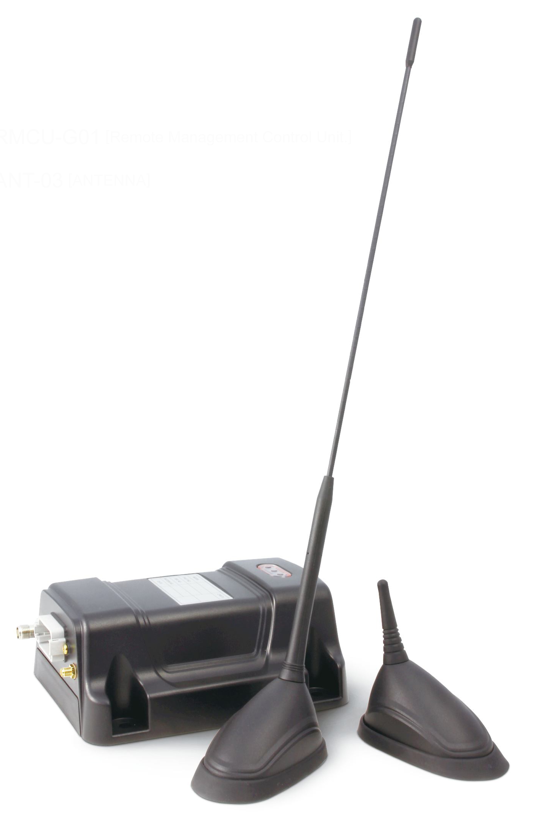
    The Global Sentinel System, by Cubic Global Tracking Solutions, tracks and monitors assets with two-way, redundant encrypted communications. The system provides up to 2,000 unique geozones for each Global Sentinel device to control precise reporting rules along the supply chain. It can monitor asset conditions including temperature, humidity, light sensing, motion, and container door status.

    The latest generation of Cubic’s Global Sentinel System provides continuous global coverage by incorporating the Iridium 9602 short-burst-data transceiver. “As an Iridium partner for the past seven years, we’ve worked closely to integrate the Iridium 9602 transceiver into Cubic’s fifth generation of products,” said Mary Ann Wagner, president of CGTS.

    Wagner said Cubic relies on Iridium to provide real-time low latency reporting on customers’ assets in areas where other modes of communication are unavailable. This capability allows for continuous global coverage for reliable secure reporting of asset position, status, and event alerts. “This is essential because of the critical nature of the assets we are tracking and monitoring for our Department of Defense and commercial customers,” Wagner said.

    Power-Saving GPS. GPS also plays an important role. With the flexibility derived from geozone attributes for GPS, Cubic can provide an optimum balance between position accuracy and power management.

    Cubic’s devices take full advantage of GPS receiver circular error probable (CEP) estimates to set accuracy limits for reporting, explained Randy Shepard, vice president of technology innovations for CGTS. While higher position accuracy may be a challenge for battery-powered units operating for years between servicing, it is often necessary to avoid false alarming for events like route deviation where position accuracy is important.

    “One of the unique features of Cubic’s devices is the aggressive manner in which we manage power for all device functions including GPS,” Shepard said. “Using the geozones that are remotely reconfigurable on the device, GPS accuracy and response time can be controlled as a function of geozone.

    “As an example, for our current GS-5B receiver used for global tracking and monitoring of shipping containers, the initial default dwell time to capture GPS position is 60 seconds. Our experience is that from a cold start we get a normal lock in less than 45 seconds. The maximum acceptable CEP is 100 meters. If a CEP of less than 100 meters is not received, we do not update position. If a CEP of less than 100 meters is received, we wait up to an additional 60 seconds to improve the CEP. Once a CEP of 10 meters or less is received, the position is captured and the GPS receiver turned off. Again, all four of these parameters are remotely reconfigurable for each of the 2,000 user-defined geozones.”

    The other GPS receiver parameter that is configurable as a geozone attribute is whether power is maintained on the receiver to retain satellite ephemeris data. If the position update interval for a geozone is more often than every 15 minutes, data back-up power is usually maintained on the GPS receiver and the satellite ephemeris data is retained. This provides and effective warm start for the GPS and usually results in a much quicker initial position lock, which saves overall power.

    To provide real-time asset tracking worldwide, Cubic’s Global Sentinel System relies on a variety of transmission links to communicate the positioning and status of an asset. Based on the location of the asset, the system selects whichever link is the most cost-effective for data transmission. This includes wireless mesh networking, cellular, or the ubiquitous global two-way coverage of the 66-satellite Iridium constellation. The Global Sentinel System relies on the Iridium network’s ability to eliminate blind spots when the asset is out of range of other routing methods.