Tag: GEODNET

  • GEODNET concludes $3.5 million seed funding round

    GEODNET concludes $3.5 million seed funding round

    Image: GEODNET
    Image: GEODNET

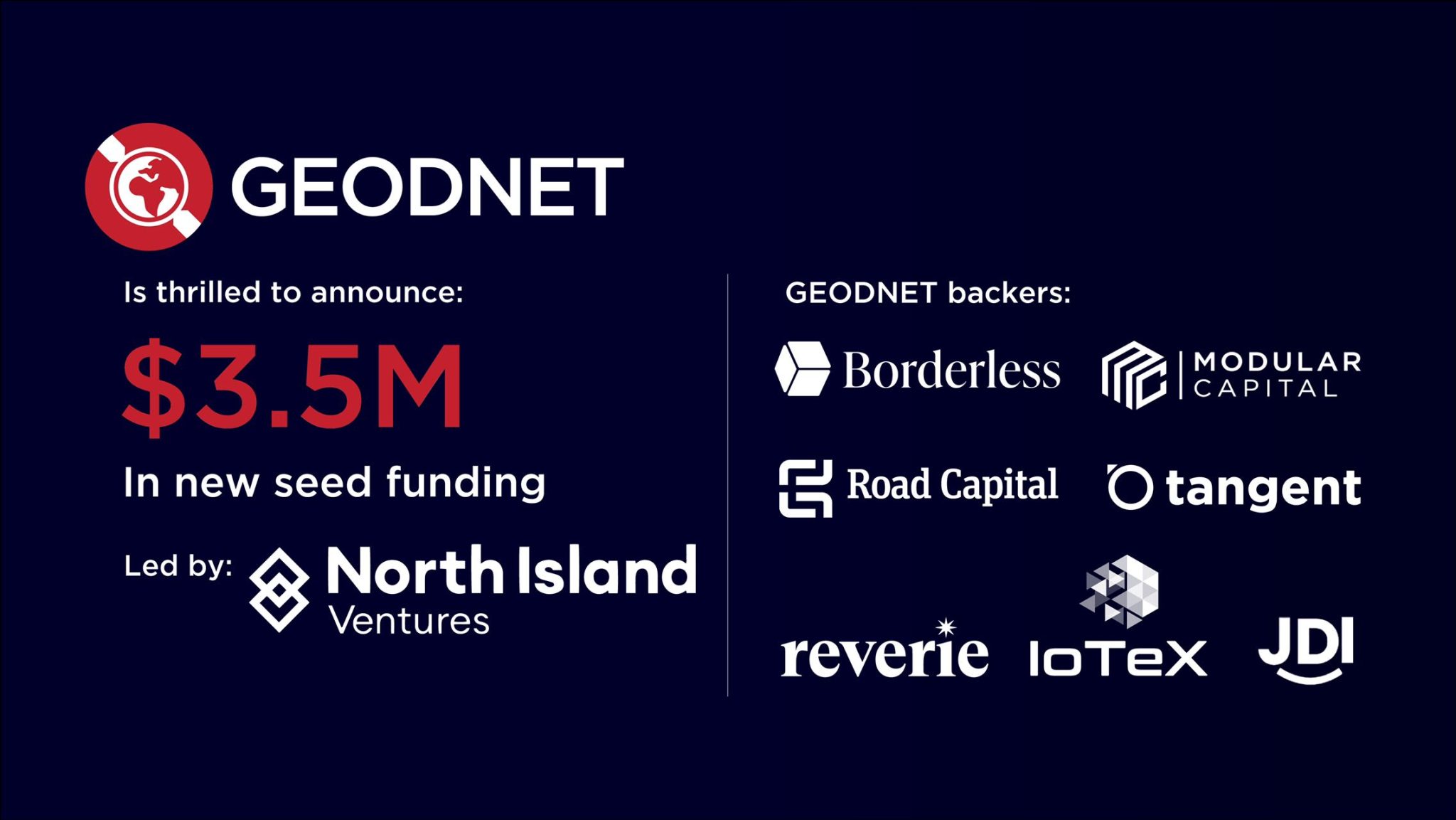
    The Global Earth Observation Decentralized Network (GEODNET) Foundation — the organization governing the blockchain-based global navigation network GEODNET — has completed a $3.5 million seed funding round. The round was led by North Island Ventures, with participation from Modular Capital, Road Capital, Tangent, Reverie, and select angels, who join existing GEODNET backers Borderless, IoTeX and JDI Ventures.

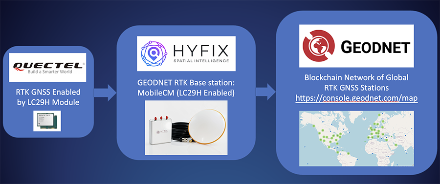
    The GEODNET Foundation is building a Global Navigation Satellite System (GNSS) reference network for positioning based on real-time kinematics (RTK). Standard GPS is typically off by two meters; however, devices connected to GEODNET’s global RTK network are designed to achieve instant accuracy within 1 cm to 2 cm. Many internet-of-things (IoT) and autonomous applications, such as UAVs, smart mowers and advanced driver assistance systems (ADAS), have shifted to RTK in place of standard GPS positioning, the company said.

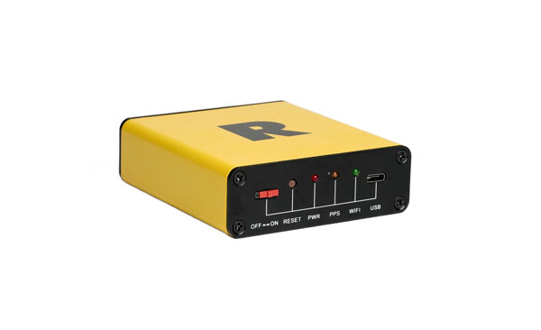
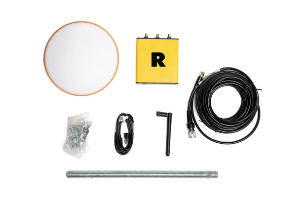
    GEODNET is a community-based decentralized physical infrastructure network (DePIN). Anyone can contribute to the network by installing and operating a reference station, known as a satellite miner. Satellite miners are designed to deliver precise RTK correction data to devices equipped with GNSS receivers in a range of approximately 20 km to 40 km. By building and participating in the network, satellite mining operators earn GEOD tokens.

    GEODNET has more than 4,000 registered reference stations in more than 2,500 cities across 120 countries. GEODNET aims to provide robust precision navigation systems to a variety of industries, including self-driving cars, agriculture, consumer robots, and more.

  • GEODNET, DST enhance precision agriculture in North America

    GEODNET, DST enhance precision agriculture in North America

    GEODNET logo

    Deep Sand Technology (DST), an autosteering and precision agriculture company, and the GEODNET Foundation have partnered to bring precision agriculture real-time kinematic (RTK) services to rural North America.

    GEODNET-compatible RTK bases will be immediately available, which support centimeter-accurate operations without the need to install an ultra-high frequency (UHF) radio link.

    The partnership between DST and GEODNET aims to offer affordable high-accuracy RTK-based GPS access into key U.S. agricultural and rural areas for precision agriculture, advanced cruise control systems, automated highway trucking operations and eco-friendly robotic lawnmowers.

    The GEODNET RTK network comprises more than 3,600 stations globally, covering over 1,800 cities in 100+ countries as of 2023.

  • ANELLO adds to its optical-gyroscope based navigation systems

    ANELLO adds to its optical-gyroscope based navigation systems

    ANELLO Photonics has added real-time centimeter-accurate positioning and localization capabilities to its line of optical-gyroscope based navigation systems.

    Its real-time centimeter accuracy is achieved by using real-time kinematic (RTK) correction data from GEODNET, a community-based decentralized network of over 3,000 GNSS reference stations worldwide.

    Under the agreement, ANELLO Photonics users will have access to a free trial of RTK services and competitive options for long-term, high-volume correction data requirements.

    By combining the ANELLO silicon photonics optical gyroscope (SiPhOG) with GEODNET’S global RTK correction network, users now have access to a new global cyber-infrastructure for reliable measurements.

    The partnership offers users a combination of optical gyroscope technology and a reliable and global RTK correction network that enables centimeter-accuracy for industries operating in challenging RF and GNSS-denied environments. These environments include city centers, construction sites and orchards.

    The agreement aims to address the challenging applications by using SiPhOG and its GNSS-denied dead-reckoning algorithms with GEODNET’s distributed global network of RTK stations. This combined technology offers high-level accuracy while reducing the total solution costs.

    The companies aim to simplify performance intensive applications such as high-definition mapping and aerial or terrestrial autonomous vehicle deployment.

    ANELLO is currently engaged in trials with users in the construction, farming, robotics, trucking, UAVs, autonomous vehicles, and defense space.

  • Borderless Capital invests in GEODNET Foundation to support decentralized location services

    Borderless Capital invests in GEODNET Foundation to support decentralized location services


    Image: GEODNET
    Image: GEODNET

    Borderless Capital has invested in the Global Earth Observation Decentralized Network (GEODNET) Foundation via its EdgeFi Fund, the first web3 investment fund focused on decentralized physical infrastructure networks. The investment will be utilized to strengthen GEODNET’s mission with emphasis on growing reliable global coverage and a mobile operating-system software development kit.

    The GEODNET Foundation manages the open network protocol and promotes service usage within the traditional GNSS and IoT industry.

    With more than 3,000 reference stations online in every major continent, the real-time GEODNET network is the largest decentralized geospatial reference network. The GEODNET location service offers reliable centimeter-accurate location for applications such as UAVs, robotic vehicles, augmented reality, and IoT/mobile devices.

    GEODNET station data is actively utilized by companies such as Hemisphere GNSS, Quectel Wireless Solutions and Rock Robotic. GEODNET stations owners set up a satellite mining station and are rewarded with the project’s native polygon token, GEOD.

  • GEODNET correction service designed for agriculture

    GEODNET correction service designed for agriculture


    Image: GEODNET
    Image: GEODNET

    GEODNET has released a real-time kinematic (RTK), centimeter-precision, GNSS corrections service designed for OEMs and system integrators of agricultural robotics. GEODNET is compatible with several GNSS receivers from major brands, on-vehicle automated steering, spraying kits, and most UAVs and robots.  

    The GEODNET corrections service has more than 1,700 total full-constellation reference stations worldwide and supports GPS, Galileo, GLONASS and BDS signals. It also has the RTCM 3.2 data format for maximum rover/receiver compatibility and NTRIP sign-on and access. 

     Additional local reference stations can be added.  

     Free GEODNET correction service trials are available now for qualified OEMs and system integrators in most agricultural regions globally. Interested parties can apply for a trial stream here 

  • ROCK Robotic announces new product and partnership

    ROCK Robotic announces new product and partnership

    Photo:
    Image: ROCK Robotic

    On Jan. 6, ROCK Robotic, a geospatial company specializing in lidar-based data processing and high-definition mapping, announced the availability of ROCK Base, a triple frequency RTK base station. Additionally, ROCK Robotic has partnered with the Web3 GEODNET initiative to support critical applications in civil surveying, high-definition mapping, digital twin creation and more.

    Photo:
    Image: ROCK Robotic

    ROCK Base is a resilient, secure, full-constellation GNSS receiver, capable of tracking signals transmitted from GPS, GLONASS, Galileo, BeiDou, QZSS, and the IRNSS navigation satellite constellations. It includes 1,400 channels, survey-grade antennae, cables and antennae-mounting equipment required to set up a permanent continuously operating reference station location.

    To make high-definition mapping more accessible and affordable, ROCK Robotic joined the Web3 GEODNET initiative, the largest decentralized GNSS reference network globally. Under the new partnership, ROCK Robotic customers will have access to the GEODNET base-station network to geo-reference ROCK Robotic’s 3D data products to millimeter-level absolute position accuracy, without setting up ground control points. Additionally, ROCK Base is pre-certified on the GEODNET network.

  • Mobile GEODNET base station using Quectel’s module announced

    Mobile GEODNET base station using Quectel’s module announced

    Image: GEODNET
    Image: GEODNET

    HYFIX.AI, an internet of things (IoT) GNSS and precise location company, has announced the availability of a GEODNET base-station using the LC29H module from Quectel Wireless Solutions.

    The Mobile Centimeter (MobileCM) base station is a dual-band GNSS base station for real-time kinematic (RTK) precise-positioning applications in autonomy, agriculture, construction/survey, drones and geo-science applications.

    Introduced at the Institute of Navigation’s 2021 ION GNSS+ conference, the Global Earth Observation Decentralized Network, GEODNET, received a best presentation award and has rapidly grown since official launch in early 2022.

    The MobileCM station automatically uploads real-time satellite data to GEODNET via a Wi-Fi-based internet connection. MobileCM base-stations are self-hosted and receive GEODNET token rewards while powering both commercial AIoT as well as citizen science climate change applications.

    The Quectel LC29H module is a surface-mount low-power 135-channel dual-band receiver that hosts both RTK and dead-reckoning algorithms such as the HYFIX.AI Embedded Centimeter (EmbedCM) stack. Using GNSS corrections from a service such as GEODNET or other network, the LC29H modules can achieve position accuracy of 10 cm in a variety of real-world conditions.

    The HYFIX.AI MobileCM base-station embeds the LC29H as well as the ATECC608B CryptoAuthentication engine. An included installation kit provides a survey-grade triple-band GNSS antenna, primary antenna cable, and roof-top installation hardware.

    “Quectel is excited to continue its partnership with HYFIX.AI to deliver precise GNSS positioning accuracy of 10 cm in the real world using our dual-band LC29 family of GNSS modules,” said Mark Murray, vice president of sales for GNSS and automotive at Quectel Wireless Solutions.

    “HYFIX.AI is pleased to continue support of Quectel’s dual-band LC29 GNSS modules and introduce a new turn-key GEODNET base station for global precise positioning,” said Mike Horton, chief executive officer of HYFIX.AI.

    Photo: Quectel
    Photo: Quectel