Tag: Geospatial Solutions

  • At-home crowdsourcing and citizen science for mapping enthusiasts

    The world so close has never seemed so far away. Locked up and adrift, somewhere between the comfort of the past and the anxiety of the future, the present slowly passes by in a procession of nameless days. The living room has become a sundial. Shadows pass from one wall in the morning to the far side by day’s end. Outside, spring has sprung, but inside, winter lingers on.

    Alone, we can do so little. Together, we can do so much.
    —Helen Keller


    Times like these, detached and disruptive, are opportunities in disguise. Ironically, while the world is confined and socially distanced from one another, humanity is more connected than it has ever been. Hard to believe, but smart mobile devices began just over a decade ago; and we are in the midst of a growing tsunami of connected devices, cloud computing, big data and open source. These events, coinciding with the exponential growth of geographic information systems and data analytics, have set the stage for crowdsourcing and citizen science. The era of empowering individual contributors has begun.

    It has probably gone unnoticed due to all the political wrangling in Washington, D.C., but over the last two administrations, with bi-partisan support, without recognition or renown, a monument to American ingenuity was christened. Beginning in 2010, the America COMPETES Reauthorization Act was passed. Then, in 2014, the White House elevated homegrown inventors and creators calling it the Maker Movement and hosted the first-ever National Maker Faire. In 2015, the STEM Education Act became law and in the same year the Senate introduced The Crowdsourcing and Citizen Science Act. In 2017, the American Innovation Competitiveness Act became law formally coining the term, crowdsourcing. In 2019, the White House Office of Science and Technology Policy (OSTP) delivered the first-ever comprehensive report to Congress about federal agencies activities involving crowdsourcing and citizen science (FedCCS). Also in 2019, OSTP along with the General Services Administration (GSA) hosted the U.S. Government Open Innovation Summit.

    The OSTP FedCCS report to Congress titled, “Implementation of Federal Prize and Citizen Science Authority,” cites 169 FedCCS prize competitions conducted by 18 federal agencies, such as the National Aeronautics and Space Administration (NASA), the Centers for Disease Control (CDC), and the National Institute of Science and Technology (NIST). However, the number of FedCCS projects is much greater than what is covered in the report. On Challenge.gov the amount of competitions rose from 744 in 2016 to 875 in 2018, and the prize awards ranged from $0 to $20 million with an average payout of $75,000 in FY2018. The next report is due in 2021.

    Governments tapping into the resources of its citizens for innovation is not new, but it has never been on this scale and granted such authority. One of the first official attempts was the United Kingdom’s Longitude Prize in 1719 offering a King’s ransom of £20,000 [see article: From the Pyramids to GIS/GPS] to solve positioning at sea. Great Britain still honors the original Longitude Prize using the name for their national grand crowdsource competition. Similarly, in the United States the grand challenge is the X-Prize, the most famous one being the Ansari X prize. You may not know the prize by its name, but as NASA’s Space Shuttle Program phased down, the Ansari X-Prize kicked-off the space race among private companies. Scaled Composites won the $10 million prize in 2004 reaching space in a reusable craft, which became Virgin Galactic.

    The term “crowdsourcing” means a method to obtain needed services, ideas, or content by soliciting voluntary contributions from a group of individuals or organizations, especially from an online community.
    —15 USC Chapter 63 §3724 (2): Crowdsourcing and Citizen Science

    The U.S. Federal Government already relies on the public for information to help improve and maintain its products and better serve the country. The National Oceanic & Atmospheric Administration (NOAA) has had an ongoing cooperative with the U.S. Power Squadrons since 1963 to report safety hazards to navigation and help maintain the information on maritime nautical charts. The agreement to support NOAA was renewed in 2013 for another 50 years.

    Image: U.S. Geological Survey
    Image: U.S. Geological Survey

    The Federal Aviation Administration (FAA) accepts reports from the general public, especially aircraft pilots regarding the accuracy of information in the products it publishes which can affect changes to aeronautical charts and flight operations.

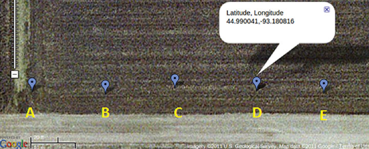
    The U.S. Geological Survey (USGS) has The National Map Corps (TNMCorps), which began in 1994 with the Earth Science Corps and the Adopt-a-Quad program. These two programs consolidated into a single online crowdsourcing effort to support USGS in 2013. TNM Corps helps maintain USGS’s maps and allows private citizens to do feature collection activities. It is easy to join and simple to use making it a way for all ages to join the crowdsource movement. What is also significant about USGS is that Dr. Sophia Liu, Co-Chair of the Federal Community of Practice for Crowdsourcing and Citizen Science resides there. Dr. Liu helped stand-up FEMA’s crowdsourcing and citizen science unit in 2007. She is now the coordinator of FedCCS activities and helped co-write the 2019 OSTP FedCCS report to Congress.

    Crowdsourcing is about actively engaging people in a certain task, sometimes a very specific micro-task that includes a two-way feedback loop with the public. We need to leverage the human power that is better at understanding, processing, and communicating information.
    —Dr. Sophia B Liu, Innovation Specialist, USGS


    Some of the most popular sites for GIS enthusiasts to get involved are Open Street Maps (OSM), GISCorps, GeoHIVE and Zooniverse. OSM has more than 2 million contributors worldwide and has been on the front line of international disasters beginning with the 2010 Haiti Earthquake. Through its Humanitarian OpenStreetMap Team (HOT) it has supported operations of the Red Cross, FEMA, and United Nations. Through the power of the crowd, OSM contributors rapidly map transportation networks in disaster areas to show the most accessible routes in order for rescue operations and emergency supplies to reach the most impacted communities.

    The GIS Corps, founded in 2003, operates under URISA and coordinates short-term mapping volunteer projects for humanitarian relief, human rights, disaster response, and other important efforts. Over 4,500 volunteers have helped support 195 missions around the world such as Hurricane Katrina, Ebola outbreaks in Sierra Leone, and the Nepal earthquake, in fact, if there is a crisis somewhere in the world, GISCorps is most likely going to have an effort in place to support it.

    GeoHIVE (Geospatial Human Imagery Verification Effort) is an imagery based geospatial crowdsource platform which began in 2015 eventually replacing Tomnod in 2018. Digital Globe formed a collaboration with Radiant Solutions, SSL and MDA combining efforts and resources creating a more robust crowdsourcing platform. GeoHIVE’s 3,000 volunteers have contributed to nearly 700 campaigns. Registering for GeoHIVE requires an Amazon Mechanical Turk account, which allows contributors to be compensated for crowdsource tasks.

    Zooniverse began as an astronomy site to enable hobbyists to help classify galaxy types but quickly grew into a crowdsource platform that encompasses all sorts of projects in addition to its cosmic origins including art, biology, literature and there are several spatially related projects to be found, as well. With Zooniverse you can contribute to science by studying gravitational waves or categorizing auroras as the ionized plasma washes up onto our cosmic shore.

    90% of all the scientists who have ever lived are alive today.
    —Steven N. Rader, Deputy Manager, NASA, Center of Excellence


    That quote by Steven Rader of NASA is accredited to Derek de Solla Price in 1961 referring to the exponential growth in the number of PhD’s and patents throughout the world. But now, science is in the hands of the Makers — those with 3D printers or those who can program a virtual world, or design an augmented reality, or those who can extract patterns from data and provide meaningful intelligence in geography, demographics, genetics, biology, and every field of study.

    Citizen scientists are making a significant mark upon the world. Take for example CeCe Moore, a genealogy hobbyist who became a self-taught expert and now tracks down killers solving several cases using her laptop and open source DNA records. Gary Hug, a backyard astronomer, who built his own observatory in Topeka, Kansas, has discovered over 300 asteroids in near Earth orbits, and in March, Michael Mattiazzo, a citizen scientist astronomy enthusiast, discovered comet (C/2020 F8) SWAN which will make its closest approach to Earth on May 13th inside Earth’s orbit. Then there is Ted Ground, a citizen scientist hero. Ted is a winner in multiple citizen science competitions winning the NASA ideation challenge for the Mars ballast payload, the Bureau of Land Reclamation challenge for identifying insect invertebrates in rivers and estuaries, and the INNOcentive challenge for identifying trace minerals in livestock.

    The day before something is truly a breakthrough, it’s a crazy idea.
    —Peter Diamandis, executive chairman of the X Prize Foundation


    Logo: Challenge.govChallenges are competitions sponsored by governments, private industry, non-profits and international entities. At the end of this article are listed several challenge sites. Agencies of the U.S. government post their challenges on Challenge.gov and CitizenScience.gov. Challenges are opportunities to work on projects for NASA, DOD, EPA, NOAA, FEMA, USGS, DARPA, and a growing list of agencies and companies. Most of these projects can be worked on at home with a laptop. Some challenges are for money or other prizes and some are just for the recognition, but all of them are ways to improve skills, build connections, and enhance a resume.

    Logo: Citizen ScienceIn closing, the legislation signed into law since 2010 culminating in the America Innovation and Competitiveness Act of 2017 requiring bi-annual reports to Congress directs federal agencies to use Crowdsourcing and Citizen Science. This movement empowers the individual. There has never been a better time for an idea whose time has come.

    All achievements, all earned riches, have their beginning in an idea.
    —Napoleon Hill, Author of Think and Grow Rich


    A final note: The four-part television series, “The Crowd & the Cloud,” sponsored by the National Science Foundation (NSF) and hosted by Waleed Abdalati, former NASA chief scientist, can be seen here.

  • ASPRS to host educational geospatial webinars for kids

    ASPRS to host educational geospatial webinars for kids

    Logo: American Society for Photogrammetry and Remote Sensing

    The American Society for Photogrammetry and Remote Sensing (ASPRS): The Imaging and Geospatial Information Society is hosting one-hour educational webinars for children focused on geospatial concepts and technology.

    The webinars, GeoBits, which are based on the organization’s GeoBytes webinar series, will be free and recorded.

    The first webinar, titled “The First GeoBit: Career Opportunities in Land Surveying,” will take place at 2 p.m. Eastern time on April 30. This webinar, hosted by licensed land surveyor Ryan Swingley, will discuss career opportunities in land surveying. Swingley will explain what surveying is and how it affects the physical world around us. The webinar, designed for kids in the eighth to twelvth grades, will cover different career segments in land surveying and the future job outlook. Register for it here.

    The second webinar, titled “The Second GeoBit: Studying Population Change using Interactive Mapping Tools,” will take place at 2 p.m. Eastern time on May 5. The webinar, hosted by geographer Joseph Kerski, will Explore how to examine patterns of population change, migration and demography with interactive web maps and web mapping applications. During the webinar, designed for middle school students, Kerski will investigate how 2D and 3D maps can be accessed, modified and turned into online presentations. Register for it here.

    The third webinar, titled “The Third GeoBit: Product Management, 3D and maps,” will take place at 2 p.m. Eastern time on May 8. Hosted by Esri Group Product Manager Chris Andrews, the webinar will cover product management and how to guide the development of a product from concept to sale to use by a real-world person to accomplish work. Register for this webinar, targeted for middle school students, here.

    Established in 1934, the American Society for Photogrammetry and Remote Sensing is a scientific association serving over 2,000 professional members around the world, providing its members professional development through education and networking experiences, professional certification, publications, scholarships, and other services.

  • GeoComm joins Amazon Web Services as tech partner

    Logo: GeoComm

    GeoComm is now a Select Technology Partner in the Amazon Web Services Partner Network (APN). The APN is a global program for technology and consulting customers who leverage Amazon Web Services to build solutions and services for customers.

    As an APN Select Technology Partner, GeoComm will leverage Amazon Web Services to bring benefits to its customers, including security to protect the infrastructure that runs GeoComm’s cloud-based public safety GIS solutions.

    In order to join the APN, GeoComm had to complete and satisfy several technical and business criteria for providing solutions and services in the APN.

    According to GeoComm, this partnership will heighten its capabilities to provide easy and secure customer GIS data uploading, as well as an increased speed of GIS data updates within its customers’ dispatch mapping applications.

    “Joining the APN to utilize AWS to protect the critical infrastructure of our customers mission critical solutions is a priority for GeoComm,” said Ryan Thomas, vice president of engineering and technology at GeoComm. “The APN designation exemplifies our desire to protect privacy and data security by providing cloud-based public safety GIS solutions with the highest standards.”

    Founded in 1995, GeoComm provides public safety GIS software and solutions. Its GIS Data Hub solution is currently listed in the Amazon Web Services Marketplace. A number of other GeoComm solutions are being built to utilize the advanced levels of security, reliability, and scalability AWS provides, GeoComm added.

  • AEC technology consultant completes Pointfuse training program

    Photo: Pointfuse
    Photo: Pointfuse

    U.S. CAD is working with Pointfuse to help shape the future of point cloud processing software. This collaboration began upon U.S. CAD completing Pointfuse’s authorized training program.

    U.S. CAD is an architecture, engineering and construction technology consultant that has 20 years’ experience in combining BIM content creation and 3D modeling with application development and configuration services. U.S. CAD is a Pointfuse distributor and has been working with Pointfuse to align Pointfuse’s software with its existing product and service portfolio, learn the full capabilities and ROI of the software, and discover product development functionality.

    Pointfuse software converts millions of individual measurements captured by laser scanning, photogrammetry and mobile mapping systems into useable 3D mesh models. Pointfuse is unique in automatically segmenting the mesh into discrete, selectable surfaces by identifying objects based on their geometry and assigning unique identifiers to them, the company said.

    “We already knew the addition of Pointfuse point cloud processing software to our market offering would release the power of laser scanning, photogrammetry and mobile mapping systems for a range of digital construction, facilities management and virtual design workflows,” said Jeff Rachel, president at U.S. CAD. “However, working with Pointfuse to complete the training program we now truly understand how to help and support our customers as they integrate these technologies within their organizations.”

  • GIS Planning data tool provides updates on open businesses amid COVID-19

    GIS Planning data tool provides updates on open businesses amid COVID-19

    Screenshot: GIS Planning
    Screenshot: GIS Planning

    New hyperlocal business directory ZoomBusiness designed to help Main Street businesses across North America engage with local residents

    GIS Planning has launched an online tool that enables local businesses across North America to communicate with customers for free in real time.

    ZoomBusiness, created in response to the COVID-19 pandemic, is an interactive, mobile-responsive mapping directory for communities that ensures customers can find open restaurants, stores and services in their region at no charge.

    Businesses can list themselves for free on their local ZoomBusiness site, hosted by economic development organizations like cities, towns, counties or chambers of commerce. The businesses can provide customized details including websites, modified hours, delivery or curbside pickup options, promotions and gift card stimulus programs.

    Residents can search for area businesses by categories, including grocery stores, pharmacies, banks, health facilities, hardware stores, pet stores and automotive shops, among others.

    North America deployment

    Local ZoomBusiness sites have already been deployed in more than 20 communities across North America during its soft launch, including regions of eastern Pennsylvania;, the City of Columbia, South Carolina; the state of Wyoming (which has listed more than 600 businesses on the directory); and Abbotsford, British Columbia.

    “We created ZoomBusiness after realizing that small businesses need new, accurate ways to communicate that they are still open to their customers, given that social distancing requirements, product availability and operating hours are changing by the day,” said Pablo Monzon, managing director and co-founder, GIS Planning. “Our development team has created an intuitive tool to index and map business information across North America in real-time, and we believe it will be an enormous resource for the communities we serve.”

    ZoomBusiness is a simple-to-use data tool, powered by Google Maps, using various layers for precise queries. Businesses are prompted to directly enter information on their current status and the content is verified by the organization hosting the GIS tool.

    GIS Planning also added free map layers, including a COVID-19 case map updated daily by the New York Times, and a job-loss vulnerability index using recent employment data from Chmura.

    Screenshot: GIS Planning
    Screenshot: GIS Planning

    Columbia, South Carolina

    The city of Columbia features 180 businesses on ZoomBusiness, helping residents discover delivery and curbside food options. That number is expected to quickly rise to more than 300 as business owners input data. Columbia will continue to promote safe and responsible “Shop Local” practices, Coleman added, in hopes that residents will take advantage of the service and support local businesses.

    “Through our work with GIS Planning, we’ve been able to take our list of open restaurants and businesses and integrate it into the available properties map on our website,” said Ryan Coleman, director of the City of Columbia Office of Economic Development. “During this crisis, local businesses need every advantage we can give them, and this is another tool in their arsenal in helping to mitigate the negative impact of COVID-19.”

    Abbotsford, British Columbia

    The new solution has also made an impact in Canada, including the City of Abbotsford, British Columbia, which is promoting 130 businesses ranging from grocers to auto shops and medical suppliers.

    “This is a resource that fills an urgent need. The long-term health and security of our businesses depend, in part, on the decisions we’re making right now,” said Kim O’Sullivan, City of Abbotsford’s economic development coordinator. “ZoomBusiness allows owners to communicate directly with their customers, many of whom would frequent these businesses, even online, if they knew they were able to do so.”

    ZoomBusiness clients are given a unique link to their region which is then shared across organizational websites and social media to reach residents.

    “Main Street businesses are truly the lifeblood of a community,” said Alissa Sklar, vice president of marketing for GIS Planning. “According to FEMA, up to 40% of small businesses never reopen after a major disaster. With ZoomBusiness, we want to help make sure the local restaurants, retailers and service providers that define local communities are still there to serve area residents when this pandemic is over.”

    GIS Planning has made its ZoomBusiness tool free for its existing economic development clients (those using its investment attraction map, ZoomProspector); it is also available to new clients for a nominal fee. Prices are indexed to population size to keep them affordable for all communities. New clients can also be set up and ready to launch the tool within one day.

    Following the COVID-19 recovery, data experts at GIS Planning forecast continued use of the directory to promote small and medium-sized businesses across North America.

  • AirDroid offers geofencing to enhance efficiency, device security

    Mobile device management solution allows users set up a digital perimeter, view the current location of a device, and track where it’s been

    Image: Shomiz / DigitalVision Vectors / Getty Images
    Image: Shomiz / DigitalVision Vectors /Getty Images

    Sand Studio, a mobile device management (MDM) solution provider, is offering AirDroid Business Geofencing, a location-based solution for businesses to monitor and track device location, automate tasks and receive notification alerts in one place.

    With geofencing, organizations that have vehicles, personnel or valuable assets in the field can use tracking data and workflows to enhance security and optimize operational efficiency.

    Geofencing integrates seamlessly with AirDroid Business’ easy-to-use yet powerful device management solution, enabling IT managers to apply different configurations to existing or newly created device groups at any time.

    Adding to the existing location tracking feature, AirDroid Business Geofencing brings new capabilities like geofencing, path tracking, automated workflow, logs, and notification management.

    Geofencing: Location-based technology where a customizable virtual fencing zone can be created for devices that are coming in and out of a predefined area on a map. Single devices or groups of devices can be added to multiple profile zones for different scenarios, which provides flexibility and more control over deployed devices.

    Path Tracking: Admins can track a device and see its extensive path history. This allows for an in-depth analysis by combining time and location. For instance, admins can track a delivery truck and see if it has deviated from the assigned route, analyze the data, and improve operational efficiency.

    Workflow, Logs and Notifications: Workflows work together with geofences. Triggered by a device entering or exiting a geofence, workflow will activate automated tasks such as device locking and factory reset. Working side-by-side with workflow is log management, where point of time, device activity, device status and events can be filtered to spot abnormal activities or insights for improvements.

    “With mobile transformation continuing to take place in every industry, more businesses and organizations are deploying mobile devices in the field. However, they are also faced with the challenge of managing these devices,” said Anson Shiong, CEO of Sand Studio. “To help with this transition, AirDroid Business’ focus on remote device management and the new geofencing solution will help businesses maintain security and operational efficiency. These new features are designed to monitor and track remote devices with precision from anywhere in the world.”

    Geofencing is beneficial to a range of industries such as medical and health institutions, public agencies who need to track people at risk in situations like the coronavirus outbreak, transportation and logistics companies that need specific details on fleet activity, corporations that disseminate company devices with confidential information, food delivery services and more.

    The new tracking capabilities ensure consistent employee productivity levels as well as enhance security by knowing where the employees and devices are while also enabling confidential materials to be remotely wiped from a device when outside of the safety zone.

  • Despite ceremony cancellation, USGIF honors 2020 award winners

    USGIF Awards Program logoThe USGIF Awards Program annually recognizes the exceptional work of the geospatial intelligence (GEOINT) tradecraft’s brightest minds and organizations pushing the community forward.

    Award winners are usually recognized at the annual GEOINT Symposium. This year’s event, scheduled for April 26-29 in Tampa, Florida, was canceled because of the COVID-19 pandemic.

    “Unfortunately, you will not see the awardees recognized on the GEOINT Symposium stage this year,” said Kevin Jackson, chair of the USGIF Awards Subcommittee. “So please take a moment to read their accomplishments and join me and the USGIF in congratulating the 2020 USGIF Achievement Awardees and the runners-up.”

    Award winners are nominated by their colleagues and selected by the USGIF Awards Subcommittee.

    “The 2020 USGIF awardees reflect the importance and the significance of the outstanding work that occurs daily in the GEOINT community,” Jackson said. “You will see how the GEOINT community always rises to the occasion to face head on the world’s toughest problems and this year is no exception.”

    Academic

    James Martin Center for Nonproliferation Studies, Middlebury Institute

    On Dec. 7, 2019, after denuclearization negotiations between the United States and North Korea collapsed, North Korea reversed commitments made in Singapore and resumed engine testing at its Sohae Satellite Launch Center. Using new technological opportunities offered by high-cadence moderate resolution satellite imagery and flexible high-resolution satellite image tasking provided by Planet Labs, analysts at the CNS, through the use of open-source GEOINT, detected and correctly identified preparations for the engine test 39 hours before it occurred. Announcing in advance that North Korea was preparing to violate an international nonproliferation commitment.

    Community Support

    NGA Expeditionary Operations Office

    NGA’s Office of Expeditionary Operations provides deployed personnel and technology to support GEOINT activities of worldwide U.S. military operations, humanitarian assistance and disaster relief efforts, and other national security objectives. The team’s world-class workforce seamlessly enables trusted global GEOINT capabilities today, while developing programs and processes to meet emerging challenges. Robust partnerships with DoD and IC allies fuel innovation and expertise, helping U.S. and foreign partners build programs that anticipate their needs, expanding the GEOINT community and optimizing meaningful consequence across the GEOINT enterprise.

    Government

    Mark A. Skoog and Loyd R. Hook

    Implementing digital terrain solutions for safer aviation has been a career-long goal for Mark Skoog and Loyd Hook. As true innovators and lifelong proponents of using digital terrain data, Skoog and Hook lead the development efforts of NASA’s award-winning Automatic Ground Collision Avoidance System (Auto GCAS), which prevents imminent collisions with the ground. Auto GCAS is the culmination of a decades-long effort to bring geospatial intelligence to aircraft safety. This work involved traveling the world, evaluating myriad digital terrain from Sweden to Hawaii. The team extensively tested the system to ensure against every category of controlled flight into terrain mishaps—and found it would have prevented every one, which resulted in ten lives saved thus far in the USAF operations.

    Industry

    Lockheed Martin Space GATR Team

    Globally-scalable Automated Target Recognition (GATR) is an artificial intelligence system that finds objects of interest in satellite imagery on a worldwide basis. It was developed by a team of scientists and engineers from Lockheed Martin Space who combined state-of-the-art deep learning algorithms with scalable high-performance computing in a cloud-based framework to achieve high-speed global automated target recognition (ATR). Unlike other ATR systems, GATR searches extremely large geographic regions with accuracy and speed. The GATR team, led by Dr. Mark Pritt, includes Tyler Bartelmo, Gary Chern, Dr. Austen Groener, Michael Harner, Andy Lam, Stephen O’Neill, Ryan Soldin, and Steve Wozniak.

    Military

    RS/GIS CX, The GRiD Team

    David Finnegan and the Geospatial Repository & Data Management System (GRiD) program provide the Department of Defense (DoD), intelligence community and geospatial community with a centralized repository for the storage, discovery, and dissemination of critical terrain and 3D data. Prior to the GRiD program, the National System for Geospatial Intelligence (NSG) lacked a centralized mechanism for the storage and discovery of this essential content. Historically, the data was subject to local storage, limiting visibility and resulting in retasking collection assets for previously characterized areas, putting military personnel and equipment at risk. By partnering with the National Geospatial-Intelligence Agency (NGA) and the DoD, the GRiD program is now the community standard and enterprise solution for 3D/elevation data discovery across the NSG.

    USGIF, the United States Geospatial Intelligence Foundation, is dedicated to bringing together the many disciplines involved in GEOINT to exchange ideas, share best practices and promote the education and importance of a national geospatial intelligence agenda. For more on the awards program, visit the USGIF website.

  • NSGIC issues joint statement on value of GIS for COVID-19 pandemic

    Image: Kat72/ iStock / Getty Images Plus/Getty Images
    Image: Kat72/iStock / Getty Images Plus/Getty Images

    The National States Geographic Information Council (NSGIC) has released a joint statement on the value of GIS in the pandemic, alongside its partners the MidAmerica GIS Consortium (MAGIC), Open Geospatial Consortium (OGC), Urban and Regional Information Systems Association (URISA), and American Association of Geographers (AAG).


    Joint Statement on the Value of GIS in the Pandemic

    The spread and effects of COVID-19 can be best understood considering space and time.

    As governments are responding to COVID-19, more leaders are recognizing the value of “knowing the where.” The importance of knowing where the outbreak is growing, where high risk populations are, where the hospital beds and important medical resources are, and where to deploy resources is essential. “Knowing the where” informs better decision-making.

    In an effort to better understand the where, governments are recognizing the value of geospatial information and technologies and are engaging geospatial professionals to help them better understand the where to help them in their decision-making and response.

    Geospatial professionals bring unique analytical and visualization skills to the table that help responders and decision-makers visualize where the pandemic is spreading more quickly and can make the important decisions regarding where response and resource needs need to be focused. The value of telling the story through a map coupled with a geospatial dashboard provides a view of the event not readily seen in a table such as a spreadsheet.

    Beyond visualizing existing data, we can connect data from a location perspective, which enhances the value of the data sources being integrated. Equally important in this event is data on COVID-19 cases and testing packaged and shared in a way useful to scientists.

    GIS (geographic information systems) is experiencing an unprecedented level of use. Historically, GIS was deployed following a disaster to help respond and recover. Today, GIS is used as a disaster is unfolding. The COVID-19 event is an outstanding example of how effective GIS is when robust data is available. Governments are realizing the value of investing in these systems and the people who run them.

    The information necessary to empower all partners already exists.

    Current nationwide models and response efforts may not benefit from the details of local geographic parameters. Local or statewide models and response efforts may not fully take advantage of the data from other areas of the country. Hospitals are surveyed by both federal and state agencies, and the results of those surveys are not readily available to the hospitals working together to care for patients. Nationwide geospatial data will empower a coalition of participants with a better understanding of the spread and impacts of COVID-19 and improve mitigation actions.

    The same data can be made available in different forms to empower people playing different roles in the response. Researchers — epidemiologists — will benefit from nationwide COVID-19 testing data and data describing factors impacting the spread. This data needs to be as disaggregated as permissible under HIPAA and in a form readily digestible in models.

    The case data could be aggregated to the same units of geography as a wealth of existing demographic data (Census tracts), which could explain and quantify local variances in the spread. Policy makers and those in emergency management can benefit from map and tabular dashboards, harnessing the power of the where by integrating data for analytics.

    The emergency response, public health and geospatial communities must come together to understand COVID-19 in the U.S. and mitigate its spread and overall impact.

    By geo-enabling public health and emergency response data, we can better:

    • understand the spread — with COVID case data, movements of people, and symptoms
    • understand the impact on individuals — with data including age, disease, obesity, and medical treatments
    • understand how to tailor outreach — by age, language, engagement with government, and lifestyle choices
    • understand the needs of the healthcare industry — by facility, day, bed capacity, type of care, ventilators, and PPE
    • understand the impact on the local economy — by county, day, unemployment, and bankruptcies
    • understand the societal impacts — by census tract, domestic violence, alcohol consumption, child abuse, animal abuse, elder abuse, mental health crises, 3-1-1 calls and firearm sales

    We are committed to beginning the national conversation about leveraging the best available data to better understand the spread and impacts of COVID-19.

    To receive more information and be part of the discussion, please share your email address with us.

    National States Geographic Information Council (NSGIC)

    MidAmerica GIS Consortium (MAGIC)

    Open Geospatial Consortium (OGC)

    Urban and Regional Information Systems Association (URISA)

    American Association of Geographers (AAG)

  • 4 more organizations select Maptitude for Redistricting

    Four more organizations have selected Maptitude for Redistricting. The South Carolina Legislature, Massachusetts Secretary of State, NJ United, and the Mississippi Planning and Development District will all be using Maptitude for Redistricting for their redistricting activities this decade.

    Photo: Caliper
    Photo: Caliper

    Maptitude is a mapping software program created by Caliper Corp. that allows users to view, edit and integrate maps. Maptitude for Redistricting is the professional tool for political redistricting.

    According to Caliper, the ease-of-use, fitness-for-purpose and competitive pricing of Maptitude for Redistricting have made Maptitude the dominant product for political redistricting. Maptitude provides measures and reports, and the program features tools such as the Efficiency Gap Measure tool for exploring redistricting problems.

    Maptitude was used to democratize redistricting in California and is used by the majority of redistricters, from independent commissions, non-profits, and civil rights groups, to the courts and political parties, Caliper added.

  • Esri offers instructor-led GIS classes online

    Logo: Esri

    Over the last few weeks, many organizations have transitioned their workforce to remote work environments. At the same time, the demand for geographic information systems (GIS) products and skilled GIS professionals is high.

    Esri announces that all of its instructor-led courses are available in its instructor-led online classroom, which is calls “an engaging learning environment that offers convenience and interactivity.”

    The company lists these features:

    • Instructors and course attendees use the phone, chat, and virtual whiteboards to talk and collaborate in real time.
    • Group breakout sessions and content reviews support peer-to-peer learning and knowledge retention.
    • Attendees access all Esri software needed to complete course exercises through virtual machines.

    “We understand that sustaining business operations and achieving your organization’s mission remains critical,” the Esri Training Team said in an email. “As always, we’re committed to helping you build the skills needed to apply ArcGIS best practices, fuel efficiencies and make the best decisions based on data.”

    Esri offers the Esri Training Pass to streamline access to its online instructor-led classes. Users can pre-purchase training days to simplify training registration and approval processes throughout the year.

  • Epson releases 3 SureColor T-Series printers

    The Epson SureColor T2170 is designed for personal workspaces and home-based high-tech offices. (Photo: Epson)
    The Epson SureColor T2170 is designed for personal workspaces and home-based high-tech offices. (Photo: Epson)

    Epson has released three new SureColor T-Series printers: the SureColor T2170, SureColor T3475 and SureColor T5475. According to the company, these printers are ideal for the architecture, construction, engineering, graphic design and education industries.

    The SureColor T2170, designed for personal workspaces and home-based high-tech offices, is a 24-in. desktop printer. It produces accurate A1/D-size prints in 43 seconds, and delivers precise blueprints, line drawings and posters up to 24 inches. The SureColor T2170 features a 4.3-in. color touchscreen and uses UltraChrome XD2 pigment inks to produce durable, instant-dry prints. In addition, the printer is integrated with wireless and Wi-Fi Direct connectivity, which allows users to print from tablets and smartphones.

    The 24-in. SureColor T3475 and 36-in. SureColor T5475 printers are designed for small- to mid-sized workgroup settings.

    The SureColor T3475 is a wide-format wireless printer that’s ideal for high-production printing of blueprints, line drawings and posters up to 24 inches. It delivers accurate, 1/D-size prints in as fast as 25 seconds, Epson said. It features a 4.3-in. color touchscreen and offers advanced network security and encryption designed to safeguard sensitive information. It uses UltraChrome XD2 pigment inks and includes the company’s PrecisionCore MicroTFP printhead.

    Finally, the SureColor T5475 is a wide-format wireless printer that’s ideal for high-production printing of blueprints, line drawings and posters up to 36 inches. According to Epson, it delivers accurate, A1/D-size prints in as fast as 22 seconds. The SureColor T5475 boasts a 4.3-in. color touchscreen and offers advanced network security and encryption designed to safeguard sensitive information. This printer also uses UltraChrome XD2 pigment inks and includes the company’s PrecisionCore MicroTFP printhead.

  • Golden Software streamlines workflows in Surfer mapping package

    Golden Software's Surfer package now includes a 3D exporting capability. (Photo: Golden Software)
    Golden Software’s Surfer package now includes a 3D exporting capability. (Photo: Golden Software)

    Golden Software has streamlined many workflows in the latest version of its Surfer grinding, contouring and 3D surface mapping product. According to the company, these enhancements will save time for end users in oil and gas exploration, environmental consulting, mining, engineering and geospatial projects.

    “We have simplified workflows by making many of the most popular Surfer mapping processes more intuitive,” said Kari Dickenson, Surfer product manager. “By deleting steps and reducing mouse clicks, we have shaved valuable minutes off the time it takes to complete many functions.”

    The updates include easier base map editing, a convertible scale bar, the ability to make colors transparent, 3D exporting, simple image cropping, adding multiple files, the ability to apply actions on multiple layers and easier cross section profiles.

    Here’s an overview of each update:

    • Easier base map editing. Users will no longer have to click “Start/Stop Editing” to make changes to base maps. Users now can click on an item on the base map, and the program will automatically enter “Edit” mode so changes can be made to the feature.
    • Convertible scale bar. Surfer now has a pulldown menu on the scale bar that allows users to convert the scale bar from one type of linear unit to another.
    • Make colors transparent. Users are able to select any color in an image or air photo and make it transparent.
    • 3D exporting. Users can now export 3D views to a variety of high-resolution image formats including TIF, PNG, JPG and BMP.
    • Simple image cropping. Surfer users can now draw a polygon around their area of interest in an image or photo to crop out unneeded data, resulting in a smaller file size and faster map editing.
    • Add multiple files. Users can select multiple map or layer files at once for importing into a Surfer project or applying certain functions.
    • Apply actions on multiple layers. Users can select multiple map items or layers and then apply functions to all of them.
    • Easer cross section profiles. Users now have the option of generating a cross section profile by drawing a line across their map or simply selecting a polyline in an existing base layer.

    Golden Software also has released a Beta version of Surfer simultaneously with the new version to give customers a chance to try out new features while they are still in development. Users can find the Beta version by clicking “File | Online” from within Surfer.

    The Beta features, which will be released in late summer 2020, include a redesigned “Open File” menu, pie charts, automatic scale change and the ability to create 3D PDFs.

    Founded in 1983, Golden Software develops scientific graphics software. The company offers six producers, Surfer for gridding, contouring and 3D surface mapping; Grapher for 2D and 3D graphing; Voxler for 3D data visualization; Strater for well log, borehole and cross section plotting; MapViewer for thematic mapping and spatial analysis; and Didger for digitizing and coordinate conversion.