Tag: geospatial

  • Map Technology Takes Center Stage in San Diego

    Map Technology Takes Center Stage in San Diego

    Esri President Jack Dangermond will deliver the keynote speech at Esri UC.
    Esri President Jack Dangermond will deliver the keynote speech at Esri UC.

    More than 16,000 people from 120 countries around the world are expected to converge in San Diego to discuss the power of maps and applying geography at the 2015 Esri User Conference (Esri UC). The Esri UC and related events will take place from July 18–24, featuring a variety of speakers from a presidential candidate to global first responders. Attendees will share ideas and best practices for improving our world through maps. 


    GPS World/Geospatial Solutions staff will also attend, and will be posting news and videos from the show. Follow us on Twitter at @GPSWorld and @GSS_NCM. Follow our coverage here.


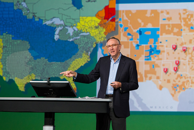
    “We have millions of users around the globe who do amazing things with our technology every day,” said Esri president Jack Dangermond. “The User Conference is our opportunity to recognize their important work, learn from them, and empower them with even better tools and techniques to continue their mission.”

    Other featured speakers will include operations staff from Hartsfield-Jackson Atlanta International Airport, executives from JPMorgan Chase, the director of Strategic Cooperation at the International Centre for Integrated Mountain Development (ICIMOD), and the president and CEO of the National Geographic Society. Former Maryland governor Martin O’Malley headlines a list of innovators from across every industry who will demonstrate how geospatial technology can make government smarter, combat global health challenges, ensure public safety, and drive greater revenues for businesses.

    With a full week of activities, the 2015 Esri User Conference is shaping up to be the biggest yet.

    Starting Off the Week with a Bang. Before the Esri UC even kicks off, a series of concurrent events related to business; education; national security; architecture, engineering, and construction (AEC ); and 3D mapping will take place July 18 and 19 in and around the San Diego Convention Center. These focused events will give attendees a deeper dive into various functional areas and equip them with an action plan to immediately invigorate their own organizations.

    Real Stories from Real People. Throughout the week, more than 1,000 users will deliver presentations detailing how GIS helps their organizations in a number of ways. Whether they’re onstage for Monday’s Plenary Session or leading one of the nearly 300 moderated paper sessions, speakers will share lessons learned and best practices that can help their peers succeed.

    Celebrating 100 Years of Mapping. The National Geographic Society will be on hand to continue celebrating the organization’s 100 years of making maps. A chronicle of the history of maps and the American presidency, from future President Dwight Eisenhower carrying maps into battle during World War II to President Barack Obama receiving official presidential maps in the White House, will present the art and science of where. Gary E. Knell, president and CEO of the National Geographic Society, will also speak at the Plenary Session about the importance of geography in science, technology, engineering, and mathematics (STEM) education.

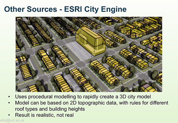
    Innovation on Display. From hundreds of expert-led technical workshops to the expansive GIS Solutions EXPO featuring more than 300 technology companies and start-ups, attendees will immerse themselves in the latest and greatest in mapping and spatial analysis. Attendees will find a range of demos, talks, and resources about hot topics—big data, 3D visualization, unmanned aerial vehicles (UAVs), and more.

    The Esri UC and related events will span seven days and offer opportunities for both technologists and managers to understand how geography can be applied to every organization’s challenge to drive better outcomes. For more information, visit esri.com/uc.

  • New Speakers Announced for Thursday’s Street Smart Webinar

    New Speakers Announced for Thursday’s Street Smart Webinar

    Three new speakers have been announced for Thursday’s GPS World Market Insights Webinar. The webinar, “Street Smart: City Modeling and Other New Geospatial Techniques in Urban Mapping and Navigation,” will be held July 16, 1 p.m. EDT/ 10 a.m. PDT/ 5 p.m. GMT. Registration is free.

    The webinar provides a high-level overview of the latest enhancements to computerized geometric city models, which can help overcome data gaps and inaccuracies created by signal obstruction, to improve GNSS positioning in dense urban areas. The webinar will focus on use of 3D mapping to aid GNSS in three different ways: shadow matching, height aiding and non-line-of-sight (NLOS) detection for conventional positioning.

    Claire Ellul, University College London, will discuss creating 3D datasets from photogrammetry, LiDAR, building information models (BIMs), Esri City Engine, Sketch Up, Google Earth and Open Street Map.

    A page from Claire Ellul's upcoming webinar presentation.
    A page from Claire Ellul’s upcoming webinar presentation.

    Also speaking are Rahul Gupta, Spirent Communications, and Gregory Moura, OKTAL Synthetic Environment, who leads the development of SE-NAV, a RayTracing simulator computing the propagation of GNSS signals in urban environments. The new version of this software can be embedded in a hardware in the loop process with Spirent’s SimGen to assess the performances of HW receiver in constrained environments.

    Paul Groves will discuss “Better GNSS Positioning in Cities using Enhanced 3D Mapping,” addressing the problems of poor GNSS geometry in urban canyons, showing how 3D mapping improves GNSS positioning in several ways: height aiding,  non-line-of-sight prediction, model-aided ranging and shadow matching.

    A page from Paul Grove's upcoming webinar presentation.
    A page from Paul Grove’s upcoming webinar presentation.

    Visit our webinar page for full biographies of the speakers, and more information about our webinars.

  • ENVI Analytics Symposium Focused on Remote Sensing

    The ENVI Analytics Symposium (EAS), scheduled for Aug. 25-26 in Boulder, Colo., will bring together experts in remote sensing science to discuss technology trends and the next generation of solutions for advanced analytics.

    Geospatial analytics are important because they can be applied to a diverse range of needs in environmental and natural resource monitoring, global food production, security, urbanization, and other fields of research, according to event organizer, Exelis.

    The need to identify technology trends and advanced analytic solutions is being driven by the staggering growth in high-spatial and spectral resolution earth imagery, radar, LiDAR, and full-motion video data. Join your fellow thought leaders and practitioners from industry, academia, government, and non-profit organizations in Boulder, Colo., for an intensive exploration of the latest advancements of analytics in remote sensing.

    Sponsors and attendees represent organizations such as Airbus Defence and Space, U.S. Fish & Wildlife Services, DigitalGlobe, U.S. Geological Survey, Esri, Naval Post Graduate School, Oak Ridge National Lab and more.

    Learn more at the conference website.

  • PTFS to Rebrand ArchivalWare as Knowvation at GEOINT 2015

    Progressive Technology Federal Systems Inc. (PTFS), a provider of Enterprise Content Management (ECM) solutions, has upgraded and rebranded ArchivalWare, its flagship product line, as Knowvation. PTFS will demonstrate the enhanced Knowvation ECM offering and the roles it can play in Activity-Based Intelligence at GEOINT 2015, which will be held June 22-25 in Washington, D.C.

    “In response to client feedback, we have improved the Knowvation graphical user interface making it faster and easier to query and retrieve content from vast enterprise repositories,” said Dan Quinn, PTFS vice president. “Knowvation will continue to appeal to government agencies, commercial organizations and libraries.”

    PTFS will demonstrate the new Knowvation ECM solution in booth #2083 at the GEOINT 2015 Symposium.

    Knowvation ECM is a web-based federated search and discovery application that manages structured and unstructured content, including born-digital and digitized files, in many databases at multiple locations across the enterprise. Fully modular, Knowvation enables users to interrogate and retrieve content by searching on metadata, full text, or geospatial parameters. Searchable content includes documents, books, newspapers, video, audio, photographs and raster/vector geospatial files in all formats.

    “Combining full-text and geospatial queries sets Knowvation apart from many other Enterprise Content Management systems,” said Quinn. “The geospatial search and discovery capability has made Knowvation a trusted all source tool relied upon by government agencies with large GIS and satellite imagery archives, especially in the Intelligence Community.”

    Knowvation users can perform geospatial searches on data archives containing over 200 different types of file formats. Format-agnostic geospatial queries can be initiated by typing a geographic name, entering latitude/longitude coordinates or drawing a polygon on a map interface. Once the analyst has retrieved required data their ELT of choice is launched with one click to perform analysis and build timely actionable intelligence.

    PTFS offers the option of deploying Knowvation as the client’s repository of record in which all content is ingested, stored, managed and searched. Or the client may keep its content in other applications and shared drives with the ECM solution deployed externally to index the information for easy search and retrieval. The Knowvation server can be located behind the client firewall or hosted by PTFS offsite or in the Amazon cloud in a Software-as-a-Service business model.

    Introduced 11 years ago as ArchivalWare, Knowvation is deployed in government agencies, libraries, academic institutions, and labor unions. The largest installations are within the U.S. federal government at DoD sites.

    PTFS President John Yokley and Global Marketing Insights President Dr. Shawana Johnson will participate in a video at GEOINT 2015 discussing emerging technologies in the Federal/Civilian space and Knowvation’s move into the Amazon Marketplace.

    Concurrent with GEOINT, Dan Quinn will speak on GeoPDF technology at 11 am on Thursday, June 25, at the U.S. government’s 9th Geospatial PDF Working Group meeting at the Washington Convention Center.

  • Live from the 2015 eMerge Americas Show

    Geospatial Solutions and GPS World‘s Art Kalinski reports from eMerge Americas, held May 4-5 in Miami. eMerge Americas is a global idea exchange focusing on how technology and innovation are disrupting industries. The conference serves as a platform connecting startups, cutting-edge ideas and global industry leaders and investors across North America, Europe and Latin America.

  • Cold Assets: GeoDecisions Platform Used to Track Icebergs

    Cold Assets: GeoDecisions Platform Used to Track Icebergs

    This photo shows drifting icebergs from the Amundsen during research expedition. (Photo: courtesy of Greg McCullough, University of Manitoba)
    This photo shows drifting icebergs from the Amundsen during research expedition. (Photo: courtesy of Greg McCullough, University of Manitoba)

    A Canadian expedition team used GeoDecisionsGeoILS platform to help track icebergs during a voyage to better understand how icebergs drift. An intelligent location server using the Esri ArcGIS platform, GeoILS enables users to monitor and locate assets and facilitate quick and coordinated responses.

    GeoDecisions, an information technology company specializing in geospatial solutions, partnered with Solara Remote Data Delivery Incorporated, Canada’s Carleton University and Esri during the project.

    Led by University of Manitoba Scientist David Barber, the crew of Canadian Coast Guard Icebreaker Amundsen sailed off the coast of Newfoundland and Labrador to research ice hazard mitigation, the effects of climate change, and polar region technology requirements. GeoILS location intelligence helped crew members visualize, analyze, and leverage project-pertinent data.

    “During the expedition, researchers and scientists used GeoILS to assess drifting through sensor monitors attached to the icebergs,” said Brian Smith, vice president of commercial solutions with GeoDecisions. “In addition to reporting and notifications, GeoILS provided the project team with maps that were tailored by selecting desired iceberg information and the geographic area of interest based on user-defined criteria.”

    Above is a representative snapshot of GeoILS’ features and range of functionality used during the Canadian iceberg expedition.
    Above is a representative snapshot of GeoILS’ features
    and range of functionality used during the
    Canadian iceberg expedition.

    GeoDecisions’ data portal was used with Iridium Solara tracking devices during the iceberg research project. “We are excited to provide tools to scientists who are gaining critical insights into the behavior of icebergs and global climate change,” said Tom Tessier, president of Solara Remote Data Delivery Incorporated.

    Solara Field Tracker 2000.
    Solara Field Tracker 2000.

    “GeoILS and the satellite tracking beacons worked very well during this project,” added Derek Mueller, assistant professor and physical geography program supervisor with Carleton University. “Thanks to our partners’ efforts, we now have a great new suite of tools for examining our data.”

  • LizardTech Extends Global Reach with Partnerships

    LizardTech, a provider of software solutions for managing and distributing geospatial content, has expanded its global presence with several new business partnerships and product purchases during the first half of 2015.

    During the last six months, national governments, energy organizations and infrastructure owners and operators have all bought LizardTech software in countries such as Canada, Sweden, Norway, Germany, United Kingdom, Spain, South Africa, Saudi Arabia, Turkey, Oman, Australia and the Philippines.

    New partnerships established this year include EMi Grup in Turkey, Beijing Space Eye Innovation Technology Co. in China, Esri Muscat in Oman, and the Cuminas Corporation in Japan. Additionally, Sani International of Canada re-committed to LizardTech product distribution in Canada and the Caribbean. LizardTech’s international relationships outside of the Americas are managed by the geospatial sales and marketing agency, Quarry One Eleven, based in Guildford, UK.

    “We are delighted with the progress we have made in promoting LizardTech’s remarkable MrSID-based software throughout the European, African and Middle Eastern market places and beyond into Asia Pacific,” said Quarry One Eleven Founder Alistair Maclenan. “LizardTech is a great client that understands the power of marketing and in-region representation. Their support has been a huge factor in the partnership and sales successes we have seen for their image compression, preparation and distribution products.”

    “We have had an exciting first half of the year which illustrates that our products are in demand all over the world,” said Jeff Young, who directs Global Business Development at LizardTech. “These sales validate the sustainability of LizardTech over the last 23 years through partnerships in multiple continents. We take pride in our customer’s loyalty and continued commitment to our MrSID image compression format.”

  • INTERGEO Conference in Stuttgart Focuses on Future

    InterGeo-logo

    The conference program and registration for INTERGEO 2015 are now live. Register before July 31 to benefit from the early-bird booking rate.

    The conference will open with keynote speeches by Chris Cappelli (Esri Inc.) on “The Age of the Location Platform: How Mapping and GIS are Transforming the Work Environment” and Prof. Georg Gartner (TU Wien, Vienna University of Applied Sciences), president of the International Cartographic Association, on “The Future of the Map – the Map of the Future.” 

    “The agenda for the INTERGEO conference in Stuttgart is packed with exciting topics that are the focus of ongoing political debate on the digital world and will play a key role in shaping the way we work in future,” reads a statement by INTERGEO. “With keynote speeches and plenary talks delivered in English and simultaneous interpreting provided for one strand of the conference on the second day, it is clear that INTERGEO is also becoming increasingly significant on an international scale.” 

    The major topic of discussion at 2014’s INTERGEO remains a key part of the conference this year — INSPIRE examines geo-issues from a European perspective, providing practical examples and focusing on further development of the European directive. Other central themes include geodata as a basis for construction management and land development, a major concern for future development at regional and local level, as well as issues relating to property markets and valuation. These subjects are all crucial when it comes to discussing the “smart cities” and “smart villages” of the future, according to INTERGEO.

    Another highlight of INTERGEO in Stuttgart this year will be the panel discussion on the second day on “Geospatial Information – A Key Element for Emerging Markets.” The high-profile panel of speakers include Bengt Kjellson (UN-GGIM Europe), Ola Rollen (Hexagon), Steve Berglund (Trimble) and Chris Cappelli (Esri Inc.).

    A further key topic at the conference that is set to have a profound effect on the working world is geoinformation and mobility. DDGI and DVW will be addressing this together and discussing practical examples in two event strands.

    The contributions on big data will focus on the rapid development of data capture, processing and presentation as well as the direct integration of data into business processes. Geoinformation as an element of networked processes is a subject of major international significance, as evidenced by the conference’s high-profile speakers. “In terms of digitization, the conference will be key to paving the path to Geospatial 4.0 and the networking of digital geodata,” said Prof. Karl-Friedrich Thöne, president of the event’s host, DVW, adding, “INTERGEO is the ideal forum for creating processes that could eventually benefit the entire value-added chain.”

    As important as data may be in the digital world, it is also crucial to have the right visualization concepts in place. This will be demonstrated through presentations on the German Cartographers’ Day, which will form part of INTERGEO this year.

  • Cisco Displays City Management Tools at eMerge Americas

    Geospatial Solutions’ and GPS World‘s Art Kalinski reports from eMerge Americas, held May 4-5 in Miami. Cisco had a very large display showing city management of transportation, utilities and planning using geospatial tools and management systems.

  • FAA Awards Harris $238M Contract for Weather Support

    The Federal Aviation Administration (FAA) has selected Harris Corporation for an eight-year, single-award indefinite delivery/indefinite quantity (IDIQ) contract with a potential value of $238 million to design and implement a system that will disseminate real-time, comprehensive weather pictures to all aviation users across the National Airspace System.

    The Common Support Services–Weather (CSS-Wx) program will help minimize flight delays and cancellations by providing additional weather data with increased accuracy to more aviation consumers, supporting real-time operational planning and decision-making.

    “About 70 percent of flight delays are caused by weather,” said Carl D’Alessandro, vice president and general manager, Civil Programs, Harris Government Communications Systems. “The enterprise-wide, data-sharing design of the CSS-Wx solution will reduce these delays, saving the FAA and flying public precious time and money.”

    The Harris CSS-Wx system is scalable, with Open Geospatial Consortium standards for common weather formats, and highly advanced geospatial- and temporal-based filtering methods to process meteorological data. It applies expertise the company has gained from work on mission-critical weather programs for the FAA, the National Oceanic and Atmospheric Administration and the Department of Defense.

    Harris has a long history of developing and integrating system solutions for the FAA in support of the National Airspace System (NAS). The company is the prime contractor for the FAA Telecommunications Infrastructure (FTI) program, which provides critical voice, data and video communications for NAS operations and mission support functions. FTI securely connects more than 4,500 national and international FAA and DOD facilities, manages over 26,000 services, and supports more than 50,000 users. Other FAA programs developed by Harris include:

    • The Weather and Radar Processor, which provides weather processing dissemination and display capabilities to air traffic controllers in the en-route air traffic control environment;
    • Datacomm, which provides air-to-ground digital data link networks to connect FAA air traffic control sites and data communications-equipped aircraft;
    • The NAS Voice System, which provides a secure, IP-based voice network for critical communications between air traffic controllers, pilots and ground personnel nationwide;
    • The Operational and Supportability Implementation System, which serves the General Aviation community in Alaska by providing weather briefing and flight planning services; and
    • The National Air Space Enterprise Messaging Service, which will provide the FAA with the network-centric, collaborative information-sharing capabilities afforded by System Wide Information Management.
  • Trimble Expands Product Line for Surveyors

    Trimble Expands Product Line for Surveyors

    Photo: Trimble

    Trimble has expanded its portfolio of geospatial solutions for surveyors, engineers and mapping professionals. Highlights include new total stations, a new GNSS receiver and new field and office software features. The solutions save time, reduce costs, streamline workflows and produce high-quality geospatial deliverables across a wide range of industries, Trimble said.

    “Trimble’s portfolio expansion will enable our customers to work in a more efficient, seamless and collaborative manner,” said Chris Gibson, vice president of Trimble. “Trimble’s solutions are best known for quality, dependability and performance. Our vision is to equip customers with the most innovative tools, which includes a focus on offering new software applications that streamline and elevate the value of geospatial data to guide smart decision-making and transform the way organizations work.”

    The expanded portfolio of productivity solutions include:

    GNSS Solutions

    The new Trimble R8s Integrated GNSS receiver and updated version of Trimble Access field software combine to offer configurable and scalable settings. Surveyors have the flexibility across their workflows by being able to tailor the Trimble R8s receiver with the updated field software for their specific application. The ability to customize provides flexibility for future business requirements and allows customers to maximize efficiencies across their workflows.

    Total Station Solutions

    Trimble-totalstations-W

    A range of new and enhanced robotic total stations — the Trimble S5, S7 and S9 — improve project efficiencies, productivity and deliverables. Times saving enhancements include improved Trimble VISION technology, SureScan technology included in the S7 and optional in the S9 total station, and the DR Plus electronic distance measurement technology as a standard feature.

    Theft and loss risks are also minimized now with Locate2Protect technology embedded in each instrument, allowing users to remotely track the location of their equipment in real-time using Trimble InSphere Equipment Manager.

    In the office, Trimble Business Center software can be used to create high-dynamic-range (HDR) images using data captured with total stations. A new total station data editor enables fieldwork to be rapidly reviewed and allows surveyors to create deliverables with confidence, Trimble said.

    Scanning Solutions

    Trimble continues to blend powerful 3D laser scanning and imaging hardware with workflow-based software to drive new efficiencies for survey applications and construction planning and design.

    The Trimble TX8 3D laser scanner now offers greater accuracy (down to 1 mm) and streamlined onboard operation when measuring to longer ranges, decreasing the field time required for capturing reliable high-accuracy data.

    Enhanced tools in Trimble RealWorks software version 9.1 further reduce the time to produce high-quality deliverables from Trimble TX8 data. The new version of Trimble RealWorks software includes improved workflows for creating floor settlement plans and 3D pipeline models as well as complete storage tank inspection and reporting capabilities.

    cameraSightImage_S6-W

    Imaging Solutions

    Trimble enhancements to Trimble VISION workflows increase the value of highly accurate image data. Survey, engineering and civil infrastructure professionals can now generate dense point cloud deliverables in Trimble Business Center from images captured using the Trimble V10 Imaging Rover. Users can also quickly generate 2D CAD and 3D real-world models from images captured with Trimble total stations using the streamlined workflows created within Trimble Business Center and SketchUp software.

    Availability

    Trimble Access field software, Trimble Business Center version 3.50 office software, the Trimble R8s GNSS receiver, Trimble S5, S7 and S9 Total Stations and TX8 3D Scanner are available now through Trimble’s Geospatial Distribution Channel.

  • EuroGeographics, EuroSDR to Join on European Spatial Research

    EuroGeographics and EuroSDR have announced that they will work together to provide a framework for European spatial data research and development.

    The cooperation agreement will further the development of the EuroSDR Research Plan and the activities of the EuroGeographics Knowledge Exchange Networks. As a result, members of both not-for-profit organizations will benefit from greater opportunities for professional development. They will also be able to take part in joint projects and hand over tasks more appropriate to the other organisation’s expertise.

    “We have a common interest in carrying out and applying relevant research and developments in the field of geographic information and spatial data infrastructures,” said Ingrid Vanden Berghe, president of EuroGeographics, the membership association of the European National Mapping, Land Registry and Cadastral Authorities.

    “With rapid technological advances generated by a digital information society, the time from research via development to operation has never been faster. This agreement will ensure our members remain up to date with and understand the possibilities presented by new technologies and methodologies so they can react more quickly to user demands.”

    Martin Salzmann, president of EuroSDR, which links national mapping, land registry and cadastral authorities with research institutes and universities in Europe, added: “Achieving synergy in our activities benefits both our members and society by strengthening research and development, sharing results of common interest and making these operational. At the same time, we will foster and stimulate a vibrant research community with which to capitalise on future technologies and to be responsive to user demands. By working together we also avoid the risks of duplication of work between us and our member organisations.”

    EuroGeographics and EuroSDR are both committed to supporting wide range of initiatives that will benefit people across Europe, the companies said. These include the European Spatial Data Infrastructure, Copernicus, Galileo, Horizon2020, European Location Framework and the European Digital Single Market.