Miguel Amor, chief marketing officer, Hexagon’s Autonomy & Positioning Division
GPS World celebrates its 30th anniversary, and together we’ve seen huge leaps of innovation over the years. Reflecting on these developments, I wanted to share some of the contributions Hexagon | NovAtel made to support the evolution of the GNSS industry.
We began in 1978 in Alberta, Canada, in the telecommunications industry. In the 1990s, we shifted our focus to satellite receivers, choosing to forge ahead in GPS/GNSS technology. This decision would see NovAtel become one of the world’s leading manufacturers of high-precision GNSS components and systems developing multiple new patents and innovative solutions.
Our engineers have seen first-hand the growth of GPS and other satellite positioning systems worldwide, GNSS adoption across industries from aerospace to agriculture, and the present-day developments of precise positioning in autonomous applications. A rising tide raises all boats, and we helped foster the evolution of the industry through our goals of assured autonomy and positioning.
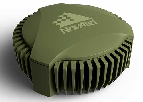
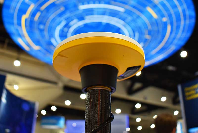
GAJT-710ML anti-jam antenna. (Photo: Hexagon)
Assured positioning means a reliable and robust solution you can trust. Technologies we’ve contributed to the broader industry include our GPS Anti-Jam Technology (GAJT) protecting users’ positioning, time and navigation, and SPAN technology, which expertly combines GNSS and inertial navigation systems (INS) measurements for seamless motion observations and a robust positioning solution. The capabilities of these technologies have been major contributors to the evolution of the GNSS industry.
Hexagon acquired NovAtel in 2007, and we’ve continued to grow and develop exciting new opportunities around the world where GNSS can grow, strengthen and improve applications in agriculture, automotive, defense, marine and many other industries. Our mission of assured autonomy and positioning encourages us to continue providing assured positioning in the most demanding environments and begin bringing autonomy to these markets.
GPS World has been a key player in covering these technological advancements for the past three decades. Together as an industry, we’ll continue innovating positioning and autonomy, and I’m excited to see how the industry will evolve over the next 30 years.
Stuart Riley, vice president of GNSS technology, Trimble
Over the past 30 years, GPS World has been at the forefront of the transition of GPS from obscure technology to ubiquitous utility. The magazine was first published before the satellite constellation achieved Initial Operational Capability (IOC). In fact, it preceded Operation Desert Storm, which created unprecedented publicity and demand for GPS equipment; and has documented a period of unprecedented increase in the rate of change in the technical disciplines.
Thirty years after the Wright brothers’ initial flight, commercial air travel remained expensive, uncomfortable, and available to relatively few people. Compare that to GPS and GNSS — in 30 years the technology has moved from 50-pound receivers powered by car batteries to residing in the pockets and on the wrists of billions of people.
In 1978, the year the first GPS Block-I satellite was launched, Trimble was founded. Trimble’s first product was a Loran receiver in 1980, followed by the world’s first commercial GPS product in 1984. The year the magazine was launched, Trimble became the first publicly traded GPS company in 1990. Positioning technology is in Trimble’s DNA and the foundation for helping transform industries such as construction, agriculture, transportation, geospatial and more.
Two factors drove GPS from obsurity to ubiquity: Rapid technological advances (electronics, software, communications, and increasing numbers of satellites) combined with innovations using positioning to benefit large numbers of users across disparate applications. Think of it as “Moore’s Law meets market demand.”
A Malaysian tribe and the Trimble 4000SLD, the first kinematic “backpack” GPS receiver. Weighing 44 lbs. without batteries, the receiver was introduced in 1988. (Photo: Trimble)
The key to GNSS’s growth is its adaptability. By serving a broad range of industries, GNSS manufacturers addressed widely differing needs for precision, form factors, interfacing, and availability of positions. The markets drove the development of more-capable and cost-efficient solutions and injected varying requirements for performance and functionality.
Recent advances illustrate the ability of GNSS technology to react to market needs. Satellite-delivered PPP corrections enable users to achieve real-time centimeter accuracy with fast convergence time almost anywhere on Earth. Low-cost, high-performance inertial sensors boost performance in challenging environments. Software-defined high-precision GNSS receivers, coupled with augmented reality on consumer devices (phones and tablets), open the door to innovation in as-yet-undiscovered directions.
GNSS is playing a key role in a broad range of applications. For example, compact, high-precision receivers are transforming work by delivering higher levels of productivity, reliability, safety and flexibility in industries including automobile and trucking, precision farming, and earthworks and construction. Future applications are expected to increasingly integrate GNSS with other sensors to drive productivity and safety for autonomous applications.
It took less than 30 years to move from static post-processed positioning to holding centimeter precision in your hand. For those of us who experienced the early days, GNSS has changed the world in ways we never imagined. The next three decades will see GNSS embedded into applications unimaginable today.
And to GPS World: Congratulations and thank you for 30 great years of pioneering the education, awareness, and promotion of the GNSS industry.
Depending on your age, 30 years represents a varying opinion of time. For some, it may seem like forever; for others, it may be a blink of an eye. In respect to technology, it can represent a complete change in the way we do things.
When we turned the calendar page to January 1990, our world had yet to experience the internet, the Hubble telescope had not been deployed to share its fantastic views, and The Simpsons television series was preparing to become the cartoon juggernaut it remains today.
Yes, lots has changed since 1990, and surveying is no exception.
Most professions look back through their history and see various periods where discoveries and inventions revolutionized how the work was completed.
For surveyors, the past 30 years have contained more advancements than all other years combined, with the greatest achievement being the global navigation satellite system (GNSS). With the United States leading the way with its Global Positioning System and the civilian ability to use this measuring system, modern surveying was forever changed.
Solar and lunar observations replaced
Before the implementation of a satellite navigation system, true global navigation was only computed using solar and lunar readings under specific conditions. GPS provided a new frontier for surveyors to establish positions without having to perform traversing from known points or collecting solar/lunar observations.
As the constellation grew, it became easier to use GPS to gain initialization for accurate and redundant position determination. As processor speeds and data storage capability increased, real-time kinematic (RTK) observations became the norm for surveyors everywhere.
The Russian satellite constellation, GLONASS, began operating fully in the late 1990s, and is now included to create today’s GNSS. More satellites provide more coverage, which in turn means more data collection potential.
Many nations and regions are building their own constellations to augment the current GNSS lineup, and also to safeguard the ability to obtain geographic locations when other systems are not available.
Bathymetric surveys made easy
GNSS capability and integration revolutionized several aspects of surveying, including a new and more reliable way of performing bathymetric surveys over large bodies of water. Computerized depth sounders were programmed to coincide readings with GNSS data collection to provide a more accurate and precise method of hydrographic surveying.
The past decade has continued the reliance on GNSS technology with many more devices and applications — not just for the surveyor, but for the public as well. While surveyors are using GNSS receivers on unmanned vehicles such as UAVs and boats, satellite navigation has infiltrated into many of our everyday routines. Cellphones, fitness trackers and our automobiles use this technology to guide us to our destinations.
Surveyors have used the GNSS revolution to create a digital world for better data collection, asset management and increased efficiency. Much has changed in 30 years for the surveyor and the world around us, so we should not be surprised about what technology will bring us next.
Current u-blox GNSS platforms — from u-blox M8 and beyond — support the recently completed BeiDou navigation satellite system modernizations, improving the availability of GNSS positioning services.
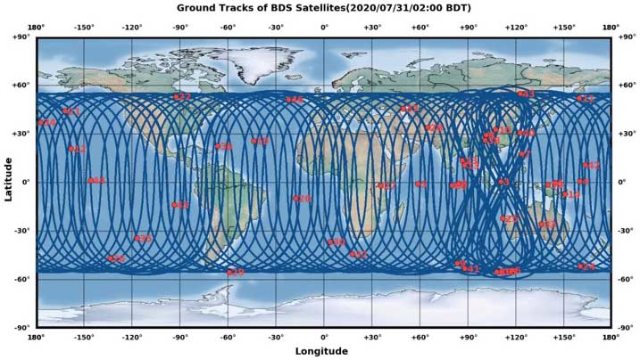
The opening ceremony of the BeiDou-3 global navigation satellite system (GNSS) was held in Beijing on July 31, officially celebrating the expansion of coverage offered by the critical Chinese space infrastructure to a global user base.
As a global supplier of GNSS positioning and wireless communication technologies, u-blox has been driving technological innovation and deeply involved in the Chinese market for many years.
Tests conducted across China and Europe have shown that including the BeiDou system can improve the positioning accuracy of GNSS receivers when multiple navigation satellite systems are tracked concurrently. When signals are partially obstructed, positioning accuracy can be significantly improved by incorporating the BeiDou system.
Data shows that in 2019, the overall output value of the Chinese satellite navigation and location service industry reached nearly 345 billion yuan, an increase of 14.4% over 2018, with the output value expected to exceed 400 billion yuan in 2020.
Graphic: China Satellite Navigation System Management Office Test Evaluation Research Center
Additional Services Provided by BeiDou
The BeiDou system provides a suite of additional services, including satellite and ground-based augmentation services, precise single-point positioning, precise timing and global short message services, laying a solid foundation for BeiDou’s ubiquitous navigation and tracking applications.
Applications of GNSS technology continue to diversify, leveraging the all-weather, all-time, tracking, navigation and timing services it offers. GNSS technology is penetrating deeper into traditional industrial verticals, such as agriculture, forestry, animal husbandry and fishery, power and energy, as well as in railway and air transportation, including their infrastructure construction and management.
At the same time, GNSS technology has become an indispensable and “smart” factor in emerging application fields such as the internet of things and the “internet of vehicles,” as well as in innovative applications such as autonomous driving, automatic parking and automatic logistics, and is now commonplace in many industrial and consumer use cases.
“U-blox has been closely following the modernization of the BeiDou navigation system and is ready to work with partners in various industries to promote the expansion of industry applications, expand emerging markets and jointly create a green industry ecosystem,” said Hamilton Chen, China country manager at u-blox.
When I was a kid in the 1960s, I was entranced by the vision of the future. Decades later, we’re here, with personal jetpacks nowhere in sight. What gives?
Photo: Photo: ridvan_celik/E+/Getty Images
When I was a kid in the 1960s, I was entranced by the vision of the future offered by science fiction books, movies, television shows and comics. Advances in technology would deliver us so many wonders — flying cars, hoverboards, robot servants. Disneyland was in on it, with an entire section of the park named Tomorrowland and its now-quaint “Carousel of Progress” attraction.
But the coolest thing would be that jetpack. You could slap it on your back and take off into the atmosphere, traveling wherever you wished like a bird. Certainly by the distant year 2020, we would all be jetting around the atmosphere from place to place.
(It didn’t occur to me that would mean strapping an actual jet engine to my body, along with highly flammable jet fuel. Where’s the fun in that?)
Decades later, we’ve all arrived in the “future,” with personal jetpacks nowhere in sight. What gives?
Then again, what I didn’t imagine in our future was a system that could pinpoint my exact location anywhere on the globe, estimate my time of arrival, and tell me about the traffic up ahead.
Back in the 1960s, that was seriously science fiction. Nor did we accurately predict the effect that capability would have on our daily lives. GPS along with internet-capable smartphones have thrust us into the Information Age.
The internet is a promise delivered, in its own way. Having a repository for all of the world’s information was another future concept, but usually envisioned with a giant worldwide computer that eventually turned on its makers.
As for flying cars, we are gradually getting there. Drone technology, supported by GNSS technology for its navigation, has led to unmanned craft and is heading toward vehicles capable of transporting people. We just need to be a little more patient.
In the spirit of looking back and ahead, check out our 30th Anniversary Supplement, which arrived with this issue. In it, experts from across the industry share memories and thoughts, and gaze into their crystal balls to predict the future of GNSS.
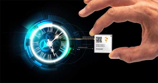
Septentrio’s mosaic-T is built specifically for resilient and precise time and frequency synchronization under challenging conditions. (Photo: Septentrio)
Septentrio has launched the mosaic-T GPS/GNSS receiver module, built specifically for resilient and precise time and frequency synchronization under challenging conditions.
According to the company, its multi-frequency, multi-constellation GNSS technology — together with AIM+ Advanced Interference Mitigation algorithms — allows mosaic-T to achieve maximal availability even in the presence of GNSS jamming or spoofing. This compact surface-mount module is designed for automated assembly and high-volume production.
“We are excited to expand our mosaic GNSS module family with mosaic-T, which will provide critical infrastructure and mission-critical PNT applications with accurate, reliable and resilient timing solutions,” said Francois Freulon, head of product management at Septentrio.
Septentrio mosaic-T delivers timing with nanosecond-level accuracy and has additional inputs for an external high-accuracy clock, the company added.
Septentrio, headquartered in Leuven, Belgium, designs and manufactures multi-frequency multi-constellation GPS/GNSS positioning technology for demanding applications.
Javad Ashjaee, founder of Javad GNSS, has died in Moscow, Russia. He died on May 30 after a three-week fight with COVID-19.
The news was first reported by a family member on social media. Ashjaee was born in 1949.
“It is with heavy hearts that we share the news of the passing of our founder Javad Ashjaee, a GPS/GNSS pioneer and visionary, on the morning of May 30, 2020, due to COVID-19 in Moscow, Russia,” reports a statement on the JAVAD GNSS website.
The website continues, “Over the course of 37 years, Javad made an incredible and far-reaching impact in the GNSS community. He pioneered the world’s most advanced GNSS technology through a multi-national effort that combined GPS and GLONASS and established more than a quarter century of partnership between Silicon Valley and Moscow. He was always proud of this ‘success story of cooperation.’ Javad was a true industry disrupter long before the term and concept became popular. His whole way of doing business was challenging and disrupting to the status quo.”
Read more about Ashjaee in his own words on the Javad GNSS website, where he describes the founding of his company:
“In 1998 I founded Javad Positioning Systems (JPS) and introduced Legacy, Odyssey and Regency products, followed by HiPer. It was a 76-channel geodetic receiver. Other companies later copied HiPer. Today, many of GNSS receivers look like it. I sold JPS to Topcon, who changed its name to Topcon Positioning System and is a very successful company.
“In 2007, after my obligations to Topcon ended and according to the provisions of our agreement, I founded Javad GNSS and introduced Triumph products. These were 216-channel receivers, integrated with several communication channels. We also introduced their Alpha, Delta, and Sigma versions. We were again the first to offer European Galileo and Japanese QZSS tracking in mass production. Triumph technology has been shown to have the best signal quality and best multipath reduction capabilities against all others tested by the German Aerospace. We also introduced GLONASS inter-channel (group/carrier delay) calibration to 0.2 millimeter which made GLONASS FDMA as good as GPS CDMA. Javad GNSS is growing fast and gaining market share.”
Articles, insight provided by Ashjaee to GPS World
Ashjaee’s nephew Sol Adibnejad provided this biography on his uncle via social media:
Javad was born in 1949 in Qom, Iran. After finishing his bachelor’s degree in electronic physics from the University of Teheran in Iran, he left Iran in 1972 to continue his education at the University of Iowa and got his graduate degrees, a doctorate in 1976. He went back to his native country Iran to teach at the university. He became the chairman of the Department of Computer Engineering at the Aryamehr University of Technology where he founded and managed a UNIVAC-100 computer centre. There, he created the first Iranian microprocessor lab. In 1978 he created one of the earliest student online and interactive registration systems in the world. In a few years and after the 1978 revolution and the political turmoil, things happened and he had to flee the country in 1981.
He went straight back to the U.S. and started the next chapter of his journey in life which led to the pioneering of GPS. He spent the rest of his life designing and manufacturing of many generations of his GPS and JPS products at JAVAD GNSS, JAVAD ArWest and JAVAD EMS in the Silicon Valley. Javad Ashjaee is listed as the primary inventor in 102 granted patents, the last one in April 2020.
GPS World spoke with Guillermo Perez-Iturbe, Trimble’s marketing director – agriculture, about the challenges for farms in adopting precision agriculture, including time, cost and connectivity issues in rural areas.
What technical challenges are faced in applying GNSS?
GNSS technology is at the center of precision agriculture and is one of the key enablers for the farm of the future. GNSS helps boost productivity, environmental sustainability and economic competitiveness.
Trimble’s GNSS agriculture solutions provide reliable, accurate positioning that can be tailored to meet specific needs, including different crops (broadacre vs. row crops) and activities (such as tilling, planting or fertilization). Trimble’s portfolio connects farming operations and includes guidance and steering; grade control, leveling and drainage; flow and application control; irrigation; harvest solutions; desktop and cloud-based data management; and correction services.
However, one of the challenges to fully realize the benefits of the future farm is connectivity. Typically, ag customers are in rural areas, where the available communications infrastructure to support Wi-Fi or cellular data communications varies widely. This can impact the ability to share information between field and office as well as between machines in the field.
But connectivity challenges have a lower impact on GNSS positioning. For example, farmers can leverage satellite-delivered corrections provided by Trimble RTX correction services using a compatible GNSS receiver and subscription service. This plays an important role in areas such as rural North America, Latin America and Australia. In many areas in Europe, farms can utilize a virtual reference station (VRS) for precise GNSS. There are also farms globally that operate their own GNSS reference networks or base stations to support accurate, high-precision, real-time positioning.
What are the remaining obstacles to adoption?
There is little resistance to the technology per se. The performance and value of precision farming are well known. Adoption rates can range from 80% to less than 40%, depending on geographic location, farm size (small family or large corporate farm), types of machines or crops, and etc.
Obstacles can come from multiple forms. For example, in some parts of the world farm staff may lack the skills or qualifications needed to operate the systems efficiently. To lower the barrier to entry, Trimble has designed intuitive user interfaces and displays based on an Android operating system. In some regions, taxation and import restrictions hinder attempts to implement GNSS into precise farming. There are also business-related issues. For example, a smaller farm must prioritize its investments, and improving or repairing a planting machine might be more important than installing GNSS technologies.
What does VerticalPoint RTK offer?
Trimble developed VerticalPoint RTK Grade Control to help farmers mitigate issues in water management and land forming. It provides centimeter accuracy in the vertical component. This accuracy level enables the precise grading needed to provide shallow flow and slow water movement.
When using VerticalPoint RTK, the GNSS rover receives and combines data from multiple reference stations to develop precise vertical measurements. It provides high confidence and can be used for grading, levees and berms, tile applications, and ditches. For larger-scale land forming based on precise terrain mapping, machines using VerticalPoint RTK can reduce the number of passes needed to bring the land to the designed grade and shape.
Do you have any other RTK services for precision ag?
The RTK technology used in Trimble agriculture solutions is consistent with RTK across other segments (construction, surveying, mapping and more). The differences are in the application and location, where we provide a variety of receivers, user displays, machine interfaces and software to produce accurate, reliable performance. The activities can range from tillage and grading to planting, adding inputs such as fertilizer or weed control — all the way through harvest. It is just a matter of talking with the farmers to understand their operations; we can then select and integrate components to optimize the solution.
As part of this, farms using Trimble RTX correction services can choose different levels of service based on their needs. This approach enables farmers to achieve (and pay for) only the accuracy they need. For example, some basic tillage operations can use RangePoint RTX with good results. Other applications, such as fertilizing row crops, may require the 2.5-centimeter accuracy provided by Trimble CenterPoint RTX corrections service.
A free GPS World webinar on Nov. 21 tackles a new frontier, if not the final one, for GNSS. “Developments in Space GNSS Navigation,” sponsored by NovAtel, brings together experts from NASA, ESA, NovAtel and Spire (the CubeSat company) to discuss how they’re taking GNSS capabilities beyond Earth’s boundaries.
Navigating through space has long proven to be challenge for aerospace engineers and professionals because of the complex combination of technology and cost required for success.
However, with advancements in GNSS and receiver technology, organizations and nations around the world are increasingly interested in space exploration activities.
Today, the space industry is seeing GNSS technology used in low-Earth orbit (LEO) and highly elliptical orbit scenarios.
In this webinar, speakers from NASA, ESA (the European Space Agency), NovAtel and Spire will examine emerging trends regarding the usage of GNSS technology in the space industry, including an increasing need for situational awareness while navigating through space and the ability to service satellites while in orbit.
These experts will also provide a look into their own experiences with a variety of ambitious space projects and applications.
Speakers include:
Werner Enderle, Head of Navigation Support Office, ESA European Space Operations Center
Benjamin Ashman, Aerospace Engineer, NASA
Erin Kahr, Critical Safety Systems, NovAtel
Dallas Masters, GNSS Program Manager, Spire
Date: Thursday, November 21, 2019 Time: 1 p.m. EST / 10 a.m. PST / 7 p.m. (1900h) Central European Time
Skylark is now available across the contiguous United States, enabling safe and lane-level accurate positioning.
Swift Navigation’s network-connected Skylark precise positioning service is now available throughout the United States. Full contiguous U.S. (CONUS) coverage reduces initialization times to seconds, ensuring high-accuracy, high-integrity positioning is available when customers need it.
Swift Navigation is a San Francisco-based tech firm providing centimeter-accurate GNSS positioning technology for autonomous vehicles, and the maker of the Piksi Multi and Duro GNSS receivers.
Skylark is built for autonomy at scale and delivers lane-level precision, with safety-of-life integrity, required by mass-market automotive and autonomous applications. Skylark is a scalable network delivering a continuous stream via the cloud of robust, reliable, multi-constellation, multi-frequency corrections, with the latency, security, precision and reliability required for safety and autonomy.
“Since Skylark was introduced last year, the Swift network team has been hard at work deploying infrastructure across the country,” said Rob Hranac, COO of Swift Navigation. “This extensive network helps remove hurdles in precise positioning for our customers and we look forward to partnering with those customers as we expand Skylark internationally.”
Skylark is designed to address the needs of automotive original equipment manufacturers (OEMs) by supporting ASIL-rated (Automotive Safety Integrity Level) systems and Ntrip2 (Networked Transport of RTCM via Internet Protocol) connections in cloud reference station (CRS) mode. It is state space representation (SSR) ready — an emerging industry format.
Skylark is hardware-independent, giving customers a choice in today’s rapidly improving and commodifying the GNSS sensor ecosystem. OEMs are able to benefit from the lane-level positioning Skylark delivers using a host of third-party receivers in addition to Swift’s Piksi Multi and Duro receivers.
Unlike legacy real-time-kinematic (RTK) services designed for smaller regions and precise point positioning (PPP) services that suffer from slow convergence times, Skylark is a high-performance hybrid nationwide U.S. network that delivers initialization times in seconds, better than 10 centimeters of accuracy and integrity required by the most demanding safety-of-life critical applications.
When used with Swift’s Starling positioning engine, Skylark is capable of delivering protection levels (PL) down to 1 meter and target integrity risk (TIR) down to 10-7/hour. Engineered for automotive functional safety standard ISO 26262 (ASIL B), Skylark is designed and built from the ground up to support next-generation GNSS applications, connected car, V2X and advanced driver assistance systems (ADAS).
Skylark packages GNSS precise positioning as an affordable subscription service for ease in deployment for large-scale autonomous vehicle fleets.
Trimble Catalyst On Demand enables automated domain-level email address access, which streamlines license allocation for organizations with a large number of users. (Photo: Allison Barwacz)
Trimble’s Catalyst software-defined Global Navigation Satellite System (GNSS) receiver for Android phones and tablets is now available with a usage-based service plan: Trimble Catalyst On Demand.
According to the company, the new service plan is focused on satisfying the requirements of a growing number of industries and organizations who recognize the benefits of using high-accuracy GNSS technology in the field, but need a more flexible payment model.
Trimble Catalyst On Demand provides scalable access to RTK-quality GNSS positioning using an affordable pay-per-use hourly pricing model in addition to the current Catalyst monthly plans, the company added. The service also enables automated domain-level email address access, which streamlines license allocation for organizations with a large number of users.
“Catalyst On Demand is Trimble’s response to the growing number of individuals and organizations needing flexible access to high-accuracy GNSS technology,” said Rachel Blair Winkler, business area manager, mapping and GIS, for Trimble. “By providing a usage-based payment model for Catalyst, we are empowering more users inside and outside the geospatial profession to record positions, navigate to points, measure relative distance and create digital maps. This results in better work and better decisions.”
Trimble Catalyst service subscriptions and the Catalyst DA1 antenna are available through Trimble’s Authorized GIS Distribution Network.