Tag: GNSS technology

  • First development kits available for Septentrio’s mosaic GNSS module

    First development kits available for Septentrio’s mosaic GNSS module

    Septentrio’s Mosaic chip-level GNSS. (Photo: Septentrio)
    Septentrio’s mosaic chip-level GNSS. (Photo: Septentrio)

    Septentrio’s mosaic development kit is now available for testing and integration.

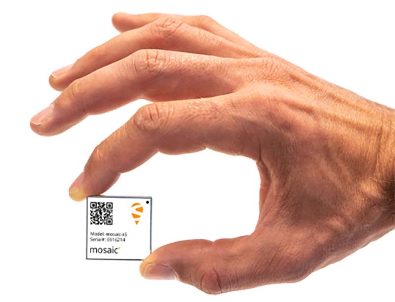
    Mosaic is Septentrio’s most compact, next-generation, high-precision multi-frequency GPS/GNSS module. The receiver brings precision and reliability of high-end multi-frequency GNSS to mass-market applications, the company said. It is designed to fit into the assembly-line process, which allows mosaic to be favorably priced for high volumes.

    Its lightweight and low power consumption helps extend the battery life of robotic devices, increasing operation time and efficiency. This makes mosaic suitable for applications such as robotics, automation, telematics and wearables.

    “We see a growing demand for reliable high-precision positioning,” said Chris Lowet, product manager at Septentrio. “A few years ago, this demand was concentrated in professional applications, for example survey, high-precision mapping and machine control. Today, with expansion of robotics, automation and IoT, a wide range of devices need high-precision positioning, from ag robots to IoT gateways to autonomous vehicles. We designed mosaic to answer these market needs.”

    Highlights of mosaic include:

    • Centimeter positioning in tough environments with multi-frequency, multi-constellation GNSS technology
    • Advanced Interference Mitigation (AIM+), which allows users to continue working despite radio interference from other electronic devices or jamming
    • Extensive corrections support for high-accuracy positioning: SBAS, PPP, SSR, RTK
    • RAIM+, integrity engine needed for safety-critical applications such as autonomous vehicles
    • Tracking all current and future GNSS satellite signals for enhanced real-time kinematic (RTK) performance and guaranteed RTK network compatibility
    • 100-Hz update rate, suitable for robotics and fast-moving vehicles.

    The development kit assists Septentrio customers with integrating mosaic into their system. It supports connectivity through internet, COM ports, USB 2.0 as well as an SD Card slot. The development kit can be requested here.

  • Abstract submissions open for GNSS event in Switzerland

    Abstract submissions open for GNSS event in Switzerland

    Logo: 7th International Colloquium on Scientific and Fundamental Aspects of GNSS

    Abstract submissions are open for the 7th International Colloquium on Scientific and Fundamental Aspects of GNSS until March 31.

    The event, which is organized by the European Space Agency and ETH Zürich, will take place Sept. 4-6 in Zürich, Switzerland.

    The event will bring together members of the European scientific community and their international partners involved in the use of GNSS — specifically Galileo — in their research. In addition, attendees will discuss opportunities where GNSS satellites can be used for scientific purposes.

    According to event organizers, the colloquium will address five major areas of research, including:

    1. Scientific applications in meteorology, geodesy, geodynamics, geophysics, space physics, oceanography, land surface and ecosystem studies, using either direct or reflected signals, differential measurements, phase measurements, radio occultation measurements, using receivers placed on the ground, in airplanes or on satellites;
    2. Scientific developments in physics with a potential impact on future GNSS, particularly in testing fundamental laws of physics;
    3. Aspects of metrology such as reference frames, on board and ground clocks, precise orbit determination and time and frequency transfer;
    4. Scientific aspects of satellite navigation, positioning and its applications, such as signal propagation, tropospheric and ionospheric corrections, multi-constellation aspects, hybridisation with additional sensors and integrated navigation, precise positioning;
    5. Transversal topics of interest to a wide number of scientific fields including collection of GNSS big data and GNSS scientific data archives; internet of things positioning for science; scientific payloads in GNSS satellites; novel disruptive technologies for science; the use of cubesats, HAPS, UAVs and autonomous vehicles for GNSS science; software receivers and low-cost SDR platforms; GNSS for space users and applications; and the topic of GNSS science and education.

    The conference will be organized as a series of plenary talks, parallel half-day sessions and poster presentations throughout the duration of the event, event organizers add.

  • Hemisphere highlights RTK products and solutions at Intergeo 2018

    Hemisphere GNSS’ Miles Ware discusses the company’s line of RTK positioning products and GNSS technology at Intergeo 2018, which took place Oct. 16-18 in Frankfurt, Germany. The solutions are suitable for the marine, machine control and land survey markets.

  • Trimble presents GNSS receiver boards at Xponential 2018

    Trimble’s Chris Wheeler offers an overview of Trimble’s GNSS technology, including its latest receiver boards, which include the BD990 and BD992, at Xponential 2018 in Denver.

  • Rockwell Collins showcases latest developments at Xponential 2018

    Rockwell Collins’ Alex Postnikov discusses the latest technology the company brought to Xponential 2018, which took place April 30-May 3 in Denver.

  • Airobot locates containers at largest European terminal

    A Belgian container terminal is about to become Europe’s largest, and GNSS technoloy will be integrated.

    The MSC PSA European Terminal (MPET) in Antwerp, Belgium, is moving its operations from the Delwaidedock on the right bank of the river Schelde to the Deurganckdock on the left bank.

    The move is part of an expansion of its capacity of 9 million TEUs annually. TEUs are a 20-foot equivalent unit, a term used to describe the capacity of container ships and container terminals.

    When fully moved and operational, the left bank terminal will feature a total of 41 quay cranes across 10 berths, 200 straddle carriers and a quay length of 3,550 meters.

    “For this project, we were looking for a positioning solution that was compatible with the solution that has been in use on the terminal since 2008,” said Douwe Witteveen, senior project manager at PSA MPET. “We need to accurately know where every container is picked up and dropped off without interfering with the actions of the driver. “Based on sensors in the vehicle, the GNSS unit must detect a pick-up or drop-off and provide a position to our system. Unfortunately, the receivers used previously were no longer available, so we needed to find someone who could make a new custom integration fast.”

    Multipath mitigation copes with GNSS reflections caused by metal cargo containers. (Photo: Airobot)

    Airobot was selected by MPET to create a solution, and did so in less than four months, said Jan Leyssens, managing director at Airobot.

    The SC-PSA-GNSS unit integrates the AsteRx-m GNSS receiver from Septentrio NV and uses EGNOS to provide submeter accurate positions. The receiver has multipath mitigation technology on board to cope with the many GNSS reflections caused by all the metal containers, and combines GPS and GLONASS to provide a solution close to the quay cranes.

    “We started discussions about the requirements in January and have delivered 100 units in less than four months’ time,” Leyssens said. “Fortunately, we have a lot of experience integrating GNSS technology into our drone solutions, so we could act fast. We also listened to the people in the field to make sure the unit is easy to install and existing cable installations could be used.”

    “We believed that the know-how and expertise of the Airobot team could help us to get a solution fast, and they delivered what they promised,” said Douwe.

  • What to expect from ION GNSS+ and Intergeo 2017

    What to expect from ION GNSS+ and Intergeo 2017

    Intergeo 2016

    It’s almost September. For the GPS World staff, this means scramble time. We have two important industry events to attend: The venerable ION GNSS+ conference and the huge Intergeo trade show.

    ION GNSS+ is the Institute of Navigation’s largest technical meeting and showcase of GNSS technology, products and services. Hundreds of papers are shared by experts in the field, in presentations and panels.

    The show has changed over the years to broaden its focus to applications, and added a “+” to its name to incorporate all the positioning, navigation and timing (PNT) technology that aids GNSS in location, much as we have also done in providing a new subtitle to our magazine.

    New this year are Short Courses, aimed at bringing your non-technical staff up to speed on the technology behind the industry, no matter their background. For instance, one course is “GNSS 101: An Introduction.”

    Intergeo, which is held each year in different city in Germany, comes to Berlin. The huge show, attended by about 17,000 people, is a conference and trade fair (emphasis on trade fair) for the fields of geodesy, spatial data, surveying, UAVs and land management.

    A hot topic at Intergeo continues to be Geospatial 4.0, the massive transformation where big data, mobility and cloud solutions are driving a new global digital economy.

    Other buzzed-about topics include photogrammetry, building information modeling (BIM) and smart cities.

    One important and timely topic is the need for infrastructure that ensures data security and protection. Once again, the Interaerial Solutions show for UAVs will take place as part of Intergeo.