Tag: GPS-denied

  • Anello Photonics and Mythos AI to advance resilient navigation for maritime, USVs

    Anello Photonics and Mythos AI to advance resilient navigation for maritime, USVs

    Collaboration focused on enabling plug-and-play, GPS-denied navigation capabilities for next-generation maritime platforms

    Anello Photonics and Mythos AI are accelerating deployment of resilient, plug-and-play navigation solutions for the maritime sector. The collaboration brings together Anello’s advanced inertial sensing technology and Mythos AI’s intelligent autonomy software to address the growing need for resilient navigation in GPS-challenged environments.

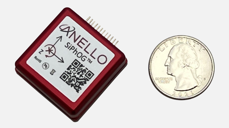
    Anello is creator of the Silicon Photonics Optical Gyroscope (SiPhOG). By combining SiPhOG-based inertial navigation with advanced sensor fusion and AI-driven collaborative autonomy, Anello and Mythos AI are delivering a fully integrated, plug-and-play solution that maintains performance when satellite signals are degraded or unavailable. It is designed to drop seamlessly into both next-generation and legacy maritime platforms. A multi-mission open systems architecture enables scalable deployment across defense, commercial and hybrid maritime operations.

    Strategic focus on maritime autonomy and USVs

    The initiative is particularly relevant to the rapidly evolving unmanned surface vehicle (USV) market. As USVs take on expanded roles in offshore energy, maritime security, hydrography, environmental monitoring and defense missions, complete end-to-end dependable navigation is essential to safe and effective operations.

    A resilient, GPS-independent navigation capability enables:

    • greater operational assurance in GPS-denied or contested maritime environments
    • enhanced autonomy and mission continuity during signal disruptions
    • reduced integration complexity for OEMs and system integrators
    • scalability across a broad range of vessel sizes and mission profiles.

    Anello and Mythos AI will collaborate with OEMs, integrators and end users to align the solution with evolving operational and regulatory demands.

  • Emesent offers SLAM, lidar, RTK and 360° imagery mobile scanner

    Emesent offers SLAM, lidar, RTK and 360° imagery mobile scanner

    Emesent has launched its GX1 all-in-one mobile scanning system at Geo Week 2026 in Denver.

    The GX1 is an integrated, highly accurate all-in-one mobile scanning system combining simultaneous localization and mapping (SLAM), lidar, real-time kinematic (RTK) georeferencing, cameras and software. The product marks a breakthrough for the autonomous mapping technology company.

    The GX1 supports a seamless workflow, from capture to validated deliverable. It not only brings Emesent’s proven SLAM technology to everyday surveying applications, but also eliminates the longstanding trade-off faced by survey firms and players in the architecture, engineering and construction (AEC) industry between mobile scanning speed and dependable survey-grade accuracy.

    According to Emesent, the GX1 can reduce the time required to survey a site by up to 95%, reducing what once took weeks into a single day of scanning. Meanwhile, the independently validated global accuracy of 5-10 mm delivers the precision needed for use cases across topographic and road surveying, scan to building information models, construction progress tracking and more.

    These capabilities are supported by integrated RTK georeferencing with real-time quality monitoring, four 20MP cameras for 360° panoramic imagery, and Emesent’s proven SLAM algorithm. This technology — which also powers the Emesent Hovermap product — was developed and validated in extreme real-world environments, including GPS-denied, underground locations to ensure repeatable accuracy and reliability both indoors and out. Accuracy validation reports are produced quickly and easily in the Aura processing software.

    With four purpose-built deployment modes — backpack, survey pole, vehicle mount and supported handheld — and integrated batteries for cable-free management, the GX1 offers a high degree of versatility. In addition, surveyors can capture data using RTK in the field or using ground control points and checkpoints in post-processing. This flexible georeferencing minimizes the risk of having to return to a site for redo.

    “With the introduction of the GX1, we’ve answered the call we’ve heard echoing throughout the surveying industry to end the tug-of-war between fast and accurate,” said Dr Stefan Hrabar, chief strategy officer and co-founder of Emesent. “By putting the power of SLAM into the hands of the everyday surveyor, the GX1 raises the bar for mobile scanning accuracy and keeps critical projects on track.”

    The launch of the GX1 comes at a pivotal moment for survey firms and the AEC industry. They are grappling with a shortage of experienced surveyors, while also facing mounting pressure from clients demanding faster, cheaper and better results without compromising on quality. The GX1 has been designed to be simple enough for junior surveyors to train on and deploy in a matter of days. At the same time, it is powerful enough to meet — and, according to Emesent, exceed — the real-world needs of professionals in the field.

  • Safe Pro unveils new algorithms for GPS-denied drone operations for U.S. Army

    Safe Pro unveils new algorithms for GPS-denied drone operations for U.S. Army

    The latest generation of Safe Pro’s AI technology will be presented at U.S. Army exercise at Fort Hood, Texas

    Safe Pro Group, a developer of artificial intelligence (AI)-enabled defense and security solutions,  has deployed upgraded AI algorithms to its patented Safe Pro Object Threat Detection (SPOTD) technology for drone operations in GPS-denied environments.

    The newly enhanced SPOTD capabilities will be prominently featured at the upcoming U.S. Army 2026 Concept Focused Warfighter Experiment (CFWE) technology demonstration taking place at Fort Hood, Texas.

    Operating on the Amazon Web Services (AWS) Cloud or at the Edge, SPOTD is Safe Pro’s patented rapid battlefield image analysis platform designed to identify and map small explosive threats such as landmines and ambush drones detected in videos collected from virtually any drone.

    The ability for SPOTD to rapidly detect threats and create 2D/3D models from drones flying in GPS-denied environments was developed after real-world exercises in Ukraine at the request of end users. The integration of these new algorithms further enhances the value of SPOTD as a situational awareness tool for use in a wide array of military reconnaissance and planning operations.

    SPOTD enhancements include:

    • Ability to process any drone video data: Turning video clips into 2D and 3D models with AI-trained explosive threat detections
    • Enhanced operational robustness: Operating capability in GPS and GPS/GNSS denied environments
    • Terrain modeling: Threat and terrain mapping in support of unmanned ground vehicles (UGVs) route planning
    • Rapid mapping-only mode: Mapping for intelligence, surveillance and reconnaissance (ISR) and missions that do not require AI-powered threat detections
    • Accelerated processing: Up to 10x reduction in processing time powered by Safe Pro’s proprietary geospatial AI algorithms.

    Powering the company’s SPOTD technology is Safe Pro’s unique real-world datasets, which include high-resolution drone imagery and GPS-tagged geospatial data encompassing more than 2.2 million drone images analyzed to date, and 41,400+ threats identified across 11,400 hectares (28,000+ acres).

  • Red Cat proves drone software for GPS-denied navigation

    Red Cat proves drone software for GPS-denied navigation

    Red Cat Holdings, a U.S.-based provider of advanced all-domain drone and robotic solutions for defense and national security, has successfully flight tested its Black Widow drone equipped with Palantir Technologies Visual Navigation (VNav) Software.

    The test demonstrated that the Black Widow drone — part of the U.S. Army’s Short Range Reconnaissance (SRR) program of record — can navigate in GPS-denied conditions using Palantir’s visual-based navigation software. This marks the first known commercial demonstration of visual navigation software on a drone already accepted into a U.S. Army program.

    “This is a breakthrough moment not just for Red Cat, but for the tactical needs of the Department of War,” said Jeff Thompson, CEO of Red Cat. “Every battlefield is a GPS-denied environment, and this successful test shows that Red Cat and Palantir are delivering a software-driven solution the Army can rely on. It requires no new hardware, is ready to deploy today, and gives warfighters the edge in contested environments. It also signals our evolution into a full-stack defense technology platform, with expected margin expansion and strong revenue potential in 2026.”

    VNav uses edge-based sensor fusion to generate real-time position estimates from visual cues and inertial data, enabling navigation in denied or degraded environments. Over a multi-day series of tests, Red Cat and Palantir engineers evaluated VNav across nominal and GPS-denied conditions, including high-speed and low-altitude flights.

    Read more about how VNav works in this Palantir blog.

    The testing sequence validated:

    • Full integration of VNav with the Black Widow flight controller, including compatibility with GPS-assisted operation
    • Accurate navigation in simulated GPS-denied environments
    • Reliable operation at altitudes as low as 150 feet AGL and speeds up to 16 mph
    • Robust performance in twilight and extremely low-light conditions
    • A simulated reconnaissance mission with dynamic flight parameters, completed successfully without GPS or human input

    The results helped define a preliminary performance envelope for VNav on the Black Widow system. The final mission demonstrated VNav’s ability to navigate a complete ISR mission profile, including cruising to a target, descending for surveillance, flying local waypoints, and returning, all without GPS and with continuous positional awareness.

    Palantir engineers reported that VNav achieved a mean positional error of approximately 7 meters over a 2.7-kilometer route. No additional hardware was required for any of the flights, as VNav runs entirely on the Black Widow’s existing onboard sensors.

    “Palantir Visual Navigation performed well in real-world conditions,” said Akash Jain, president and CTO, Palantir USG. “This demonstrates our approach to visual navigation in disrupted environments –– delivering intelligent software that adapts, scales across platforms like Black Widow, and supports the Army’s integrated operating systems.”

    Red Cat and Palantir are working toward a formal Army demonstration and full productized VNav capability for all fielded Black Widow systems.

  • Researchers find hybrid navigation best for GPS-denied UAVs

    Researchers find hybrid navigation best for GPS-denied UAVs

    A report published in the April 7 edition of Satellite Navigation (DOI: 10.1186/s43020-025-00162-z) concludes that hybrid approaches are the most reliable solution for UAV navigation. The comprehensive review, by a research team from Prince Sultan University, evaluated 132 papers on UAV navigation in GPS-denied environments.

    The research team focused on absolute and relative localization techniques including vision-based systems, lidar and terrain-aided algorithms. The review examined two primary methods for UAV navigation in GPS-denied areas:

    • absolute localization, which uses pre-mapped terrain data (such as TERCOM and DSMAC)
    • relative localization methods such as SLAM (simultaneous localization and mapping) and visual-inertial odometry that relies on real-time sensor data.

    While absolute methods face limitations in featureless environments, relative techniques offer adaptability but require significant computational resources. Vision-based systems, particularly when enhanced with AI for feature recognition, hold considerable promise, though lighting conditions remain a challenge, the report concludes.

    The research emphasizes the importance of sensor fusion, demonstrating that combining lidar, radar and inertial measurements – alongside advanced filtering techniques such as Kalman filters – can substantially improve navigation reliability.

    Furthermore, real-time processing is crucial, with hardware accelerators like GPUs and optimized algorithms, such as LSTM networks, enabling faster data analysis and decision-making.

    While hybrid systems combining terrain maps with live SLAM data offer a balance of accuracy and flexibility, the study acknowledges the need for further refinement to scale these solutions across various environments. Advancements in AI processing power and edge computing will be key to fully autonomous UAV operations in unpredictable real-world conditions.

    “No single sensor or algorithm can solve all the challenges of GPS-denied navigation,” said Imen Jarraya, lead author of the study. “Our research shows that combining absolute and relative localization with multi-sensor fusion is the key to achieving reliable UAV navigation. Future work must focus on optimizing these systems to handle the unpredictability of environments ranging from dense urban areas to remote disaster zones.”

    This research holds implications for industries relying on UAVs, such as logistics, agriculture, and defense, Jarraya  explained. UAVs delivering medical supplies to remote or disaster-stricken areas could operate without GPS, and military drones could navigate in signal-jammed regions.

    The study also points to the need for regulatory frameworks to standardize these technologies, ensuring their safe and efficient integration into future infrastructures. As UAVs become integral to smart cities and infrastructure inspection, overcoming the limitations of GPS will ensure safer, more effective operations. These findings encourage further investment in AI-driven navigation and collaborative research to refine these systems for global use.

  • Trimble joins with Exyn on autonomous surveying solution

    Trimble joins with Exyn on autonomous surveying solution

    Trimble and Exyn Technologies are developing multi-platform robotic autonomy for complex, GPS-denied environments. (Photo: Trimble)
    Trimble and Exyn Technologies are developing multi-platform robotic autonomy for complex, GPS-denied environments. (Photo: Trimble)

    Trimble and Exyn Technologies are working on a proof of concept for a fully autonomous surveying solution for construction.

    The solution will integrate the Boston Dynamics Spot robot, the ExynPak powered by ExynAI, and the Trimble X7 total station. It will enable fully autonomous missions inside complex and dynamic construction environments, which can result in consistent and precise reality capture for production and quality-control workflows.

    Autonomous robots powered by ExynAI can sense and avoid obstacles, dynamically adapting to the complexity of construction environments. To ensure safety and efficiency, the ExynPak integrates with a robot, supporting Level 4 of autonomous exploration missions without requiring the robot to “learn” about its environment beforehand.

    A surveyor can define a 3D volume for a mission, and then the integrated robotic solution handles the complexities of self-navigation without needing a map, GPS or wireless infrastructure.

    The integration of the Trimble X7 provides high-speed, high-accuracy 3D laser scanning to capture the state of the environment. The captured data can be uploaded to the Trimble Connect collaboration platform and shared with project stakeholders for further analysis, including a comparison to building information models (BIM) and previous scans to monitor quality and progress. The result is a detailed and accurate map collected with minimal human intervention and risk.

    Exyn and Trimble will be demonstrating their technology at the Trimble Dimensions+ Conference Nov. 7-9 in Las Vegas.

  • Aerovironment’s visual-based navigation system takes over for GPS

    Aerovironment’s visual-based navigation system takes over for GPS

    AeroVironment's Puma is hand-launched. (Photo: Lance Cpl. Frank Cordoba/U.S. Marine Corps)
    AeroVironment’s Puma is hand-launched. (Photo: Lance Cpl. Frank Cordoba/U.S. Marine Corps)

    AeroVironment Inc. has introduced Puma VNS, a visual-based navigation system for its Puma 2 AE and Puma 3 AE small unmanned aircraft systems (SUAS). The system enables navigation across GPS-denied environments.

    Puma VNS will receive frequent software and hardware updates, providing operators with advanced navigation capabilities, features and functionality. The system will also enable integration of future autonomy capabilities.

    “Puma VNS gives operators an unprecedented advantage in the battlefield,” said Trace Stevenson, AeroVironment vice president and product line general manager for SUAS. “Operators now can execute missions with more confidence in GPS-contested environments with the system’s new navigational capabilities.”

    VNS uses a suite of downward-looking sensors to gather imagery data and track features on the ground, as well as an embedded computing module to process and determine the precise location of an aircraft while in flight. The system automatically transitions to and from GPS-denied navigation mode without operator input.

    Puma VNS is available as an add-on option for new Puma 3 AE system orders and as a retrofit kit for fielded Puma 2 AE and Puma 3 AE systems.

  • Portable Time-Loader ready for field deployment

    Portable Time-Loader ready for field deployment

    Image: Focus Telecom
    Image: Focus Telecom

    Focus Telecom has introduced a new timing product for defense and mission-critical applications, the Time-Loader.

    The Time-Loader can be deployed in environments where GNSS signals are denied or disrupted, to support any ground, naval and airborne system that needs real time of day (TOD) and 1PPS external synchronization aligned to UTC or GNSS.

    In this emerging era of rapid tactical deployment of defense systems, communications intelligence, missile defense systems, radar/electro-optical sensors and UAS batteries in the field are often in GNSS-denied or jammed environments. This situation creates challenges for access to real time and accurate time of day.

    To solve this problem, the Time-Loader generates a GPS L1 C/A code RF output as if the signal were coming from a live-sky GPS antenna. It provides full-constellation GPS output and is compatible with external GNSS receivers. It encodes times with nanosecond accuracy for GPS timing receivers.

    The Time-Loader’s GPS-disciplined oscillator (GPSDO) is the Microsemi MAC-SA53/55, which provides excellent UTC accuracy with outstanding hold-over rubidium clock performance.

    The Time-Loader is the size of a suitcase, hand-carried and easily deployed. It activates quickly from a cold start or when sensors are deployed for the first time.

    Included in the Time-Loader is a self-contained, miniature GPS simulator that provides real-time extremely accurate signals. The 18-channel full-constellation simulator stores location/time/date data in internal memory and stores complex vector data to simulate dynamic scenarios. The simulator also can be used to transcode NMEA or SCPI position/velocity/time (PVT) data into GPS RF signals.

    Learn more about the Time-Loader.

  • Northrop Grumman to equip Marines with next-gen targeting devices

    Northrop Grumman to equip Marines with next-gen targeting devices

    Image: Northrop Grumman
    Image: Northrop Grumman

    The U.S. Marine Corps has selected Northrop Grumman to provide the Next Generation Handheld Targeting System (NGHTS), a compact device that provides precision targeting and is capable of operation in GPS-denied environments.

    The laser-based device will give marines an enhanced capability to identify and designate targets from extended ranges.

    “NGHTS will significantly enhance the ability of marines to identify ground targets under a wide range of conditions,” said Bob Gough, vice president, navigation, targeting and survivability, Northrop Grumman. “Connected to military networks, NGHTS can provide superior situational awareness and accurate coordinates for the delivery of effects from beyond the line of sight.”

    Northrop Grumman’s NGHTS is capable of performing rapid target acquisition, laser terminal guidance operation and laser spot imaging functions. Its high-definition infrared sensors provide accuracy and grid capability over extended ranges. Additional features include a high-definition color display and day/night celestial compasses.

  • US Army selects TRX Systems to provide DAPS PNT system

    US Army selects TRX Systems to provide DAPS PNT system

    The TRX DAPS solution will allow warfighters to better target, move and communicate in operational environments where GPS is degraded or denied.

    TRX DAPS Dismounted A-PNT Device. (Photo: TRX Systems)
    TRX DAPS Dismounted A-PNT device. (Photo: TRX Systems)

    TRX Systems, developer of NEON GPS-denied location solutions, has been selected by the U.S. Army to provide a next-generation Dismounted Assured Positioning, Navigation and Timing (PNT) System (DAPS).

    The TRX DAPS solution employs a lightweight soldier-worn device that enables dismounted warfighters to successfully conduct operations when operating in GPS challenged, degraded or denied environments.

    Military equipment can be the subject of enemy electronic attacks, potentially resulting in a loss of location awareness that can put army missions at increased risk. The TRX DAPS solution alerts the users when their position isn’t reliable and then leverages multiple sensors and timing sources to provide the best soldier position possible within the GPS-degraded operational environment.

    The solution — designed to replace the Defense Advanced GPS Receiver (DAGR) — supports both a standalone configuration and integration with the Nett Warrior ensemble. It combines inputs from small, body-worn sensors and other sources to provide assured PNT while meeting the size, weight and power (SWaP) needs of dismounted soldiers already physically burdened with heavy equipment loads.

    TRX Systems has delivered GPS-denied location technology to thousands of military, public safety  and security users worldwide.

    “Maintaining assured PNT is paramount to the situational awareness of U.S. warfighters in the many conflict zones around the world,” said Carol Politi, president and CEO of TRX Systems. “When initial units are fielded in mid-2022, the TRX DAPS solution will deliver a balance of the highest possible level of integrated PNT capabilities with the smallest package that can be fielded for dismounted warfighters.”

  • Inertial Labs acquires IMU company Memsense

    Inertial Labs acquires IMU company Memsense

    Inertial Labs has acquired Memsense, a developer of inertial measurement units (IMUs) and a long-time business partner. Inertial Labs is a developer and supplier of orientation, inertial navigation and optically enhanced sensor modules.

    The Inertial Labs and Memsense workforce will address the rapidly evolving needs of global customers. The combined company of more than 100 employees and 500 customers expects to introduce breakthrough technologies at an accelerated pace across high-value areas such as autonomous vehicles, GPS-denied navigation, industrial machines, and aerospace and defense.

    In addition, Inertial Labs and Memsense have a strong balance sheet to support critical business initiatives, deliver with short product lead times, and invest in promising integrations, the company stated in a press release.

    “Our strategic acquisition of Memsense brings together two high growth companies with proven performance in solving some of the world’s most difficult stabilization and navigation problems,” said Jamie Marraccini, president and CEO of Inertial Labs. “Our customers will benefit from our combined capabilities and resources.”

    “As we move forward, Inertial Labs and Memsense will define the future of MEMS IMUs,” said James Brunch, CEO of Memsense. “Our focus on innovation, our world-class team, and our strength in customer collaboration allow us to deliver the exact specs needed by our customers.”

    Inertial Labs cites the following benefits for current and future customers:

    • increased production capabilities of up to 50,000 units annually to meet the needs of larger aerospace and defense contracts for guidance and navigation applications
    • low-cost, consumer-grade IMUs, ruggedized industrial-grade models, affordable tactical-grade IMUs, and IMUs with near-FOG level of performance (0.1 deg/h bias instability)
    • a larger range of devices for unmanned ground vehicles (UGV); unmanned aerial vehicles (UAV); autonomous and automated ground vehicles (AGV).
    • expanded research and development efforts to accelerate delivery of IMUs for stabilization applications, such as electro-optical systems, pan-and-tilt platforms, and remote weapon stations (RWS)
    • new IMU models with improved performance will increase capabilities of the company’s GPS-aided inertial navigation systems (INS), wave sensors, motion reference units (MRU) and attitude heading reference systems (AHRS)
    • development of new high-performance systems including a MEMS-based gyro-compasses (3 MILS azimuth and 1 MIL elevation accuracy).
  • Maxar 3D data integrated into Swedish fighter jet for GPS-denied navigation

    Maxar 3D data integrated into Swedish fighter jet for GPS-denied navigation

    Saab, the Swedish defense and security company, and Maxar recently demonstrated a solution to GNSS-denied navigation by integrating Maxar’s 3D Data and Precision 3D Registration (P3DR) technology into the fighter jet software for the Swedish Gripen E fighter jet.

    Saab develops and manufactures the fighter jet for Sweden and other countries.

    A camera on the jet captures a livestream of its flight path. Maxar’s P3DR compares that incoming livestream to the Maxar 3D Surface Model of the area stored on the jet. By matching scenes in the livestream to the 3D data in real time, P3DR can determine the jet’s precise location, enabling the pilot to navigate and carry out the mission without GPS.

    Maxar 3D Surface Model, immersive 3D data with superior accuracy and global coverage, offers a highly accurate representation of Earth. The data is produced with unique automated technology, delivered rapidly and with high precision. It is based on Maxar’s high-resolution, unclassified commercial satellite imagery, without the need for ground control points. Maxar’s 3D Surface Model product is a key input to the company’s Globe in 3D, a worldwide foundation of 3D data with resolution of 50 cm or better and 3 m accuracy in all dimensions.


    The chart across the top of the video indicates the accuracy of the P3DR matching of the livestream video to the Maxar 3D Surface Model. When the camera encounters clouds, it lowers the accuracy of P3DR’s match; however, as long as there is some view of the ground, the accuracy is relatively high.

    Maxar’s P3DR is a standalone software solution that automatically geo-registers imagery from any source to Maxar 3D reference data. This real-time capability enables navigation in a GPS-denied environment, safeguarding against signal jammers in an anti-access area denial (A2AD) environment.

    Saab put the GPS-denied navigation technique to the test with a Gripen flight demonstration over Sweden. The GIF below demonstrates how P3DR closely overlays the livestream image on the Maxar 3D Surface Model, allowing the pilot to understand where they are on the map.

    During the flight demonstration, the Gripen’s GPS receiver was on to monitor the accuracy of the results. The GPS receiver verified that the demonstration’s results were accurate.

    The Gripen E jet fighter built by Saab. (Photo: Saab)
    The Gripen E jet fighter built by Saab. (Photo: Saab)