Third Lockheed Martin-Built GPS III satellite climbs to orbit on its own power
GPS III SV03 increases number of secure military code (M-code) enabled satellites in GPS constellation to 22 total.
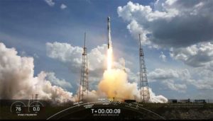
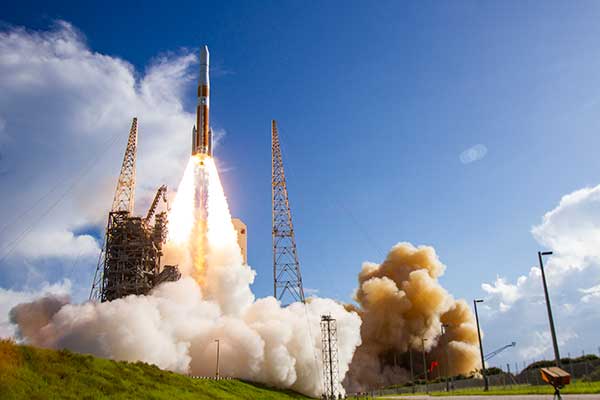
After a successful launch on June 30, the third Lockheed Martin-built GPS III satellite headed to orbit under its own propulsion. The satellite separated from its rocket and used onboard power to climb to its operational orbit, approximately 12,550 miles above the Earth.
GPS III Space Vehicle 03 is responding to commands from U.S. Space Force and Lockheed Martin engineers in the Launch & Checkout Center at the company’s Denver facility. There, they declared rocket booster separation and satellite control about 90 minutes after the satellite’s June 30 launch aboard a SpaceX Falcon 9 rocket from Cape Canaveral Air Force Station, Florida.
“In the coming days, GPS III SV03’s onboard liquid apogee engines will continue to propel the satellite towards its operational orbit,” said Tonya Ladwig, Lockheed Martin’s acting vice president for Navigation Systems. “Once it arrives, we’ll send the satellite commands to deploy its solar arrays and antennas, and prepare the satellite for handover to Space Operations Command.”
After on-orbit testing, GPS III SV03 is expected to join the GPS constellation — including GPS III SV01 and SV02, which were declared operational in January and April — in providing positioning, navigation and timing signals for more than four billion military, civil and commercial users.
Lockheed Martin designed GPS III to help the Space Force modernize the GPS constellation with new technology and capabilities. The new GPS IIIs provide three times better accuracy and up to eight times improved anti-jamming capabilities over any previous GPS satellite. They also offer a new L1C civil signal, which is compatible with other international global navigation satellite systems, like Europe’s Galileo, to improve civilian user connectivity.
GPS III also continues the Space Force’s plan to field M-code, a more-secure, harder-to-jam and spoof GPS signal for our military forces. GPS III SV03 brings the number of M-code enabled satellites to 22 in the 31-satellite GPS constellation.
“As a nation, we use GPS signals every day — they time-stamp all our financial transactions, they make aviation safe, they make precision farming possible, and so much more,” added Ladwig. “GPS has become a critical part of our national infrastructure. In fact, the U.S. economic benefit of GPS is estimated to be over $300 billion per year and $1.4 trillion since its inception. Continued investment in modernizing GPS — updating technology, improving its capabilities — is well worth it.”
As we bid farewell to the last GPS-IIA satellite and read of delays to both the launch schedule for GPS III satellites and roll-out of the OCX program, we are mindful of the need to maintain GPS as the “Gold Standard” in GNSS.
Certainly, new signals, enhanced resilience and expanded capabilities are offered by the modernized GPS playbook. Delays relative to both the BeiDou and Galileo constellations could seriously impact the position of GPS on the medals podium — maybe not in the longer term, but certainly in the coming few years.
This may have a secondary impact on the receiver market, shifting focus away from GPS to more capable signals in the near term. Once GPS has caught up, receiver manufacturers may choose to retain the technology that they developed to capitalize on BeiDou and Galileo signals, rather than developing their legacy GPS capabilities.
GPS L2C is currently “pre-operational,” transmitted by slightly more than half the existing mixed-generation satellite fleet and waiting for OCX support. As of Feb. 20, a realistic estimate for operational capability of GPS L2C is now 2023.
GPS L5 is also pre-operational, transmitted by slightly less than half of the GPS satellites and waiting for OCX support. As of Feb. 20, a realistic estimate for GPS L5 is 2027.
The forecast for GPS L1C operational capability is the late 2020s. This is intended to be the signal that offers international interoperability with the current interoperability signals offered by existing BeiDou and Galileo satellites.
Delays to the implementation of GPS L1C may mean that GPS misses the interoperability boat entirely. During the delay, new interoperability capability with even more robust signals could be devised and lofted aboard Galileo, BeiDou and GLONASS satellites. By then, other countries could also develop their own constellations, possibly regional or even global systems.
Potentially, GPS could be left behind as other nations discuss non-GPS internationally interoperable signals on yet-to-be launched satellites. This may have a profound impact on SBAS, too. Differential corrections provided by the Japanese MSAS, Russian SDCM and European EGNOS SBAS systems might evolve to support “beyond L1C” interoperability signals. Aircraft landings at world airports could mandate the use of corrections to these new signals. This might mean that U.S. receiver manufacturers could be frozen out, or will have to incorporate these new interoperable signal standards.
GPS Block III satellites along with OCX offer improved signals, capabilities and resilience, but the satellites need to be flying, OCX needs to be operational and receivers need to be in the hands of the users. Sooner rather than later is a must for Gold-Standard GPS.
Paul Crampton is a senior systems engineer at Spirent Federal Systems with more than 30 years of GPS experience.
The United States Space Force’s GPS III program reached another milestone with the successful core mate of GPS III Space Vehicle 08 at Lockheed Martin’s GPS III Processing Facility in Waterton, Colorado, April 15.
With core mate complete, the space vehicle was named in honor of NASA trailblazer and “hidden figure” Katherine Johnson.
The two-day core mate consisted of using a 10-ton crane to lift and complete a 90-degree rotation of the satellite’s system module, and then slowly lowering the system module onto the satellite’s vertical propulsion core. The two mated major subsystems come together to form an assembled GPS III space vehicle.
Despite the COVID-19 pandemic, the Space and Missile Systems Center (SMC) and its mission partner Lockheed Martin ensured that SV08 core mate took place, in accordance with all Centers for Disease Control and local guidelines to minimize exposure or transmission of COVID-19. The GPS III Processing Facility’s cleanroom high bay was restricted to only key personnel directly supporting the operation.
“Core mate is the most critical of the GPS space vehicle single-line-flow operations,” said Lt. Col. Margaret Sullivan, program manager and materiel lead for the GPS III program. “Despite the restrictions presented by the COVID-19 pandemic, our team adapted and worked tirelessly to achieve this essential milestone.”
Katherine Johnson. (Photo: NASA)
Katherine Johnson. When the core mate operation is successfully completed, a GPS III satellite is said to be “born.” In keeping with the team’s tradition of naming GPS III satellites after famous explorers and pioneers, SV08 was named “Katherine Johnson” in honor of the trailblazing NASA mathematician and “human computer” who designed and computed orbital trajectories for NASA’s Mercury, Apollo and space shuttle missions.
One of four African-American women at the center of the nonfiction book by Margot Lee Shetterly and the movie Hidden Figures, Johnson was awarded the Presidential Medal of Freedom in 2015 for her groundbreaking contributions to the U.S. space program.
Other GPS III satellites have been named in honor of explorers including GPS III SV01 “Vespucci” after Amerigo Vespucci; GPS III SV02 “Magellan” after Ferdinand Magellan; and GPS III SV03 “Columbus” after Christopher Columbus.
Next up, performance tests. The next step for the newly christened “Katherine Johnson” is the post-mate Systems Performance Test (SPT) scheduled to begin in August. SPT electrically tests the performance of the satellite during the early phase of build and provides a baseline test data set to be compared to post-environmental test data.
GPS III SV08 is currently scheduled to launch in 2022.
The Mobile Service Tower rolls back from the ULA Delta IV rocket carrying the GPS III SV02 satellite in preparation for launch. (Photo: ULA)
GPS III is the most powerful GPS satellite ever developed. It is three times more accurate and provides up to eight times improved anti-jamming capability over previous GPS satellites on orbit. GPS III brings new capabilities to users as a fourth civilian signal (L1C), designed to enable interoperability between GPS and international satellite navigation systems, such as Europe’s Galileo system.
GPS III satellites will also bring the full capability of the Military Code (M-code) signal, increasing anti-jam resiliency in support of the warfighter. These continued improvements and advancements to the GPS system makes it the premier space-based provider of positioning, navigation, and timing services for more than four billion worldwide.
GPS III SV03 is scheduled to launch on June 30.. (Photo: Lockheed Martin)
GPS III SV03 to Launch June 30. Launched in December 2018 and August 2019, GPS III SV01 and SV02 became part of today’s operational constellation of 31 satellites, on January 13 and April 1, 2020 respectively. GPS III SV03 is scheduled to launch on June 30.
The SMC, located at the Los Angeles Air Force Base, California, is the center of excellence for acquiring and developing military space systems. Its portfolio includes the GPS, military satellite communications, defense meteorological satellites, space launch and range systems, satellite control networks, space based infrared systems, and space situational awareness capabilities.
By Airman 1st Class Jonathan Whitely, 50th Space Wing Public Affairs
News from Schriever Air Force Base
The 2nd Space Operations Squadron performed the first station keeping maneuver on a GPS III satellite to Satellite Vehicle Number 75 on May 14 at the Schriever Air Force Base in Colorado.
The maneuver set a new standard for how GPS maneuvers should be conducted for the squadron that provides precision, navigation and timing signals to billions of users around the world.
A station keeping maneuver is performed to keep vehicles in their node (or parking spots in orbit) and involves burning the satellite’s thrusters and changing the vehicles speed at a particular point in its orbit. This causes the orbit to change, in turn, keeping the vehicle in the ideal position to provide coverage.
“All operational GPS vehicles are assigned nodes, when all nodes are filled with healthy vehicles there is good global GPS coverage,” said 1st Lt. Michael Gallagher, GPS subsystems analyst. “When new vehicles are launched they typically aren’t launched directly into their final node. This means that the 2 SOPS analysis flight must perform a re-phase maneuver to put a vehicle in its node.”
The maneuver required GPS III’s signal to be turned off. Turning off the navigation signal while performing the maneuver prevents users from receiving inaccuracies generated by a change in satellite velocity.
“This was a new process that we could learn from as it was the first station keeping [maneuver] performed for the newest generation of GPS satellites,” said Senior Airman Harrison Sherwood, 2 SOPS satellite systems operator, who sent the commands to the satellite during the maneuver. “[Since] this was the first [maneuver] of the newest generation satellites, it was a bit of a guinea pig for future maneuvers.”
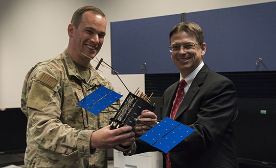
Johnathon Caldwell, Lockheed Martin Space vice president of navigation systems, right, presents Lt. Col. Stephen Toth, 2nd Space Operations Squadron commander, with a GPS III model satellite as a token of appreciation for the 2nd SOPS critical mission in space at Schriever Air Force Base, Colorado, July 29, 2019. The squadron performed its first station keeping maneuver on a GPS III satellite May 14, 2020, at Schriever AFB. (Photo: U.S. Air Force/1st Class Jonathan Whitely)
However, the unit was able to complete the maneuver flawlessly. The maneuver was completed in a special mission area and there were no changes to the normal operations floor.
“This maneuver had no effect on the rest of the [GPS satellite] constellation,” Gallagher said. “SVN-45 was in the node SVN-75 was being placed into, so there was no decrease in GPS signal quality as a result of this maneuver.”
This procedure was also the first of its kind to be performed with the 2nd SOPS Architecture Evolution Plan, which all active satellites in the program are operated. Since GPS III vehicles are fully integrated into the program with this maneuver, all maintenance is conducted through AEP.
“Station keeping maneuvers are essential to satellite operations and must be done for regular maintenance,” said 2nd Lt. Tyler Gorman, 2nd SOPS navigation payload engineer. “This activity helped validate a nominal maintenance activity for a new generation of vehicles.”
The unit plans to continue to use this new method and program for future GPS satellites that are being launched and need to be re-phased into their operation slots. The next satellite that will need a station maneuver performed is SVN-76, which is scheduled to launch in the next few months.
“GPS maintenance requires a coordinated effort to ensure our worldwide service is preserved,” Gorman said. “That means careful planning and execution from our analysts in 2 SOPS, our satellite system operator and the operational support from Lockheed Martin and the Aerospace Corporation.”
L3Harris’ Jason Hendrix discusses the company’s latest developments, including the delivery of its GPS III payloads, at ION GNSS+ 2019, which took place Sept. 16-20 in Miami.
By Peter Steigenberger, Steffen Thoelert, Oliver Montenbruck and Richard B. Langley
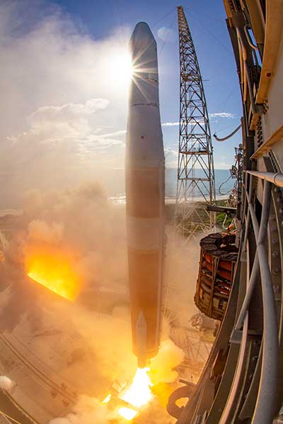
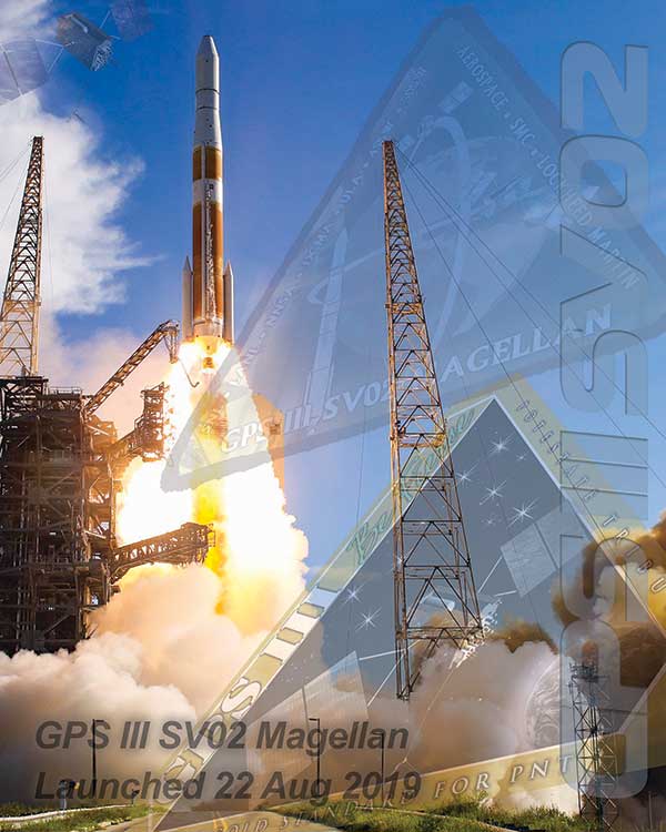
The first GPS III satellite, “Vespucci,” was launched in December 2018, started signal transmission in January 2020, and was set healthy later that month. The second GPS III satellite, nicknamed “Magellan,” was launched on Aug. 22, 2019, on a Delta IV rocket from Cape Canaveral, Florida.
Magellan, also identified by its space vehicle number (SVN) 75 (here referred to as GPS-75), started signal transmission with standard pseudorandom noise code (PRN) number 18 (here referred to as G18) on March 13. The L1 C/A, L1 P(Y), and L2 P(Y) signals were activated at 17:16:30 GPS Time (GPST), while the L1C, L2C and L5 signals followed less than two hours after Vespucci’s launch at 18:59:30 GPST. Transmission of navigation messages started at 19:00:00 GPST with GPS-75 (G18) marked as unhealthy.
PRN G18 was previously used by the 27-year-old Block IIA satellite GPS-34 that had been already removed from the active GPS constellation on Oct. 7, 2019, but continued signal transmission until March 9, 2020. GPS-75 is already being tracked by a large number of tracking stations of the International GNSS Service (IGS). Based on the data collected by these stations, the Center for Orbit Determination in Europe (CODE), headquartered in Bern, Switzerland, has been providing precise orbit and clock products for this satellite since March 14.
A comparison we performed with the CODE precise orbit products revealed initial broadcast ephemeris errors of up to 100 meters (3D) and an orbit-related signal-in-space range error (SISRE) of about 13 meters. Within four days, a SISRE (orbit component) of 24 centimeters was achieved, which closely matches the performance of the rest of the GPS constellation.
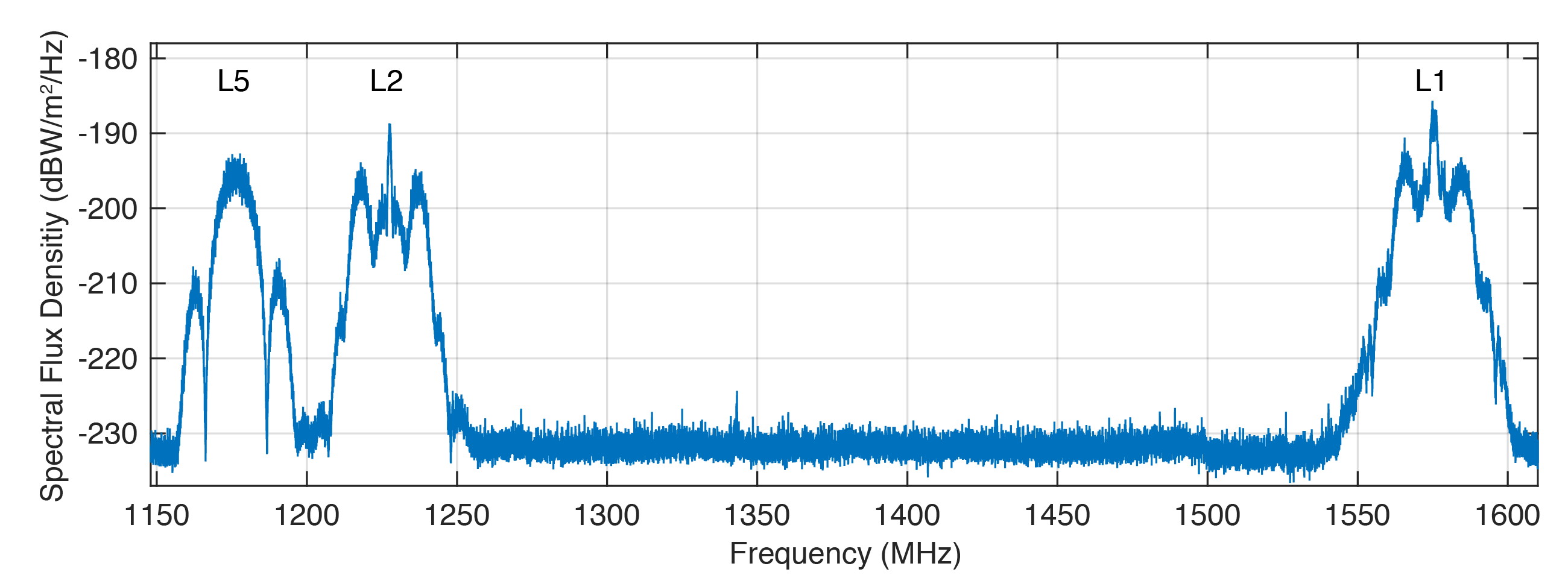
Figure 1 shows the spectral flux density of GPS-75 in the L1, L2 and L5 frequency bands obtained with the 30-meter high-gain antenna of the German Aerospace Center (DLR) located in Weilheim, Germany. The civil L1 C/A, L1C and L2C signals can be identified as sharp peaks in the center of the respective frequency bands.
FIGURE 1. Spectral flux density of GPS-75 measured with DLR’s 30-meter high-gain antenna. (Figure: Steigenberger, et al)
The prominent side lobes in the L1 and L2 bands are associated with the military M-code. The wide main lobe of the L5 signal with two smaller and sharper side lobes is caused by the superposition of two in-phase and quadrature signals with a 10-MHz binary phase-shift keying (BPSK) modulation. We found that all signals are in good shape and have a quality similar to that of the first GPS III satellite.
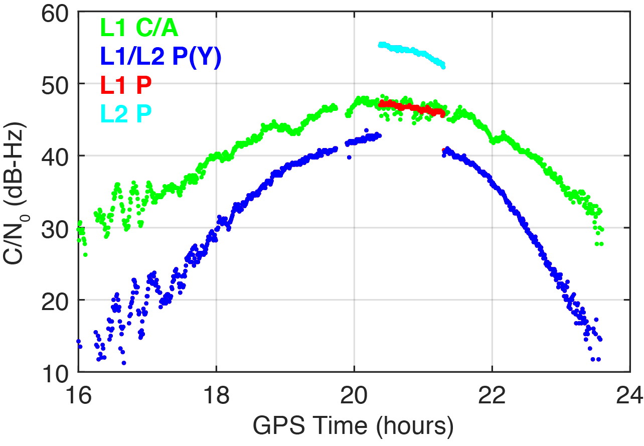
On March 16, 2020, we detected a significant change in the carrier-to-noise-density ratio of the L1 and L2 P(Y)-code signals. Figure 2 illustrates these changes for the IGS station located in Patumwan, Thailand (CUSV00THA). The L1 and L2 P-code signals are usually encrypted with the W-code to prevent spoofing (the generation of fake signals by adverse parties). The resulting encrypted signals are denoted by P(Y). Geodetic GNSS receivers are capable of tracking the P(Y) signals with a semi-codeless approach.
FIGURE 2. Carrier-to-noise-density ratio (C/N0) of the second GPS III satellite, GPS-75, tracked by the IGS station CUSV00THA in Patumwan, Thailand, on March 16, 2020. Between 20:22 and 21:18 GPST, unencrypted P-code signals were tracked. (Figure: Steigenberger, et al)
As a result, C/N0 of L1 P(Y) and L2 P(Y) are virtually identical and significantly smaller than the C/N0 of the unencrypted signals due to losses of the semi-codeless tracking technique. This can be seen in the blue-colored plot of Figure 2, where the C/N0 values of L1 P(Y) and L2 P(Y) are identical and smaller by 4.5–16 dB compared to L1 C/A depending on the elevation angle of the satellite.
However, between 20:22 and 21:18 GPST, an increase of the P-code C/N0 values was observed. The values changed by 4.5 and 12.5 dB for L1 and L2, respectively. This change is an indicator that unencrypted P-code signals were transmitted, rather than encrypted ones. This assumption can be verified by the “Anti-Spoof Flag” given as the 19th bit of the handover word (HOW) of the GPS LNAV navigation message.
Indeed, decoding of the raw navigation data from the IGS station CHOF00JPN in Chofu, Japan, showed that the Anti-Spoof Flag indicated a deactivation of anti-spoofing between 20:22:00 and 21:17:48 GPST and verified our assumption that unencrypted P-code signals were transmitted during that time period.
It has to be noted that only Javad receivers within the global multi-GNSS network of the IGS show this increase in C/N0. Other receiver types report continuous C/N0 values for the P-code signals, indicating that a semi-codeless tracking technique was continuously applied irrespective of the Anti-Spoof Flag.
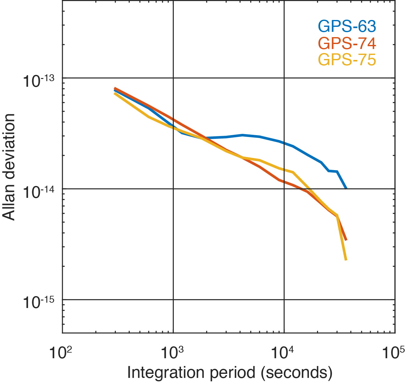
Figure 3 shows the two GPS III satellites’ Allan deviation, which measures the clock stability achieved in orbit; that is, the average frequency error over different time scales. In addition, the Block IIF satellite GPS-63 is shown, which is in the same orbital plane as GPS-75.
FIGURE 3. Allan deviation of the Block IIF satellite GPS-63 and the GPS III satellites GPS-74 and GPS-75 computed from 5-minute clock solutions produced by DLR. (Figure: Steigenberger, et al)
For integration times up to 2,000 seconds, the clock stability of GPS-75 is slightly better compared to the first GPS III satellite, GPS-74, but the situation is opposite for integration times larger than 5,000 seconds. The latter finding might be caused by the fact that GPS-75, unhealthy at the time, was tracked by a smaller number of stations compared to the healthy GPS-74.
As a consequence, the observed Allan deviation may partly be contaminated by orbit determination errors. In any case, both GPS III satellites clearly outperform the Block IIF satellite GPS-63 that suffers from thermal line bias variations visible as an increased Allan deviation starting at an integration time of about 2,000 seconds.
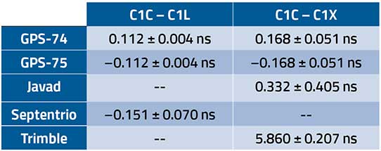
The activation of the second GPS III satellite transmitting the new civil L1C signal enables the estimation of differential code biases (DCBs) between, for example, the L1 C/A signal (Receiver Independent Exchange [RINEX] format observation code C1C) and different tracking modes of the L1C signal. Septentrio receivers track only the pilot component of the L1C signal (C1L), whereas Javad and Trimble receivers perform a combined data+pilot tracking (C1X).
DCBs are estimated from pseudorange (code) observations of a global tracking network and are corrected for ionospheric delays obtained from global ionosphere maps. The DCB estimates shown in Table 1 are based on eight days of data from 10 Javad, 21 Septentrio and 3 Trimble receivers.
TABLE 1. Differential code bias estimates in nanoseconds between L1 C/A and L1C for the GPS III satellites and average receiver DCBs. (Data: Steigenberger, et al)
As we have applied a zero-sum condition for the estimation of satellite DCBs of just two satellites, the values of GPS-74 and GPS-75 obtained from the same type of L1C observables differ only by the sign. The DCBs estimated from different L1C observables, namely C1L and C1X, differ by 56 picoseconds, corresponding to a range difference of 1.7 centimeters. The receiver DCBs are quite homogeneous for receivers from each manufacturer but differ by up to 6 nanoseconds between various manufacturers.
On April 1, 2020, GPS-75 was set healthy and joined the constellation of operational GPS satellites. The third GPS III satellite, named “Columbus,” was shipped to the Cape Canaveral launch site in February 2020. Its launch is expected no earlier than June 30, 2020, and at least two GPS III launches per year are planned for the near future.
Equipment. Measurements reported in this article were collected with JAVAD GNSS TRE_G3TH and TRE_3, Septentrio PolaRx5 and Trimble Alloy multi-GNSS, multi-frequency receivers. The spectral overview was captured with a Rohde & Schwarz EM100 digital compact receiver.
PETER STEIGENBERGER and OLIVER MONTENBRUCK are scientists at the German Space Operations Center of the German Aerospace Center (DLR). STEFFEN THOELERT is an electrical engineer at DLR’s Institute of Communications and Navigation. RICHARD B. LANGLEY is a professor at the University of New Brunswick and editor of the “Innovation” column for GPS World magazine.
Further Reading
“Optimum Semicodeless Carrier-Phase Tracking of L2” by K.T. Woo in Navigation, Vol. 47, No. 2, 2000, pp. 82-99, doi: 10.1002/j.2161-4296.2000.tb00204.x.
Interface Specification IS-GPS-200K: NAVSTAR GPS Space Segment/User Segment Interfaces by Global Positioning Systems Directorate Systems Engineering & Integration, Los Angeles Air Force Base, El Segundo, California, March 4, 2019. Available online: https://www.gps.gov/technical/icwg/IS-GPS-200K.pdf
“Apparent Clock Variations of the Block IIF-1 (SVN62) GPS Satellite“ by O. Montenbruck, U. Hugentobler, E. Dach, P. Steigenberger and A. Hauschild in GPS Solutions, Vol. 16, No.3, 2012, pp. 303-313, doi: 10.1007/s10291-011-0232-x.
“Differential Code Bias Estimation Using Multi-GNSS Observations and Global Ionosphere Maps” by O. Montenbruck, A. Hauschild and P. Steigenberger in Navigation, 2014, Vol. 61, No. 3, 2014, pp. 191-201, doi: 10.1002/navi.64
The United States Space Force’s Space and Missile Systems Center (SMC) has decided to reschedule the launch of GPS III SV03 (GPS III-3) from Cape Canaveral Air Force Station to minimize the potential of COVID-19 exposure to the launch crew and early-orbit operators.
Originally scheduled for late April, the launch is now projected for no earlier than June 30, pending a reevaluation in May.
“We do not make this decision lightly, however, given our GPS constellation remains strong, we have the opportunity to make a deliberate decision to maintain our mission assurance posture, without introducing additional health risk to personnel or mission risk to the launch,” said Lt. Gen. John F. Thompson, SMC commander and program executive officer for space.
The Lockheed Martin-built GPS III satellite will be the second GPS satellite launched on a SpaceX Falcon 9 rocket. It will be the first National Security Space Launch mission where SpaceX will attempt to recover the booster, reports Space News.
GPS III-3 brings the third modernized GPS III satellite to the operational GPS mission, and the team remains ready to execute. GPS III will bring three times better accuracy and up to eight times improved anti-jamming capability than its predecessor.
The current constellation is healthy with 31 satellites on orbit, allowing the team to take this strategic pause without gaps in coverage or capability.
“The GPS system supports vital U.S. and allied operations worldwide, unabated. As the COVID-19 pandemic is a threat to national security, likewise, rescheduling the launch is in the interest of national security,” said Gen. Thompson. “We have to get it right the first time, and protecting our people is just as important as cost, schedule, and performance.”
SMC still plans to complete the next three GPS launches this year. The team is taking the necessary steps to protect the health of personnel to allow a swift return to the mission.
“Some of the steps include procedural and facility modifications at the GPS III Launch and Checkout Capability (LCC) operations center and reducing the onsite crew size to provide adequate physical distancing, per CDC guidelines,” said Col. Edward Byrne, chief of Medium Earth Orbit Space Systems Division. “Once these efforts are completed, and the crews have rehearsed and are deemed proficient and ready to execute under these modified conditions, we fully intend to return to our launch cadence for deploying GPS III satellites.”
A leader of GPS III acquisition, SMC’s Production Corps is the United States Space Force’s acquisition office for producing and delivering GPS satellites, ground systems and military user equipment. The Production Corps’ agile program management techniques, smart business approach and close teaming with Lockheed Martin Space are enabling the production and delivery of GPS III’s new civil and warfighting capabilities by 2023. GPS delivers the “gold standard” of space-based positioning, navigation, and timing services vital to U.S. and allied operations worldwide, and underpins critical financial, transportation, and agricultural infrastructure that more than four billion users have come to depend on daily.
SMC’s Launch Enterprise, located at Los Angeles Air Force Base, California, is responsible for the acquisition and operation of launch vehicles, which includes mission assurance and launch safety. The Launch Enterprise is also responsible for leading the effort to certify new entrants to provide launch services for National Security payloads.
GPS III SV03 will be launched into operational orbit by a SpaceX Falcon 9 rocket. GPS III SV03 will be the second National Security Space Launch (NSSL) mission to be launched on a SpaceX Falcon 9 rocket and the first NSSL mission where a Launch Service Provider is recovering a booster.
The Space and Missile Systems Center is the U.S. Space Force’s center of excellence for acquiring and developing military space systems. SMC’s portfolio includes space launch, global positioning, military space vehicle communications, defense meteorological space vehicles, range systems, space vehicle control networks, space-based infrared systems, and space situational awareness capabilities.
SMC continues to deliver vital capabilities to the warfighter and the world, despite the challenges of COVID-19. Recent examples include the successful launch of AEHF-6 on March 26, Operational Acceptance of GPS III SV02 by Space Operations Command on March 27, and the inclusion of SV02 into the operational GPS constellation on April 1.
SpaceX’s Falcon 9 rocket orbited the first GPS III satellite on Dec. 23, 2018. (Photo: SpaceX)
The second GPS III satellite, nicknamed Magellan, has been designated healthy and usable.
According to a Notice of Advisory to Navstar Users (NANU) issued by the U.S. Coast Guard, the satellite has been designated usable as of April 1, 1945 ZULU.
The 2nd Space Operations Squadron (2 SOPS) accepted control of the Magellan on March 27 at the Schriever Air Force Base in Colorado.
Designated Satellite Vehicle Number 75 (SVN75) in the GPS constellation, Magellan is the second GPS III satellite to be accepted into the program, and the first to be accepted during a global pandemic.
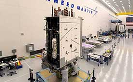
The second GPS III satellite is encapsulated before launch. (Photo: Lockheed Martin)
“We’re continuing to make major strides even while working through this pandemic, and we continue to expand our capability to further the program along,” said Lt. Col Stephen Toth, 2 SOPS commander. “This is a huge, momentous occasion for us, that we’re reaching this milestone, that our programs are being delivered, that they’re being executed and the systems are performing as expected. Ultimately, we’re all very excited that we’ve accomplished this major milestone in the program’s history, and we’re very excited for the next things to come.”
The new generation of GPS III vehicles have a 15-year design life and signals that are three times more accurate than the current generation.
“[This means users will have] better accuracy anywhere in the world, with a user’s device being able to determine their location more reliably,” said Capt. Ryan Thompson, 2nd SOPS assistant director of operations.
Additionally, the new satellites have eight times improved anti-jam capability, allowing the military warfighter to operate better in contested, degraded and operationally limited environments.
The vehicles are designed to be forward and backward compatible, which allows them to adapt to the future while remaining fully adaptable to the previous generation of vehicles.
Eight more GPS III satellites are scheduled to launch from now until 2025.
Despite any challenges that may arise, 2nd SOPS remains focused on the mission and continues to make history in space.
“As we’ve moved forward into the Space Force, we’ve taken a bigger mindset approach toward being warfighters,” Toth said. “What COVID has actually brought out of us is the full understanding of what it is to operate with a warfighter mindset. We may not be at war with an enemy per say, but we are definitely at war with the virus. My job is to ensure we continue to provide position, navigation and timing to the world. And we take that very seriously, so despite the virus, we’ll ensure that our mission continues.”
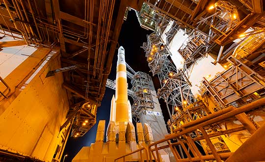
A ULA Delta IV rocket carrying GPS III SV02 lifts off from Space Launch Complex-37 on Aug. 22. (Photo: ULA)
The Space and Missile Systems Center achieved a major GPS milestone on March 27 with the Contingency Operations (COps) program and GPS III Space Vehicle (SV) 02, both of which received U.S. Space Force’s Operational Acceptance approval.
COps is an upgrade to the current GPS Operational Control System to operationally command and control GPS III satellites. These satellites are the newest generation built by Lockheed Martin, providing precise positioning, navigation and timing information with three times better accuracy, and up to eight times improved anti-jamming capability than previous generations of GPS satellites.
The first GPS III satellite, SV01, was launched on Dec. 23, 2018, and achieved Operational Acceptance on Jan. 2, 2020. USSF made SV01 available for use by military and civilian users for critical missions worldwide on Jan. 13.
Operating in a trial period since October 2019, COps supports developmental testing of the GPS III ground and space capabilities. The trial period culminated in a fully mission capable rating from the Air Force Operational Test and Evaluation Center’s Operational Utility Evaluation conducted on the new GPS III satellite and COps upgrade. This event successfully completed on Feb. 20.
Subsequently, GPS Operational Control System and COps received the second GPS III satellite — SV02, nicknamed “Magellan” — which the Space and Missile Systems Center launched on Aug. 22, 2019.
“The COps and GPS III SV02 Operational Acceptance marks another major milestone for the GPS enterprise and presents a clear picture that the Department of Defense is moving to the future,” said Lt. Col. Stephen Toth, 2nd Space Operations Squadron commander. “Of all the programs that will be delivered this year, there are few that carry with it as significant an impact to the warfighter and civilian users as this program will. This is truly a remarkable leap forward for the GPS enterprise and the capability it provides, and I couldn’t be more proud of the team that came together to make it happen.”
Photo: ULAA ULA Delta IV rocket carrying GPS III SV02 lifts off from Space Launch Complex-37 on Aug. 22. (Photo: ULA)
GPS IIIF’s M-code can be broadcast from a high-gain directional antenna in a concentrated, high-powered spot beam, in addition to a wide-angle, full-Earth antenna. (Artist rendering: Lockheed Martin)
U.S. Space Force, Lockheed Martin upgrade Operational Control System (OCS) and refresh GPS constellation with new satellites.
The final steps to fully enable the ultra-secure, jam-resistant military code (M-code) signal on GPS are now underway.
As part of the U.S. military’s effort to modernize GPS, the U.S. Space Force has been steadily upgrading its existing GPS Ground Operational Control System (OCS). The Space Force recently announced Operational Acceptance of the GPS Contingency Operations (COps) upgrade, developed by Lockheed Martin.
The Space Force’s M-Code Early Use (MCEU) upgrade, delivered earlier this year, will enable the OCS to task, upload and monitor M-code within the GPS constellation, as well as support testing and fielding of modernized user equipment, prior to the completion of the next-generation ground control systems.
This spring, work will begin to install the components needed to command and monitor the M-Code encrypted GPS signal, which enhances anti-jamming and protection from spoofing, as well as increases secure access for our forces, into the GPS OCS. M-code signals are available on all the on-orbit GPS IIR-M, IIF and III space vehicles.
A key to enabling M-code is a new software-defined receiver Lockheed Martin developed and is installing at all six Space Force monitoring sites. The M-code Monitor Station Technology Capability (M-MSTIC) uses a commercial, off-the-shelf general purpose graphics processing unit (GPU) to cost effectively receive and monitor M-code signals. Operators can monitor the signal as needed. M-MSTIC complements MSTIC’s, which Lockheed Martin developed and fielded to replace aging hardware receivers that were becoming difficult and expensive to maintain.
“Our warfighters depend on GPS signals every day for many critical missions, so anything we can do to make these signals more resistant to jamming and spoofing is extremely important — and available today,” said Johnathon Caldwell, Lockheed Martin vice president of Navigation Systems. “The more powerful GPS III/IIIF satellites coupled with Lockheed Martin’s upgrades to the GPS ground system are making that possible.”
GPS III also provides a new L1C civil signal, compatible with other international GNSS, such as Europe’s Galileo.
Lockheed Martin is contracted to build up to 32 GPS III/GPS III Follow On (GPS IIIF) satellites to help modernize the GPS constellation with new technology and advanced capabilities. The delivery tempo for these modernized GPS satellites will allow for several launches per year. The third M-code enabled GPS III satellite, named “Columbus,” is expected to launch in April, 2020.
Red Dragon Cybersecurity Suite
Cyber defenses across the upgraded GPS system were recently evaluated by a government assessment team and passed the Operational Utility Evaluation. Lockheed Martin delivered the Red Dragon Cybersecurity Suite (RDCSS) Phase III upgrade during the fourth quarter of 2019, dramatically improving Defensive Cyber Operations (DCO) visibility into GPS network traffic.
Other add-ons include user behavior analytics to analyze patterns of traffic and network taps to improve data collections.
“GPS is an attractive target for our adversaries, so it was critical we bring our best cybersecurity defenses to the table,” said Stacy Kubicek, vice president of Mission Solutions Defense and Security. “Since we began sustaining the Ground OCS in 2013, we have systematically upgraded and replaced software and hardware — it’s now a very secure system.”
Lockheed Martin has sustained the GPS Ground OCS since 2013. In November of 2018, the team completed the AEP 7.5 architectural change – replacing the hardware and software to improve resiliency and cybersecurity. In December of 2018, the Air Force awarded Lockheed martin the GPS Control Segment Sustainment II (GCS II) contract to further modernize and sustain the AEP OCS through 2025.
The GPS III team is led by the Production Corps, Medium Earth Orbit Division, at the Space Force’s Space and Missile Systems Center, at Los Angeles Air Force Base. The GPS OCS sustainment is managed by the Enterprise Corps, GPS Sustainment Division at Peterson Air Force Base. 2 SOPS, at Schriever Air Force Base, manages and operates the GPS constellation for both civil and military users.
On March 23, the U.S. Space Force’s Space and Missile Systems Center successfully transferred the second GPS III space vehicle (GPS III SV02) to Space Operations Command.
GPS III SV02, dubbed “Magellan” in honor of Ferdinand Magellan, the Portuguese explorer who led the first expedition to circumnavigate the Earth, is now officially under the control of the Second Space Operations Squadron located at Schriever Air Force Base, Colorado.
GPS III SV02 was launched on August 22, 2019, aboard a United Launch Alliance Delta IV Medium+ launch vehicle from Cape Canaveral Air Force Station, Florida.
GPS III satellites deliver positioning, navigation and timing information with three times better accuracy, and up to eight times improved anti-jamming capability than its predecessor. This is crucial for the warfighter, who will benefit from the increased power, accuracy and protections provided by the newer GPS III systems.
“This marks our second transfer of Satellite Control Authority for the GPS III program as we continue to modernize the GPS constellation with more capable and resilient systems,” said Col. Edward Byrne, chief of Production Corps’ Medium Earth Orbit Space Systems Division. “It’s only through the hard work, professionalism, and dedication of our entire government and industry partner team that we can successfully transition GPS III SV02 to operations.”
The GPS III spacecraft has a 15-year design life, 25 percent longer than the last generation of GPS satellites currently on-orbit. Additionally, it delivers new capabilities, such as a fourth civilian signal (L1C), designed to enable interoperability between GPS and international satellite navigation systems, such as Galileo. GPS III satellites will also bring the full capability of the military code (M-code) signal, increasing anti-jam resiliency in support of the warfighter.
These continued improvements and advancements to the GPS system make it the premier space-based provider of positioning, navigation, and timing services for more than four billion users around the globe.
U.S. Space Force’s Space and Missile Systems Center, located at Los Angeles Air Force Base in El Segundo, California, is the U.S. Air Force’s Center of Excellence for acquiring and developing military space systems. Its portfolio includes the Global Positioning System, military satellite communications, defense meteorological satellites, space launch, range systems, satellite control networks, space-based infrared systems and space situational awareness capabilities.
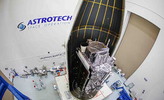
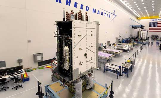
The nation’s third next-generation GPS III satellite — and the first delivered by Lockheed Martin to the new U.S. Space Force — has arrived in Florida for an expected April launch.
On Feb. 5, the third Lockheed Martin-built GPS III space vehicle (GPS III SV03) was shipped to Cape Canaveral from the company’s GPS III Processing Facility near Denver aboard a massive Air Force C-17 aircraft traveling from Buckley Air Force Base, Colorado.
GPS III SV03 — nicknamed “Columbus” — is the latest of up to 32 next-generation GPS III/GPS III Follow-On (GPS IIIF) satellites Lockheed Martin has designed and is building to help the Space Force modernize GPS with new technology and capabilities.
On Jan. 13, 2020, GPS III SV01 (“Vespucci”) was set healthy and active by the 2nd Space Operations Squadron (2 SOPS) at Schriever Air Force Base, in Colorado. 2 SOPS is now using the GPS III Contingency Operations (COps)-upgraded OCS ground control system to operate both the new GPS III and previously launched GPS satellites.
GPS III SV02 (“Magellan”), launched on Aug. 22, 2019, has completed its on-orbit testing and is currently awaiting its turn for integration into the constellation.
On Jan. 21, 2020, the Space Force called up GPS III SV04 for a launch later this summer. GPS III SV05-09 are now in various stages of assembly and test at Lockheed Martin’s commercial-like large satellite production line for GPS III satellites near Denver.
The company is expected to soon complete its critical design review with the Space Force to begin production on the first two GPS IIIF satellites under contract.
GPS III Advantages
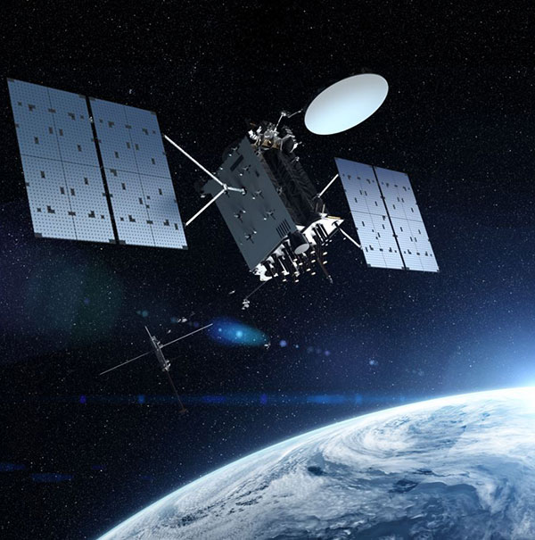
GPS III is the most powerful and resilient GPS satellite ever put on orbit. Developed with an entirely new design for U.S. and allied forces, GPS III has three times greater accuracy and up to eight times improved anti-jamming capabilities over any previous GPS satellites in the constellation.
GPS III is also the first GPS satellite to broadcast the new L1C civil signal, which is shared by other international global navigation satellite systems, like Galileo, to improve future connectivity worldwide for commercial and civilian users.
“Every day, more than four billion civil, commercial and military users rely on the positioning, navigation and timing (PNT) services provided by 31 GPS satellites launched since 1997,” said Tonya Ladwig, Lockheed Martin’s program manager for GPS III. “We are excited to help the Space Force refresh the constellation to ensure U.S. and allied forces always have the best technology and that the U.S. Global Positioning System remains the gold standard for PNT.”
GPS III was designed to evolve with new technology and changing mission needs. The satellite’s evolutionary modular design will allow new GPS IIIF capabilities to start being added at the 11th satellite. These will include a fully digital navigation payload, a Regional Military Protection capability, an accuracy-enhancing Laser Retroreflector Array, and a Search & Rescue payload.
”It’s an exciting time across the GPS mission as we bring together the best of our space, ground, and operations systems to help the United States Space Force modernize this critical national capability,” commented Johnathon Caldwell, Lockheed Martin’s vice president for Navigation Systems.
Lockheed Martin’s GPS III team is led by the Production Corps, Medium Earth Orbit Division, at the Space Force’s Space and Missile Systems Center, Los Angeles Air Force Base.
2 SOPS, at Schriever Air Force Base, manages and operates the GPS constellation for both civil and military users.
Lockheed Martin shipped the U.S. Space Force’s third GPS III satellite to Cape Canaveral, Florida, ahead of its expected April launch. (Photo: Lockheed Martin)