Tag: GPS modernization

  • Space Force awards Lockheed Martin new GPS IIIF contract

    Space Force awards Lockheed Martin new GPS IIIF contract

    Total GPS IIIF commitment now at 14 satellites

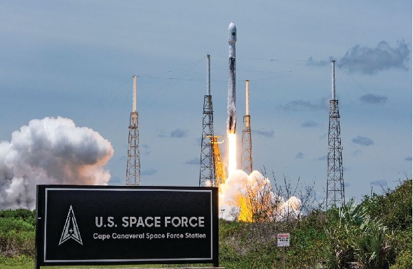
    The U.S. Space Force has awarded Lockheed Martin a $514 million contract to build GPS IIIF Space Vehicles 23 and 24, bringing its total GPS IIIF commitment to 14 spacecraft.

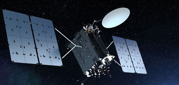
    With legacy spacecraft past their intended design life, the award marks a vital step in continued modernization of the constellation. The 14 upcoming GPS IIIF satellites will deliver advanced, reliable positioning, navigation and timing (PNT) capabilities for both military and civilian users.

    IIIF capabilities include: 

    • The Regional Military Protection capability that provides a 63-fold increase in anti-jam capabilities, allowing warfighters to access strong GPS signals in contested environments
    • Additional M-code-enabled satellites, allowing for secure GPS connection for warfighters
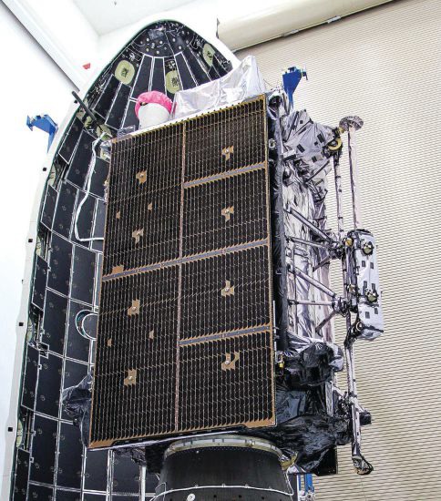
    • A digital navigation payload, increasing accuracy and reliability of IIIF spacecraft.

    “Modernizing the constellation with highly resilient, next-generation space vehicles ensures warfighters have access to the GPS capabilities they require for their missions,” said Christina Mancinelli, vice president of global communications and navigation at Lockheed Martin. “We continue to invest in advanced technology, facilities and the people who are the driving force in the production of this spacecraft that help our military secure peace.”

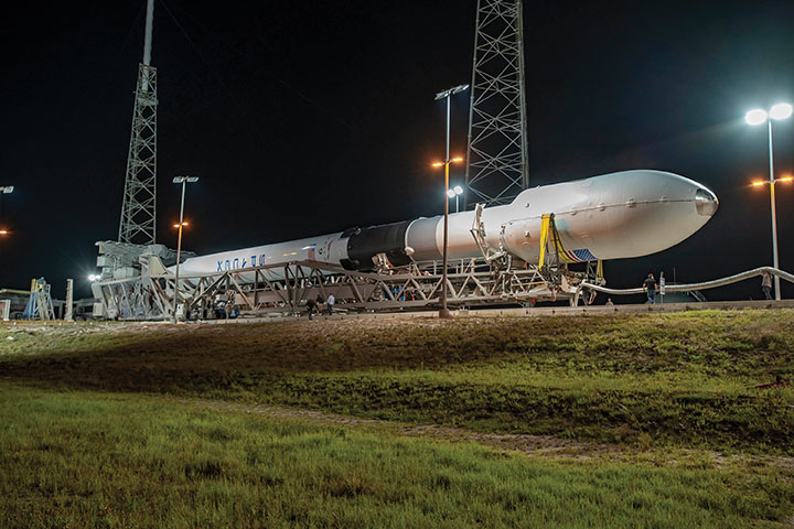
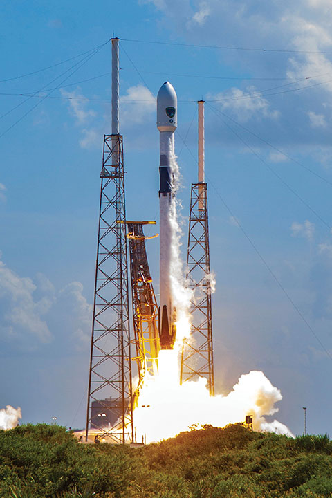
    Earlier this year, all Lockheed Martin-made GPS III satellites reached orbit. GPS III SV09 and SV10 each launched on accelerated timelines, bringing unprecedented levels of resiliency to the constellation.

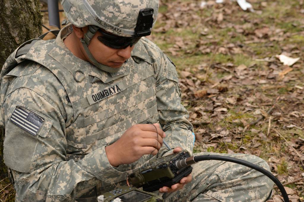
    The GPS constellation provides critical positioning, navigation and timing capabilities to key warfighter platforms made by Lockheed Martin. For example, the F‑35 uses GPS to determine its exact location, keep its systems perfectly synchronized, and share real‑time position data with other assets, enabling autonomous navigation and pinpoint strike capabilities.

    Similarly, the UH-60 Black Hawk employs GPS to navigate accurately, deconflict with ground and air forces, and deliver cargo or weapons with high precision, enhancing mission safety and effectiveness.

    For civilians, the GPS constellation underpins banking transactions, telecommunications networks, emergency‑response services, and everyday navigation. The new GPS IIIF satellites broadcast all civil signals — including the interoperable L1C and L5 — at greater accuracy and reliability.

    Advanced design features speed and resiliency

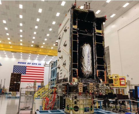
    GPS IIIF satellites are engineered for resiliency. Starting with SV13, these spacecraft are built on the evolved LM2100 Combat Bus, providing increased cyber-hardening, improved spacecraft power, propulsion and electronics. The LM2100 Combat Bus is also outfitted with additional size, weight and power to accommodate future capability insertions.

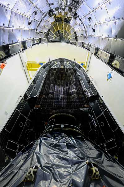
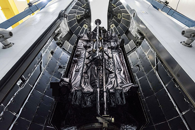
    The company has already completed the core mate milestone — marking the official “birth” of a satellite — for three GPS IIIF satellites, with all other IIIF satellites in different phases of production. The company was also recently awarded a $105 million contract to continue modernization of the GPS ground segment. With these contracts, Lockheed Martin reaffirms its long-term commitment to a resilient, high-performance GPS constellation that supports billions of users worldwide.

    Lockheed Martin continues to advance GPS IIIF production at its Denver area facilities, employing emerging technologies such as augmented reality and digital twins to accelerate build rates and ensure capabilities are delivered to the warfighter quickly.

  • US Army awards contracts for mounted PNT NorthStar solution

    US Army awards contracts for mounted PNT NorthStar solution

    Project Manager Positioning, Navigation and Timing (PM PNT) has announced the Army Contracting Command – Aberdeen Proving Ground award of two Other Transaction Authority (OTAs) via a C5 prototyping project for a mounted PNT NorthStar solution to IS4S and GPS Source.

    With an estimated value of up to $41 million and 36-month period of performance, the OTAs enable the selected vendors to develop next generation of mounted Assured PNT capability that’s modular and upgradable for Army 2040 ground-based platforms.

    “We’re excited to move into the next phase of NorthStar with this award,” said Chris Jais, project manager, PM PNT. “We’re confident that with our vendor partners, we’ll introduce an affordable, MOSA-compliant product with next-generation capability into our family of open solutions and continue to bring upgradable and scalable APNT products to soldiers in the field.” 

    PM PNT’s Modernization product office introduced the NorthStar effort in August 2023 via a virtual event and release of an RFI that received 27 vendor responses. These responses informed PM PNT’s decision to solicit industry for the design of tiers of capability that would offer a range of non-radio frequency technologies to outpace the threat of Army 2040; the responses, combined with tech evaluations and review of white papers, also led to the organization deciding to ultimately award a NorthStar OTA to more than one vendor. 

    “Awarding to multiple vendors encourages competition, speeds up implementation and integration of new technology to meet emerging threats, and reduces cost of engineering change proposals,” said Erik Scott, product manager for PNT Modernization. “Prioritizing a modular system design for hardware and software ensures the best value for the government and the best solution for our warfighters.”

    Contract kickoffs with each vendor are scheduled for next month with design review and a soldier touchpoint to follow.

    For more information on PM PNT, visit the PM PNT page on the Capability Program Executive Intelligence and Spectrum Warfare website.

  • Talking to the satellites

    Talking to the satellites

    On the operations floor of the GPS Master Control Station at Schriever Space Force Base in Colorado, Luccio looks at feeds from a worldwide network of monitor stations and ground antennas. (Image: U.S. Space Force photo by Dennis Rogers)
    On the operations floor of the GPS Master Control Station at Schriever Space Force Base in Colorado, Luccio looks at feeds from a worldwide network of monitor stations and ground antennas. (Image: U.S. Space Force photo by Dennis Rogers)

    The young operators on duty at the GPS Master Control Station, at Schriever Space Force Base in Colorado, receive feeds from a worldwide network of monitor stations and ground antennas, monitor the GPS satellites, and send them commands as needed. This month’s cover story features excerpts of an interview with their commander, Lt. Col. Robert O. Wray, about the training and duties of his team members, the challenges they face, and what brought him to his current assignment.

    Also in this month’s cover story a Q & A with Spirent Federal Systems on how simulation supports GPS modernization and one with Hexagon | NovAtel on the company’s anti-jamming antennas.

    Check out the three Q&A’s featured in this cover story:

    GPS Master Control Station

    Spirent Federal

    Hexagon | NovAtel 

  • GAO discusses DOD PNT management and leadership — again

    GAO discusses DOD PNT management and leadership — again

    In early August, the U.S. Government Accountability Office (GAO) released its third report in 15 months about GPS and other positioning, navigation and timing (PNT) issues within the Department of Defense (DOD). Each report raised raised concerns about the way in which PNT programs were being managed and led within the department.

    Defense Navigation Capabilities

    In May 2021, GAO reported on “Defense Navigation Capabilities: DOD is Developing Positioning, Navigation, and Timing Technologies to Complement GPS.

    Observations included that DOD continues to rely heavily on GPS despite known vulnerabilities. Also, that alternate PNT efforts are not well coordinated and receive little support.

    “Opportunities” for DOD to improve its alternate PNT efforts, according to the report, include:

    • Improving coordination across the services
    • Clarifying authorities and responsibilities for prioritizing needs
    • Focusing on resiliency versus GPS as the cornerstone of department PNT efforts
    • Clarifying PNT requirements rather than just defaulting to GPS as “the need”
    • Coordinating with industry.

    GPS Modernization

    In May, GAO issued the report “GPS Modernization: Better Information and Detailed Test Plans Needed for Timely Fielding of Military User Equipment.” about the implementation of M-code — the military-only, stronger, more jam-resistant signal.

    The report pointed out that M-code has been in development for 20+ years, and that GPS satellites have been capable of transmitting M-code signals since 2005. Also, while there are still program risks, the Next Generation Ground Control Segment, known as OCX, is forecast to be ready to support M-code use by 2023.

    OCX has experienced severe cost overruns and is more than five years behind its original schedule. GAO issued a report on OCX delays in May 2019.

    M-code won’t really be a capability in DOD, though, until user equipment is widely fielded. That will take several more years, according to GAO.

    One of the remaining challenges to M-code implementation, GAO said, was that the department did not collect and validate all the data it needed for leadership planning and prioritization.

    GPS Alternatives

    The first week of August saw release of the GAO report “GPS Alternatives: DOD Is Developing Navigation Systems But Is Not Measuring Overall Progress.”

    A summary on the first page of the report contains what could be seen as harsh criticism of how PNT efforts are led within DOD:

    “DOD’s overall PNT portfolio is managed by the PNT Oversight Council, a statutorily established senior-level body. However, the Council has largely prioritized modernizing the existing GPS system over alternative PNT efforts during recent meetings and has no strategic objectives or metrics to measure progress on the alternative efforts.”

    Image: DOD
    Image: DOD

    Too Much Leadership?

    Some believe the real problem with DOD PNT is not a lack of leadership, but rather too much.

    “If everyone is in charge, no one is,” commented one retired senior military officer familiar with the issue.

    “Congress has been concerned about DOD’s lack of attention to GPS and PNT alternatives for years,” the individual said. “In 2015 Congress mandated creation of the Oversight Council to help ensure PNT got the right amount of leadership attention.” This may have not had the desired effect, though.

    “The council is comprised of three undersecretaries, the vice chairman [of the Joint Chiefs of Staff], four combatant commanders, the NSA [National Security Agency] director, DOD’s CIO [chief information officer], and host of other very senior folks. All of whom have way too many other duties. It’s no wonder the department has a hard time getting things done!”

    The department’s CIO is the Defense Secretary’s Principal Staff Assistant for PNT. As such, the CIO is tasked with coordinating department-wide efforts. The task is made particularly difficult by the many and diverse players across the department, all of whom have their own authorities, interests and projects.

    Proposed systems and capabilities are examined and developed by a variety of DOD organizations. These include laboratories belonging to the five services and the Defense Advanced Research Projects Agency (DARPA).

    Programs of Record, which usually lead to acquisition of large systems, are led and managed within the individual services.

    A Better Way?

    Aside from recommending improved coordination of PNT efforts across the department, GAO has never addressed the way DOD manages its PNT enterprise.

    “That is not something we normally get into unless specifically tasked,” said one of the reports’ authors. “We assume departments know best how to lead and manage their efforts.”

    Others are not so reticent. They believe the current management structure is incapable of managing the development, acquisition and fielding of the DOD PNT Enterprise with any urgency or efficiency.

    “GAO’s focus on the Oversight Council is misplaced,” one retired official asserted. “The missing piece is not oversight, it’s day-to-day DOD-wide management.”

    “They need a multi-service program of record for resilient PNT,” the official said. “This would be separate from the GPS program, which would keep its own projects going and feed into the resilient effort. The new resilient PNT program should be managed by a Joint Program Office, which could consolidate integration and acquisition of resilient PNT applications. The office would be the steward for the critical technologies that underpin the modular, open-system integration strategy, including the digital reference architecture, input and output standards, software fusion engines, and needed modeling and simulation tools to ensure NAVWAR compliance.”

    Such a construct could provide needed focus and coordination to DOD efforts, address many long-standing congressional concerns, and, by coordinating efforts within DOD and with industry, accelerate progress.

    Related article: Who Runs GPS? 


    Dana A. Goward is President of the Resilient Navigation and Timing Foundation. He serves on the President’s National Space-based Positioning, Navigation, and Timing Advisory Board.

  • Directions 2022: GPS positioned for the future

    Directions 2022: GPS positioned for the future

    By Michael J. Dunn, Space Systems Command, Capability Area Integrator for Positioning, Navigation and Timing

    The Global Positioning System is the premier positioning, navigation and timing (PNT) source for more than six billion users worldwide. It is vital to the function of all 16 of the United States’ essential critical infrastructure components. Life as we know it relies on the essential services that GPS provides.

    The United States Space Force (USSF) is committed to maintaining a healthy GPS constellation that continues to deliver the “gold standard” of PNT availability and reliability throughout the world. Continuous improvements in equipment and performance have been a hallmark of the enterprise since its inception. 2021 was no exception, with a continued record-setting delivery of new capabilities.

    Space Systems Command (SSC) at Los Angeles Air Force Base in El Segundo, California, is laser-focused on delivering the most important modernization in GPS history. The government and industry team are committed to bringing major upgrades to the space, control and user-equipment segments. It is an exhilarating time for the GPS enterprise. The specific updates within each segment cement the continued evolution in GPS and the USSF commitment to delivering advanced capabilities to the nation and the world.

    Space Segment

    Currently, 37 GPS satellites are on orbit, with 29 satellites set healthy. The baseline constellation requirement is 24 satellites. The system continues to perform in stellar fashion, providing an average 48-centimeter position accuracy throughout 2021.

    Orbital systems modernization is focused on the GPS III satellite fleet, and the program continues to deliver peerless capabilities. GPS III space vehicles (SV) 1–4 were all operationally accepted in 2020. In 2021, the most notable event was the launch of GPS III SV05 in June. The satellite successfully achieved operational acceptance and mission-capable status for USSF in just under two weeks: a new record. SVs 6–8 are available for launch and are awaiting their launch windows. SV09 system-level testing is in progress. SV10 component deliveries continue. GPS III provides up to eight times better anti-jam and a new L1C signal to improve user connectivity.

    For the GPS IIIF program, the long-range picture remains bright as the contract for GPS IIIF SVs 15–17 was awarded in October 2021. The delivery of the first GPS IIIF is expected early in 2026. GPS IIIF will build upon the tremendous increase in capability provided by GPS III with the addition of a search-and-rescue payload, a laser retroreflector array for precise ranging, a fully digital navigation payload, and a Regional Military Protect capability that will provide 60 times greater anti-jam for operations in electromagnetically hostile environments.

    GPS III space vehicle 05 (GPS III-SV05) launched in June 2021 from Cape Canaveral Space Force Base, Florida, aboard a SpaceX Falcon 9 launch vehicle. (Photo: SpaceX)
    GPS III space vehicle 05 (GPS III-SV05) launched in June 2021 from Cape Canaveral Space Force Base, Florida, aboard a SpaceX Falcon 9 launch vehicle. (Photo: SpaceX)

    Control Segment

    The next-generation Operational Control System (OCX) continues to execute within its program baseline. OCX will provide enhanced command and control capabilities, modernized architecture, robust information assurance and cyber security.

    OCX’s incremental development approach began with OCX Block 0, which is the launch and checkout system (LCS) for GPS III. The LCS successfully supported the launch and checkout of GPS III SV 01–05. OCX Blocks 1 and 2 will control all legacy GPS III satellites and both legacy and modernized signals.

    Despite barriers presented by the global COVID-19 pandemic, all 17 global OCX monitoring station installations were completed in July 2021. Most of the remaining equipment was fielded throughout December 2021. System integration and verification continues with transition to operations scheduled for early 2023.

    The Next Generation OCX 3F contract was awarded in April 2021. The program will modify OCX to launch and control GPS IIIF satellites with enhanced capabilities. Acquisition Milestone B is expected in 2022, and operational acceptance is planned for 2027.

    MGUE: The future warfighter’s battlespace edge. (Image: Space Systems Command Production Corps)
    MGUE: The future warfighter’s battlespace edge. (Image: Space Systems Command Production Corps)

    User Equipment Segment

    Millions of GPS receivers are fielded, but very few of them can use the military code (M-code) signal that is being broadcast by 24 GPS SVs. To keep our competitive advantage against the adversary, the GPS enterprise is focused on developing modernized GPS user equipment (MGUE) that takes advantage of these signals. The MGUE program is a joint service program developing modernized, M-code-capable military GPS receivers. The program is broken into two increments (Inc 1 and Inc 2). Both are designed to deliver secure PNT performance, allow navigation warfare operations, enhance anti-jam, anti-spoof and anti-tamper, and enable Blue Force Electronic Attack.

    MGUE Inc 1 achieved a major milestone in September 2021 with successful testing on the Marine Corps Joint Light Tactical Vehicle (JLTV). The event took place in an electromagnetically degraded GPS environment at White Sands Missile Range, New Mexico. The JLTV is a pathfinder lead platform for the MGUE program. Lead platforms for the other services, the Army Stryker combat vehicle, Air Force B-2 bomber, and Navy Arleigh-Burke Class Guided Missile Destroyer, will commence integration testing in FY23 and FY24.

    MGUE Inc 2 development continues to make progress in maturing the next generation ASIC technology required for all weapon-system platforms to provide functionality and backward compatibility. It will deliver a miniature serial interface card in CY26 to support handheld and ground applications. Eventually, MGUE receiver cards will be loaded onto hundreds of Department of Defense (DOD) weapon systems.

    GPS III SV04 in Highbay (Photo: Lockheed Martin)
    GPS III SV04 in Highbay (Photo: Lockheed Martin)

    Partner Community

    The GPS enterprise is committed to cooperation on a global basis. It works closely with the DOD, the armed services, the U.S. Coast Guard, other federal agencies, the International Civil Aviation Organization and all the other global and regional navigation satellite systems toward the development of PNT in the global commons.

    A highlight of this cooperative work is GPS enterprise involvement in the National Executive Committee for Space-Based PNT (PNT EXCOM), which supports the interests of the various federal bodies, especially the Department of Transportation (DOT) and the Federal Aviation Administration (FAA). The PNT EXCOM is applying GPS technology to a broad variety of governmental activities, including the development of the Next Generation Air Transportation System and intelligent transportation systems.

    The GPS enterprise commitment to international partners is unwavering. Our support to the North Atlantic Treaty Organization (NATO) is ongoing with support to the Capability Panel 2 for Navigation working toward the integration of MGUE and compatibility arrangements with Europe’s Galileo system. A highlight this year was the first delivery of MGUE loan equipment to the United Kingdom, Canada, Germany, and the Republic of Korea. Germany is the first country to purchase MGUE equipment.

    Conclusion

    GPS is the foundation of global PNT and a cornerstone of modern life. Improvements to the enterprise are continual. As the nation moves into the complex and dynamic world of the coming decades, the dedicated military, civilian and industry professionals that provide this world-changing capability will continue their challenging and rewarding work. Semper Supra!

    The "encapsulation" of a GPS satellite. (Photo: U.S. Department of Defense)
    The “encapsulation” of a GPS satellite. (Photo: U.S. Department of Defense)

  • US representatives call for greater investment in GPS modernization

    US representatives call for greater investment in GPS modernization

    The following op-ed was released by U.S. representatives Don Bacon and Mikie Sherrill, co-chairs of the congressional Global Positioning System Caucus.


    The US military needs a modernized GPS capability to maintain superiority

    By Rep. Don Bacon and Rep. Mikie Sherrill

    Don Bacon
    Don Bacon

    In December 1993, the U.S. declared that the satellites comprising the Global Positioning System constellation had achieved initial operational capability, representing the culmination of a 20-year effort to develop and launch the first global navigation satellite system.

    GPS, which began as a U.S. government project to provide positioning, navigation and timing information by broadcasting radio signals from satellites to the ground, stands alone in the revolutionary impact it has had on both our warfare abilities and our commercial industries. However, an aging constellation and unyielding international competition has put America’s GPS superiority at risk.


    “We believe it is critical to our international interests that the U.S. reinvest in GPS modernization. We cannot afford to overlook the satellites.”


    Mikie Sherrill
    Mikie Sherrill

    In the decades since achieving initial operational capability, GPS has become integrated into virtually every facet of the U.S. economy and is part of everything from our cellphones to our financial, agricultural, transportation and manufacturing sectors — and to every aspect of our national security.

    Even as GPS has grown to become a fundamental part of our everyday life, the U.S. provides GPS signals for free to users worldwide. And yet, China, Russia, the European Union, India, and Japan have all developed regional or global satellite systems since GPS was launched.

    Most recently, China’s completion of its BeiDou system comprised of over 30 satellites — part of its broad Belt and Road Initiative — risks endangering U.S. technological leadership. Beijing has made it clear that it will leverage BeiDou as part of an overall strategic effort to obtain greater influence internationally, heavily subsidize the adoption of BeiDou-equipped infrastructure for government and military use in countries throughout its region, and advantage BeiDou-compatible domestic products.

    As the House co-chairs of the congressional GPS Caucus, we believe it is critical to our international interests that the U.S. reinvest in GPS modernization. We cannot afford to overlook the satellites — the oldest of which were launched in the late 1990s or early 2000s — that underpin civil and social infrastructure, including civil aviation, banking systems, financial markets, power grids, precision agriculture, and communications networks and applications. Even as manufacturers develop multi-constellation devices that can receive signals from both GPS and other global systems, it is more critical than ever that the U.S. accelerate its investment in next-generation GPS satellites.

    To that end, the U.S. has begun modernizing the GPS constellation, with significant technological benefits for U.S. warfighters and civil users. New GPS satellites provide three times greater accuracy, and eight times improved resistance to inference and signal blocking known as jamming. However, the replacement of outdated GPS satellites in the constellation has not kept pace with our international competition and emerging global threats.

    A U.S. paratrooper uses a Defense Advanced GPS Receiver during a live-fire exercise at Grafenwoehr, Germany. (Photo: Spc. Markus Rauchenberger/U.S. Army)
    A U.S. paratrooper uses a Defense Advanced GPS Receiver during a live-fire exercise at Grafenwoehr, Germany. (Photo: Spc. Markus Rauchenberger/U.S. Army)

    We believe that our efforts to invest in American technological leadership must include an increased launch rate of new GPS satellites with both crosslinks and on-orbit reprogrammable capabilities. Crosslinks enable greater accuracy, and on-orbit reprogrammability can counter jamming and spoofing by providing means to update signal and/or data streams and quickly counter emerging threats without the need to produce and launch new satellites.

    A necessary and critical element of GPS modernization is also the development of a systematic road map for the use of our modernized GPS system by civil manufacturers and users across industries. Together, these steps will allow the United States to maintain its global leadership; enable U.S. firms to continue to offer innovative GPS-based products and services; and counter efforts by our international adversaries to give preference to their own technologies.

    As the first and unrivaled provider of space-based services to the public, GPS currently provides $1 billion in economic impact from the U.S. civil GPS sector every day. As we move to a multi-constellation world, it is more critical than ever that the U.S. accelerates investment in our GPS enterprise to enable the next-generation benefits that a modernized constellation will bring to our warfighter, the U.S. economy and the free nations of the world.


    Rep. Don Bacon, R-Neb., is a member of the House Armed Services Committee and a co-chair of the congressional Global Positioning System Caucus. He retired from the U.S. Air Force as a brigadier general.

    Rep. Mikie Sherrill, D-N.J., serves on the House Armed Services Committee and is a co-chair of the congressional Global Positioning System Caucus. She served in the U.S. Navy for nearly a decade as a helicopter pilot and Russian policy officer.

  • GPS in an era of global competition

    GPS in an era of global competition

    By Alex Damato
    Acting Executive Director, GPS Innovation Alliance 

    Alex Damato
    Alex Damato

    Innovation is the watchword in Washington this year. Amidst an ongoing supply-chain crisis and rising global trade tensions, policymakers have put renewed emphasis on U.S. leadership in such industries as semiconductors, wireless broadband and artificial intelligence — areas rightly seen as the “enabling technologies” of the 21st century.

    Alongside chips and supercomputers is another innovation underpinning everything from our communications networks to financial transactions and air transportation: GPS technology. 2022 will see a flurry of activity to accelerate U.S. competitiveness for the modern economy and accelerating the modernization of our GPS constellation must place high on this list.

    It’s no surprise that allies and adversaries alike have taken notice of GPS. While for decades U.S.-led GPS was the “only game in town” for global navigation satellite systems (GNSS) services, the current global picture is much changed. Russia, China, the European Union, Japan, India and other nations have explored, tested and deployed satellites to build out their own global or regional positioning, navigation and timing (PNT) networks and capabilities. The more recently deployed GNSS — including China’s BeiDou, which was completed in 2020 — represent a competitive threat by our international adversaries in spite of U.S. GPS technology advancements in performance and resilience. The potential loss of global leadership poses a dramatic challenge for U.S. interests.

    Although our current GPS constellation continues to enable critical services that touch nearly every aspect of daily life, the oldest satellites were launched in the late 1990s. As new, more advanced GPS satellites go up in the sky, we can take several policy steps here on the ground to ensure that GPS remains the global standard — undermining attempts to create an information ecosystem independent of the United States and reliant on our international competitors. 

    Enter the United States’ GPS modernization program. Allocating the resources necessary to accelerate the launch of new GPS satellites will pave the way to keeping GPS globally competitive — both in defense and civil applications. Take accuracy, for starters. New GPS satellites will bring three times better accuracy than existing systems and up to eight times improved anti-jamming capabilities, both of which will keep us competitive and add critical security against domestic spoofers and foreign adversaries. 

    While U.S. firms should continue to create multi-constellation receivers that are interoperable with global PNT signals, U.S. policy should promote American technological leadership by accelerating modernization of the GPS space and control segments. Importantly, a necessary element of this technological leadership is development of a systematic roadmap to spur adoption of these new modernized features in civil applications. Establishing this clear pathway for civilian applications of a modernized GPS constellation is critical to ensuring that the potentially more than $1 billion of economic benefits added every day by the U.S. civil GPS sector are fully realized.

    As Congress continues to focus on innovation and global competition, the GPS Innovation Alliance is committed to working with policymakers to promote the critical security, economic and diplomatic benefits to the United States of investing in next-generation GPS infrastructure.

    Originally a product of the Sputnik era, GPS has demonstrated the very best features of competitive U.S. government investment. As the United States prepares for a renewed era of global competition, the promise today of invigorated support for GPS remains the same. 

    The United States must continue to lead by modernizing GPS and establishing a clear pathway for civilian applications of the improved constellation. (Image: matejmo/iStock/Getty Images Plus/Getty Images)
    The United States must continue to lead by modernizing GPS and establishing a clear pathway for civilian applications of the improved constellation. (Image: matejmo/iStock/Getty Images Plus/Getty Images)

  • How GPS became core tech at CES

    How GPS became core tech at CES

    J. David Grossman, executive director, GPSIA
    J. David Grossman

    GPS drives the innovation economy

    By J. David Grossman
    Vice President of Regulatory Affairs
    Consumer Technology Association

    This January, the annual Consumer Electronics Show (CES) — owned and produced by the Consumer Technology Association (CTA) — returned to Las Vegas. As the premier global platform for innovation, each year CES showcases the latest and greatest consumer technologies, from smartphones and wearables to self-driving trucks and electric cars.

    GPS continues to play a central role in the technology we use daily. At CES, GPS-enabled technologies are found in nearly every product category, including 5G, internet of things (IoT), smart cities, vehicle tech and fitness wearables.

    They are also among the CES 2022 Innovation Awards honorees, such as a connected bracelet that can alert emergency contacts and a robot that can identify the difference between crops and weeds.

    How did GPS come to play such a critical role in devices as diverse as drones and smartphones?

    Over the past 40 years, GPS has transformed from its origins as a military technology to one that no consumer or business can live without. During the 1990s, CTA members such as Panasonic and Sony pioneered commercially available GPS receivers.

    At CES 1998, Garmin introduced StreetPilot, described as “one of the first practical and affordable GPS-based road navigation devices” and paved the way for huge growth in the consumer GPS market.

    By the 2000s, GPS was no longer just a stand-alone technology. Following new Federal Communications Commission requirements, GPS-enabled smartphones opened the door for all-in-one devices. These products could deliver turn-by-turn navigation or identify the location of a lost or stolen device. In more recent applications, GPS technology provides the foundation for ever-more-complex mobile applications.

    Opening of the 2022 Consumer Electronic Show. (Photo: Consumer Technology Association)
    Opening of the 2022 Consumer Electronic Show. (Photo: Consumer Technology Association)

    Foundational Technology

    The evolution of GPS reflects a broader industry trend: innovators integrate foundational technology into successive generations of products, spurring development of new products and services. We’ve seen the same pattern play out for Wi-Fi, Bluetooth and Near Field Communication (NFC), which enables the latest tap-to-pay technologies. Hundreds of companies simply would not exist without free, global access to GPS signals!

    With GPS, ridesharing companies such as Lyft match drivers and passengers, lead drivers to a precise pick-up location, and chart out a safe and efficient driving route. GPS-integrated smartwatches allow runners and cyclists to easily track pace and distance, a huge boon for many of us in the pandemic era. Closer to home, GPS-enabled pet collars help families keep tabs on their furry friends.

    Revolutionary

    Beyond the technology we use daily, GPS technology is also revolutionizing such industries as agriculture. Thanks largely to GPS, centuries-old businesses are now technology companies. For instance, John Deere leveraged its 185-year history of building tractors and combines GPS with other location technologies to steer semi-autonomous tractors with centimeter accuracy. In addition to the time and efficiency benefits for farmers, technologies like these support sustainable agriculture by reducing the use of pesticides, water, seed and fertilizer.

    John Deere held a Media Days press conference at Mandalay Bay during CES 2022. (Photo: Consumer Technology Association)
    John Deere held a Media Days press conference at Mandalay Bay during CES 2022. (Photo: Consumer Technology Association)

    The success of GPS is important for our industry’s success, and I am proud of the role GPS plays in everyday life. Modernization of GPS, supported by the U.S. government and industry, will enhance the accuracy, reliability and resiliency of the technology, which in turn will ensure GPS remains central to the innovation economy.

  • SpaceX launches GPS satellite to provide PNT services

    SpaceX launches GPS satellite to provide PNT services

    SpaceX launched into orbit for the U.S. Space Force the fifth GPS III satellite (SV05) on June 17.

    Photo: U.S. Space Force
    Photo: U.S. Space Force

    GPS III SV05 eventually will replace one of the legacy GPS IIR satellites. Once GPS III SV05 is operational, about 16% of the 31-satellite constellation will be modernized with GPS III’s new capabilities.

    M-Code Requirement Met

    GPS III SV05 is the 24th M-code satellite on orbit, completing the constellation’s baseline requirement to provide U.S. military forces a more-secure, harder-to-jam and spoof GPS signal.

    GPS III SV05 is the fifth Lockheed Martin-built, next-generation GPS III space vehicle. The SpaceX Falcon 9 rocket is the first U.S. Space Force mission to reuse a previously-flown booster, the company said.

    The U.S. Space Force contracted Lockheed Martin to design and build GPS III/GPS IIIF satellites to help modernize today’s GPS satellite constellation with new technology and advanced capabilities. Lockheed Martin said the GPS III provides three-times greater accuracy, eight times improved anti-jamming capability for U.S. military forces; a new L1C civil signal to the constellation that is compatible with other GNSS; and a new modular design that allows new technology and capabilities to be added in the future to better address changing mission needs and emerging threats.

    Future GPS III Satellites

    GPS III Space Vehicles 06, 07 and 08 already are complete and waiting to be called up for their launch dates, which are to be determined.

    In addition, GPS III SV09 was core-mated, meaning it reached a major production milestone in which two major satellite components — the mission module and the propulsion core — are paired to form one space vehicle. The GPS III SV10 currently is in the component build up stage.

    Lockheed Martin has been contracted to design and build up to 22 additional GPS III Follow On – or GPS IIIF – satellites (SV11-32), with even more capabilities. Contract options for the first four GPS IIIFs, SV11-14, have been exercised so far.

    Photo: Lockheed Martin
    The U.S. Space Force contracted Lockheed Martin to design and build GPS III/GPS IIIF to help modernize today’s GPS satellite constellation. Photo: Lockheed Martin

  • GPS upgrade: SMC shares constellation modernization plans

    GPS upgrade: SMC shares constellation modernization plans

    By Col. Ryan Colburn
    Director, Spectrum Warfare Division and Portfolio Architect,
    Space and Missile Systems Center

    The United States’ Global Positioning System is used now more than ever before. With an estimated four billion users worldwide, industries of all kinds continue to leverage the precise and consistent data streaming from the GPS satellites. The universal use of GPS signals permeates our lives and creates positive impacts around the globe.

    We continue to deliver on our decades-long commitment to provide precise positioning and timing data to the civil, commercial and scientific communities. To support the evolving use of this global utility, the government and industry GPS Enterprise team has embarked on major investments to modernize GPS capabilities for our stakeholders. These efforts are occurring across all of our segments and combine to deliver incremental capabilities and improvements over time.

    Colonel Ryan Colburn leads the team dedicated to modernizing the GPS constellation to meet tomorrow’s needs. (Photo: U.S. Space Force)
    Colonel Ryan Colburn leads the team dedicated to modernizing the GPS constellation to meet tomorrow’s needs. (Photo: U.S. Space Force)

    GPS ENTERPRISE ROADMAP

    The GPS Enterprise Roadmap is an overview of the many programs we have in execution or planning stages. These efforts will enable us to deliver new and improved positioning, navigation and timing (PNT) capabilities across all segments. We are upgrading each of the three GPS segments (space, control, and user equipment) to deploy modernized capabilities while continually replenishing the GPS constellation; ensuring we have 24 or more operational satellites available at least 95% of the time.

    Additionally, we are always working on what’s next. We are actively researching, prototyping and planning; looking at how we will continue to evolve this architecture into one that is more robust and resilient than it is today. Our team is working to define the next set of capabilities for not only the GPS, as the backbone of our architecture, but also for ways to build off of this system and expand our ability to deliver PNT capabilities in new and useful ways.


    “We continue to deliver on our decades-long commitment to provide precise positioning and timing data to the civil, commercial and scientific communities.”


    2021 UPCOMING MILESTONES

    Space Segment

    The GPS III program is off to a great start, further enhancing military readiness and bolstering the activities and assurance of all GPS users. The program continues to push space acquisition boundaries with the first reuse of a Falcon 9 rocket for a National Security Space mission.

    Slated for launch in June, SV05 will launch on a flight-proven Falcon 9 booster that was recovered after successfully launching SV04 into orbit.

    SV05 will continue the GPS constellation modernization effort and will deliver users a bump in performance and accuracy. The satellite features the interoperable L1C signal, the newest civilian L5 signal and anti-jamming improvements. For the military user, SV05 will become the 24th military-code (M-code) satellite, bringing M-code utility to its Initial Operating Capability.

    The GPS III SV03 satellite is encapsulated in its protective launch fairings. (Photo: U.S. Space Force)
    The GPS III SV03 satellite is encapsulated in its protective launch fairings. (Photo: U.S. Space Force)

    Ground Segment

    2021 will be a big year for the Next Generation Operational Control System (OCX). OCX will soon complete the installation of an entirely modernized network of 17 global monitoring stations. These stations allow OCX to monitor the full suite of legacy as well as modernized military and civil navigation signals, including L2C and L5.

    In the factory, OCX will continue to use a newly accredited GPS System Simulator (GSYS) in support of mission software testing. In parallel, OCX will continue to replace mission equipment with Hewlett-Packard Enterprise hardware prior to its deployment to operational sites. Once deployed, connections to the GPS command and control antennas will begin, and interconnections to other mission systems will be established.

    This includes the GPS Global Information Grid Automated Information System (GGA) subsystem, which will ensure timely dissemination of important navigation data to the public. OCX’s Launch and Checkout System (LCS) will be used to launch and initialize GPS III SV05.

    OCX 3F is a modification of the OCX baseline to support GPS IIIF-specific mission requirements. OCX 3F will maintain backward compatibility with the existing systems to support the legacy GPS constellation and will integrate future GPS IIIF capabilities. For example, it will implement command and control of the Regional Military Protection (RMP) and Rapid Warfighter Effects requirements. We are on track for an OCX 3F contract award later this year.

    A GPS Antenna is installed at the Diego Garcia Tracking Station, part of the Satellite Control Network operated by the Space Force. (Photo: U.S. Space Force)
    A GPS Antenna is installed at the Diego Garcia Tracking Station, part of the Satellite Control Network operated by the Space Force. (Photo: U.S. Space Force)

    User Equipment Segment

    In 2021, Military GPS User Equipment (MGUE) Increment 1 will culminate its ground user form factor efforts by completing a Field User Evaluation (FUE) of M-Code GPS technology in two service-nominated lead platforms. The Army FUE will be conducted with multiple variants of Stryker vehicles.

    Meanwhile, the U.S. Marine Corps will use the Joint Light Tactical Vehicle (JLTV) for their FUE. Both events will assess the performance of the enhanced GPS receivers in operationally relevant environments. Toward the end of 2021, MGUE Increment 1 will deliver the aviation/maritime form factor, which will enable Navy Guided Missile Destroyer (DDG) and USAF B-2 bomber lead platform integration in 2022.

    GPS III SV03 is rolled out to the launchpad (above) before its daytime launch on June 30, 2020 (left). The M-code-enabled satellite was joined by SV04 in December. SV05, the 24th M-code-enabled satellite, is expected to launch by July 2021, completing the Initial Operating Capability of M-code. (Photo: U.S. Space Force)
    GPS III SV03 is rolled out to the launchpad before its daytime launch on June 30, 2020.

    Enterprise Integration

    None of these systems are delivered in a vacuum, and we work hard to integrate them all. It is the only way we can continue to deliver on our promises outlined in our published standards. From test campaigns and requirements management, to model-based systems engineering and roadmaps; it takes a united team of government and industry partners to deliver truly integrated capabilities.

    We have many exciting milestones this year and we have a world-class government and industry team working tirelessly to ensure continued delivery, maintenance, and operations of GPS Enterprise capabilities. Our motivation is simple — continuing to deliver and evolve the gold standard PNT capabilities we all rely on day in and day out.

    The U.S. Space Force’s Space and Missile Systems Center (SMC), located at the Los Angeles Air Force Base in El Segundo, California, is the center of excellence for acquiring and developing military space systems. The SMC’s portfolio includes space launch, global navigation satellite systems, military satellite communications, a meteorological satellite control network, range systems, space-based infrared systems, and space situational awareness capabilities.

    The M-code-enabled SV03, shown launching in June 2020, was joined by SV04 in December. SV05, the 24th M-code-enabled satellite, is expected to launch by July 2021, completing the Initial Operating Capability of M-code. (Photo: U.S. Space Force)
    The M-code-enabled SV03, shown launching in June 2020, was joined by SV04 in December. SV05, the 24th M-code-enabled satellite, is expected to launch by July 2021, completing the Initial Operating Capability of M-code. (Photo: U.S. Space Force)

  • L3Harris joins advocacy group GPS Innovation Alliance

    L3Harris joins advocacy group GPS Innovation Alliance

    Logo: GPS Innovation AllianceAlliance membership has tripled in past 13 months as the organization grows advocacy for ever-increasing importance of GPS technologies to the global economy.

    The GPS Innovation Alliance (GPSIA) has announced L3Harris Technologies as the newest member of the organization.

    L3Harris Technologies, a global aerospace and defense technology innovator, joins a core of companies committed to furthering GPS innovation, creativity and entrepreneurship.

    As the newest member, L3Harris Technologies will work with GPSIA to promote the modernization of GPS and its impact on military operations, economic growth and technological innovation.

    J. David Grossman
    J. David Grossman

    “With the addition of L3Harris, the alliance welcomes a company recognized globally for developing and advancing innovative uses of GPS to protect our nation’s national security,” said GPSIA Executive Director J. David Grossman. “Having now tripled membership over the last 13 months, GPSIA is in a position of strength to continue leading advocacy for the promotion, protection and enhancement of GPS, both in the U.S. and around the globe. L3Harris Technologies is an integral part of the deployment of next-generation GPS III satellites and we look forward to working with them to ensure this technology remains the gold standard for delivering positioning, navigation and timing functions to our military as well as a wide range of other sectors, including transportation, agriculture, electricity and finance.”

    L3Harris Technologies has played an integral part in the story of GPS, as it has provided navigation technology for every U.S. GPS satellite ever launched. L3Harris Technologies is developing 10 GPS III satellite navigation payloads for the U.S. Air Force’s GPS III satellite program, four of which are already operational.

    The company will also provide navigation payloads with fully digital Mission Data Units (MDU) for the U.S. Air Force’s GPS III Follow-On, known as GPS IIIF, satellites. The MDU will provide even more powerful signals and ensure flawless atomic clock operations.

    “GPS technology is an important part of the modern world and critical for the warfighter,” said Joseph Rolli, L3Harris Technologies Positioning, Navigation and Timing.

    “With more than 40 years of experience developing GPS technologies, L3Harris aims to continue to improve the system with a more powerful, reliable, and flexible signal. We look forward to joining GPSIA and its other industry leading members as we advocate for continued support of this incredible system,” Rolli said.

  • SMC awards 3 agreements for modernized GPS handheld

    SMC awards 3 agreements for modernized GPS handheld

    SMC awards multiple rapid prototyping agreements for joint modernized GPS handheld device; four demonstrations to be held

    The Defense Advanced GPS Receiver (DAGR) in use in 2011. (Photo: U.S. Army)
    The Defense Advanced GPS Receiver (DAGR) in use in 2011. (Photo: U.S. Army)

    On June 26, the United States Space Force’s Space and Missile Systems Center awarded three separate rapid prototyping agreements to Collins Aerospace, Raytheon Intelligence & Space and the Technology Advancement Group for a total of $41.1 million.

    The firm-fixed price agreements are for the development of a basic working prototype of the joint modernized GPS handheld device. The contract provides the government with innovative solutions demonstrated via hardware and software prototype development.

    The purpose of this rapid prototyping effort is to produce a joint modernized handheld smaller in size with low power consumption, increased military-code capability, and improved anti-jamming and anti-spoofing capabilities compared to the equipment now used by the military.

    4 demonstrations coming

    This is the second competitive objective under the current Phase I strategy and is the result of a down-select from five to three vendors. It builds off the first objective of Phase I, which focused on mock-ups and drawings.

    These agreements provide for four demonstrations to be held with Army and Marine Corps representatives. The demonstrations give the end users an early opportunity to provide feedback and the ability to influence the final design — ultimately making for a more seamless transition to operations.

    “This is the first major update to the military’s GPS handheld device in more than 15 years,” said Col. Clifford Sulham, User Products Division chief.  “The advanced capabilities of this device will allow our airmen, soldiers, sailors and Marines to conduct operations in GPS-challenged environments.”