Tag: GPS satellites

  • General Dynamics Awarded $25M by Lockheed for GPS III Program

    At least some of the work on GPS III continues along prepared tracks, with the award of a Lockheed Martin contract to General Dynamics for two more satellites’ worth of communications hardware. General Dynamics Advanced Information Systems, a business unit of General Dynamics, was awarded a $25.4 million full-production contract from Lockheed Martin to support the GPS III Network Communications Element (NCE) for space vehicles seven and eight (SV 07-08). This commitment fills out that aspect of the current Lockheed Martin  bevy of eight bought by the U.S. Air Force.

    Many if not all components of the GPS III constellation beyond the Initial Eight have been called into question recently, with the U.S. Senate, the Air Force, and Lockheed itself keeping open minds about alternatives.

    General Dynamics’ NCE components provide the communications functions for the GPS III satellites, including the ground-to-space command and control channel, the space-to-space inter-satellite channel and the command and telemetry communications channels within each satellite. General Dynamics is now under contract with Lockheed Martin for GPS III SV 01-08. Delivery of the NCE components for SV03 and SV04 are scheduled for this summer.

    Compared to prior GPS vehicles, the Air Force’s GPS III satellites will deliver three times better accuracy, provide up to eight times more powerful anti-jamming capabilities and include enhancements that extend spacecraft life 25 percent further. GPS III-series satellites also will carry a new civil signal designed to be interoperable with other international global navigation satellite systems, enhancing civilian-user connectivity.

    The majority of the work under contract will be performed at the General Dynamics Advanced Information Systems facilities in Scottsdale, Arizona, and Bloomington, Minnesota.

  • Lockheed Misses GPS III Deadline After Production Delays

    The U.S. Air Force is shopping for alternative companies to head  the GPS III program after its current contractor, Lockheed Martin Space Systems, hit production delays, according to the Denver Post.

    There have been technical problems with the first GPS III satellite navigation system, which is supplied by Lockheed Martin subcontractor Exelis, the newspaper reports.

    After the current eight-satellite contract is fulfilled, contracts to build the 22 remaining spacecraft are up for bid, according to a notice posted by the Air Force on the Federal Business Opportunities website.

    Exelis’ navigation system was producing signal interference that prevented Lockheed from delivering by its target date earlier this year, which is now anticipated for delivery in 2015. The system is undergoing rigorous tests.


  • GPS IIF-6 Launched into Orbit Following Weather Delay

    GPS IIF-6 Launched into Orbit Following Weather Delay

    div_gpsiif6_l3517201433120AM63

    The sixth GPS Block IIF satellite was successfully launched Friday at 8:03 p.m. local time. Built by Boeing Space and Intelligence Systems of El Segundo, California, GPS IIF-6 launched aboard a United Launch Alliance Delta 4 rocket from Cape Canaveral Air Force Station in Florida.

    The launch was originally planned for Thursday evening, but bad weather led to a 24-hour hold. One hour remained in the countdown when the launch was scrubbed.

    Two more GPS IIF satellites are scheduled to launch before the end of the year.

    Below is a video of the launch.

    Here are launch highlights.

    This patch commemorates the launch of GPS IIF-6, nicknamed Rigel.
    This patch commemorates the launch of GPS IIF-6, nicknamed Rigel.

    GPS IIF-6 is nicknamed Rigel. All of the Block II-F satellites have been named after stars. Rigel is is the brightest star in the constellation Orion and the seventh brightest star in the night sky, with a visual magnitude of 0.12.

    In the patch commemorating the launch, Orion is depicted with an alligator head. This is in reference to the “Night Gators,” the part of the launch team that is responsible for moving payloads to the launch pad, which has typically occurred at night.

    A slideshow of photos from United Launch Alliance:

    A slideshow of images from Spaceflight Now.

    Innovation Editor Richard Langley helped compile this report.

  • GPS IIF-6 Launch Delayed until Friday Night

    Update: The launch of the GPS IIF-6 satellite has been delayed one day due to bad weather.


    Another GPS IIF satellite is expected to lift off aboard a United Launch Alliance Delta 4 rocket from Cape Canaveral at 8:08 p.m. EDT May 15 at the opening of an 18-minute launch window.

    The satellite, designated GPS IIF-6 and built by Boeing, is one of the next-generation GPS satellites, incorporating  improvements to provide greater accuracy, increased signals, and enhanced performance for users. According to Boeing, each GPS IIF satellite has:

    • greater navigational accuracy through improvements in atomic clock technology.
    • a new civilian L5 signal to aid commercial aviation and search and rescue operations.
    • improved military signal and variable power for better resistance to jamming in hostile environments.
    • a 12-year design life providing long-term service and reduced operating costs.
    • an on-orbit, reprogrammable processor that can receive software uploads for improved system operation.

    GPS IIF-6 will be the United Launch Alliance’s fifth launch of 2014 and 82nd overall. It also will mark the 26th flight of the Delta IV launch vehicle since its inaugural flight in November 2002.

    ULA will provide a live webcast of the launch, beginning at 7:48 p.m. EDT. Also, those interested can hear updates to the launch countdown via phone, by dialing the ULA launch hotline at 1-877-852-4321, or join the conversation at www.facebook.com/ulalaunch and twitter.com/ulalaunch, hashtag #GPSIIF6.


  • Delay in Setting Recently Launched Block IIF Satellite Healthy

    Delay in Setting Recently Launched Block IIF Satellite Healthy

    A United Launch Alliance Delta IV lifts off from Space Launch Complex-37 with the Air Force's Global Positioning System (GPS) IIF-5 satellite. This launch marked the 25th Delta IV flight since the first flight in 2002.
    A United Launch Alliance Delta IV lifts off from Space Launch Complex-37 with the Air Force’s Global Positioning System (GPS) IIF-5 satellite. This launch marked the 25th Delta IV flight since the first flight in 2002.

    The latest GPS Block IIF satellite, IIF-5 or SVN64 (operating as PRN30), was launched on February 21, 2014. Typically, GPS satellites are checked out and made operational within about a month following launch. SVN64 has yet to be set healthy.

    The delay is due to an extended navigation test being performed by the GPS master control station. A navigation upload for SVN64 was performed in March with ephemeris and clock data as usual streching weeks in advance. However, unlike with operational satellites, no further updated uploads have been performed. The aging ephermis and clock data gradually becomes less and less accurate as time goes by but should degrade gracefully.

    Inquisitive observers will have noticed that the received navigation data from SNV64 changes infrequently. Currently, the navigation data changes once per day with an epoch of 13:00 GPS Time unlike every two hours with operational satellites. And the data fit interval is 26 hours, compared to four hours.

    The test is scheduled to run until mid-May.

  • New GPS IIF Satellite Launched

    New GPS IIF Satellite Launched

    A United Launch Alliance Delta IV lifts off from Space Launch Complex-37 with the Air Force's Global Positioning System (GPS) IIF-5 satellite. This launch marked the 25th Delta IV flight since the first flight in 2002. Credit: Ben Cooper/ULA
    A United Launch Alliance Delta IV lifts off from Space Launch Complex-37 with the Air Force’s Global Positioning System (GPS) IIF-5 satellite. This launch marked the 25th Delta IV flight since the first flight in 2002. Credit: Ben Cooper/ULA

    News compiled with the assistance of CANSPACE listserv.

    After a brief delay due to concerns over solar radiation trends, the GPS IIF-5 satellite was successfully launched at the end of the designated launch window at 01:59 UTC on February 21. The satellite, attached to the launch rocket’s upper stage, was initially placed in a highly elliptical orbit. Following a third burn of the rocket, the satellite was released into its assigned orbit at about 05:37 UTC today.

    Here is a video showing highlights of the launch:

    GPS IIF-5 will replace the aging spacecraft known as GPS IIA-28 in Plane A, Slot 3 of the constellation.The GPS IIA-28 satellite was launched aboard Delta 249 on November 5, 1997, as the final member of the Block IIA series. It will go into a reserve role in the network for the remainder of its useful life.

    This is the first of three GPS launches planned through July to replace aging craft in the constellation. GPS IIF-5 incrementally upgrades the constellation with improved accuracy, enhanced internal atomic clocks, better anti-jam resistance, a civil signal for commercial aviation, and a longer design life, all features of the Boeing-build Block IIF series. This will be the fifth of 12 Block IIF spacecraft being built to form the backbone of the GPS fleet for the next 15 years.

    Launch logo. The nickname of the IIF-5 satellite is Canopus, the brightest star in the modern constellation Carina and the second brightest star in the night-time sky, after Sirius.
    Launch logo. The nickname of the IIF-5 satellite is Canopus, the brightest star in the modern constellation Carina and the second brightest star in the night-time sky, after Sirius.

    According to the Air Force, the new capabilities of the IIF satellites will provide greater navigational accuracy through improvements in atomic clock technology, a more robust signal for commercial aviation and safety-of-life applications, known as the new third civil signal (L5), a second civil signal (L2C) available for the dual-frequency GPS receivers and a 12-year design life providing long-term service. These upgrades improve anti-jam capabilities for the warfighter and improve security for military and civil users around the world.

    “I am pleased with the outcome of today’s launch. The new capabilities provided by the IIF satellites will improve operations, sustainment and overall GPS service for the warfighter, international, commercial and civil communities,” said Col. Bill Cooley, director of the Space and Missile Systems Center’s Global Positioning Systems Directorate.

    “The modernized capabilities that are coming on board with the successful launch of GPS IIF-5 will support the worldwide GPS community for years to come. I would like to recognize the outstanding commitment and the superb dedication to mission success from the 45th and 50th Space Wings, our industry partners: Boeing and United Launch Alliance, and the GPS IIF and Delta IV program teams at the Space and Missile Systems Center,” said he said.

    The GPS Block IIF satellites are built by Boeing, and are operated by the United States Air Force following their launch by United Launch Alliance, using Evolved Expendable Launch Vehicles.

    • The first GPS IIF satellite was launched on May 27, 2010, and entered service on Aug. 26, 2010.
    • The second satellite, which launched on July 16, 2011, entered service on Aug. 22, 2011.
    • The third satellite launched on Oct. 4, 2012, and entered service 22 days later.
    • The fourth IIF was launched May 15, 2013, and entered service on June 21, 2013.

    Every modern GPS satellite was launched from Cape Canaveral Air Force Station.

    Each GPS IIF satellite delivers:

    • Greater navigational accuracy through improvements in atomic clock technology,
    • A new civilian L5 signal to aid commercial aviation and search and rescue operations,
    • Improved military signal and variable power for better resistance to jamming in hostile environments,
    • A 12-year design life providing long-term service and reduced operating costs,
    • An on-orbit, reprogrammable processor that can receive software uploads for improved system operation.

    “Once again, a group of talented mission partners rose to the challenge of launching another successful mission from the Cape,” said Col. Douglas Schiess, commander, 45th Operations Group, who served as the Launch Decision Authority. “Those mission partners include the 45th Space Wing, the Space and Missile Systems Center, the 50th Space Wing, United Launch Alliance, Boeing, and our other industry partners with the Delta IV and GPS IIF launch teams.”

    A United Launch Alliance Delta IV lifts off from Space Launch Complex-37 with the Air Force's Global Positioning System (GPS) IIF-5 satellite. This launch marked the 25th Delta IV flight since the first flight in 2002.
    A United Launch Alliance Delta IV lifts off from Space Launch Complex-37 with the Air Force’s Global Positioning System (GPS) IIF-5 satellite. This launch marked the 25th Delta IV flight since the first flight in 2002.
    div_gpsiif5_l5
    A United Launch Alliance Delta IV lifts off from Space Launch Complex-37 with the Air Force’s Global Positioning System (GPS) IIF-5 satellite. This launch marked the 25th Delta IV flight since the first flight in 2002.
  • GPS Satellite Launch Set for Thursday

    GPS Satellite Launch Set for Thursday

    GPS IIFThe United Launch Alliance Delta 4 rocket family will launch a new GPS IIF satellite from Cape Canaveral Thursday night.

    Liftoff is scheduled for Thursday at 8:40 p.m. EST, at the start of a 19-minute launch opportunity, according to the United Launch Alliance. The window is timed to deliver the GPS IIF-5 satellite directly into Plane A of the navigation network 11,000 miles above Earth.

    GPS IIF-5 will replace the aging spacecraft known as GPS IIA-28 in Plane A, Slot 3 of the constellation. The GPS IIA-28 satellite was launched aboard Delta 249 on November 5, 1997, as the final member of the Block IIA series. It will go into a reserve role in the network for the remainder of its useful life.

    Spaceflight Now will host a live stream of the launch.

    This is the first of three GPS launches planned through July to replace aging craft in the constellation. GPS IIF-5 incrementally upgrades the constellation with improved accuracy, enhanced internal atomic clocks, better anti-jam resistance, a civil signal for commercial aviation, and a longer design life, all features of the Boeing-build Block IIF series. This will be the fifth of 12 Block IIF spacecraft being built to form the backbone of the GPS fleet for the next 15 years.

    The Delta’s flight will last three hours and 33 minutes from liftoff until spacecraft separation, firing its cryogenic upper stage in three different burns to reach an initial parking orbit and taking a two-step transfer route to reach the circular GPS orbit tilted 55 degrees to the equator.

  • Extra Life for IIRs, IIR-Ms

    U.S. Air Force engineers are testing on-orbit a technique to extend the life of the 19 GPS IIR and IIR-M satellites on orbit, roughly 60 percent of the current constellation.

    A new charging method may reduce the rate of satellite battery degradation, thereby extending satellite operational life. If the technique passes the test, the initiative could add a combined 20 years to the life of the satellites — saving the Air Force tens of millions of dollars in the process.

    Gen. William Shelton, commander of Air Force Space Command, credits Capt. Jacob Hempen of the Air Force’s 2nd Space Operations Squadron for the job. Capt. Hempen says in turn that Warren Hwang of the Aerospace Corporation originated the idea.

    When satellite solar panels are directly exposed to the Sun, they charge satellite batteries while continuing to power other operations on board the space vehicle. When the satellite passes  into the Sun’s shadow behind the Earth, it runs on batteries. The batteries can be recharged at variable rates. When some of the batteries are powered above a certain rate threshold, they can overheat, accelerating their natural rate of decay.

    Lowering battery charging rates could still enable the satellites to perform well while minimizing the rate of degradation. Hitting the optimum number called for some finely-honed calculations.

    The satellites were built by Lockheed Martin Space Systems, and the oldest still in operation was launched in 1997. They had an initial design life of eight years, which many have now well outlasted. If the technique proves out and is carefully applied across the board, it could conceivably fill in replenishment gaps equivalent more than two additional spacecraft — conceivably as much hundreds of millions of dollars in build and launch costs, postponed. In today’s budget environment, a postponement can be construed as equivalent to outright savings.

  • 2C or Not 2C: The First Live Broadcast of GPS CNAV Messages

    By Oliver Montenbruck, Richard B. Langley, and Peter Steigenberger

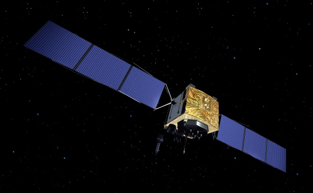
    Over the past several years, some users of the GPS navigation system have already benefitted from the addition of various new signals in addition to the legacy C/A- and P(Y)-code. With the introduction of the Block IIR-M satellites in 2005, a new civil signal (L2C) was transmitted on the L2 frequency, and a new signal on a new frequency (L5) was introduced as a standard signal with the Block IIF satellites beginning in 2010. These new signals provide direct access to dual-frequency observations and thus enable improved ionospheric corrections for civil, including aeronautical, users. In addition, a new Civil Navigation (CNAV) broadcast message has been defined in the GPS Interface Specifications (IS-GPS-200 and IS-GPS-705).

    This message will be transmitted jointly on the L2C and L5 signals and provides a variety of useful new parameters. Compared to the legacy L1 C/A-code navigation message, the CNAV message also offers an increased flexibility concerning the type, sequence, and repeat rate of specific messages.

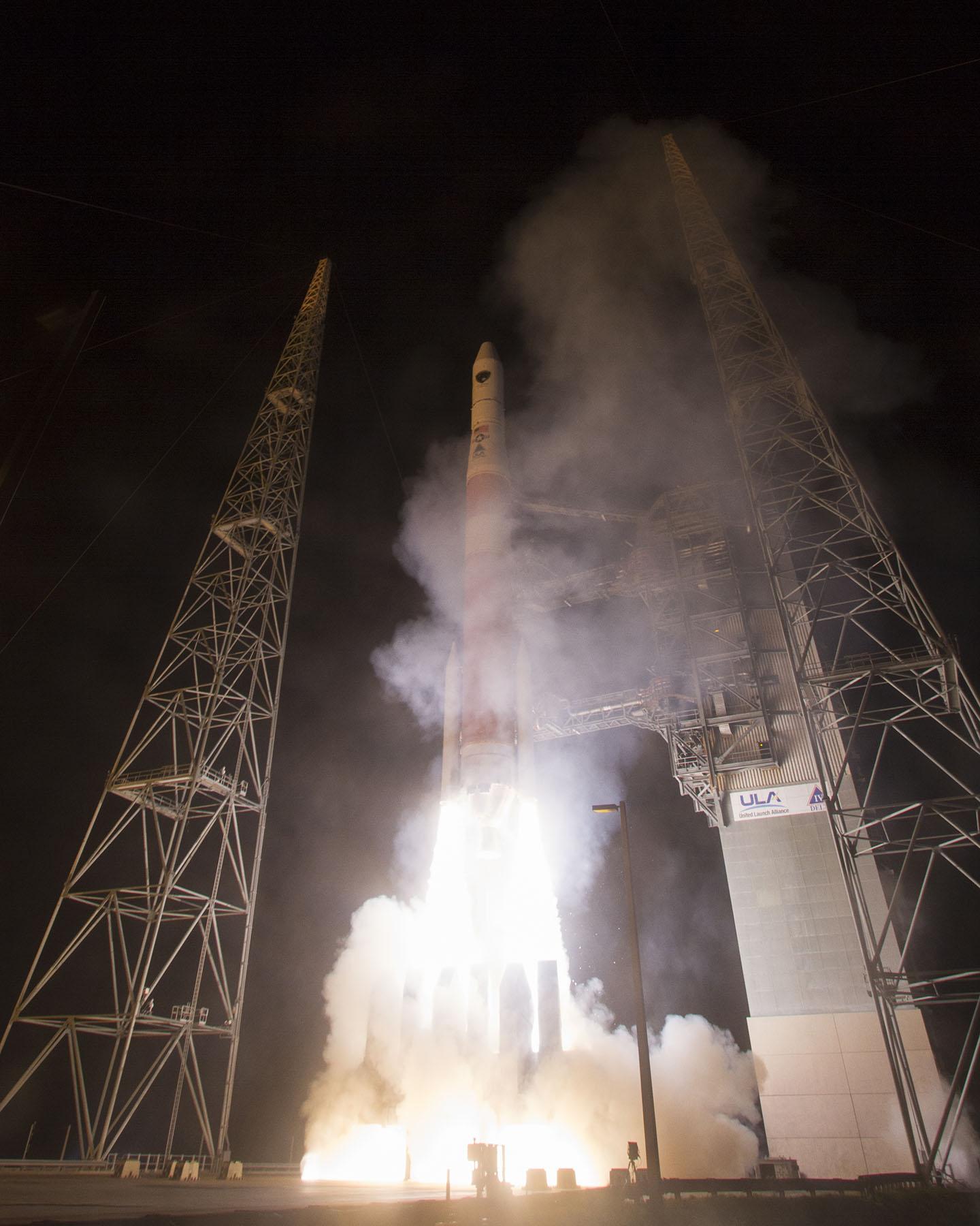
    CNAV messages have already been broadcast over the past two years by the Michibiki (QZS-1) satellite of the Japanese Quasi-Zenith Satellite System (QZSS), which shares many aspects of the GPS signal design. In contrast to this, Block IIR-M and IIF GPS satellites have only transmitted dummy messages so far and a fully operational CNAV transmission is only foreseen once the ongoing modernization of the GPS control segment has been completed.

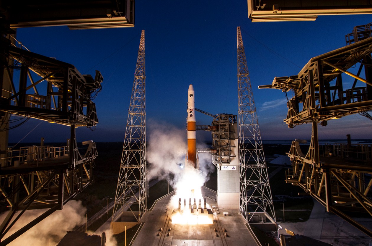
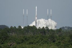
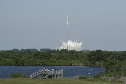
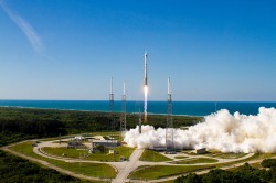
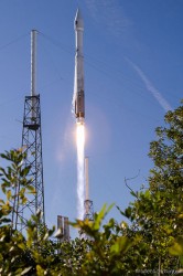
    Triggered by various interest groups, the Global Positioning Systems Directorate has just conducted a first test campaign with live CNAV transmissions on L2C and L5 over the two-week period from June 15 to 29 (see Global Positioning System Modernized Civil Navigation (CNAV) Live-Sky Broadcast Test Plan.) It served as a first opportunity for end users and receiver manufacturers to test the decoding and use of the new messages under a wide range of different configurations.

    CNAV messages have a common length of 300 data bits and are identified by a message type number that signifies their contents. The messages presently defined for GPS are summarized in Table 1. For QZSS, complementary messages have been established, which enable, among other features, a rebroadcast of GPS-specific data to QZSS users.

    Table 1. Summary of CNAV message types transmitted by space vehicles (SVs). Messages marked by an asterisk were transmitted during the recent CNAV test campaign.

    Message

    Type

    CNAV Message Title

    Function/Purpose

    0*

    Default Default message (transmitted when no message data is available)

    10*

    Ephemeris 1 SV position parameters for the transmitting SV

    11*

    Ephemeris 2 SV position parameters for the transmitting SV

    12*

    Reduced Almanac Reduced almanac data packets for seven SVs

    13

    Clock Differential Correction SV clock differential correction parameters

    14

    Ephemeris Differential Correction SV ephemeris differential correction parameters

    15*

    Text Text (29 eight-bit ASCII characters)

    30*

    Clock, Iono & Group Delay SV clock correction parameters, ionospheric and group delay correction parameters (inter-signal correction parameters)

    31

    Clock & Reduced Almanac SV clock correction parameters, reduced almanac data packets for four SVs

    32*

    Clock & EOP SV clock correction parameters, Earth orientation parameters; Earth-centered, Earth-fixed to Earth-centered inertial coordinate transformation

    33*

    Clock & UTC SV clock correction parameters, Coordinated Universal Time parameters

    34

    Clock & Differential Correction SV clock correction parameters, SV clock and ephemeris differential correction parameters

    35*

    Clock & GGTO SV clock correction parameters, GPS to GNSS time-offset parameters

    36

    Clock & Text SV clock correction parameters, text (18 eight-bit ASCII characters)

    37

    Clock & Midi Almanac SV clock correction parameters, midi (mid-accuracy) almanac parameters

    Other than the legacy L1 navigation message, which adheres to a fixed order of subframes, the sequence of CNAV messages can be varied widely to provide users with an optimized set of low latency information and parameters that change infrequently. As a baseline, the two ephemeris message types 10 and 11 are combined with any of the clock-and-auxiliary data messages (types 30 through 37) to provide users with the orbit and clock data of the received satellites. With a transmission duration of 12 seconds per CNAV message on L2C, a minimum of 36 seconds is required to transfer this information to the user if no other messages are transmitted. On L5, which operates at twice the data rate, a new frame is transmitted once every 6 seconds yielding a minimum of 18 seconds for the broadcast of ephemeris and clock data.

    The recent test campaign started at 18:00 GPS Time on Saturday, June 15, 2013, with the transmission of message types 10, 11, 15, and 30 on a first space vehicle (PRN24) and included PRN12 from 18:42 onwards. Other space vehicles were sequentially phased in until all active IIR-M and IIF satellites (except for the recently launched IIF-4 satellite) transmitted CNAV on the supported signals. When the test ended exactly two weeks later (June 29, 18:00 GPST), all participating satellites were transmitting a complex master frame of 15 x 4 = 60 individual messages, which was repeated once every 12 minutes (on L2C). Each minor frame comprised the two ephemeris messages and at least one clock-data message (see Table 2).

    Table 2. Sequence of message types in a CNAV master frame.

    Message Types

    10

    11

    15

    30

    10

    11

    32

    33

    10

    11

    12

    35

    10

    11

    12

    30

    10

    11

    12

    33

    10

    11

    12

    35

    10

    11

    12

    30

    10

    11

    32

    33

    10

    11

    15

    35

    10

    11

    32

    30

    10

    11

    12

    33

    10

    11

    12

    35

    10

    11

    12

    30

    10

    11

    12

    33

    10

    11

    12

    35

    Other messages included a reduced almanac (message type 12) and a text message (message type 15) with dummy content (“THIS IS A GPS TEST MESSAGE.”)

    The CNAV data were recorded by selected multi-GNSS monitoring stations of the German Aerospace Establishment (Deutsches Zentrum für Luft- und Raumfahrt or DLR) and the University of New Brunswick (UNB), which were specifically configured to record raw GPS navigation frames in addition to the normal observation data. The stations are located at Singapore (SIN0); Sydney, Australia (UNX2); Maui, U.S.A. (MAO0); and Hartebeesthoek, South Africa (HRAG); as well as Fredericton, Canada (UNB) and are equipped with either Javad Delta-G2/G3TH or NovAtel OEM6 receivers. Following initial validation, the raw and decoded data from the CNAV test will be made available to interested users through the Multi-GNSS Experiment (MGEX) of the International GNSS Service (see http:/igs.org/mgex) to facilitate the development of user software and suitable data formats (such as an extended RINEX navigation message format).

    The CNAV orbit and clock data were updated once every two hours and offer a slightly higher bit resolution than their legacy counterparts. However, the accuracy of the ephemeris data has not yet been evaluated nor compared to that of the L1 C/A-code navigation data.

    As indicated above, the CNAV data can also provide a particularly compact form of almanac data known as the reduced almanac. It does not offer clock information (that is not normally required for a signal search) and assumes a circular orbit, which reduces the overall accuracy. Still, it can be transmitted (and repeated) in a much shorter time interval than the legacy almanac, which requires a total of 12.5 minutes. Each reduced almanac message (message type 12) provides orbit information for a total of seven satellites and it takes a set of five such messages to convey information for a complete constellation. For the master frame layout described above, the full constellation reduced almanac is repeated twice within 12 minutes on L2C (and half this time on L5).

    Novel types of CNAV data not covered by the legacy navigation message include the differential code biases (also known as inter-system corrections or ISCs), which are required for pseudorange-based positioning with signals other than the legacy P(Y)-code (in addition to the established Timing Group Delay parameter or TGD). An overview of TGD and ISC values broadcast by the various satellites participating in the CNAV test is given in Table 3.

    Table 3. Differential code biases (in nanoseconds) of GPS Block IIR-M and IIF satellites broadcast during the test campaign as part of the message type 30 CNAV messages.

    SV Type

    SVN

    PRN

    TGO

    ISC L1CA

    ISC L2C

    ISC L5I5

    ISC L5Q5

    IIR-M

    48

    07

    -10.71

    -0.84

    6.52

    IIR-M

    50

    05

    -10.24

    -0.32

    5.41

    IIR-M

    52

    31

    -13.04

    -0.55

    7.36

    IIR-M

    53

    17

    -10.24

    -0.84

    6.17

    IIR-M

    55

    15

    -10.24

    -0.47

    5.62

    IIR-M

    57

    29

    -9.31

    -0.76

    5.06

    IIR-M

    58

    12

    -12.11

    -0.76

    6.64

    IIF

    62

    25

    5.59

    -2.07

    -5.24

    -0.38

    -0.87

    IIF

    63

    01

    8.38

    -2.30

    -7.57

    0.38

    2.15

    IIF

    65

    24

    2.79

    -0.26

    -2.27

    2.27

    3.70

    Another important achievement is the provision of Earth orientation parameters (EOP) in message 32, which provides GPS users with access to the celestial reference frame.  EOPs were transmitted during the second test week and updated on a daily basis (see Table 4). Knowledge of these parameters is of particular interest for GPS-based orbit determination and navigation of spacecraft (in low Earth orbit), which is preferably referred to an inertial rather than an Earth-fixed coordinate system.

    Table 4. Daily Earth orientation parameters from the CNAV test campaign (pole coordinates and dUT1 (UT1-UTC) time differences and derivatives).

    Epoch (GPST)

    x_p

    (arcseconds)

    x_p_dot

    (arcseconds per day)

    y_p

    (arcseconds)

    y_p_dot

    (arcseconds per day)

    dUT1

    (seconds)

    dUT1_dot

    (seconds per day)

    June 22, 0:00

    0.13517

    0.00104

    0.39657

    -0.00054

    0.06341

    -0.00046

    June 23, 0:00

    0.13621

    0.00102

    0.39604

    -0.00056

    0.06295

    -0.00049

    June 24, 0:00

    0.13740

    0.00101

    0.39535

    -0.00058

    0.06231

    -0.00053

    June 25, 0:00

    0.13815

    0.00099

    0.39487

    -0.00060

    0.06164

    -0.00063

    June 26, 0:00

    0.13846

    0.00096

    0.39443

    -0.00062

    0.06078

    -0.00067

    June 27, 0:00

    0.13885

    0.00094

    0.39381

    -0.00064

    0.06004

    -0.00067

    June 28, 0:00

    0.13947

    0.00093

    0.39310

    -0.00066

    0.05909

    -0.00063

    June 29, 0:00

    0.13987

    0.00090

    0.39246

    -0.00068

    0.05842

    -0.00053

    Overall, CNAV offers exciting prospects for improved GPS utilization and users may look forward to the next test campaigns, which will tentatively be conducted once every six months.

    As a side note, it should be mentioned that individual satellites could be observed to transmit various types of non-standard CNAV messages as well as CNAV messages with improper data (such as an invalid week count) after the end of the main test campaign. Various receivers in the MGEX network, which were processing the received CNAV messages internally and which put full confidence in their proper contents, were mislead by such information. During the actual test campaign, all data appeared fully valid and no problems were reported by the stations.


    OLIVER MONTENBRUCK is the head of the GNSS Technology and Navigation Group at DLR’s German Space Operations Center in Oberpfaffenhofen, Germany.

    RICHARD B. LANGLEY is a professor in the Department of Geodesy and Geomatics Engineering at the University of New Brunswick, Fredericton, New Brunswick, Canada.

    PETER STEIGENBERGER is  a staff member in the Institut für Astronomische und Physikalische Geodäsie of the Technische Universität München (TUM) in Munich, Germany.


  • Update: GPS IIF-4 Successfully Launched from Cape Canaveral

    Update: GPS IIF-4 Successfully Launched from Cape Canaveral

    UPDATE, May 24, by Richard Langley: The Centaur upper stage with the payload still attached was photographed from Tavistock, Devon, in the U.K. by Andy Smith. As can be seen from the ground trace figure in an earlier GPS World news item, the Centaur passed over the U.K. following MECO1, the first main engine cutoff. From Europe, the Centaur could be easily seen by reflected sunlight against the background stars. Its maximum (apparent) brightness magnitude has been estimated as -1 or -2. (Sirius, the brightest star in the night sky, has a magnitude of -1.5; Betelgeuse in the constellation Orion has a mean magnitude of about 0.4; and the limiting visual magnitude for the unaided eye is about 6.)

    Smith’s photograph was taken at 21:58:38 UTC (start) with a Canon EOS 450D Digital Rebel camera with an 18-55mm zoom lens. The camera settings were: focal length 55mm, aperture f/5.6, and an exposure of 8 seconds at an ISO value of 1600. Two images are shown below: the original, as obtained from the camera, and a greyscale image with edge enhancement.

    The Centaur can be seen traveling left to right and starts its track as it crosses the constellation of Cygnus. There’s a slight wobble at the beginning as the shutter release was pressed. The glow at the bottom of the frame is from a streetlight. The elevation angle of the Centaur was approximately 12 degrees.

    SVN66 will operate as PRN27 and it will eventually occupy the C-2 orbital slot, replacing SVN33/PRN03, a Block IIA satellite launched in 1996. SVN66 is currently in a drift orbit about 400 kilometers above the operational constellation. It should reach the C-2 slot within a few days from now. The satellite has already been added to the broadcast almanac although it has not yet started to transmit standard signals. It is currently marked as unhealthy in the almanac and will remain so, even after standard signals are switched on, until testing is completed sometime this summer.

    Centaur upper stage with the payload still attached. Photo credit: Andy Smith
    Centaur upper stage with the payload still attached, original photo. Photo credit: Andy Smith

    The same photo digitally enhanced:

    Photo credit: Andy Smith
    Digitally enhanced photo. Photo credit: Andy Smith

    Photo credit: Pat Corkery, United Launch Alliance.
    Photo credit: Pat Corkery, United Launch Alliance.

    A U.S. Air Force Global Positioning System satellite built by Boeing was successfully launched May 15. The fourth GPS IIF satellite, Space Vehicle Number (SVN) 66, was carried aboard a United Launch Alliance Atlas V Launch Vehicle at 5:38 p.m. EDT (21:38 UTC) May 15 from Cape Canaveral Air Force Station, Florida.

    The new capabilities of the IIF satellites will provide greater navigational accuracy through improvements in atomic clock technology; a more robust signal for commercial aviation and safety-of-life applications, known as the new third civil signal (L5); and a 12-year design life providing long-term service. These upgrades improved anti-jam capabilities for the warfighter and improved security for military and civil users around the world, the Air Force said in a statement.

    The Atlas rocket took off on schedule. The satellite was released from the Centaur upper stage at T+ 3 hours, 23 minutes and 52.8 seconds or about 01:02 UTC on May 16. Details on the Block IIF satellites and the Atlas rocket can be found here.

    “I’m extremely pleased with today’s launch and delighted to be part of this mission that enhances our nation’s critical GPS capability. Thanks to the superb efforts of the of the 45th and 50th Space Wings, United Launch Alliance, our industry partners, the Atlas V and GPS IIF launch teams, the GPS IIF-4 mission was successfully carried out,” said Col. Bernie Gruber, director of the Space and Missile Systems Center’s Global Positioning Systems Directorate.

    “The GPS constellation remains healthy and continues to meet and exceed the performance standards to which the satellites were built. Our goal is to deliver sustained, reliable GPS capabilities to America’s warfighters, our allies and civil users around the world, and this is done by maintaining GPS performance, fielding new capabilities and developing more robust modernized capabilities for the future,” said Colonel Gruber.

    Here are videos of the launch:


    Opening photo by Pat Corkery, United Launch Alliance.

    Photos show the launch of the U.S. Air Force’s GPS IIF-4 satellite from the Kennedy Space Center and Cape Canaveral Air Force Station.

  • Lockheed Martin Team Completes Delta Preliminary Design for Next GPS III Satellite Capabilities

    Lockheed Martin has successfully completed a Delta Preliminary Design Review (dPDR) for the next Global Positioning System (GPS) III satellite vehicles planned under the U.S. Air Force’s GPS III program.

    The GPS III program will replace aging GPS satellites, while improving capability to meet the evolving demands of military, commercial and civilian users. GPS III satellites will deliver three times better accuracy and up to eight times improved anti-jamming signal power while enhancing the spacecraft’s design life and adding a new civil signal designed to be interoperable with international GNSS.

    The Air Force plans to purchase up to 32 GPS III satellites. Lockheed Martin is under contract for production of the first four GPS III satellites, and has received advanced procurement funding for long-lead components for the fifth, sixth, seventh and eighth satellites.  The successful dPDR addresses design modifications, agreed on by the Air Force and the Lockheed Martin-lead industry team, which will provide new capabilities for GPS III Space Vehicle 9 (SV09) and beyond, including the addition of a search and rescue satellite payload and a Laser Retroreflector Array (LRA). An innovative new waveform generator permits the addition of new navigation signals after launch to upgrade the constellation without the need to launch new satellites.

    “We have worked very closely with the Air Force and GPS community to make GPS III the most affordable and lowest risk solution for bringing new capabilities to the GPS constellation,” said John Frye, Lockheed Martin’s GPS III capability and affordability insertion manager. “The design modifications from this dPDR address ways to further reduce Air Force launch costs by $50 million per satellite through dual launch of two GPS III space vehicles on a single booster. This successful dPDR milestone sets the stage to proceed with SV09 design maturation.”

    From the beginning of the program, the Lockheed Martin team has remained focused on affordability for GPS III, the company said, while working to ensure the enhanced satellite system can evolve to continue to meet the world’s global navigation and timing needs for the next 30 years. To help reduce risks and cut costs, the GPS III team developed a GPS Non-Flight Satellite Testbed (GNST), which serves as the program’s ground pathfinder and vehicle demonstrator for the first complete satellite. The entire GPS III development and production sequence uses the GNST to provide space vehicle design level validation; early verification of ground support and test equipment; and early confirmation and rehearsal of transportation operations.

    Lockheed Martin team has met recent milestones and appears to be on track to deliver the first GPS III satellite, for launch availability in 2014.

    In February, the Lockheed Martin team successfully turned on power to the system module of the program’s first spacecraft, designated GPS III Space Vehicle 1 (SV01), demonstrating mechanical integration, validating the satellite’s interfaces, and leading the way for electrical and integrated hardware-software testing.  The satellite will complete its Assembly, Integration and Test (AI&T) in Lockheed Martin’s new GPS Processing Facility (GPF) designed for efficient and affordable satellite production.

    The GPS III team is led by the Global Positioning Systems Directorate at the U.S. Air Force Space and Missile Systems Center. Lockheed Martin is the GPS III prime contractor with teammates ITT Exelis, General Dynamics, Infinity Systems Engineering, Honeywell, ATK and other subcontractors. Air Force Space Command’s 2nd Space Operations Squadron (2SOPS), based at Schriever Air Force Base, Colorado, manages and operates the GPS constellation for both civil and military users.

  • SNV49 Off the Air?

    News courtesy of CANSPACE Listserv.

    It appears that GPS SVN49, the Block IIR-M satellite with the problematic L5 test transmitter and operating most recently as PRN27, stopped transmitting standard L-band signals on March 13. No International GNSS Service tracking station has observed the satellite since that date.

    The satellite was being used for tests, was set unhealthy, and had not been included in broadcast almanacs.