Tag: GPS World Editorial Advisory Board

  • EAB Q&A: Urgent actions needed to protect resilient PNT amid spectrum sharing and GNSS policy shifts

    EAB Q&A: Urgent actions needed to protect resilient PNT amid spectrum sharing and GNSS policy shifts

    What urgent policy or industry actions are needed to protect and advance resilient PNT services amid spectrum sharing debates and GNSS regulation changes?

    Headshot: Jules McNeff
    Jules McNeff, vice president, strategy & programs, Overlook Systems Technologies

    In my article, “Is There a Silver Bullet for Resilient PNT?”, I addressed the confusion caused by the numerous and diverse industry initiatives now being offered. Industry is understandably motivated to provide resilient PNT capabilities, but each also wants the government to pick its solution and make policy decisions accordingly. Spectrum sharing decisions that favor a single service provider may harm others in a crowded space, and so are difficult or impractical, as we have seen with the decades of litigation associated with LightSquared/Ligado and the spectrum surrounding the GPS L1 frequency. 

    Not everyone can win that competition, and as I noted at the end of the article, “Unless our government accepts responsibility, there will be no PNT silver bullet for domestic CI. Experience shows that industry will not solve this problem alone.”

    For years, I have advocated that U.S. PNT technology policy be managed and services acquired holistically as vital dual-use civil/military capabilities. For the civilian community, that means making sure the national leadership understands the reliance our domestic critical infrastructure (CI) has on constant access to precise PNT to maintain continuity of operations across all CI sectors in the face of well-known threats.  The leadership must then decide whether that reliance deserves proactive attention by the government to ensure PNT continuity is not disrupted.

    Several years ago, I suggested that significant regulatory changes were needed in how civil PNT services were handled throughout U.S. CI. Both the Departments of Homeland Security and Transportation were assigned responsibility in Presidential Directives for finding a GPS backup to PNT services in domestic CI. I won’t revisit that years-long debate (which is still unsolved), but I will revive the framework of the suggestion.

    The DOT has overall responsibility for civil agency PNT matters, and DHS frequently cites lack of regulatory authority as a limitation on its ability to encourage compliance in the CI sectors for which it is responsible. Therefore, I suggested that the National Space-Based PNT Executive Committee consider regulatory changes to expand the definition of the Transportation CI Sector to include safe and uninterrupted transportation of all elements contributing to domestic critical infrastructure.  In addition to current air, road, rail, and oil/gas pipeline transportation, add the interstate transport of information (Communications and IT), electrical energy (Power Grids), economic transactions (Finance), crops (Agriculture), and water, as well as domestic maritime services (U.S. Coast Guard) and possibly emergency response services in the case of large disasters. 

    In the spirit of the former Interstate Commerce Commission, which years ago was replaced by a DOT Surface Transportation Board (primarily concerned with freight rail), the DOT may then seek expansions to STB authorities and membership to address the PNT dependencies and vulnerabilities affecting those fundamentally transportation-oriented activities vital to the viability of all U.S. critical infrastructure sectors.

    — Jules McNeff
    Overlook Systems Technologies

    Headshot: Miguel Amor
    Miguel Amor, chief marketing officer, Hexagon’s Autonomy & Positioning Division

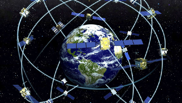
    Regulatory authorities must quickly approve and protect RF spectrum allocated for new PNT capabilities, particularly for emerging low-Earth orbit (LEO) constellations. These systems offer clear advantages in signal strength, geometric diversity and resilience against jamming and spoofing. Without timely and well-defined spectrum authorization, along with strong adjacent-band protections, the deployment of GNSS receivers capable of supporting these constellations will be delayed.

    On the industry side, LEO PNT developers must urgently finalize signal structures and release Interface Control Documents, enabling GNSS receiver manufacturers to begin implementation, validation and system integration.

    — Miguel Amor
    Hexagon Positioning Intelligence

    Mitch Narins
    Mitch Narins, Strategic Synergies

    Interesting and timely question.  I’ve written quite a few pieces and papers on the need for resilient and robust PNT services.  If I were to point to a single thing that has held the US (and many other countries in the world back (except for China) it is lack of strong mission-oriented, dedicated leadership.  It has been said that the definition of a committee is an entity with four or more legs and no brain. It is time to designate a single entity and a single office and a single person as responsible for ensuring resilient PNT services to US critical infrastructure so as to maintain the safety and security and economic benefits these these sectors support.  Some wise men once came up with the idea that a government must “provide for the common defense” and “support the general welfare.” Resilient PNT is essential to achieving both.

    In addition to the lack of empowered, centralized PNT leadership, a key problem that has impeded progress towards resilient PNT is the lingering belief by many that given enough time and money and spectrum, GNSS-sole means is achievable and that all non-GNSS systems (affectionately called “Legacy PNT Systems”) can be discontinued. In fact, over the years budget justifications for GNSS systems have used discontinuance of ground-based systems as “a benefit” to balance out the costs of establishing, updating, and operating GNSS.

    Engineering System Designer should never fall in love with their solutions.  The mission, i.e., the needs of the customers must always remain their first concern.  After many years, integrity was added to the list of PNT metrics; coverage has yet to be officially added. Yet, even today, there remains confusion regarding the availability metric and the associated risks.  For GNSS systems, the risk of losing required PNT metrics should always be considered “1.0”, and therefore, for critical infrastructure users and providers, require effective and implementable contingency/continuity of operation plans.  Loss of PNT performance (accuracy, availability, integrity, continuity, and coverage) the using GNSS can no longer be considered a “Black Swan” event.

    — Mitch Narins
    Strategic Synergies


    In the February 2025, Professor Washington Ochieng proposed the following question to the GPS World EAB.

    When we discuss the security of GNSS/PNT systems, we nearly always focus on interference — i.e., meaconing, intrusion, jamming or spoofing. However, GNSS/PNT systems are embedded in systems of systems that also offer many other opportunities for cyberattacks. What should we do about it?

    I have thought for some time about why this is an issue.  This is an interesting question, and the answer should be straightforward – but it’s not.  For whatever reason, it seems many in the “cyber community” believe they are different, somehow, and apart.  This has been apparent to me in dealing with those in the cyber community regarding their PNT dependencies and vulnerabilities going back to the creation of USCYBERCOM as a separate combatant command within the DoD.  Those in the cyber world seemingly do not see a need to recognize and account for the intersection of PNT and cyber as mutually integral parts of a broader Information Technology ecosystem.  Yet, across that entire IT ecosystem, PNT is simultaneously an enabler and a product of IT functionality, as communications and data systems could not operate without it, and it is likewise vital to IT users in executing their diverse missions.  Ultimately, interference effects, whether from jamming or spoofing in their various forms or from digital intrusions of one kind or another, disrupt vital elements of that IT ecosystem.  Our national and economic security depend on the continuous, reliable, uncorrupted functioning of IT services enabled by and delivering PNT information. So, a straightforward but difficult to implement answer is that we need formal education programs to routinely inform the leaders of industry and government (and the public) of the ubiquitous, vital role of positioning and timing (what we call PNT) throughout all the systems-of-systems whose operation depends on the IT ecosystem – and how to tell if something is amiss.

    — Jules McNeff
    Overlook Systems Technologies

    Read more responses to Professor Ochieng’s question.

  • EAB Q&A: Diverse PNT sources essential for uninterrupted service

    EAB Q&A: Diverse PNT sources essential for uninterrupted service

    Image: GarryKillian/iStock/Getty Images Plus/Getty Images
    Image: GarryKillian/iStock/Getty Images Plus/Getty Images

    Mitch Narins’ answer to the question, “If not GNSS, then what?” in the August 2024 issue’s EAB Q&A column, conveys an important message. As a result of their quality and availability, services offered by GNSS create dependencies and subsequently the expectation that of course they must always be there. However, recent experiences have shown we cannot rely on that expectation because either natural or hostile occurrences can disrupt GNSS services, no matter what measures are taken to protect them. That is why the U.S. Department of Defense (DOD), in its “Strategy for the DOD PNT Enterprise,” assessed that, “To combat man-made and natural threats to GPS, other sources of PNT information will be necessary to assure continuous PNT service …”

    The strategy describes a layered PNT architecture using global (GPS), regional (eLoran), and local (or self-contained) sources of PNT information. It states, “The global PNT layer is space-based and available worldwide. The regional PNT layer may be implemented in areas … where PNT resiliency must be assured with backup capability. The local layer provides PNT information using man-made and natural information sources available for a limited time or over a limited area.” To achieve resilience from this layered architecture, the strategy provides an integration concept in which GPS and other GNSS are individually integrated with PNT information from the other layers into resilient applications to operate through the hostile environments they will encounter.

    Unfortunately, the U.S. government is ignoring a major piece of this layered strategy in favor of space-based and local or self-contained solutions, as it has dismantled virtually the entire legacy Loran infrastructure in the United States and completely in Alaska, although GPS backups are lacking in the Arctic and northern Pacific regions. The loss of the Alaska sites is particularly concerning as the Arctic and northern Pacific Ocean coverage they would provide is a valuable backup to vulnerable GPS signals at a time when other nations are eying the sea lanes north of Alaska/Canada and conducting excursions around the Aleutian Island chain and the Alaskan coast. Coincidentally, the DOD has just published a new “Arctic Strategy,” which requires availability of PNT from GPS (at least) for its success, though “PNT” is not mentioned. However, without effective PNT, whether from GPS or other sources, the systems on which the strategy depends will fail.

    As Mitch notes, there are those GNSS advocates who see strengthened GPS/GNSS as the best answer – but real-world events highlight the need for diversification, and now other nations are expanding their Loran-based regional systems. For its Arctic interests and domestic critical infrastructure as well, the U.S. must wake up to reality and do the same.

  • EAB Q&A: What is the most promising innovation in satellite navigation?

    EAB Q&A: What is the most promising innovation in satellite navigation?

    Photo: Orolia
    John Fischer

    What is the most promising innovation in satellite navigation being introduced by BDS, Galileo, QZSS, or NavIC?

    Two things are having an immediate impact: authentication methods, such as Galileo’s Open Service-Navigation Message Authentication (OS-NMA), and the proliferation of correction services for high accuracy. Navigation message authentication offers a practical, easy-to-implement defense against several (though not all) types of spoofing attacks. QZSS and NavIC offer this too. And though paid correction services have been available for some time, Galileo’s High Accuracy Service (HAS) will bring it into the mainstream. Sometimes innovation is just applying simple techniques in a useful, efficient manner.”

    — John Fischer
    Safran Navigation & Timing 


    For critical infrastructure, how good a remedy are multi-constellation receivers to GNSS vulnerability?

    “Multi-constellation receivers do not do much to combat jamming and spoofing; they only detect failures in a constellation itself through comparison. Since they all are open standards, a good spoofer can fake all the systems simultaneously. Multi-frequency receivers are a bit more resistant to jamming, since one must jam multiple bands, but since all the bands are relatively close, the barrier is not high. To be truly resilient, you need diverse, redundant PNT sensors — IMUs, CRPAs, strong signals of opportunity, lidars, etc. — in addition to GNSS receivers.

    — John Fischer
    Safran Navigation & Timing 

  • EAB Q&A: Is the GNSS community  failing to exploit the potential of CSAC?

    EAB Q&A: Is the GNSS community failing to exploit the potential of CSAC?

    “Is the GNSS community failing to exploit the potential of chip-scale atomic clocks (CSAC)?”


    Photo: Orolia
    John Fischer

    “Yes! And there are several CSAC suppliers, each with varying accuracies, power consumptions, and price points. These atomic clocks are no longer exotic scientific instruments but rather commercialized, proven devices that can be mounted on a circuit card at a reasonable cost. They offer extended holdover time in the absence of GNSS and help with spoofing detection by verifying the incoming signal. They provide exact frequency recovery on power-up (re-trace) for power saving modes. Defense, telecom, financial transactions, and autonomous navigation for cars and drones are all applications that can be made more resilient by these clocks.”

    — John Fischer
    Safran Navigation & Timing


    Jean-Marie Sleewaegen
    Jean-Marie Sleewaegen

    “Atomic clocks, including CSAC, are frequently used in GNSS timing applications, for example to keep accurate time during GNSS outages or to assist in identifying spoofing attacks targeting the time component. On the other hand, the long-term stability of atomic clocks is not particularly relevant in navigation applications where time is not the main output, and the additional cost, power consumption and size of CSAC are not justified.”

    — Jean-Marie Sleewaegen
    Septentrio


    Headshot: Ismael Colomina
    Ismael Colomina

    “Indeed. After the DARPA-NIST initiative and subsequent commercialization, affordable, accurate and stable chip-scale oscillators can be easily integrated into circuit boards providing additional measurements to PNT systems to improve positional vertical accuracy, as well as reliability and integrity. For example, in high-end mobile mapping systems operating in complex urban scenarios, their use helps detect GNSS outliers at a relatively negligible additional cost.”

    — Ismael Colomina
    GeoNumerics

  • EAB Q&A: Should countries build their own GNSS constellations?

    EAB Q&A: Should countries build their own GNSS constellations?

    “When Galileo was just an idea, its EU proponents used the argument of “political, economic, social and technological sovereignty.” Should countries such as Brazil build their own GNSS constellations?”


    Headshot: Ismael Colomina
    Ismael Colomina

    “When, almost 20 years ago, I was in Brazil giving talks about the future of Galileo and promoting its combined use with GPS, I was often asked the logical question as the EU Galileo sovereignty arguments were known. It is not for us Europeans to answer that question for other countries or oppose their plans. However, while being aware of the defense aspects of GNSS, we may ask ourselves whether an international cooperative approach could avoid a somewhat unjustified future proliferation of GNSS constellations.”

    — Ismael Colomina
    GeoNumerics


    Headshot: Jules McNeff
    Jules McNeff

    “GPS enables continuous access, free of fees and political encumbrances. A decision by any nation to bear the cost of creating a separate GNSS should be justified by realistic requirements for security or coverage that cannot be satisfied by GPS. Japan, South Korea and India are models for additional GNSS services driven by regional needs. For any new system, compatibility with other GNSS, as well as life-cycle costs, are the primary factors to consider.”

    — Jules McNeff
    Overlook Systems Technologies


    Headshot: John Fischer
    John Fischer

    “When Galileo was just an idea, the U.S. military’s GPS was the only viable global constellation. GLONASS was a rusting cold-war relic and BeiDou was in an embryonic stage. The U.S. military’s official policy was that any civilian use was not guaranteed and could be interrupted anytime. Therefore, no nation outside of the United States could depend on GPS and maintain its independent interests. However, today, any country could reasonably maintain its sovereignty by ensuring interoperability with all four — betting that at least one of those constellations would always be available to them. They don’t need their own system.”

    — John Fischer
    Orolia


    F. Michael Swiek
    F. Michael Swiek

    Those are always nice-sounding words when trying to justify a monumentally huge expense. However, is there an actual need to justify that expense? Can the expense and burden of perpetual system operation and maintenance, along with technological innovation to keep pace with other systems and user requirements, be guaranteed over the long term? For the users, GPS can be seen as the gift that keeps on giving, whereas to the operators it is the gift that keeps on costing. So, do Brazil, or other nations, have the commercial or social need, technological foundation, economic resources and political will to initiate a new system and sustain it over the long term? Providing a GNSS constellation is not for the faint of heart or those of short-term vision.

    — Michael Swiek
    GPS Alliance

  • EAB Q&A: Could a new PNT constellation replace GNSS?

    EAB Q&A: Could a new PNT constellation replace GNSS?

    “Could a new PNT constellation using LEO satellites fully replace the services provided by the four existing GNSS constellations?”


    Mitch Narins
    Mitch Narins

    “From a pure capabilities standpoint, the answer is “Yes”. LEO constellations can provide the PNT performance metrics that users require. However, should this strategy be followed, it would lack the diverse, complementary solutions needed to ensure the safety, security, and efficiency of critical infrastructure. Many have recognized the need for resilient PNT solutions and identified system-of-systems approaches. Multiple satellite constellations — MEOs and LEOs (despite the number of platforms) — lack this needed resilience. A resilient system-of-systems should include satellites in multiple orbits and complementary ground-based PNT infrastructure, each providing needed performance and overall demonstrating resilience from diverse threats.”

    — Mitch Narins
    Strategic Synergies


    Photo: Orolia
    John Fischer

    “In theory, yes. With a much stronger signal (antijam) that is encrypted (antijam), they counter GNSS’s two main vulnerabilities. However, with a paid service business model, it is difficult to compete with a free service. Moreover, large constellations are needed to overcome GDOP. OneWeb, Starlink, et al. already have launched and will continue to launch large constellations, so they must compete with these high bandwidth communications constellations that can provide accurate PNT as a side service and don’t have a GDOP limitation because of their size. Adoption of a single-purpose PNT system will be difficult.”

    — John Fischer
    Orolia


    Bernard Gruber
    Bernard Gruber

    “Yes, it could. That said, as with any new product or technology, evolution of PNT capabilities will be dependent on competition, value or threats that undermine the current environment. Burgeoning systems such as Xona, Satelles or any number of augmentations utilizing “signal of interest” such as Starlink will rightly contribute to the evolution of enhanced PNT. Current advantages of LEO-based systems such as increased received power, decreased convergence time and numerical diversity are noteworthy, but replacing an investment of $100B+ government backed GNSS systems that adhere to well established policies and published ICDs is another.”

    — Bernie Gruber
    Northrop Grumman


    Headshot: Jules McNeff
    Jules McNeff

    “As my colleagues above note, the answer is yes from a technical perspective. However, in practice, not so much. Even with software-defined receivers, issues of signal reception and processing, interface standards, comm/nav service prioritization, security, integration into complex systems, integrity assurance, etc. make use of such nav services in lieu of purpose-built GNSS services impractical.”

    Jules McNeff
    Overlook Systems Technologies 

  • Editorial Advisory Board Q&A: How could the U.S. develop GPS high-accuracy analogous to Galileo’s HAS?

    What would be required for the United States to develop and deploy a GPS high-accuracy service analogous to Galileo’s HAS?


    Headshot: Ismael Colomina
    Ismael Colomina

    “Galileo HAS is a particular implementation of a PPP-RTK service. U.S. companies are already providing similar fee-based services that are even more accurate than HAS. Therefore, there is no big technical challenge for the United States to provide a GPS HAS. Actually, the European Union already provides a HAS for GPS. It is more a question of strategy for GPS policy makers: which user segment to service with a HAS-like augmentation? What about other services analogous to Galileo’s OSNMA and the upcoming CAS [commercial authentication service] for resiliency purposes? In short, a HAS-like service would just require including it in the U.S. GNSS evolution roadmap.”

    — Ismael Colomina
    GeoNumerics


    Photo: Orolia
    John Fischer

    “The challenge is probably more political than technical. The U.S. government usually refrains from competing with commercial services. The prevailing attitude in the United States is that the private sector is more efficient than the public sector. Maybe the most practical approach is for the government to provide the authentication mechanism and open access to the data required, then allow the private sector to offer services. There isn’t a pressing need for high-accuracy GPS for transportation — it needs resiliency/reliability. However, precision agriculture needs it, so maybe sponsorship from the Department of Agriculture would be more effective than from the Department of Transportation.”

    — John Fischer
    Orolia


    Mitch Narins
    Mitch Narins

    When I saw this question, my first impression (as a systems engineer) was to ask ‘For whom? For what applications? For which services?’ (Positioning? Navigating? Time/frequency?) Many have concentrated on accuracy, competing in a GNSS Olympics to see who can achieve ‘the best’ position accuracy and precision (repeatability). Finally, (thanks to Logan Scott) integrity is being pushed beyond just SBAS and GBAS, and real civil authentication of signals is being pursued. I can promise nanometers/nanoseconds if I don’t have to prove it’s true. While we finally understand the need for zero trust, we must still address loss of service by establishing real complementary PNT.

    — Mitch Narins
    Strategic Synergies

  • Editorial Advisory Board Q&A: The role of AI and ML

    What role do artificial intelligence (AI) and machine learning (ML) play in analyzing GNSS signals? How might that evolve?


    Ellen Hall
    Ellen Hall

    “ML is gaining adoption across many GNSS application areas due to its ability to extract data and classify signal information often within complex operational environments. By combining ML with AI, systems are now able to characterize receiver correlator outputs and ranging residuals, and then fuse this with identified environmental features — all potentially increasing GNSS accuracy, integrity and availability. As AI and ML mature, we can expect to see new novel methods to optimize PNT sensor-fusion engines. This will include the combination of GNSS signals with other sensor signals such as inertial and vision.”

    — Ellen Hall
    Spirent Federal Systems


    Bernard Gruber
    Bernard Gruber

    “AI will come to the battlefield and I would like to think that AI and ML will play a large part in GNSS solutions and specifically protection from adversaries in the future. As AI can ‘anticipate’ threats (i.e., spoofing, jamming, poor coverage) based upon what it sees and knows one should be able to reduce the cycle time to combat that threat (e.g., find/fix/identify and then target, change frequencies, evade). Seeing this data, ML can adapt to morphing threats as well as ‘fuse’ data from all different domains (air, space, sea and land) to provide solutions.”

    — Bernard Gruber
    Northrop Grumman


    Jules McNeff
    Jules McNeff

    “I would like to turn the question around and ask ‘How does GNSS contribute to enabling AI and ML to function in physical space?’ Many AI and ML experts don’t think about this aspect of the technologies. Of course, timing is essential to AI and ML operation, but both must be spatially oriented as well if they are to interact effectively with things in the ‘real world.’ The more complex the interactions, the higher the need for precise, continuous PNT information. Depending on the applications, the relationships can become synergistic.”

    — Jules McNeff
    Overlook Systems Technologies


    Greg Turetzky Principal Engineer Intel
    Greg Turetzky

    “AI and ML have a great opportunity to fundamentally change the way GNSS signals are used for positioning. In particular, the new modernized signals with wider bandwidths and higher chipping rates create a fundamentally richer data set than classic range/range rate measurements. By analyzing the channel response and using AI/ML techniques, the entire signal environment of LOS and NLOS signals can all be used to make more accurate measurements. In fact, in deep urban canyons with appropriate training, it is even possible to accurately position using only multipath signals such that more multipath makes the position more accurate, not less.”

    — Greg Turetzky
    oneNav

  • Editorial Advisory Board Q&A: What will OCX bring?

    What improvements will the Next Generation Operational Control System (OCX) bring?


    Ellen Hall
    Ellen Hall

    “The OCX system is a part of an enormous modernization effort to enhance the ground control segment of the current GPS. This enhancement alone increases accuracy, but coupled with modernized satellites, the next generation OCX will increase and improve coverage and security of GPS. In terms of coverage, the Next Generation OCX will be able to fly twice as many satellites, including both legacy equipment as well as GPS IIIF satellites. In terms of security, the modernized receivers host anti-jam capabilities and information assurance features.”
    — Ellen Hall
    Spirent Federal Systems


    Bernard Gruber
    Bernard Gruber

    “The latest GPS modernization program was envisioned in the 1990s and started with the U.S. Air Force awarding the Lockheed Martin Team a $1.4 billion contract in 2008 to build the GPS III space system. As part of the modernization effort the initial OCX contract award was given to Raytheon two years later, in 2010, while a series of development contracts have been awarded, primarily Inc 1 and Inc 2, for the Modernized GPS User Equipment (MGUE) programs to L3Harris, Raytheon and then Rockwell Collins. The improvements of OCX aligned to the space and user efforts and substantially increased security protection of this world asset. Specifically, OCX controls all legacy satellites (GPS II) and civil signals (L1 C/A) and military signals (L1P(Y), L2P(Y)). It also controls the new modernized civil signal (L2C) and the aviation safety-of-flight signal (L5). Moreover, it also will have control functions for the MGUE signals (L1M and L2M (M-Code)), and the globally compatible signal (L1C). The next Block IIIF will finally upgrade capabilities to synchronize the entire system to include a worldwide network of dedicated monitoring stations, ground antennas and backup capabilities.”
    — Bernard Gruber
    Northrop Grumman


  • Editorial Advisory Board Q&A: Do we need a new PNT office?

    Given that space is increasingly a congested and contested arena, should the U.S. government establish a new office to manage both space-based and terrestrial-based PNT systems?

    Photo: Orolia
    John Fischer

    “The U.S. government already has the National Executive Committee for Space-Based PNT (see gps.gov), which coordinates policy among all the branches of government. There is also a PNT Advisory Board, which includes some international members to inform the committee, and a National Coordination Office to execute the policies. This is in addition to the new U.S. military’s Space Command under which GPS operates. So, space-based issues are being addressed, but maybe more could be done to coordinate terrestrial-based PNT systems with space-based ones.”
    — John Fischer


    Ellen Hall
    Ellen Hall

    “As new technology advances, government, along with its policies and laws, struggles to keep pace. This was certainly true of the internet and cybercrime. This is also true of terrestrial-based PNT, where new technology emerges in areas not currently covered. Policy gaps and overlapping technologies need to be addressed and coordinated. It certainly seems that this would be one of those areas that could benefit from oversight. Space-based PNT is currently addressed by the National Executive Committee for Space-Based PNT, among others.”
    — Ellen Hall


    Bernard Gruber
    Bernard Gruber

    “The threat to U.S. space-borne assets and the signals they generate is very real. Both commercial and military users of GPS continue to seek independent alternatives to current PNT systems that are diverse and robust. The National Coordination Office supports the National Executive Committee (NEC) for Space-Based PNT. I believe the role of the NEC should be broadened to include terrestrial and alternative PNT as a first step to charter/secure a new or expanded program office.”
    — Bernard Gruber


    Editorial Advisory Board

    Tony Agresta, Nearmap 

    Miguel Amor, Hexagon Positioning Intelligence

    Thibault Bonnevie, SBG Systems

    Alison Brown, NAVSYS Corporation 

    Ismael Colomina, GeoNumerics

    Clem Driscoll, C.J. Driscoll & Associates

    John Fischer, Orolia

    Bernard Gruber, Northrop Grumman

    Ellen Hall, Spirent Federal Systems

    Jules McNeff, Overlook Systems Technologies

    Terry Moore, University of Nottingham

    Mitch Narins, Consultant

    Bradford W. Parkinson, Stanford Center for Position, Navigation and Time

    Stuart Riley, Trimble

    Jean-Marie Sleewaegen, Septentrio

    Michael Swiek, GPS Alliance

    Julian Thomas, Racelogic Ltd.

    Greg Turetzky, Consultant

  • Terry Moore wins international navigation award from IAIN

    Terry Moore wins international navigation award from IAIN

    Terry Moore is the first British academic to take home the John Harrison Award for outstanding contributions to navigation.

    Terry Moore
    Terry Moore

    Terry Moore, a positioning and navigation expert at the University of Nottingham and longtime GPS World Editorial Advisory Board member and author, has become the first British academic to win a prestigious international award in the field.

    Terry Moore is an Emeritus Professor and former director of the Nottingham Geospatial Institute at the University’s Faculty of Engineering.

    The International Association of Institutes of Navigation (IAIN) awarded Moore with its John Harrison Award for outstanding contributions to navigation. The award ceremony took place during a special session of the Navigation 2021 Conference in Edinburgh, which took place Nov. 16-18.

    HRH The Princess Royal (Princess Anne) attended via Zoom to present the award, and had a one-to-one conversation with Professor Moore.

    The John Harrison award is a premier global award in the navigation field and Professor Moore is its first British winner.

    “It’s a great honor to be recognized by the global navigation community, and I feel quite humbled,” Moore said. “John Harrison was a simple country carpenter in the 18th century who solved the major problem of measuring longitude at sea, through his remarkable marine chronometers. Despite his genius, he struggled for acceptance by the scientific establishment, and it took many years until he received the recognition (and financial reward) he deserved. It is sad that over 200 years later we are still fighting for improved equality, diversity and inclusion throughout scientific disciplines. I am absolutely delighted to receive the award in his name.”

    A professor of satellite navigation for 20 years at the university, Moore’s association with Nottingham goes back to his undergraduate degree starting in 1979. During his distinguished career, all of it spent at Nottingham, he has taken a leading role in national and European initiatives aimed at integrating academic research and teaching activities in GNSS. He has also interacted closely with industry throughout that time.

    He was the founding director of GRACE — the GNSS Research and Applications Centre of Excellence — which was jointly funded by the University and the East Midlands Development Agency and has now been extended to cover all geospatial applications as the Geospatial Research and Applications Centre of Excellence.

    Moore has overseen numerous research projects funded by industry, research councils, the European Space Agency and the European Commission, and has supervised almost 40 successful PhD students.

    He is a Chartered Engineer, a Fellow and the Immediate Past President of the Royal Institute of Navigation (RIN) and also a Fellow and a Member of Council of the Institute of Navigation (ION) in the United States. He was recently elected as the Chair of the European Group of Institutes of Navigation (EUGIN), and is an Honorary Member of IAIN. In 2013 he was awarded the RIN Harold Spencer-Jones Gold Medal. He received RIN’s J E D Williams Medal and the ION Johannes Kepler Award, both in 2017.

    Professor Moore is a member of the U.S. National Space-Based Positioning, Navigation and Timing (PNT) Advisory Board and is a Member of the European Space Agency (ESA) GNSS Science Advisory Committee. He was an expert contributing to the UK Government Blackett Review on GNSS Vulnerability and has worked extensively on the UK’s PNT Strategy.

    He is a Fellow of the Chartered Institution of Civil Engineering Surveyors, a Fellow of the Royal Astronomical Society, and an Associate Fellow of the Remote Sensing and Photogrammetry Society, and is a Member of the Editorial Advisory Council of The Journal of Navigation.

    “Many congratulations to Terry on this outstanding achievement,” said Stuart Marsh, director of the NGI. “It is fantastic to see our former director, who has spent so many years of his career in our faculty, serving in many different capacities, receive such a high honor.”

  • EAB Q&A: How should we secure PNT resilience?

    EAB Q&A: How should we secure PNT resilience?

    Two decades ago, the Volpe National Transportation System Center released its landmark report on the vulnerability of GPS. Have this study and its many successors helped move us to the necessary levels of PNT resilience? Have we done enough? What is left to be done?

    Bernard Gruber
    Bernard Gruber

    “This study and others underscore that safety must be maintained in the event of GPS loss. Among the many recommendations, I maintain that ‘systems and procedures to monitor, report, and locate unintentional [and intentional] interference should be implemented.’ Similar to GPS integrity monitoring, awareness of signal vulnerability ‘hot spots’ may allow an understanding of the RF landscape, and thus users may employ tactics, tools and techniques to combat against it. This ‘issue’ will not be solved with a singular solution; rather, continued education and urgency will produce innovative solutions over time. I just hope that a large ‘trigger event’ is not needed to do so.”
    — Bernard Gruber, Northrop Grumman

    Photo: Orolia
    John Fischer

    “We have widespread awareness now, but not enough implementation of safeguards. There is no one simple solution – a single alternative system to GPS is not the answer. Rather, the integration of several diverse alternative PNT sources will provide the necessary resiliency. DHS and NIST have taken the proper initial steps to set standards for resiliency, but the next step is implementation. Twenty years without a major incident has only reinforced complacency, but we can’t keep betting our luck will continue. We have everything we need now — the technology, the standards, the exec orders — let’s implement!”
    — John Fischer, Orolia

    Ellen Hall
    Ellen Hall

    “This study was instrumental in getting the U.S. government to face the fact that GPS is vulnerable on many fronts. It seems that the first response was to focus on making signals more robust and therefore less vulnerable. The backup systems, alternatives, or simply additional sensors have come onto the scene very slowly due to factors that include funding, politics, and difficulty in deployment on all platforms, where the costs could be astronomical. I hope that it doesn’t take a catastrophic event to force all factions to come together to find best solutions, but that is sadly often the case.”
    — Ellen Hall, Spirent Federal Systems

    GPS World Editorial Advisory Board

    Tony Agresta
    Nearmap

    Miguel Amor
    Hexagon Positioning Intelligence

    Thibault Bonnevie
    SBG Systems

    Alison Brown
    NAVSYS Corporation

    Ismael Colomina
    GeoNumerics

    Clem Driscoll
    C.J. Driscoll & Associates

    John Fischer
    Orolia

    Bernard Gruber
    Northrop Grumman

    Ellen Hall
    Spirent Federal Systems

    Jules McNeff
    Overlook Systems Technologies

    Terry Moore
    University of Nottingham

    Mitch Narins
    Consultant

    Bradford W. Parkinson
    Stanford Center for Position,
    Navigation and Time

    Stuart Riley
    Trimble

    Jean-Marie Sleewaegen
    Septentrio

    Michael Swiek
    GPS Alliance

    Julian Thomas
    Racelogic Ltd.

    Greg Turetzky
    Consultant