Tag: handheld

  • Trimble Announces New RFID Accessory for Nomad Handheld

    Trimble announced a new UHF RFID Reader accessory for its Nomad rugged handheld computer. 

    The Trimble ThingMagic Reader supports reading and writing of EPC Global Gen2 tags which are commonly used for asset and inventory management. The UHF RFID Reader accessory is designed to withstand drops, vibration, humidity, extreme temperatures and immersion, making it ideal for challenging environments.

    Nomad RFID Reader

    "The Nomad has been a very successful rugged mobile platform, supplying field workers with a robust tool for data capture and navigation," said Jim Sheldon, general manager of Trimble's Mobile Computing Solutions Division. "The RFID Reader further extends the Nomad's capabilities and offers enterprise management more options in its use."

    "Similar to the widespread integration of GPS into today's positioning solutions, we believe RFID is a natural complement to many asset management applications and Trimble solutions," said Tom Grant, general manager of Trimble's ThingMagic Division. "Integrating high-performance RFID technology into high-value products like the Nomad delivers a strong platform for next generation productivity applications."

    The UHF RFID Reader is available in two variations: one for use in Europe, and the other for use in the U.S., Canada and most of South America. The Reader is based on the best-in-class ThingMagic M5e Compact UHF RFID module, and includes device drivers and a Software Development Kit to enable systems integrators to add RFID capabilities to their mobile applications.

  • Rugged Trimble Pro Series GNSS Receivers Provide Flexibility for GIS and Mobile Mapping

    Pro20Series20Cover20View Trimble
    Trimble

    Trimble introduced today the next-generation of its Trimble GPS Pathfinder family — the Trimble Pro 6H and Pro 6T receivers for GIS and mobile mapping. The Trimble Pro series with advanced features allows mobile workers to configure a solution for a wide range of applications, delivering flexibility in professional GIS data collection, Trimble said. The series offers a new streamlined form-factor and dramatic productivity improvements in difficult GNSS environments with Trimble Floodlight technology.

    The modular Trimble Pro series receiver gives users the flexibility to choose their setup configurations:

    • Optimized for use with Trimble data collection devices such as the Trimble Juno or Nomad G series handhelds, or Yuma tablet computer, the Trimble Pro series can also be used with other tablets and handhelds with NMEA output.
    • Real-time or postprocessed GIS workflows.
    • The receiver can be deployed in a backpack, on a pole or mounted on a vehicle.
    • Two models are available: the Trimble Pro 6H delivers decimeter accuracy, while the Pro 6T is the submeter model for standard GIS applications.

    With the availability of the new Pro series receivers, data collection professionals now have access to the productivity-enhancements of Floodlight technology in both integrated and modular configurations,” said Daniel Wallace, general manager of Trimble’s GIS Data Collection Division. “While some prefer the convenience of an integrated, all-in-one handheld, others will appreciate the Pro series’ flexibility to choose from a range of data collection devices such as a high-resolution tablet or lightweight Trimble Juno.”

    Trimble Floodlight technology allows users to collect decimeter accuracy data in tough GNSS environments, Trimble said. Buildings and trees can cause satellite shadow and limit the environments where high-accuracy GNSS data collection can be performed. Trimble Floodlight technology combines a range of techniques to increase the availability of positions and boost accuracy in areas affected by satellite shadow. Using Floodlight technology, the Pro series can keep teams productive without compromising on accuracy. Users can work with fewer disruptions and ensure better data, faster data collection and higher field efficiency.

    Trimble Pro series receivers are rugged and built to withstand the rigors of long hours in tough outdoor conditions, yet optimized for high-accuracy GIS data collection workflows, Trimble said. For applications such as utilities inspections and timber stand valuations, Trimble Pro receivers provide long battery life and tough construction for dependable service over the course of rigorous data-collection projects.

    With its IP65 rating, the receivers offer reliable operation, even after prolonged exposure to water and dust, Trimble said. An integrated antenna reduces the complexity of the system for fast setup and swift data collection campaigns. Field workers can be up and running with minimal training, saving time and money. Combined with a Trimble handheld solution and Trimble TerraSync software, the complete system provides dedicated field workflows to simplify data collection and improve integration with the GIS for total workflow improvements.

    The new Trimble Pro 6H and 6T receivers are available from Trimble’s worldwide Mapping & GIS authorized distribution channel.

  • Nexteq Releases RTK Float Augmentation for T6 Handheld

    Nexteq, based in Calgary, Alberta, Canada, announces the release of its new RTK-F (Real Time Kinematic Float) positioning augmentation system for its T6 GNSS handheld (at right). RTK-F is well suited for demanding applications by providing the highest accuracy available for the T6, Nexteq Navigation said. With RTK-F, the T6 reaches a consistent 20-centimeter accuracy level, further improving upon the unit’s sub-meter level accuracy currently available with Nexteq’s Freedom or i-PPP point positioning technologies. The addition of RTK-F further enhances the flexibility of the T6 platform.

    The T6 RTK-F augmentation system utilizes RTCM messages with code and phase corrections from reference networks or stand-alone base stations. These corrections can then be transmitted over the Internet with non-proprietary hardware, drastically improving efficiency and giving freedom of movement to the user with minimal latency, Nexteq said. Further, Nexteq Navigation’s upcoming T5A GNSS handheld can be used as a reference base station for RTK-F, eliminating the need for costly subscriptions to corrections from commercial sources.

    Like all Nexteq Navigation handhelds, the T6 is a ruggedized and tough unit. The T6 has an IP66 rating with excellent dust and water resistance, Nexteq said.

  • Guiding the Troops: Operation Waypoint Puts GPS Devices into Soldiers’ Hands

    Operation Waypoint, a Minnesota-based, non-profit program administered by American Legion Post 621, has broadened its program from a state and regional focus to national in scope with its new website, gpsfortroops.org.

    Run by volunteers, the program is committed to increasing the safety of military men and women deploying to the Middle East with the guidance of highly accurate, handheld GPS units and mapping cards for Iraq and Afghanistan. Since its inception, Operation Waypoint has relied heavily on its partnership with GPS device manufacturer Lowrance to provide GPS products and charts to soldiers preparing to serve, as well as generous donations from service and social organizations and numerous individuals to fund the effort.

    Operation Waypoint was started in 2005 by retired educator Ed Meyer after a former student, preparing for deployment to Iraq, contacted him to ask what type of GPS unit would be best for his mission. As the military only provides one GPS device per unit, which is usually mounted in a vehicle, Meyer contacted a friend at Lowrance, requested three GPS handheld devices, and trained the company commander and two former students how to use them.

    Close Call in Baghdad. Shortly after the soldiers arrived in Iraq, while traveling at night, their 24-vehicle convoy took a wrong into a dangerous Baghdad neighborhood following the lead truck’s Army-issued GPS unit. Realizing the mistake, the convoy commander called Sgt. Gaylen Heacock, one of the soldiers equipped with a Lowrance GPS supplied by Meyer. Heacock’s device determined the correct route and was able to guide the convoy to safety. Upon hearing of how the Lowrance units aided in safety, Meyer worked through the American Legion Auxiliary and Post 621 to broaden the idea into a full not-for-profit program.

    “Our goal is to spearhead an even larger movement where communities nationwide can directly support our troops in a very meaningful way,” said Meyer. “I believe that every soldier that feels a GPS would aid them in their mission in the Middle East should have one with them.”

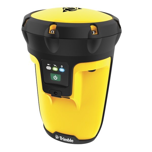
    With the enhancement of GPS accuracy and advanced features, today’s GPS units are even better suited to the challenges often seen by the military than when the program began. Operation Waypoint provides soldiers with Lowrance Endura Safari handheld GPS units that contain a precision GPS+WAAS antenna with 42-channel receiver and 3-axis magnetic compass to ensure troops have pinpoint accuracy for proper guidance or calling in air support when needed. The combination of the touchscreen, simple menus, and the ability to control one-handed or with gloves keeps usability fast and seamless, Meyer said. However, the most important benefit is the ability to store up to 2,000 waypoints for areas of safe passage, suspected insurgent buildings, and other items that are marked and identified with any of 193 different icons and then shared between GPS units over time or added to satellite maps.

    “The [GPS] unit helped ensure the safety of crews while running convoys through the worst part of Iraq,” said Sgt. Heacock. “It’s helpful in pinpointing casualty evacuation points and points of hostile action.”

    To date, Operation Waypoint is responsible for delivering more than 200 handheld devices into the hands of deploying soldiers. The St. Augusta American Legion accepts donations for Operation Waypoint and purchases its Endura Safari handheld GPS units directly from Lowrance. Lowrance also provides permission for the organization to copy and encrypt its Middle East mapping onto locally sourced microSD cards. While more work, this avoids packaging and operational overhead costs that would normally be seen by a manufacturer. Once the GPS and mapping cards are prepared, each participating soldier is personally trained on the GPS device and mapping before he or she takes it overseas.

    “Each Lowrance GPS and chart card costs $115 after corporate discounts are factored in,” said Meyer. “Unfortunately, there are still times when we can’t purchase enough units. I have even given my personal GPS away, because I can’t imagine turning down a brave soldier. The challenge, as with most non-profits, is maintaining enough donations to support the program effectively.”

    Operation Waypoint seeks to grow nationally by working with other American Legion Posts and organizations with a goal to provide a GPS device to every deployed unit. The Operation Waypoint website was redesigned to build awareness, make it easier for visitors to donate, and encourage other organizations to become partners in the project to provide GPS devices for soldiers in their own communities.