On April 26, the U.S. Department of Transportation publicly released the long-awaited GPS Adjacent Band Compatibility Assessment. See the June issue of GPS World for an expert and measured analysis of this highly impactful document.
The article will be posted online when it becomes available in mid-to-late May.
Merger Mystery
Contrary to the “Out in Front” editorial published in the April issue of GPS World magazine, there was an Izvestia story published on March 28 touting a merger of the GLONASS and BeiDou systems, and there will be an International Conference on Advanced Technologies in Manufacturing and Materials Engineering in Harbin, China, at which such a possibility may hypothetically be discussed.
However, neither hard news nor any official statements have emerged to substantiate such a dubious claim, despite repeated queries to officials of both countries.
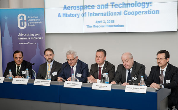
Javad Ashjaee (far left, above), CEO of JAVAD GNSS and based in Moscow, communicated that he spoke on a panel at an aerospace technology event organized by the American Chamber of Commerce in Russia, alongside representatives from NASA, Boeing, Honeywell and Roskosmos.
Ashjaee asked the Roskosmos official publicly about the prospect of a GLONASS merger with BeiDou, and “he knew nothing.”
Diverger Dilemma
As this magazine goes to press, stories emerge of a U.K. plan to launch a satellite-navigation system separate from the European Union’s Galileo project. This comes in response to an EU statement that the UK would be shut out of key elements of the European satnav program, particularly the Public Regulated Service, after Brexit.
Historically, in the late 1980s or early 90s the UK drew up plans for its own GNSS prior to the launch of Galileo. And UK-based Surrey Satellite Technology Ltd. built all operational Galileo payloads to date. So the country clearly has the capability. That SSTL is currently owned by Airbus (either German or Dutch division) may or may not constitute a wrinkle.
Finally, the UK spent 1.4 billion euros on Galileo, and may now file for a refund.
The Long Life of GPS III
By Robin Wrinn, Contributing Author
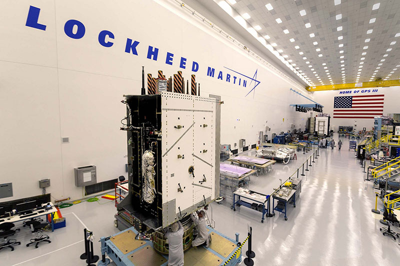
GPS III SV01 in electromagnetic interference, compatibility and passive intermodulation testing. (Photo: Lockheed Martin)
During interviews with Lockheed Martin and Harris Corporation at the 34th Space Symposium, time and space were a frequent focus of discussion, but not in the normal “continuum” kind of way.
Greater mission longevity is one of the key improvements GPS III delivers over those currently in service. Space Vehicles 1–10 have a planned mission life of about 15 years, 25 percent longer than their predecessors. Yet that begs the question “How long should a satellite live in space, with technology innovation occurring almost annually?”
Advanced payload technology provides a partial answer to that question. Both Lockheed Martin and Harris Corporation highlighted new payload capabilities with built-in flexibility to adapt satellites in orbit to technology advances, as well as changes in missions.
Lockheed Martin provided the media a tour of their Radio Frequency Payload Center of Excellence. Meanwhile, Harris recently announced completion of the fully digital Mission Data Unit (MDU), core to the navigation payload for GPS III 11 +. As a reminder, the current Harris payload for SVs 1–10 includes:
greater than three times reduction in range error,
up to eight times increase in anti-jamming power,
added signals, including L1C, compatible with other GNSS such as Galileo, and
greater signal integrity.
According to Harris, the fully digital navigation payload will provide the ability to change and upgrade the satellites incrementally over mission life.
Meanwhile, Lockheed announced a partnership with NEC to introduce artificial intelligence for computer learning in orbit. The company’s Payload Center experts touted significant advances in processers and a move toward next-generation antennas, arrays and transmitters to drive more satellite flexibility, capability and resilience.
Observation: The market pressures of ‘new space’ players is prompting delivery of products that can drive more value for less cost. In this case, delivery of a common payload architecture and electronically steered beams to make satellite antennas become any shape you want. Most likely, beams of a different size on demand is a much better business case than a static one built five years ago.
The day I interviewed Lockheed Martin’s Navigation Systems mission area Program Manager Johnathon Caldwell, the company had submitted its proposal for the U.S. Air Force’s GPS III Follow On (GPS IIIF) program. That same day, April 16, the media was given a tour of Lockheed Martin’s GPS III satellite assembly floor. It was clear from both Lockheed’s press materials and Caldwell that Lockheed Martin believes it is fully recovered from prior production hiccups and is
on track to deliver GPS Space Vehicles (SVs) 1 through 10, and
deserves to win the bid for GPS IIIF. Now that both Boeing and Northrop Grumman have dropped out of the running, Lockheed is virtually assured the contract. The government has said it will announce the award in March 2019.
What are the differences in the GPS III satellite payloads that were instituted to enable the new signals?
The main difference is the power. The Air Force’s requirements called for significantly more anti-jamming capability. All the transmitters are a higher power.
What was the most significant obstacle (or top obstacles, plural) in designing and manufacturing this new payload, to new Air Force specifications? How did you overcome it/them?
Same answer really, the higher power. Keeping in mind, we went from a 7-year mission life requirement to a 15 year. That higher power puts more strain on components and new cyber requirements in software. When you couple all that together we are not just upgrading payload technology. It is really engineering a new set of payload requirements. It’s new generation, advanced.
What are the advantages of a digital payload over the alternative?
The advantages and the 30 percent difference are the timekeeping system portion. We’re moving from a manual, analog timing to digital to deliver to the Air Force more flexibility. It’s a nice option to have to be able to reprogram in orbit and maybe enhance capabilities desired in the future.
with Johnathon Caldwell, Navigation Systems Mission Area Program Manager
Any changes in your production approach having completed SV01?
No, the performance on Vehicle 01 was as designed there were no technical or design changes necessitated throughout the rest of the fleet. So, it was a very successful from that perspective — from the standpoint of validating the design and wringing it out, Vehicle 01 served its purpose well.
It had a very good T-Vac. I would say overall when you look at the industry, Vehicles 01–02, our vacuum test campaigns are the most rigorous test. Both went through their tests quite well. Some of the best I’ve seen.
This month, we bring you a guest column on the 34th Space Symposium in Colorado Springs, Colorado. Robin Wrinn, a communications professional based in Atlanta, gives her perspective on the premier annual space event, held in April. Among her findings: information on the mission longevity vs. technology innovation debate, GPS IIIF program bids, discussions of time and space, and more.
— Alan Cameron, editor
During recent interviews with Lockheed Martin and Harris Corporation conducted during the 34th Space Symposium (April 16-19) in Colorado Springs, time and space were a frequent focus of discussion, but not in the normal “continuum” kind of way.
Greater mission longevity is one of the key improvements GPS III delivers over those currently in service. Space Vehicles 1-10 have a planned mission life of about 15 years – 25 percent longer than their satellite predecessors. Yet that bragging right begs the question “How long should a satellite ‘live’ up in space with technology innovation occurring almost annually?” After all the last Block IIR-M series satellite was launched in 2009. To put that into perspective, that same year the Canadian company Blackberry (RIM) held 20 percent of the smartphone OS market share and was the second largest OS in the world. Apple had just introduced the iPhone two years earlier.
A partial answer to that question it seems is advanced payload technology. Both Lockheed Martin and Harris Corporation highlighted their advances in payload capabilities that would enable built-in flexibility to adapt satellites in orbit to advances in technology, as well as changes in missions. Lockheed Martin provided the media a tour of their RF (Radio Frequency) Payload Center of Excellence (Payload Center). Meanwhile, Harris Corporation recently announced that is has completed development of the company’s fully digital Mission Data Unit (MDU), which is core to the navigation payload for GPS III 11 +.)
As a reminder, the current Harris payload for SVs 1-10 includes:
Greater than three times reduction in range error,
Up to eight times increase in anti-jamming power,
Added signals – including one (L1C civil signal) compatible with other Global Navigation Satellite Systems (GNSS), like the European Space Agency’s Galileo.
And greater signal integrity.
According to Harris, the new, fully digital navigation payload it has engineered will deliver more powerful signals, PLUS the ability to change and upgrade the satellites incrementally over the mission life.
Meanwhile, Lockheed recently announced a partnership with NEC to introduce artificial intelligence for computer learning in orbit. And the company’s Payload Center subject matter experts touted their significant advances in processers and a move toward the next generation of antennas, arrays and transmitters that would drive more flexibility and capability and resilience into satellites.
Observation: It seems the market pressures of ‘new space’ players is prompting delivery of products that can drive more value for less cost. In this case, delivery of a common payload architecture and electronically steered beams to make satellite antennas become any shape you want. Most likely, beams of a different size on demand is a much better business case than a static one built five years ago.
GPS III 1-10 on track. in full production. GPSIII SV1 awaiting U.S. Air Force “Call Up” for Launch
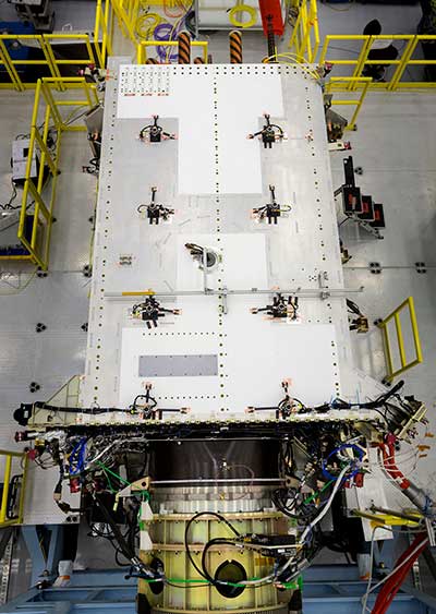
Lockheed Martin’s GPS III SV03 became fully integrated in August 2017. Photo: Lockheed Martin
The day I interviewed Lockheed Martin’s Navigation Systems mission area Program Manager Johnathon Caldwell, the company had submitted its proposal for the U.S. Air Force’s GPS III Follow On (GPS IIIF) program. That same day, April 16, the media was given a tour of Lockheed Martin’s GPS III satellite assembly floor. It was clear from both Lockheed’s press materials and Caldwell that Lockheed Martin believes it is fully recovered from prior production hiccups and is
• “on track” to deliver GPS Space Vehicles (SVs) 1 through 10, and
• deserves to win the bid for GPS IIIF. Now that Boeing has dropped out of the running, it seems they probably have it. (The government has said it will announce the award in March 2019.)
Here is the GPS III SVs 1-10 Update:
SV 01. Declared “Available for Launch” (AFL) by the Air Force on Sept. 28, 2017. Awaiting “Call Up” for launch. A formal date has not been set. “Sometime this year” was the answer Lockheed Martin provided when asked a timeframe.
SV 02. Completed Thermal Vacuum (TVAC) testing, Dec. 2017. Currently in final environmental EMI (electromagnetic)/EMC (electromagnetic compatibility)/PIM (passive intermodulation) testing. AFL expected Summer 2018.
SV 03. Fully integrated, Fall 2017. Currently in TVAC testing, AFL expected. Spring 2019
Interview with Harris Corporation’s Jason Hendrix, PNT Program Director.
GPS World readers are familiar with the differences in the GPS III signals as compared to those transmitted by satellites to date. What are the differences in the GPS III satellite payloads that were instituted to enable those new signals?
The main difference is the power. The Air Force’s requirements called for significantly more anti-jamming capability. All the transmitters are a higher power.
What was the most significant obstacle (or top obstacles, plural) in designing and manufacturing this new payload, to new Air Force specifications? How did you overcome it/them?
Same answer really, the higher power. Keeping in mind, we went from a 7-year mission life requirement to a 15 year. That higher power puts more strain on components and new cyber requirements in software. When you couple all that together we are not just upgrading payload technology. It is really engineering a new set of payload requirements. It’s new generation, advanced.
What are the advantages of a digital payload over the alternative? When you say “Our current GPS payload is 70 percent digital” does that refer to the IIR payload? The offered “fully digital navigation payload with enhanced performance” — is that the GPS III payload? What’s the new 30 percent that has gone digital?
The advantages and the 30 percent difference are the timekeeping system portion. We’re moving from a manual, analog timing to digital to deliver to the Air Force more flexibility. It’s a nice option to have to be able to reprogram in orbit and maybe enhance capabilities desired in the future.
Can you provide any perspectives on how Harris is performing now in delivering payloads for SVs 1-10?
We’re now ahead of schedule. We delivered the 5th payload three weeks early (early March 2018). We are on time for 4 and three more are due this year.
Interview with Lockheed Martin’s Navigation Systems Mission Area Program Manager Johnathon Caldwell
Can you provide some general updates on assembly of GPS 1-10?
Photo: LMCO
Vehicle SV01: It is ready and we’re very excited about that. We defer to the Air Force on questions about launch date. But once they call it up we will install the solar panels and take it to a C-17. Then load it in the back of the plane and fly it down to Florida. We will then take it over to the vehicle processing facility and mate it up with the launch vehicle provider. The GNST – the satellite prototype -has gone to the Cape twice already. So, we have conducted a dry run for shipping SV 01.
Vehicle SV02: It has completed thermal vacuum testing – a major milestone. We’re in the last of the environmental tests. And we’re tracking to have that vehicle declared AFL this summer.
Vehicle SV03. It is fully integrated and is in the T-Vac chamber now. The door is closed and it’s going through tests. (Pump down to vacuum is achieved in approximately three hours and the total testing time is 70 days.)
Vehicle SV04: It is fully integrated on the floor. It is in its baseline electrical tests and will be in environmental tests as soon as 3 comes out of the chambers. It is staged to go in right after – 3.
Vehicle SV05: It is about to go through its integration to the propulsion core. And five has its navigation payload. Integrating it this summer.
Any changes in your production approach having completed SV01 that you are fixing in your production approach to SV02, 03 or 04?
No, the performance on Vehicle 01 was as designed there were no technical or design changes necessitated throughout the rest of the fleet. So, it was a very successful from that perspective – from the standpoint of validating the design and wringing it out, Vehicle 01 served its purpose well.
It had a very good T-Vac. I would say overall when you look at the industry, Vehicles 01 – 02, our vacuum test campaigns are the most rigorous test. Both went through their tests quite well. Some of the best I’ve seen.
We consider thermal vacuum the gold standard for testing any satellite before it goes into operations. It really is putting the craft through the paces. When it goes through the testing, the satellite is on. It is working. It is exposing it to the heat and the cold and the zero pressure while the satellite is functional. The entire thermal vac testing from start to end is a little over 70 days. “Test like you fly.” From the time it launches and deployment sequence we test it like it is real. Minus the shaking, the satellite thinks it is getting launched. Meanwhile, our people are looking at the data and its health. T Vac is a huge milestone for a satellite to go through it and come out without any issues. Which is why we are so pleased about the two.
Have there been any production delays since last year.
No, we’ve been quite stable in our production schedule.
Can you shed some light as to how many Lockheed Martin employees are involved in the production of GPS III?
The way we’re organized, there are engineers that flux in and out of the project depending the stage we’re in. This is production program, so we use the skillsets we need at the time we need them, then those engineers go on to do other work. But this also comes back to some of the commonality we’re trying to achieve across out product lines. That when you have common processes, common parts and common procedures in building spacecraft you gain leverage and major cost savings to have flex in resources.
Can you speak to any issues with subcontractors? Any delays?
No, since last year, the Harris production line has stabilized. We’ve been receiving Harris payloads, and we’ve just received the 5th payload and we’re finishing up integration. Vehicle 6 navigation payload is currently in test. And Vehicle 7 and 8 payload production is going according to schedule. We feel Harris has definitely overcome some of the challenges of the past. And we’ve been seeing stable production deliveries. By the end of this year we should receive 3 more payloads and by the first quarter of next year, the 8th, and they are contracted for 9 and 10.
From a civilian perspective, can you remind us what will be different with GPS III?
Three times better accuracy and up to eight times improved anti-jamming capabilities. And it is a longer life vehicle and healthy constellation of satellites that people can rely on. The new L1C signal is common with other GNSS, like Galileo, so as that becomes incorporated into equipment, it will give you more data points for better service, more accuracy and reliability.
For GPS IIIF requirements, are there capabilities that will require innovation or new technology?
We’ve designed with some of those capabilities in mind. If you just look down the list. The regional military protection is about bringing higher power and boosting the signal where the military needs it most. That’s not a particularly new technology per se, but it is bringing a new capability that the current GPS satellites don’t have.
The Search and Rescue payload, again, I wouldn’t consider it a new capability, it is provided by a partner nation, a Canadian company, but it effects those folks in need.
Digital payload. For 11+, fully digital payload for greater flexibility for the government. It allows the government to expand or enhance capabilities of the mission over time. It enables loading new software to do different things.
GPS III was designed with a modular, flexible architecture. Because Lockheed Martin knew that as time goes by, technology evolves. New technology becomes available and the government’s mission needs are likely to change.
Now that ability to evolve is down to the payload with a fully, 100 percent digital payload.
Lockheed Martin has been working on a lot of the GPSIII F design requirements already (preliminary design review level).
Can you speak to the other “Risk Retired” you mentioned in your slides?
Last fall, we had our first time with the OCX zero ground system. It’s one thing to talk to satellite in the high bay, it’s another thing to talk to it with the entire Air Force control network you plan to use when you’re operating. So, we were excited to get that done and run the entire chain from the vehicle out from the Air Force control network the AFCN network, utilizing the OCX system to command the vehicle. It was a big milestone for us. And previously we demonstrated our compatibility of our signals (with OCX).
Our future satellites in our GPS IIIF proposal share a common design with GPS III so they also will be compatible with OCX because we have proven that compatibility.
Can you speak to the GPS III Ground System Support Contracts Lockheed Martin has received?
The government asked us to help provide some gap fillers for the ground system (rmw note: if OCX isn’t there yet). To take the heritage AEP ground system and provide the ability to fly GPS III satellites using that ground system. So that activity has been going well and the critical design review has been completed and it is on track for delivery to the government next year. And subsequently, we were also put on contract for the M-code new signal to add some capabilities to the legacy ground system to begin to furnish early use of that new GPS III M-code signal to the military. We’ve been working hard on that. We conducted our preliminary design review last fall and just recently completed a critical design review to add that capability.
Opening remarks by Alan Cameron, editor and publisher of GPS World
Everyone at this great conference is actively engaged in innovation: new approaches, new combinations, new integrations, new methodologies.
Our sponsors are not only innovators, they are active in building those innovations in the field, installing the cornerstones of GPS and GNSS technology. Harris Corporation has been building the GPS satellite payloads since the beginning of time, Rockwell Collins has built so much user equipment, historically and currently, and Spirent Federal Systems has been enabling the development and testing of much user equipment by many companies in this room.
Just to give you an idea of who else is seated among you at the tables, we have NovAtel, Spectracom, IFEN, Septentrio, Satelles, Syntony, Unicore, u-blox, ComNav, RaceLogic, Rohde & Schwarz, ublox, Locata, GMV, Leica, Thales, Boeing, Broadcom, Qualcomm, Google, Apple, Intel, MITRE and Aerospace Corporation; the U.S. Air Force GPS Directorate, the U.S. State Department, the European Space Agency, the European GNSS Agency and the European Commission, NASA, the French and German aerospace agencies; the Institute of Navigation and the Royal Institute of Navigation; and universities and research institutes almost too many to number.
This is a great industry to be part of, and I feel lucky to be kind of a spectator, a commentator in it without the benefit of the scientific upbringing that everybody else in this room has had. I still get to participate in the excitement and the developments and for that I am truly grateful.
Satellites Leadership Award
Galileo Builder
Wolfgang Paetsch
Director of Navigation and Member of the Executive Board, OHB
For his leadership in setting up the routine production of the Galileo satellites leading to Galileo constellation deployment, including thequadruple Ariane 5 launch in November 2016.
Paul Verhoef (right), director of the Galileo Programme and Navigation-related Activities, European Space Agency, accepted the award and delivered remarks on behalf of Wolfgang Paetsch. (Right photo: Melanie Beus)
Introduction by Rob Scott, Rockwell Collins
“Forty years ago, Rockwell Collins celebrated the first receipt of a GPS signal,using a six-foot tall, two-person receiver. Now we have something something 1 by 1-1/4 inches that is far more capable. It’s amazing to see how technology has advanced.”
Remarks by Wolfgang Paetsch
I must admit I am rather at fault for Wolfgang not being here, because I keep him rather busy producing satellites, as OHB is completing the last of 22 satellites under contract from ESA. We are going to launch again in December, as you know we have had a few problems, which I’m glad to say we have solved. The issues are behind us, and the Swiss clocks are working fine now, which is great.
On Dec. 12 we are going to launch. The first two satellites are in Kourou already, the next ones are going in two weeks [as of Sept. 28; all satellites are now in Kourou. — Ed.] We’re going to go up on an Ariane 5 again, with these four satellites. Next summer we are doing another four, so it brings the whole Galileo constellation from 18 to 26, and then we are fully operational.
In this business it is quite a challenge to keep up the pace. I think OHB, with Wolfgang in the lead, has done very well in the past years to set up indeed a very impressive production line and keep all the machinery ticking over. It has been a big challenge for them, as they had been a relatively small player in the space business, while at the same time they have been able to win other competitions in the space business in other areas. OHB has been doing very well and we are glad of course that they are doing well because it was important to get Galileo up and running.
OHB has managed to win recently another contract, good for them, we are about ready to give them the first options on that contract, so we will have a total of 14 satellites under contract with them, in addition to the 22 they are completing. These satellites will further complete the constellation and they will already start replacing the first IOV satellites which we have put up. So you see the cycle is rather quick. Of course we are waiting a bit to see what the real lifetime of the satellites is going to be. We don’t know that yet but we will find out in the next couple of years.
Looking Ahead. So what are the challenges for us in the next years? We are currently working with colleagues from the European Commission and the European GNSS Agency on what the next constellations are going to do. Obviously there is a lot of pressure for further innovation, for further improvements. The user community over the last couple of years has become more outspoken about what they want and what they expect, which is nice. Obviously we need to take care of the legacy users, and we are having to see what new technology would allow us to do. At the end of the day there is then also a small thing called budget, which needs to have its play in these things.
In any case, the plan is by the end of the year we will start the procurement of the next batch of satellites. This will take a while to do, this procurement, as it concerns new developments, but then we are going to go for the next constellation.
So let me finish by paying a tribute to Wolfgang and his team. It has been a real challenge for them. I know that he was pretty amazed, and after that pretty proud, of this prize he has gotten, and I will carefully carry this back to him in Europe.
Alan, thank you very much.
Services Leadership Award
Global Educator
Patricia Doherty
Director and Senior Scientist, Institute for Scientific Research, Boston College
For initiating and leading the African GNSS Outreach program since 2009, to help developing countries derive social and economic benefits from satellite-based PNT.
Frank van Diggelen (left, above), an African Outreach faculty member and principal software engineer, Google, introduced and conferred the award to Pat Doherty. (Photo: Melanie Beus)
Introduction by Frank van Diggelen
“I had the great honor and privilege of teaching in the African GNSS Outreach program. If you are approached to participate in this, seize the opportunity! It’s a fabulous thing, with people from all over Africa, and you’ll learn far more than you think.”
Remarks by Patricia Doherty
I would like to thank GPS World for this Leadership Services Award. I am sincerely honored and humbled by this recognition. Serving the GNSS community with the African Outreach Program has been a joy and a privilege that I am personally grateful for every day.
This program began in 2009. The idea was conceived at a G8-UNESCO World Forum that I was fortunate to attend in 2007. At that forum, leaders from developing nations of Africa described the need for assistance in developing science and technology in their countries, technologies that would lead the way to socio-economic transformation and integration into the world economy. As all of us here know, GNSS is a space technology that can change the world with applications that can increase food security, monitor natural resources, manage wildlife conservation, improve emergency location services, and provide greater precision and safety in land, sea and air navigation — just to name a few of the possibilities.
Thus the goal of the African Outreach Program was to encourage the use of GNSS for societal and economic development and for scientific exploration in Africa. The way to do that was to help build a knowledgeable African GNSS workforce. I am glad to report that the program has been quite successful. To date, we have hosted 9 workshops. In those workshops, we have introduced the art and science of GNSS navigation to over 450 professors and students from at least 23 of the 54 countries in Africa. Many of the African participants have gone on to do great things: hosting local workshops, developing GNSS programs in their universities, gaining government confidence and interest in GNSS technology and building infrastructure that enabled the use of GNSS.
One of the prime reasons for this success are the sponsors who support us and the lecturers who generously share their time, their knowledge and their zeal for GNSS to teach at the workshops. Many of these lecturers are here tonight. So thank you all. Many of these lecturers have expressed that their lives were enriched by this program. Others have told me that they have never seen a more attentive audience and that just having the opportunity to meet and work with people from the developing world in Africa is a gratifying experience. Several of our lecturers, including myself, are now involved in collaborations with scientists in the developing world.
More to come. Although this sounds like we have done our job, there is still so much to do. Change is slow in Africa. Our plans for the future include building on our success by hosting additional workshops where we will try to reach additional countries in Africa and strengthen current programs and infrastructure in countries where that has been slow to develop. We are also opening the program to other developing countries around the world, as there has been much interest from Central America, South America and Asia. Finally, we are working to bring more workshops to the African continent, where we can reach more students, have an effect on local universities and speak to the local government about the benefits of using GNSS as an enabling technology for societal betterment and economic growth.
In closing, I am honored to receive this award and I look forward to continuing our work to support the use of GNSS in developing nations. Thank you, GPS World, and thank you to our sponsors, lecturers and our African participants for making this program a success.
Signals Leadership Award
Spectrum Advisor
Chris Hegarty
Director for Communications, Navigation and Surveillance Engineering and Spectrum, The MITRE Corporation
For contributions to the U.S. Department of Transportation’s GPS Adjacent Band Compatibility Assessment.
Chris Hegarty (Photo: Melanie Beus)
Introduction by Joe Rolli, Harris Corporation
“On behalf of the Harris Corporation and the team I work with in the Precision Navigation and Timing Business Area, providing the world with GPS signals from space for over forty years, I am pleased to present this year’s Leadership Signals Award.”
Remarks by Chris Hegarty
Thank you very much. I really appreciate this. The truth be told, of course, the Adjacent Band Compatibility (ABC) study has had many contributors. I’m honored to receive this award, but equally deserving are many others including Karen Van Dyke at DOT, Steve Mackey and Hadi Wassaf at DOT’s Volpe Center, Karl Shallberg at Zeta, and too many others to list at DOT, the Air Force, NASA, other federal partners and their contractors.
Looking forward, for those of you who have not been following this issue, the GPS spectrum is being challenged. The spectrum is highly valued and of course there are companies that would like to use that spectrum.
I think that it’s safe to say that no one would really want to stop them from using that spectrum if it didn’t have an impact on GPS, but the unfortunate reality is that it appears the deployment of a 4G network or other potential use of the bands adjacent to GPS with similar transmitter power levels would disrupt the operations of many hundreds of thousands of receivers. To ignore the issue would really be a mistake for our industry.
This issue unfortunately isn’t going to go away. The pressure on spectrum is going to continue to grow — until someone figures out how to communicate without using electromagnetic waves. So this is going to be a persistent problem.
I think we can build receivers, in the future, that can deal with some new systems in adjacent bands, but it’s going to be imperative for a long transition period to protect the investments made by many people in the room here and the folks that we support.
That’s all I wanted to say, thank you again very much.
Products Leadership Award
Advanced Capability Developers
Charles Abraham, Andreas Warloe and Javier de Salas
Vice President of Engineering, Senior Director of Engineering, and Director of Software Engineering, respectively, Broadcom
For developing the first dual-frequency L1/L5 E1/E5 GNSS chip for smartphones, ushering in a new era of high-precision GNSS in mass-market products.
Charles Abraham and Andreas Warloe, with Javier de Salas (not shown); Ellen Hall (left), CEO of Spirent Federal Systems, introduced and conferred the award. (Photo: Melanie Beus)
Introduction by Ellen Hall, Spirent Federal
“As pioneers in GNSS satellite simulation, beginning in 1985, we’re really proud of our heritage. We’re also really proud of Broadcom.They are a user of Spirent equipment as well, so that makes us doubly happy to award this to them.”
Remarks by Andreas Warloe
Thank you to GPS World and the sponsors and supporters of this event, from Charlie Abraham, Javier de Salas, myself and the Broadcom marketing and engineering teams, for this award. We are very honored that our efforts to provide the best possible GNSS to as many people as possible have been recognized in this way.
A few years back, we had completed receiver support for a fifth GNSS L1 system and asked ourselves “What’s next?” At that time, technology nodes were getting to a point where a single chip L1/L5/E1/E5 receiver could be contemplated, and the Galileo launch schedule was picking up speed. An old outlandish idea suddenly didn’t seem as outlandish any more.
Many or most of you in this room are experts in the business of perfection; the business of perfecting and pushing performance boundaries for GNSS. As designers of mass-market devices, we have instead become experts in the art of compromise: If we can achieve good performance at 10mA, then how about 5mA? If we can implement a 16-bit data path with 0.1dB losses, how few bits can we get away with for 0.2dB losses? How can we add support for new GNSS systems without growing RF, digital hardware or software? It is this extreme frugality that now has enabled us to put a complete single chip L1/L5 system in the hands of phone and wearables manufacturers, with smaller size and lower power consumption than the previous L1-only generations.
Competition in our market is fierce, but we are excited about this opportunity to work together with our competitors to promote this new level of precision to our common customers. We have taken initiative in this area by forming the Dual Frequency Alliance. There is an investment that has to be made in phones, with antenna and filtering support for the new band. Only when these investments are made will we be able to bring this new performance level to hundreds of millions of people. Only then will we start seeing new applications built on high-precision — applications that haven’t even been envisioned yet. Once those applications are available, there will be pressure to expand L1/L5 technology from flagship phones to truly mass-market phones.
L5 support enables high-accuracy GNSS, but it does not guarantee it. To go from multi-meter precision to sub-meter precision requires advanced software. GNSS chip manufacturers can provide a good starting point, but once GNSS measurements are made available, GNSS students and experts alike can supply clever applications, professional software tools and infrastructure to further advance GNSS technology. Our job is to work together to push the L1/L5 technology into phones, to provide a new platform for GNSS development.
In summary, we would like to work as an industry to make L1/L5/E1/E5 the new standard for GNSS performance, and to make these measurements available in phones for as many engineers as possible to either monetize their existing IP or develop entirely new IP.
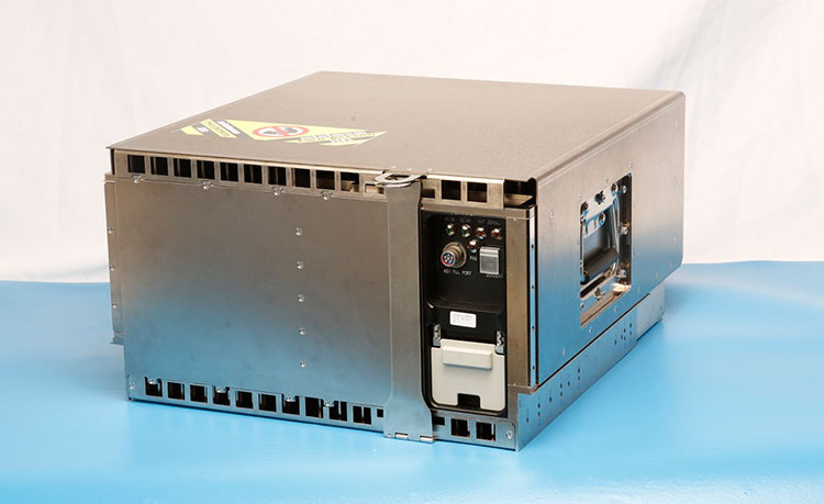
The fully digital Mission Data Unit (MDU) will create precise civil and military timing navigation signals for GPS III satellites 11 and beyond. Pictured here is the advanced MDU on navigation payloads being delivered for GPS III Space Vehicles 1-10. (Photo: Harris)
Harris Corporation has completed development of its fully digital Mission Data Unit (MDU), which is at the heart of its navigation payload for Lockheed Martin’s GPS III satellites 11 and beyond.
Harris has already provided MDUs and payloads for the first 10 GPS III satellites, one of which has been declared “available for launch” and the second of which is completing its testing. The other eight are in various stages of production assembly.
Payloads for the satellites 11 and beyond bring further signal transmit capabilities, providing more powerful signals and built-in flexibility to adapt to advances in GPS technology, as well as future changes in mission needs.
The new MDU that will eventually go aboard satellites 11+ “can be upgraded incrementally over its mission life due to built-in adaptability,” according to a Harris spokesperson.
GPS OCX
The U.S. Air Force Space and Missile Systems Center has accepted delivery of the GPS Next Generation Operational Control System (GPS OCX) Launch and Checkout System (LCS) baseline from Raytheon Intelligence and Information Systems. Also known as Block 0, LCS demonstrated conformance through test and analysis with all contractual requirements. OCX Block 0 is the foundation for Raytheon’s future Block 1 and 2 delivery, slated for 2022.
LCS is a fully modernized cyber-secure ground system complete with the computing hardware, operations center workstations, and mission application software necessary to launch the first GPS III satellite into orbit and perform initial on-orbit testing.
Mission operators are now using LCS in the GPS III Mission Readiness Campaign. The ground system is performing as expected during the rehearsals and space vehicle checkout.
Galileo Launch
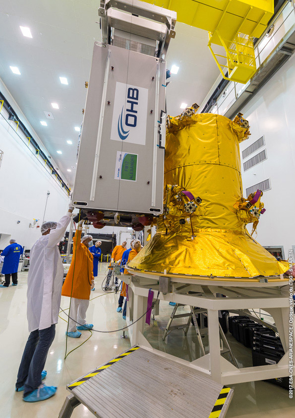
A Galileo satellite undergoes its fit-check validation at the Spaceport. Flight VA240. (Photo: ESA/Arianespace)
As this magazine goes to press, final preparations are underway for Galileo’s quadruple launch on Dec. 12. The Ariane 5 rocket has completed its build-up at the spaceport in French Guiana and is moving toward payload integration and rollout to the launch zone.
The four 700-kilo (1,543-pound) Full Operational Capability (FOC) Galileo satellites have completed checkout and one-by-one verification of their interfaces with the payload dispenser that will release them once aloft in mid-Earth orbit.
They will soon take on fuel for their long space life.
The satellites will bring the Galileo operating constellation to 22, and, according to the European Space Agency, this will provide availability to users anywhere in the world for a high-quality position solution — defined as position dilution of precision (PDOP) less than 5 — 99.8% of the time.
Harris Corporation has completed development of its fully digital Mission Data Unit (MDU), which is at the heart of its navigation payload for Lockheed Martin’s GPS III satellites 11 and beyond.
The current Harris payload for GPS III space vehicles (SVs) 1-10 includes a greater than three times reduction in range error, up to eight times increase in anti-jamming power, added signals — including one compatible with other Global Navigation Satellite Systems (GNSS) — and greater signal integrity.
The fully digital Mission Data Unit (MDU) will create precise civil and military timing navigation signals for GPS III satellites 11 and beyond. Pictured here is the advanced MDU on navigation payloads being delivered for GPS III Space Vehicles 1-10. (Photo: Harris)
Harris’ GPS III SV11+ fully digital navigation payload will further improve on performance for the U.S. Air Force by providing more powerful signals, plus built-in flexibility to adapt to advances in GPS technology, as well as future changes in mission needs.
“This design is fully mature — an Engineering Development Model, not a prototype — and is ready to be inserted into GPS III SV11+,” said Bill Gattle, president, Harris Space and Intelligence Systems. “The payload has the flexibility to serve the warfighter over the entire mission life and can be upgraded incrementally over its mission life due to built-in adaptability.”
Harris navigation payloads are already integrated in the second GPS III space vehicle, pictured here, and the first GPS III satellite, declared available to launch in 2018. (Photo: Lockheed Martin)
The payload design also ensures flawless atomic clock operations, providing the reliable GPS signal that millions of people — including U.S. soldiers — and billions of dollars in commerce depend on every day, the company said. It also will provide the clock signal for a new GPS III Search and Rescue (SAR) payload.
Beyond flexibility and reliability, the new Harris SV11+ navigation payload offers a smooth transition to the Air Force’s GPS OCX ground control segment. The Harris payload for the first ten GPS III satellites already has been verified for OCX compatibility, and this will allow Harris to seamlessly port the Harris SV11+ design, minimizing integration risks and associated costs.
It is a beautiful, crisp afternoon, the last of the summer, as I write and as we prepare for next week’s ION GNSS+ conference, where GPS World and sponsors Harris Corporation, Rockwell Collins and Spirent Federal Systems will host the 2017 Leadership Dinner and confer this year’s Leadership Awards in Satellites, Signals, Services and Products.
The engraved glass awards nestle snug in their boxes beside me, the names upon them known only by a few.
However, as you read this, it is early October — and hopefully another beautiful crisp afternoon among autumn’s best — and those glass awards are safe at home with their new owners. Their names are known by all 125 Leadership Dinner attendees, and now by you as well. We will publish their spoken remarks in the December issue. Here now are the basic details.
The voting ballot for the awards was assembled by polling a group of roughly 25 industry VIPs for their nominations, and that same group plus another 40 voted for the final recipients.
The 2017 Leadership Award for Satellites went to Wolfgang Paetsch, director of Navigation for OHB, primarily responsible for the space projects that the company executes for the European Space Agency (ESA) and the European Union. He was nominated for his leadership in setting up the routine production of the Galileo satellites leading to Galileo constellation deployment, including the quadruple Ariane 5 launch in November 2016. As one voter remarked as he cast his ballot, “The quadruple launch capability is a key enabler for the future.”
The Leadership Award for Signals was conferred upon Christopher Hegarty, director for Communications, Navigation and Surveillance Engineering and Spectrum at The MITRE Corporation, for contributions to the Department of Transportation’s GPS Adjacent Band Compatibility Assessment. Said Compatibility Assessment has been a long and winding road, and has required several sure hands, Chris’ among them, to guide it. We hope to publish something on its outcomes soon.
The Leadership Award for Services was given to Patricia Doherty, director and senior scientist at the Institute for Scientific Research at Boston College, for initiating and leading the Africa GNSS Outreach program since 2009. The program’s mission is to help developing countries derive social and economic benefits from satellite-based positioning, navigation and timing. Each year, around 50 graduate students and faculty from African and other countries attend these GNSS workshops. The faculty reads like a Who’s Who of satnav scientists and teachers, testifying to both Doherty’s formidable recruiting talents and the dedication of this community to knowledge-sharing around the world.
2017 GPS World Leadership Awards.
The Leadership Award for Products was a tri-partite affair, going to colleagues Charles Abraham and Andreas Warloe, vice president of Engineering and senior director of GPS Engineering, respectively, at Broadcom. As the chief designer and the architect of the first dual-frequency L1/L5 E1/E5 GNSS chip for smartphones, they are helping to usher in a new era of high-precision GNSS in mass-market products. See this article for more details on the just-launched product.
The two shared the award with Javier de Salas, director of Software Engineering at Broadcom, for leadership in establishing Galileo-ready receiver products.
A good time was had by all at the Leadership Dinner, which also included the PNT Powerplay Puzzle and Pig-in-a-Poke Live Auction. Details in December!
After two decades of providing the U.S. government with Geiger-mode lidar data, Harris Corporation offers high-resolution lidar data and its derived products to commercial organizations.
The data can be used for land-use planning and management, transmission-line monitoring, pipeline design and maintenance, transportation engineering and planning, urban modeling, asset management and forestry analytics.
Geiger-mode lidar offers the most accurate elevation data available, according to Harris Corporation, the only provider of Geiger-mode lidar data.
According to the company, the sensor allows for collections on a large scale, while also collecting data up to 10 times faster and at 10 times the resolution of existing linear lidar sensors.
Geiger-mode lidar provides multi-angle illumination that penetrates foliage, removes shadows and and eliminates voids.
Harris Corporation has delivered the third of 10 advanced navigation payloads to Lockheed Martin, which will increase accuracy, signal power and jamming resistance for U.S. Air Force GPS III satellites.
The navigation payload before integration into the second GPS III SV, which now is in environmental testing. (Photo: Harris)
The advanced navigation payloads feature a Mission Data Unit (MDU) with a unique 70-percent digital design that links atomic clocks, radiation-hardened computers and powerful transmitters — enabling signals three times more accurate than those on current GPS satellites.
The new payloads also boost satellite signal power, increase jamming resistance by eight times and help extend the satellite’s lifespan.
The payload is expected to be integrated into GPS III Space Vehicle 3 (GPS III SV03) this summer. In May, Harris’ second GPS III navigation payload was integrated into GPS III SV02.
The first navigation payload is integrated aboard GPS III SV01, which has now completed rigorous testing and is in storage awaiting its expected 2018 launch.
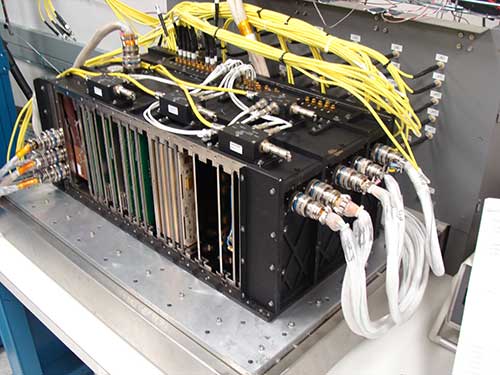
The MDU performs the primary mission of the GPS satellite, which is generation of the navigation signals and data that provide precise time information to users on a continuous basis. (Photo: Harris)
“We are now in full production and on target to deliver the fourth GPS III navigation payload to Lockheed Martin this fall,” said Bill Gattle, president, Harris Space and Intelligence Systems. “Our payloads help U.S. and allied soldiers complete their missions, enable billions of dollars in commerce and benefit the everyday lives of millions of people around the world.”
Harris has a long legacy of expertise in creating and sending GPS signals, extending back to the mid-’70s — providing navigation technology for every U.S. GPS satellite ever launched.
Harris is also developing a fully digital MDU for the U.S. Air Force’s GPS III Space Vehicles 11+ acquisition. This new MDU will be demonstrated in fall 2017 and provides even greater flexibility, affordability and accuracy versus existing GPS satellites.
Harris navigation payloads are already integrated in the second GPS III space vehicle, now in environmental testing, and the first GPS III satellite (pictured here), expected to launch in 2018. (Photo courtesy Lockheed Martin)
Grand Sky Airfield Operations, a 217-acre UAS test facility in North Dakota, has selected Harris Corporation to provide an advanced solution to support beyond-visual-line-of-sight (BVLOS) unmanned aerial systems (UAS) flight operations, reducing the need for chase planes to provide constant visual surveillance during flight. Grand Sky tenants will have the ability to conduct BVLOS UAS flights, enabling commercial and government operators to deploy their technologies, test and conduct operations. The announcement was made during AUVSI’s Xponential.
Harris will provide a customized RangeVue sense-and-avoid solution that delivers real-time situational awareness of surrounding unmanned and manned aircraft traffic, with multi-sensor surveillance for cooperative and non-cooperative vehicles. airspace situational awareness tool designed specifically for test-range operations for unmanned air systems (UAS). RangeVue puts real-time NextGen surveillance data, obstacle data, flexible background maps and weather information in the hands of the people who are actually in the field testing and validating UAS missions. The solution will cover the 217-acre unmanned aircraft business and aviation park located on Grand Forks Air Force Base, North Dakota.
It will enhance Grand Sky’s infrastructure for safe and efficient BVLOS UAS operations and testing, ensuring the FAA’s stringent safety requirements are met and eliminating the need for expensive chase planes to track UAS entering, exiting or operating within Grand Sky’s 60 nautical-mile radius airspace.
Harris’ Grand Sky solution will combine available surveillance sources — including Grand Forks AFB’s radar feed, locally installed ADS-B Xtend and FAA NextGen surveillance data — into a single stream that offers area coverage and airspace visualization for drone operators. Xtend supplements the FAA’s existing ADS-B nationwide network operated by Harris, which provides precise and reliable satellite-based surveillance for the nation’s air traffic control system.
Harris Corporation delivered the first of 34 modernized receivers to support the GPS Next-Generation Operational Control System (OCX). They will receive the signals sent by the current GPS satellite constellation plus the new signals sent by the next generation GPS III — 13 military and civilian signals in all.
The receiver was shipped to the prime contractor, Raytheon Company, in Aurora, Colorado, after it passed a critical electromagnetic interference test, the first of many stringent qualification requirements. Though the receivers will be placed throughout the world, this first production unit will be installed in Aurora as OCX software development and integration continues.
OCX will replace the existing ground control system that receives signals from the 31 operational GPS satellites already orbiting Earth. Only OCX will be able to receive and decrypt all GPS III military and civil signals, however.
In addition to receivers, Harris has delivered 14 ground encryptors that will help protect the GPS signal. Harris also is providing critical software elements, which provide the fundamental navigation data to the GPS satellites and enable U.S. Air Force operators to better know and monitor the exact position and timing of the GPS constellation.
Risk Reduction Testing Completed for GPS OCX
Image: Raytheon
Raytheon reached a milestone in development of the GPS Next Generation Operational Control System (OCX), completing a series of Risk Reduction functional checkouts of OCX Block 1 capabilities, with a focus on OCX software.
This activity integrated iteration 1.5 of the OCX Block 1 Master Control Station with the GPS System Simulator and ran operational scenarios, representing the first end-to-end integration of available Block 1 capabilities.
The testing included GPS constellation management and sustainment, demonstrating OCX’s abilities for precision navigation and timing capabilities in a fully cyber-hardened environment.
The test also included running Kalman filters and generating GPS satellite navigation uploads. Future development will add to and expand capability to include both the civil and military modernized signals.
OCX’s development is delivered in “blocks,” with Block 0 comprising the Launch and Checkout System to take GPS III satellites into early orbit. Block 1 is built on Block 0 and delivers the full OCX capability, which allows the Air Force to transition from its current GPS ground controls to the modernized and secure GPS OCX master control station.
GPS OCX is being developed by Raytheon under contract to the U.S. Air Force Space and Missile Systems Center.
M-Code User Equipment Certified
L-3 Communications announced that its next-generation military code (M-code) GPS user equipment has successfully completed the final step in a government security certification process. L-3’s M-code GPS features advanced user equipment technology, increasing soldiers’ ability to resist enemy jamming and spoofing and performing significantly better in contested environments. The development and certification of this technology was performed under the Air Force Military GPS User Equipment (MGUE) program led by the GPS Directorate.
Certification review was performed by an independent government review team, with a focus on the security design of the L-3 GPS User Equipment. The goal of these new security standards is to further protect the integrity of the navigation and timing solutions and provide required safeguards for critical information inside GPS User Equipment.
Work on this project will be done by L-3 Interstate Electronics Corporation (L-3 IEC), which is part of the Precision Engagement and Training sector within L-3’s Electronic Systems business segment.
The first eight GPS III satellites are under contract and in production at Lockheed Martin’s GPS III Processing Facility outside of Denver.
GPS III Satellites 9 and 10 Procured, Launches Targeted for 2022
The U.S. Air Force Space and Missile Systems Center awarded a contract option to Lockheed Martin Space Systems Company to procure two additional GPS III satellites, space vehicles nine and 10 of the next generation. The contract option procures long lead and production hardware.
“The GPS III SV 9 and 10 satellites are expected to be ready for launch in 2022, thus sustaining the GPS constellation and the global utility the world has come to expect,” said Lt. Gen. Samuel Greaves, the Space and Missile Systems Center’s commander.
The Lockheed Martin team is finishing up final testing and integration activities on the first GPS III satellite, GPS III SV01, and is preparing to deliver it to the Air Force later this year. The second satellite, GPS III SV02, is poised to have its major functional systems fully integrated into one space vehicle prior to starting its own environmental testing. GPS III SV03 also is beginning to take form in the company’s production clean room as its major subcomponents are being assembled. All eight of the first set of GPS III satellites are in various stages of production at Lockheed Martin’s GPS III Processing Facility outside of Denver.
The government expects to compete future purchases of GPS III satellites, beginning with GPS III SV 11. This competition will maintain the current technical baseline of GPS III and will add additional hosted payloads to increase system accuracy, search-and-rescue capability, and universal S-band compatibility.
European GNSS Service Centre Opens
The European GNSS Agency (GSA) is gearing up to assume its operational role for Galileo in early 2017. This summer, the GSA formally accepted the Loyola de Palacio facility in Madrid, Spain, that houses the European GNSS Service Centre (GSC). This is a significant milestone in the development of the programme and its service provision as Galileo’s “door to the GNSS world.”
GSA already oversees the operation and service provision for the European Geostationary Navigation Overlay Service (EGNOS), along with managing the security accreditation and general security provision for both programmes.
The GSC offers 1,100 square metres of space and employs over 40 people. Since 2013, the core team at GSC has been providing limited services and working as a precursor to GSC v1. Its key work includes supporting the lead up to Galileo Initial Services provision, along with operating the GSC Helpdesk, disseminating orbital products to the search-and-rescue community, supporting GNSS-related research and industrial activity, and monitoring user satisfaction.
Once operational, GSC v1 will be connected to the Galileo core system, enabling the long-anticipated Commercial Service. This service is expected to enter operations by mid-2017.
It was not a big wager as wagers go, at least not in monetary value, but the underlying premise of the wager spoke volumes. It all began innocently enough in 2005 when the first test, or proof of concept, Galileo satellite known as GIOVE-A was launched.
In March of that year, a group of PNT experts made a simple wager that there will be:
10 or fewer operational Galileo satellites by 12/31/15
or
11 or more operational Galileo satellites by 12/31/15
Galileo’s GIOVE-A retired in June 2012.
About 20 PNT experts took the bet, evenly divided on both sides, which essentially said that given that the first test (GIOVE) Galileo satellites were launched in 2005 and 2008 respectively, surely there would be at least 10 operational satellites on orbit or about one per year by 2015.
The stakes were modest, but as I said, the import of the faith (or lack of faith) in the European Union and its ability and understanding of the difficulties involved in the Galileo endeavor spoke volumes. As the chief scientist at Air Force Space Command stated at the time, “This is rocket science; this is hard.”
Chutzpah and/or naïveté
But the Europeans refused to believe it was a very hard problem. Indeed, after the second GIOVE launch, GIOVE-B in 2008, the European ministers announced, with incredible chutzpah and/or naïveté, that the Galileo constellation would be fully operational (24 fully operational on-orbit satellites) by 2013.
Of course, nothing of the sort has happened. Following the in-orbit validation (IOV) satellites, the first operational satellite launch did not occur until October 2011, almost six years later.
As of May 2016, there were 12 operational Galileo satellites on orbit along with two in early orbit or checkout stages — a far cry from the predicted 24 operational satellites. This is not a criticism of the Galileo system; rather, a validation of those who took the pessimistic side of the wager and of the chief scientist who clearly stated the obvious: this is indeed, as a popular euphemism states, a DARPA hard problem.
So the Europeans have been going about this PNT business since the initial decision to proceed in 2003 — 13 years. The United States has been producing and launching GPS satellites continuously since the first test launch of a NAVSTAR satellite in 1977 (39 years), with a continuously fully operational system (FOC) since 1995 (21 years), and guess what? It is still a hard problem. No one denies that. Which brings us to GPS III.
GPS III Update
Since the United States — specifically the United States Air Force (USAF) — has been in the space-borne PNT business longer than any other nation, you would think we would have this down by now. But it is still a hard problem with, fortunately, a long string of successes and very few (only two) failures.
To date, the U.S. government has launched a total of 72 GPS satellites. There are 31 active operational GPS SVs (satellite vehicles) on orbit, with seven additional in residual or test status; 32 have been retired into a parking orbit where they will not interfere with the operational constellation. That equates to 1.85 GPS satellites launched per year on average, or one every 6.5 months — an enviable record, failures and all.
Plus, there are GPS IIA satellites still on orbit that have been there for more than 22 years. Not bad for a satellite built to last (contracted service life) for 7.5 years.
Amazingly, the payloads on every GPS satellite to date were built, in part, in partnership with or completely by one company, now known as Harris, nee Exelis, nee ITT. Of course, the complexity of the payloads being built by Harris for the GPS III satellites is a far cry from the payloads built in 1975 for launch in 1977. According to GPS III program manager and VP Mark Stewart and his cohorts at Lockheed Martin (LMCO), the aerospace company building the GPS III satellites, GPS III
“…will deliver three times better accuracy, provide up to eight times improved anti-jamming capabilities and extend spacecraft life to 15 years [ed. contracted life], 25 percent longer than the [ed. latest family of satellites on orbit today]. GPS III’s new L1C civil signal … will make it the first GPS satellite to be interoperable with other international global navigation satellite systems.”
While many of you may look upon that LMCO statement as marketing hype, in fact it is a rather incredible prophesy. To a PNT expert it translates to: almost all GPS users globally will have sub-meter level positional accuracy from a group of signals that will rarely if ever be completely jammed, from an SV with a projected lifetime of 30 years that has more signals and greater signal strength, flexibility and interoperability than ever before. By the numbers GPS is still, far and away, the world’s gold standard.
So exactly where are we in relation to a launch of the first evolutionary GPS III satellite? After all, the last IIF launch, number 12 in the series, built by Boeing, occurred in February, so by the law of averages we should have the first GPS III launch later this month. That is not going to happen, but then what is a few months among friends when iterated over 39 years?
Currently the first GPS III launch date, according to the USAF, is scheduled for May 2017. All indications are the government is on track to meet that date with, interestingly enough, the availability of a suitable launch vehicle being the LIMFAC (limiting factor), not the availability of an GPS III SV to launch.
SV 01 in testing at Lockheed Martin’s Denver facility. (Photo: LMCO)
According to my sources, GPS III SV-01 is fully integrated, has completed all environmental testing and is essentially ready to ship to Cape Canaveral,. It would be available for launch (AFL) sometime before the end of the calendar year if there were a launch vehicle, a ground control system and range availability.
GPS III SV-02 will undergo full integration (“core-mating”) completion sometime this fall and — following successful completion of its environmental tests — should certainly be AFL in 2017.
The complete navigation panel (from Harris) for GPS III SV-03 should arrive in the LMCO Denver facility early next year. Providing the vehicle stays on track through testing, it should be AFL in 2018.
The government has yet to complete the contract award process for GPS III vehicles SV-09 and SV-10 to LMCO, but I am assured the award is imminent.
My sources confirm that Harris is continuing to pump money, expertise and technology into the GPS III payload development process, a manufacturing tour de force, and the company should be back on schedule early next year.
As for OCX, the future GPS Ground Control Segment, that is another tale for another time. For all other GPS III segments, all in all it is a positive message for development and deployment. Which is an admirable feat — after all, it is rocket science!
By the way, the Galileo wager is open to interpretation. There were certainly more than 10 Galileo platforms on orbit on the last day of December 2015, but only nine of them were operational at the time. Both sides are claiming victory. What a surprise!
A product to save your hearing
The EB15LE with Hearing Defenders with accessories. (Photo: ERI)
Before I close, I want to mention a product I have tested as extensively as I can in a limited environment. I agreed to test this non-GPS product because of all the emails and letters I receive concerning tinnitus and how it negatively affects our warfighters. Several emails make clear the necessity and criticality of a good sight picture or display for GPS guidance, especially where exfiltration is concerned.
When warfighters or law enforcement officers are suffering the ill effects of extremely loud noises, it is often disorienting. Much like the effects of a flash-bang device, a victim can lose his bearings and needs to have a clear visual of how to exit the threat environment.
The best solution would be not to suffer the devastating effects of the loud noises in the first place. This is where a company named Etymotic Research Incorporated (ERI) comes into play. ERI has developed electronic hearing protection for law enforcement officers and military users.
The version I tested was designated the EB15 for law enforcement. It functioned well as electronic hearing protection and amplification where needed. The device is essentially an electronic hearing aid that amplifies natural or quiet sounds up to five times, and a hearing defender that electronically blocks loud, harmful sounds by up to 25 decibels.
While I was not able to test the hearing defenders in actual combat, the testing I did perform demonstrated that the EB15-LE is an impressive product with a plethora of earplugs for various noisy environments that may help save a user’s hearing. Our warfighters and law-enforcement officers deserve the best technology available, especially if it helps them retain their orientation in a dangerous environment and saves their hearing.
Until next time, happy navigating, and remember: GPS is brought to you free of charge courtesy of the USAF.