At the Esri 2019 User Conference, L3Harris’ Zachary Norman discusses how the company’s ENVI® (Environment for Visualizing Images) image analysis software, combined with deep learning, help with disaster response. Norman covers two scenarios where the technology can be used: flooding and forest fires, including the California Camp Fire in November 2018.
Tag: Harris
-
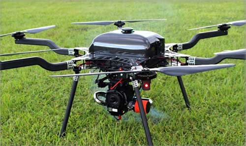
Lidar USA integrates lidar scanners with heavy-lift drones

Photo: Lidar USA Lidar USA is integrating its UAV scanning systems with the Harris Aerial H4/H6 Hybrid multicopters.
As surveyors and mappers experience growth, they assume larger and larger projects, making longer flight times increasingly important. The Harris Hybrid can provide such flights with lidar and industrial-grade cameras, allowing for far greater coverage in a single flight.
“The beauty of the Harris Hybrid, is that the pilot continues to enjoy the flexibility of a multicopter, availability of fuel, and relatively compact packaging at an affordable price,” said Jeff Fagerman, CEO of Lidar USA. “While it is louder than an all-electric system, for particularly large, rural projects it is a very nice solution.”
Harris Aerial, a drone manufacturer near Orlando, Florida, builds and sells heavy-lift hybrid multicopters. These copters use a small generator running on 95 (or higher) octane fuel to power the UAV for up to 5 hours. The H6 can carry an A-series HD lidar system of 3 kg for 2.5 hours and a V-series of 5 kg up to 1.5 hours.
For the lidar operator, most projects require only one or two flights. On projects that are relatively flat with a clear line of sight to the horizon in all directions, these systems can cover everything legally possible in a single flight.
Lidar USA offers the Harris Aerial H4/H6 Hybrid an integrated package with any Lidar USA scanning system.
-

L3Harris Technologies merger completed
The Harris-supplied navigation payload before integration into the second GPS III SV. (Photo: Harris) L3Harris Technologies announced the successful completion of the all-stock merger between Harris Corporation and L3 Technologies on June 29. Headquartered in Melbourne, Florida, L3Harris becomes the sixth largest defense company in the U.S., and a top 10 defense company worldwide, with approximately $17 billion in revenue and 50,000 employees, including 20,000 engineers and scientists.
Both companies have long been dominant presences in the U.S. GPS industry: Harris as a provider of the GPS satellite navigation payloads and geospatial intelligence software products, and L3 as a provider of military GPS user equipment and guided munitions. Both companies supply a wide range of other geospatially-related products as well.
L3Harris has organized its operating businesses into four segments to best meet customers’ mission requirements and leverage the combined company’s broad technical capabilities:
- Integrated Mission Systems — headquartered in Palm Bay, Florida, with approximately $4.9 billion in revenue. Includes intelligence, surveillance and reconnaissance; advanced electro optical and infrared solutions; and maritime power and navigation
- Space and Airborne Systems — headquartered in Palm Bay, Florida, with approximately $4.0 billion in revenue. Includes space payloads, sensors and full-mission solutions; classified intelligence and cyber defense; avionics; and electronic warfare
- Communication Systems — headquartered in Rochester, New York, with approximately $3.8 billion in revenue. Includes tactical communications; broadband communications; night vision; and public safety
- Aviation Systems — headquartered in Arlington, Texas, with approximately $3.8 billion in revenue. Includes defense aviation products; security, detection and other commercial aviation products; air traffic management; and commercial and military pilot training
Shares of Harris common stock, which traded on the NYSE under the ticker symbol “HRS,” began trading on July 2 under the ticker symbol “LHX.” L3 Technologies shares ceased trading upon market close on June 28 and have converted into 1.3 L3Harris shares for each L3 share.
The merger comes at approximately the same time that two other leading GPS companies, Raytheon and United Technologies, itself a merger including the former Rockwell Collins, now Collins Aerospace, also merged.
-

Harris and Grand Sky partner on UAS BVLOS super corridor

Photo: iStock.com/valio 84sl, via FAA Grand Sky Business and Aviation Park and Harris Corp. have joined forces to enable the country’s first and largest unmanned aerial system (UAS) airspace to support beyond visual line of sight (BVLOS) flight operations and UAS Traffic Management (UTM) research.
Stretching up to 100 miles, this BVLOS “super corridor” is the most technologically sophisticated UAS airspace supported by multiple and redundant systems for cooperative and non-cooperative surveillance.
These surveillance capabilities make possible a wide range of UAS BVLOS applications in precision farming, oil and gas, infrastructure inspection, public safety, package deliveries, and others.
“Customers of Grand Sky will have access to a truly unique UAS operational capability, in addition to better facilities, comprehensive airspace surveillance, and wide operational areas,” Grand Sky Development Co. President Thomas Swoyer Jr., said. “We all benefit from efficient and safe BVLOS flight operations and a larger corridor with proven FAA collaboration and flight authorizations.”
The surveillance system combines data feeds from a network of advanced sensors and towers. Two long-range primary radars located at Grand Forks Air Force Base and at Hillsboro, North Dakota, provide detection of non-cooperative aircraft.
The Federal Aviation Administration (FAA) secondary radars and ADS-B network in the region, as well as local Harris ADS-B Xtend sensors, add additional layers of visibility for cooperative aircrafts in the airspace.
Aviation-grade displays help pilots and electronic observers monitor the airspace environment over the BVLOS corridor and safely steer UAS from approaching manned aircraft.
The combination of best practices in aviation safety management, proven technologies and experience with BVLOS regulatory approvals will make it easy for users of the airspace to advance UAS technology commercialization and routine, efficient flight operations.
UAS operators can work with Grand Sky and Harris to develop, test, and refine a variety of complex BVLOS concepts of operations and secure waivers from the FAA for large-scale use.
A full range of UAS operations can be supported for all types and sizes of unmanned aerial vehicles along the BVLOS corridor including a variety of airspace classes and execution of diverse defense, civil and commercial applications.
“This is another first for Grand Sky and North Dakota in leading the UAS Industry,” Harris Vice President and General Manager of Commercial UAS Solutions George Kirov said. “The size and complexity of the airspace opened to UAS BVLOS operations is unmatched in the UAS industry. The sophistication of the Harris BVLOS system at Grand Sky is also unprecedented — linking Harris’ most advanced suite of surveillance and detect-and-avoid services with a variety of surveillance assets that, together, ensure the highest level of UAS aviation safety.”
This partnership lays the foundation for larger and more capable surveillance corridors to enable UAS “highways” across the state of North Dakota and in support of expanding the variety of commercial UAS operations across the United States.
-
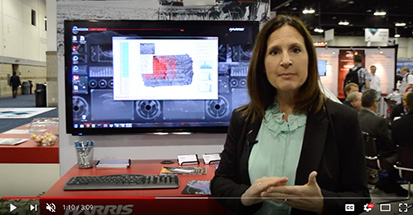
Harris showcases PrecisionPass solution at Xponential 2018
Rebecca Lasica, director of enterprise platforms and partners at Harris Geospatial Solutions, offers a rundown on the company’s PrecisionPass solution at Xponential 2018. According to the company, PrecisionPass enables UAV pilots to quickly determine in the field if a data collection meets the required criteria or if it needs to be collected again.
-
System of Systems: GPS III payloads delivered
QZS-2 signal analysis, QZS-3 launched
The second satellite of Japan’s Quasi-Zenith Satellite System (QZSS) has started transmitting navigation signals. QZS-2, or Michibiki-2, was launched on June 1, 2017, and joins its predecessor QZS-1 (Michibiki-1), which has been in orbit since September 2010.
Both satellites have been placed into inclined geosynchronous, elliptical orbits, which enable extended satellite visibility periods over Japan and are characteristic features for this regional navigation system.
The third satellite QZS-3 was launched on Aug. 19, 2017, into a geostationary orbit. If all goes according to plan, a fourth satellite in an eccentric orbit will follow by the end of this year and complete the constellation.
GPS Monitor Station Receivers Deployed
Three of six new Lockheed Martin-developed receivers are now deployed at U.S. Air Force monitoring stations to maintain the accuracy of GPS satellite signals.
In June, the first Monitor Station Technology Improvement Capability (MSTIC) receiver became operational at Cape Canaveral Air Force Station, Florida. Upgrades continued at USAF monitoring stations at Kwajalein Atoll and Hawaii. These upgrades from early 1990s technology are part of an overall effort to modernize the current GPS ground control system, known as the Architecture Evolution Plan Operational Control Segment.
MSTIC software-defined radio technology replaces legacy receivers’ hardware-based application-specific integrated circuit platform. MSTIC leverages commercial off-the-shelf hardware without the need for custom firmware. Standard interfaces and architecture configurability simplify sustainment and enable MSTIC software to migrate to new hardware platforms as commercial vendors increase processing power, improve reliability and enhance cybersecurity. MSTIC enables remote application of mission-specific software updates to improve performance and enable reception of modernized GPS signals, according to the company.
The three remaining GPS Monitoring Stations will be upgraded with MSTIC receivers by the end of 2017.

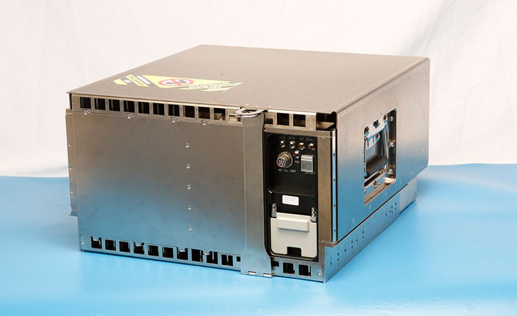
The navigation payload before integration into the second GPS III SV, which now is in environmental testing. (Photo: Harris) GPS III Payloads Delivered
Harris Corporation has delivered the third of 10 advanced navigation payloads to Lockheed Martin. The payloads will increase accuracy, signal power and jamming resistance for GPS III satellites. They feature a Mission Data Unit (MDU) with a 70-percent digital design that links atomic clocks, radiation-hardened computers and powerful transmitters, enabling signals three times more accurate than those on current GPS satellites. The new payloads also boost satellite signal power, increase jamming resistance by eight times and help extend the satellite’s lifespan.
The payload was integrated into GPS III SV03 over the summer. The first navigation payload is integrated aboard GPS III SV01, which is in storage awaiting expected 2018 launch.
Harris announced it is in full production and on target to deliver the fourth GPS III navigation payload to Lockheed Martin in fall. Harris is also developing a fully digital MDU for the U.S. Air Force’s GPS III Space Vehicles 11+ acquisition. The new MDU will be demonstrated in fall 2017 and provides even greater flexibility, affordability and accuracy versus existing GPS satellites.
Next GLONASS-M Readied
The Russian navigation satellite GLONASS-M 52 moved from ISS-Reshetnev Company’s assembly plant to the Plesetsk Cosmodrome launch site about 800 km north of Moscow in August. One of the system’s ground spares, it was built more than two years ago and stored awaiting launch. The satellite is due to launch in September.
There are six GLONASS-M satellites in ground reserve.
-
Harris providing industry training to NGA employees
Harris Corporation and the National Geospatial-Intelligence Agency (NGA) are partnering to provide industry training for NGA employees, including skills in industrial practices and procedures which are not available through military or civil education programs.
Participants in the Training with Industry (TWI) program spend a year at Harris learning its business practices — such as workflows, innovative technologies and commercial processes — and then execute an assignment directly related to the training they received.
-
Harris displays RangeVue UAS detect-and-avoid system at Xponential 2017
Harris Corporation’s James Cieplak discusses the company’s RangeVue UAS detect-and-avoid system and how it works at AUVSI’s Xponential 2017 in Dallas.
-
SpaceX launches first batch of Iridium NEXT satellites
Iridium Communications Inc. has successfully launched its first 10 Iridium NEXT satellites, which will support real-time automatic dependent surveillance broadcast (ADS-B) operations in oceanic regions.
Iridium NEXT is the company’s next-generation satellite constellation, replacing and enhancing its existing network of low-Earth orbit satellites spanning the entire globe — the largest commercial satellite constellation in space.

A SpaceX Falcon 9 rocket lifts off from Space Launch Complex 4E at Vandenberg Air Force Base, California, Jan. 14. (Photo: SpaceX) The satellites were delivered into low-Earth orbit an hour after a SpaceX Falcon 9 rocket lifted off from Vandenberg Air Force Base in California at 9:54:39 a.m. PST on Jan. 14.
The launch is the start of a series of Iridium NEXT launches scheduled over the next 18 months, and marks the beginning of one of the biggest “tech refreshes” in history, completely replacing the only satellite constellation providing 100-percent global communications coverage.
Once fully deployed, Iridium NEXT will enable a new broadband multi-service capability called Iridium CertusSM, while providing the technical flexibility to support innovative new services and technologies from Iridium’s extensive partner network.
Aircraft surveillance
Among those technologies is a unique hosted payload from Iridium’s partner Aireon, which will provide a real-time global aircraft surveillance service, extending aircraft visibility across the planet.

Aireon’s space-based ADS-B receiver network will relay signals from all ADS-B equipped aircraft to controllers worldwide, allowing 100 pecent global air traffic surveillance. (Image: Aireon) According to Aireon, its space-based ADS-B network will transform air traffic management capabilities, providing air traffic surveillance and flight tracking across 100 percent of the planet. Currently, more than 70 percent of the earth, including oceanic and remote airspace, has no existing air traffic surveillance.
The first 10 Iridium NEXT satellites were delivered to a 625 kilometer (km) temporary parking orbit where they will be tested and exercised by Iridium over the coming weeks. Upon meeting testing and validation requirements, the satellites will then be moved into their 780-km operational orbit and begin providing service to Iridium’s customers.
As part of this testing and validation process, Aireon’s ADS-B receivers, which were manufactured by Harris Corporation, will provide air traffic surveillance data through the Aireon network to the Service Delivery Points (SDPs) at partners NAV CANADA, NATS, ENAV, the Irish Aviation Authority (IAA), as well as the Federal Aviation Administration (FAA) William J. Hughes Technical Center in Atlantic City, New Jersey.
One by one, the new satellites will be positioned near a current generation satellite, each moving at approximately 17,000 miles per hour as testing begins. Iridium’s inter-satellite communication links from nearby satellites will be repositioned to point to the new Iridium NEXT satellite as it prepares to take over service. Existing satellites will eventually be de-boosted and de-orbited.
“Today Iridium launches a new era in the history of our company and a new era in space as we start to deliver the next-generation of satellite communications,” said Matt Desch, chief executive officer of Iridium. “We have been working endless hours for the last eight years to get to this day, and to finally be here with ten Iridium NEXT satellites successfully launched into low-Earth orbit is a fulfilling moment. We are incredibly thankful for all of the hard work from our team, as well as our partners, to help us achieve this milestone.”
Both Thales Alenia Space, System Prime Contractor for the program, and their subcontractor for production, Orbital ATK, have been integral in the development of the Iridium NEXT program, from the design and manufacturing of the Iridium NEXT satellite vehicles to managing an 18-station, state-of-the-art assembly line production system.
“Leading a worldwide team to manufacture, assemble, test and prepare each satellite for this moment has been incredibly exciting,” said Bertrand Maureau, executive vice president of telecommunications at Thales Alenia Space. “We are very proud to have conducted such a unique program, in terms of scale and complexity as well as to have successfully completed the end-to-end whole constellation on-ground validation. The system is fully tested, and the compatibility of Iridium NEXT with the Block-1 operating satellites has been perfectly demonstrated. It has truly been an honor, and we are looking forward to completing the rest of the Iridium NEXT constellation through 2017 and early 2018.”
“We are proud to be a part of this revolutionary satellite program,” said Frank Culbertson, president of Orbital ATK’s Space Systems Group. “Seeing these first ten satellites launch successfully into space is the result of a unique assembly-line process at our satellite manufacturing facility that represents a remarkable achievement. We look forward to seeing the innovative solutions these satellites, which are great examples of leading-edge technology and manufacturability, will enable.”
In addition to partnering with Thales Alenia Space as System Prime Contractor, Iridium has partnered with SpaceX for the launch of 70 Iridium NEXT satellites on its Falcon 9 rocket.
“We are very proud to be chosen as the launch provider for the entire Iridium NEXT program and are excited about today’s successful first launch,” said Gwynne Shotwell, President of SpaceX. “Iridium was one of SpaceX’s first customers, and working alongside them to deliver one of the largest aerospace projects underway is an exciting moment for us at SpaceX.”
Iridium and SpaceX are partnered for a series of seven launches, deploying ten Iridium NEXT satellites at a time. The next major milestone will be the completion of on-orbit testing of these satellites, to validate performance requirements are met.
The second Iridium NEXT launch will be scheduled after testing is completed in April. The entire Iridium NEXT network is scheduled to be completed by mid-2018.
-
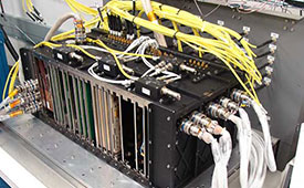
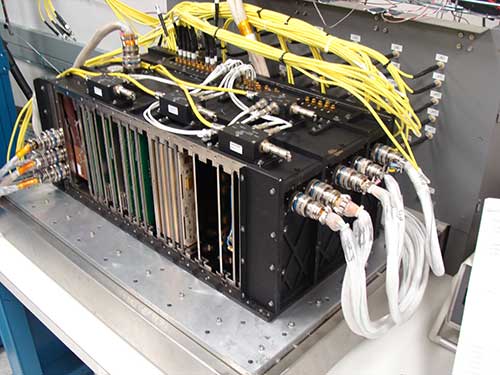
Harris delivers first OCX receiver
Photo: Harris Harris Corporation delivered the first of 34 modernized receivers to support the GPS Next-Generation Operational Control System (OCX). They will receive the signals sent by the current GPS satellite constellation plus the new signals sent by the next generation GPS III — 13 military and civilian signals in all.
The receiver was shipped to the prime contractor, Raytheon Company, in Aurora, Colorado, after it passed a critical electromagnetic interference test, the first of many stringent qualification requirements. Though the receivers will be placed throughout the world, this first production unit will be installed in Aurora as OCX software development and integration continues.
OCX will replace the existing ground control system that receives signals from the 31 operational GPS satellites already orbiting Earth. Only OCX will be able to receive and decrypt all GPS III military and civil signals, however.
In addition to receivers, Harris has delivered 14 ground encryptors that will help protect the GPS signal. Harris also is providing critical software elements, which provide the fundamental navigation data to the GPS satellites and enable U.S. Air Force operators to better know and monitor the exact position and timing of the GPS constellation.
Pictured here is the advanced MDU on navigation payloads being delivered for GPS III Space Vehicles 1-10. (Photo: Harris)

