Icaros Inc., a provider of aerial remote sensing services and software, has announced that Harris Geospatial Solutions, a division of Harris Corporation, will offer the Icaros OneButton family of image processing software as a front-end complement to its ENVI geospatial analytics solution for users extracting information from manned and unmanned aerial sensor data.
“Together, OneButton and ENVI create a complete image processing and analytics workflow for aerial image data,” said Tom Bosanko, Icaros CEO. “Both packages are highly customizable to meet the needs of specific vertical market applications.”
Icaros developed the OneButton family for geospatial end users to easily and automatically generate precise, fully orthorectified 2D maps and 3D models from frame-based aerial imaging systems. Originally engineered for manned aircraft sensors, the OneButton software has been modified to accommodate the collection conditions of unmanned aerial systems (UAS).
“The combination of OneButton and ENVI provide best-of-breed, application-specific image processing and analytics, that enable customers to solve challenging problems related to everything from agriculture and forestry to utilities and city planning,” said Beau Legeer of Harris Geospatial Solutions.
OneButton automatically processes raw raster imagery with onboard GPS/IMU data to stitch the individual scenes together into a seamless, color-balanced orthomosaic meeting photogrammetric standards.
Outputs include digital elevation models (DEMs), true color 3D point clouds, multispectral mosaics and controlled oblique imagery — all ready for ingest directly into the ENVI software environment.
OneButton comes in both Standard and Professional versions. The Standard package asks the end user to specify the application and terrain type for the project at hand. The software then intuitively sets parameters of the photogrammetric engine to perform the mosaicking to the level of precision required. For example, the processing algorithms would handle flat agricultural fields different from a rolling urban landscape.
“The Professional version is more customizable, allowing end users to adjust the processing parameters themselves based on the precision they need, and then edit the resulting mosaic to remove anomalies, like an airplane moving down a runway. OneButton Professional was specifically designed to generate results with the efficiency and accuracy necessary for large scale projects and survey-quality results,” Bosanko said.
OneButton is platform and sensor agnostic, and processes raster image data from small-, medium-, and large-format frame sensors capable of capturing visible RBG, multispectral, near-infrared and thermal infrared data.
The OneButton solution for ENVI is available now to existing and new customers, and both companies expect further technology integration in the near future around cloud enablement of the UAS data processing and analytics workflow.
Esri and Harris Corporation are embarking on a broad strategic relationship to develop modernized foundation GEOINT data production, apps and tools within a WebGIS environment, for federal agencies.
The partnership will advance the state-of-the-art in automated GEOINT (geointelligence) production methods leveraging commercial-off-the-shelf (COTS)-based solutions.
The collaborative effort will help programs across multiple security domains to meet the expected surge of commercial imagery from small satellites, unmanned aerial system (UAS) platforms and open-data sources.
Visit Esri and Harris Corporation at GEOINT Symposium 2016 this week: booth 828 Harris; Booth 600 Esri.
The latest release of ENVI software, version 5.3, adds significant lidar point cloud analysis and visualization capabilities that previously were only available in the ENVI lidar software package. The Harris Corporation software offers users a single software interface to work with hyper-spectral, multi-spectral, panchromatic and lidar data.
The out-of-the-box functionality includes 3D point-cloud visualization, derived terrain product generation (such as digital elevation models) and lidar analytics such as viewshed line-of-sight calculation.
For users who need point-cloud or terrain products in an area where collecting lidar is not feasible or is too expensive, the ENVI Photogrammetry Module is able to generate synthetic 3D point clouds from stereo optical imagery to take advantage of existing imagery archives.
The dimension of time can be critical for a thorough geospatial analysis of an area, and the new ENVI release has added enhancements to the Spatio-Temporal analysis toolset. Spatio-Temporal analysis visualizes change and derives statistics from data over time, enabling users to observe events of the past to better predict upcoming activities.
New additions were also added to the ENVITask system, a relatively new method for performing discrete bits of image processing programmatically through the ENVI object-based API. This programmatic approach to image processing can save time because users can chain together multiple ENVITasks, allowing the output from one ENVITask to become the input to the next. There are now 138 ENVITasks available in the ENVI API.
Harris Corporation has expanded a collaboration with Boundless to further extend its capabilities in open-source geospatial technology. This partnership makes it easier and more cost-effective for customers to access, manage and share the huge amount of location-based data available from devices, sensors and satellites, the companies said.
Most recently, Harris has developed a geospatial data warehouse called One Object One Time (1O1T), which eliminates redundant data and stores the most current representation of geospatial objects such as a lighthouse or communications tower. This capability ensures data currency and significantly reduces the time required for processing and delivering content and products compared with traditional methods.
Harris is using 1O1T to provide content management services and create high-quality data and products for use by a wide variety of government and commercial customers.
Boundless’ OpenGeo Suite is an open-source enterprise geospatial software bundle. It expands Harris’ existing offerings like 1O1T. Boundless experts support and consult around the implementation of OpenGeo Suite components including GeoServer, PostGIS, Open Layers and QGIS.
“We like Boundless’ savvy and nimble approach to providing open-source geospatial software and services,” said Tim Ellis, director of Harris’ IntelliEarth geospatial business. “This is a very productive collaboration for both companies and most important, our customers.”
“Harris provides top-notch, responsive products for some of the most important geospatial initiatives in the world,” said Boundless CEO Andy Dearing. “Together, we are extending the possibilities of the open-source geospatial platform.”
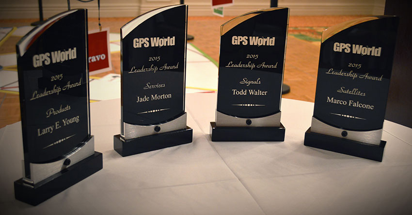
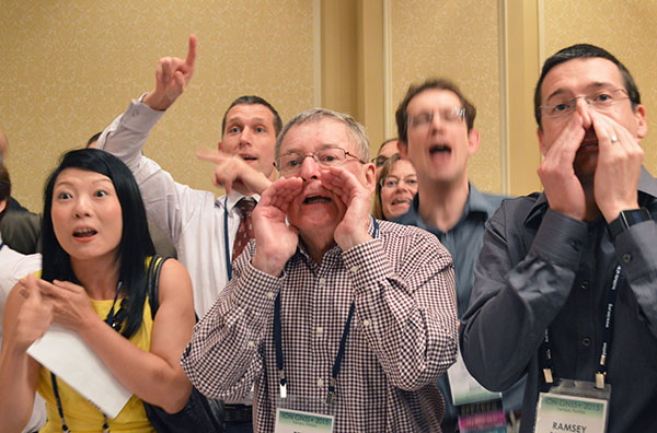
GPS World‘s Leadership Awards were presented during a sponsored ceremony and dinner at ION GNSS+ 2015 in September in Tampa. The awards recognize significant recent achievement in four fields of position, navigation and timing: satellites, signals, services and products.
Nominations came from a group of industry executives and the magazine’s Editorial Advisory Board. Votes were cast by a slightly larger group of added VIPs from the community.
The Leadership Dinner was sponsored by Lockheed Martin, Harris, Raytheon and Braxton Technologies.
Satellites category winner
Marco Falcone, Galileo System manager, European Space Agency
Falcone led the Galileo program through a very difficult time, following the faulty orbital injection of the first two operational Galileo satellites in August 2014. He gave detailed descriptions of the anomalous launch, the planned activities to salvage what was possible from the event, and the likely impact of this event on the program. His mission control team worked around the clock to ensure that the satellites were configured so that final orbits would provide some utility to the Galileo program.
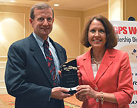
Remarks delivered by Daniel Blonski, system performance engineer at ESA, on behalf of Marco Falcone:
Marco Falcone, Galileo System manager, European Space Agency, winner of the 2015 Leadership Award for Satellites.
I would like to thank GPS World and the GNSS Community.
The recovery of satellites 5 and 6 of the Galileo constellation following the August 2014 launch wrong-orbit injection demonstrates the multidisciplinary capability of the European Space Agency and its industry. In fact, this recovery involved around 300 experts from our mission analysis and flight-control teams, system engineering signal and user receiver teams, space segment engineering teams, ground control and mission segment teams, as well as security operations. This award goes first of all to them for having believed in this recovery from the very first moment.
I apologise for not having been able to join this event in person due to the Launch and Early Operations Phase of the 5th Galileo Launch, which occurred Sept. 10. Galileo has now 10 (I repeat, 10) Satellites in orbit and operations are running smoothly. I count on GNSS chipset manufacturers to introduce Galileo constellation in their chipsets and eventually have Galileo-enabled devices as of next year.
In addition, the European Space Agency is also preparing for the future. In fact, we need already now to plan those system improvements that are necessary to replenish the constellation after 2020. These improvements go into the direction of higher positioning and timing accuracy, long-term validity ephemeris and faster time to first fix, improved interoperability with other GNSS and contribution to space users service volume, additional spoofing/jamming protection through authentication, enhanced online monitoring and signal-in-space flagging functionalities, as well as flexible digital signal generation to cope with the rapid time to market required for new services evolution.
Again, I thank you for recognizing the efforts of our teams at ESA and in industry. This award gives us even more energy.
Serving over A billion users every day
The most powerful GPS satellite ever is on its way
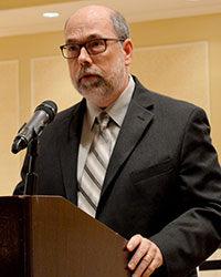
Remarks delivered by John Frye, program manager, Navigation Systems Advanced Programs, Lockheed Martin:
John Frye, program manager, Navigation Systems Advanced Programs, Lockheed Martin.
I would like to thank GPS World for the opportunity to speak briefly at this year’s GNSS Leadership Awards.
At Lockheed Martin, we are proud to continue our support of the U.S. Air Force’s GPS program. We applaud the Air Force on this year’s 20th anniversary of the GPS constellation reaching full operational capability.
This is a tremendous milestone in the history of positioning, navigation and timing, as well as global navigation satellite systems. In addition, I’d like to recognize tomorrow’s 68-year anniversary of the establishment of the Air Force.
Lockheed Martin is honored to have contributed to the GPS milestone. Right now, 19 of our GPS IIR and IIR-M satellites make up about 60 percent of the current GPS constellation. It is a real privilege to be serving more than a billion military, commercial and civilian users every day. But our commitment doesn’t end there. If you had the opportunity to see the pictures in our booth, you know that Lockheed Martin will soon be introducing the world to GPS III — the most powerful GPS satellite ever developed — and GPS III will be the first GPS satellite to field the internationally compatible L1C signal, offering a new level of GNSS compatibility.
So, thank you. It has been an honor to speak before you, the international PNT community. Thank you for all that you do, and congratulations to all of tonight’s honorees.
New messages: Any SBAS, any GNSS
Signals category winner
Todd Walter, senior research engineer, Stanford University
This past year, Todd completed the message design for dual-frequency, multi-constellation SBAS, a huge step forward for aviation and other multi-constellation users. It means that SBAS will be able to provide corrections and integrity data for all constellations, leading to better accuracy and availability.
Remarks delivered by Todd Walter:
Todd Walter, senior research engineer, Stanford University, and Ellen Mitchell, senior communications manager, Space and Intelligence Systems, Harris Corporation.
I ’d like to thank GPS World for this award. In reality, the work on the dual-frequency, multi-constellation SBAS messages has been a long ongoing group effort. Numerous people at Stanford, the FAA, Zeta, MITRE, ESA, CNES, RTCA, EUROCAE and others have contributed to the development of the planned messages on L5. ESA and CNES in particular have been handling the document management and comment resolution.
I would also like to especially thank my colleagues at Stanford University for their hard work and support.
The new messages now planned for L5 will allow any SBAS to correct any constellation that it chooses. Rather than only supporting L1-only signals on GPS, as the current systems do, SBASs will be able to support the use of two frequencies, using as many constellations and satellites as they choose to monitor.
We will no longer need to suffer availability outages due to limited satellite geometries. Furthermore, we will not suffer availability limitations due to ionospheric disturbances. Dual-frequency operation will allow precise vertical guidance throughout the globe, and in particular in equatorial regions.
The original L1 SBAS specification took more than 20 years of development. The new dual-frequency multi-constellation specifications are even more complicated and will require a similarly long development time. Our latest effort started many years ago when the GPS L5 was initially planned to be fully operational in 2018. Since that time, the GPS L5 date has moved back to 2024.
And in the mean time, the other constellations have progressed in their development. Our original efforts changed from a dual-frequency update to the SBAS messages into a truly multi-constellation concept.
In order to utilize new constellations and new signals for aviation, it is essential that the designs of these signals be stable and clearly documented. Furthermore, we require performance commitments from the constellation providers so that we can know what to expect.
To date, GPS leads the way in both of these requirements. Its signal designs have been stable and well described for many years, and it has published performance standards documenting the level of performance we can count on. There is widespread expectation that the other constellations will be very similar to GPS. However, this will not necessarily be the case.
We need to be prepared to deal with constellation-specific behaviors. Already we recognize differences in how GPS and GLONASS operate. We can only expect to uncover additional differences as we further utilize these constellations. Also, as we field new satellites and a new control segment on GPS, we can expect to see behavior that might be different from some of our fundamental assumptions.
It is important to plan for the future in order to incorporate new signals and new constellations; however, we must remain flexible with our planning to incorporate the reality of what we actually get.
— Postscript added in November: Thanks again for the award, it looks very nice on my desk!
All about the signal
Remarks delivered by Ellen Mitchell, senior communications manager, Space and Intelligence Systems, Harris Corporation:
On behalf of the Harris Corporation and its more than 22,000 employees, I congratulate the award recipients this evening. It is particularly fitting that Harris has the honor of presenting the Signals award. As the GPS navigation payload provider, we create and deliver the GPS signal. Furthermore, our products help our customers better utilize the GPS signal and detect and prevent jamming of the GPS signal. We’re all about the signal.
This is our first year at this dinner as Harris employees. As a result of Harris Corp. acquiring Exelis on May 29, there now are 9,000 engineers and scientists in the new company. Many Harris colleagues have expertise in areas directly applicable to cutting-edge GPS payload development, for example. Current and future customers will benefit from working with this larger and even more capable new team.
We believe the combination of Exelis’ heritage of proven, assured GPS navigation payloads joined with Harris’ skill in the RF spectrum, satellite communications and reprogrammable payloads gives the new company a unique and innovative edge to support the next generation of GPS satellites.
We look forward to telling you more about our progress at next year’s Leadership Dinner. But this year, now, without further ado, I’d like to call Todd Walter to the dais to receive the Leadership Award for significant recent achievement in the area of Signals. Thank you for this opportunity.
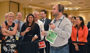
After the awards ceremony and dinner, attendees played the Interference Event, competing to see which team could generate the strongest, most accurate signal, conveying critical information in a GNSS trivia game.
Unprecedented opportunities
Services category winner
Jade Morton, professor, Colorado State University
For her work on advanced GNSS receiver algorithms for accurate and reliable operations in challenging environments; studies of the atmosphere using radar and satellite signals; and development of new applications using satellite navigation technologies. Her research has contributed to understanding of space weather phenomena and their effect on GNSS signals.
Remarks delivered by Morton:
Jade Morton, professor, Colorado State University
Thank you for a wonderful evening, and for offering the GPS World Leadership award to me. I am humbled!
Over the past decade, we have witnessed rapid progress in the development of multiple constellations of GNSS. While much of the focus has been on improvements in the availability, integrity, continuity, and inter-operability of multi-GNSS for PNT applications, a real winner as far as scientific discovery is concerned is in the use of GNSS in atmospheric and space weather studies. With a large and growing number of free open signals across a wide range of frequencies in the L-band, multi-GNSS will be able to provide distributed, low-cost, passive remote sensing of the atmosphere on a global scale. It is fair to say that there is no other technology that offers comparable potentials, coverage and cost-effectiveness.
In the coming decade, multi-GNSS will offer unprecedented opportunities for researchers to measure atmospheric and ionospheric parameters with high spatial and temporal resolution, and monitor atmospheric responses to solar, geomagnetic and other natural and man-made events.
This is an exciting time for multi-GNSS technological development and atmospheric research. I am fortunate to have the opportunity be a part of it and to explore and contribute to the interesting intersection between GNSS and the atmosphere.
Securing GPS against attack
Remarks delivered by Steve Moran, business development director, Raytheon:
Steve Moran, business development director, Raytheon
It’s great to be here with colleagues who understand the importance of a modernized GPS infrastructure.
I was asked to speak tonight because Raytheon is partnered with the Air Force in modernizing the GPS ground segment, which is at the core of the Air Force’s GPS modernization initiative. We like to call OCX the brains of GPS.
Over the past 30 years, GPS has ensured the safety and effectiveness of our nation’s warfighters and has become an integral component of global and national telecommunication, commerce and transportation infrastructures.
The GPS modernization initiative is essential to protecting our economy and the homeland, as GPS is an ingrained part of our nation and our world’s infrastructure. As critical as GPS is to so many key functions of daily life, it must be secured against cyber attacks.
The emergence of growing cyber threats creates daily headlines and drives an urgent need for GPS modernization. GPS has been recognized as an enabler of nearly all U.S. critical national infrastructure, such as the power grid or the water supply, and is a global utility that must be ready for emerging cyber threats.
OCX is a pathfinding program that answers that need and will deliver many other benefits to GPS users across the globe. Some of the new capabilities include enabling new civil and military signals; improving system accuracy and integrity; providing flexibility and evolvability to meet future mission needs; setting the bar for information assurance at an unprecedented level; and securely sharing information with net-connected users.
Raytheon’s OCX represents new approaches to emerging and even unimaginable changes and threats. We are confident that we have the right technology, team and resources in place to deliver the OCX program. It is critical we do so.
Thank you for inviting me here tonight, and I offer a sincere congratulations to all of the GPS World Leadership Award winners.
Novel GPS/GNSS uses just keep coming
Products category winner
Larry E. Young, GPS systems group supervisor, Jet Propulsion Laboratory
For many years he has been key in the development of radiometric technology. Specific areas of research include the development of GPS science receivers, multipath mitigation, sub-nanosecond clock synchronization, and sub-centimeter formation flying. He has been instrumental in developing the TriG multi-Global Navigation Satellite System receiver used in radio occultation to measure physical properties of the atmosphere, and key to NASA’s efforts to protect radionavigation satellite services from interference.
Remarks delivered on behalf of Larry E. Young by James J. Miller, deputy director, Policy and Strategic Communications, Space Communications and Navigation, NASA:
James J. Miller, NASA
I would like to thank GPS World and the GNSS community.
I greatly appreciate the honor conveyed by this award. We all know that most advances in technology are made by a team of smart, enthusiastic and hard working scientists and engineers. JPL’s advanced GNSS receivers are a true example of teamwork.
In particular, Don Spitzmesser was a prolific inventor who could quickly conceive of, build and test novel circuits and antennas. I do not think he ever passed kitchen utensils without thinking of antennas. There are actually “heli-wok” antennas in space. The original helix was wound onto a glass, glued onto a wok backplane.
Lyle Skjerve was a highly skilled experimentalist. His previous job was detecting incoming ground-to-air missiles from the backseat of a Marine jet, and conducting electronic countermeasures to steer the oncoming missile off course. In addition to being smart, he was quick to debug problems during an experiment, and never gave up.
NASA headquarters has provided great support to GNSS technology, continuing the program Jim Miller leads today. I especially thank John LaBrecque, who provided critical early support for our speculative development of the “all-digital” receivers that produced 0.1-millimeter baseline precision.
I have been very happy to be able to work on GPS, and I am most thankful for the great group of colleagues I’ve had the fortune to work with at JPL and from other NASA centers.
My training was in experimental nuclear physics, where I was excited to measure the anomalous orbital magnetic moment of a neutron orbiting inside a superconducting magnet on the beam line of a tandem Van deGraff accelerator. I always enjoyed building measurement systems for first-time measurements.
After graduation, I got an opportunity to shift from nuclear scales too small to see (femptometer) to those too large to imagine (109 lightyears), characteristic of the distances to quasars. In all, that was a change of 40 orders of magnitude! The Jet Propulsion Laboratory hired me to help develop Very Long Baseline Interferometry to measure tectonic plate drifts in real time, and oh yes, to precisely navigate NASA’s interplanetary spacecraft.
Larry e. Young, GPS Systems group supervisor, Jet Propulsion Laboratory
From VLBI, it was a short step to GPS. Even though quasars produce the greatest power levels known to man, the power per square meter is much higher from nearby GPS satellites. Scientists and engineers at JPL and elsewhere quickly realized that GPS would provide precision geodesy as soon as the first satellites were launched circa 1978.
During a 1984 receiver shootout among JPL’s SERIES and SERIES-X receivers, the MIT Macrometer, and Texas Instrument’s TI4100, we set up for the night’s experiment near an old Bilby tower in the desert. These were used in the old days to provide line-of-sight optical surveys. Now that we had GPS, those days were gone, and we (the shootout adversaries) teamed together and pulled down the tower, burning it to ward off the pre-dawn cold. It seemed quite symbolic. Remember, back then the only time four satellites were mutually visible in the winter was during early morning.
The current set of JPL’s receiver developments started when Tom Yunck realized we could use radio occultation, developed for interplanetary spacecraft, as a very useful means to probe the Earth’s atmosphere.
Novel uses for GPS/GNSS just seem to go on and on, as smart innovative people around the world continue to find productive new applications. Some of the older ideas we are working on include using non-GNSS signals for navigation and remote sensing, using GNSS signals as sources for bistatic radar measurements, and applying the GPS receiver’s precise phase shifters to form dynamic multiple high-gain antenna beams.
As always, advances in computers and chips will help drive applications. Our receivers have always been software driven and flexible, and the exponentially growing throughput of digital devices shows no signs of slowing. We are at a point where the number of GNSS satellites is exploding. Other signal sources are available to aid navigation and remote sensing. I do not want to call the exact shot, but I am confidant that at least one person reading this magazine today is already thinking of a new GNSS breakthrough, which will delight the world with its applications!
Commercialization and competition
Remarks delivered by Edward Baron, director, Braxton Technologies:
Edward Baron, director, Braxton Technologies
I would like to thank the GPS World team for organizing another wonderful awards dinner. As a commercial product company, Braxton is honored to help sponsor this event recognizing tonight’s Product Award innovator.
I’ve heard a few requests for innovation from the government this week. If they’re interested in innovation, I would like to make an argument for commercialization and competition as a key driver for it.
Within the navigation world, the receiver and application markets are excellent examples where innovation is driven by daily competition in a commercial market. It’s amazing to see the accelerating global pace of innovation these highly competitive markets drive — creating new and better products, along with their economic and social benefits.
We are also seeing competition between the constellations themselves, as they compete to increase their global market share.
If commercialization and competition drive innovation, and could benefit the performance of a constellation, who will take steps to commercialize other segments to improve their performance?
Galileo has already taken steps to commercialize their ground operations, and the U.S. is starting to talk about it.
It’s not possible to predict, but maybe in the future, GPS World will recognize someone for an innovation from a commercially operated GNSS system.
The Federal Aviation Administration (FAA) has selected Harris Corporation for an eight-year, single-award indefinite delivery/indefinite quantity (IDIQ) contract with a potential value of $238 million to design and implement a system that will disseminate real-time, comprehensive weather pictures to all aviation users across the National Airspace System.
The Common Support Services–Weather (CSS-Wx) program will help minimize flight delays and cancellations by providing additional weather data with increased accuracy to more aviation consumers, supporting real-time operational planning and decision-making.
“About 70 percent of flight delays are caused by weather,” said Carl D’Alessandro, vice president and general manager, Civil Programs, Harris Government Communications Systems. “The enterprise-wide, data-sharing design of the CSS-Wx solution will reduce these delays, saving the FAA and flying public precious time and money.”
The Harris CSS-Wx system is scalable, with Open Geospatial Consortium standards for common weather formats, and highly advanced geospatial- and temporal-based filtering methods to process meteorological data. It applies expertise the company has gained from work on mission-critical weather programs for the FAA, the National Oceanic and Atmospheric Administration and the Department of Defense.
Harris has a long history of developing and integrating system solutions for the FAA in support of the National Airspace System (NAS). The company is the prime contractor for the FAA Telecommunications Infrastructure (FTI) program, which provides critical voice, data and video communications for NAS operations and mission support functions. FTI securely connects more than 4,500 national and international FAA and DOD facilities, manages over 26,000 services, and supports more than 50,000 users. Other FAA programs developed by Harris include:
The Weather and Radar Processor, which provides weather processing dissemination and display capabilities to air traffic controllers in the en-route air traffic control environment;
Datacomm, which provides air-to-ground digital data link networks to connect FAA air traffic control sites and data communications-equipped aircraft;
The NAS Voice System, which provides a secure, IP-based voice network for critical communications between air traffic controllers, pilots and ground personnel nationwide;
The Operational and Supportability Implementation System, which serves the General Aviation community in Alaska by providing weather briefing and flight planning services; and
The National Air Space Enterprise Messaging Service, which will provide the FAA with the network-centric, collaborative information-sharing capabilities afforded by System Wide Information Management.
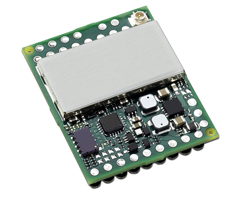
Rockwell Collins has signed a contract to provide its MicroGRAM GPS receivers (pictured here) for Harris Corporation’s tactical radios, bringing secure, jam-resistant GPS capability to products such as the Falcon III AN/PRC-158 and AN/PRC-117G.
Rockwell Collins has signed a contract to provide its MicroGRAM GPS receivers for Harris Corporation’s tactical radios, bringing secure, jam-resistant GPS capability to products such as the Falcon III AN/PRC-158 and AN/PRC-117G.
The contract, which represents the largest annual purchase of MicroGRAM, calls for Rockwell Collins to provide 5,000 GPS receivers to Harris over the next three years. Deliveries began in January.
“MicroGRAM enables Harris Corporation to meet military customer demands for embedded, secure GPS,” said Mike Jones, vice president and general manager of Communication and Navigation Products for Rockwell Collins. “MicroGRAM protects warfighters from the growing jamming and spoofing threats on the battlefield, while enhancing survivability and mission success.”
With this selection, Jones said Harris is one of the first major original equipment manufacturers to commit to using MicroGRAM to meet the Department of Defense’s (DoD) requirement to use Selective Availability/Anti-Spoofing Module (SAASM) technology in its products.
“Harris is pleased to continue our long relationship with Rockwell Collins as our provider of GRAM SAASM GPS modules. Integrating the MicroGRAM receiver into a number of our new tactical radios allows us to reduce the size and weight while extending the battery life of our products,” said George Helm, president, Department of Defense business, Harris RF Communications. “The end result is delivering reliable situational awareness down to the individual warfighter.”
MicroGRAM is the world’s smallest, lightest, lowest powered SAASM-based GPS receiver. It enables military micro-users who require secure Position, Navigation & Timing (PNT) to comply with U.S. DoD policy that all combat and combat support systems use SAASM-based GPS devices. This capability is critical at a time when threats to commercial GPS are increasing. The use of unprotected commercial non-SAASM GPS devices has inherent vulnerabilities which introduce a false sense of situational awareness on the battlefield.
Harris Corporation has developed a commercially available Geiger-mode lidar sensor. The Harris IntelliEarth Geospatial Solutions Geiger-Mode LiDAR sensor will provide customers with the ability to collect high-quality, wide-area elevation data faster and more affordably than before, Harris said.
Additionally, the company’s fully automated, high-volume production capabilities allow for rapid processing of large amounts of raw sensor data and automates quality control. Thousands of square kilometers of data can be processed in a few hours.
Harris is applying technology and processing methods it has perfected over the past 15 years in support of the U.S. Department of Defense to deliver superior, LiDAR-based data and derived products to commercial users at cost-effective prices, the company said.
With 10 times the collection speed and resolution of today’s best traditional lidar sensors, the Geiger-Mode lidar sensor makes wide area collections affordable for the first time.
Under Foundation GEOINT Content Management (FGCM) contracts, Harris will create high-quality data and products of the Pacific, North America, South America, and Africa regions of the world for use by the U.S. intelligence community and military. FGCM will contribute to and maintain a comprehensive, geospatially accurate map of the world that can be accessed quickly as intelligence, operational, and crisis needs arise.
Harris will use its One Feature One Time database, which automatically eliminates data redundancy and stores the most current representation of each geospatial feature. This capability ensures data currency and significantly reduces the time required for processing and delivery of products compared with traditional methods.
“Our unique solution provides improved accuracy, reduced production costs and significantly faster turn-around of geospatial products and content,” said Bill Gattle, vice president and general manager, National Programs, Harris Government Communications Systems. “This major win continues our legacy of providing high quality, responsive geospatial products to the intelligence and military communities.”