Hexagon has successfully completed acquisition of Inertial Sense, strengthening its assured positioning, navigation, and timing (PNT) portfolio with tactical-grade GNSS+INS technology.
The acquisition reinforces Hexagon’s long-term commitment to innovation in high-performance navigation technologies. Inertial Sense strengthens Hexagon’s positioning portfolio and further enhances its assured PNT capabilities.
Headquartered in Provo, Utah, Inertial Sense will continue supplying inertial navigation solutions and will be integrated into Hexagon’s Aerospace & Defence Division.
“Inertial Sense brings exceptional GNSS+INS innovation that advances our assured PNT roadmap and expands resilient positioning capabilities in GPS-challenged environments,” said Stig Pedersen, president, Aerospace & Defence Division, Hexagon. “Their compact, cost-effective solutions meaningfully enhance our ability to serve aerospace and defence applications.”
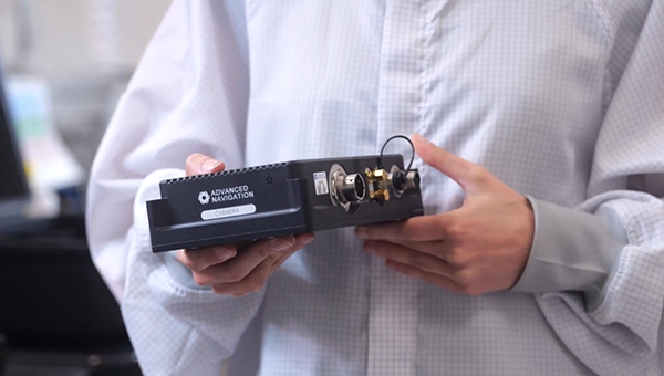
Inertial Sense is a provider of high-performance navigation solutions, with more than 30,000 inertial systems deployed worldwide across defense and commercial applications.
Inertial Sense was founded in 2013 by Walt Johnson, who started Inertial Sense 10 years ago to make precision navigation lightweight and affordable so that it could be deployed anywhere and accessible to any business. This includes the rapidly emerging industries of drones, mobile robotics, aerospace and defense, autonomous vehicles, and automated manufacturing, all of which would require scalable and affordable navigation solutions.
FastXY can transform standard mobile devices into professional-grade data collection tools for geospatial information systems (GIS) and architecture, engineering and construction (AEC) professionals. FastXY offers professionals the ability to collect point, line and polygon data, and delivers advanced capabilities including 3D basemaps, construction staking, topographic surveying, on-the-fly datum transformations and survey-grade elevations. A built-in Bluetooth data parser allows users to configure the app to collect data from virtually any instrument supporting BLE Bluetooth or RS-232 — including echosounders, radiation sensors, laser rangefinders, barcode scanners and more — and marry that data instantly with precise GNSS coordinates. Available in free and premium versions.
Handheld scanner: Designed for BIM, indoor scanning and reality capture
The RS7 handheld SLAM (simultaneous localization and mapping) scanning solution was built for BIM documentation, indoor surveying, renovation planning and complex spatial analysis. It is designed to help professionals capture high-density 3D data efficiently and convert it into practical deliverables through CHCNAV’s software and cloud ecosystem. The RS7 integrates a next-generation lidar scanner capable of measuring up to 1.15 million points per second. Its wide field of view (360° x 189°) supports comprehensive coverage of floors, walls and ceilings, helping reduce the need for repeated passes and complex capture maneuvers in tight or cluttered spaces. The scanner also includes a high-precision inertial measurement unit with bias stability better than 0.5°/h. By combining lidar and inertial data, the system is designed to maintain stable motion estimation and consistent point-cloud quality in environments that challenge many mobile workflows, including long corridors, repetitive structures, and feature-limited interiors.
Mobile scanner: All-in-one system offers SLAM, LIDAR, RTK and 360 degree imagery
The GX1 is an integrated, highly accurate all-in-one mobile scanning system combining simultaneous localization and mapping (SLAM), lidar, real-time kinematic (RTK) georeferencing, cameras and software. It supports a seamless workflow, from capture to deliverable, and can reduce the time required to survey a site by up to 95%. The independently validated global accuracy of 5 mm to 10 mm delivers the precision needed for topographic and road surveying, scan to building information models, construction progress tracking, and more. These capabilities are supported by integrated RTK georeferencing with real-time quality monitoring, four 20MP cameras for 360° panoramic imagery, and a proven SLAM algorithm. The GX1 has four deployment modes — backpack, survey pole, vehicle mount and supported handheld.
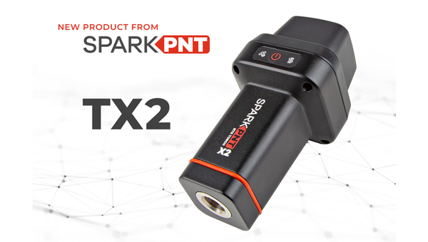
Quad-band GNSS rover: With support for Galileo high accuracy service
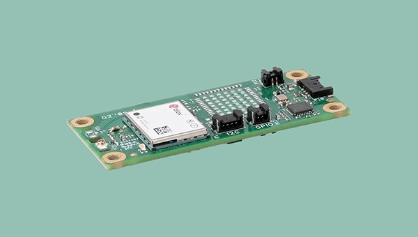
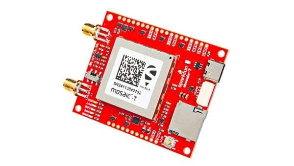
The SparkPNT TX2 quad-band GNSS rover combines an IP67-rated aluminum enclosure with support for Galileo’s High Accuracy Service (HAS) and standard RTK correction workflows. The receiver is built around the Quectel LG290P quad-band GNSS engine and supports multi-constellation tracking. Galileo HAS support provides sub-20 cm accuracy globally without subscription-based correction services, while RTK workflows via NTRIP or u-blox PointPerfect can achieve centimeter-level positioning. Battery life is rated at 50-plus hours, positioning the TX2 for multi-day field campaigns without recharging. The unit connects to iOS and Android devices via Bluetooth and WiFi, with compatibility reported for common GIS and data-collection applications. A notable design choice is the open-source firmware, which gives users visibility into how positioning data is processed and allows for customization and third-party integration. SparkFun has positioned this as an alternative to closed GNSS ecosystems where firmware and processing pipelines are not user-accessible.
Mobile
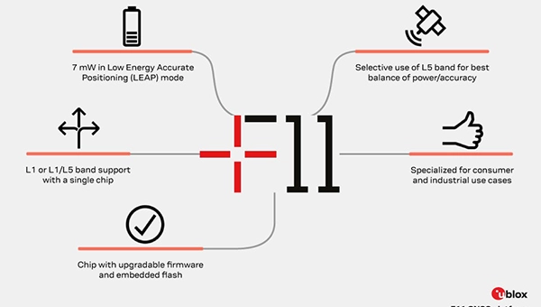
GNSS platform: Provides ultra-low power GNSS for all environments
The u-blox F11 platform provides L1/L5 dual-band standardprecision GNSS to improve positioning accuracy while reducing power consumption to as low as 7 mW in typical configurations. It combines ultra-low power operation with intelligent signal management to meet the evolving demands of tracking, wearables, telematics and mobility applications — including micromobility solutions and drones. The platform enables device manufacturers to achieve longer battery life, faster and more reliable position fixes, and greater design flexibility. Its situationally aware GNSS architecture, with integrated geofencing and indoor detections, dynamically balance accuracy and power consumption. By selectively using dual band L1/L5 operation only when it helps maintain positioning performance, the platform reduces energy use while providing resilience and maintaining confidence in location data.
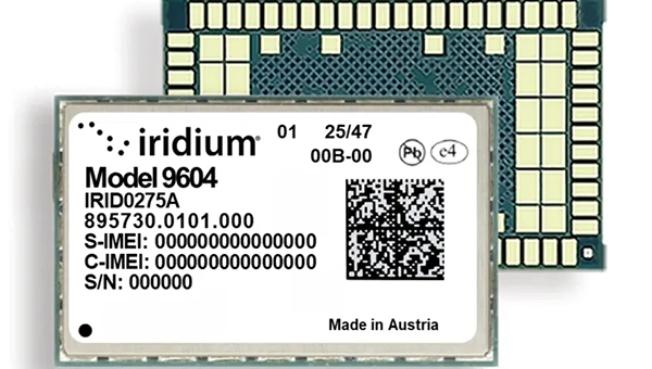
The Iridium 9604 is a compact, threein-one internet of things (IoT) module that integrates Iridium short burst data satellite service, LTE-M cellular connectivity, and GNSS positioning into a single platform. The Iridium 9604 seeks to make dual-mode IoT connectivity viable for price-sensitive, high-volume deployments. Built on the u blox SARA-R5 platform, the module comes in a compact 16 mm x 26 mm x 2.4 mm form factor, suitable for dual-mode IoT deployments across industrial, infrastructure and mobility applications.
L1+L5 GNSS modules: For trackers and high-precision IOT
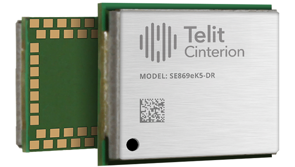
Two dual-band positioning modules built on Airoha’s AG3335 chipset series are available: the ultracompact SE873K5-D and the high-end SE869eK5-DRK. Both support space- and power-constrained IOT devices and use cases that require continuous, ultraprecise positioning. The modules provide a scalable path to adopt dual-band L1 + L5 GNSS.
Timing
Cesium-less clock: An alternative to cesium-accuracy holdover clocks
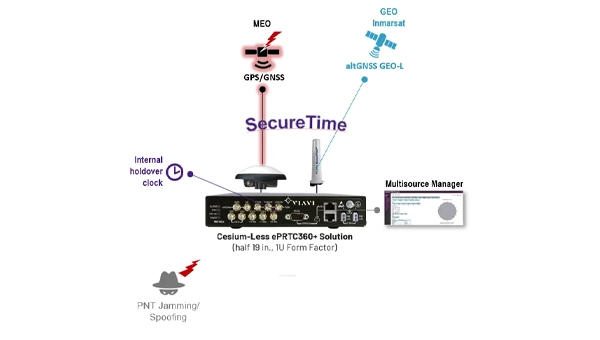
The patent-pending Cesium-less ePRTC360+ holdover solution is designed to safeguard atrisk infrastructure against the increased threat of GNSS timing disruptions. It is the only alternative to Cesium clocks to meet ITU-T G.8272.1 standards. It can protect critical power grids; transportation, aviation and public safety systems; 5G mobile networks; and AI data centers. It meets the international ITU-T G.8272.1 standard and has been successfully tested across a range of livesky defense and commercial jamming/spoofing environments. It has been integrated into VIAVI’s SecurePNT 6200 product series and can maintain 100 ns accuracy during GNSS-denied threats through the resilient altGNSS GEO-L service with no time limit.
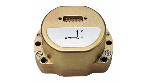
The U4930 series is a reliable and cost-effective six-axis microelectromechanical system (MEMS) and inertial measurement unit (IMU) module for navigation, control and measurement of vehicles, ships and drones. Applications include vehicle/ship attitude measurement, UAV attitude reference and trajectory control, mobile mapping, track inspection and underwater highprecision navigation. The U4930 series integrates high-performance MEMS gyroscopes and accelerometers within an independent structure. The three-axis MEMS gyroscopes sense the angular motion of the carrier, and the three-axis MEMS accelerometers sense the linear acceleration of the carrier. The system internally performs compensation for zero bias, scale factor, non-orthogonal error and acceleration-related terms across all temperature parameters, maintaining high measurement accuracy over a long period of time. The module supports custom communication protocols and provides synchronization for GPS/GNSS time data and pulse per second (PPS) signals.
Underground navigation: For navigating mines and unmapped environments
Chimera Land is a 3D laser velocity sensor (LVS) designed to solve the primary challenge for underground mining: maintaining precise vehicle positioning in deep, dark and unmapped environments where GPS cannot reach. When fused with an Advanced Navigation inertial navigation system (INS), Chimera Land allows underground vehicles to maintain stable navigation over extended distances and time. Instead of needing to query an external beacon or satellite for its location, the sensor uses specialized lasers to measure a vehicle’s ground-relative 3D velocity with high accuracy. By feeding this precise data into the vehicle’s INS, the sensor eliminates the drift that typically comes with standalone INS. Using AdNav Intelligence, the result is a resilient, high-performance, infrastructure-light positioning solution that excels in the highdust, zero-light conditions typical of underground mines.
Simulators
GNSS test tool: Provides real-world testing with signals from the field
The SimXTRACT GNSS test tool bridges the gap between field and laboratory. It enables signals captured in field environments to be comprehensively decomposed into individual, discrete signals and applied to lab simulation for realism at every stage of the development test cycle. Developers usually rely on either RF record-and-playback or lab simulation for testing and validation of PNT systems and devices. SimXTRACT takes real signals captured in field environments and performs complex signal decomposition, breaking down each received signal into discrete line-of-sight and multipath ray paths, along with metadata such as Doppler offset, code error, power level and angle of arrival. This decomposed environment is then automatically converted into fully controllable simulation scenarios for Spirent GNSS simulators.
Autonomous
Inertial measurement unit: For unmanned air, land and sea
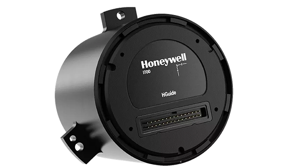
Honeywell launched the HGuide i700, an inertial measurement unit (IMU) that delivers high-accuracy performance for unmanned air, land and sea vehicles. By pairing near navigation-grade capability with a nolicense-required (NLR) classification, the HGuide i700 provides integrators worldwide with a new option for critical sensing and navigation. The HGuide i700 uses high reliability sensors and electronic architecture found in Honeywell’s HG3900 inertial measurement unit (IMU). Compact and low power, the HGuide i700 delivers near-navigationgrade accuracy and reliability while being optimized to support longer range navigation in GNSS-denied environments. The HGuide i700 offers strong GNSS-denied performance for by limiting maximum acceleration and spin rates in a license-free package. The latest in Honeywell’s HGuide suite of no-license inertial solutions, the HGuide i700 allows customers to streamline development cycles, simplify system architecture and transition to field deployment quickly. The HGuide i700’s rugged design, compact size and low-power profile make it suitable for diverse commercial, industrial and defense applications, including autonomous vehicles, mapping and surveying.
Anti-jam antenna system: Provides multi-constellation, multi-frequency GNSS signal protection
The GAJT-AE3 protects all major GNSS constellations from jamming with full multiconstellation, multi-frequency coverage, ensuring reliable PNT in demanding airborne environments. Its antenna electronics mitigate interference by creating up to seven nulls per band in the direction of jammers, providing significant anti-jam protection even in dynamic multi-jammer scenarios. The output is a protected radio frequency signal, free from jamming and suitable for input to modern and legacy GNSS receivers. The GAJT-AE3 protects and supports all GNSS frequencies, including L-band corrections and Iridium PNT.
OEM
GNSS board: All-band multifrequency reception and HAS-ready
Syslogic’s new all-band GNSS expansion board for rugged embedded computers is powered by the u-blox X20 receiver. It supports all major GNSS constellations and frequencies, including L1, L2, L5, L6 and L-band, and enables the use of the Galileo High Accuracy Service (HAS). It provides centimeter-level positioning, opening up new applications across industries such as autonomous field management, operation of construction machinery in remote areas, or navigation of automated guided vehicles and autonomous mobile robots. The GNSS board is designed for worldwide use. The integrated u-blox receiver supports modern correction techniques such as RTK, PPP-RTK and PPP. For the first time, it has been fully optimized for PointPerfect Global, u-blox’s proprietary high-precision GNSS correction service, delivering centimeter-level positioning anywhere in the world. This is particularly useful in remote areas without cellular coverage.
GNSS L1/L5 breakout: For meter-level positioning in embedded applications
The SparkFun GNSS L1/L5 Breakout – NEO-F10N (SMA) is a compact GNSS module designed for meter-level positioning accuracy in embedded applications. It uses dual-frequency L1 and L5 bands, with the L5 signal offering improved performance in urban environments due to reduced RF interference within the protected ARNS spectrum.
The board supports concurrent reception of GPS, Galileo and BeiDou, and uses u blox dual-band multipath mitigation to enhance accuracy in challenging conditions. It features a single UART interface, with an onboard CH340 USB-to-serial converter for easy connection to a computer, and standard pin headers for integration with external systems.
The module includes an SMA connector for secure antenna attachment and is configurable using u-blox u-center software.
Hexagon has joined the Multilateral Memorandum of Understanding (MMoU) on Strengthening the Global Geodesy Supply Chain.
The MMOU is a shared recognition by the United Nations Global Geodetic Centre of Excellence (UN-GGCE) — alongside member state government departments and agencies, private sector companies, organizations, associations, and academic institutions — that action is required to make the foundations of positioning, navigation and timing services robust.
With HxGN SmartNet, Hexagon has built a reliable, scalable GNSS infrastructure that integrates physical reference stations, specialized software such as Leica Spider, and a secure environment for distributing precise positioning data. Supporting tens of thousands of users worldwide, SmartNet delivers the accuracy and continuity essential for daily operations across many sectors.
The MMoU signatories hope to advance resilient positioning services and strengthen geospatial capabilities for nations around the world. Through joint initiatives, they aim to:
Enhance continuity and accuracy of GNSS-based positioning services
Strengthen resilience against signal interference
Support countries in developing and maintaining geodetic infrastructure
Expand education and workforce development in geodesy.
These initiatives ultimately help end users access more consistent accuracy, higher service availability, and stronger resilience against jamming or spoofing.
The MMoU was signed by Henning Sandfort, president, Geosystems Business Area, Hexagon, and Dieter Fritsch, Hexagon’s representative to the UN-GGIM Private Sector Network, on Nov. 17.
“Joining the MMoU underscores our commitment to ensuring that accurate, dependable geospatial information is accessible to governments and organisations worldwide,” Sandfort said.
“Hexagon’s contribution under the MMoU demonstrates the importance of global collaboration between Member States, UN and the geospatial industry,” said Nicholas Brown, head of Office at the UN-GGCE. “Hexagon is a key player of GNSS technology and digital reality solutions and therefore mostly welcomed to contribute the future vision of a strengthened global geodesy supply chain.
Hexagon, a global leader in measurement and positioning technologies, has entered an agreement to acquire Inertial Sense, a provider of tactical-grade global navigation solutions and inertial navigation systems (INS), to strengthen the breadth of its positioning portfolio.
Inertial Sense’s capabilities seek to complement Hexagon’s assured positioning, navigation and timing (PNT) portfolio, which provides an affordable, high-performance navigation solution to users across aerospace and defense, robotics and UAV industries.
Inertial Sense has established itself as a trusted provider of high-performance navigation solutions across a wide range of defense and commercial applications, with more than 30,000 inertial systems deployed worldwide. Its patented designs and proprietary technology enable tactical-grade solutions for space-constrained applications, delivering centimeter-level accuracy with a competitive price point.
“Assured PNT is critical to success of our customers,” said Anders Svensson, president and CEO of Hexagon. “The team at Inertial Sense has developed an impressive array of GNSS+INS solutions which address the assured PNT requirements of our customers and fit seamlessly into our aerospace and defense product portfolio, while also providing opportunities for expansion into robotics and UAV applications.”
Inertial Sense, headquartered in Utah, is expected to generate revenues of around $5 million in 2025, with strong growth rates and profitability in line with Autonomous Solution’s average levels. Inertial Sense will be reported within Hexagon’s Autonomous Solutions business area. Completion of the transaction is subject to regulatory approvals and other customary conditions and is expected to be finalized in the first half of 2026.
Hexagon’s surveying solutions are playing a key role in the construction of Project Rogfast, a 27-km subsea road tunnel in Norway that is set to be the longest and deepest of its kind. Running 392 m below sea level, the tunnel will link Stavanger, Haugesund and Bergen, aiming to cut travel time by up to 50% and strengthening economic connections in the oil and gas sector.
The project, led by construction firm Skanska, presents unique engineering challenges, including tunneling from both ends with a final meeting point that allows for no more than a 5 cm margin of error. Even small misalignments could result in significant delays and costly rework. Skanska is using Hexagon’s portfolio of Leica Geosystems solutions to align machinery and validate measurements in real time, enabling precise tunneling under extreme conditions.
Hexagon’s technologies are delivering measurable impact across the project by:
Enabling precise alignment with total stations, GPS, multistations and laser scanners.
Reducing rework, emissions, and cost through real-time data capture and validation.
Powering safe operations under extreme conditions, 392 m below sea level.
“In a project like this, even a millimeter of misalignment can trigger cascading risks,” said Trond Valleur, vice president at Skanska. “Hexagon’s technology gives our teams the confidence to move forward with accuracy, efficiency and safety.”
The Leica Nova MS60 MultiStation is a robotic total station that can measure points down to 1 mm to 2 mm and capture 3D scans. (Credit: Hexagon)
The collaboration reflects a partnership between Skanska and Hexagon that has spanned more than 30 years. The Skanska team is using several Leica Geosystems surveying instruments, including the Leica RTC360, Leica MS60 MultiStation, Leica AP20 AutoPole and Leica TS60.
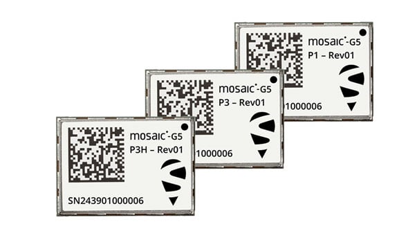
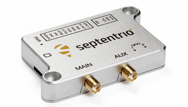
Septentrio, part of Hexagon, has introduced the mosaic-G5 series, expanding its line of compact GNSS receiver modules. The mosaic-G5 modules offer a 60% reduction in size and a 40% decrease in power consumption compared to the earlier mosaic-X5 receiver. The new modules measure 23 mm x 16 mm and weigh as little as 2.2 g, making them suitable for applications where size, weight and power are critical considerations, such as commercial UAVs, robotics and high-volume industrial equipment.
The mosaic-G5 modules offer reliable, high-accuracy positioning even in environments where GNSS signals may be degraded or obstructed. The mosaic-G5 product line includes several variants tailored to different use cases. The triple-band mosaic-G5 P1 is designed for high-volume applications, such as inspection drones and robotic mowers. The quad-band mosaic-G5 P3 and the triple-band heading module mosaic-G5 P3H offer enhanced positioning reliability in challenging conditions and are suited for applications such as delivery UAVs and light show UAVs. The P3H variant can calculate heading with a minimal baseline between two GNSS antennas, enabling accurate navigation for small autonomous device.
The new modules complement the mosaic product line, where the mosaic-X5 receiver remains as the benchmark for world-leading GNSS open signal anti-jamming and anti-spoofing resilience in a small form factor.
The mosaic-G5 modules complement Septentrio’s broader mosaic portfolio, which is recognized for its all-band GNSS technology, accuracy, reliability, and resilience to jamming and spoofing. The established mosaic-X5 receiver remains a benchmark for anti-jamming and anti-spoofing performance in a compact form factor. Like the mosaic-X5, the new modules are compatible with widely used open-source autopilots, such as PX4 and ArduPilot, simplifying integration and reducing development time. An evaluation kit, mosaic-go G5, is available to facilitate testing, and the RxTools user interface is provided for setup and evaluation.
Samples of the new mosaic-G5 P1, mosaic-G5 P3, and mosaic-G5 P3H modules are now available, with volume orders available for delivery later this year.
The United States Navy’s Naval Air Systems Command (NAVAIR) has awarded TrustPoint a $1.2 million Small Business Innovation Research Phase II contract. The funding supports the initial delivery and demonstration of TrustPoint’s C-band GNSS service-enabled receivers for the U.S. government. TrustPoint is collaborating with Hexagon U.S. Federal and NovAtel, both part of Hexagon.
This project combines TrustPoint’s C-band services with NovAtel’s GNSS receiver technology, aiming to advance resilient positioning, navigation and timing solutions for military use. The partnership draws on extensive experience in military-grade GNSS equipment and services, and represents a significant step in developing technology that can operate reliably in challenging operational environments.
The contract highlights the increasing importance of frequency and orbital diversity for future navigation and timing needs. With Hexagon as a key partner, TrustPoint is positioned to address the Department of Defense’s evolving requirements for assured PNT, supporting mission continuity even in contested environments
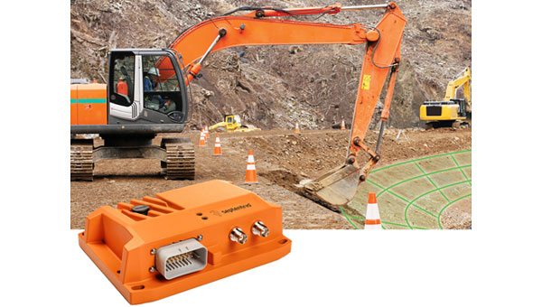
Septentrio, a division of Hexagon, has introduced two new products, the AsteRx RB3 GNSS receiver and the AsteRx RBi3 GNSS/INS system. These receivers are designed to operate in extreme environments, featuring IP69K-rated housings and components that have undergone rigorous ISO-standard testing.
The technologies robust construction ensures durability under heavy shocks, vibrations and challenging environmental conditions, making them suitable for demanding applications such as construction, mining and port automation.
The AsteRx RB3 and RBi3 utilize multi-frequency GNSS technology to deliver precise, centimeter-level positioning even in environments where GNSS signals are typically difficult to maintain. The receivers can be mounted externally on heavy machinery or integrated into chassis systems, offering flexibility in placement and simplifying installation.
The AsteRx RBi3 incorporates FUSE+ technology, which combines a high-performance GNSS engine with an industrial-grade inertial sensor. This integration provides accurate orientation data — such as heading, pitch and roll — alongside reliable positioning. In dual-antenna configurations, the receivers deliver sub-degree GNSS heading accuracy immediately upon initialization.
The AsteRx RB3 and RBi3 are ideal for machine guidance in industries requiring rugged equipment capable of maintaining precision under extreme conditions.
An early 1900s Italian folk song tells of a farmer walking into his fields at dawn to spread wheat seeds with his hand from a small bag.1 Farming has changed quite a bit since then. After remaining essentially unchanged for about 12 millennia, in the past century, it has been transformed by such innovations as tractors, electrification, chemical fertilizers and pesticides. In the 1990s, precision agriculture (PA) emerged. (This magazine produced a few supplements on the subject around 1999. If you still have any of them, please let me know.)
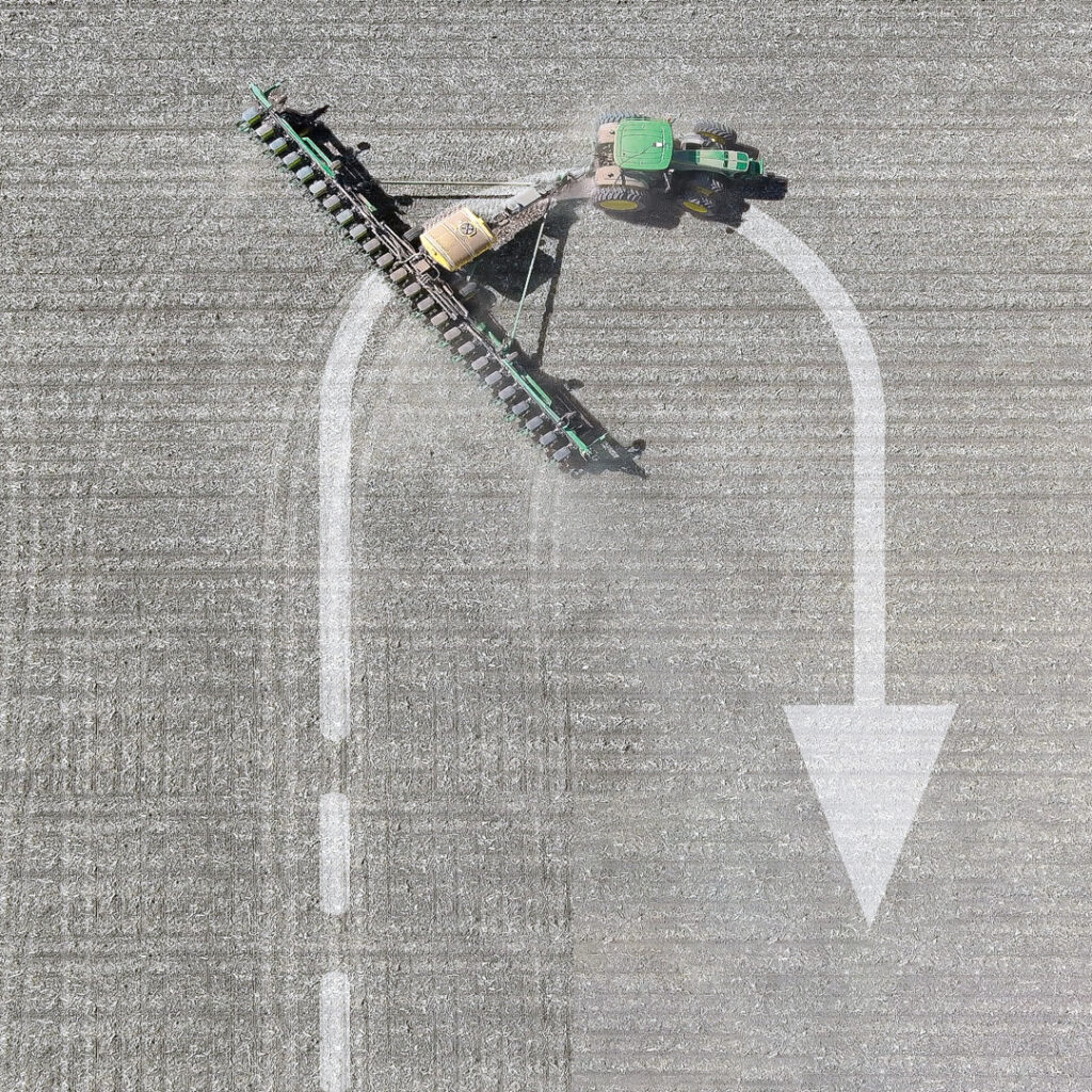
PA reduces inputs of water, fertilizer, seeds, pesticides and fuel and increases harvests by mapping variations in soil characteristics and plant health and then using those maps to adjust the inputs using variable rate technology on sprayers. It also ensures that no part of a field is sprayed twice or missed and greatly reduces overlap in seeding and tilling. Double spraying is costly and wasteful; missing a row when spraying pesticide can cause pests to concentrate there and then spread, nullifying a whole spraying operation.
The data for the maps are gathered from sensors on tractors and other farm machinery in the fields, as well as by aerial platforms — nowadays, mostly UAVs. GNSS receivers are essential in guiding the farm machinery. The required accuracy depends on the crop but is typically at the centimeter to decimeter level.
Increasingly, farm machinery also incorporates a variety of other sensors, both to compensate for GNSS outages and to minimize the risk of collisions, such as when a cow crosses the path of a tractor. To maintain navigation during GNSS outages, inertial navigation is used. For obstacle avoidance lidar, radar and stereo vision cameras are used to measure the distance to the object. (Both challenges — navigation in GNSS-denied areas and obstacle avoidance — and their solutions are very similar to those encountered with autonomous vehicles on roads.)
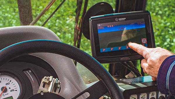
In-cab displays enable growers to monitor their progress in real time. They often also download the data and maps to a laptop to better identify missed spots or areas with special issues and to plan their next task.
Manufacturers of PA equipment compete in a global market. Some challenges are the same everywhere, while some are specific — such as strong ionospheric scintillations in Brazil or antiquated agricultural practices in Japan’s Furano region. For this year’s cover story on PA, I discussed these challenges and the latest generation of farming hardware, software and services with
■Kirstin Schauble, director of systems engineering, ANELLO Photonics
■ Joey Koebelen, founder and CEO, Deep Sand Technology
■ Chad Huedepohl, PA portfolio manager, autonomy and positioning division, Hexagon
■ Ken MacLeod, director of product management and Gordon Echlin, director of business development, Calian GNSS.
This article contains a few excerpts from those interviews. I also received case studies from AgLeader Technology, ComNav Technology and Harxon Corporation.
ANELLO Photonics makes silicon photonics optical gyroscopes, which enable accurate dead reckoning without GNSS and are targeted mostly at the autonomy market. (Anello means ring in Italian, which reflects the nature of the company’s technology and the Italian-American background of its CEO, Mario Paniccia.) Because ANELLO specializes in high precision in situations with obstructed GNSS signals, orchard cultivation is one of the agricultural practices in which it specializes. “Orchards have high-value crops, such as almonds or walnuts, and you’re driving your tractor between very narrow rows with trees completely covering the sky above you,” Schauble said. “Our job is to replace that GNSS input with our inertial navigation system (INS) input.”
Deep Sand Technology — in partnership with GEODNET, the largest real-time kinematic (RTK) network in the world — sells affordable RTK corrections to farmers. It also maintains and troubleshoots the system, compensated by the network’s cryptocurrency. “We handle the blockchain and use it for maintenance,” said Koebelen. “We have someone that checks every day and makes sure that the bases are up. We do the support on it. Instead of charging for that, we take the tokens; that’s just our part of the program, and they get free RTK.” Koebelen, who is also a peanut farmer, adds: “You can trust anything that we sell because it has been tested and used by a farmer and is supported by a farmer.”
Hexagon, a very large company, makes a wide range of sensors that capture and display data about physical reality. Its latest contributions to PA include the TerraStar-C PRO and the TerraStar-X Corn Belt corrections services, which incorporate improvements in ionospheric resiliency. “Especially in the Brazil market, some growers were often experiencing hours of downtime due to ionospheric scintillation,” said Huedepohl. “With the ionospheric enhancements that we’ve added, that downtime now is down to just a few minutes here and there.” He also cites safety enhancements for the autonomy market, such as dual antenna solutions and geofencing.
Calian GNSS is a global supplier of technical solutions, services and products to the space communications, defense, wired and terrestrial wireless, manufacturing, GNSS, agricultural technology and nuclear industries. The company’s recent entries in the PA market include GNSS antennas with lower elevation gain and extended filtering. “Our GNSS agriculture antennas support centimeter level precision, have best in class lower elevation angle gain enabling L-Band correction reception (at northern and southern latitudes), and have eXtended Filtering (XF), which creates very deep attenuation of nearby out of band radio frequency signals,” said Echlin. “Having a digital signal from the antenna to the smart ag controller simplifies and reduces the cost of the installation,” said MacLeod.
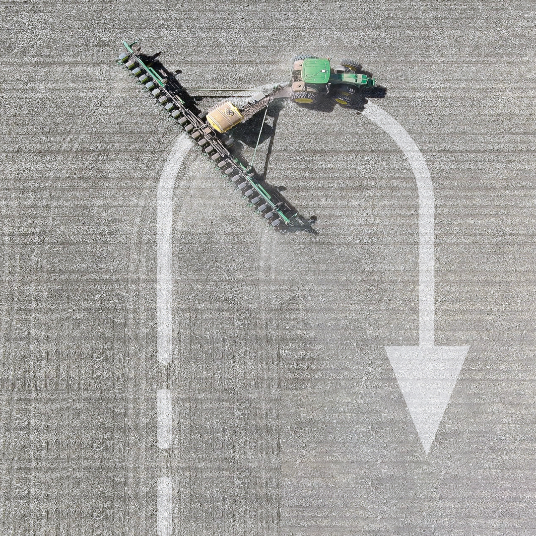
Ag Leader, founded in 1992 and focused exclusively on precision farming technology, offers a complete line of systems that integrate with existing farm machinery. In February, it introduced the RightPath passive implement steering solution to alleviate the problem of trailed implements drifting off the guidance line by up to 10 inches or more, even when farmers utilize auto steer and on flat ground. RightPath keeps implements centered on the guidance line, ensuring precise input placement and increasing operational efficiency throughout the growing season while minimizing crop damage, yield loss and operator challenges, Ag Leader said. To utilize RightPath, both the vehicle and the implement require Ag Leader’s GPS 7500, but only the vehicle needs to be equipped with TerraStar-C, TerraStar-X, or RTK. RightPath will be available in late fall 2025 through a single purchase unlock and without any recurring subscription fee.
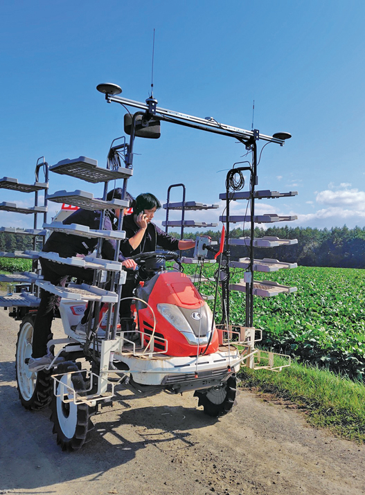
ComNav Technology is an original equipment manufacturer (OEM) that develops and manufactures GNSS OEM boards, receivers and solutions for high-precision positioning applications worldwide. Japan’s Furano region is renowned for its vast farmland and abundant agricultural resources. Still, it is challenged by traditional manual driving methods that provide insufficient accuracy, low efficiency, and operator fatigue during prolonged tasks. To address these issues, ComNav introduced the AG502 autosteer system, which integrates satellite reception, positioning, navigation and autonomous driving. It is compatible with a variety of mainstream tractors on the market and is suitable for a wide range of agricultural tasks such as ridging, seeding, spraying and harvesting, ComNav said. In the Furano project, the AG502 demonstrated its versatility through its successful deployment on a transplanting machine.
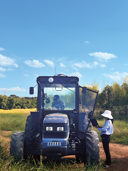
Harxon Corporation makes GNSS positioning antenna solutions. The company has been collaborating with Brazilian agricultural navigation solutions and systems developer Agres to integrate Harxon’s Smart Antenna into the AgresAutopilot System. This secure and robust agricultural navigation solution has been widely adopted by Brazilian agribusinesses to provide automatic steering on straight or curved parallel lines to assist with such field operations as preparing the soil, planting seeds, cultivating the plantation and harvesting the crops. These systems are suitable for various brands and tractor/vehicle models such as Kuhn, John Deere, Valtra, Massey Ferguson, New Holland, LS, Landini, Jacto and others.
To maximize an operator’s turning accuracy and efficiency, Ag Leader introduced TurnPath, hands-free steering for automatic, repeatable end-of-row turns. (Photo: Ag Leader)
Challenges
The key technical challenges faced by PA systems include minimizing multipath and RF interference and monitoring the positions of implements relative to the tractor. “Agriculture requires positional accuracy, so mounting an antenna on a farm machine is not a trivial matter,” said MacLeod. “On metallic machinery, radio frequency surface currents and reflections (multipath) will degrade the antenna radiation pattern, and RF noise coming from other electronics on the machine can interfere with GNSS.” Additionally, because most GNSS applications now are full band, “the challenge is designing antennas that are small and full band, and which also reduce local multipath on the machine.”
Regarding the position of the implements, MacLeod said: “Many agricultural applications use the moving base technique to estimate a precise heading which can be used to monitor pass to pass overlap. Calian GNSS have smart antennas that support the moving base application.”
Accuracy and Reliability
Nearly all PA practices require RTK, which gives repeatable accuracy of 1 cm to 2 cm. “I have this conversation daily with farmers,” Koebelen said. “All crops or farm practices benefit from RTK, even if you’re just doing hay work — whether you’re planting or harvesting. We can’t control the weather, commodity prices, or fuel prices but we can reduce input costs. So even if you’re just tilling, GEODNET RTK will pay for itself and is better than using traditional autosteer, because you’re eliminating all overlap.”
Additionally, farmers need reliable repeatability, even from one season to the next, to be able to return to the same spot to harvest what they planted. “Peanut farmers may plant with RTX or SF3, but satellite-based corrections, even higher precision ones, didn’t provide them enough repeatability to come back to harvest,” said Koebelen. “So, they still had to adjust their lines or hand-drive them. If the spacing between passes are off by even two to three inches, you’re going to lose peanuts. That’s why peanut farmers — as well as growers of potatoes, cucumbers, and other crops — need RTK.”
Once they enter a GNSS-denied area, such as an orchard, farm machines will need a dead reckoning capability that can keep them within a 20 cm to 30 cm error, said Schauble. “This is typically posed as a cross-track error. Errors in the direction of the distance traveled are slightly less important, because you can tell based on visuals when you exit a row.”
Growers think of reliability, accuracy and repeatability in terms of whether they can count on a system to do what they are asking it to do, Huedepohl explained. “They think about all those things. They do not necessarily focus on one thing versus another.”
Retrofitting
While many agricultural systems are proprietary, there is also a lot of mixing-and-matching and retrofitting going on. More than 90% of new tractors come with factory-installed guidance, but some growers want to retrofit new receivers on their machines, either because they did not have them or to upgrade. On some machines, it is possible to feed better positioning data — for example, integrating GNSS and inertial navigation — into the port that previously took in only GNSS data, using a standard NMEA format.
“It’s a simple plug-and-play to exchange someone’s GNSS receiver with our INS solution. Obviously, they need to do some testing to optimize placement, installation and stuff like that,” said Schauble. “Many companies are retrofitting existing tractors with an autonomy stack. They take commercial off-the-shelf (COTS) systems, such as ours, or a lidar or a camera, and retrofit a tractor. That’s their business model.”
The AG502 autosteer system being tested and calibrated on a transplanter in Japan’s Furano region, which is renowned for its vast farmland. (Photo: ComNav Technology)
Additional Sensors
Among the additional sensors often used are wheel odometers. “Without the wheel speed, you’re relying heavily on accelerometers,” said Schauble. “Growers cannot afford to pay $100,000 for a reference-grade system. The navigation systems for these applications use MEMS accelerometers, as we do. So, wheel speed aiding is extremely important to maintain that distance traveled.”
Integrating GNSS and inertial measurement units (IMUs) has long been standard. Increasingly, this integration is done inside an antenna, called a smart antenna. Calian, among others, does that. “We also have smart antennas that employ the L1-L5 observation pair rather than L1-L2, since the L5 signal is stronger and performs better under cover,” said MacLeod. “L5 uses an enhanced signal architecture with 10x faster chipping rate (10.23 MHz) offering more precise standard localization and improved multipath mitigation for reflections exceeding 29.3 m.”
Corrections
Corrections have also been key to the evolution of PA. A reference base station can provide 1-inch accuracy for up to 21 miles, degrading beyond that distance. It needs a WiFi network to communicate, so farmers often place the base station near their home and connect it to their home network. “We haven’t found an internet connection that isn’t quick enough to handle that,” said Koebelen. “From there, you can use your hotspot with a SIM card on your phone, and it’s like texting, so it will not drop like with voice calls. We haven’t run across rural areas where cell coverage is the limiting factor.”
RTK adoption is growing among farmers. “In the past, many people did not want to use RTK, because it was not very affordable nor easy,” Koebelen said. “However, now that we have these networks [such as GEODNET], you’re going to see a lot more people rely on the precision of RTK and you’re going to see many new products come out. Right now, even John Deere, Trimble and other major brands that are more expensive are trying to make the tier below RTK more affordable or easier to get — for example, RTX, SF3, the satellite-based corrections.” GEODNET’s network is growing rapidly, he said, “because our price for RTK is lower than Trimble’s or John Deere’s basic entries, which use free satellite signals that drift throughout the day.”
Huedepohl agrees that RTK has improved while prices have dropped significantly. “Earlier in my career,” he said, “RTK positioning was very expensive and satellite-based augmentation systems (SBAS) were not as stable. Also, RTK systems and such used a single constellation for the longest time. We started adding in GLONASS and then positioning network (Ntrip) corrections, which gave us a lot more robustness.”
Precise point positioning (PPP) has also improved. It used to have convergence times of up to 45 minutes. “Then, you would drive underneath one tree on the edge of a field, and you had to start all over,” Huedepohl recalls. “That did not sit well with farmers, so PPP corrections struggled to take off. Because of those early experiences, it took a long time for the market to start to accept the newer PPP models that we’ve seen in the past seven or eight years. Now there are farmers who enjoy the reliability of those PPP corrections.” The convergence time for one of Hexagon’s PPP services, TerraStar-C PRO, is often less than five minutes, according to Huedepohl. “We have a fast startup time. So, if the tractor was shut down, already converged and you turn it back on, most people are going to be reconverged in just a minute or two.”
Harxon enables autonomous agricultural applications with GNSS antennas, smart antennas and wireless data radios. (Photo: Harxon)
Division of Labor
The division of labor between manufacturers of PA equipment depends, in part, on whether a system is a retrofit or built from scratch. “If you are, let’s say, John Deere, and you own the entire autonomy stack within this tractor, then you can take our INS solution, add cameras, maybe add a lidar, and you can have your own fusion of those sensors,” said Schauble. “We have our own sensor fusion with IMUs and GPS. The tractor’s autonomy stack can do the sensor fusion with our output and other visual sensors, such as cameras and lidars.”
“Dealerships want their tractors to be known as having the highest tech,” said Schauble. “For a dealership to offer our state of the art, autonomy-enabling technology would be a huge benefit to them.”
Another differentiator is whether a factory-installed system is an OEM or branded. “We’ve been providing NovAtel branded receivers to AGCO for many years, through their channel, both factory-installed and aftermarket. Some of the others, such as CNH, are white labeled, so it would just say ‘Case-IH’ or ‘New Holland’ and have no Hexagon markings.”
Whether OEM or aftermarket, most manufacturers have some type of proprietary integration. “There are products that are just NEMA; they are typically at the lower end and priced much lower,” said Huedepohl. “The higher performing flagship products out of everybody’s portfolio are usually doing a more customized integration.”
Echlin has a similar perspective: “We provide products to OEMs who designed our products into their machinery. There are also system integrators and aftermarket system providers that use our smart antennas.”
According to Harxon, one reason for the success of its smart antenna in the agriculture market, especially for autonomy users, has been its ease of integration and high performance. “GNSS positioning is just one part of an autonomous system, and the autonomous integrators don’t necessarily have resources or expertise to develop an OEM component portfolio. Therefore, it’s a timesaving and cost-effective choice to directly integrate a smart antenna into an autonomous system.”
1 “Di buon mattino il contadino va nei suoi campi a seminare il grano. Ha un sacchettino e ci tuffa la mano.”
■ The term precision agriculture emerged when yield monitoring was first invented and brought to market.
■ GPS receivers were added to map the sources of the yields, which began to make it possible to manage farmland and zones based on productivity.
■ This very quickly evolved into also mapping soil sampling results and directly tying that type of information to point-specific yield information from a field.
■ After several years, variable rate application of fertilizer emerged.
■ In the mid-2000s, auto-swath technology came on the market, making it possible to turn on and off the different implement sections on application equipment — primarily, sprayers and spreaders.
■ In the mid-2000s, autosteering systems started to become standard on newer equipment and soon became a key product in the aftermarket. This gave farmers better efficiency and helped provide them more hours of productivity per day. It also allowed them to pay better attention to the equipment and the application that they were set up to do.
■ The combination of swath control and auto guidance greatly accelerated the development of precision agriculture, eventually leading to the monitoring and control of planter equipment.
■ More recently, the trend toward autonomy began, with greater focus on live sensors, including camera imagery.
An exclusive interview with Chad Huedepohl, precision agriculture portfolio manager, Autonomy & Positioning division at Hexagon. Read the full story and additional exclusive interviews here.
Precision agriculture has been around for more than 30 years. (GPS World published several issues of a supplement on the subject about 26 years ago.) What have been some of the key turning points? What options do farmers have now that they did not have, say, five years ago? Are the main improvements in accuracy, repeatability, reliability, or cost?
The term precision agriculture started to come into play when yield monitoring was first invented and brought to market. One of the first successful ones was through Ag Leader Technology and their yield monitoring system, which then added positioning through GPS to start mapping where the yields were coming from. This then created the ability to start managing farmland and zones based on productivity. In turn, this very quickly evolved into also mapping soil sampling results and directly tying that type of information to point-specific yield information from a field. Auto-steering systems had been on the market prior, but really started becoming part of the precision agriculture portfolio in the late 90s.
The industry took off in that direction for several years, then started to get into variable rate application of fertilizer, which was another way of more intimately managing the farmland. That then led, in the early 2000s, to the coming to market of auto-swath technology, which made it possible to turn on and off the different implement sections on application equipment — primarily, sprayers and spreaders. This enabled the operator to avoid putting a second application where you had already been, as well as making sure you had full coverage and no skips.
In the mid-2000s, autosteering systems started to become standard on newer equipment and soon became a key product in the aftermarket. Auto-steering had a major impact on farmers because it gave them better efficiency, but also helped provide more hours of productivity per day. It enabled them to focus on other things and not be so physically and mentally drained by the end of the day because of constantly concentrating on where the machine had to go. It allowed them to pay better attention to the equipment and the application that they were set up to do.
So, the combination of swath control and auto guidance is what sent the precision ag world into major acceleration, which eventually led to planter control. The company Precision Planting emerged into the precision ag space at about that time, drawing awareness of the need to utilize precision on row-crop planters. The industry soon started getting into much more finite monitoring and precision ag soon became an integrated featureset into planter equipment, rather than just an add-on.
More recently, we’ve started the trend toward autonomy. It’s not mainstream yet, though. We started putting a lot more focus on live sensors, including camera imagery. There’s been some evolution toward sensors on the implements that make those decisions on the go. It’s catching on somewhat. It still does not have a whole lot of market penetration, yet that’s changing rapidly.
When it comes to GNSS, I think the biggest part has been reliability — on a farmer’s terms. “Can I really count on this system to do what I’m asking it to do?” Farmers view that as reliable in the GNSS world. We then start asking, “What is reliable? Is it accuracy? Is it repeatability? Is it integrity with the actual position?” Growers think about all those things. They do not necessarily focus on one thing versus another.
In terms of the integration, of how they use it in the cab, reliability has had the biggest impact on that, then cost has brought in more people. In the early days, just autosteering cost north of $20,000. Nowadays, a complete systems will cost somewhere around $20,000, so the out-of-pocket cost has not necessarily come down a lot, but what you’re getting for that value has advanced significantly. If you want to do just entry-level autosteering, that can be done relatively inexpensive compared to the early days.
Most growers today are doing far more than just navigation.
I was familiar with this history because I’ve written a dozen articles on precision ag over the past 20 years, but the way you summarized it was great. One thing you didn’t touch on, however, is the vast expansion in options for corrections data.
I’m glad you brought that up. Corrections have been an important part of the evolution of precision agriculture as well. When farmers plant this field or spray that field, they want it to be done reliably. That is where accuracy comes in. Earlier in my career, real-time kinematic (RTK) positioning was very expensive and satellite-based augmentation systems (SBAS) were not as stable.
Also, RTK systems and such used just single constellation for the longest time. We started adding in GLONASS and then positioning correction providers, which gave us a lot more robustness. Some of the early challenges with RTK were having enough common satellites with baselines. I think that really took off in about 2009. Prior to then, it was mostly just SBAS or RTK.
There was also PPP, but the challenges that the industry was facing with PPP was the long convergence time. It used to be common for conversions to take 40 to 50 minutes. Then you would drive underneath one tree on the edge of a field and you had to start all over. When you’re talking about the actual cost of a farming operation, having to sit idle because of something like that did not sit well with farmers. So, PPP corrections struggled to take off. Because of those early experiences, it took a long time for the market to start to accept the newer PPP models that we’ve seen in the last, say, seven or eight years.
Now there are farmers who enjoy the reliability of those PPP corrections, because the redundancy and resiliency between the different providers, such as Hexagon providing TerraStar services, through vegetation and being able to withstand some outages, definitely sits well with customers.
The accuracy and convergence times have also improved significantly. At the end of the day, it’s one fewer thing that can go wrong for them or their dealer to have to deal with. I don’t have to worry about the state-sponsored continuously operating reference station (CORS) network going offline, about software updates or cellular issues, or, season to season, someone having to make sure that their system is all up and operational. A PPP solution is automatic. It either works or it doesn’t. That’s something that farmers like. They don’t like to have to deal with all this other integration technology.
What’s PPP’s convergence time now?
With TerraStar-C PRO, we’re often seeing a convergence time of less than five minutes. We have a fast startup time. So, if the tractor was shut down, already converged and you turn it back on, most people are going to be reconverged in just a minute or two.
That’s a hot start.
Yeah, right.
Precision agriculture involves collecting data (on the ground and from the air), analyzing the data, creating maps, displaying the maps in the cabs of tractors and other machines, and using the maps to guide those machines as they water, spray, plant, and harvest crops. So, it involves hardware, software, data, analyses, and decisions. Besides making GNSS receivers and providing corrections via TerraStar, in which aspects of precision agriculture is Hexagon involved? For example, do you store and/or analyze any of the data that growers collect or create maps for them?
We sell displays and controls that operators use that control equipment and collect the data for the farm. Many of our agriculture OEM and technology customers have their own software solutions that provide their crop growers with the tools they need to manage their farms, and Hexagon provides the hardware that feeds into them. However, Hexagon does have a software portfolio that provides tools for operation planning, monitoring and analysis to large enterprise farming customers like those in the sugarcane, bioenergy and forestry industries. In summary, we sell the control equipment — basically, the display interface — as well as rate control and implement control functionality. We sell the TerraStar PPP corrections as well as RTK corrections through Hexagon’s SmartNet.
Do you have any unit that does a service for the growers of analyzing that data and creating the maps they use for planting, watering, and spraying?
No, Hexagon does not provide any after-the-fact data analysis, certainly not for row crops.
How is the adoption of precision agriculture proceeding in the United States? For example, roughly what percentage of growers currently use autosteer on their tractors?
I don’t have any reports to reference other than those from USDA. Adoption rates across most row crops in the United States are going to typically be north of 70%. On machines built in the last five years, you’re talking about an adoption rate of more than 90%. Acres of crops grown using auto steer are probably 80% in North America. More than 50% of that is using a correction that is more accurate than just simple SBAS.
What is the division of labor between Hexagon and the manufacturers of tractors, combines, sprayers, and other agricultural machines – such as John Deere, AGCO, Case IH, Kubota, Massey Ferguson, etc.? Do you have privileged relations with any of them? Are your guidance systems typically installed at the factory or by dealers?
We go to market in a couple different ways, and we’re involved with most of the leaders in precision agriculture. We’re providing solutions t — whether OEMs, regional OEMs, or after-market solutions. So, we’re involved in most of the leading precision agriculture solutions in the global market.
OEM solutions are factory-installed and the grower doesn’t even see the name Hexagon anywhere, correct?
That is true in many or our partnerships. We are a factory option and some of the leading OEMs do both white label as well as branded. We’ve been providing NovAtel branded receivers to AGCO for many years, through their channel, both factory-installed and aftermarket. Some of the others, such as CNH, are white labeled, so it would just say “Case-IH” or “New Holland” and have no Hexagon markings.
Is the aftermarket phasing out as it becomes standard for these solutions to be factory-installed on new machines?
Yes and no. In some ways, there is more adoption of aftermarket products to pair with the mainline factory systems, but many of the shorter line OEMs and aftermarket solutions are accessing parts of the market that have machines that originally came with factory-installed solutions that are now antiquated, so they want to upgrade to get more out of it.
You also have increasing consolidation — such as AGCO’s joint venture with Trimble and CNH’s acquisition of Hemisphere — so there are fewer GNSS providers for competing brands to utilize in the market.
Does the signal into the autosteer use the NEMA standard, so that you can just replace the old receiver with a new one?
Most of the companies, whether they’re OEMs or aftermarket solutions, have some type of proprietary integration. There are products that are just NEMA; they are typically at the lower end and priced much lower. The higher performing flagship products are usually doing a more customized integration.
Would you like to highlight any recent Hexagon products or services in the precision agriculture area?
Probably the biggest one is bringing more awareness to the TerraStar-C PRO and the TerraStar-X Corn Belt products and a lot of the ionospheric resiliency that we’ve been able to improve with those products. They provide more robustness and reliability in challenging ionospheric scenarios. Especially in the Brazil market, some growers were often experiencing hours of downtime due to ionospheric scintillation. With the ionospheric enhancements that we’ve added that downtime now is down to just a few minutes here and there.
Another one would be enhancements that we’ve been bringing to the autonomy market, such as dual antenna solutions and geofencing, for safety.
Who integrates the other sensors used for safety, such as lidar or radar?
That’s a key area we’re focusing on. We are currently working with specific integrators with our perception system. We have perception systems that primarily utilize cameras, but we can also utilize lidar and other sensors.
Hexagon has finalized its acquisition of Septentrio NV. By integrating Septentrio’s GNSS platforms with Hexagon’s existing portfolio, the company aims to enhance access to high-accuracy and high-performance positioning technology designed for Size, Weight and Power (SWaP) efficiency.
According to Gordon Dale, President of Hexagon’s Autonomous Solutions division, the collaboration will enable the delivery of advanced solutions for autonomy and mission-critical applications across various industries.
The combined expertise of both companies is expected to accelerate the adoption of autonomous systems while addressing the needs of emerging sectors such as robotics, UAVs and other mission-critical technologies. Septentrio, headquartered in Leuven, Belgium, will maintain its existing business model of providing GNSS technology to a broad base of original equipment manufacturers.