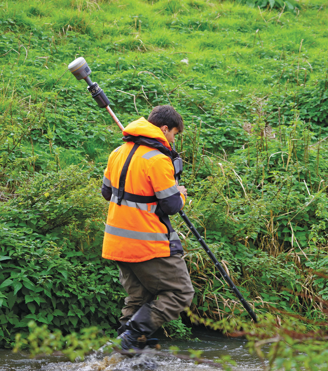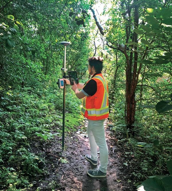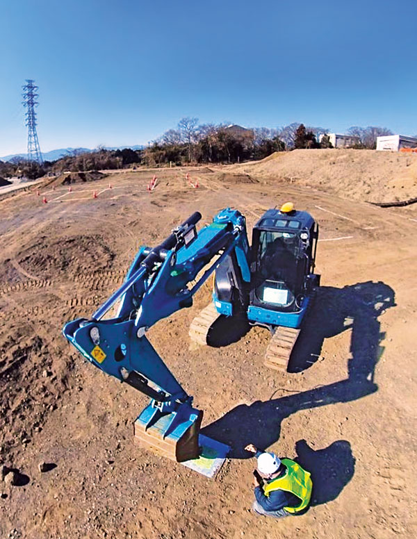
For decades, surveying — which consists largely of making measurements to determine the relative positions of points above, on or beneath Earth’s surface — had much higher accuracy than mapping for geographic information systems (GIS) — which is mostly based on aerial photogrammetry for base maps and field data collection of the locations of features. When I started in this field a quarter century ago, we typically classified GPS receivers as survey grade, resource grade or consumer grade, with “resource grade” referring to field data collection for GIS.
Today, however, the accuracy of all receivers has greatly increased — thanks to improved chipsets, new GNSS constellations, and a plethora of corrections services — and those three categories are no longer relevant. Therefore, surveying and mapping are increasingly overlapping.
For this cover story, I asked the same three questions about mapping and surveying to representatives of four companies.
CHC Navigation — Rachel Wang, product manager of survey and engineering product line
Hexagon — Craig Hill, VP marketing and services, surveying solutions, Leica Geosystems
OxTS — Geoff Besbrode, product marketing executive
Trimble — Chris Trevillian, director of product marketing, Geospatial Solutions
Additionally, click below to read insights from:
- Aaron Nathan, CEO and founder of Point One Navigation, explains the ways in which construction firms rely on GNSS signals.
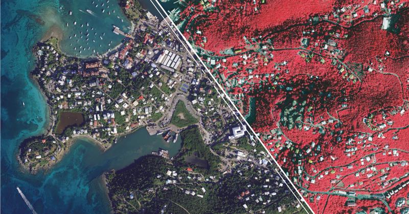
- Raphael Goudard, global mobile mapping segment manager, Leica Geosystems, part of Hexagon, discusses the power of mobile mapping for transportation infrastructure.
Surveying and mapping are increasingly overlapping. What are the remaining differences between them, in terms of accuracy requirements and challenges in the field?
CHC Navigation
While advances in technology such as lidar and photogrammetry are narrowing the gap, there are still notable differences between surveying and mapping. Surveying often requires centimeter- or even millimeter-level accuracy at specific points. In contrast, mapping focuses on collecting dense 3D data over large areas. Although the accuracy of mapping point clouds is steadily increasing, the integration of ground-based GNSS data collection with aerial imagery and lidar is becoming widespread. Mapping tends to be less labor-intensive and involves fewer safety risks in the field, but it requires a unique skill set, particularly in point cloud processing.
Hexagon
Traditionally, surveying and mapping differ primarily in their accuracy requirements and application scales; however, this paradigm is changing with mapping becoming increasingly accurate. Surveying focuses on high-precision geospatial data of specific points. From road, rail and tunnel construction to high-rise buildings, there is no substitution for the precision delivered by surveying equipment and procedures. In contrast, mapping focuses on larger areas.
Recent advancements in sensor technology, including both airborne and mobile mapping systems such as the Leica CityMapper-2 and the Leica Pegasus TRK, have significantly improved the efficiency and precision of mapping, bringing it closer to the levels achievable with traditional surveying equipment.
OxTS
Surveying comes with a large overhead during the data collection process. It requires meticulous preparation and attention to detail to achieve high accuracy in the raw data. GNSS quality, lever arms, user operation, etc., can all cause problems later on. Getting any part of the process wrong can have major cost implications through having to redo the process.
Mapping is focused on the act of aligning that data to datums and control points after the surveying process is completed but it also requires major attention to detail in aligning coordinate frames and origin points in order to avoid baking in any errors that lead to mistakes being made once the map data is handed over to a customer
The problem is that if the surveying process wasn’t accurate, the mapping process will not have a solid foundation in the raw data to deliver accurate maps, so they are inherently tied to each other.
Trimble
Surveyors today have many tools in their toolbox, giving them flexibility across surveying and mapping applications. There are many highly accurate, easy-to-operate data capture systems to choose from these days, but challenges grow when combining and analyzing vast amounts of data from different sensors in the office to provide final deliverables. This has made field-to-finish software that delivers technological integration, workflow optimization and adaptability essential for the job.
Mapping projects often require less accuracy, but a lot of advanced survey technology is entering the mapping domain (e.g., mobile mapping and laser scanning) because of easier field operations and increasing understanding of the value of rich data to asset management.
What is your company’s niche in surveying/mapping?
CHC Navigation
CHC Navigation (CHCNAV) has been at the forefront of positioning and navigation for more than two decades, continually adapting to meet the diverse needs of the surveying and mapping industry. Our innovative solutions often lead the industry in providing end-to-end, integrated technology fusion — GNSS, inertial measurement unit (IMU) and imaging lidar — as a standard that empowers geospatial professionals worldwide. CHCNAV strives to provide accessible, value-added solutions from the start, positioning itself as a key technology enabler for the geospatial community.
Hexagon
Whether you are mapping an entire city or surveying a site for construction, capturing reliable and precise geospatial data is essential. Hexagon’s niche lies in its commitment to innovation, its extensive portfolio and the convergence of superior hardware, intelligent software solutions and expert services — enabling precise, efficient and scalable surveying and mapping for diverse needs. Our multitude of solutions, whether handheld, tripod-mounted, flying, or vehicle-mounted, are designed to collect data efficiently and safely from complex or dangerous environments — enabling the greatest accuracy and high-value deliverables.
Furthermore, Hexagon is uniquely positioned with its robust suite of software solutions that work seamlessly with our hardware, such as Reality Cloud Studio, Leica Cyclone, Leica Captivate or Leica Infinity for collecting, processing, modeling, analyzing, and presenting data. We offer end-to-end solutions that not only provide high accuracy but also ensure productivity and ease of use.
OxTS
OxTS offers localization and georeferencing technology that can help accelerate the collection of high accuracy survey data, allowing more work to be completed in a given time frame without compromising on accuracy.
Trimble
Trimble is known for offering a wide range of highly accurate and reliable data capture sensors but our “niche” — our truly unique offering — is our ability to offer comprehensive solutions that make our customers more productive and their projects more streamlined. We do this through hardware and software solutions that enable highly efficient survey and mapping workflows that connect field and office operations. Our software helps transform the captured data into true information utilizing an increasing number of AI-powered tools while our cloud services allow customers to share the data with a variety of stakeholders, unlocking the transformational power of geospatial data.
What is your latest surveying/mapping product? What are its key specs, markets and applications?
Hexagon
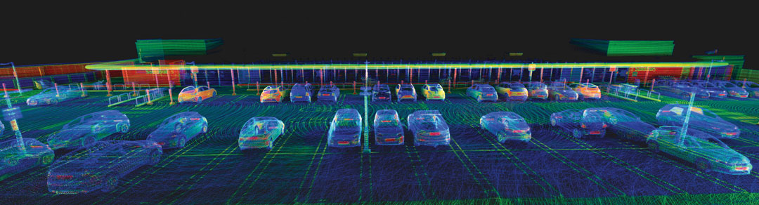
Among our surveying and mapping solutions, the Leica BLK ARC stands out with its flexibility to integrate with various robotic and mobile carriers. The BLK ARC provides autonomous laser scanning with static and dynamic scans, creating 3D digital twins and ensuring operator safety. Similarly, the Leica BLK2GO introduces an agile, handheld mobile scanning solution, capturing point clouds and images, with a user-friendly design. Both solutions are great allies for professionals requiring accurate, efficient, and versatile mobile scanning solutions.
For those looking to offer wide-scale data-capturing capabilities and overcome capacity constraints, the Leica Pegasus TRK mobile mapping system stands out because it can gather extensive data quickly and accurately. Its high-resolution data capture, advanced lidar technology, and enriched 3D point cloud capabilities ensure detailed and comprehensive datasets. Building on this range of solutions, the autonomous flying laser scanner Leica BLK2FLY enhances surveying efficiency by capturing hard-to-reach areas and environments. Its user-friendly operations, advanced obstacle avoidance and seamless cloud-based data integration make it a valuable tool for enhanced productivity and safety in surveying work.
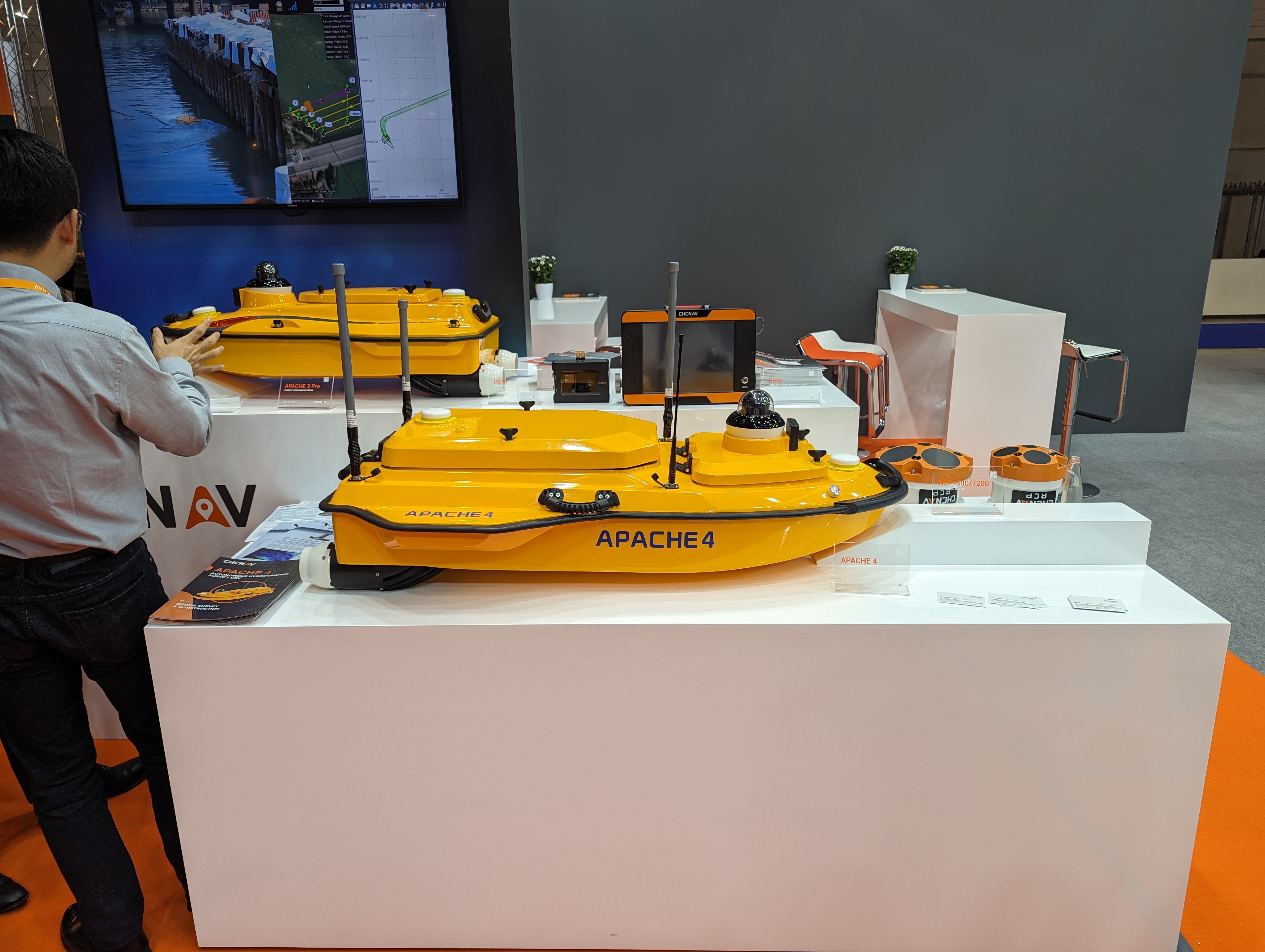
CHC Navigation
Our latest offering, the RS10, demonstrates the integration of surveying and mapping technologies by combining GNSS RTK, laser scanning and visual SLAM into a unified platform. The RS10 enhances traditional GNSS capabilities with V-lidar and SFix technologies. V-lidar enables non-contact offset measurements up to 15 m, ideal for rover applications. Meanwhile, SFix technology leverages laser and visual SLAM data to deliver 5 cm accuracy within one minute in environments with weak or absent GNSS signals. This breakthrough enables accurate GNSS measurements in challenging environments such as indoor spaces and urban canyons, bringing simplified workflows and increased productivity to professional surveying and mapping.
OxTS
OxTS recently released Lidar Inertial Odometry (LIO), which offers improved localization in GNSS-obstructed environments while maintaining a fully global frame output. It means that survey data can retain accuracy for longer in harsher GNSS environments but doesn’t give up the global reference to coordinate frames used by surveyors and does not require ground control points to be anchored to those coordinate frames.
Trimble
The newly released Trimble Business Center (TBC) v2024.00 delivers on its commitment to innovation by offering technological integration and workflow optimization, as well as adaptability and innovation for the ultimate field-to-finish workflow. A key highlight in the new release is the seamless integration of survey data delivery for pavement inspection within AgileAssets, which bridges the gap between Esri and Autodesk through feature services for more efficient pavement management.
In addition, AI technologies provide enhanced point cloud classification and new feature extraction routines for game-changing analysis of aerial, terrestrial, mobile mapping and tunneling data. Collaboration also is greatly enhanced through Trimble Connect for seamless data integration across TBC and Trimble Access field software.