Tag: Indonesia

  • GNSS increasingly essential for Indonesia

    GNSS increasingly essential for Indonesia

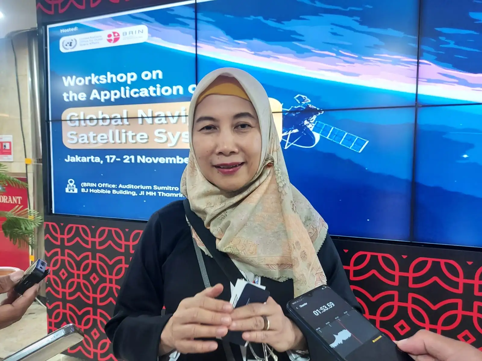
    The 2025 Global Navigation Satellite Systems (GNSS) Workshop in Jakarta, Indonesia, emphasized one important message: navigation satellite data has become a fundamental necessity in modern life, yet Indonesia remains completely dependent on systems owned by other countries.

    The workshop was held by the National Research and Innovation Agency (BRIN) in collaboration with the University of Indonesia (UI) and the United Nations Office for Outer Space Affairs (UNOOSA), at the BJ Habibie BRIN Building, Nov. 17–21.

    “Indonesia cannot just be a market. In the future, we must also become a producer of satellite services and have our own satellite industry.”

    Navigation satellites are a “silent technology” whose contribution is rarely recognized, yet they support almost all location- and time-based activities, explained Rr. Erna Sri Adiningsih, director of the Secretariat of the Indonesian Space Agency (INASA). “When we use Google Maps, search for addresses, find directions or positions, everything relies on data from navigation satellites,” she said. Even robotics, drones, aviation systems, and global time synchronization operate thanks to satellite navigation services.

    Therefore, she emphasized that disruptions to the navigation system would have direct implications for public activities. “If a navigation satellite operator stops operating or malfunctions, most of our communication devices will cease to function. Time won’t synchronize, location won’t be read, and robotics and drones won’t operate,” she said.

    Adiningsih added that the workshop is crucial for connecting operators with users. “We want to ensure that the needs of users from various countries are understood,” she said.

    The 2025 GNSS Workshop is a strategic platform for bringing together the GNSS operator community with national stakeholders such as the Ministry of Transportation, AirNav Indonesia, academia and the industrial sector. BRIN itself operates the experimental A1, A2 and A3 satellites, but does not yet have a navigation satellite.

    Crucial time for increased capacity

    Indonesia, Adiningsih said, is at a crucial point in increasing its capacity. Despite having the capability to build micro-satellites for earth monitoring and privately operated communications satellites, navigation satellite technology requires mastery of a different system. “Indonesia has never built a navigation satellite. We are still in the stage of utilizing the data, not building the satellites,” she said.

    Augmentation. The development of navigation augmentation systems for aviation, drones and maritime transportation currently relies on ground-based equipment managed by the Geospatial Information Agency (BIG). These are expensive and have limited coverage. “If we use a satellite system, one system can be used across the entire region without having to install ground-based equipment,” Adiningsih said.

    Therefore, Indonesia requires integrated policies and support from various ministries and agencies. The national space program already has a clear direction through Space Policy 2045, including a target for technological independence. “Indonesia cannot just be a market. In the future, we must also become a producer of satellite services and have our own satellite industry,” she emphasized.

    Adiningsih hopes that the five-day workshop will not only serve as a forum for sharing experiences but also open up opportunities for international collaboration in the development of satellite navigation technology and systems. “With humanity’s increasing dependence on satellite data, Indonesia must begin building its capabilities so that it is not completely dependent on other countries,” she said.

  • Position Partners, Teleo partner on autonomous heavy equipment technology

    Position Partners, Teleo partner on autonomous heavy equipment technology

    Image: Teleo
    Image: Teleo

    Position Partners has entered an agreement to partner with Teleo, a U.S. based company building autonomous technology for heavy equipment. Under the agreement, Position Partners will offer the full Teleo remote-operated and autonomous solutions across Australia, New Zealand and Southeast Asia.

    Teleo’s system can be modified to any make and model of machine and includes the company’s proprietary software, a remote command center to operate the equipment, and a mesh network to enable two-way communication between the command center and machines.

    The system incorporates sensors, including high dynamic range cameras that deliver high-definition visibility and video footage both day and night.

    Once Teleo’s technology is integrated, users can control multiple machines, at multiple sites, from a single station.

    “With ongoing labour and skills shortages in the construction sector, there is more work to be done than there are people to do it,” Position Partners CEO Martin Nix said.

    Position Partners will offer the full Teleo solution to customers and support sales, installation and training in all countries in which the company operates including Australia, New Zealand, Singapore, Indonesia, Malaysia and the Philippines.

  • Seen & Heard: Singapore crashes, BeiDou’s supersonic flight

    Seen & Heard: Singapore crashes, BeiDou’s supersonic flight

    “Seen & Heard” is a monthly feature of GPS World magazine, traveling the world to capture interesting and unusual news stories involving the GNSS/PNT industry.


    Photo: tropicalpixsingapore/iStock/Getty Images Plus/Getty Images
    Photo: tropicalpixsingapore/iStock/Getty Images Plus/Getty Images

    3D Maps Solve Accidents

    3D mapping is helping forensic teams reconstruct fatal traffic accidents in Singapore, reports The Straits Times. In 2021, Singapore had 100 fatal road accidents. Experts use 3D replicas of the accident site and simulation models to recreate events leading to an accident and its aftermath. This helps forensic scientists determine whether the vehicles were speeding or flouting traffic rules. The National 3D Mapping Program of the Singapore Land Authority has mapped every road, lane and highway in Singapore with a 3D laser scanner and car-mounted cameras, and plans to update the maps regularly. Autonomous vehicles will also depend on the 3D point-cloud data.


    Diagram: U.S. General Accountability Office
    Diagram: U.S. General Accountability Office

    BeiDou Enables Hypersonic Flight

    In simulation drills using BeiDou, Chinese space scientists flew a hypersonic flight from Jinan, China, to New York over the Arctic Ocean, reports EurAsian Times. BeiDou facilitated contact between the command center on Earth and the hypersonic vehicle as it dodged enemy air defenses. Researchers claim using BeiDou provided a time lag of less than a second. They also claim to have optimized signal transmitters and designed new satellite-jumping methods to overcome communication challenges. China and Russia are the only countries with operational hypersonic weapons — Russia has used its Kinzhal hypersonic missile in the Ukraine war.


    Photo: adiartana/iStock/Getty Images Plus/Getty Images
    Photo: adiartana/iStock/Getty Images Plus/Getty Images

    Drone Mapping Aids Education

    Indonesia’s National Research and Innovation Agency (BRIN) and Dr. Soetomo University are cooperating on aerial photo mapping using an unmanned aerial vehicle and GNSS hardware. BRIN’s Ocky Karna Radjasa said he expects that the two parties will extend the opportunity to advance research and innovation as well as bolster the quality of education in Indonesia. The university’s Nur Saidah expects BRIN’s support will increase, stating, “We still have limitation in laboratory facilities, so we seek industry cooperation. Let us hope that, as a result of this cooperation, we can receive help.”


    Photo: JacobH/iStock/Getty Images Plus/Getty Images
    Photo: JacobH/iStock/Getty Images Plus/Getty Images

    Navigating with Muons

    A new navigation system addresses shortcomings of GNSS using cosmic-ray muons. Muometric navigation enables positioning underground, indoors or underwater within a reference coordinate system defined by the 3D positions of multiple detectors, researcher Hiroyuki K. M. Tanaka explains in the June issue of Nature. Tanaka’s work shows the system offers a navigation quality almost equivalent to aboveground GPS-based handheld navigation by determining the distance between the reference frame and the receivers with a precision of 1 to 10 meters.

  • Seen & Heard: Russia threatens GPS, protecting sea turtles

    Seen & Heard: Russia threatens GPS, protecting sea turtles

    “Seen & Heard” is a monthly feature of GPS World magazine, traveling the world to capture interesting and unusual news stories involving the GNSS/PNT industry.


    Photo: lindsay_imagery/E+/Getty Images
    Photo: lindsay_imagery/E+/Getty Images

    Where Sea Turtles Nest

    Florida’s Sea Turtle Grants Program — funded with proceeds from special license-plate sales — were used to purchase Trimble TDC100 and TDC600 handheld GNSS receivers for state park staff to gather data about turtle nesting activity. The staff also uses Esri’s ArcGIS Survey123 field-capture software to report on turtles using the 108 miles of beach in 40 of Florida’s state parks. Negative impacts from commercial fishing, plastic waste and climate change have become a threat to sea turtles, which are now classified as an endangered species.


    Concept of vertiport at airport. (Groupe ADP)
    Concept of vertiport at airport. (Groupe ADP)

    Paris up in the Air

    Paris has begun testing electric air taxis at a new site outside the French capital, with an eye toward creating at least two demonstration flight paths during the 2024 Olympics to ferry passengers from nearby airports. Inaugurated in November, the test site is dedicated to new sustainable urban air mobility, and will study the use of electric vertical take-off and landing (eVTOL) aircraft. Choose Paris Region, Groupe ADP and RATP Group are managing the effort with VoloCity taxis by Volocopter onboard.


    Photo: Stanislav Ostranitsa/iStock/Getty Images Plus/Getty Images
    Photo: Stanislav Ostranitsa/iStock/Getty Images Plus/Getty Images

    Russia Threatens GPS

    The Kremlin warned it could blow up 32 GPS satellites with its new anti-satellite technology (ASAT), which it tested Nov. 15 on a retired Soviet Tselina-D satellite, according to numerous news reports. Russia then claimed on state television that its new ASAT missiles could obliterate NATO satellites and “blind all their missiles, planes and ships, not to mention the ground forces,” said Russian Channel One TV host Dmitry Kiselyov, rendering the West’s GPS-guided missiles useless. “It means that if NATO crosses our red line, it risks losing all 32 of its GPS satellites at once.”


    Bali toll gate. (Photo: dwart/iStock/Getty Images Plus/Getty Images)
    Bali toll gate. (Photo: dwart/iStock/Getty Images Plus/Getty Images)

    Indonesia Goes Cashless

    Indonesia’s GNSS-based cashless toll system will take effect by the end of 2022, reports Indonesia Expat. The country’s Public Works and Public Housing Ministry plans to have its multi-lane, free-flow-based non-cash toll transaction system implemented on 40 toll roads on the islands of Java and Bali. MLFF uses GNSS plus a map-matching process and special toll road apps on smartphones to determine fees. The system is expected to increase efficiency, effectiveness, security and convenience in conducting toll road payment transactions.

  • Seen & Heard: Illegal coffee farms, Nikon camera upgrade

    Seen & Heard: Illegal coffee farms, Nikon camera upgrade

    “Seen & Heard” is a monthly feature of GPS World magazine, traveling the world to capture interesting and unusual news stories involving the GNSS/PNT industry.


    Screenshot: Global News video
    Screenshot: Global News video

    Our Spinning Globe

    A highlight of the opening ceremony at the Tokyo 2021 Olympics was a revolving globe above the Olympic stadium. The 1,824 Intel Shooting Star 3 drones formed a complex set of geometrical shapes before transitioning into the games’ emblem, and then a 3D representation of Earth. The Intel Shooting Star 3 drones are designed for entertainment purposes. Each drone weighs 340 grams, is equipped with four extremely bright LEDs, and features real-time kinematic (RTK) GPS for the increased positional accuracy needed for high-resolution animations, sharp imagery and dynamic 3D animations.


    Photo: slowmotiongli/iStock/Getty Images Plus/Getty Images
    Photo: slowmotiongli/iStock/Getty Images Plus/Getty Images

    Coffee Buzz

    Illegal coffee plantations have appeared inside Bukit Barisan Selatan National Park in Indonesia, a key habitat for the endangered Sumatran tiger and other species. Conservationist Matt Leggett noticed in satellite images the declining size of the forest, and sent a team of researchers on an undercover operation on dirt bikes with cameras and GPS receivers, reports the Aug. 11 New York Times Magazine. Leggett’s team mapped hundreds of small coffee farms and investigated the complex chain of custody, which ends with major brand names. No solution has been found, though some farmers have promised to replant the forest over the next 15 years, while others continue to clear park land.


    Hawaiian GPS station. (Photo: USGS/Jeff Freymueller)
    Hawaiian GPS station. (Photo: USGS/Jeff Freymueller)

    Now that’s heavy

    Seven scientific-grade GPS stations are joining a network of 65 that the USGS Hawaiian Volcano Observatory operates on the Hawaiian Islands. As Hawaiian volcanoes erupt and grow, they add weight to the Earth’s surface, causing the Pacific Plate to flex downward and possibly causing the shelf to splinter. Earthquakes this spring in Hawaii likely were related to weight on the underlying crust and mantle from eruptions. Collecting years of data from these stations should help scientists better understand motions of the Pacific Plate, according to researcher Jeff Freymueller, Michigan State University. The first three GPS stations were installed in May; others are being installed this summer.


    Photo: Zephyr18/iStock/Getty Images Plus/Getty Images
    Photo: Zephyr18/iStock/Getty Images Plus/Getty Images

    Camera Upgrade

    Nikon could be launching a consumer camera equipped with GNSS instead of only GPS, providing a major upgrade for the geolocation coordinates provided with photo metadata. Filings with the governments of Russia and Indonesia describe a camera dubbed N2014, which will be equipped with GNSS as well as Wi-Fi and Bluetooth. A number of Nikon CoolPix digital cameras have built-in GPS, while other cameras — Nikon D-SLRs and select Nikon 1 — can use optional accessory GPS devices.

  • Seen & Heard: Drones and robots fight coronavirus

    Seen & Heard: Drones and robots fight coronavirus

    “Seen & Heard” is a monthly feature of GPS World magazine, traveling the world to capture interesting and unusual news stories involving the GNSS/PNT industry.


    Drone with megaphone. (Screenshot: Xinhuanet video)
    Drone with megaphone. (Screenshot: Xinhuanet video)

    Drones and robots fight Coronavirus

    China’s efforts to contain the coronavirus include drones and robots, according to news reports. Drones are being used to spray disinfectant and enforce instructions to wear face masks. Some reports say drones with thermal imaging are detecting people with fevers from the air. On the streets, hazmat workers are using tank robots to disinfect 50,000 square meters per hour. Other robots are feeding quarantined air passengers at a hotel and disinfecting rooms.


    Jakarta toll road. (Photo: GeorginaCaptures/iStock Editorial/Getty Images Plus)
    Jakarta toll road. (Photo: GeorginaCaptures/iStock Editorial/Getty Images Plus/Getty Images)

    Hungary helps Indonesia with road tolling

    Indonesia and Hungary are in talks to build a multi-lane free flow (MLFF) e-toll system that allows payments without gates while cars are moving. The technology is estimated to cost US$90 million. The GNSS e-toll system is already installed in several eastern European countries, including Hungary. Using GNSS, motorists are charged tolls through sensors installed inside vehicles that identify their locations.


    Photo: Anne Webberi/iStock/Getty Images Plus
    Photo: Anne Webberi/iStock/Getty Images Plus/Getty Images

    Albatross on patrol

    The albatross, which has a wingspan as long as 11 feet, is helping catch illegal fishing vessels. Henri Weimerskirch of the French National Center for Scientific Research has outfitted nearly 200 albatrosses with GPS trackers that detect radar from ships that lack an automatic identification system. This allows the birds to transmit the locations of fishers in the midst of illicit acts. Fishers who trawl without a license, exceed quotas or underreport their hauls imperil fragile ecosystems and cost the global economy up to $30 billion a year.


    A black bear in Shenandoah National Park. (Photo: USNPS/Neal Lewis)
    A black bear in Shenandoah National Park. (Photo: USNPS/Neal Lewis)

    How fare the bears?

    When problem bears are relocated outside the Great Smoky Mountains, 74 percent are never seen again. Do they thrive after being moved at least 40 miles from their home range? Upcoming GPS research may figure out what happens to them. “There is a mindset where everybody thinks we can just go catch a bear and move it somewhere else, and everything is okay. And it’s not,” said wildlife biologist Bill Stiver. The U.S. National Park Service has approved a three-year grant for a GPS research project beginning in 2021 to track bears relocated from the Great Smoky Mountains National Park and Shenandoah National Park in Virginia.