Tag: marine

  • Calian announces two new pole mount controlled reception pattern antennas

    Calian announces two new pole mount controlled reception pattern antennas

    Calian has introduced two pole mount variants of its controlled reception pattern antenna (CRPA) line. The new models support L1/E1 + L2/E5b (CR8894PXF+) and L1/E1 + L5/E5a (CR8854PXF+), giving customers expanded deployment and frequency support options for resilient GNSS applications.

    The new architecture increases installation flexibility across critical infrastructure, timing, marine and defense environments while maintaining Calian’s CRPA and extended filtering plus (XF+) interference mitigation performance.

    Flexible deployment

    The pole-mount design integrates into fixed and marine installations such as communications towers, vessels, monitoring stations and critical infrastructure, supporting rapid setup and optimal antenna placement.

    With dual-band options, the platform aligns with modern multi-frequency GNSS architectures, improving accuracy, robustness, interference rejection and compatibility with current and next-generation receivers.

    Advanced anti-jamming features include:

    • GPS and Galileo support
    • Operation across L1/E1 and L2/E5b or L5/E5a
    • Mitigation of three jamming sources per band
    • Integrated XF+ filtering for superior out-of-band rejection and cross-band isolation
    • Real-time situational awareness messaging.

    Visit Calian during ION’s Joint Navigation Conference 2026, booth 207, Northern Kentucky Convention Center, June 2–3.

  • Xsens IMUs deliver sub-5 cm heave accuracy for maritime wave motion

    Xsens IMUs deliver sub-5 cm heave accuracy for maritime wave motion

    Firmware upgrade available for Xsens Sirius and Xsens Avior motion sensors delivers centimeter-level vertical displacement measurement for marine stabilization and control systems

    Xsens has announced a major capability upgrade for its industrial-grade Xsens Sirius and Xsens Avior inertial measurement units (IMUs). The new Heave feature delivers centimeter-level vertical displacement measurement, enabling real-time stabilization and wave compensation in a wide range of marine applications. 

    Marine engineers can now access comprehensive motion data — roll, pitch, yaw and Heave — from a single compact sensor. This eliminates the need for external processing or for oversized tactical-grade systems while maintaining the precision required for offshore platforms, vessels, docking systems, marine robots, buoys and surveying equipment.

    The Heave output operates at up to 100Hz, providing the real-time response needed in active stabilization and wave compensation systems. All processing happens on-device, simplifying system integration and reducing latency.

    Xsens motion reference units (MRUs) — IMUs with Heave capability — deliver real-time Heave accuracy better than 5 cm for wave periods up to 29 s. This covers most marine applications. For longer wave periods up to 40 s, accuracy is approximately 6cm, twice the range supported by comparable industrial-grade MRUs.

    “Engineers now get vertical displacement data directly onboard, alongside roll, pitch and yaw,” said Ayush Sharma, Algorithms Engineer at Movella. “This gives marine customers the complete motion reference they need for stabilization and compensation systems, without the size or certification overhead of tactical MRUs.”

    The algorithm uses proprietary phase correction and bias estimation to mitigate the effect of drift over extended operating periods. Users can also define offset points — center of rotation (COR) and point of interest (POI) — ensuring that Heave values reflect the true motion of the vessel or payload, even when the MRU is installed away from the POI.

    The Heave algorithm is available for download immediately as a firmware update for existing Xsens Sirius and Xsens Avior units in the field, with no hardware modifications required. All new units ship with the feature integrated. Heave output is enabled with a single setting in the MT Manager software or the Xsens software development kit (SDK). 

    Designed for straightforward integration

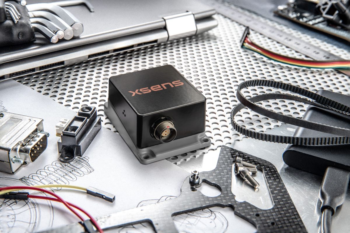
    Xsens Avior is a compact OEM module for embedded system designs.

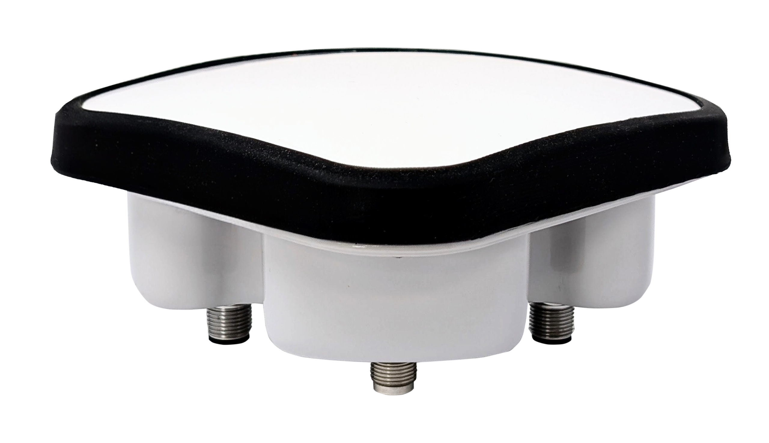
    Xsens Sirius is a standalone MRU in a rugged IP68 housing for harsh environments. It meets MIL-STD-202 requirements.

    Both products support RS-422, CAN, and UART interfaces. Development kits are available for prototyping, with free SDKs for C/C++, Python, ROS1, ROS2, and MATLAB. All units meet CE, FCC, and RoHS regulatory requirements, and are ITAR-free.

    Xsens Avior and Xsens Sirius MRUs are available globally from Movella and authorized partners. For specifications, datasheets, and ordering information, visit www.movella.com/products/sensor-modules or contact a Movella sales representative.

  • RIN updates navigation system guide for small craft

    RIN updates navigation system guide for small craft

    The Royal Institute of Navigation Small Craft Group has released Version 2 of a free navigation guide for small and leisure craft.

    “Electronic Navigation Systems: Guidance for safe use on leisure vessels” is offered as a free digital download and as a hard copy for purchase from Bookharbour. The RIN website is asking those who want to download a copy to answer a single survey question.

    Updates in the new version reflect developments in GNSS, electronic charts and their display systems, as well as feedback from readers, including a new sub-section on Astronavigation (Chapter 5).

    Guidance includes

    • safe use of electronic navigation and associated systems on leisure vessels
    • “keys to safety” in many operational situations
    • advantages and drawbacks of different systems and approaches.

    Version 1 of the “Electronic Navigation Systems” booklet is still available as a free download.

    Feedback for Manufacturers

    As a result of work on the first edition, published in 2020, the small craft group has compiled commendations for improvements to electronic navigation systems for leisure vessels. The improvements could be made by manufacturers and official bodies to assist the safety of leisure vessels through better design or regulation. “These recommendations did not sit comfortably in the booklet so can be viewed here,” the Small Craft Group announced.

    As a result, the Pleasure Vessel Navigation Systems Working Group (PVNSWG) was set up, reporting to the UK Safety of Navigation Committee (UKSON). The Working Group’s remit is to

    • Propose minimum standards of functionality expected from electronic leisure charts and display systems.
    • Explore and consider if a means by which electronic charts and systems displaying them, which meet these standards, could be recognized by the Maritime and Coastguard Agency (MCA) for use on pleasure vessels.
    • Discuss with electronic chart and display system equipment manufacturers the most efficient approach to deliver proposed minimum standards and achieve recognition.

    The report can be downloaded from the Small Craft Group’s webpage when available.

  • Teledyne completes acquisition of Saab’s TransponderTech

    Teledyne completes acquisition of Saab’s TransponderTech

    The new FLIR TransponderTech unit will advance GNSS, AIS and VDES technologies for maritime, aerospace and defense markets.

    Teledyne Technologies has completed its acquisition of the TransponderTech business from Saab AB. The acquired company, now operating as Teledyne FLIR TransponderTech AB, will become part of Teledyne’s Raymarine, FLIR Marine, ChartWorld and Teledyne CARIS group of maritime technology brands.

    Based outside of Linköping, Sweden, the company will market its products and solutions as FLIR TransponderTech. The brand will continue to focus on delivering GNSS, Automatic Identification System (AIS) and VHF Data Exchange System (VDES) technologies.

    Going forward, FLIR TransponderTech will be well positioned to continue to pioneer maritime communication solutions for civil and military customers in shipping, marine traffic, airborne and space segments.

  • Digital Yacht offers Onefix high-performance GNSS sensor for boaters

    Digital Yacht offers Onefix high-performance GNSS sensor for boaters

    Digital Yacht is offering OneFix , a high-performance GNSS sensor designed to offer positioning better than 1 m. The multi-constellation, dual-band sensor also has robust anti-spoofing algorithms to provide more reliable navigation.

    The sensor can fit most popular navigation systems, including legacy units, as well as connect to iPads and tablets and the latest multi-function NMEA 2000 compatible displays.

    OneFix incorporates a dual-band (L1 and L5) processor and works with GPS, Galileo, NavIC and Beidou to calculate a fix. GLONASS is available as an option with a second active antenna. Its advanced algorithm compares position fixes across all networks and frequencies to minimize spoofing and positional inaccuracies. The result is a highly reliable position fix which typically offers sub-1m accuracy.

    Photo:
    Photo: Digital Yacht

    It’s also been designed to connect to older systems via legacy NMEA 0183 as well as more modern systems with NMEA 2000. The wireless interface allows connectivity to iPads and tablets including popular apps such as Navionics and TimeZero. Most importantly, the wireless interface allows the user to view satellite status and potential errors or issues of position spoofing. Alerts for the navigation display are generated via NMEA 2000 if OneFix detects issues.

    It also incorporates data logging and an external event marker switch input so key points of a voyage (or even fishing hotspots) can be logged to memory. Tracks and data can be exported via a mobile device to Google Map overlays.

  • Kongsberg provides maritime gyro compasses for independence from GNSS

    Kongsberg provides maritime gyro compasses for independence from GNSS

    With real-world disruptions increasingly affecting shipping and aviation safety, Kongsberg Discovery’s MGCs (motion gyro compasses) deliver an alternative for reliability, accuracy and resilience in contested environments, according to the company.

    Although traditional gyrocompasses are immune to GNSS signal-based attacks by design, many modern navigation systems incorporate GNSS data to enhance positioning accuracy. For maritime operators, having an autonomous and reliable source of heading and positioning data ensures safety and maintains operational continuity in contested or signal-denied environments. 

    Kongsberg’s MGCs offer resilience, using high-grade strap-down inertial sensors that detect the Earth’s rotation without the need of external input. This allows them to determine true north and maintain precise heading without relying on GNSS. Unlike traditional mechanical gyros, Kongsberg’s MGCs can estimate latitude internally. This ensures consistent accuracy from equatorial regions to the poles. 

    The system also supports Doppler-based seabed and water-column tracking to determine vessel velocity, eliminating the need for satellite-derived speed data.

    MGC Highlights

    Kongsberg’s MGCs provide resilient navigation with advanced inertial technology and motion reference capabilities that enable:

    Photo: Kongsberg
    Photo: Kongsberg
    • Continuous latitude estimation from Earth’s rotation measurements
    • Accurate heading, roll, pitch and heave without GNSS
    • Versatile support for velocity tracking and input

    This robust combination ensures that even when GNSS signals are lost or manipulated by spoofing or jamming, the MGC continues to operate with high precision – offering a resilient navigation backbone when it’s most needed.

    Kongsberg’s MGCs are designed to be maintenance-free, eliminating the need for frequent calibration or mechanical upkeep. Other features include:

    • IMO type-approved: Fully compliant with global navigation standards
    • Maintenance-free design: No spinning parts and no mechanical drift
    • Versatile integration: Can be used standalone or seamlessly incorporated into an INS (inertial navigation system)

    According to Kongsberg, these attributes make the MGCs suitable for commercial and passenger vessels, offshore platforms and naval ships operating in challenging environments.

  • How NOAA is digitizing charts of the Erie Canal

    How NOAA is digitizing charts of the Erie Canal

    Built between 1817 and 1825, the Erie Canal provided a water route from Albany to Buffalo, New York, nearly 363 miles to the west. The Canal connected the Hudson River with the Great Lakes via parts of the Mohawk River, through various land cuts and natural lakes.

    Photo: NOAA
    Photo: NOAA

    Today, NOAA cartographers from the Marine Chart Division are converting paper nautical charts to a digital format and incorporating them into NOAA electronic navigational charts (NOAA ENC). NOAA created its suite of ENCs by digitizing its paper nautical charts. An ENC is a vector database that supports all types of marine navigation. Marine navigators can use the system to see their real- time position in relation to features on a chart.

    Marine navigators using NOAA ENC. (Photo: NOAA)
    Marine navigators using NOAA ENC. (Photo: NOAA)

    By digitizing the paper Erie Canal charts, NOAA can now provide ENCs for the canal from Albany to Lake Ontario. As part of the digitizing process, NOAA cartographers standardized the chart scales covering the canal, moving away from the 64 irregularly shaped paper charts in chart 14786, New York State Canal System.

    1:10,000 SCALE NOAA Custom Chart output near Waterford, New York.(Photo: USGS/NOAA)
    1:10,000 SCALE NOAA Custom Chart output near Waterford, New York. (Photo: USGS/NOAA)

    The ENC is the primary nautical navigation product of the agency, which is ending the production and maintenance of its traditional paper and raster nautical chart products. The remaining paper charts are only being updated with critical corrections until they are fully canceled. Chart 14786 will be one of the last ones canceled, on Dec. 5, 2024.

    Now, marine users are referred to the NOAA Custom Chart Application. It is an online map tool for users to create paper and PDF nautical charts derived from the official NOAA ENC.

  • UK organizations join new center for seabed mapping

    UK organizations join new center for seabed mapping

    Initiative aims to increase the global coverage, quality and accessibility of seabed mapping data through collaboration and the creation of a more integrated marine geospatial sector

    Durdle Door on the beach in Dorset County, United Kingdom. (Photo: Fonrimso/iStock/Getty Images Plus)
    Durdle Door on the beach in Dorset County, United Kingdom. (Photo: Fonrimso/iStock/Getty Images Plus)

    The UK Hydrographic Office (UKHO) is inviting UK government organizations involved in seabed mapping who share common interests in optimizing the UK’s national maritime assets to become members of the newly unveiled UK Centre for Seabed Mapping (UK CSM).

    UK CSM is administered by the UKHO, and was submitted as a UK Government Voluntary Commitment to the United Nations at the UN Ocean Conference in Lisbon, Portugal, on June 27.

    The UK CSM has a remit to increase the coverage, quality and access of seabed mapping data collected using public funds, as well as to better promote it as a critical component of national infrastructure.

    Working groups established

    Created to spearhead a coordinated approach to the collection, management and access of seabed mapping data – and to champion a more integrated marine geospatial sector in the UK – the UK CSM has established three working groups: National Data Collaboration, International Data Collaboration, and Data Collection Standards.

    These working groups will further the discussion and coordination of data accessibility, collection and collaboration, as well as progress work on data standards, by creating the conditions and developing infrastructure to enable the diverse community of marine geospatial stakeholders to come together to deliver significant, sustained and strategic benefits to the UK – particularly in the context of the integrated review and the UK’s Global Britain vision.

    So far, 22 government agencies are involved in the inaugural management group meeting of the UK CSM and volunteered to participate on the working groups.

    The UK CSM will develop specifications that support UK and international standards for the collection of marine geospatial data.

  • Honeywell expands navigation portfolio with new HGuide products

    Honeywell expands navigation portfolio with new HGuide products

    New offerings will deliver accurate navigation to industrial applications even in areas where GPS is unavailable

    The HGuide o360 Navigator. (Photo: Honeywell)
    The HGuide o360 Navigator. (Photo: Honeywell)

    Honeywell has expanded its HGuide industrial navigation portfolio with three new technologically advanced navigation systems — the HGuide o360 INS/GNSS navigator, HGuide n500 inertial navigator and the HGuide g080 GNSS receiver.

    The new HGuide products are designed for a wide array of industrial and autonomous applications across air, land and sea vehicles and related equipment.

    The HGuide o360 navigation system is a compact single-card, all-attitude inertial navigation system (INS) GNSS navigator that can deliver an accurate and robust position and attitude navigation service, even through GNSS-challenged or denied environments, to industrial and autonomous applications. It provides the features and compatibility needed for a simple integration.

    “The HGuide o360 is an engineering marvel and a technological breakthrough. There are no similar competing products in the industry today that can achieve such a high-performance level at this price point and size,” said Matt Picchetti, vice president and general manager, Navigation & Sensors, Honeywell Aerospace. “The entire HGuide product line is suitable for a wide range of industries, including autonomous vehicles, marine and a host of industrial applications where accurate positioning and attitude information is required in real time.”

    The HGuide o360 INS/GNSS navigator contains a powerful dual antenna, multi-frequency, multi-constellation, real-time kinematic (RTK) GNSS receiver, Honeywell’s i300 inertial measurement unit (IMU) technology, and a high-grade calibrated magnetometer.

    The HGuide o360 is designed for platforms that require high-performance navigation data in an ultra-low size, weight and power (SWAP) package.

    The HGuide n500 inertial navigator is a navigation-grade bring-your-own-GNSS all-attitude navigator that supports continuous position and attitude navigation even during prolonged GNSS outages. The HGuide n500 is built on Honeywell’s HG4930 IMU plus the Honeywell HGuide Sensor Fusion software.

    The HGuide g080 GNSS receiver is a dual-antenna, triple-radio frequency, all-constellation GNSS receiver that delivers heading and positioning down to sub-centimeter levels even in GNSS-challenged environments. It includes an onboard IMU to allow tracking during short GNSS outages and enable smooth and fast reacquisition. The product is available with or without RTK functionality.

    Inertial navigation systems are highly critical in navigation and comprise an IMU, a GNSS receiver and sensor fusion software. These components work together to calculate position, orientation and velocity to deliver critical navigation information in GNSS-denied areas such as urban canyons, bridges, tunnels, mountains, parking garages and dense forests.

  • Advanced Navigation launches Boreas digital FOG

    Advanced Navigation launches Boreas digital FOG

    Photo: Advanced Navigation
    Photo: Advanced Navigation

    Advanced Navigation has launched a new fiber-optic gyroscope inertial navigation system (INS), named Boreas. It is an ultra-high accuracy, strategic-grade INS, offering a reduction in size, weight, power and cost. Boreas is the first product to be released based on Advanced Navigation’s new DFOG (digital fiber-optic gyroscope) technology, which is the culmination of 25 years of development involving two research institutions.

    The Boreas is targeted at applications requiring always-available, ultra-high accuracy orientation and navigation including marine, surveying, subsea, aerospace, robotics and space.

    “Boreas is the first product on the market to offer our patent-pending DFOG technology,” said Advanced Navigation CEO Xavier Orr. “DFOG represents a step-change for fiber-optic gyroscopes. With Boreas’ ultra-high-accuracy and strategic-grade performance combined with the reduction of size, weight, power and cost by 40%, we will be able to enable new industries and applications that were never possible before.”

    The Boreas delivers strategic-grade bias stability of 0.001 deg/hr. This allows it to achieve ultra-high roll/pitch accuracy of 0.005 degrees and heading accuracy of 0.006 degrees. Boreas allows for full independence from GPS with dead-reckoning accuracy of 0.01% distance traveled with an odometer or Doppler velocity log.

    The Boreas features ultra-fast gyro compassing, taking only 2 minutes to acquire heading in both stationary environments or on the move. Gyro compassing allows the system to determine a highly accurate heading of 0.01 degrees secant latitude without relying on magnetic heading or GPS.

    The Boreas contains Advanced Navigation’s sensor-fusion algorithm, which is more intelligent than the typical extended Kalman filter. The algorithm is able to extract significantly more information from the data by making use of human-inspired artificial intelligence. It was designed for control applications, with a high level of health monitoring and instability prevention to ensure stable and reliable data.

    Advanced Navigation designed Boreas from the ground up for reliability and availability. Both the hardware and software are designed and tested to safety standards, and it has been environmentally tested to mil standards.

    The system is designed for a mean time between failures of 500,000 hours. Additional features include Ethernet, CAN and NMEA protocols, as well as a disciplined timing server providing PTP. An embedded web interface provides full access to all of the device’s internal functions and data. Internal storage allows for up to one year of data logging.

  • Hexagon | Veripos expands SPAN GNSS+INS portfolio for dynamic positioning

    Hexagon | Veripos expands SPAN GNSS+INS portfolio for dynamic positioning

    Ensures safe operations through reliable, robust and continuous positioning with GNSS+INS integration

    Hexagon | Veripos has expanded its inertial solution SPAN GNSS+INS technology from NovAtel, also part of Hexagon, to dynamic positioning (DP) applications and vessels.

    SPAN technology delivers a deeply coupled GNSS and inertial navigation system (INS) that provides robust, reliable and continuous centimeter-level positioning for operators to maintain safety and maximize uptime.

    With a GNSS+INS solution, DP vessels can bridge outages in GNSS tracking and through short periods of radio-frequency interference, jamming or spoofing.

    Veripos is a leader in offshore high-precision positioning, delivering reliable and trustworthy GNSS solutions such as the LD900 receiver, PPP correction services and positioning visualization software. This expertise is demonstrated through SPAN technology’s deep coupling of GNSS and inertial measurements.

    Deep coupling describes how inertial measurements enhance the signal tracking for GNSS solutions, leading to improved resiliency against GNSS outages and enabling rapid reacquisition in case of interruptions. SPAN technology builds system robustness against potential signal outages, interference or disruptions while optimizing operational efficiency.

    “The robust positioning, heading, velocity and attitude measurements generated from a deeply coupled GNSS and inertial solution like SPAN technology is a game-changer to dynamic positioning operations,” said David Russell, marine segment portfolio manager at Hexagon’s Autonomy & Positioning division. “SPAN technology has a proven track record of bridging outages, enabling rapid reacquisition of signals, and building a reliable and robust positioning system. It’s the best option for vessels to ensure an added layer of resiliency and achieve continuous centimeter-level accuracy across all conditions.”

    SPAN GNSS+INS technology is compatible with commercial inertial measurement units (IMUs) and scalable with the LD900 GNSS receiver, Quantum visualization software and APEX correction services.

    Image: Hexagon
    Image: Hexagon

  • RTK From the Sky tech transforms TerraStar-C PRO service with 3-minute global convergence

    RTK From the Sky tech transforms TerraStar-C PRO service with 3-minute global convergence

    TerraStar-C PRO is the first global correction service from Hexagon to incorporate RTK From the Sky technology to achieve RTK-level accuracy in three minutes with 99.999% availability

    In late 2020, Hexagon’s Autonomy & Positioning division announced its technological breakthrough of global RTK From the Sky, demonstrating a future where instantaneous PPP and global RTK-level accuracy is possible.

    Integrating this innovation into the core of TerraStar-C PRO, NovAtel’s corrections service, is the first phase in implementing RTK From the Sky technology into the company’s diverse portfolio of correction services for users worldwide.

    As a result, TerraStar-C PRO has become the fastest global correction service to provide centimeter-level accuracy, not just in open-sky environments but also across challenging conditions created by buildings and foliage, according to Hexagon | NovAtel.

    “RTK From the Sky technology is the foundation that enables our global correction services to be world-leading across agriculture, automotive, defense, survey, marine and autonomous applications,” said Michael Ritter, Autonomy & Positioning division president and CEO. “Our dedication to research culminated in an industry-changing technology; we’ll continue that commitment by providing the best positioning experience in speed, accuracy, availability and reliability anywhere in the world.”

    TerraStar-C PRO now converges in less than three minutes by utilizing quad-band receiver and antenna technology to leverage modernized BeiDou III, GPS III and Galileo E6 signals. The resulting process generates state-of-the-art corrections for all GNSS frequencies.

    Hexagon is a consistent innovator in GNSS, as seen in its role in developing RTK and PPP solutions. With this next-generation modernization of PPP correction generation and algorithm development, the company continues this tradition in providing the highest quality and best performing global positioning experience to users with land- and air-based applications.

    “It’s been a privilege to collaborate across the division to develop RTK From the Sky technology and leverage our collective expertise in correction generation, PPP algorithms and the entire positioning ecosystem,” said Leos Mervart, head of PPP algorithm development at Hexagon’s Autonomy & Positioning division. “I’ve worked with PPP technologies since the beginning of my career and am proud to say that this is a new era of what global positioning can look like.”

    The TerraStar-C PRO improvements are accessible now through the 7.08.10 firmware release for users on OEM7700, OEM719 and OEM729 cards and their associated enclosures for land and air applications.

    Future firmware releases will include global RTK From the Sky technology throughout Hexagon’s correction service portfolios for its global client base, including precision agriculture and marine applications.

    To learn more about TerraStar correction services or to request a free 5-day trial, visit NovAtel.com/TerraStar.