The International Marine Contractors Association (IMCA) has published “Guidelines on the use of GNSS for tide calculations” (IMCA S 027). It provides an overview of how GNSS can assist in more accurate real-time direct measurement of tidal changes. IMCA S 027 is available for members to download free of charge, and costs £50 for non-members.
IMCA S 027 includes sections on
tide theory
geodetic reference systems and tidal datums
tides from GNSS
quality assurance and quality control
glossary, references and a list of further reading
“As with horizontal positioning, vertical positioning is referenced to specified datums,” explained Nick Hough, IMCA’s technical adviser for Offshore Survey. “Unlike land surveying, where vertical measurements (elevations) are made from and to a known, fixed position, vertical measurements offshore (depths) are taken against a moving dynamic surface.”
“All absolute depths recorded from survey activities need to be adjusted for tide and reduced to a known constant vertical datum such as Mean Sea Level (MSL) or Lowest Astronomical Tide (LAT),” Hough said. “The effect of tides will result in depth differences at different times of the day, and at the same times on different days.”
“Advances in GNSS technology enable accurate and consistent calculation of height above a known datum, which means reliance on tide gauges or tide prediction tables is no longer necessary,” Hough said.
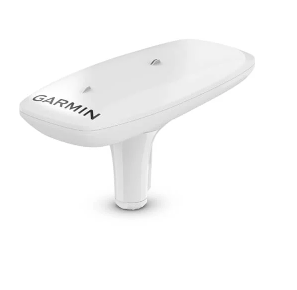
GPS-based navigation tool with multi-band GNSS provides reliable, accurate heading and position information
Garmin International Inc. has launched the MSC 10 marine satellite compass with multi-band GNSS and a fully integrated attitude and heading reference system (AHRS) for a smooth and accurate GPS-derived heading and position on the water.
“Garmin was the first to deliver a marine positioning receiver and antenna utilizing multi-band GNSS support, and we’re pleased to continue to bring this innovative technology to our customers with the MSC 10 satellite compass,” said Dan Bartel, Garmin vice president of worldwide sales. “An advanced navigation tool, the GPS-based MSC 10 won’t be impacted by magnetic interference, so even in challenging situations, you’ll know exactly where you’re headed.”
Utilizing both L1 and L5 GPS frequencies, along with multi-constellation support (GPS, Galileo, GLONASS and BeiDou), the MSC 10 provides precise positioning and heading accuracy within 2 degrees. Its 10-Hz position update rate delivers better, more detailed tracking information. By using satellite signals, it eliminates magnetic interference, which can degrade heading accuracy.
The MSC 10 is easy to install and can be used as the primary position and heading sensor across multiple systems, including autopilots. Along with heading, the MSC 10 will also deliver reliable, precise pitch, roll and heave information — even in rough seas — to a compatible Garmin chartplotter via the NMEA 2000 network. In the rare case that satellite signal is lost, it will seamlessly transition from GPS-based to a backup magnetometer-based heading.
NMEA 2000 certified, the MSC 10 is compatible with a wide range of Garmin chartplotters, including the GPSMAP 8400/8600 series, the new GPSMAP 7×3/9×3/12×3 series, and the keyed GPSMAP 10×2/12×2 series.
The MSC 10 is expected to be available this month.
New service provides PPP convergence for centimeter-level accuracy on land, air and marine applications around the world
Research from Hexagon’s Autonomy & Positioning division has resulted in breakthrough innovations in precise point positioning (PPP) that enable nearly instant global centimeter-level accuracy. These developments pave the way to bring “RTK from the Sky” performance to worldwide users through correction service products and GNSS receivers from Hexagon.
RTK from the Sky technology provides the quick accuracy of an RTK solution with the high accessibility and availability of PPP. Users will no longer have geographic or regional infrastructure restrictions — they will be free to operate anywhere around the world with the same premium level of positioning performance.
RTK from the Sky technology removes the traditional PPP barrier of long convergence times as well as internet and radio communication limitations, delivering instantaneous convergence anywhere in the world. This breakthrough establishes the foundation for assured positioning with no downtime in marine, agriculture, and autonomous applications.
To achieve these results, there must be masterful attention to detail throughout the entire positioning ecosystem: no errors conveniently cancelled and no errors ignored. All errors are carefully estimated and removed from the final GNSS position faster and more reliably than ever before.
This end-to-end fine-tuning of measurement quality and error mitigation establishes the foundation for RTK from the Sky performance. No matter the location or application, users will be able to rely upon the highest availability and accuracy of corrections anywhere in the world, without the convergence time, Hexagon said.
“In 2020, PPP has become RTK — without the mobility limitations,” said Sandy Kennedy, VP of Innovation at Hexagon’s Autonomy & Positioning division. “RTK from the Sky has been a very satisfying development. To see this kind of positioning performance available anywhere in the world is the realization of the next step of innovation for GNSS.”
RTK from the Sky technology will be the foundation for future correction service products and applications from Hexagon built for diverse applications.
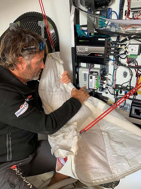
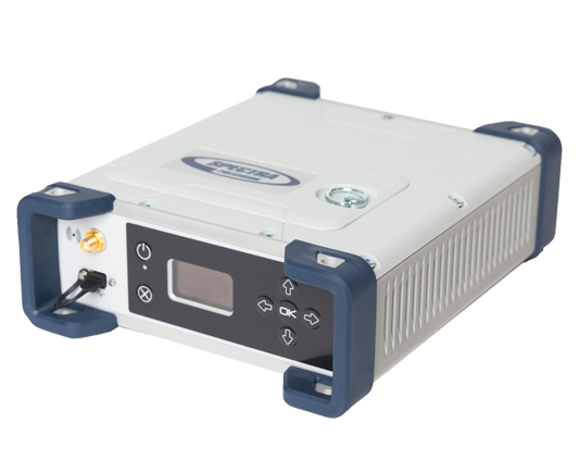
The Spectra Geospatial SP90m GNSS receiver will guide the racing yacht Maître CoQ for the 2020 Vendée Globe, single-handed, non-stop around-the-world yacht race. The Vendée Globe is an extreme endurance test for both sailor and boat and widely considered the ultimate challenge in ocean racing. The race starts Nov. 8 and is expected to finish in late January or early February.
The SP90m will provide the skipper of the Maître CoQ, Yannick Bestaven, with precise position and boat heading information. The SP90m information is integrated to a separate attitude information source, and the entire package of the position, heading and attitude is sent to the boat’s autopilot.
Photo: Spectra Geospatial
Bestaven, responding to the changing sea and wind conditions, strategically adjusts the autopilot to keep the boat moving at top speed to the desired destination as he changes and trims sails and trims foils to achieve maximum sailing efficiency.
The Maître CoQ is an advanced design mono-hull foiling sailing yacht in the category of IMOCA (International Monohull Offshore Class Association) which have a fixed length of 18.28 meters (60 feet), Antoine Connan, head of engineering for the Maître CoQ racing team, selected the SP90m.
The hostile environment and requirements for precise position information at sea far from land made the selection of the SP90m an important technical choice. It always delivers an accurate position and precise heading with no GNSS corrections.
Commenting on the performance of the SP90m in the recent July 2020 2,800-mile qualifying race, the Vendée- Arctique-Les Sables D’Olonne, Connan reports, “We are already very happy with its installation on board.”
The SP90m is a rugged design for marine environments. With 480-channel tracking and dual GNSS antenna inputs, the SP90m is an integrated onboard rover receiver offering minimal size and low power consumption.
When the Maître CoQ technical team, based in La Rochelle, decided they needed to upgrade the boat’s navigation system, they contacted Cadden, a specialist in supplying advanced electronic precision measurement sensors. In addition to the requirement for delivering fast, precise position and heading data, the new sensor had to be lightweight, small, require little power, be easy to integrate, and flawlessly withstand a hostile saltwater environment. Cadden’s analysis concluded the Spectra Geospatial SP90m fit the spec perfectly.
“We are thrilled that the Maître CoQ racing team selected the Spectra Geospatial SP90m,” said Olivier Casabianca, vice president Spectra Geospatial. “It’s one more confirmation that Spectra Geospatial provides truly the highest quality rugged and precise GNSS receivers.“
About the Vendée Globe 2020. Held every four years, the Vendée Globe is a single-handed (solo) non-stop yacht race around the world without assistance. It starts and finishes in Les Sables-d’Olonne in the Département of Vendée in France. The course is a circumnavigation from Les Sables- d’Olonne, that heads south in the Atlantic Ocean to the Cape of Good Hope, then east in the Southern Ocean clockwise around Antarctica, keeping Australia’s Cape Leeuwin and South America’s Cape Horn to port (to the left); and then back north in the Atlantic returning to finish in Les Sables-d’Olonne.
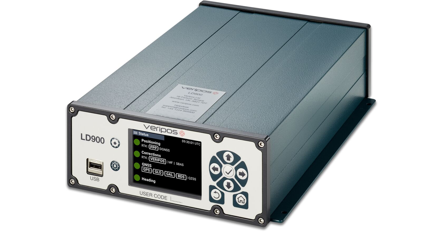
Veripos has released the LD900, a quad-band GNSS receiver capable of tracking GPS, GLONASS, BeiDou, Galileo and QZSS constellations to provide reliable and accurate positioning. Access to multiple GNSS signals allow for better satellite availability and reduce the impact of satellite masking or blockage, which can affect positioning.
LD900 also receives L-band signals on multiple channels, providing access to the worldwide independent correction links and services provided by Veripos. With correction data available simultaneously from up to three correction satellites, the impact of satellite masking can be minimized to ensure reliable reception of correction data. Using the independent L-band RF input on the LD900 allows the connection of a dedicated L-band antenna ensuring optimal reception of correction services, especially at high latitudes, the company said.
Veripos provides accurate and reliable positioning for all marine applications via their redundant positioning and multi-frequency precise point positioning (PPP) Apex and Ultra services.
The Apex5 correction service utilizes all GNSS constellations delivering 5cm positioning accuracy for use in the most demanding offshore applications. Real-time kinematic (RTK) corrections can be utilized by the LD900 for applications where this service is required.
The intuitive color display and navigation menu makes setup, configuration and system status monitoring simple. The display also helps troubleshoot issues with the LD900 allowing faults to be quickly diagnosed and resolved. The LD900 can also be configured remotely through the Veripos Quantum software.
Features and Benefits
Supports decimeter-level multi-constellation positioning with Veripos Apex and Ultra PPP correction services
Multi-channel L-band allows simultaneous tracking of 3 Veripos correction service satellites
Independent L-band RF input
Easy-to-use, intuitive, color display for simple configuration and monitoring
Advanced signal filtering mitigates the effects of interference from other transmitters
Optional ALIGN GNSS heading solution
Optional MSK Beacon receives corrections from IALA marine radio beacon network
Automatic 72-hour rolling data log for incident support
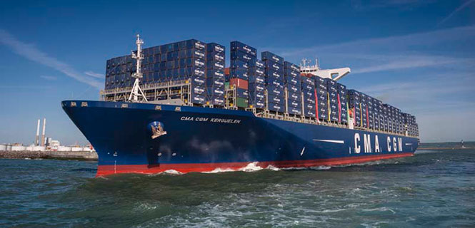
The 18,000-container-capacity CMA CGM Kuergelen. (Photo: CMA CGM)
Of the 273 papers researchers presented this year at the Institute of Navigation’s annual ION GNSS+ conference, which took place in Miami on Sept. 16–20, the following five focused on maritime issues. Papers are available at www.ion.org/publications/browse.cfm.
Automating the Sharing of Ocean Weather Data
The Automatic Identification System (AIS) — mandatory for large ships and used by many mid-sized ones — was designed to help avoid collisions, enable shore authorities to provide vessel traffic services, and allow coastal states to monitor their waters. It also may be used to transmit other information between AIS stations onboard and ashore.
In the aftermath of the sinking of the container ship El Faro in 2015, the U.S. National Transportation Safety Board (NTSB) and U.S. Coast Guard found a contributing factor was lack of reliable weather forecasts. The NTSB then recommended to the National Oceanic and Atmospheric Administration (NOAA) that it determine whether AIS could be used to share weather data collected by ships, to supplement the Voluntary Observing Ship (VOS) program where ships voluntarily submit weather observations to NOAA. The paper describes a successful test of this concept.
Citation. Gregory Johnson, Ken Dykstra, Gaurav Dhungana and Brian Tetreault, “Sharing Ships’ Weather Data via AIS.”
EGNOS for Maritime Navigation
The European Geostationary Navigation Overlay System (EGNOS), which has been providing guidance to civil aviation since 2011, also can support maritime, railway and road applications. This paper assesses its use for maritime navigation compliant with International Maritime Organization (IMO) requirements for harbor entrances, harbor approaches and coastal waters: 99.8% of signal availability, 99.8% of service availability, 99.97% of service continuity, and 10 meters of horizontal accuracy. A kinematic test campaign was conducted in the waters of the Canary Islands using a geodetic multi-frequency, multi-constellation receiver-antenna pair installed aboard two vessels. The EGNOS Maritime Service met all IMO requirements by achieving a signal availability of 99.999%, a service availability in 99.9% of a predefined rectangular region, and 1.06 meters of horizontal accuracy at the 95th percentile. The service continuity requirement, however, was met in only 62.50% of the predefined region. Therefore, the paper concludes that the continuity risk is the most limiting factor for expanding the EGNOS Maritime Service along the coastal waters of the Canary Islands.
Citation. Deimos Ibáñez Segura, Adria Rovira Garcia, Jaume Sanz, José Miguel Juan, Guillermo González Casado, María Teresa Alonso, José A. López Salcedo, Huamin Jia, Francisco Javier Pancorbo Garcia, Carlos Garcia Daroca, Irene Martin Calle, Santos Rodrigo Abadía Heredia and Manuel López Martínez, “A Kinematic Campaign to Evaluate EGNOS 1046 Maritime Service.”
Options for Integrity
Many maritime authorities are considering how to maintain the integrity of navigation systems as their infrastructure ages, especially given that the need for integrity in the user position is expected to increase with e-navigation services and for autonomous vessels. In harbor entrances, harbor approaches and coastal waters, the International Association of Marine Aids to Navigation and Lighthouse Authorities (IALA) prescribes an absolute horizontal accuracy of ≤10 meters 95% of the time, with an integrity risk of 99.99999%. Today’s GNSS more than meets that accuracy requirement, so the driver is integrity. Options for integrity are marine radiobeacon DGPS/DGNSS, the primary augmentation system in use today; receiver autonomous integrity monitoring (RAIM); satellite-based augmentation systems (SBAS); and others (such as commercial services or inertial.). The European MarRINav project is investigating resilient PNT options to support UK Critical National Infrastructure. Part of this work is comparing EGNOS and marine radiobeacon DGPS performance to inform international discussions and receiver standardization.
Citation. Alan Grant, George Shaw and Martin Bransby, “Considering SBAS and marine radiobeacon corrections to support safe maritime operations.”
Evaluation of WAAS for Use in Canadian Waters
Mariners navigating in Canadian waters use a ground-based augmentation system (GBAS) that provides differential corrections and integrity monitoring of GPS. This GBAS has been provided since 1994 by the Canadian Coast Guard (CCG) in the form of a differential GPS (DGPS) broadcast service. The service is only provided south of latitude 60°N in collaboration with the U.S. Coast Guard. Before embarking on a recapitalization program of its 24-year-old DGPS, and given that the U.S. Coast Guard is progressively shutting down its National Differential GPS sites, the CCG is evaluating options for its own DGPS network. Options include the wide-area augmentation system (WAAS), originally developed by the U.S. Federal Aviation Administration for civil aviation. This paper describes the authors’ evaluation for the CCG to determine the expected accuracy, integrity and availability of WAAS throughout Canadian waters, concluding that the current WAAS provides acceptable accuracy and integrity for most of Canada, excluding the higher latitudes.
Citation. Gregory Johnson, Gaurav Dhungana and Jean Delisle, “An Evaluation of WAAS 2020+ to Meet Maritime Navigation Requirements in Canadian Waters.”
GNSS + INS for Attitude Determination
Attitude determination (AD) is an important navigation component for ships and spacecraft. GNSS enables resolving their orientation in a precise and absolute manner, by employing multiple antennas rigidly mounted on the vessel. This requires carrier-phase observations, with the consequent added complexity of resolving integer ambiguities. Inertial aiding has been extensively exploited for AD, because it enables tracking fast rotation variations and bridging short periods of GNSS outage. In this paper, the fusion of inertial and GNSS information is exploited within the recursive Bayesian estimation framework, applying an Error State Kalman Filter, which, unlike common Kalman filters, tracks the error or variations in the state estimate, posing meaningful advantages for AD. The results show that the inertial aiding, along with a constrained attitude model for the float estimation, significantly improve the performance of attitude determination compared to classical unaided baseline tracking.
Citation. Daniel Medina, Vincenzo Centrone, Ralf Ziebold, and Jesús García, “Attitude Determination via GNSS Carrier Phase and Inertial Aiding.”
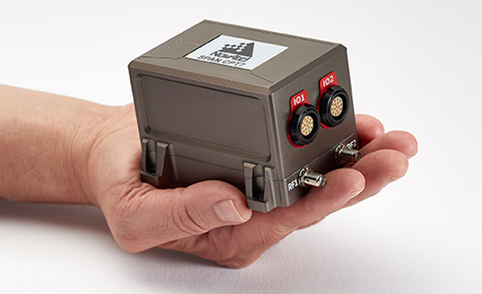
NovAtel, part of Hexagon’s Positioning Intelligence division, now brings users greatly improved processing speed and accuracy as well as significantly reduced signal acquisition time through the latest 7.07.03 firmware release.
The SPAN CPT7. (Photo: NovAtel)
The firmware works best with the recently launched TerraStar-X correction service, which delivers accuracy and reliability, as well as the OEM7, SPAN CPT7 and PwrPak7 products, which use signals from all GNSS constellations and frequencies to provide users with reliable autonomy and exceptional positioning availability.
The 7.07.03 firmware offers a significant improvement to the SPAN GNSS + INS (inertial navigation system) technology. SPAN with 7.07.03 shows improvements of up to 20% in the horizontal position over the entire SPAN IMU catalog and across various industry use cases including agriculture and marine. SPAN with 7.07.03 also provides improved motion detection, resulting in more robust time to convergence.
“The 7.07.03 firmware features improvements to both our SPAN Marine and SPAN Rail profiles that will greatly impact application performance and consistency,” noted NovAtel Director of Product Management, Neil Gerein, “The SPAN Marine Profile sees improvements to the heave performance and will allow users to start their work significantly faster thanks to a simplified setup for applications in marine dynamics. The SPAN Rail Profile improves position accuracy over long GNSS outages, which is crucial for applications in rail environments that often deal with potential signal obstructions such as trees, tunnels and dense urban areas.”
To download the 7.07.03 firmware update for your platform, click here.
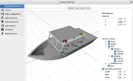
The Horizon fiberoptic gyro (FOG) inertial measurement unit (IMU) now forms part of SBG Systems’ Navsight Marine Solution, dedicated to hydrographers. Navsight is available at different levels of accuracy to meet the various application requirements and can be connected to various external equipment such as echo-sounders, lidar, and so on.
Photo: SBG Systems
Navsight Marine Solution already offered two levels of performance with the Ekinox and Apogee IMUs. These MEMS-based IMUs address most of hydrographics markets whether shallow or deep water.
The new Horizon IMU enables customers to deploy Navsight in the most demanding environments such as surveying highly dense areas (bridges, buildings, and so on) as well as applications where only a single antenna can be used.
The Horizon IMU is based on a closed-loop FOG technology which enables ultra-low bias and noise levels. This technology allows robust and consistent performance even in low dynamics survey.
Navsight solution is easy to install, as the sensor alignment and lever arms are automatically estimated and validated. Once connected to the Navsight processing unit, the web interface guides the user to configure the solution. A 3D view of the vessel shows the entered parameters so that the user can check the installation. The Navsight unit also integrates light emitting diode (LED) indicators for satellite availability, RTK corrections, and power. It comes with a rugged enclosure, or in a rack version for larger vessels.
Completing the Navsight offer, Qinertia, SBG’s post-processing software, gives access to offline RTK corrections from more than 7,000 base stations located in 164 countries. Trajectory and orientation are then greatly improved by processing inertial data and raw GNSS observables in forward and backward directions. Computation takes less than 3 minutes for a 6-hour log thanks to the Forward and Backward calculation processed at the same time.
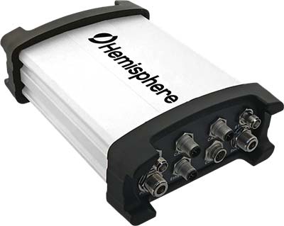
Hemisphere GNSS has introduced the Vector V1000 GNSS receiver for precision marine applications. The V1000 provides high-accuracy heading, position, pitch, roll and heave data.
The company made the announcement at the Oceanology International conference being held this week in London, U.K.
The V1000 supports multi-frequency GPS, GLONASS, BeiDou, Galileo, QZSS and IRNSS (with future firmware upgrade and activation) for simultaneous satellite tracking. The receiver is powered by Hemisphere’s Athena real-time kinematic (RTK) engine and is Atlas L-band capable.
The new V1000 is designed for professional marine applications, such as hydrographic and bathymetric surveys, dredging, oil platform positioning, buoys and other applications that demand the highest level 3D positioning accuracies. Based on Hemisphere’s Eclipse Vector technology, the V1000 uses the most accurate differential corrections including RTK and Atlas L-band.
The V1000 is Hemisphere’s flagship receiver, with an integrated display, that can be conveniently installed near the operator. The two antennas can be installed at user-specified separation, providing valuable flexibility in terms of install locations and desired heading accuracy.
The V1000 has heading accuracy of better than 0.01 degree when using a 10-meter antenna separation. With CAN, serial, Bluetooth, Wi-Fi and Ethernet support and flexible installation, the all-new rugged enclosure gives the V1000 the advantage of working reliably in harsh environments, the company said.
Septentrio, a designer and manufacturer of GNSS solutions, has awarded the Katholieke Universiteit Leuven (KU Leuven) Ecochallenge team — the winners of the Galileo Masters (Flanders Challenge) of the European Satellite Navigation Competition (ESNC) — with an AsteRx-m UAS receiver for its proposal to use high-precision high-reliability Galileo receivers to modernize inland waterway transport by introducing autonomous technology for the vessels.
The judging panel were impressed with the proposal from the KU Leuven Ecochallenge team to use high-quality Galileo receivers to improve the safety and efficiency on autonomous and existing vessels, which can be retrofitted with the solution.
The ambitious proposal offers a pragmatic step towards rejuvenating inland waterways as a viable ecological alternative for freight transportation, Septentrio said in a news release.
The KU Leuven team also participated in Ecorace Challenge organized by the Flemish Waterways Agency and was both the overall winner in the cargo category as well as being voted the most innovative vessel in 2016.
The AsteRx-m receiver board won by KU Leuven Ecochallenge team is a GNSS solution for applications in autonomous and unmanned vehicles, such as drones. The AsteRx-m UAS offers centimeter-level accuracy at 700 mW using L1/L2 GPS and GLONASS RTK.
The AsteRx-m OEM Board by Septentrio.
“As traffic continues to increase, exploiting inland waterways has been identified as a critical development for easing the pressure on road networks,” said Jan van Hees, director of business development at Septentrio. “High-precision high-reliability positioning technology using GNSS is an essential element of the development. The KU Leuven team have demonstrated an innovative autonomous small vessel prototype already to move cargo safely and efficiently on the Flemish waterways, and we look forward to continued collaboration as they further develop this technology for bigger ships.”
“The team is very pleased with their performance winning the Septentrio Prize and the Ecorace Challenge together in the same year,” said Geert Waeyenbergh of KU Leuven, who mentored the KU Leuven Ecochallenge team. “The received AsteRx-m will further help research and development of better ships going into the future.”
NovAtel, the OEM supplier of high-precision GNSS positioning technology, unveiled its Oceanix Nearshore correction service at the Ocean Business show in Southampton, U.K.
Oceanix Nearshore, a subscription-based GNSS correction service for Precise Point Positioning (PPP), provides exceptionally reliable subdecimeter positioning for marine applications such as dredging, hydrographic survey, mapping and coastal patrolling.
The robustness of Oceanix infrastructure sets it apart from the competition. Oceanix precise corrections data is generated utilizing a network of over 80 strategically located GNSS reference stations globally.
Oceanix’ high-rate corrections ensure the full accuracy of carrier phase is gained for enhanced solution accuracy. Oceanix corrections are delivered via geostationary satellites over L-band directly to the enduser, providing reliable high accuracy positioning worldwide.
“NovAtel is in the unique position to have control over the entire PPP data generation process as well as the positioning algorithms that drive GNSS receiver performance, delivering the best user experience for our marine customers,” said Miguel Amor, chief marketing officer for Hexagon Positioning Intelligence. “With the launch of Oceanix Nearshore, our customers now have the ability to obtain not only world-leading GNSS technology, but also a truly robust correction service and integrated support all from a single vendor.”
Oceanix offers multiple subscription durations so that our clients can obtain the service that best fits with the needs of their application. Driven by the NovAtel CORRECT positioning engine, Oceanix Nearshore delivers 4 cm horizontal and 6 cm vertical accuracy rms. Algorithms proprietary to NovAtel CORRECT greatly enhance the accuracy and recovery speed from GNSS signal interruptions.
TCarta Marine LLC of Denver, Colorado, has merged with Proteus Geo of Oxford, England, to create a global mapping company that provides bathymetric and marine data sets from the shallow coastal zone out to the continental shelf.
The new company is called TCarta Marine and will maintain offices in Denver and Oxford.
“By merging, we believe the merged company provides a wider and more sophisticated range of products than any other supplier worldwide,” said TCarta Marine CEO David Critchley. “TCarta Marine is now a one-stop shop for bathymetric and marine data.”
Image: Proteus Geo
TCarta Marine will continue offering all existing product lines from the two companies, as well as new products and services under development. Primary markets served will be engineering, oil and gas, government and defense with expansion planned into the insurance, 3D modeling and aquaculture industries.
“Our goal is to make it easier for the marine community to obtain and use quality mapping data,” said TCarta Marine President Kyle Goodrich. “To support every phase of offshore projects, we now offer lower resolution bathymetry for regional planning as well as high-resolution, highly accurate seafloor modeling for precise coastal engineering activities. Additionally, we offer a range of global and regional marine basemaps.”
In recent years, TCarta Marine and Proteus Geo collaborated on many projects and had numerous clients in common due to the complementary nature of their product lines.
David Critchley established Proteus Geo in the United Kingdom in 2011 to leverage a new technology that derives high-accuracy seafloor survey and seabed classification information from multispectral satellite imagery. Operating at a fraction of the cost of traditional ship and airborne bathymetric technologies, the Proteus methodology has been deployed extensively in energy exploration, infrastructure engineering and environmental applications in shallow-water coastal zones.
“The two-meter satellite-derived bathymetric data can be derived to depths of 35 meters depending on water clarity and every depth has an uncertainty value assigned,” said Critchley.
TCarta Marine was started in 2008 by Kyle Goodrich to fill an enormous gap in quality bathymetric data from the littoral zone out to the base of the continental shelf, distance often spanning hundreds of kilometers. The firm developed proprietary techniques for aggregating seafloor depth data from numerous medium- to coarse-resolution sources, including navigation charts, ship tracklines, and boat surveys. TCarta Marine has built an off-the-shelf line of 90- and 30-meter GIS-ready products covering the Earth’s most important marine areas.
“Our bathymetric products are available via annual subscription for streaming directly into our clients’ GIS and mapping applications,” said Goodrich. “Oil, gas and renewable energy companies have become major users of TCarta Marine products.”
As president of the new TCarta Marine, Goodrich will focus on developing additional products and innovative methods for delivering them. The global company seeks to expand its foothold in traditional marine markets and cultivate new applications for seafloor data. Critchley, as CEO of TCarta Marine, will be responsible for business development in new geographic regions of the world.
In the near term, TCarta Marine and Proteus Geo customers can look forward to purchasing the existing 90-, 30- and 2-meter resolution product lines online through a new web portal, now under development. Information can be found and orders placed now through the new unified TCarta Marine website at www.TCartaMarine.com.
Proteus FZC, an affiliated company of Proteus Geo based in the United Arab Emirates, will remain a stand-alone company offering terrestrial geospatial and marine consulting services in the Middle East.