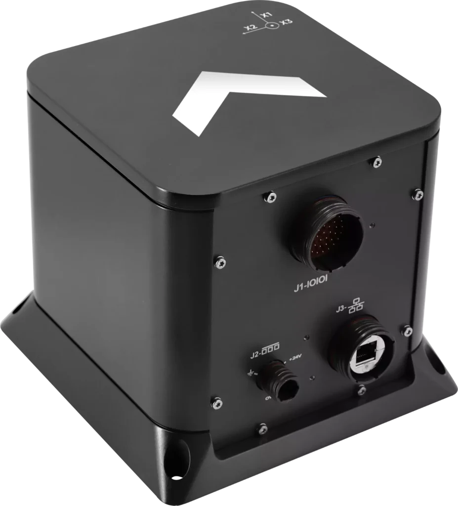
Exail has unveiled the Advans Vega SL, a new high-precision inertial navigation system that maintains navigation continuity across amphibious operations.
In contested littoral environments, maintaining reliable navigation across the sea-to-land transition remains a persistent challenge for amphibious forces. In the event of GNSS jamming, spoofing or signal unavailability, the Advans Vega SL operates independently of any external signal from vessel departure to shore, ensuring forces maintain continuous positioning and fire control readiness without reconfiguration at any stage.
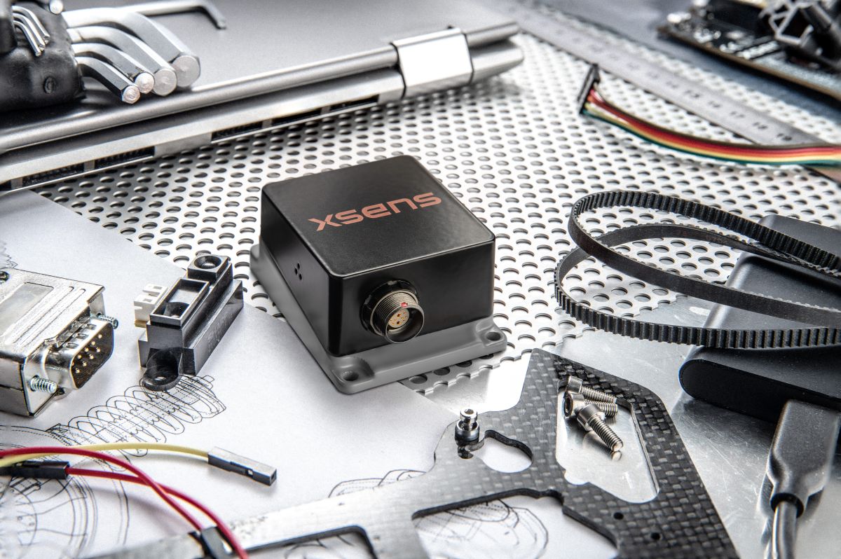
The Advans Vega SL INS. (Credit: Exail)
As a single, self-contained solution covering both maritime and land phases, it also removes the integration constraints associated with multi-system architectures, which typically require reconfiguration or handover at the water-to-land transition.
With 0.05° RMS heading accuracy in the maritime phase and 0.5 mils RMS on land, the Advans Vega SL system maintains positioning continuity in GNSS-denied environments without reconfiguration.
“GNSS signal denial is now an operational assumption in any amphibious and littoral combat planning,” said Yann Le Balc’h, business development manager for land defense, Exail. “The Advans Vega SL removes satellite dependency at the most exposed phase of an amphibious operation, giving forces the autonomy to project ashore on their own terms.”
Drawing on Exail’s fiber-optic gyroscope technology, the Advans Vega SL delivers 0.05° RMS heading accuracy in the maritime phase and 0.5 mils RMS on land — the highest navigation precision achieved to date in a system designed for the full sea-to-land transition. This performance level is rooted in decades of navigation expertise across land and naval operations, now brought to bear on a capability requirement that has become increasingly critical in modern amphibious warfare.
With navigation systems in service with more than 70 navies and land forces worldwide, Exail is a recognized supplier for defense forces requiring sovereign, signal-independent positioning capability across all operational domains.
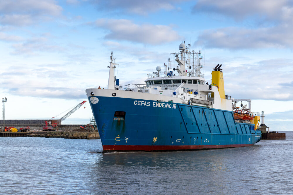
The UK Centre for Seabed Mapping (UK CSM) will undertake a seabed mapping survey – CSM2026 – to explore and map the seabed along the UK’s southwest coastline.
The research survey takes place between April 20 and May 19. It consists of two survey legs, starting in Lowestoft, Suffolk, and ending in Falmouth, Cornwall. Throughout the four-week survey, using cutting‑edge survey technology deployed from the Research Vessel Cefas Endeavour, a team of 26 scientists from across the field of maritime research began collecting vital hydrographic, geological and environmental data when they set sail from Lowestoft next week.
The survey represents an unprecedented level of collaboration within the maritime sector. By combining skills and capabilities in a single survey, the team aim to secure data to deliver the UK government’s commitments and make advances in how the seabed is mapped, understood and managed.
UK CSM includes more than 30 public sector organizations commited to collect and share high-quality marine data. For the coastline mapping project, the 11 involved are the Maritime and Coastguard Agency (MCA); the UK Hydrographic Office (UKHO); British Geological Survey (BGS); Centre for Environment, Fisheries and Aquaculture Science (Cefas); Department for Environment, Food & Rural Affairs (Defra), The Crown Estate; Historic England; Joint Nature Conservation Committee (JNCC); Agri-Food and Biosciences Institute, Northern Ireland (AFBI); Natural England and the Royal Navy.
Over the course of the survey, the scientists on board will have the opportunity to work with experts from other public sector organizations, share skills, and source key seabed mapping data that supports a wide range of applications including offshore energy and infrastructure, marine ecosystem science, safety at sea, marine policy, and defense.
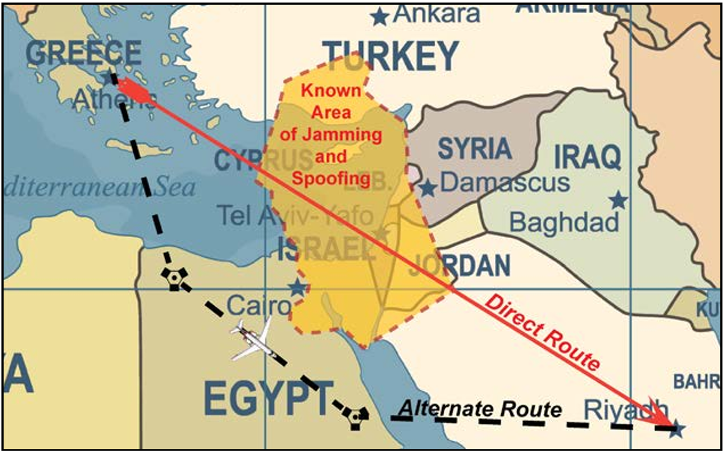
The U.S. Federal Aviation Administration (FAA) has updated its GNSS Interference Resource Guide with updated information on GNSS vulnerabilities and general edits throughout.
The FAA’s Flight Technologies and Procedures Division (AFS-400) developed the guide to provide U.S. operators and pilots with the most current information regarding GPS and GNSS jamming and spoofing.
According to the guide’s introduction, “The impacts of safety hazards from GNSS interference rapidly spread over the past few years and is persistent. As the threat of GNSS jamming and spoofing is constantly changing, the FAA will update this resource guide to provide the best guidance in the rapidly changing environments.”
ArkEdge Space successfully launched its micro-satellite AE1a on March 30, and has begun initial checkout following the establishment of communications through test radio signals.
AE1a is a technology demonstration satellite developed to advance maritime digitalization by enabling wide-area, real-time vessel tracking and communications. The satellite adopts ArkEdge Space’s standardized 6U satellite bus in its large-antenna configuration. In addition to demonstrating a deployable antenna for VDES (VHF Data Exchange System) applications, AE1a will improve and validate core technologies for a VDES receiver.
AE1a will operate in coordination with AE1d, which began operations in January 2025, and AE3Va, which began operations in June 2025, forming a three-satellite constellation for demonstration across wide-area maritime areas.
AE3Va continues to acquire AIS signals across multiple sea areas, including waters around Japan and vessel-congested areas along critical shipping lanes. Accumulated reception data is being systematically verified and analyzed.
Going forward, the program will advance from reception-focused demonstration to two-way communications, including transmission from orbit. This will enable satellites to deliver operational information directly to vessels, expanding the scope of VDES demonstration and advancing progress toward concrete use-case validation across the maritime sector.
Firmware upgrade available for Xsens Sirius and Xsens Avior motion sensors delivers centimeter-level vertical displacement measurement for marine stabilization and control systems
Xsens has announced a major capability upgrade for its industrial-grade Xsens Sirius and Xsens Avior inertial measurement units (IMUs). The new Heave feature delivers centimeter-level vertical displacement measurement, enabling real-time stabilization and wave compensation in a wide range of marine applications.
Marine engineers can now access comprehensive motion data — roll, pitch, yaw and Heave — from a single compact sensor. This eliminates the need for external processing or for oversized tactical-grade systems while maintaining the precision required for offshore platforms, vessels, docking systems, marine robots, buoys and surveying equipment.
The Heave output operates at up to 100Hz, providing the real-time response needed in active stabilization and wave compensation systems. All processing happens on-device, simplifying system integration and reducing latency.
Xsens motion reference units (MRUs) — IMUs with Heave capability — deliver real-time Heave accuracy better than 5 cm for wave periods up to 29 s. This covers most marine applications. For longer wave periods up to 40 s, accuracy is approximately 6cm, twice the range supported by comparable industrial-grade MRUs.
“Engineers now get vertical displacement data directly onboard, alongside roll, pitch and yaw,” said Ayush Sharma, Algorithms Engineer at Movella. “This gives marine customers the complete motion reference they need for stabilization and compensation systems, without the size or certification overhead of tactical MRUs.”
The algorithm uses proprietary phase correction and bias estimation to mitigate the effect of drift over extended operating periods. Users can also define offset points — center of rotation (COR) and point of interest (POI) — ensuring that Heave values reflect the true motion of the vessel or payload, even when the MRU is installed away from the POI.
The Heave algorithm is available for download immediately as a firmware update for existing Xsens Sirius and Xsens Avior units in the field, with no hardware modifications required. All new units ship with the feature integrated. Heave output is enabled with a single setting in the MT Manager software or the Xsens software development kit (SDK).
Designed for straightforward integration
Xsens Avior is a compact OEM module for embedded system designs.
Xsens Sirius is a standalone MRU in a rugged IP68 housing for harsh environments. It meets MIL-STD-202 requirements.
Both products support RS-422, CAN, and UART interfaces. Development kits are available for prototyping, with free SDKs for C/C++, Python, ROS1, ROS2, and MATLAB. All units meet CE, FCC, and RoHS regulatory requirements, and are ITAR-free.
Xsens Avior and Xsens Sirius MRUs are available globally from Movella and authorized partners. For specifications, datasheets, and ordering information, visit www.movella.com/products/sensor-modules or contact a Movella sales representative.
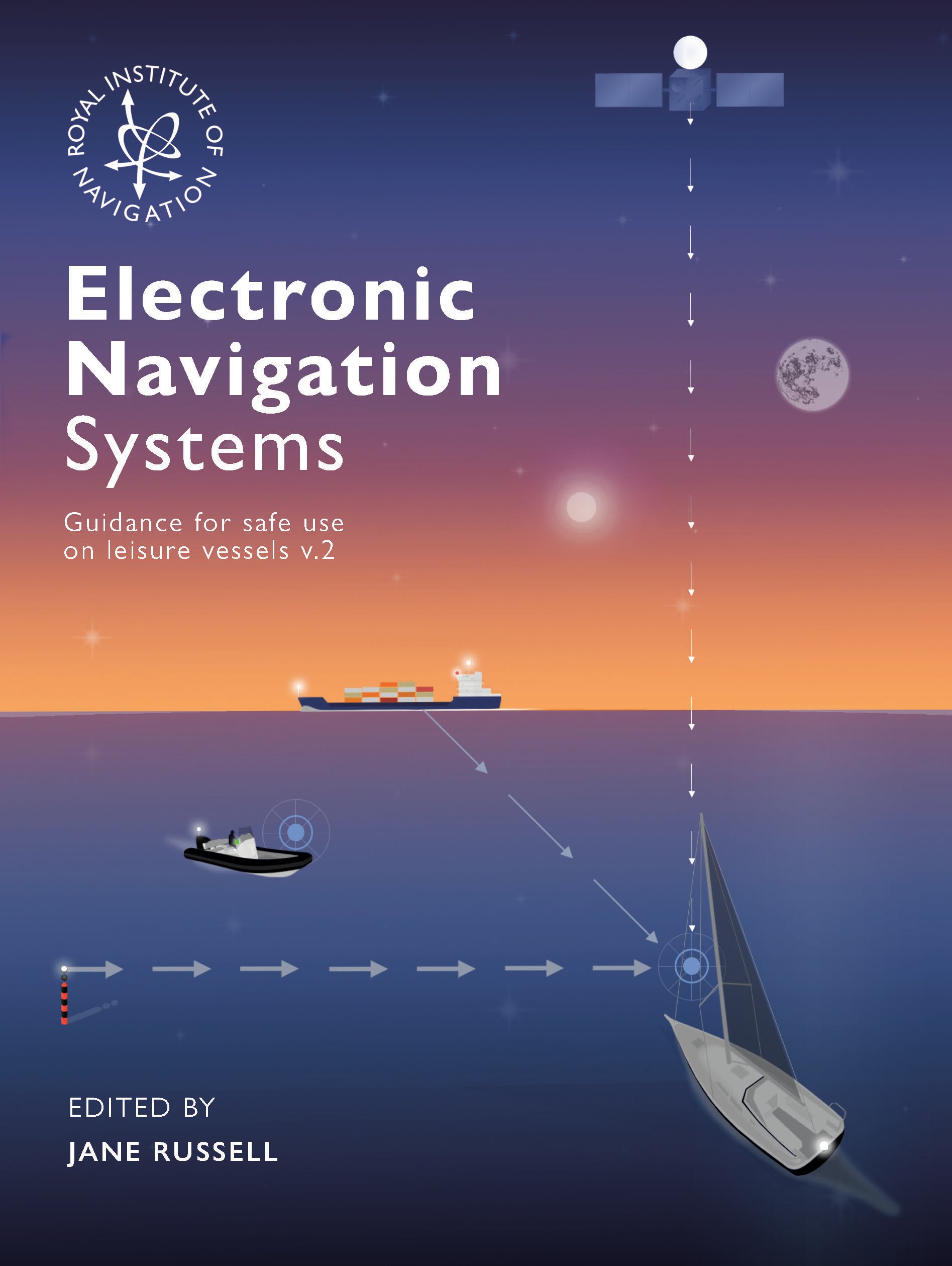
The Royal Institute of Navigation Small Craft Group has released Version 2 of a free navigation guide for small and leisure craft.
“Electronic Navigation Systems: Guidance for safe use on leisure vessels” is offered as a free digital download and as a hard copy for purchase from Bookharbour. The RIN website is asking those who want to download a copy to answer a single survey question.
Updates in the new version reflect developments in GNSS, electronic charts and their display systems, as well as feedback from readers, including a new sub-section on Astronavigation (Chapter 5).
Guidance includes
safe use of electronic navigation and associated systems on leisure vessels
“keys to safety” in many operational situations
advantages and drawbacks of different systems and approaches.
Version 1 of the “Electronic Navigation Systems” booklet is still available as a free download.
Feedback for Manufacturers
As a result of work on the first edition, published in 2020, the small craft group has compiled commendations for improvements to electronic navigation systems for leisure vessels. The improvements could be made by manufacturers and official bodies to assist the safety of leisure vessels through better design or regulation. “These recommendations did not sit comfortably in the booklet so can be viewed here,” the Small Craft Group announced.
As a result, the Pleasure Vessel Navigation Systems Working Group (PVNSWG) was set up, reporting to the UK Safety of Navigation Committee (UKSON). The Working Group’s remit is to
Propose minimum standards of functionality expected from electronic leisure charts and display systems.
Explore and consider if a means by which electronic charts and systems displaying them, which meet these standards, could be recognized by the Maritime and Coastguard Agency (MCA) for use on pleasure vessels.
Discuss with electronic chart and display system equipment manufacturers the most efficient approach to deliver proposed minimum standards and achieve recognition.
The new FLIR TransponderTech unit will advance GNSS, AIS and VDES technologies for maritime, aerospace and defense markets.
Teledyne Technologies has completed its acquisition of the TransponderTech business from Saab AB. The acquired company, now operating as Teledyne FLIR TransponderTech AB, will become part of Teledyne’s Raymarine, FLIR Marine, ChartWorld and Teledyne CARIS group of maritime technology brands.
Based outside of Linköping, Sweden, the company will market its products and solutions as FLIR TransponderTech. The brand will continue to focus on delivering GNSS, Automatic Identification System (AIS) and VHF Data Exchange System (VDES) technologies.
Going forward, FLIR TransponderTech will be well positioned to continue to pioneer maritime communication solutions for civil and military customers in shipping, marine traffic, airborne and space segments.
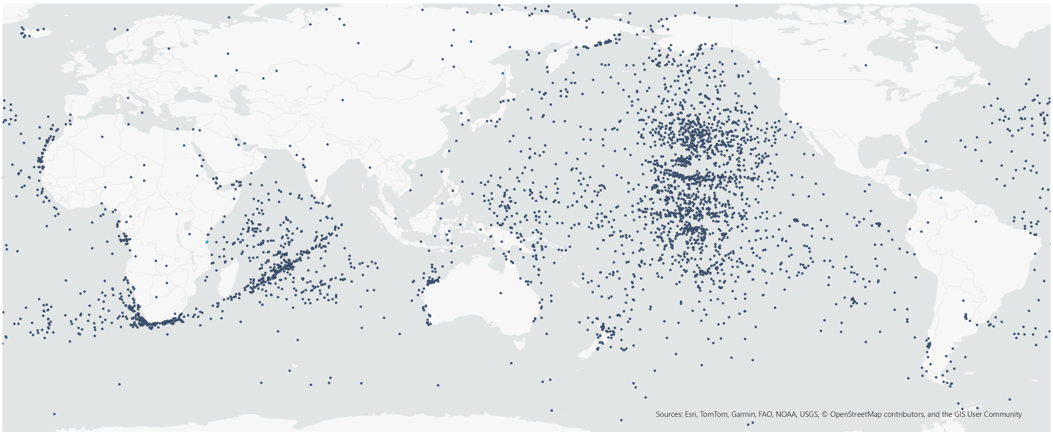
The Royal Institute of Navigation (RIN) Maritime Working Group is investigating GNSS jamming and spoofing in the maritime sector, starting with a survey. The survey is “aimed at anyone in the maritime sector who has experienced GNSS interference and who can provide us with further information on the impact that it is having,” the group stated.
Interference have been pervasive for years now in areas such as the Baltic Sea and the Black Sea. In the Strait of Hormuz alone, almost 1,000 ships per day experience GNSS interference, impacting crew safety and the security of their cargo. Collisions and groundings are a very real threat, with the Frontier Eagle and MSC Antonia accidents being the most recent examples.
The RIN will be producing a report similar to the September 2024 OPSGROUP report that focused on GPS spoofing in the aviation sector.
NAL Research is partnering with SGM Technology, a maritime technology company, and Tschudi Shipping, a maritime logistics company, to deliver a resilient navigation and tracking product line for the commercial shipping industry enabled by Iridium’s low-Earth orbit (LEO) satellite network.
NAL Research is a U.S.-based firm specializing in assured positioning, navigation and timing (APNT) solutions.
The partnership aims to provide reliable asset tracking and assured navigation in high-risk maritime environments. Threats to GPS and GNSS signals — such as jamming, spoofing and interference — are reaching unprecedented levels worldwide. In some regions, maritime authorities reported a 350% increase in affected vessels over the past six months, according to NorthStandard. These disruptions are leading to serious consequences, including collisions, delays, financial impacts on global trade, and heightened security risks for crews at sea.
Under the partnership agreement, the companies are leveraging NAL Research’s 25+ years of expertise in APNT, tracking, and connectivity to develop solutions built on the Iridium PNT service, a powerful and fully authenticated L-band signal resilient to spoofing and jamming.
The partnership will also benefit from SGM’s 15+ years of experience delivering technology to the commercial maritime sector and Tschudi Shipping Company’s global presence and 140+ years in commercial shipping and logistics. Together, the collaboration aims to provide maritime users with unmatched resilience and reliable navigation for GPS/GNSS-compromised environments. Trials of this state-of-the-art solution are underway.
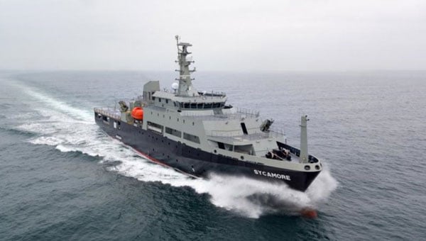
Q-CTRL has completed a major field trial with Australian Defence on board the Royal Australian Navy’s Multi-role Aviation Training Vessel (MATV), the MV Sycamore. The results of the trial demonstrated advancements in software-ruggedized quantum sensing for navigation.
In the trials, Q-CTRL field deployed a quantum dual gravimeter, which measures tiny variations in Earth’s gravity as part of a next-generation quantum-assured positioning, navigation, and timing (PNT) system operable when GPS is unavailable or untrusted.
This first trial saw over 144 hours of continuous operation and successful data collection with no human intervention during real maritime operations.
“Quantum sensors provide a near-term opportunity to achieve transformational defense capabilities, but previous deployments in the field have struggled to deliver defense-relevant performance,” said Q-CTRL CEO and founder Michael J. Biercuk. “Operating on a real moving vehicle is just not the same as conducting a science experiment; at Q-CTRL, we’ve taken a different approach to getting quantum sensors out of the lab, focusing on software as the critical enabler of performance in the real world.”
Earlier this year, Q-CTRL announced successful airborne field trials of a new generation of quantum-magnetic navigation solutions, Ironstone Opal, validated for the first time to outperform comparable conventional alternatives in challenging real-world settings by 50 times.
Developed and fielded in 14 months, the dual gravimeter was installed in a “strapdown” configuration (bolted to the floor) in the space of a single server rack in a communications room onboard MV Sycamore. The sensor consumed only 180W of power – about 10 times less than a household toaster.(Photo: Q-CTRL)
The newly announced trials of Q-CTRL’s gravimetric navigation technology open opportunities to bring quantum-assured navigation to maritime vessels where magnetic navigation can be less effective.
GPS denial has become one of the most pressing strategic challenges in both defense and commercial settings, risking major disruptions to civilian and military operations. Quantum navigation promises a robust and reliable GPS backup that cannot be jammed or spoofed.
Q-CTRL’s navigation capability is urgently needed in contested maritime environments, as instances of spoofed signals caused significant disruptions to ships in the Middle East waterways as recently as June 23. This causes not only critical logistical issues but disrupts collision avoidance efforts, revealing major safety implications.
In quantum gravimetric navigation, the quantum gravimeter continuously “sees” the otherwise invisible hills and valleys in Earth’s gravity, allowing a navigation computer to compare its observations against known gravity maps. This is similar to orienteering, where one can position oneself on a map by identifying landmarks like valleys, mountains, rivers, or roads. GPS is not needed, making it a robust backup in contested regions.
Q-CTRL’s demonstration with the Royal Australian Navy departs from most previous quantum sensing field trials in that these tests mandated peak performance with full autonomy and without the addition of any special infrastructure. The sensor had to operate as a real navigation system would operate during a defense mission.
The ship’s motion and engine vibrations were sufficient to cause total loss of signal using conventional operating techniques typically employed in research experiments. To address these losses, Q-CTRL’s software-ruggedization strategies recovered operation even while MV Sycamore was underway.
Quantum sensing leverages the physics of light and matter on the smallest scales to enable the detection of tiny signals. Because these devices work based on the fundamental laws of physics and are not affected by drift like other GPS alternatives, their outputs do not change over time, enabling new opportunities where long-term stability is essential. Generally, however, these devices are significantly degraded when taken from a research laboratory into the real world, an issue addressed by Q-CTRL’s software-ruggedization technology.
For more on Q-CTRL’s software-ruggedized quantum sensing technology, read their peer-reviewed technical demonstration published in Nature.
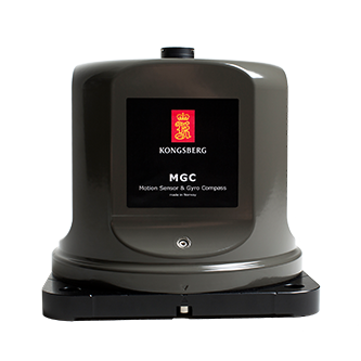
With real-world disruptions increasingly affecting shipping and aviation safety, Kongsberg Discovery’s MGCs (motion gyro compasses) deliver an alternative for reliability, accuracy and resilience in contested environments, according to the company.
Although traditional gyrocompasses are immune to GNSS signal-based attacks by design, many modern navigation systems incorporate GNSS data to enhance positioning accuracy. For maritime operators, having an autonomous and reliable source of heading and positioning data ensures safety and maintains operational continuity in contested or signal-denied environments.
Kongsberg’s MGCs offer resilience, using high-grade strap-down inertial sensors that detect the Earth’s rotation without the need of external input. This allows them to determine true north and maintain precise heading without relying on GNSS. Unlike traditional mechanical gyros, Kongsberg’s MGCs can estimate latitude internally. This ensures consistent accuracy from equatorial regions to the poles.
The system also supports Doppler-based seabed and water-column tracking to determine vessel velocity, eliminating the need for satellite-derived speed data.
MGC Highlights
Kongsberg’s MGCs provide resilient navigation with advanced inertial technology and motion reference capabilities that enable:
Photo: Kongsberg
Continuous latitude estimation from Earth’s rotation measurements
Accurate heading, roll, pitch and heave without GNSS
Versatile support for velocity tracking and input
This robust combination ensures that even when GNSS signals are lost or manipulated by spoofing or jamming, the MGC continues to operate with high precision – offering a resilient navigation backbone when it’s most needed.
Kongsberg’s MGCs are designed to be maintenance-free, eliminating the need for frequent calibration or mechanical upkeep. Other features include:
IMO type-approved: Fully compliant with global navigation standards
Maintenance-free design: No spinning parts and no mechanical drift
Versatile integration: Can be used standalone or seamlessly incorporated into an INS (inertial navigation system)
According to Kongsberg, these attributes make the MGCs suitable for commercial and passenger vessels, offshore platforms and naval ships operating in challenging environments.
The Carbonix Volanti vertical take-off and landing (VTOL) drone. (Photo: Carbonix)
Fugro is partnering with Australian drone manufacturer Carbonix to establish a new long-range drone capability. It is Fugro’s first partnership working towards long-range beyond-visual-line-of-sight (BVLOS) missions, bolstering Fugro’s existing geographic information system (GIS) capability.
Carbonix will supply Volanti and Ottano vertical take-off and landing (VTOL) drones over the next 27 months, to further enhance Fugro’s remote operations.
Fugro is engaged in the transition to remote and autonomous operations with a global network of nine remote operation centres (ROCs). From these centers, Fugro operates boats and other vehicles, and provides survey, inspection and piloting services to the global maritime industry.
Carbonix will support Fugro’s Australian long-range maritime and land projects from the sky, using aerial surveying and data-capture technology, while integrating with Fugro’s ROCs for the joint development of systems technology and capabilities.