Tag: military

  • Pathfinder provides signal-resilient autonomy in navigation

    Pathfinder provides signal-resilient autonomy in navigation

    Aero Drop Systems (ADS) has developed Pathfinder, a proprietary autonomous navigation framework designed to reduce dependence on GNSS-based positioning. Pathfinder is signal-resilient, capable of maintaining precision even in complete GNSS dead zones and unaffected by deceptive interference.

    At the core of Pathfinder lies an array of sensors and advanced self-regulating logic driven by machine learning. Unlike traditional systems that treat GPS as a singular source of truth, Pathfinder fuses a constant stream of information from multiple internal and external domains and dynamically rebalances itself in real time as it evaluates, cross-verifies, and refines its positional understanding based on an algorithm that classifies the trustworthiness of each data stream.

    The result is a self-correcting navigation intelligence that can anticipate changing conditions, isolate false data, and continue to perform when other systems cannot. This allows Pathfinder to sustain highly accurate navigation during satellite connection or radio frequency outages or when being targeted with jamming or spoofing.

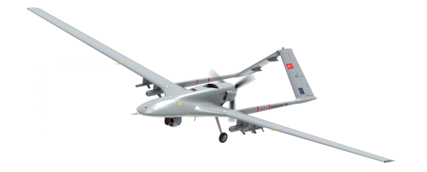
    Designed as a modular framework, Pathfinder can be integrated across a range of fully autonomous platforms operating on land, at sea, or in the air. Its flexible architecture makes it suitable for both commercial logistics and defense applications, where navigation integrity is critical to mission success.

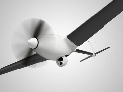
    Currently in the testing phase, Pathfinder is part of ADS’s broader initiative to develop resilient, autonomous logistics technologies capable of performing in contested and complex environments. ADS has confirmed that Pathfinder will serve as the core navigation technology for the platform Aerocrate. Aerocrate is a disposable, autonomous aerial delivery system that enables precise, reliable resupply without requiring recovery operations, staging areas, or active communication with the platform.

  • AUVSI analyst shares insights from defense conference

    AUVSI analyst shares insights from defense conference

    Military officials from across all branches, federal security personnel, and industry leaders gathered at the AUVSI Defense conference, held Sept. 22 in Alexandria, Virginia, to discuss critical issues surrounding the integration of uncrewed technologies.

    In a publication released Oct. 11, AUVSI Senior Economic Research Analyst Aaron Bull summarized key topics discussed at the event, including:

    • defense priorities for the next-generation uncrewed system
    • how uncrewed systems will impact the ways wars are fought
    • lessons learned by senior defense leaders from the Bayraktar TB2 in Ukraine.

    Download the “The Changing Landscape of Military Uncrewed Systems”.

    Bayraktar - TB2 surveillance/attack drone (Photo: Baykartech)
    The Bayraktar TB2 surveillance/attack drone (Photo: Baykartech)

    Highlights from the Report

    Flexibility in the fighting force is needed, which affects the defense requirements for autonomous vehicles heading to the battlefield.

    Multiple speakers pointed to the Turkish Bayraktar TB2, a cost-effective combat-capable drone purchased and fielded by the Ukrainian armed forces that has been a game changer for Ukraine since the war began. While the drone is not top of the line, it was fielded quickly, required little training and could be fitted for a variety of purposes. As a result, “Nearly every speaker came prepared to discuss the need for developing multiple layers of flexibility around the U.S. fighting force,” Bull writes.

    An uncrewed vehicle that can be refitted for multiple missions of different types offers an inherent advantage for missions, and it requires supporting logistical infrastructure.

    Requirements include:

    • flexibility and disguise of role
    • ability to outfit to different technical and operating capabilities
    • flexibility to operate with different levels of human interaction
    • modularity to re-fit the drone around the mission
    • hardware-to-hardware modularity
    • software-to-hardware modularity.

    Download the report.

  • Thales and Syrlinks to develop quantum clocks for France

    Thales and Syrlinks to develop quantum clocks for France

    Thales logoThales and Syrlinks have signed a multi-year contract with the French defence procurement agency (DGA) to develop a new generation of tiny, high-performance atomic clocks.

    Code-named Chronos, these new quantum clocks will meet the requirements of numerous civil and military applications. With their very high stability (error of less than 1 second in tens of thousands of years), defence electronics equipment will be able to operate when a GNSS signal is unavailable, for example due to hostile jamming.

    Working with the procurement agency, the partners will help safeguard France’s technological sovereignty in GNSS-denied positioning, guidance, navigation and encrypted military communications. In civil applications (5G network synchronization, transport, energy, etc.), the Chronos quantum clocks will deliver low price and high performance to French and international customers.

    Large swaths of the modern economy now rely on satellites for synchronization. GNSS technology provides the precise time reference for critical infrastructure such as 4G/5G networks, internet, air and rail transport, energy networks, global banking transactions and high-frequency trading, which would quickly fail if the signal were unavailable. In view of this high level of dependency, backup systems are needed to ensure that our civil and military infrastructure can continue to operate even if the GNSS timing signal is unavailable.

    Thales’s industrial facility in Vélizy-Villacoublay and the Thales Research & Technology center in Palaiseau, both near Paris, have the industrial capabilities and talent to manufacture the atomic and optical core of these future quantum clocks.

    Syrlinks — a French company based in Rennes, Brittany — specializes in satellite radiocommunications, radionavigation systems and miniature atomic clocks, and its products were selected to equip 650 satellites for the American operator OneWeb. The company will develop the electronic brain of the Chronos clock and guarantee its high-precision timing function.

    The CNRS will provide critical scientific support for this project via its SYRTE (Observatoire de Paris) and Femto-ST (Université de Franche-Comté) joint research units.

  • WingXpand’s expandable-wing drone stretches to 7 feet

    WingXpand’s expandable-wing drone stretches to 7 feet

    Photo: WingXpand
    Photo: WingXpand

    WingXpand has debuted a 7-foot expandable-wing drone that fits in a backpack. The drone was first revealed to the special forces community at the Special Operations Forces Industry Conference (SOFIC 2022) held May 16-19 in Tampa, Florida.

    WingXpand is U.S. made with a patented design that takes the small size and simplicity of a quadcopter and combines it with the horsepower of an airplane. WingXpand maximizes capability, efficiency and safety for the military and public safety officials. It can also be used  by farmers, surveyors and inspectors.

    WingXpand expands in less than 2 minutes. Though the full system weighs less than 10 pounds, it flies five times longer and carries ten times more weight than other drones of its size class, according to WingXpand. It can carry high-resolution cameras and other modular payloads such as a real-time pattern analysis system.

    WingXpand can reduce or replace the need for more costly, scarce or dangerous options. More than 10 WingXpand UAS can fit in a public safety vehicle, more than 30 in a pickup, and 250 on a standard airlift pallet.

    The WingXpand team provides end-to-end services, including pilot services, training, data analysis and sustainment.

  • BAE Systems unveils tiny M-code military GPS receiver

    BAE Systems unveils tiny M-code military GPS receiver

    Photo: U.S. Army/Spc. Brooke Davis, Operations Group, National Training Center
    Photo: U.S. Army/Spc. Brooke Davis, Operations Group, National Training Center

    BAE Systems has unveiled its ultra-small MicroGRAM-M GPS receiver that receives the new M-code military GPS signals resistant to jamming and spoofing.

    About the size of a postage stamp, MicroGRAM-M is a small, lightweight and power-efficient M-code embedded GPS receiver, capable of delivering assured positioning, navigation and timing (PNT) for size-constrained and other micro-applications.

    “We’re delivering reliable PNT where our customers need it — from soldiers’ handheld devices to small unmanned aerial vehicles,” said Greg Wild, director of Navigation and Sensor Systems at BAE Systems. “MicroGRAM-M provides our armed forces and allies with a low-SWAP M-code GPS solution that’s resistant to adversaries’ disruption efforts in highly contested environments.”

    MicroGRAM-M features rapid, secure GPS signal acquisition, enhanced security and resiliency, anti-jamming and anti-spoofing capabilities, and very low power consumption for an M-code device. The 1.0 x 1.25 x 0.275-inch MicroGRAM-M has the same physical dimensions as its predecessor, enabling quick upgradability to M-code and reduced system integration costs. At its core is a proven, tamper-proof M-code Common GPS Module that encapsulates classified data and signal processing.

    “MicroGRAM-M is the latest BAE Systems M-code military GPS product, joining MPE-M and NavStrike-M, which deliver enhanced awareness in highly contested environments and precision munitions guidance,” said John Watkins, vice president and general manager of Precision Strike & Sensing Solutions at BAE Systems. “Qualification of MicroGRAM-M is underway, with full-rate production expected in 2022.”

    Delivering M-code User Equipment to Germany

    On June 29, BAE Systems received the first contract from the Space and Missile Systems Center’s Space Production Corps to deliver M-code military GPS user equipment to Germany. Under a Foreign Military Sales contract, the company is delivering the advanced M-code GPS technology to Germany, enabling precise, resilient, and secure geolocation and positioning capabilities that improve the effectiveness of allied operations.

    The German FMS order focuses on BAE Systems’ Miniature PLGR Engine — M-code (MPE-M), which delivers precise positioning, navigation and timing capabilities; anti-jamming and anti-spoofing capabilities; a modern security architecture; and a size suitable for space-constrained applications.

    BAE Systems will provide the first MPE-M receivers to Germany for integration, test and evaluation in 2021. Work on the program will be performed at BAE Systems’ facilities in Cedar Rapids and Coralville, Iowa.

  • Honeywell launches ultra-rugged IMUs for commercial, defense use

    Honeywell launches ultra-rugged IMUs for commercial, defense use

    As illustrated here, the new HG1126 IMU is about the size of a water-bottle cap. (Photo: Honeywell)
    As illustrated here, the new HG1125 IMU is about the size of a water-bottle cap. (Photo: Honeywell)

    Honeywell has launched a new series of miniature inertial measurement units (IMUs) ruggedized to offer high accuracy along with the durability to survive high-shock environments.

    Roughly the size of a water-bottle cap, the new HG1125 and HG1126 IMUs are low cost and serve both commercial and military applications.

    The new family of IMUs can survive shocks up to 40,000 G-force, making it one of Honeywell’s toughest IMU products to date. The HG1125 and HG1126 can be used for a variety of defense and commercial applications such as tactical military needs, drilling, unmanned aerial vehicles or navigation systems for general aviation aircraft.

    “Low-cost, ultra-rugged IMUs are in high demand across a variety of market segments where customers need high-performance navigation, but they’re limited by size or cost constraints,” said Matt Picchetti, vice president and general manager, Navigation & Sensors, Honeywell Aerospace. “Our new HG1125 and HG1126 products meet all of these requirements, making them an ideal solution for customers operating in a wide variety of high-shock environments, including everything from military tactical operations to industrial applications such as drilling.”

    An IMU uses gyroscopes, accelerometers and electronics to give precise rotation and acceleration data. This enables a vehicle system to calculate where it is, in what direction it is going, and at what speed, even when GPS signals are not available.

    The HG1125 and HG1126 use sensors based on micro-electromechanical systems (MEMS) technology to precisely measure motion. They are the newest IMUs from Honeywell’s tactical IMU production facility, which delivers nearly 100,000 IMUs each year to customers across a wide range of segments.

    The first deliveries of these new products are set to begin in June.

    Honeywell’s lineage in navigation dates to the 1920s, and it has long been a pioneer in MEMS-based IMUs. Honeywell has developed and manufactured high-performance navigation solutions found on many aircraft and other vehicles worldwide.

  • Registration open for ION Joint Navigation Conference 2021

    Registration open for ION Joint Navigation Conference 2021

    Logo: ION JNCThe Institute of Navigation (ION) announces that registration for the Joint Navigation Conference (JNC) is now open.

    The JNC, sponsored by the Military Division of the Institute of Navigation, will be held Aug. 24-26 (FEDCON U.S. ONLY) at the Northern Kentucky Convention Center in Covington, Kentucky (Greater Cincinnati, Ohio).

    The Classified Sessions (Secret U.S. ONLY) will be held Aug. 27, at the Air Force Institute of Technology on Wright-Patterson Air Force Base, Ohio. Visit requests and approvals are required for all session attendees.

    View the JNC 2021 program and register at ion.org/jnc.

    JNC 2021 is the largest U.S. military positioning, navigation and timing (PNT) conference of the year, with joint service and government participation.

    Four new panel sessions have been introduced to this year’s technical program, which will host leaders and decision makers as they discuss and debate

    • MGUE Integration
    • Rapid Agile Development and Manufacturing
    • the National Critical Infrastructure Threat
    • Combatant Command Joint Urgent Operation Need (Secret, U.S. Only).

    The technical program will focus on enhancing dominance and resilience for warfighting and homeland security PNT, and will include keynote addresses from:

    • William B. Nelson, director, Assured Positioning Navigation &Timing (APNT) Cross Functional Team (CFT), U.S. Army Futures Command
    • Ray Chartier, Jr., Safety of Navigation Mission manager, National Geospatial Intelligence Agency
    • General David D. Thompson, vice xhief of Space Operations, United States Space Force
    • Bradford Parkinson, Stanford Center for PNT

    Attendance Restricted for JNC Technical Sessions

    Conference attendance for both FEDCON (U.S. ONLY) (Aug. 24-26) and Classified Sessions (U.S. ONLY) (Aug. 27) will be screened by the Joint Navigation Warfare Center. Visit requests and approvals are required for all technical participants.

    The exhibit hall is open to any registered conference attendee or exhibiting company representative, and all materials shall be designated DISTRO A/Publicly Releasable After Review.

    Government-issued photo ID will be required to access all conference events.

    If you have questions, contact the Institute of Navigation at [email protected] or by calling +1-703-366-2723.

  • Anti-jamming market for GPS to be worth $5.9 billion by 2025

    Anti-jamming market for GPS to be worth $5.9 billion by 2025

    Photo: Milan_Jovic/E+/Getty Images
    Photo: Milan_Jovic/E+/Getty Images

    According to a new market research report, “Anti-Jamming Market for GPS with COVID-19 Impact, by Receiver Type (Military and Government Grade and Commercial Transportation Grade), Technique (Nulling, Beam Steering and Civilian), End-User, Application and Geography — Global Forecast to 2025,” the anti-jamming market for GPS is valued at $4 billion in 2020 and is expected to reach $5.9 billion by 2025.

    The report, published by MarketsandMarkets, also states that the market is expected to grow at a CAGR of 7.9% from 2020 to 2025. Some of the key factors driving this growth include high demand for GPS technology in military applications and ongoing developments to improve overall GPS structure. Factors such as the growing demand for unmanned airborne vehicles and systems and the development of low-cost GPS anti-jamming solutions also are expected to provide growth opportunities to players in the GPS anti-jamming market.

    According to the report, Nulling Technique is expected to hold largest share of GPS anti-jamming market from 2020 to 2025. In addition, surveillance and reconnaissance are expected to hold largest share of GPS anti-jamming market during the forecast period.

    The GPS anti-jamming market in Asia Pacific is expected to grow significantly, as a result of a rise in the number of terror attacks in the region, which has led to countries enhancing their surveillance and antiterrorism capabilities, the report added. Countries in this area are also manufacture defense aircraft, which is expected to increase the scope of GPS anti-jamming for defense and aerospace systems. An increase in the defense expenditures of India and China, among other countries, and the expansion of militaries in emerging economies also have accelerated the demand for GPS anti-jamming solutions in Asia Pacific.

    Raytheon Technologies, Hexagon, Thales Group, L3Harris Technologies, BAE Systems, Cobham, Mayflower Communications, infinDome, Lockheed Martin, Israel Aerospace Industries, Furuno Electric and Meteksan Defense are few major players in the GPS anti-jamming market.

    MarketsandMarkets provides B2B research on 30,000 niche opportunities/threats that will impact 70% to 80% of worldwide companies’ revenues, the research firm said.

  • Defense small-vehicle navigation system designed for export

    Defense small-vehicle navigation system designed for export

    Photo: Etion Create
    Photo: Etion Create

    A new military vehicle navigation system designed and developed by South Africa-based Etion Create is ready for the local and export markets.

    Designed for harsh environments and battlefield conditions, the CheetahNAV provides outstanding situational awareness, according to Etion Create. The crew of a light military vehicle can count on highly accurate position information, irrespective of whether they are denied satellite navigation. This is achieved through an advanced inertial measurement system (IMS), comprising several aids, including a gyro-compensated compass and an advanced Kalman filter-based algorithm.

    A brochure on CheetahNAV is available here.

    “We are confident that the system provides dead-reckoning horizontal position accuracy of 0.2% of distance travelled in a GNSS denied situation,” said Jan Hurter, senior product manager. “This translates, by way of example, to accuracy of just 200 metres over a distance of 100 kilometers.”

    The CheetahNAV can integrate with any number of different inertial navigation systems (INS) and can be aligned with any of the satellite navigation constellations. Combined with GNSS and compass information, the system enables dead-reckoning and accurate positioning of the vehicle in tactical situations. The tactical grade integral inertial measurement unit (IMU) ensures jamming-free operation.

    Some of the guidance cues the system provides to the crew during tactical maneuvers include the vehicle’s current position, true heading and desired heading towards the next waypoint, current speed and desired speed to reach the next waypoint or destination on time, and the next waypoint or destination. It also shows the pitch and roll attitude of the vehicle and the track it has travelled.

    This data is displayed on a sunlight-readable touch-screen enabled moving map display unit measuring 11.6-inch diagonal, in 16:9 TFT format, with a 1920×1080 resolution. Etion Create is also offering a slave unit for the vehicle driver, as the main display might be positioned elsewhere in a space constrained vehicle. This slave unit, measuring 3.5-inch diagonal TFT, displays information that is specifically required by the driver.

    Significant benefits of the CheetahNAV system include ruggedness for extreme battlefield conditions and 28V or 12V DC operation in line with military standards. Moreover, it boasts a high operational reliability.

    “It is important to note that Etion Create, as original design manufacturer, is focusing the CheetahNAV on the export market, including the possibility of technology transfer for indigenous manufacturing,” said Hurter. “Besides we offer a multi-language option, which is certainly a key advantage in multinational operations that are almost the norm nowadays.”

    The CheetahNAV is non-ITAR controlled, which is the preference of most land forces around the world today to meet their battlefield management requirements.

    Having utilized the building blocks of previously developed military off-the-shelf technologies, Etion Create considers the system to be at a high TRL (technology readiness level), and thus available for the export market.

    Previously called Parsec, Etion Create is a South African original design manufacturer (ODM) with a long-standing international reach and a professional portfolio of technology offerings and experience across a wide range of business sectors, including defence and aerospace, information security, and mining and industrial sectors.

  • Orolia, Seven Solutions partner for resilient PNT solutions

    Orolia, Seven Solutions partner for resilient PNT solutions

    Logos: Orolia, Seven Solutions

    Orolia and Seven Solutions have partnered to deliver resilient, accurate, and stable time and frequency for global military, commercial and critical infrastructure applications.

    According to the companies, the partnership will address the ultra-precise, resilient timing and frequency requirements of industries such as defense, aerospace, data centers, telecom, financial services, smart grids and other critical infrastructure.

    Through the partnership, Orolia will offer a modular approach to resilient PNT, which includes a combination of GNSS signals protected with interference detection and mitigation technology, together with low Earth orbit secure alternative signals. The Orolia-Seven Solutions partnership also will offer terrestrial sub-nanosecond time distribution from distant and potentially redundant locations.

    “This partnership is a key example of Orolia’s commitment to combining best-in-class technologies into more robust resilient PNT solutions for our customers,” said Orolia CEO Jean-Yves Courtois. “Those who require the most accurate, extremely precise time and frequency technology will now also benefit from an unprecedented level of resilience to protect critical PNT data sources, for more confidence and peace of mind.”

    This new partnership between Seven Solutions and Orolia will facilitate global operations and naturally integrate with reliable time sources. Seven Solutions will focus on bringing the best-in-class time and frequency distribution, the companies said.

  • GPS-based portable JPALS landing system sets up fast

    GPS-based portable JPALS landing system sets up fast

    Raytheon’s F-35 precision landing system can be set up anywhere in less than 1.5 hours

    A Raytheon Company team has conducted a rapid set-up demonstration of a land-based expeditionary version of its Joint Precision Approach and Landing System (JPALS) to a group of global military officials at Naval Air Station Patuxent River, Maryland.

    JPALS is a GPS-based precision landing system that guides aircraft to precision landings in all weather and surfaces conditions.

    “The entire system was fully operational in 70 minutes on Day One and 50 minutes on Day Two,” said Matt Gilligan, vice president at Raytheon’s Intelligence, Information and Services business. “Raytheon is offering the U.S. and its allies fast and accurate precision landing systems that support operations from bare-base locations.”

    During the demonstration, military officials from all four services, as well as representatives from Japan, United Kingdom, The Netherlands and Italy, watched multiple F-35Cs land on the same designated runway landing point every time over the course of six different approaches.

    This was the second proof-of-concept event in 2019 showing how F-35s can use a reconfigured mobile version of JPALS to support landings in austere environments.

    JPALS is a differential, GPS-based precision landing system that guides aircraft onto carriers and amphibious assault ships in all weather and surface conditions up to the rough waters of Sea State 5. It uses an encrypted, jam-proof data link to connect to software and receiver hardware on the aircraft and an array of GPS sensors, mast-mounted antennas and shipboard equipment.

    A Raytheon technician operates the rapidly installed JPALS equipment during a demonstration at the Naval Air Station. (Photo: Raytheon)
    A Raytheon technician operates the rapidly installed JPALS equipment during a demonstration at the Naval Air Station. (Photo: Raytheon)

  • Safran and Orolia launch global resilient PNT partnership

    Safran and Orolia launch global resilient PNT partnership

    Logo: Orolia

    Safran and Orolia are partnering to offer the latest resilient positioning, navigation and timing (PNT) solutions for military forces, especially in GNSS-denied environments.

    This partnership will provide mission-critical equipment for air, land, sea and space programs in environments where GNSS signals are not available or degraded. Whether the outage is unintentional or intentional (jamming, meaconing or spoofing), the Safran-Orolia partnership will provide an alternative to GNSS-dependent military systems.

    The Safran-Orolia team will offer military forces an unparalleled convergence of PNT capabilities, including Orolia’s portfolio of precise timing references and PNT sensor-fusion technology, as well as Safran’s proven defense inertial navigation solutions. Initial program priorities include navigation warfare (NAVWAR), along with mobile and fixed PNT solutions.

    “Today’s military operations are increasingly mobile and global, with mission priorities that often bring them into territories where GNSS jamming and spoofing are becoming common threats,” said Orolia CEO Jean-Yves Courtois. “We’re proud to introduce this unique resilient PNT military partnership to better protect and enable mobile operations for NATO and allied countries worldwide.”

    “In a world full of uncertainty, our partnership will provide autonomous and sovereign PNT solutions to Armed Forces facing harsh GNSS denied environments,” said Safran Electronics & Defense Chief Executive Officer Martin Sion.

    Orolia’s PNT solutions improve the reliability, performance and safety of critical, remote or high-risk operations. With locations in more than 100 countries, Orolia provides virtually failsafe GNSS and PNT solutions to support military and commercial applications worldwide.

    Safran is an international high-technology group, operating in the aircraft propulsion and equipment, space and defense markets. Safran has a global presence, with more than 92,000 employees and sales of 21 billion euros in 2018.