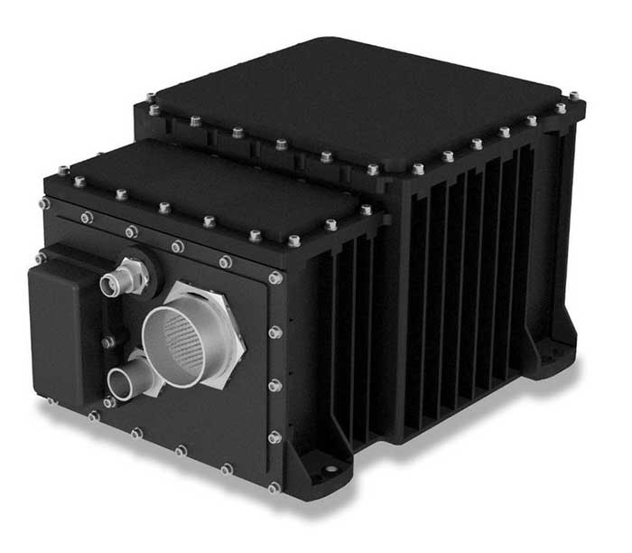
The SeaFIND inertial navigation system (INS) on April 1 received Type Approval from the U.S. Coast Guard, confirming that it meets an important international performance benchmark.
SeaFIND — Sea Fiber Optic Inertial Navigation with Data Distribution — was developed by Northrop Grumman for small- to medium-size combatant and auxiliary ships. With its small footprint, it can also be used on unmanned underwater and surface vehicles, or coastal and offshore patrol vessels.
SeaFIND builds from the software, algorithms and digital messages used on the MK39, a ring-laser INS installed around the world with the U.S. Navy and partner fleets. Instead of a ring-laser gyro, SeaFIND uses Northrop Grumman’s enhanced fiber-optic gyro technology (eFOG). eFOG maintains equivalent performance in a much smaller footprint — yet is more reliable.
“Fiber-optic technology is inherently more reliable with a higher mean time between failure rate than ring-laser gyro technology, which requires a high-voltage laser to operate and degrades over time,” explained Tom Disy, manager of Strategic Planning for Maritime/Land Systems & Sensors. An improved version of FOG, eFOG allows for the inertial measurement unit (IMU) within SeaFIND to achieve dependable navigation-grade performance, Disy explained.
SeaFIND’s embedded Navigation Data Distribution System (NAVDDS) software collects all the navigation data the ship receives, including SeaFIND and GPS data. NAVDSS then provides this data to other ship systems in a time-corrected, system-specific format. Time correction is necessary to maintain accuracy requirements, especially for applications requiring highly accurate dynamic attitude. NAVDDS’ low data latency allows the system to interface with any users that require accurate position and timing, such as combat systems or TACAN (tactical air navigation systems).
The SeaFIND INS complements the data received from GNSS. “Our inertial systems utilize GPS data when available; however, the SeaFIND INS also provides other key navigation data, including heading, roll and pitch,” Disy said. “The SeaFIND INS provides reliable position data for a significant period of time if the GNSS system data becomes unreliable or unavailable for any reason.”
SeaFIND is not subject to ITAR (International Traffic in Arms Regulations) and available for use by domestic and international navies.
A Eutelsat communications satellite launched Oct. 9 carried a payload for the European GNSS Agency (GSA) called GEO-3. GEO-3 is a geostationary satellite designed to augment GNSS signals.
The EGNOS payload, manufactured by Airbus Defence and Space, will hone the accuracy of satellite navigation signals over Europe for use in aviation, maritime and other industries as part of the European Geostationary Navigation Overlay System (EGNOS).
The Eutelsat-5 West B satellite also hosts a payload that will enable service continuity for television broadcasting in Europe and North Africa.
The GSA signed a contract in March 2017 with Eutelsat Communications for the development, integration and operation of the next-generation GEO-3 EGNOS payload.
EGNOS operational messages are broadcast via navigation payloads on-board two GEO satellites, including an Inmarsat-3F2 satellite that is fast approaching end-of-life. The GEO-3 services replenish the EGNOS SBAS payloads, guaranteeing EGNOS availability and supporting the transition to the dual-frequency multi-constellation-capable EGNOS V3.
Eutelsat will also develop two redundant RF ground stations to uplink the EGNOS message to the payload. It will also host EGNOS’ Navigation Land Earth Stations (NLES) in Rambouillet, France, and Cagliari, Italy, both of which will be co-located and connected to the RF ground stations.
Proton-powered launch
The satellite was carried aloft on a Proton rocket along with a second satellite, the Mission Extension Vehicle-1 for Northrop Grumman subsidiary SpaceLogistics, designed to service satellites. Both spacecraft were built by Northrop Grumman.
The Proton rocket lifted off at 6:18 a.m. Eastern Time from Russia’s Baikonur Cosmodrome in Kazakhstan. Its two passengers separated from the rocket 16 hours later in a supersynchronous transfer orbit.
Eutelsat-5 West B is a replacement for the 17-year-old Eutelsat-5 West A satellite.
Satellite NTS-3 above Earth. (Illustration: Lt. Jacob Lutz, AFRL Space Vehicles Directorate)
Harris Corporation has been selected as the prime contractor to build Navigation Technology Satellite-3, the next-generation experimental positioning, navigation and timing (PNT) spacecraft. The satellite, called NTS-3, is expected to launch in 2022, with one year of experimental operations.
The Air Force Research Laboratory and the Space and Missile Systems Center selected Harris on Dec. 20, 2018, and announced it on Jan. 17.
PNT Testbed
As a unique testbed in geosynchronous orbit, NTS-3 will integrate several advanced technologies to demonstrate resiliency and new concepts of operation to include experimental antennas, flexible and secure signals, increased automation, and use of commercial ground assets.
Technologies matured and knowledge gained from NTS-3 are expected to transition to future generations of GPS and augmentation layers for national PNT capabilities.
Satellite NTS-3 closeup. (Illustration: Lt. Jacob Lutz, AFRL Space Vehicles Directorate)
“The National Defense Strategy tells us we must evolve our nation’s Position, Navigation, and Timing capabilities to be more resilient,” said AFRL Space Vehicles Director Col. Eric Felt. “NTS-3 is all about resiliency, and I am incredibly excited about the resiliency experiments our SMC, AFRL, and Harris team will be able to conduct with NTS-3’s innovative and flexible hardware, software, and waveforms.”
Agile Waveform Platform
In support of NTS-3, Harris plans to develop the Agile Waveform Platform, a digital signal generator that can be reprogrammed on-orbit, enabling operators to quickly develop and deploy new signals to meet rapidly-evolving needs on the battlefield.
Additionally, Harris’ electronically steerable phase-array antenna will support simultaneous broadcast of multiple waveforms in both Earth-coverage and spot-beam configurations.
NTS-3 will use Northrop Grumman Innovation System’s ESPAStar bus, building on AFRL’s EAGLE spacecraft that launched in April 2018.
The NTS-3 Space Experiment
Navigation Technology Satellite – 3 (NTS-3) was selected as the Space Vehicle Directorate’s next major integrated space experiment in 2015, and it represents AFRL’s first PNT flight experiment to prototype a more resilient PNT multi-layer architecture in accordance with the Space Enterprise Vision (SEV) and the Space Warfighting Construct (SWC).
Satellites NTS-1, 2 and 3. (Illustration: Lt. Jacob Lutz, AFRL Space Vehicles Directorate)
NTS-3 builds on a heritage of Department of Defense (DoD) satellite navigation (SATNAV) success that began in the 1970s with the predecessors of the modern GPS constellation. NTS-1 was developed by the Naval Research Laboratory (NRL) and launched in 1974 with two rubidium-vapor frequency standards that advanced the timing and navigation precision demonstrated by the earlier TIMATION satellites.
NTS-2 launched in 1977 as the first NAVSTAR GPS Phase I satellite, and demonstrated cesium frequency standards and a worldwide network for data acquisition. There has been no major DoD SATNAV developmental program for experimentation since then, until NTS-3.
In 2017, AFRL restructured NTS-3 to emphasize mission objectives to demonstrate disaggregated, resilient PNT in a multi-layer space architecture, as outlined by the SEV and the SWC. NTS-3 will provide space qualification for core technologies such as on-orbit digital signal reprogrammability and solid-state amplifiers. In addition to new signals, onboard experiments include improvements to timing accuracy and integrity, including ensembling to improve long- and short-term stability. NTS-3 will demonstrate key tactics, techniques and procedures (TTPs) for multi-layer PNT through all three segments of the SATNAV system: space, control, and user.
Ground Control
Braxton Technologies was selected in June 2017 to handle NTS-3 SATNAV ground control, while demonstrating and maturing innovative and affordable ground-based command and control capabilities to ensure resilient PNT in contested and denied environments.
Braxton experts also will demonstrate satellite ground-control technologies to inform future GPS ground-control systems. They will use the Multi-Mission Space Operations Center (MMSOC) open architecture standard, as well as the Air Force Satellite Control Network (AFSCN) for primary direct and secure communications with the future NTS-3 space payload.
Satellite NTS-3 in space. (Illustration: Lt. Jacob Lutz, AFRL Space Vehicles Directorate)
Ground control segment (GCS) objectives include commanding of multiple antennas to form high-gain regional beams in conjunction with traditional Earth coverage beams, and processing the subsequent impact on phase center bias and pattern variation.
The GCS will also incorporate commercial antennas for TT&C and experiment with automation of common functions to reduce the level of manual control that GPS requires. GCS development will emphasize cyber security and compatibility with Enterprise Ground Services (EGS).
Collaborators Wanted
AFRL/RV is seeking collaboration from industry, government agencies, and universities in developing experimental concepts and participating in the flight experiment.
A roundup of recent products in the GNSS and inertial positioning industry from the September 2018 issue of GPS World magazine.
OEM
Reference receiver
For real-time networks (RTN)
Photo: Trimble
The Trimble Alloy GNSS reference receiver is designed for continuously operating reference stations (CORS). It offers 672 channels and constellation tracking of GPS, GLONASS, BeiDou, Galileo, QZSS, IRNSS and SBAS for robust and reliable reference data. With an IP68 rating for protection against dust and moisture, the Alloy performs in rugged environments to meet the demands of professionals in earth science, surveying, construction, mapping and agriculture. The Alloy allows RTN owners and operators to track and log all current and planned GNSS and deliver absolute position monitoring, as well as centimeter-level accuracy in real time with Trimble RTX precise point positioning technology. Featuring a four-line OLED screen, the receiver displays key information without the need to scroll through multiple menus. Other features include dual hot-swappable batteries, multiple power inputs and serial ports, Wi-Fi connectivity and remote access options.
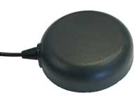
The TW7875 magnetic-mount GNSS antenna is designed for precision dual-frequency positioning. It is capable of receiving GPS L1/L5, GLONASS G1, BeiDou B1, Galileo E1/E5a and NavIC L5. It employs Tallysman’s Accutenna technology, which provides superior multipath signal rejection due to its low axial ratio across the full bandwidth. It also provides a linear phase response and tight phase-center variation. It is designed for precision agriculture, autonomous vehicles and other precision applications. The TW7875 is housed in a magnetic-mount IP67-rated housing, but can also be mounted with screws or adhesive tape. The embedded version, Model TW3875, has a wide selection of connectors and custom cable lengths, and can be custom tuned by Tallysman to ensure optimum performance within the customer’s enclosure.
The SPAN CPT7 provides tightly coupled GNSS+INS navigation technology in a rugged, compact unit. Commercially exportable and designed for integration into a wide variety of applications, it delivers assured positioning anywhere. SPAN technology tightly couples GNSS and inertial navigation system (INS) measurements. The system enables continuous, robust positioning and fast reacquisition in challenging navigation environments where GNSS signals may be unreliable or unavailable for short periods. Dual antennas deliver instant alignment. NovAtel’s OEM7 Interference Toolkit (ITK) provides interference detection and mitigation, with the spectrum analysis function allowing integrators to identify interference within the GNSS frequency bands and implement digital filters to eliminate the problem.
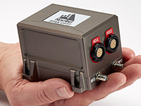
The commercial-off-the-shelf (COTS) LN-200C is a compact and lightweight six-degrees-of-freedom inertial measurement unit (IMU) that can be used for instrument stabilization, motion compensation and navigation in commercial, aerospace and industrial applications. Based on fiber-optic gyro (FOG) technology, the LN-200C IMU’s hermetic seal and lack of moving parts help to ensure low noise and extended operational life. The LN-200C can serve as a drop-in replacement for applications that don’t require the full operational range of the original LN-200 and that can benefit from the expedited licensing and global ease of use offered by the LN-200C.
Global Certification Forum (GCF) protocol conformance tests available
Photo: Rohde & Schwarz
The Rohde & Schwarz CMW500 wideband radio communication tester and SMBV100A GNSS simulator have been expanded to support Global Certification Forum (GCF) protocol conformance tests for C-V2X device certification. Utilizing the Qualcomm 9150 C-V2X chipset from Qualcomm Technologies, the R&S CMW500 acting as an LTE network simulator allows automakers to test C-V2X direct communications (PC5) according to GCF Work Item 281. The new R&S CMW-KK550 test package includes the 3GPP Protocol Conformance tests from LTE-V2V GCF Work Item 281 and LTE-V2X GCF Work Item 282. The R&S CMW-KU514 C-V2X software package on the R&S CMW500 is used to verify data transmission and reception over the PC5 interface in ideal, faded and congested channel conditions. Together, both packages enable Rohde & Schwarz to support C-V2X device testing through all protocol layers.
The Multimax FV family is available in a range of configurations, supporting multi-constellation GNSS. The antennas also support up to dual MIMO LTE (including Band 14 for the FirstNet public safety network), 3×3 MIMO Wi-Fi or 2×2 MIMO Wi-Fi. With a small footprint and a strong, bolt-mount aluminum base, the Multimax FV family provides protection against natural hazards threatening vehicles, including vibration, ice, salt, car washes and tree sweeps. The high-gain antennas deliver a large cellular footprint alongside high-rejection GNSS technology (GPS, GLONASS, Galileo and BeiDou).
For Beyond Visual Line-of-Sight (BVLOS) flight operations
Arctic UAV has adopted Kongsberg Geospatial’s IRIS UAS Airspace Awareness application for BVLOS operations within Canada’s Arctic. IRIS provides simultaneous monitoring of multiple drones. It offers real-time calculation of aircraft separation and communications line-of-sight, real-time visualization of track and weather data.
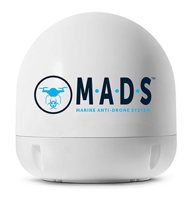
M.A.D.S detects and identifies commercial drones within a 5+ kilometer range, providing GPS positioning of both drone and pilot together with the drone’s speed and heading. Once a drone threat is established, the system enables a 500-meter electronic exclusion zone to be created around the yacht. Should the drone approach this exclusion zone, its control/video signal is blocked, initiating a fail-safe mode and forcing a landing or return to operator.
Operates on the Wave Relay mobile ad hoc network (MANET)
The Auto-Tracking Antenna System is a portable ground-to-air antenna for tracking aircraft, including drones. Defense customers can use it for better airborne communications relay and full-motion video camera/sensor data transmission. It can be assembled and deployed in less than 15 minutes.
Version 6 of Virtual Surveyor drone surveying software offers a faster, more efficient workflow and better user experience in a more stable platform than previous versions. Along with new capabilities is an improved licensing system and an extended free application. The software generates an interactive onscreen environment through orthophotos and digital surface models generated from a UAV, where the surveyor selects survey points and breaklines to define the topography. It enables land surveyors to complement traditional fieldwork with UAV imagery to generate highly accurate topographic products.
Foresights is a risk management and geospatial analytics platform designed to help clients manage forestry assets quickly, effectively and accurately. Foresights identifies areas of new or potential risk, and delivers operations tracking and forest damage management services. It combines satellite imagery, topography maps, soil maps, meteorological data and near real-time ground input from operational teams to deliver optimized insights. It can detect damage as small as 0.1 hectare (0.25 acre) from pests, disease and drought.
EOS Platform provides a powerful toolset for geospatial analysts — offering search, analysis, storing and visualization of large amounts of geospatial data. Image data obtained from LandViewer or uploaded from a user’s computer is stored in cloud-based EOS Storage and is instantly available for remote-sensing analysis or image processing. EOS Processing offers 16 workflows that run online, including raster tools, remote sensing analytics, photogrammetry and proprietary feature extraction algorithms designed by EOS engineers and data scientists to address the main challenges of agriculture, forestry, oil, gas, retail, city planning, defense and other industries.
The Esri book GIS for Surface Water: Using the National Hydrography Dataset by Jeff Simley details how to use geographic information system (GIS) technology to visualize and analyze data sets. Simley is an award-winning cartographer and the former lead of the hydrography program at the United States Geological Survey (USGS). The book examines the complexities of surface water systems and shows readers how to use the Esri ArcGIS software with government water data sets to better study and manage the United States’ vast water system.
EOMAP has opened a commercial online store for global shallow-water bathymetry derived from satellite data. At the store, EOStore Bathymetry, customers can search for and request high-quality data. Satellite-derived bathymetry (SDB) is a valuable tool for the surveying, planning and management of coastal and offshore sites. SDB can provide shallow-water bathymetric data worldwide without the need for a physical presence in the area of interest. EOMAP developed the bathymetry store in response to industry feedback. EOStore Bathymetry offers different horizontal spatial resolutions of the bathymetric grid of 2 to 15 meters, making the data suitable for surveying as well as planning and modeling purposes.
After a couple of good hours of progress, we suddenly ran up against a massive “tail-back” — as the English call road-blocks — on the A303. We eventually crawled along further and discovered that all the rubber-neckers were slowing to grab a glimpse of Stonehenge, which you can see on the left, not far from the road. A little further on I saw a sign for Farnborough and thought that its surely around this time of year for that huge aerospace show known as the Farnborough International Airshow. So when I arrived home after almost three email-less weeks, it was not surprising that my inbox was crammed with lots of European aerospace news.
SkyGuardian MQ-9B
General Atomics (GA-ASI) seems to have come out tops in UAV public relations, flying its MQ-9B company-owned SkyGuardian from Grand Forks, North Dakota, to Royal Air Force (RAF) Fairford in Gloucestershire, U.K. on July 10-11 — that’s a 3,760 nautical mile flight in a fraction just over 24 hours. The RAF has operated the MQ-9 Reaper for over 10 years and the RAF configuration of the MQ-9B will apparently be called PROTECTOR RG Mk1. It just so happens that the RAF is celebrating its 100-year anniversary, so GA-ASI took the opportunity to drop in and say hello at a much smaller airshow at Fairford July 13-15.
Then they announced last week at Farnborough that GA-ASI had been selected to provide UAS to the Royal Netherlands Air Force (RNLAF) following consideration by the Ministry of Defence for the Netherlands. Doesn’t sound exactly like a contract yet, but its close enough to say that the Netherlands will take delivery of the Predator B/MQ-9 Reaper Medium Altitude, Long-endurance UAS. They also reminded us that the Spanish Air Force is to take delivery of MQ-9 systems in 2019.
From a SatNav point of view, we might also be interested that the GPS receiver on this UAV has also been upgraded to add Galileo signal capability — a requirement for what seems to be an expanding number of government forces in Europe. No luck yet in securing better information from GA-ASI about this upgrade, but Farnborough has likely kept them hopping, so hopefully more news later.
Zephyr S High Altitude Pseudo-Satellite UAV
Photo: Airbus
Fresh on the heels of taking on the Canadian Bombardier C-Series program (now the Airbus A-220) and closing the first deal with JetBlue for 60 of these aircraft, Airbus has committed to production of the Zephyr S HAPS (High Altitude Pseudo-Satellite) solar–electric, stratospheric UAV.
Zephyr has an 82-ft. wingspan and is designed to operate on solar power in the stratosphere at an altitude of around 13 miles emulating equivalent services provided by satellite. This is well above clouds, the jet stream and the ozone layer, and importantly well away above regular air traffic. Airbus anticipates the drone flying for up to 100 days without landing (its currently record is 14 days) and to travel up to 1,000 nautical miles per day. It weighs 165 pounds, but can support a payload up to five times its own weight.
The Zephyr aircraft began its maiden flight in Arizona a few days ago — the “qualification flight” is being supported by both the U.K. and U.S. governments — and the U.K. Ministry of Defence is the launch customer for Zephyr. The aircraft has so far logged around 1,000 hours total flight time. The test flight will conclude once engineering objectives have been met. Other solar-cell powered aircraft have struggled with landing or take off due to the large wing, light weight and hence stability under wind gusts, so several projects have not progressed past the R&D stage. Airbus & RAF’s commitment to production indicates their faith in the aircraft design.
Staying with the U.K. theme, the Goodwood Estate in Chichester, England — famous for the Goodwood car racing circuit — has recently hosted the Goodwood Festival of Speed, which apparently included drone racing. And at the same time, a Guinness World Record drone speed record was established.
Wingcopter XBR
The Wingcopter XBR is a tilt-rotor UAV with two lift props and two horizontal velocity props, and the drone flown by teenage drone racer Luke Bannister reached an average of 240.6kmph (~150m/h) over a Goodwood 100 meter track, flying over the measured track in both directions to account for wind. This set the world record for the fastest ground speed by a “remote-controlled tilt-rotor aircraft.” A previous record of 179.6 mph has been achieved by a quadcopter drone rather than a tilt-rotor UAV like the Wingcopter, but there is apparently more drag with type of drone, so its classified as a different category of UAV.
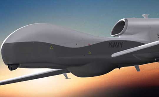
Northrop Grumman Triton High Altitude UAV
Northrop Grumman Triton High Altitude UAV. (Photo: Northrop Grumman)
Meanwhile, Northrop Grumman released a statement at Farnborough on their continuing discussions with Germany towards the sale of its high-altitude Triton MQ-4C unmanned surveillance drone, but apparently a lot of work still remains. In April the U.S. State Dept. authorized the sale of up to four drones worth up to $2.5 billion, and the German government has since been working closely with the US Navy towards a deal.
People may recall the previous cancellation of the “Eurohawk” program back in 2013 — under which Germany had planned to buy a version of Northrop’s Global Hawk drone — after escalating estimated costs for civil certification of the vehicle hit 600 million euros ($702 million) — not a minor task in any way.Subsequently, Northrop and Airbus Defense and Space have teamed up on a new ‘Pegasus’ program, which will add UAVs to Germany’s surveillance capabilities — drones flying autonomously as high as 60,000 feet to gather a wide array of intelligence data.
The German government plans to buy three of the drones, equipped with sensors and a mission system now to be engineered by Airbus. Preparations for certifying equipment to enable the drones to operate in civil airspace are moving more smoothly this time, but with deliveries to only start in 2025. Northrop developed the Triton, a marine-based variant of the Global Hawk, under a U.S. Navy contract awarded in 2008. And Australia last month said it plans to buy six Triton aircraft for maritime patrol, initially expected to cost A$1.4 billion ($1 billion U.S.).
So, lots of military drone stuff this month — not unusual given the nature of the Farnborough U.K. airshow, even though Boeing and Airbus also use the show to one-up each other’s announcements of commercial aircraft contracts and options. Lots of good news for General Atomics, not so much yet for Northrop Grumman, and some light relief with high speed drone records at Goodwood. Back to more North American UAV news hopefully next month.
In late 2017, Northrop Grumman and San Diego Zoo Global planned and carried out a research mission to map Arctic sea ice formations to learn more about polar bear habitats — proving autonomous technology is making a name for itself as a key tool in conservation projects.
The project began as a competition between teams of Northrop Grumman employees who aimed to find a way to map Artic sea ice formations, and the winning team — Team Polar Eye from Melbourne, Florida — earned the privilege of using its technology to map the area.
“The project name is Wildlife Challenge,” said Charlie Welch, materials and process engineer at Northrop Grumman and technical lead of the Wildlife Challenge. “It’s a collaboration between San Diego Zoo Global and Northrop Grumman to help bring really high-level technology to the San Diego Zoo’s conservation efforts — specifically unmanned technology.”
Polar bears have to wait for the ice to freeze to hunt, and the zoo wanted to repeatedly map the same area in the Artic to learn more about the ice, including how it’s freezing, where a polar bear is on the ice and what the ice looks like, such as its thickness. The zoo then planned to use this data to predict how changes in the ice — and overall climate change — will affect the polar bears.
To carry out the project, the Northrop Grumman team developed a drone that could handle the freezing temperatures. The team then flew to Northern Canada to gather the ice data.
“We had to take the drone out to the middle of nowhere, basically, and be confident that this could work and collect critical data on a really key, iconic species,” Welch said. “Half the engineering was designing the logistics of getting our team out there, getting every spare part we could think of and making sure that we could survive out there, along with the system.”
Click on the icon in the top left hand corner to choose the video you’d like to watch.
During the 10-day mission, the team used its modified DJI M600 hexacopter drone to capture the data, as well as ground equipment to process the data and ensure the drone was operating correctly. According to the company, the hexacopter platform consisted of six rotors, a triple-redundant navigation system, high-voltage battery packs and a custom payload bay to hold a range of integrated sensors. It was also equipped with a ruggedized thermal shell, designed to withstand temperatures as low as minus-20 degrees Fahrenheit.
“We had to make a few adjustments in the field, as we kind of anticipated,” Welch said. “So we designed the drone to be reconfigurable really easily.”
The Northrop Grumman team used its modified DJI M600 hexacopter drone to capture the ice data. Photo by Allison Barwacz
The team conducted several successful sea ice mapping missions and collected an array of habitat data, including 3D sea ice maps and multispectral data, both collected at sub-centimeter resolution, the company said. Northrop Grumman sent the data to zoo scientists, who are still closely working with the company. Northrop Grumman also donated its hexacopter drone to the zoo so that it be used for other conservation projects.
“We’re keeping in collaboration [with the zoo] to try and figure out what they want to do next from a scientific perspective, and how the data we collected is working out for what their goals were,” Welch said. “We see these innovative projects as a good way to engage our employees and give them the ability to work on projects that are very science-based. We also want to make a positive impact toward STEM (science, technology, engineering and mathematics) and be able to show students how engineering and science fields can be applied in a variety of ways.”
The decision means Lockheed Martin is all but assured the contract. Lockheed Martin announced on April 17 that it had submitted its proposal.
All three companies received study contracts in 2016 valued at up to $6 million each to demonstrate their ability to build future GPS satellites, in preparation for the planned competition.
The U.S. Air Force plans to release a request for proposal (RFP) for the second phase of GPS III Follow-On satellite production “on or about” Feb. 13, according to a report by Inside Defense.
The RFP was expected in December 2017, but was held up as officials worked to solidify requirements.
The solicitation is expected to result in a contract for up to 22 GPS III Follow-On satellites in the 2019 time frame.
Lockheed Martin is on contract to build the initial 10 GPS III satellites, the first of which is expected to launch this year. Besides Lockheed, Boeing and Northrop Grumman have both expressed interest in competing to produce the next batch of satellites.
Northrop Grumman Corporation has been awarded a contract from the U.S. Air Force for technology maturation and risk reduction in support of next-generation navigation systems.
Under the $49 million contract from the Air Force Life Cycle Management Center, Northrop Grumman will provide the preliminary hardware and software architecture design for the Embedded GPS/Inertial Navigation System (INS)-Modernization, or EGI-M, technology. The modernized system is expected to be available for platform integration starting in 2019.
Northrop Grumman’s EGI-M will be based upon modular, open systems architecture to support the rapid insertion of new capabilities and adaptability based on unique platform requirements. Additionally, EGI-M will incorporate M-code-capable GPS receivers, which will help to ensure the secure transmission of accurate military signals.
“We are dedicated to ensuring mission success and the safety of warfighters by providing an EGI-M solution that offers robust, accurate and reliable positioning, navigation and timing [PNT] information, even in GPS-denied conditions,” said Dean Ebert, vice president, navigation and positioning systems business unit, Northrop Grumman Mission Systems.
EGI-M technology is designed for compatibility with current systems on legacy aircraft, allowing ease of integration and rapid adoption of new capabilities.
EGI-M will also comply with the Federal Aviation Administration’s NextGen air traffic control requirements that aircraft flying at higher altitudes be equipped with Automatic Dependence Surveillance-Broadcast (ADS‑B) Out by January 2020.
ADS-B Out transmits information about an aircraft’s altitude, speed and location to ground stations and to other equipped aircraft in the vicinity.
The I-want-free-advice syndrome was once called the “Doctor Syndrome” or “Expert Syndrome.” I have recently heard it referred to as the “unsolicited advice” syndrome, because there is a new version that involves shaming the expert in to giving free advice.
Occasionally those of us with expertise in an area of interest, which certainly include doctors and lawyers, are faced with tough decisions involving rules, regulations, laws and conflicts of interest.
We are all guilty of these ethical violations in one way or another. On an airplane you discover your seatmate is a doctor of osteopathic medicine; not five minutes have gone by and you are telling him or her about all your aches and pains and seeking advice. My daughter, a clinical psychologist, says this frequently happens to her, but legally it is not a syndrome, although it could certainly be described as a phenomenon.
Regardless of the nomenclature, the newest wrinkle goes like this, as stated by a congressman at our table at a fundraiser I attended recently, when he was asked about the troubled OCX program (Next Generation GPS Operational Control System) and GPS funding in general. “Well, I don’t know much about GPS or navigating, but this is what I know about OCX and GPS. I am sure Don will correct me if I am wrong…”
I mention this phenomenon because for position, navigation and timing (PNT) issues, it is growing at an alarming rate. For instance, my 10-20 emails per day asking about PNT issues have grown over the past few weeks more than tenfold. I perceive that many of you are confused and concerned about the future of GPS, PNT and GNSS in general.
With the House Armed Services Committee deleting more than $420 million from the GPS budget line for OCX in the 2017 budget and canceling funding for certain Acquisition, Technology and Logistics (AT&L) positions dealing with acquisition, there are all kinds of rumors and innuendo floating around. [Editor’s Note: the Senate did not make the same deletions, so this must be worked out in congressional committee meetings before the end of September]. So, I went out and formally asked the experts (GPS Directorate, Lockheed Martin and Harris Corp among others) what they think the future holds for GPS. Here is what I learned…
Artist’s concept of the nextgen GPS III satellite (courtesy of the USAF).
GPS III Spacecraft. According to Colonel Steve Whitney (USAF), the director of the Global Positioning Systems Directorate, Space and Missile Systems Center (SMC), Air Force Space Command (AFSPC), Los Angeles AFB, California: “The GPS III program is actively engaged in production of the first eight [GPS III] satellites (SV), while proceeding ahead with contracting actions for the ninth and tenth spacecraft. “
Colonel Whitney went on to explain, “We have had several notable successes over the last year, including delivery of the first two navigation payloads [from Harris Corp] and completion of the first spacecraft’s environmental tests (acoustic, thermal vacuum and electromagnetic compatibility). As we prepare to accept delivery of the first spacecraft, the directorate is gearing up for the Mission Readiness Campaign and satellite launch.”
I spoke independently with representatives from both Harris Corp and Lockheed Martin, and they expressed the same opinions. Work is progressing toward a launch of the first GPS III SV hopefully sometime in 2017.
Of course, all of the companies mentioned and many others are also involved in the follow-on production of GPS III satellites known officially, oddly enough, as the:
GPS III SV11 + Follow-On Production Phase One (1). According to Colonel Whitney, “The GPS SV11+ program is implementing a phased acquisition approach to determine first if viable alternate sources exist for a production-ready spacecraft. We successfully awarded three Phase 1 contracts on 5 May 2016, and are working with all three vendors to inform our follow-on approach.”
For those of you who have not been keeping up, the three Phase 1 contracts were in the amount of $5M to each company. LMCO is included in the competition and was one of the three companies. To go into a bit more detail, the three GPS III awards are firm-fixed-price contracts that are not-to-exceed $6 million; the base contract plus two $500,000 options. The base contract period of performance is 26 months, and each option extends that time by six months for a total period of just over three years or 38 months.
At the end of the competition, the GPS Directorate will award one GPS III Phase 1 Production Readiness Feasibility Assessment contract to one or more of the three companies:
Colonel Whitney’s boss, Lt. Gen. Sam Greaves, who is the Space and Missile Systems Center commander and Air Force program executive officer (PEO) for space, said: “Industry told us they were ready to compete for the GPS III space vehicles. We look forward to working with Boeing, Lockheed Martin, and Northrop Grumman to assess the feasibility of a follow-on, competitive production contract.”
The USAF has issued an artist’s concept of the GPS III satellite, but seriously, I have listened to the proposals from all three companies in detail, and the proposals are all so radically different that the picture is just that, an artist’s concept, it may not even be close to reality.
Artist’s concept of the nextgen GPS III satellite (courtesy of the USAF).
Certainly, $5-6M is not much money in the scheme of things, certainly not enough to design and build a GPS satellite from scratch, but it is a show of good faith on behalf of the U.S. government, proving they are serious in their search for a new and improved PNT satellite in the GPS III family.
Next-Generation Operational Control System (OCX). The original OCX contract was awarded for somewhere slightly south of $900M for a six-year total effort to deliver a new Full Operational Capability (FOC) ground control system for all GPS satellites except the long-lived GPS IIAs. The federal government, having watched programs like OCX go south before, took the Raytheon bid and quietly doubled it and assured everyone they had the program well in hand. The government assured us time and again that OCX would never breach Nunn- McCurdy levels as they planned for double the cost. Smart move, but OCX costs finally reached double the original estimate plus 25 percent, which triggered the Nunn-McCurdy breach on June 30.
Now Raytheon and the government have until October to decide whether to continue with the OCX program. However, Colonel Whitney and the folks at SMC remain confident; he kindly describes the current status of OCX this way: “The OCX team continues to pursue a restructured plan approved by the Defense Acquisition Executive [USD (AT&L)] and will hold its next deep dive with the Secretary of the Air Force [SECAF] and USD (AT&L) in early July [maybe this week]. Raytheon is driving for Functional Qualification Testing of the GPS III Launch and Checkout System (GPS LCS and OCX Block 0) in August 2016.”
My sources tell me that a realistic date for OCX FOC, based purely on past performance, software issues and cyber-security concerns, is 2023 with a total cost of $4.2B. This may all be academic if OCX cannot clear the Nunn-McCurdy hurdles.
The interesting story here is that there are alternatives. This brings us to the…
GPS III Contingency Operations or Cops, which Colonel Whitney described this way when I asked him about it. “We [USAF, SMC] awarded the GPS III Contingency Operations effort on 3 February 2016 on an expedited basis with the task of delivering the capability to put on-orbit GPS III spacecraft into operations, providing legacy mission capabilities. We successfully completed the Preliminary Design Review (PDR) on 11 May 2016 and are on-track for Critical Design Review (CDR) in November 2016.”s
What the Colonel meant to say — my words, not his — is that we (the U.S government) are finally hedging our bets. Just in case OCX does not come to fruition, both for launch and operations, we know we need to put a GPS III satellite on orbit soon so we can check it out before all the satellites are produced and sitting in a warehouse and we discover a major anomaly. We are running out of time.
If all of the GPS satellites are produced (and there are only six or eight more to be built under the current contract depending on the future award schedule), and not one of them has been launched, then the program is in trouble. If LMCO does not win the follow-on contract, then the GPS III production line will be shut down at LMCO and experts scattered to the winds. Spare parts for a satellite in storage will be hard if not impossible to find, much less repair or install. If the first GPS III satellite is not launched until after production ceases and a major flaw or anomaly is discovered, then the government’s options are slim to none.
To prevent a worst-case scenario, the government must launch a GPS III satellite, and soon. Certainly a date in 2016 is preferable, but a 2017 date will suffice, according to my sources. However that is doubtful with an OCX-based launch program that has yet to launch a satellite.
Kudos to the government for looking at OCX alternatives, and for looking down the road at…
Military GPS User Equipment or MGUE. Colonel Whitney, who successfully ran this program for several years before becoming the overall GPS SPO director, knowledgeably described the current MGUE effort this way. “We have taken delivery of the first GPS Military GPS User Equipment (MGUE) Final Test Articles this past month. These articles are going through initial checkout in the test labs as we prepare for integration into our lead platforms, like the B-2 Bomber.”
Approving the final test articles is a big deal for MGUE because it not only puts the products in the hands of operational integrators and users, but opens the door for a multitude of changes necessary to incorporate the latest up-to-date technology. This technology hopefully includes the use of GNSS signals and capabilities as well as other PNT signals and augmentations that can now be incorporated.
By the way, the congressman at the fundraiser dinner that I mentioned at the beginning did a credible job, but managed to get most of it wrong. But then, congress has so much more on its plate than GPS. That’s why the real experts need to make sure they keep everyone informed.
Wooldridge and Ramo on the cover of Time Magazine, 1957.
Simon Ramo
I hate to end on a sad note, but I must acknowledge the passing of a legend in the aerospace industry. Dr. Simon “Si” Ramo, who I knew well and worked with for many years early in my career, passed away on June 27 at the age of 103.
Si, who held two doctorates, was already a leader in the aerospace industry when I was born, and I credit many of his well-known books (he was a prolific author) for drawing many a young person to space, rockets, the dynamics of space launch, and engineering.
Dr. “Si” Simon Ramo
Si cofounded TRW Inc. in the late 1950s by taking two companies — Ramo-Wooldridge and Thompson Products — and leading them into the ICBM (Intercontinental Ballistic Missile) world. He was a tireless promoter of the space industry. The world will not soon see another character, gifted leader and entrepreneur like Si Ramo.
Until next time, happy navigating, and remember: GPS is brought to you free of charge by the United States Air Force.
The U.S. Air Force’s Joint Service Systems Management Office (JSSMO) has awarded Northrop Grumman Corporation an order to support embedded GPS/inertial navigation system (INS) pre-Phase 1 modernization efforts.
Integration of inertial technology with GPS systems across all military platforms — some, such as munitions, are already so equipped — could have far-reaching effects. The move reflects the military’s concern over GPS vulnerabilities in challenged environments.
The Military GPS User Equipment (MGUE) program is developing M-code-capable GPS receivers, which are mandated by Congress after fiscal year 2017 and will help to ensure the secure transmission of accurate military signals.
Under the $4.8 million order, Northrop Grumman will perform trade studies, assess the state of development of MGUE for upcoming applications, and contribute to architecture development for next-generation GPS/inertial navigation systems.
The JSSMO is responsible, among other things, for a GPS lab in the Department of Defense that helps develop and test software for GPS systems used throughout the military.
One of the systems it maintains is the Blue Force Tracker (BFT), which is used by all military branches and can track friendly units regardless of their location. Not only can the system see where the unit is located, it can also determine whether or not a unit is moving and what form of transportation it is using.
Aviation Use. The updated GPS/inertial navigation system will also comply with the Federal Aviation Administration’s NextGen air traffic control requirements that aircraft flying at higher altitudes be equipped with Automatic Dependence Surveillance-Broadcast (ADS-B) Out by January 2020. ADS-B Out transmits information about an aircraft’s altitude, speed and location to ground stations and to other equipped aircraft in the vicinity. The modernized system is expected to be available for platform integration starting in 2018.
Inertial market to top $8.9 billion by 2020
The inertial navigation system (INS) market is projected to grow from $4.64 billion in 2015 to $8.87 billion by 2020, according to a January 2016 reported from research firm ReportLinker. Factors driving the global INS market include the increasing number of aircraft, technological advancements in navigation systems, increasing demand for accuracy in navigation, and availability of smaller components at lower cost.
“Commercial platform application segment to witness the highest growth during the forecast period,” says the report.
Key applications considered in the market study are naval, airborne, land and commercial platforms. The overall INS market is dominated by the naval platform segment. However, the commercial platform segment is projected to grow at a comparatively higher CAGR during the forecast period of 2015 to 2020, primarily driven by the demand for new aircraft in response to the burgeoning rise in air travel and congestion of airspace.
Recent advances in inertial technology have replaced the mechanical components with electronic ones, particularly micro-electro-mechanical sensors (MEMS). Overall focus has remained on increasing the accuracy and reducing weight of the INS.
The major companies profiled in the report include Northrop Grumman Corporation (U.S.), Honeywell International Inc. (U.S.), Sagem (France), Rockwell Collins (U.S.) and Thales SA (France), among others.
Lidar
Lidar market grows with 3D
Anew market report on light detection and ranging (lidar) technology says that the demand for lidar is increasing in line with an increase in the demand for 3D scanning and 3D imagery.
According to the report, the global lidar market is anticipated to expand at 15 percent annually from 2014 to 2020, growing from a value of $225 million in 2013 to $605 million in 2020.
Lidar enables direct measurement of 3D structures and underlying terrain with high resolution and high data accuracy. The adoption of lidar technology is slowly penetrating in various government sectors such as roadways, railways and forestry management, among others.
However, the lidar market faces challenge related to the complexity in interpreting the output data, because of the lack of data-set standardization.
The 80-page research study is titled LiDAR Market: Global Industry Analysis, Size, Share, Growth, Trends and Forecast 2014–2020, available for sale from Transparency Market Research.
The lidar market can be segmented based on types into airborne and terrestrial lidar and based on applications into coastal, forestry, transportation, infrastructure, defense and aerospace, transmission lines and flood mapping, among others.
Geographically, the lidar market is dominated by North America owing to high adoption of advanced 3D imagery technologies by the U.S. government. Europe follows with a minimal difference in the market share. A large number of key players are based in Europe and are involved in making innovations to meet the requirements of consumers in different applications.
The report has been segmented by type, application and geography. It also includes the drivers, restraints, opportunities and value chain of the global lidar market.
Imagery
RoboParachute drops
The U.S. Army’s Joint Precision Airdrop System (JPADS) has developed a new capability exploiting a navigation alternative to GPS. In recent tests, JPADS were dropped from planes, and immediately determined their location using optical sensors to compare local terrain with commercial satellite imagery. The new system demonstrated navigation to its intended point, using nothing but imagery to guide it. The new JPADS also works with little knowledge of the aircraft’s location at the drop point.
JPADS, largely guided by GPS, has already proven its importance in supplying troops with necessary materials and equipment, relying less on vulnerable convoys.
Contractor Draper will continue developing the system to eliminate current obstacles, such as cloud cover that degrades the vision-aided navigation system’s ability to compare vision sensor inputs with satellite imagery. These imagery-data analysis technologies could be used to help guide military freefall paratroopers and autonomous aerial vehicles.