OriginGPS teamed with Friendly Technologies, an internet of things (IoT) and device management company, and Humavox, a wireless charging expert, to create an IoT-connected baseball in six weeks.
Friendly’s IoT platform interfaces the OriginIoT (cellular IoT) system to enable communication, management and a graphical user interface, while Humavox’s compact Wi-Fi-charging bowl re-energizes the system.
The demonstration — developed in six weeks without a single line of embedded code or RF engineering — was showcased at CTIA Mobile World Congress 2017, in San Francisco Sept. 12–14.
The OriginIoT effectively resolves inherent costly issues to IoT developments — namely long project cycles and required embedded software expertise. It expedites development cycles, and eliminates the need for embedded coding and RF engineering, resulting in substantial cuts in development resources, the companies said. With OriginGPS’ cellular-GNSS integrated in the IoT cellular system, the smart baseball is a proof of concept for rapid and accessible IoT development.
Friendly’s One-IoTTM platform enables service providers to manage the data and configuration of millions of devices on a single platform, accelerating deployment and streamlining IoT service management, while cutting operational costs.
Opening remarks by Alan Cameron, editor and publisher of GPS World
Everyone at this great conference is actively engaged in innovation: new approaches, new combinations, new integrations, new methodologies.
Our sponsors are not only innovators, they are active in building those innovations in the field, installing the cornerstones of GPS and GNSS technology. Harris Corporation has been building the GPS satellite payloads since the beginning of time, Rockwell Collins has built so much user equipment, historically and currently, and Spirent Federal Systems has been enabling the development and testing of much user equipment by many companies in this room.
Just to give you an idea of who else is seated among you at the tables, we have NovAtel, Spectracom, IFEN, Septentrio, Satelles, Syntony, Unicore, u-blox, ComNav, RaceLogic, Rohde & Schwarz, ublox, Locata, GMV, Leica, Thales, Boeing, Broadcom, Qualcomm, Google, Apple, Intel, MITRE and Aerospace Corporation; the U.S. Air Force GPS Directorate, the U.S. State Department, the European Space Agency, the European GNSS Agency and the European Commission, NASA, the French and German aerospace agencies; the Institute of Navigation and the Royal Institute of Navigation; and universities and research institutes almost too many to number.
This is a great industry to be part of, and I feel lucky to be kind of a spectator, a commentator in it without the benefit of the scientific upbringing that everybody else in this room has had. I still get to participate in the excitement and the developments and for that I am truly grateful.
Satellites Leadership Award
Galileo Builder
Wolfgang Paetsch
Director of Navigation and Member of the Executive Board, OHB
For his leadership in setting up the routine production of the Galileo satellites leading to Galileo constellation deployment, including thequadruple Ariane 5 launch in November 2016.
Paul Verhoef (right), director of the Galileo Programme and Navigation-related Activities, European Space Agency, accepted the award and delivered remarks on behalf of Wolfgang Paetsch. (Right photo: Melanie Beus)
Introduction by Rob Scott, Rockwell Collins
“Forty years ago, Rockwell Collins celebrated the first receipt of a GPS signal,using a six-foot tall, two-person receiver. Now we have something something 1 by 1-1/4 inches that is far more capable. It’s amazing to see how technology has advanced.”
Remarks by Wolfgang Paetsch
I must admit I am rather at fault for Wolfgang not being here, because I keep him rather busy producing satellites, as OHB is completing the last of 22 satellites under contract from ESA. We are going to launch again in December, as you know we have had a few problems, which I’m glad to say we have solved. The issues are behind us, and the Swiss clocks are working fine now, which is great.
On Dec. 12 we are going to launch. The first two satellites are in Kourou already, the next ones are going in two weeks [as of Sept. 28; all satellites are now in Kourou. — Ed.] We’re going to go up on an Ariane 5 again, with these four satellites. Next summer we are doing another four, so it brings the whole Galileo constellation from 18 to 26, and then we are fully operational.
In this business it is quite a challenge to keep up the pace. I think OHB, with Wolfgang in the lead, has done very well in the past years to set up indeed a very impressive production line and keep all the machinery ticking over. It has been a big challenge for them, as they had been a relatively small player in the space business, while at the same time they have been able to win other competitions in the space business in other areas. OHB has been doing very well and we are glad of course that they are doing well because it was important to get Galileo up and running.
OHB has managed to win recently another contract, good for them, we are about ready to give them the first options on that contract, so we will have a total of 14 satellites under contract with them, in addition to the 22 they are completing. These satellites will further complete the constellation and they will already start replacing the first IOV satellites which we have put up. So you see the cycle is rather quick. Of course we are waiting a bit to see what the real lifetime of the satellites is going to be. We don’t know that yet but we will find out in the next couple of years.
Looking Ahead. So what are the challenges for us in the next years? We are currently working with colleagues from the European Commission and the European GNSS Agency on what the next constellations are going to do. Obviously there is a lot of pressure for further innovation, for further improvements. The user community over the last couple of years has become more outspoken about what they want and what they expect, which is nice. Obviously we need to take care of the legacy users, and we are having to see what new technology would allow us to do. At the end of the day there is then also a small thing called budget, which needs to have its play in these things.
In any case, the plan is by the end of the year we will start the procurement of the next batch of satellites. This will take a while to do, this procurement, as it concerns new developments, but then we are going to go for the next constellation.
So let me finish by paying a tribute to Wolfgang and his team. It has been a real challenge for them. I know that he was pretty amazed, and after that pretty proud, of this prize he has gotten, and I will carefully carry this back to him in Europe.
Alan, thank you very much.
Services Leadership Award
Global Educator
Patricia Doherty
Director and Senior Scientist, Institute for Scientific Research, Boston College
For initiating and leading the African GNSS Outreach program since 2009, to help developing countries derive social and economic benefits from satellite-based PNT.
Frank van Diggelen (left, above), an African Outreach faculty member and principal software engineer, Google, introduced and conferred the award to Pat Doherty. (Photo: Melanie Beus)
Introduction by Frank van Diggelen
“I had the great honor and privilege of teaching in the African GNSS Outreach program. If you are approached to participate in this, seize the opportunity! It’s a fabulous thing, with people from all over Africa, and you’ll learn far more than you think.”
Remarks by Patricia Doherty
I would like to thank GPS World for this Leadership Services Award. I am sincerely honored and humbled by this recognition. Serving the GNSS community with the African Outreach Program has been a joy and a privilege that I am personally grateful for every day.
This program began in 2009. The idea was conceived at a G8-UNESCO World Forum that I was fortunate to attend in 2007. At that forum, leaders from developing nations of Africa described the need for assistance in developing science and technology in their countries, technologies that would lead the way to socio-economic transformation and integration into the world economy. As all of us here know, GNSS is a space technology that can change the world with applications that can increase food security, monitor natural resources, manage wildlife conservation, improve emergency location services, and provide greater precision and safety in land, sea and air navigation — just to name a few of the possibilities.
Thus the goal of the African Outreach Program was to encourage the use of GNSS for societal and economic development and for scientific exploration in Africa. The way to do that was to help build a knowledgeable African GNSS workforce. I am glad to report that the program has been quite successful. To date, we have hosted 9 workshops. In those workshops, we have introduced the art and science of GNSS navigation to over 450 professors and students from at least 23 of the 54 countries in Africa. Many of the African participants have gone on to do great things: hosting local workshops, developing GNSS programs in their universities, gaining government confidence and interest in GNSS technology and building infrastructure that enabled the use of GNSS.
One of the prime reasons for this success are the sponsors who support us and the lecturers who generously share their time, their knowledge and their zeal for GNSS to teach at the workshops. Many of these lecturers are here tonight. So thank you all. Many of these lecturers have expressed that their lives were enriched by this program. Others have told me that they have never seen a more attentive audience and that just having the opportunity to meet and work with people from the developing world in Africa is a gratifying experience. Several of our lecturers, including myself, are now involved in collaborations with scientists in the developing world.
More to come. Although this sounds like we have done our job, there is still so much to do. Change is slow in Africa. Our plans for the future include building on our success by hosting additional workshops where we will try to reach additional countries in Africa and strengthen current programs and infrastructure in countries where that has been slow to develop. We are also opening the program to other developing countries around the world, as there has been much interest from Central America, South America and Asia. Finally, we are working to bring more workshops to the African continent, where we can reach more students, have an effect on local universities and speak to the local government about the benefits of using GNSS as an enabling technology for societal betterment and economic growth.
In closing, I am honored to receive this award and I look forward to continuing our work to support the use of GNSS in developing nations. Thank you, GPS World, and thank you to our sponsors, lecturers and our African participants for making this program a success.
Signals Leadership Award
Spectrum Advisor
Chris Hegarty
Director for Communications, Navigation and Surveillance Engineering and Spectrum, The MITRE Corporation
For contributions to the U.S. Department of Transportation’s GPS Adjacent Band Compatibility Assessment.
Chris Hegarty (Photo: Melanie Beus)
Introduction by Joe Rolli, Harris Corporation
“On behalf of the Harris Corporation and the team I work with in the Precision Navigation and Timing Business Area, providing the world with GPS signals from space for over forty years, I am pleased to present this year’s Leadership Signals Award.”
Remarks by Chris Hegarty
Thank you very much. I really appreciate this. The truth be told, of course, the Adjacent Band Compatibility (ABC) study has had many contributors. I’m honored to receive this award, but equally deserving are many others including Karen Van Dyke at DOT, Steve Mackey and Hadi Wassaf at DOT’s Volpe Center, Karl Shallberg at Zeta, and too many others to list at DOT, the Air Force, NASA, other federal partners and their contractors.
Looking forward, for those of you who have not been following this issue, the GPS spectrum is being challenged. The spectrum is highly valued and of course there are companies that would like to use that spectrum.
I think that it’s safe to say that no one would really want to stop them from using that spectrum if it didn’t have an impact on GPS, but the unfortunate reality is that it appears the deployment of a 4G network or other potential use of the bands adjacent to GPS with similar transmitter power levels would disrupt the operations of many hundreds of thousands of receivers. To ignore the issue would really be a mistake for our industry.
This issue unfortunately isn’t going to go away. The pressure on spectrum is going to continue to grow — until someone figures out how to communicate without using electromagnetic waves. So this is going to be a persistent problem.
I think we can build receivers, in the future, that can deal with some new systems in adjacent bands, but it’s going to be imperative for a long transition period to protect the investments made by many people in the room here and the folks that we support.
That’s all I wanted to say, thank you again very much.
Products Leadership Award
Advanced Capability Developers
Charles Abraham, Andreas Warloe and Javier de Salas
Vice President of Engineering, Senior Director of Engineering, and Director of Software Engineering, respectively, Broadcom
For developing the first dual-frequency L1/L5 E1/E5 GNSS chip for smartphones, ushering in a new era of high-precision GNSS in mass-market products.
Charles Abraham and Andreas Warloe, with Javier de Salas (not shown); Ellen Hall (left), CEO of Spirent Federal Systems, introduced and conferred the award. (Photo: Melanie Beus)
Introduction by Ellen Hall, Spirent Federal
“As pioneers in GNSS satellite simulation, beginning in 1985, we’re really proud of our heritage. We’re also really proud of Broadcom.They are a user of Spirent equipment as well, so that makes us doubly happy to award this to them.”
Remarks by Andreas Warloe
Thank you to GPS World and the sponsors and supporters of this event, from Charlie Abraham, Javier de Salas, myself and the Broadcom marketing and engineering teams, for this award. We are very honored that our efforts to provide the best possible GNSS to as many people as possible have been recognized in this way.
A few years back, we had completed receiver support for a fifth GNSS L1 system and asked ourselves “What’s next?” At that time, technology nodes were getting to a point where a single chip L1/L5/E1/E5 receiver could be contemplated, and the Galileo launch schedule was picking up speed. An old outlandish idea suddenly didn’t seem as outlandish any more.
Many or most of you in this room are experts in the business of perfection; the business of perfecting and pushing performance boundaries for GNSS. As designers of mass-market devices, we have instead become experts in the art of compromise: If we can achieve good performance at 10mA, then how about 5mA? If we can implement a 16-bit data path with 0.1dB losses, how few bits can we get away with for 0.2dB losses? How can we add support for new GNSS systems without growing RF, digital hardware or software? It is this extreme frugality that now has enabled us to put a complete single chip L1/L5 system in the hands of phone and wearables manufacturers, with smaller size and lower power consumption than the previous L1-only generations.
Competition in our market is fierce, but we are excited about this opportunity to work together with our competitors to promote this new level of precision to our common customers. We have taken initiative in this area by forming the Dual Frequency Alliance. There is an investment that has to be made in phones, with antenna and filtering support for the new band. Only when these investments are made will we be able to bring this new performance level to hundreds of millions of people. Only then will we start seeing new applications built on high-precision — applications that haven’t even been envisioned yet. Once those applications are available, there will be pressure to expand L1/L5 technology from flagship phones to truly mass-market phones.
L5 support enables high-accuracy GNSS, but it does not guarantee it. To go from multi-meter precision to sub-meter precision requires advanced software. GNSS chip manufacturers can provide a good starting point, but once GNSS measurements are made available, GNSS students and experts alike can supply clever applications, professional software tools and infrastructure to further advance GNSS technology. Our job is to work together to push the L1/L5 technology into phones, to provide a new platform for GNSS development.
In summary, we would like to work as an industry to make L1/L5/E1/E5 the new standard for GNSS performance, and to make these measurements available in phones for as many engineers as possible to either monetize their existing IP or develop entirely new IP.
NovAtel’s GPS Anti-Jam Technology (GAJT) has been selected for the United Kingdom’s Type 26 frigates to meet a requirement as part of a protected navigation system.
The frigates are 21st-century warships that will replace the Type 23 frigate as the workhorse of the British Fleet, undertaking the Royal Navy’s three core roles — warfighting, maritime security and international engagement — on the world stage.
GAJT-710MS
GAJT protects GPS-based navigation and precise timing receivers from intentional jamming and accidental interference, ensuring that the satellite signals necessary to compute position and time are always available. It is a commercial off-the-shelf (COTS) product, and comes in versions suitable for land, sea, fixed installations and smaller platforms such as unmanned aerial vehicles (UAVs).
Warships, military vehicles and platforms, networks and timing infrastructure can all benefit from the protection that GAJT provides. There is no need to replace GPS receivers already installed, because GAJT works with civil and military receivers including SAASM and M-code.
The Type 26 frigates of the British Fleet will use NovAtel anti-jam technology. (Photo: BAE Systems)
“The selection of GAJT for the Type 26 frigates is the result of cooperation between Drumgrange, with its proven track record for rapid realisation of demanding defence design tasks, and Forsberg Services, an established navigation systems company and NovAtel dealer whose high quality manufacturing was instrumental to the project,” said Peter Soar, business development manager for military and defence at NovAtel. “GAJT is in use operationally and has been shipped to 16 allied nations around the globe. We are grateful for the rigorous technology selection process conducted which led to this choice.”
NovAtel’s commitment to precise, assured positioning and timing is central to the design of the GAJT antenna. The company’s lean manufacturing techniques and quality processes mean that it can ramp up quickly to meet volume requirements. Reliability is assured by NovAtel’s industry-best low return rate.
Tersus GNSS Inc. has announced the BX316D to extend its GNSS OEM RTK PPK board and offer more compatibility to the market.
BX316D is a GNSS real-time kinematic (RTK) OEM board for accurate positioning and heading. It is able to integrate with other host devices or to serve as an independent positioning system. The versatile interface and log/command formats make it compatible with major GNSS OEM boards in the market, the company said.
Key Features
Supports RTK positioning mode or RTK positioning+ heading mode, and modes are software configurable
Up to 20Hz RTK solution and raw data output
Supports IMU raw data output
Pin-to-pin compatible with Novatel OEM617D
LOG & Command compatible with Novatel Protocol
Supports PPS output and event mark input
Serial ports with LVTTL level
External antenna input through MMCX connectors
Data output: NMEA-0183 and Tersus Binary format
Correction: RTCM 2.x/3.x/CMR/CMR+
Easy to integrate with Pixhawk and other autopilots
VersaLogic has released an industrial temperature GPS module that provides access to multiple satellite systems. It offers higher accuracy than previous models, for both location and timing data, the company said.
Its multi-channel capability also allows better accuracy and coverage in difficult environments such as cityscape and building canyons.
“The need for enhanced accuracy and precision timing data is growing in embedded computing. The G3 has time pulse accuracy that is less than 20ns when outdoors and 0.5 seconds indoors,” said Kerry Howell, VersaLogic product manager. “When combined with its ability to use multiple satellite systems simultaneously, the G3 becomes a very valuable positioning tool.”
The advanced GPS receiver provides two simultaneous receiver paths with 72-channel operation for stable satellite tracking, as well as aided startup for fast initial signal acquisition. Increased coverage is provided by support for GPS, GLONASS, Galileo and BeiDou systems.
In addition to positioning and navigation applications, GPS/GNSS signals are widely used as precision time or frequency references for remote or distributed wireless communication, industrial, financial and power-distribution equipment.
The G3’s extremely small Mini PCIe format allows it to be added to a system with little impact to the overall size of the system. The G3 is compatible with a variety of popular x86 operating systems including Windows, Windows Embedded and Linux using standard software drivers.
The G3 is designed and tested for industrial temperature (-40 degrees to +85 degrees Celsius) operation and meets MIL-STD-202G specifications to withstand high impact and vibration. It is RoHS compliant, and includes VersaLogic’s 5+ year production life guarantee.
It is customizable, even in low OEM quantities. Customization options include conformal coating, revision locks, custom labeling, customized testing and screening and more.
If you blink or take your eyes off the growing unmanned aerial systems industry, you might get blind-sided — something new and significant seems to happen all the time.
We’ve heard about drones being developed to provide temporary cell-phone service before, but few have been actually used until hurricanes Irma and Maria double-devastated the Caribbean islands.
Package delivery testing in the U.S .by the big mail-order companies is showing promise, but China is already using drones to deliver fruit.
Air-transport fans of the huge Antonov AN-225 might be surprised that the Russian manufacturer has now shown up with a mid-sized UAV
Uber is working towards flying taxis
Despite all this great progress for the industry, idiots are trying to destroy all this positive work by flying drones into passenger aircraft on final approach!
Restoring Cell Coverage in Puerto Rico
We’ve all heard the mess that Puerto Rico has become following hits by, first, hurricane Harvey, and then again, by Maria a few weeks later — never mind the devastation in many of the nearby other Caribbean islands. Restoring even electrical power on Puerto Rico seems to be taking months, and many people are still subsisting on supplies flown in by the U.S. Government.
So, it’s possibly a good thing when we hear about AT&T’s flying COW (Cell On Wings) being deployed in Puerto Rico to provide temporary voice and data coverage.
AT&T’s flying COW (Cell On Wings).
This is the first time an LTE cell site on a drone has been successfully deployed to connect residents after a disaster, and is providing customers with wireless connectivity for around a 40-square-mile-area from 200 feet in the air and is currently deployed in the San Juan area.
Thanks to these and other efforts, nearly 70 percent of the population in Puerto Rico and nearly 95 percent of the population in the U.S. Virgin Islands are once again connected.
Chinese Drone Deliveries
Alibaba, the Chinese e-commerce giant, has tested unmanned aerial vehicles to deliver packages over water for the first time — from Putian in the East of mainland China to Meizhou Island. Three drones — each carrying four kilograms of passionfruit — flew into strong headwinds over the 5-km trip to cross the channel to the island in around nine minutes.
Alibaba delivery drone.
The drones were jointly developed by Alibaba’s delivery company Cainiao Network, the company’s rural shopping platform Rural Taobao, and a “domestic technology firm,” and each has capacity to carry 7 kg. Alibaba plans to use drones to deliver high value-added products such as fresh food and medical supplies over water in the future.
Another Chinese e-commerce platform, JD.com, started conducting trial deliveries using drones in 2016. Smaller drones are being used in Xi’an, Shaanxi province, and Suqian, Jiangsu province.
Big Manufacturer, Small Drone
Then we have the manufacturer of the world’s largest aircraft — the Antonov AN-225 Mriya — who has now joined the UAV club with initial test flights of the BPLA tactical UAV.
While the AN-225 is 50 percent heavier than a fully loaded USAF C-5A, the BPLA checks in with a maximum take-off weight of only 200 pounds — still a good size for a UAV.
The BPLA is similar to the Textron Shadow with a twin-boom, inverted-V tail control surface. BPLA is to be used for intelligence-gathering and artillery spotting, with Ukrainian army trials expected to take place in the spring of 2018.
Uber Partners with NASA
Uber has joined an existing industry group working under NASA’s auspices to develop an air traffic control system for drone traffic management — part of NASA’s Space Act Agreement, a consortium of industry players working to ensure “safe and efficient operations” of taxis and other small unmanned aerial systems flying at low altitudes.
With plans to introduce flying taxis as early as 2020, Uber intends to be one of the first with unmanned air vehicles carrying people around and between cities as uberAIR.
Uber previously announced city partnerships to conduct four-person ride-sharing flights in Dallas, Texas, and Dubai, with additional demos coming to Los Angeles in 2020. Uber has signed up Embraer, Mooney, Bell Helicopter and Pipistrel Aircraft to develop new vertical take-off and landing aircraft for this service — electric jet-powered vehicles that are part helicopter, part drone and part fixed-wing aircraft, with multiple rotors capable of both vertical take-off and landing and rapid horizontal flight.
The objective of the agreement with NASA is to solve issues involved in operating hundreds or thousands of driverless aircraft in, over and around cities and busy airports and potentially to enable the system to integrate them into existing air traffic control systems. Uber is building software to manage these flying taxi networks and is working with other manufacturers including Boeing’s Aurora Flight Sciences.
Bad Actor crashes Drone into Boeing 737
Despite all this positive progress for the UAS industry, some rogue operators are still making terrible decisions and risking lives by flying drones in heavily restricted airspace. The basic tenent of operating any drone in the U.S. is to be at least 5 miles away from any airport and to remain below 400 feet above ground.
Having said that, there are exceptions, but they are strictly controlled by the FAA under restricted operating procedures. What’s causing these incidents is either bad actors intending to cause potential loss of life and/or to damage passenger aircraft, or people who are negligent and don’t believe UAV operating regulations should apply to them.
A small drone flew into an Aerolineas Argentinas Boeing 737-800 in mid-October, on final approach to Buenos Aires Jorge Newbery Airport. While the aircraft landed safely, the captain of the aircraft notified the tower that a major incident was averted, after the drone struck just below the window on the commander’s side of the aircraft. Had the drone gone into the engine, it would likely have resulted in engine failure at a critical point in the aircraft’s lower energy operating regime. Loss of the aircraft could have been possible.
There were no injuries, but the aircraft did sustain minor damage and it was taken out of service for inspection and repair. Just taking a passenger aircraft out of the operational rotation for unplanned service alone can cost many thousands of dollars.
The incident is being investigated by the Brazilian National Civil Aviation Administration (ANAC) and the Civil Aviation Accident Investigation Board (JIAAC).
Wrap-up
So, good news for restoring cell coverage using drones; authorized parcel delivery by drone can’t be far away; even the big manufacturers believe in the emerging drone market; and are we closer now for flying taxis and The Jetsons’ view of tomorrow?
However, we must still do more to prevent drone incursions — intentional or otherwise — into places where they are not wanted. Lots of versions of anti-drone or area-denial systems for drones are emerging or are already on the market — let’s get some of these into place to protect commercial aircraft take-off and final approach paths as well as to protect vital and sensitive facilities.
Esterline CMC Electronics and NovAtel Inc. have entered a new strategic partnership, extending their collaboration in GNSS positioning technology that started in the late 1990s.
The partnership will see NovAtel’s GNSS measurement technology integrated into a new Esterline CMC-designed multi-constellation, multi-frequency chipset for certified aviation use.
The DO-254 Level A certified chipset will allow both companies to develop new GNSS receiver solutions for use in a variety of safety critical applications, including DO-178C Level A certified products designed for commercial aviation, military and unmanned aerial systems (UAS).
Combining the capabilities of NovAtel’s GNSS expertise with Esterline CMC’s aviation and certification experience will allow the companies to bring innovative solutions to the market, meeting the requirements of new and evolving industry standards as the modern age of multi-constellation, multi-frequency GNSS positioning in aviation is ushered in, the companies said.
NovAtel and Esterline CMC plan to combine their resources to deliver competitive solutions with a new standard for excellence in this application space.
“Esterline CMC and NovAtel have a highly successful and growing relationship built on the strengths of both companies often described as ‘1+1 yields 3,’” said John Studenny, director, aviation GPS products at Esterline CMC. “While Esterline CMC Electronics is an acknowledged industry leader with its reliable, dependable, DAL-A certified CMA-5024 and CMA-6024 landing system receivers, our company will usher in a new generation of high-performance Multi-Constellation-Multi-Frequency (MCMF) GNSS products certified to the highest levels, supporting current and new aircraft GNSS precision approach.”
“We are proud to extend our long-standing and successful collaboration with Esterline CMC Electronics,” said Jonathan Auld, vice president of engineering and safety critical systems at NovAtel. “We believe that this partnership will strengthen the technology portfolio of both companies. NovAtel is a major supplier of precise GNSS technology to mission-critical military and civilian UAS, for example, and with this new, certified chipset we will extend our solution portfolio with assured positioning solutions to meet the emerging industry standards.”
VectorNav’s new Tactical Series includes the VN-110 IMU/AHRS, the VN-210 GPS/INS and the VN-310 dual-antenna GPS/INS.
VectorNav Technologies, a provider of inertial navigation solutions, has received accreditation for the AS9100 Rev. D international aerospace standard for its Dallas headquarters.
Based on ISO 9001 standards, the AS9100 standard is a set of quality requirements established by the aerospace industry to satisfy DOD, NASA and Federal Aviation Administration quality requirements.
Founded in 2008, VectorNav is an innovator of miniature, high-performance micro-electro-mechanical systems and GPS/GNSS-based inertial navigation systems.
Recent releases include VectorNav’s surface mount VN-100 IMU/AHRS, VN-200 GPS/INS and VN-300 dual-antenna GNSS/INS, in a new tactical-grade line of inertial navigation systems.
The AS9100 accreditation marks VectorNav’s achievement in demonstrating the highest level of manufacturing, quality and customer service standards. The certification represents the company’s ability and commitment to deliver to its customers worldwide the highest quality miniature inertial navigation systems, from rapid procurement during testing and development to high-volume capacity for integration and production, the company said.
“Earning the AS9100 designation for our Dallas facility demonstrates that we are a highly capable supplier to the global aerospace industry,” said Scott MacDonald, process and quality engineer at VectorNav. “Operating to the highest standards of quality has always been a core principle for us, and this certification reflects our continued commitment to ensure our processes and systems deliver products and services that exceed our customers’ quality, cost, and speed expectations.”
VIA Technologies has launched of the VIA SOM-9X20 system-on-module (SoM) powered by the Qualcomm Snapdragon 820 embedded platform.
The VIA SOM-9X20 module
The VIA SOM-9X20 is designed to make the power of Snapdragon available in an ultra-compact SoM that will help developers quickly create new commercial internet of things (IoT) systems, scenarios and use cases.
The VIA SOM-9X20 is an ultra-compact SoM that harnesses the performance and low power consumption of the Snapdragon 820 embedded platform to provide a flexible solution for enabling the rapid development of a variety of enterprise IoT and embedded system applications ranging from human-machine interface, surveillance and digital signage to robotics, cameras and video conferencing, the company said.
The module provides a full set of advanced wireless connectivity features including GPS.
“Combining cutting-edge computing, graphics, and video capabilities with advanced wireless connectivity and low power consumption, the Snapdragon 820 meets the exacting performance and power efficiency requirements of next-generation Enterprise IoT and embedded devices,” said Richard Brown, vice president of international marketing, VIA Technologies. “The VIA SOM-9X20 is designed to enable our customers to accelerate the development of groundbreaking new products with stunning 4K video capabilities for rapidly emerging applications such as machine intelligence, computer vision, and augmented and virtual reality.”
“The Snapdragon 820 embedded platform provides the performance, energy efficiency, and connectivity required in cutting-edge Enterprise IoT devices,” said Jeffery Torrance, vice president, business development, Qualcomm Technologies. “We are delighted that VIA is making the power of Snapdragon available in an ultra-compact SoM that will help developers quickly create new and exciting commercial IoT systems, scenarios, and use cases.”
The VIA SOM-9X20 module measures 8.2 x 4.5 centimeters and features 64-GB eMMC Flash memory and 4-GB LPDDR4 SDRAM on board. It offers rich I/O and display expansion options through its MXM 3.0 314-pin connector, including USB 3.0, USB 2.0, HDMI 2.0, SDIO, PCIe, MIPI CSI, MIPI DSI and multi-function pins for UART, I2C, SPI and GPIO.
The module also provides a full set of advanced wireless connectivity features including GPS, BT 4.1 and Wi-Fi 802.11 a/b/g/n/ac through an integrated combo module featuring two antenna connectors. A multi-I/O evaluation carrier board is available to accelerate system development. Customers can also utilize VIA’s extensive technical support and design assistance services to develop a custom baseboard.
The VIA SOM-9X20 comes with a BSP that features Android 7.1.1 as well as the VIA Smart Embedded Tool Kit comprising a number of APIs, including Watchdog Timer for safeguarding against system crashes, GPIO access, RTC for auto-power on and a sample app.
A full set of hardware and software customization services that speed up time to commercialization and minimize development costs is available. A full turnkey development service can also be provided for interested customers.
Protects critical infrastructure from spoofing and jamming
The BlueSky GPS Firewall is designed to provide security protection for GPS-delivered position, navigation and timing (PNT) data. It can be deployed in-line between any standard GPS antenna and stationary GPS receiver to provide protection against GPS signal incidents, both intentional or accidental, before they enter a GPS receiver system. BlueSky GPS Firewall filters the GPS signal in real time, removing anomalies before the signal is consumed by the downstream GPS receiver. This creates an intelligent and secure barrier against jamming and spoofing, and prevents the GPS receiver from being impacted by such incidents. It incorporates an Ethernet interface for remote management and monitoring and includes a secure web interface for configuration and set-up. Evaluation kits are available in advance of full production release, both in response to the growing number of GPS incidents and their potential threat to critical infrastructure.
Four new models of high-performing wideband low noise amplifiers (LNAs) are now available for choke-ring antennas, with options of 35-dB and 50-dB gain. The LNAs are designed for upgrading existing choke-ring antennas with Dorne Margolin/EDO elements to receive new and expanding GNSS signals. The LNAs provide consistent gain across the full bandwidth and include filters for suppression of out-of-band interfering signals, such as cellular LTE and Iridium signals, while maintaining a low noise figure, high third-order intercept point, small group delay and low power consumption. The enclosure is designed to fit a wide variety of currently deployed choke-ring antennas.
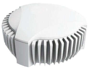
OEM boards for high-precision guidance and control
The BD GNSS family of boards includes the BD940 GNSS and GNSS-inertial boards and new BD990 GNSS, GNSS-heading and GNSS-inertial boards. The BX940 and BX992 models are available in a rugged enclosure (pictured) for applications in harsh environments. The BD GNSS boards offer simple connectivity and configuration, allowing system integrators and OEMs to easily add GNSS positioning and orientation — with the ability to upgrade its capabilities — using the same board footprint, connectors and software interface for specialized and custom hardware solutions. The compact boards include a broad range of receiver capabilities, from high-accuracy GNSS-only to full GNSS-inertial features for positioning and 3D orientation. Firmware options are upgradeable, allowing functionality to be added as requirements change. The boards are designed for UAVs, autonomous vehicles, fleet management and aviation.
The Precis-BX306 RTK board (pictured: Precis-BX306 board easy kit) has been upgraded with new and improved GPS and GLONASS functionality. The new version supports up to 20-Hz real-time kinematic (RTK) solution and raw measurement output, which can be integrated with autopilots and inertial navigation units. With improved algorithms, the new Precis-BX306 demonstrates an ability to quickly fix a 30-km baseline. Stable fix rate is achieved when under tree canopy, in urban canyons and other challenging environments. This latest version of Precis-BX306 is pin-to-pin compatible with major GNSS boards in the market, offering a flexible interface. Event mark and PPS are supported as always.
Offers advanced radio connectivity with GNSS receivers
The R4S-BT UHF radio provides an external option for use with the Sokkia GCX receiver line. The UHF multichannel radio modem has a tuning range of up to 70 MHz. It features an IP67 certified housing with internal batteries designed to be easy to carry with versatile mounting options. The radio modem makes the GCX GNSS receiver a more scalable and modular solution for situations without a network connection or when long-range Bluetooth technology is not enough on its own. Survey and mapping professionals can add the radio modem to extend the range between the base and rover. Connectivity options include wireless data transfer and USB connections.
The Triumph-F1 Survey UAV and Receiver is based around a geodetic GNSS receiver with 864 channels. When used on the ground, the receiver can function as base or rover. It includes eight propeller motors, a sim card slot, two micro SD card slots, USB connector, satellite tracking and communications indicators, flight and gyro status indicators, storage and selector for saved flight patterns, up to four antennas including Bluetooth and Wi-Fi, four angled cameras and a downward-facing high-precision camera for photogrammetry.
The S321+ and C321+ smart antennas are upgrades to the previous versions S321 and C321 and offer added benefits. Powered by the Eclipse P326 OEM board, the smart antennas support 394 channels and can simultaneously track all satellite signals including GPS, GLONASS, BeiDou, Galileo and QZSS. The boards come with two hot-swappable lithium batteries providing up to 12 hours of operation. The S321+ and C321+ combine Hemisphere’s Athena GNSS engine and Atlas L-band correction technologies with a new customer-friendly web user interface. Both antennas meet IP67-standard requirements. The S321+ and C321+ come in two versions, with 4G LTE optimized for either North American or international locations. The S321+ is designed for use in land or marine survey, GIS, mapping and construction. With the SureFix advanced processor, the S321+ delivers high-fidelity RTK-quality information. The C321+ is designed for construction environments, and can be paired with Hemisphere’s SiteMetrix software that helps manage construction jobsite activities.
Integrates data from a variety of sensors in one platform
X-PAD Office Fusion is an all-in-one office software combining data from multiple sensors into a single interface. It manages, combines and processes data from GNSS receivers, total stations, laser scanners and other sensors, whether from GeoMax or another provider. There is no need to export the data from one program to another, and X-PAD also offers all CAD features. The program handles a multitude of different types of data: measurements, coordinates, drawings and point clouds. Large quantities of data can be managed in the fastest way with maximum accuracy. The software automatically detects the common points between the point clouds and performs a first rough alignment. The Bundle Adjustment feature performs the final and accurate alignment in order to reduce errors. Personalized reports are then created with little effort.
The TSO Public Tracker provides public transportation riders with a variety of GPS-based monitoring capabilities. Riders can view exact locations and information on a variety of public vehicles. Passengers can view on a single screen the whereabouts of connected-fleet vehicles in real time. The tracker can be used by agencies of all sizes and in different geographical locations. The related TSO Mobile App provides route information, current and historical location updates in different map views through Google Maps, and more. TSO Mobile’s transportation solutions also provide agencies with driver reports based on customized behavior metrics to improve driver behavior.
Omnitracs Virtual Load View (VLV) provides brokers, shippers and carriers with direct access to the position data of assets carrying their freight, allowing them to easily track loads. Position data about the load is either shared from the Omnitracs Intelligent Vehicle Gateway (IVG) or Mobile Computing Platform (MCP) unit, or if no Omnitracs unit is available, through the VLV Mobile smartphone application, which the driver can download from the iOS and Android app stores. VLV can also be directly integrated into a company’s back office system, so employees are not required to learn and access a new platform. Brokers and shippers can identify loads that are behind schedule so they can make the proper adjustments in a timely manner.
The lightweight fixed-wing UX11 UAV combines a powerful integrated onboard system, industry-grade sensors, limitless communication range and PPK centimeter-level positioning. It carries enough onboard computing power to access and process pictures, then send them to the operator in real-time. It will run automated quality checks on the images (such as blur detection or overlap checks) to help ensure the operator is acquiring quality data. Its redundant communications system includes a proprietary line-of-sight radio and 3G/4G connectivity between the ground-control station and the UAV using a worldwide machine-to-machine pre-paid plan. The UX11 is ready for beyond visual line-of-sight (BVLOS) flights with unlimited range and adds a new level of safety with this communication link.
Super 35 Camera for Professional Aerial Cinematography
The Zenmuse X7 UAV camera features superior image quality, interchangeable lenses and a new post-production color system. The Super 35 digital film camera is designed to work with the DJI Inspire 2 drone. The Zenmuse X7 features 14 stops of dynamic range for more detail in low-light conditions. Its low-noise image capture enhances grading flexibility by preserving details in both highlight and dark areas while enabling a shallow cinematic depth of field. It is capable of shooting 6K CinemaDNG RAW or 5.2K Apple ProRes at up to 30 frames per second (FPS), as well as 3.9K CinemaDNG RAW or 2.7K ProRes at up to 59.94 FPS to integrate into industry-standard post-production workflows.
The Atlas NEST smart protective charging station is designed for autonomous beyond visual line-of-sight (BVLOS) operation of the Atlas Pro drone platform. The Atlas NEST is a landing, protective charging station that extends flight range and provides constant drone readiness in remote locations. When the Atlas Pro UAV requires new batteries, it can autonomously land in a NEST charging station where a robotic arm changes the drone’s batteries, allowing the Atlas Pro to continue flying to mission completion. The Atlas NEST can be stationary or motorized.
VTOL lift-off followed by tilt to fixed wing in flight
The WingtraOne vertical take-off and landing (VTOL) UAV bridges the gap between traditional multi-rotors and fixed-wing drones. It takes off and lands vertically like conventional multirotors, but once in flight, the drone tilts forward to fly like a fixed-wing aircraft. Being able to carry a heavy payload such as the Sony RX1RII, the drone offers high mapping accuracy, while covering an area of 980 acres (400 Ha) at 3 cm/px (1.2 in/px) GSD or the equivalent of 570 football fields. The WingtraOne is available in use in Europe, China, the United States and Australia for applications ranging from surveying and precision agriculture to glacier monitoring.
“Prepare for Tomorrow: Find Vulnerabilities Today” was the title of our wide-ranging webinar in July that focused on GNSS signal simulation for jamming and spoofing scenarios. We did not have time to address all the questions posed by the audience, so we return to them here.
Q: While testing receivers, realistic scenarios for jamming and spoofing are very important. What is the typical approach to set the number of interference sources, their type and main signal parameters?
Two different approaches are common, those involving the use of an anechoic chamber and those which are lab-based. Each approach has its limitations and merits. Each approach must address the number of significant interferers, their signal powers and the waveforms of the interference signals. Each must also consider the geometric arrangement of these interferers relative to the antenna under test and relative to the simulated constellations under test.
Changes in signal phase, signal Doppler and signal power are as important for the interference signals as they for the wanted GNSS signals. These changes are caused by the simulated motion of the vehicle and potentially the motion of the interferers. These changes should also include the impact of terrain surrounding the vehicle and the interferers, and also the gain and phase patterns of the receive antenna on the vehicle and the transmit antennas on the interferers. Some interferers might be discounted from the significant set due to their signals being masked from the vehicle by the terrain or antenna patterns or by them being too far from the vehicle to have an impact. These interference signals may become significant as the scenario progresses due to vehicle or interferer motion.
Simulator graphical user interface. (Image: Spirent Federal Systems)
Q: In GNSS navigation systems for commercial applications, what emphasis of design effort should be on anti-jamming/anti-spoofing over improving the navigation accuracy?
Commercial applications is a broad area, so it will depend on the particular application as to whether it needs more accuracy or more resiliency against AJ/AS, but in general, the accuracy of GNSS is fairly mature. Standard GNSS offers accuracies on the order of ~1 meter. Centimeter accuracy can be achieved with differential or real-time kinematic (RTK). Multi-constellation use can increase availability in areas with limited sky view such as urban canyons. Multi-frequency can aid in the reduction of multipath and improve accuracy. If the application needs accuracy, these features are readily available.
However, integrity and resiliency are growing needs in commercial applications, especially ones that are in critical operations. Much more can be done to detect jamming and spoofing than what is in standards GNSS receivers today. In our systems, we include an additional software layer called BroadShield, which monitors internal state variables of the receiver, and will alarm on detection. Additional sensors combined with the GNSS receiver such as an inertial measurement unit (IMU), magnetometer, odometer, or even the much stronger Satellite Time and Location (STL) signal offer augmentation during periods of GNSS denial, or in the case of spoofing, authentication of the navigation solution.
While both jamming and spoofing are intentional attacks, they are highly different in their set-up and serve very different purposes. Due to their simplicity, most jamming attacks can be mitigated thanks to adaptive filtering or pulse blanking. On the other hand, spoofing is a malicious attack, highly complicated, and requires knowledge of the GNSS signal structure as well as precise timing and positioning.
The question is thus whether one should emphasize navigation accuracy over the ability to output a position (jamming case) or the possibility to output a completely erroneous position (spoofing case). The answer lies, obviously, in the end application and the coupling of GNSS receivers with other systems. High-precision non-life-critical applications should emphasize navigation accuracy while implementing simple jammer filtering strategies. Life-critical applications, being often coupled with other systems, should ensure the reliability of the solution even if that means being unable to compute a position due potential threats.
Q: Do you have GPS/inertial navigation system (INS) test capabilities?
The CAST-3000 EGI integration system produces GPS RF signals commensurate with simulated IMU sensor data to provide repeatable testing in the integration laboratory for a wide range of military and government applications.
CAST GNSS/INS simulators generate high-fidelity signals required for emulating the legacy GPS signals as well as those used by next-generation navigation technologies. This is because our sole business focus is supplying GNSS simulators, GNSS/INS test equipment, and GNSS/INS support services to government and military avionics laboratories, prime contractors, and GNSS receiver manufacturers. For 35 years we have provided off-the-shelf products to both the government and U.S. major defense contractors.
CAST EGI integration tools are used by Northrop Grumman and Honeywell and are now also being used in integration laboratories worldwide. Our equipment supports system integration in major weapons platform labs and development at major military contractor labs. CAST simulators produce high-quality, accurate signals that are used in government, military and commercial labs around the globe.
Our NCS TITAN GNSS simulator is able to emulate the presence of IMUs and micro electro-mechanical systems (MEMS) sensors with the optional available real-time IMU/Sensor Emulation Package (SEP). The SEP upgrades the TITAN to support the simulation of inertial sensors, which nowadays are implemented as MEMS, among others, and of other common aiding sensors. To obtain more accurate positioning for location-based services and navigation, GNSS chipset and receiver manufacturers as well as system integrators combine more and more GNSS navigation with such sensor fusion or signals of opportunity.
The optional SEP enables controlled and progressive testing of sensor-fusion algorithms when used with NCS Control Center operating software. This software supplies the SEP with an internally- or externally-generated center-of-gravity (CoG) trajectory for the device under test.
The various sensor models to be emulated by the SEP run within the Control Center software. The device under test (vehicle) input trajectory at the CoG passes through the sensor model, which in turn generates the appropriate sensor output, by taking into account the corresponding error model for each sensor defined.
We have added the capability to emulate INS/IMU data in addition to GNSS signals to our Constellator simulator, to offer to the customers a complete testing platform. Constellator can simulate up to six gyrometers and six accelerometers. The attitude of each sensor is defined with respect to the vehicle axes. Deterministic errors can be configured to simulate the axis misalignment and scale factors, and biases can be defined in order to simulate realistic sensors. Stochastic error models are also available such as random walk or Gauss-Markov models for each sensor (gyrometer or accelerometer) to improve the sensor emulation fidelity.
Q: Do you have detailed scenarios for jamming and spoofing in timing use of GNSS receivers, that is, involving time synchronization for telecommunications companies?
The simulated jammer’s signal specification must be very flexible in order to faithfully simulate real-world jamming events. For example, the jammer’s spectral shape should be flexible enough to simulate a Blue Force electronic attack (BFEA) on a GNSS receiver.
Also, the simulator should be able to simulate dynamic scenarios by varying the power of the jammers as a function of their trajectories and as a function of different antenna patterns.
Sometimes when testing receivers, the simulated jammers should replicate pre-recorded waveforms from real world. The ability to play back the pre-recorded IQ-baseband signal in conjunction with GNSS signals is another powerful feature of a simulator. Simulation of spoofing attacks on a GNSS timing receiver is only possible when the GNSS simulator provides fine-grained control of transmitted signal. This includes controlling the offsets on the pseudoranges with additive ramps, as well as individual signal power levels at very precise points in time.
Also, the GNSS simulator must be able to synchronize itself with the live sky’s GNSS signal. Another way to achieve realistic spoofing is to use two simulators controlled independently (that is, full control on constellation, navigation message, propagation time offset, power and so on).
FIGURE 1. Real-world jamming simulation must take into account key factors such as varying jammer power, as a function of their trajectories and antenna patterns. (Image: Skydel)
Q: Please discuss how to simulate a smart spoofer that would generate a replica of a constellation (or all constellations) and then produces two full RF transissions: one that is the true signal, and a strong spoofed signal that pulls the receiver to a false location. Can you simulate the two full multi-band RF ensemble?
Two artificial synchronized scenarios could be created using SatGen signal generator software that can reproduce the GNSS signals from a number of constellations. The user could create two separate signal streams, both starting at exactly the same position and time and using the same constellations, chosen by the user.
The second scenario could then be set to diverge away in position from the first scenario, while staying perfectly synchronized in time. The signal-to-noise ratio of each scenario could be adjusted independently of each other to simulate a spoofing situation where the spoofing signal is much stronger than the real signal. A file containing this twin scenario can be replayed using a LabSat Wideband with two separate RF outputs, each synchronously replaying the two different scenarios. This would closely simulate the actions of a smart spoofer, but in a completely repeatable, and controllable manner.
This could be accomplished by either combining the output of two of our CLAW GPS simulators, or by combining the output of a single CLAW simulator with live-sky signals using passive industry-standard splitters/combiners. The CLAW is able to receive a custom ephemeris download in RINEX format to match either the spoofed live-sky constellation, or to generate a synthesized constellation in the case where two CLAW simulators are being used.
The simulator has a wide RF power adjustment range of over 45-dB, allowing the spoofing signal to be gradually introduced to the primary GPS constellation RF signal. This spoofing simulation could be accomplished with better than 0.5 meter peak-to-peak positioning accuracy and better than 5-ns real-mean-squared (rms) typical UTC (GPS) offset unit-to-unit, allowing the victim receiver to be pulled off of its true (live-sky) position with very high accuracy. Typically, GPS receivers are spoofed easily as long as the UTC timing synchronization is 500-ns or better between the live-sky and spoofed signals.
Timing synchronization to the spoofed victim GPS signal to within nanoseconds is achievable through the external 1PPS reference input, the simulator accepting a position, navigation and timing (PNT) fix in real time via its NMEA serial and 1PPS inputs. This allows capturing a moving victim receiver by estimating its momentary position, then ramping up the spoofer power, and then presenting the victim receiver with alternate position information as required (see Figures 2 and 3).
High position and timing accuracy between the spoofed and live-sky signal is important to prevent and mitigate spoofing detection via UTC phase or position jumps that could happen when the receiver gradually or quickly switches over to the spoofed satellite signals.
FIGURE 2. Spoofing attack on a GPS receiver using a CLAW simulator to spoof a live-sky antenna signal. Initially the spoofer was phase- and frequency-synchronized to UTC(GPS), then spoofer RF power is ramped up, and once the victim GPS receiver is captured, a frequency offset is added to UTC(Spoofer), which pulls the system off-phase. (Figure: Jackson Labs)FIGURE 3. Simulating a spoofing attack on a timing application where the spoofer does not know the exact victim antenna location with certainty. The resulting antenna position offset error (50 meters in this simulation) still allows the victim receiver to be captured, and then causes a time error as satellites move in and out of view even with the spoofer being synchronized to UTC(GPS) at all times. This error is clearly visible in the resulting UTC(Spoofer) output from the victim receiver equipment. (Figure: Jackson Labs)
Q: We want to correctly model and simulate effectiveness of various anti-jamming (AJ) and anti-spoofing (AS) solutions to make informed decisions about which AJ/AS solution is most effective for a specific mission and interference scenario. How can you help?
Live-sky testing on a jamming/spoofing range provides a wealth of data, and reassurance that the system under test does work as intended. Record and playback systems (RPS) under live-sky conditions can allow further evaluation back in the lab, after the live-sky tests are complete. Performance parameters of the RPS may degrade the validity of the signal when played back; signal bandwidth and bit-depth are absolutely key, for example. Recordings that use too few bits will degrade the dynamic range of the recorded signals, so significant care should be taken when selecting an RPS.
Either way, under live-sky or with recorded live-sky, you get what you get. It is extremely difficult to predict what the test parameters actually are. It is perilous to attempt to alter the test parameters after the event. Lab-based or anechoic chamber-based systems have their limitations, but they are repeatable, predictable and tweakable. Again, performance parameters of the simulation system play a key role in the validity of the testing. The ability to calibrate the simulation system to give a repeatable, predictable performance is as important as the realism of the simulation. Carrier-phase accuracy/repeatability among antenna elements and signal timing accuracy are important parameters when evaluating AJ and AS systems.
Q: We had a receiver where the time stamp for any location report would drift off progressively, up to an hour off of the known true location. What might contribute to this? We do not believe this was an intentional threat, but an artifact of nearby electronics or other system conditions. It actually occurred on a pivot irrigation arm in motion, with substantial vibration. The receiver was electrically isolated. The results were repeatable on the pivot arm, but not on our vibration table.
Interesting problem with no obvious answer. Even the worst oscillator will take many months to drift off by up to an hour with no GNSS, even under horrible vibration conditions, so this is an unlikely cause. Is it drift or a jump in error? Nearby electrical noise could cause GNSS denial (jamming), but not erroneous data. That requires spoofing. If you have no reason to believe that it is intentional, that makes spoofing unlikely, but still possible. Is a GNSS repeater or a record/playback GNSS tester operating in the area? These are spoofers, even if they are unintentional.
If this is a precision agriculture application, then an RTK reference station transmitting erroneous data could be the cause. What time-stamping format is used: local time or UTC? An unlikely but possible scenario is the unit is changing time zones so local time jumps an hour. Is there a processor/software app between your output and the actual GNSS receiver? This could introduce errors. What is the position output indicated when the time drift occurs? The best way to diagnose this is to record the time and position output as log files using a laptop PC connected to the serial data.
Q: Do your simulators work as well for testing handheld, consumer-grade GPS? Please discuss the differences in testing techniques or approaches for high-precision vs. mass-market receivers?
We have a range of simulators suitable for all levels of GNSS testing. If you don’t need the high fidelity and wide bandwidth of the LabSat Wideband, then the entry level LabSat 3 will also work with any GNSS device including handheld consumer-grade products.
To fully explore the performance of high-precision receivers, including multipath effects and P-code reception, a wider bandwidth and a greater number of bits would be required to capture and replay all of the available signals. For these applications, we recommend a bandwidth of 56 MHz and at least 4 bits of resolution.
For testing of consumer-grade, handheld devices with simpler RF front ends, we recommend a much reduced bandwidth of around 9 MHz and only 2 bits of resolution. This smaller bandwidth and fidelity will easily reproduce the majority of real-world conditions, and the resulting data files will be much easier to handle.
FIGURE 4. Simulator graphical user interface. (Image: Racelogic)
Q: How many GNSS signals can a software-defined radio produce?
The theoretical limits of a software-defined radio (SDR) are based on four distinct characteristics of the SDR: the digital-to-analog converter’s (DAC’s) bit resolution, the maximum sampling rate, the bandwidth and the number of RF outputs. With most SDRs, available bandwidth is defined by the sampling rate.
With a 16-bit DAC, there is enough dynamic range to generate up to 50 GNSS signals and hundreds of multipath echos (with more than 60 dB of range to accommodate different signal power levels) per RF output.
For example, with a sampling rate of 50 MSps, a 40-MHz wide signal — combining GNSS constellation signals such as GPS L1 C/A, Galileo E1, GLONASS G1 — can be generated. Nowadays, SDRs can have two or more RF outputs and are able to operate with sample rates of 100 MSps or higher. By distributing the GNSS signals across different RF outputs, the entire GNSS spectrum can be covered at a relatively low cost in terms of hardware.
A handful of SDRs can easily be synchronized to form multiple RF output systems. In such cases, the complete range of GNSS signals for all visible satellites can be generated at the same time.
Q: In a dual-frequency receiver would it be possible to still use L1 spoofed/jammed with L2 clean to get an accurate position? Is it possible to do a combination between the two signals in order to save the spoofed/jammed L1?
In principal, it is still possible to use L1 spoofed/jammed with L2 clean in a dual-frequency receiver to get an accurate position. Such receivers are available as off-the-shelf products. These receivers use a special algorithm to detect if a GNSS frequency band is spoofed/jammed and automatically switch over to the clean frequency band. However, this principle can only be applied if the entire GNSS spectrum is not completely jammed. Whether a dual-frequency receiver can still use L1 spoofed/jammed with L2 clean to get an accurate position is therefore finally basically dependent on the overall bandwidth of the interferer/jammer.
With IFEN’s TITAN simulator, it is possible to easily create the corresponding simulation scenarios for the real-time simulation of realistic test scenarios to test the robustness of GNSS receivers against interference/jamming and also spoofing. In doing so, various static and dynamic interference/jamming sources are supported by the simulator’s software.
It is possible to achieve a PNT solution using L2 signals only. This requires reception and decoding of either the military L2 P(Y) signal, or reception of the new but still pre-operational L2C commercial signal. Codeless or semi-codeless commercial L1/L2 receivers rely on tracking the carrier phase on L2 to be able to mitigate effects such as solar flares and ionospheric errors; however, they are not capable of generating a PNT solution with L2-only reception as would be the case under this spoofing/jamming scenario.
P(Y) signal reception on L2 typically requires reception of the coarse acquisition (C/A) signal on L1 prior to tracking P(Y) unless the receiver has its own internal (atomic) time-base synchronized to UTC to the sub-microsecond level.
On-Demand Webinars
Simulation against Jamming and Spoofing: With cyber attacks on the rise, it is more critical now than ever to thoroughly test GPS and GNSS systems against jamming and spoofing.
 OriginGPS teamed with Friendly Technologies, an internet of things (IoT) and device management company, and Humavox, a wireless charging expert, to create an IoT-connected baseball in six weeks.