Since we’re running essentially a navigation magazine, someone had the bright idea that maybe we could bring together the monthly review of UAS/UAV activities combined with some hint of navigation content. Seems reasonable. So delving into the academic world once more, we’ve been searching for prior papers that address novel ways for divining where a UAV might be and how it might find its way about.
Promising non-GNSS approach
Turns out investigators at the Institute of Systems Optimization (ITE) at the Karlsruhe Institute of Technology (KIT) in Germany have been working on a promising approach that does not use GNSS.
The initial premise of the ITE approach is that for future autonomous flight, especially in the potentially difficult indoor environment of search and rescue (SAR) such as in a building fire, GNSS signal reception may be little to none. But most UAVs are equipped with GNSS and inertial, so aiding the inertial solution with a back-up system is preferred. ITE chose to use a monocular camera and a 2D laser rangefinder combined into a hybrid laser-camera sensor for navigation aiding.
The camera and laser-range finder were initially calibrated by focusing from multiple different adjacent locations on one object, and so determining the attitude and translation between the two sensors. Basic navigation sans GNSS is established using the acceleration and angular rate information provided by the IMU, but inertial drift rapidly decreases accuracy, so aiding is essential.
The aiding solution has several components which are first integrated together. The camera sensor provides an initial “keyframe” from which relative motion can be derived.
The next phase was to verify the initial performance of the inertial/hybrid solution, by flying the UAV down a corridor towards a wall. Horizontal position began to degrade around 67 seconds.
Corridor test.
The next more challenging demonstration involved transit down the corridor then into an adjacent room and leaving via a different exit. In addition, solutions using hybrid aiding and laser scanning aiding were evaluated.
Corridor-room test.
The hybrid approach appeared to satisfy the anticipated test constraints very accurately with a deviation of about 0.8? during the 274 second flight, while the laser scanning approach had a horizontal error between start and end point of about 3.7?. It was felt that the structured environment in the test rooms presented challenges for laser scanning and resulted in vertical variations coming from the dependence on the UAV’s attitude, while the hybrid solution overcame these problems.
The conclusion from the testing was that the hybrid sensor performance was not limited by the structured test environment. So missions in more challenging environments could be better navigated in future with the hybrid system, compared to those where existing laser-scan-matching approaches would be used. The researchers intend to now focus on better perception of the test environment. For exploration missions, not only is accurate positioning crucial but also an accurate representation of the environment is necessary, for which the hybrid sensor is a promising tool.
Acknowledgments
Both research projects covered here were presented at ION ITM 2017 in Monterey, California.
Jamal Atman and Manuel Popp, Institute of Systems Optimization (ITE), Karlsruhe Institute of Technology (KIT), Germany. Gert F. Trommer, Institute of Systems Optimization (ITE), Karlsruhe Institute of Technology (KIT), Germany & ITMO University, St. Petersburg, Russia
Improved maneuverability
Another project ITE has undertaken has been to increase the level of control of quadrotor drones by adding tiltable rotors and associated control systems. The object is to maintain a certain orientation of the UAV and its payload without altering platform attitude, to manage maneuvering more effectively and to compensate for disturbances faster and possibly enlarge the area of operation for rescue forces.
For fire disaster recovery, hovering multi-rotor UAVs can provide invaluable information within buildings, rather than risking the lives of first responders. Locating survivors or difficult to find fire sources using video transmitted by drones may save time and reduce exposure for critical personnel.
A two-part nonlinear control system has been implemented by ITE — the first part takes the measurements of the vehicle dynamics and connects these measurements to a back-stepping controller to generate the desired forces and torque to change vehicle motion.
At first the commanded signals have to be fed through a filter in order to provide smooth and continuous command signals and to produce the derivatives required by the control algorithm. The smoothed command signal is then used by an arbitrary controller to create vectors of required forces and torque to control the attitude and velocity of the vehicle.
Desired force and torque is fed into an adaptive and dynamic control allocation algorithm to generate the values for the actuators – there are four propulsion motor commands and four servo motor commands. The control allocation algorithm is an adaptive algorithm – used in order to adjust for changing situations and environments. For example, when flying in a hallway and near walls, ceiling or floor, flight characteristics change significantly due to different aerodynamic effects. On the other hand, outdoors flight behavior is usually much easier to manage as the only nonlinear behavior occurs relatively close to the ground.
3D modeled performance versus flight data. Source: GPS World
3D modeled performance versus flight data (both diagrams show the same flight).
In order to verify the performance of the system it was modeled — flight dynamics and operator control inputs were simulated. Performance was found to closely match actual recorded flight data. This novel approach could have a number of possible applications — possibly to serve as an alternative to a gimbal mount for a camera?
Acknowledgments
Both research projects covered here were presented at ION ITM 2017 in Monterey, California.
Georg Scholz, Institute of Systems Optimization (ITE), Karlsruhe Institute of Technology (KIT), Germany. Gert F. Trommer, Institute of Systems Optimization (ITE), Karlsruhe Institute of Technology (KIT), Germany.
A key feature of the tilt rotor approach is insensitivity to wind gusts; enabling successful operation in situations where standard UAVs could fail. So we might anticipate applications such as all-weather reliable delivery of goods, surveillance tasks even in storms, inspection of operational wind-generation parks, and uninterrupted searches for avalanche victims regardless of continuing stormy weather.
It’s easy to see that other applications may well want production solutions for ways to navigate when GNSS signals are blocked. It’s possible SAR in rugged mountainous terrain could also suffer intermittent GNSS signal blockage, as could UAV flight in heavily wooded forests, or anywhere where a canopy blocks out the sky. So could survey be a potential commercial application for this type of augmentation? What about mining and subways as well as indoors and outdoors search and rescue?
Octopus ISR Systems, a division of UAV Factory Ltd., has released a precision geo-pointing feature for its miniature Epsilon series of gyro-stabilized gimbals. The feature, Precision Geo-Lock, combines a GPS-aided inertial navigation system (GPS/INS) with dedicated software algorithms and payload operator software.
To guarantee the successful implementation of the Precision Geo-Lock feature, UAV Factory partnered with VectorNav Technologies of Dallas.
Precision Geo-Lock provides the user with highly accurate target geo-location, range-to-target, as well as Geo-Lock functionality and moving map user interface.
Equipping a miniature airborne gimbal with precision geo-location presents a multitude of challenges. The gimbal operates in a high vibration environment and is subjected to high accelerations and extreme ranges in temperature. In addition, small size and low power consumption are significant factors for miniature gyro-stabilized gimbals which are often used in unmanned aircraft.
The attitude solutions commonly available onboard unmanned aircraft typically do not present a reliable solution.
“Traditionally, small gyro-stabilized gimbals use an external heading source to estimate the geo-location of the target,” said UAV Factory CEO Konstantins Popiks. “Onboard the unmanned aircraft, the attitude data is usually supplied by an autopilot, and the estimate accuracy is not very precise due to the nature of low-cost sensors used in miniature autopilots. Miniature autopilots simply do not need the precise heading data required by the gimbal, and as a result, the heading error generates large geo-location errors and provides little to no use for the unmanned aircraft operator. There are also additional errors due to misalignment of the gimbal and autopilot, as these are separate subsystems mounted in different locations on individual soft vibration mounts.”
VectorNav’s VN-200 surface mount GPS/INS.
To enable the Geo-Lock feature, an external GPS/INS needed to be integrated, and such a GPS/INS needed to provide a high level of accuracy.
“Today, the state- of-the-art miniature gyro-stabilized gimbals have a narrow field of view of less than 1.3 degrees; therefore, the accuracy of the pointing should be significantly better than 1.3 degrees to prevent the target pointing location from going out of the video frame,” Popiks said.
VectorNav is a developer and manufacturer of high-performance inertial navigation systems using the latest in MEMS sensor and GPS/GNSS technology. VectorNav’s industrial series line of inertial navigation solutions provide small, light and low-power consumption solutions in the industrial-grade inertial navigation performance category (attitude accuracy 0.1-0.3).
“VectorNav’s VN-200 was the only product on the market that offered a high-level of performance but small enough form factor that it could be integrated directly into the optical bench of the gimbal,” Popiks said. “When the product delivered that level of accuracy despite the high vibrations, accelerations and temperature fluctuations of our application the choice was obvious.”
UAV Factory’s Precision Geo-Lock provides better than 0.3 degree accuracy and is plug-and-play, so the customer can install the Epsilon gimbal and get accurate results on any platform and in a high-vibration environment.
Epsilon gyro-stabilized turrets will be available with both VectorNav’s VN-200 single GPS-based INS solution, as well as the VN-300 dual GPS-based INS. A single GPS/INS solution is suitable for dynamic platforms such as manned and unmanned aircraft, while dual GPS/INS is a necessity for platforms with low dynamics, such as aerostats, ships and helicopters.
The European Satellite Navigation Competition (ESNC) — the largest international competition for the commercial use of satellite navigation — is once again in search of outstanding ideas and business models for accelerating Galileo applications.
Renowned institutions and regional partners are set to award prizes worth a total of more than €1 million in more than 20 categories.
Submissions are due June 30.
Innovation Network for Satellite Navigation
Satellite navigation is indispensable when it comes to accurate, reliable and continuous localization, according to the ESNC. This technology is fundamental to a variety of current trends, including multimodal logistics, the Internet of Things (IoT) and machine-to-machine (M2M) communication, unmanned aerial vehicles (UAVs) and smart cities.
First held in 2004, the ESNC has evolved into the leading innovation scouting mechanism in terms of Galileo-related applications across Europe and beyond. Moreover, the ESNC promotes the transformation of groundbreaking business ideas into market-ready products and new ventures.
Each year, the competition offers advantages to more than 400 business ideas. It has awarded prizes to more than 300 winners, which represent just a fraction of the 3,700 innovative concepts submitted by 11,000 participants. Through its network — including the ESA Business Incubation Centres, other incubators across Europe and the new E-GNSS Accelerator co-funded by the European Commission — the ESNC plays a decisive role in the realization of promising ideas by supporting the foundation of startups and creating high-tech jobs.
One of the main objectives of the ESNC is fostering the European space sector’s competitiveness globally by boosting the development of commercial space applications, especially for startups, SMEs and young entrepreneurs. Advancing Europe’s space programs and meeting user needs, especially when it comes to space data access to encourage alternative business models and technological progress, represent major goals of this strategy.
The involvement of the pan-European spirit within the EU Space Strategy is realized in the ESNC by engaging multiple regions across Europe with their own dedicated prizes.
“The investment in space technologies and applications as well as the support of forward-thinking entrepreneurs and startups ensure Europe’s increased competitiveness,” said Elżbieta Bieńkowska, commissioner for internal market, industry, entrepreneurship and SMEs. “To achieve this ultimate goal, the European Satellite Navigation Competition (ESNC) and the Copernicus Masters are a proven platform for trendsetting technologies and business models based on Galileo and Copernicus to implement the new EU Space Strategy.”
Within this context, this year’s ESNC patronage taken over by Markku Markkula, president of the European Committee of the Regions (CoR), sets the tone for the innovation competition’s pan-European mission of uniting the European regions and cities through the support of space-related businesses and future-oriented entrepreneurs, increasing the market and user uptake of Galileo.
“The European Committee of the Regions attaches great importance to the new opportunities linked to the involvement of European regions in innovation networks, such as the European Satellite Navigation Competition,” Markkula said. “I have therefore gladly taken on the role of patron for the ESNC as of 2017.”
E-GNSS Accelerator
As the high-tech platform for pioneering satellite navigation applications, the ESNC is now additionally equipped with the new E-GNSS Accelerator. This program is a unique opportunity for entrepreneurs and startups to accelerate their business case on a broad scale and bring their products and services to market.
The E-GNSS Accelerator will run for three years and will directly support the winners of the ESNC 2017, 2018 and 2019. Thereby, the participants await even more prizes, services and three further business incubations worth an additional value of EUR 500,000.
ESNC Partners
In the ESNC 2017, special prizes are to be offered in partnership with the following institutions: the European GNSS Agency (GSA), the European Space Agency (ESA), the German Aerospace Center (DLR), and the German Federal Ministry of Transport and Digital Infrastructure (BMVI).
Prototypes can also be entered into the GNSS Living Lab Challenge.
The University Challenge, meanwhile, is explicitly designed for students and research associates.
In addition, participants choose from this year’s confirmed partner regions: Asia, Austria, Baden-Württemberg / Germany, Basque Country / Spain, Bavaria / Germany, Catalonia / Spain, Estonia, France, Hesse / Germany, Ireland, Madrid / Spain, The Netherlands, Norway, Poland, Romania, United Kingdom, and the Valencian Community / Spain.
Stay tuned for more updates on additional ESNC regions.
Obtain more information at the official website, www.esnc.eu, comprising all relevant information on prizes, partners, and terms of participation involved in the ESNC.
Prizes for the Best Applications
This year’s winners will take home prizes worth a more than EUR 1 million and be welcomed into the ESNC’s leading innovation network for global satellite navigation systems.
Along with cash, the various prize categories offer primarily technical, business-related and legal support in realizing the winning business models. A jury of international experts from the realms of research and industry will also evaluate the winners of all the categories to select an overall winner, who will be revealed at the festive Awards Ceremony in early November 2017.
Furthermore, three additional incubations, supported by the European Commission, will be awarded in front of a high-ranking audience.
Those who enter the ESNC also stand to benefit greatly from the opportunity to work closely with leading institutions and regional partners. The ESNC is geared towards individuals and teams from companies, research facilities and universities around the world.
Awards Ceremony and Space Conference
A partner program, the Copernicus Masters (Earth observation), also kicked off on April 5 in Brussels.
The Awards Ceremony for both the ESNC and the Copernicus Masters takes place in early November. The event brings together industry, politics, entrepreneurship and research to showcase the most disruptive space applications and discuss trendsetting developments in the satellite downstream sector and its various application fields.
Tersus GNSS Inc., a GNSS real-time kinematic (RTK) manufacturing company, has launched its new GNSS RTK board, the Precis-BX306.
The launch of Precis-BX306 aims at facilitating the applications that need centimeter positioning accuracy and dynamic operation mode, enforcing effective observation data logging and management, and popularizing the adoption of high precision in aerial mapping and drone-related integration.
Compared with previous Precis GNSS RTK boards, Precis-BX306 further improves the reliability and continuity of positioning performance in challenging environments. It supports GPS L1/L2, GLONASS G1/G2 and Beidou B1/B2 with 192 tracking channels.
The Precis-BX306 can easily integrate into Pixhawk and other autopilots. The event mark and PPS features of the new board provide more possibilities for shutter synchronization.
Assessing the health of an entire industry is not an easy task, but talking with industry leaders and looking for examples of growth and investment can help. My inquiries have led to discussions with General Atomics, Association for Unmanned Vehicle Systems International (AUVSI), Aeryon Labs and SensoFusion. Further viewpoints welcome; see the conclusion of this article.
Discussions included questions around these issues:
The level of maturity of common technologies in use on UAV platforms and systems
The level of maturity of integration of those technologies
A sketch portrait of the industry
Rough numbers or percentage of small players versus large ones
The rate of consolidation of companies: Has it happened, or has it yet to happen?
The financial underpinnings of the market: Does it have legs to go the distance?
If we start with a top-level overview of the industry, we find on the commercial side an industry trying to figure out what it is and who its customers might be. But a well-established military segment is quite mature. A large number of multi-rotor UAV suppliers use simple handheld controllers, all aimed at different applications where they are seeking a niche. The FAA’s release of regulations last year for use of small unmanned vehicle systems (sUAS) has provided a real boost to many more commercial pay-for-service ways these vehicles are now being used.
Multi-rotor UAVs are being put to use in surveying, filmmaking, newsgathering, real estate, crop and pipeline inspection, firefighting, law enforcement, security, search and rescue, and disaster monitoring and relief, just to mention a few applications. Of course, home and hobby flying your own drone in your backyard or open areas has fueled the Chinese DJI drone manufacturers’ growth significantly. While the FAA requires registration of private drones, this has not prevented an increase in commercial pilot reports of UAV incursions into controlled airspace, which appear to be on the increase.
Military Use. Then there are small, medium and large fixed-wing UAVs that appear to have been mostly developed for and used by the military. These include hand-launched surveillance drones for small groups of ground troops; mid-sized, longer range surveillance drones finding applications in commercial inspection; and the bigger GA Predator type aircraft that have become the U.S. military’s search and destroy long-range vehicle, which can carry significant ordinance.
At the top end, UAVs like Global Hawk are used for very high altitude, long-endurance surveillance. Finally, we have target drones like the Northrup Grumman BQM-74E, which earns its living pretending to be an enemy anti-ship cruise missile for the U.S. Navy.
Northrop Grumman’s BQM-74E Target Drone works for the U.S. Navy. (Photo: U.S. Navy)
Commercial Growth. Brian Wynne, president and CEO of the Association for Unmanned Vehicle Systems International (AUVSI), believes for the commercial segment that, “The UAS industry is primed for incredible growth. UAS are being used in all 50 states by industries like real estate, agriculture and the oil and gas industry for more than 40 different types of business applications, including aerial photography, emergency management and utility inspection.”
More than 500,000 people have registered their UAVs with the FAA in the U.S., and around 20,000 of those are looking to start commercial operations. AUVSI expects more than 100,000 jobs will be created when UAS are integrated into and allowed to operate in the U.S. National Airspace System (NAS).
AUVSI analysis of initial UAS applications. (Source: AUVSI)
However, Wynne went on to comment, “This this can only happen if the government puts in place a true, holistic plan for full UAS integration that includes flights over people, as well as beyond line-of-sight operations, access to higher altitudes and platforms above 55 pounds.” AUVSI estimates that in the first decade after full UAS integration into the NAS, these commercial operations could generate more than $82 billion is economic impact.
Even before the FAA’s release of formal regulations (known as Part 107) for use of sUAS in June 2016, more than 5,500 businesses received approval to fly for commercial purposes. AUVSI published a report analyzing these applications: “Commercial UAS Exceptions By the Numbers” provides an overview of the developing commercial UAS industry in the U.S. (See auvsi.org/advocacy/exemptions70)
More than 90 percent of these businesses make less than $1 million in annual revenue and have fewer than 10 employees. This indicates that the engine behind this growth comes from small, independent business.
Nevertheless, big organizations such as CNN are also exploring visual line-of-sight operations over people and safely using UAS for newsgathering in populated areas, as part of the FAA’s Pathfinder Program. PrecisionHawk is testing extended visual line-of-sight operations in rural areas, aimed at precision agriculture, and BNSF Railway is testing beyond visual line-of-sight (BVLOS) operations in rural and isolated areas for the inspection of rail system infrastructure.
Anti-Drone Systems. More recently, anti-drone systems have joined the party to help defend against unwanted UAV incursions into secure areas already protected by conventional systems like radar, acoustic and optical detection systems. Secure areas include prisons, government buildings/facilities, utility companies (including nuclear power stations) and airports. Sensofusion in Finland is one such company with its Airfence, one of three anti-drone systems tested last November by the FAA at Denver airport. The other systems were supplied by CACI International and Liteye Systems.
The Airfence drone countermeasure platform can automatically detect, locate, track and take over UAV controls as well as locate the operator.
Kaveh Mahdavi, VP of Operations for Sensofusion, thinks that, relatively speaking, the UAV industry is quite mature — what’s still being developed are systems to enable autonomous drone flight. The regulations published so far only address ground-pilot-controlled operations, even though BVLOS testing is progressing well.
On the other hand, the maturity level of anti-drone systems range from proven to embryonic. As many as 50 companies with different technical solutions are vying to succeed in this new segment.
As the UAV segment continues to grow, so does the need for detection and prevention of drone incursions.
These systems employ three basic technologies: radar, optical and RF. Radar and optical need direct line of sight and cannot see over the horizon. That makes them quite short-range, and detection and defense has to be exceptionally quick to prevent unwanted UAV visits. The Airfence RF system is omnidirectional and can even detect UAS preparing for take-off up to six miles away, as demonstrated at the Denver airport.
Thus, intrusion warnings at a geofence distance of 3–4 miles can be generated, and automatic defense/prevention is readily achieved. Some utility companies want to have detection, warnings and control of intruder drones within a mile of their facilities.
Mahdavi described how Airfence uses a library of drone control RF signatures for all known UAS, with new signatures added regularly. The system can detect, intercept and directly take control of the offending vehicle.
During the Denver tests, Airfence initially only detected one third of the target UAVs, but the RF signatures of all targets were acquired.
Using remote engineering updates to the library, by Day Three all were detected. With lower prices, consumer drones are becoming a real threat for these sensitive areas.
The anti-drone industry will no doubt face considerable consolidation over the next couple of years, but Mahdavi feels that Sensofusion is well placed, with significant military and government business funding its growth — “securing the right contracts with the right customers,” as he says — without external investment.
Mature Company. General Atomics Aeronautical Systems Inc. (GA-ASI), makers of the well-known Predator, Reaper and other Medium-Altitude Long-Endurance (MALE) drone systems, has been in this business for almost 25 years. GA-ASI considers its products to be proven, mature and resilient for the military and government markets that demand them to be so. The company uses in-house products and technology across its range of air and ground systems.
SeaGuardian and SkyGuardian will be commercially certifiable versions of the Predator.
In an effort to align with European customer interest, GA-ASI has been investing in a certifiable version of the Predator-B, recently named SkyGuardian. A derivative for marine applications will be known as the SeaGuardian.
Just as military transport aircraft want to transit through civilian airspace and, in order to do so, have been equipping with certified navigation systems for a number of years, military drone operators want to be compatible with Europe’s high-density commercial flight regulations and to operate within existing air-traffic control corridors.
To arrive in time for these European programs, GA-ASI has invested to get ahead of the market. This has entailed assessment of all on-board and ground components, and has led to upgrades and redesigns where necessary.
“Nevertheless, on existing product lines, there is a large degree of commonality across common systems on multiple platforms,” said Mike Cannon, VP of international programs. Common systems include datalinks, avionics, de-icing systems, and some airframe components.
GA-ASI has developed and integrated its own flight control system in its aircraft for more than 20 years. This has proven to be a key element of the success for the Predator family of products. Because all these systems have been flying for so long, they have become proven elements of their unmanned systems.
Hughes Network Systems Defense and Intelligence and Systems Division (DISD) has been selected by GA-ASI to provide satellite communications on the type-certifiable Predator B remotely piloted aircraft (RPA) system. Working with GA-ASI, Hughes will customize the aircraft’s satellite communications system with modified Hughes HM series modems. The advanced modems will enable a significant increase in data transfer rates, using an enhanced waveform that ensures resilient and secure communications when operating in challenging environments.
Big Players. It is very difficult for new start-up companies to enter this top-level segment of the UAV market. It’s very expensive to develop, demonstrate and prove large airframes, control systems and avionics that customers can rely on. GA-ASI has a unique position alongside major suppliers such as Boeing, Northrup Grumman, Israel Aerospace Industries, and Lockheed Martin. However, viable Chinese UAS are beginning to show up in the marketplace, apparently as a result of significant, focused investment.
Nevertheless, with an enviable position as a major supplier of platforms used in multiple applications, with sufficient internal resources to fund initial vehicle developments, GA-ASI has secured a large number of programs with multiple follow-on orders and funding for increasingly more capable derivative UAS. As the company now looks toward the certifiable segment using another internally funded product launch, it is again reinforcing its leadership position in its chosen unmanned market segment.
Small Vehicles. Meanwhile, the world of small unmanned air vehicles (sUAS) continues to thrive, given the release of FAA regulations last year, and the blossoming of many commercial applications using increasingly capable small multi-rotor drones. David Koetsch, CEO and co-founder of Aeryon Labs in Ontario, Canada, thinks the sUAS segment is also quite mature.
Aeryon has been around for more than 10 years, so it has also had time to prove its platforms and internal systems. It also builds its own flight-control hardware and software, affording substantial power savings and longer endurance from automatically managing rotor speeds.
Aeryon Labs provides complete solutions, such as its SkyRanger sUAV partnered with AeryonLive Tools software.AeryonLive Tools software. by Aeryon Labs.
“The quad platform has been around since 1938, so the concept is hardly new; however, over the last decade, Aeryon Labs has substantially matured and ruggedized our platform, the Aeryon SkyRanger sUAS,” Kroetsch said.
The company’s focus is on not only on the UAV platform, but also in supplying complete systems meeting different customer needs. With electro-optical and thermal imaging camera payloads and an onboard georeferencing data collection/processing system, it provides integrated solutions such as AeryonLive Video and Telemetry and AeryonLive Fleet Management using real-time software tools.
For the oil and gas industry, providing compatibility for off-line flight planning software inputs and importing compatible aerial imagery into existing GIS systems is a significant feature. The SkyRanger UAS has benefited from many years of use in the field, and has been designed with modularity and ease of use with snap-on/off parts that make set-up and operating in bad weather a lot easier.
Aeryon’s business is currently 50% military, 25% oil and gas and 25% public safety (such as rapid traffic accident data gathering). Other entrants to these segments might find it easy to put together an unmanned system from parts bought on the internet; what comes considerably harder is proving reliability and interoperability with existing customer systems.
Actually, to develop an industrial-grade UAV takes lots of investment and requires experience gathered over many years. Customers have learned how to differentiate between those dabbling in the market and those with serious capabilities.
Consolidation. Consolidation is inevitable in this market segment — perhaps within the next six months, certainly over the next two years — because there are so many companies trying. Investment for these start-ups is getting harder to find, and it may be too late for most, as the leaders are already well established.
“It’s essential to pick a niche within the increasingly competitive UAV industry,” Kroetsch said. “This is why Aeryon chose early on to focus on enterprise-level offerings in commercial, public safety and military.”
Recall what happened to 3D Robotics. Even though 3D Robotics raised many millions in funding, its Solo quadrotor fell from grace, perhaps due to continuing design issues and being higher priced compared to rapidly declining DJI Phantom 3 prices. “Competition and consolidation look to be very similar to that which happened with digital cameras,” Kroetsch said.
For Aeryon, being Canadian appears to be an advantage, as U.S. export regulations seem to be handicapping U.S. drone manufacturers. Aeryon sells in 35–40 countries because its product does not contain military-restricted components and only uses commercial parts. Canadian regulations for drone system exports do not prohibit worldwide sales for such products, while U.S. regulations can be difficult for U.S. suppliers to negotiate.
Nevertheless, unexpected hurdles to adoption still exist, such as company policies related to health and safety, union restrictions, and potential internal clashes on responsibility for implementation. But with 100% test, and a hardened design for tough environments, Aeryon sees itself well positioned to grow in its chosen industrial sector.
Conclusion
This has been a brief overview of the UAV/UAS industry — a first try, if you will. Nevertheless, it’s a summary that we can use as a benchmark for where we are right now, and a departure point for future growth.
We have quite mature capability in both large and small UAS, with integration focused on flight-control and navigation systems. The larger UAS enjoy a relatively mature market with established suppliers of lower numbers of expensive systems, while the sUAS segment is larger, younger and less expensive, with fewer barriers to entry.
Nevertheless, the mature industrial segments with harder, more integrated requirements make it difficult for new entrants to climb the steps into more complex commercial operations. The recreational segment is dominated by DJI, and it remains strong with well-performing, easy-to-operate drones.
Because of the ease of access to smaller drones, despite FAA and other countries’ regulations, people seem to want to penetrate secure facilities like utilities, airports, military bases, prisons and other government locations. Therefore, anti-drone systems using optical, radar and RF are becoming available, and facilities are being equipped to prevent unwanted drone incursions.
AUVSI XPONENTIAL. In May, I’ll be roving the show floor at the XPONENTIAL show in Dallas, and I welcome your added insight, from all corners of the UAV industry. We will continue this assessment in an upcoming
Professional OEM + UAV newsletter column (subscribe free at gpsworld.com/subscribe).
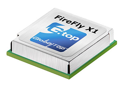
Sierra Wireless, a provider of fully integrated device-to-cloud solutions for the Internet of Things, has completed the acquisition of GlobalTop Technology’s GNSS embedded module business for $3.2 million.
GlobalTop’s GNSS embedded module portfolio will become part of the Sierra Wireless OEM Solutions product line, and the GNSS staff from GlobalTop will join Sierra Wireless.
GlobalTop’s GNSS products generated $5 million in revenue in the last 12 months, and the business is break-even, Sierra Wireless said.
“Building on our portfolio of cellular, Wi-Fi and Bluetooth modules, we will have additional products to offer to our customers in markets where positioning data is critical, including high-value asset tracking, telematics, drones and automotive,” said Dan Schieler, senior vice president and general manager of OEM Solutions for Sierra Wireless.
The TitanX1 GNSS antenna.
GlobalTop GNSS modules include the Firefly, Ivory and Hummingbird series (GNSS standalone), and the Titan and Ladybird (GNSS with antenna). GlobalTop launched the Titan X1 module in February.
“With a wide array of modules and established sales channels, as well as a proven engineering team, we believe that the GlobalTop GNSS business is an important addition to Sierra Wireless,” Schieler said.
Narrowband IoT (NB‑IoT) is a new way of communicating with the “things” in Internet of Things that was standardized by 3GPP in June 2016.
The latest mobile broadband standard, NB-IoT is aimed at devices that need to communicate small amounts of data over long periods in hard-to-reach places. It connects devices through existing GSM and LTE spectrum networks.
NB-IoT uses the 3GPP-licensed network spectrum, which is secure and free from interference, and offers low power, long range, the ability to penetrate walls and metal barriers, and support for about 50,000 devices per single cellular cell.
“Narrowband IoT will be good for connecting devices in locations where the signal distance is in kilometers and for locations in basements and underground,” said Antenova CEO Colin Newman.
“It could be the enabler for some of the IoT applications that are emerging that are not suited to the established telecoms networks, where the data throughput is quite low and infrequent.
“We see these antennas being used for smart metering, agricultural technologies, building automation and smart-city applications with lighting, waste bins and parking spaces,” Newman said.
Digicom’s narrowband IoT GPS tracker has u-blox inside.
u-blox and Digicom. Chip-maker u-blox partnered with Digicom to develop its NB-IoT products, carrying out a series of innovative and successful field trials of the new NB-IoT technology.
Digicom offers solutions for industrial markets using NB-IoT, with a focus on connectivity solutions for smart cities, smart buildings, industry 4.0 in general and the automotive industry. Digicom platforms are designed for the protection of vehicles, people and pets, offer ultra-low-power consumption and several years of operation in battery mode.
Embedded in Digicom’s products are u-blox modules such as the SARA‑N2 NB-IoT.
CEVA Dragonfly. CEVA Inc. and Hong Kong Applied Science and Technology Research Institute Company Limited (ASTRI) introduced Dragonfly NB1, a comprehensive NB-IoT solution with excellent performance and power consumption. It is easily integrated into a system on chip (SoC).
GMV Add-On for GNSS. Also, CEVA and ASTRI teamed up with GMV to offer integrated GNSS for smart devices with location tracking of logistics, assets, wearables and more.
The GNSS IP is available as an add-on software that runs on the CEVA-X1 together with NB-IoT and leverages ASTRI’s GNSS RF IP embedded in the solution.
GMV’s software IP supports all four GNSS constellations: GPS, BeiDou, GLONASS and Galileo, and allows seamless switching between constellations when required or to run multiple constellations concurrently to improve resolution and offer global asset tracking.
Antenova Latona. Antenova has developed a new NB-IoT chip antenna in the company’s lamiiANT antenna family named Latona. The antenna measures 20 x 11 x 1.6 mm, and is built to a novel design that allows it to perform well within a device while being easy to integrate onto a small printed circuit board (PCB), as with all of Antenova’s embedded antennas.
Suresh Ram has been appointed president of u-blox America, a wholly owned subsidiary of u-blox AG, a Swiss wireless and positioning technology company.
Ram’s appointment takes effect immediately. He is responsible for sales, marketing, field applications and operations aimed at supporting the growing regional customer base.
“The Internet of Things presents enormous opportunities for wireless technology,” Ram said. “As this emerging and rapidly developing application space matures, my focus will be on further strengthening our market position, investing in our technology, streamlining our operations and building new partnerships.”
Most recently, Ram served as head of the Americas’ RF and Sensors Business Unit within Infineon Technologies, and senior director of Global Marketing for Fluke Corporation.
Ram will be assisted by Nikolaos Papadopoulos, who has been appointed to the new position of senior vice president of strategy. Together, the management team will continue to develop key markets for u-blox’s range of positioning and wireless products.
“I look forward to Mr Ram’s contribution to develop and lead new strategies for introducing the class-leading range of u-blox products to meet the emerging demands and opportunities within the industrial, automotive and consumer IoT markets,” said u-blox’s CEO Thomas Seiler.
The new appointments strengthen the position of u-blox in the Americas, with a key objective of supporting the long-term needs of its customers and their markets. The appointments will help the company meet its medium-term goal of becoming a leading Internet of Things (IoT) connectivity company.
Ram has worked in the semiconductor and automation industries in roles that include general management, marketing and leading engineering teams to develop products for wireless infrastructure, consumer, medical, industrial automation, test equipment, military and aerospace markets. He holds a master of business administration from Santa Clara University and master of science in electrical engineering from Clemson University, South Carolina.
Tallysman, manufacturer of economical high-performance GNSS antennas and related products, has introduced a through-hole mount dual-band plus L-band GNSS antenna, the TW3892.
The introduction of this antenna is a continuation of Tallysman’s expansion into broader band GNSS antennas.
The TW3892 antenna employs Tallysman’s Accutenna technology and is capable of receiving GPS L1/L2, GLONASS G1/G2, BeiDou B1, Galileo E1 plus L-band correction services (1213MHz to 1261MHz + 1525MHz to 1610MHz).
TW3892 (other radomes are available). Photo: Tallysman
This TW3892 is a precisely tuned antenna with a tight pre-filter to protect against intermodulation and saturation caused by high-level cellular 700 MHz and other signals.
The TW3892 antenna provides superior multipath signal rejection, a linear phase response, and a tight phase center variation (PCV) at an economical price point. It provides comparable or superior performance to higher priced dual-band GNSS antennas on the market.
The TW3892 is designed for precision agriculture, autonomous vehicles, navigation, real-time kinematic, precise point positioning and other applications where precision matters. The ability of the TW3892 to access L-Band correction services extends its utility to a wider range of applications.
The TW3892 is housed in a through-hole mount, weatherproof enclosure for permanent installations. For non-rooftop installations, L bracket or pipe mount (part numbers 23-0040-0, 23-0065-0 respectively) are available. A 100-mm ground plane is recommended for non-rooftop installations.
Swift Navigation is teaming up with Carnegie Robotics LLC to develop a line of navigation products for autonomous vehicles, outdoor robotics and machine control. The first navigation product will be announced May 8 at the AUVSI XPONENTIAL event in Dallas, Texas.
Swift Navigation is a San Francisco-based startup building centimeter-accurate GPS technology for autonomous vehicles, and Carnegie Robotics LLC (CRL), the industry leader in reliable robotic components and systems.
Swift Navigation solutions use real-time kinematics (RTK) technology, providing location solutions that are 100 times more accurate than traditional GPS. In 2016, Swift shipped the Piksi Multi, a multi-band, multi-constellation high-precision GNSS receiver, suitable for autonomous vehicles.
The Piksi Multi.
The Piksi Multi offers advanced precision GNSS capabilities for the mass market. The robotics market, through this partnership with Carnegie Robotics, stands to benefit from Piksi Multi’s improved localization and control, the companies said.
Carnegie Robotics supplies rugged, reliable robotic systems for real-world work. The team at Carnegie Robotics has decades of experience successfully transitioning state-of-the-art technologies from early design into commercial use in precision agriculture, machine control, autonomous vehicles and industrial and military robots. This process requires both a deep knowledge of robotics and best-in-class engineering, but it cannot succeed without also addressing the business case, the needs of the end-user, reliability, maintenance, safety, certifications and the dozens of other essential factors necessary for a product to succeed in the real world.
“Swift’s technology is perfectly suited for the world of robotics, and we couldn’t do better than working with the renowned industry leaders at Carnegie Robotics,” said Timothy Harris, CEO of Swift Navigation. “From their robotics technology expertise to their inertial intellectual property, Carnegie is an ideal partner for Swift. We are looking forward to developing an exciting line of products and making more joint announcements in the near future.”
“Thanks to its focus on high-accuracy and low-cost, Swift Navigation has established itself as a leader and innovator in the world of high-precision GNSS,” said Steve DiAntonio, CEO of Carnegie Robotics. “Swift is an ideal partner to work with us on rapid development of robots and autonomous systems. We’re designing our joint line of products specifically for outdoor robots and autonomous vehicles with the appropriate physical, electrical and software interfaces to enable rapid deployment of precision GNSS and other mission-critical sensors.”
More information about the partnership and the unveiling of this duo’s first joint product will take place at AUVSI XPONENTIAL. Visit the joint Swift Navigation and Carnegie Robotics booth #506 at the Kay Bailey Hutchison Convention Center.
The mini choke ring antenna (right) with a traditionally sized antenna.
Harxon, manufacturer of high-precision antennas in China, has released a new patented mini choke ring antenna, the HX-CSX610A. Weighing less than 2 kg, the tiny antenna could be considered the next generation of reference antenna trends, Harxon said.
Harxon’s patent for the HX-CSX610A design includes its compact body, which offers flexible transportation and installation. Applications for the antenna include CORS stations, geodetic surveying and mapping, and other monitoring.
The HX-CSX610A is armed with excellent phase center symmetry and multipath suppression across all GNSS constellations, Harxon said, including GPS L1/L2/L5, GLONASS L1/L2, BDS B1/B2/B3, Galileo E1/E2/E5ab/E6 and L band.
For tracking performance, it can reach -0.5 dB at 20 degrees elevation.
An anti-jamming improvement over previous antenna is a method of combining the choke-ring structure with spatial filtering multipath signal suppression.
Hardware configurations meet IEC and GB standards. The antenna is water- and dust-proof.
A new industry report provides a study of the global GNSS receiver market, forecasting growth and other factors for the period 2017-20.
The GPS & GNSS Receivers Market 2017 Research Report by Markets.biz provides a “thorough and complete study on receiver industry volume, market share, trends, growth, applications, utilization ratio, supply and demand analysis, manufacturing capacity and price.
The report concentrates on a complete analysis of present and past historical details of the market as well as the competitive landscape.
Vendors mentioned include:
Trimble
Topcon
Navipedia
Sokkia
Geo
NavtechGPS
JAVAD GNSS
CHC Navigation
SOUTH
ComNav Technology
Hemisphere GNSS
NovAtel
NavCom Technology
Leica Geosystems
Eos Positioning Systems
NVS Technologies
Suzhou FOIF
Pulse Engineering
CSR
Broadcom
Garmin
The report organizes the receiver market across the globe into divisions based on industry standards and on geographical regions. The report throws light on dominant players in each region: United States, European Union, China, Japan). Other regions can be added accordingly.
Discrete aspects of the receiver industry such as value-chain analysis, rules and policies, factors driving the growth of the market, and the constraints hampering the growth are explained.
The report mentions products currently available in the market along with their cost structures, manufacturing volume, requirement and supply analysis, import/export scenario and their overall global contribution to market revenue globally.
Further, the report analyzes the feasibility of investment and investment return analysis, and shows a complete picture of market development scope and business strategies followed by leading industry players along with their company profiles, market shares and contact information.