CoreLogic has expanded its location-based intelligence data with the addition of structure footprint information to its other parcel and property characteristics data offerings.
CoreLogic is a global property information, analytics and data-enabled services provider. The company made the announcement at the 2016 Esri User Conference, being held in San Diego, California, June 27-July 1.
CoreLogic Structure Footprint enables accurate roof-top geocoding and identifies the location and outline of relevant structures on a parcel, including all known sub-addresses, to provide a more granular and precise property description.
Street, parcel and structure geocoding appear on a single map. (IMAGE: CoreLogic)
CoreLogic residential and commercial structure footprint data covers more than 35 million rural and urban parcels throughout the U.S, including two-thirds of the largest 50 metro areas. When combined with other CoreLogic proprietary property data, including business financial health, natural hazard risks, occupancy information and building characteristics, the added structure footprint data provides a more complete picture of a property than was previously available.
Accurate location data is a critically important factor for planning and operations in oil and gas, insurance, geo-commerce and other industries that need to understand what type of structures and building characteristics are associated with property addresses.
The addition of structure footprint data complements the existing CoreLogic property characteristic data, which details attributes in 150 distinct categories that provide location intelligence on everything from zoning and land use to details about roof type and number of bedrooms.
“The addition of this property data layer, which identifies individual structures within a single parcel, can improve efficiencies and risk segmentation for everything from geo-commerce to insurance,” said Steve Brewer, senior vice president of Insurance and Spatial Solutions at CoreLogic. “It’s exciting to see this level of granularity added to location intelligence that was previously not available — granularity that can be used in a variety of decision-making situations including natural hazard risk assessment, marketing, asset management and claims processing.
Veripos, a global supplier of high-precision GNSS positioning services to the offshore oil and gas industries, has extended its ranges of proprietary software with the introduction of Quantum, a new, all-purpose suite of visualization modules providing a state-of-the-art user interface to support next-generation services and features.
Designed to operate with all current Veripos positioning options including its latest Apex5 multi-constellation PPP service (see below), the new software has been developed with significant input from a wide range of users by way of simplifying any system configuration while easing methods of interpretation. Other advances include integral diagnostic functions for simple identification of operational problems together with indications of likely solutions.
Visualization modules can also be operated independently without affecting concurrent positioning calculations which might otherwise be feeding critical survey or vessel systems.
At the same time, the Quantum framework comprises a series of different modules to meet a variety of specific operational tasks such as those necessary for hydrographic and seismic surveying as well as dynamic positioning. Its versatility also extends to providing a basic foundation for accommodating new modules or features.
Apex5 PPP service launched
Veripos has extended its Apex service with introduction of Apex5, which is capable of receiving observations from five available satellite constellations comprising GPS, GLONASS, Beidou, Galileo and QZSS.
Using precise point positioning (PPP) methods for correction or modeling of all GNSS error sources, the new multi-constellation service with its access to increased civilian signals ensures greater power levels via interoperable networks in addition to improved levels of observation and redundancy. Other advantages include a higher satellite count and position availability, particularly in masked and scintillated environments.
Calculations are based on Veripos’s own orbit and clock determination system (OCDS) which derives real-time corrections for all available satellite constellations using proprietary algorithms. The OCDS uses data from the company’s own global network of reference stations with multiple and redundant systems supported by dedicated network control centres in Aberdeen and Singapore.
Apex5 is broadcast alongside existing Apex, Apex2 and Ultra services via seven geostationary satellites to ensure continuous availability and service redundancy. Typical position accuracies are better than 5cm horizontal at the two sigma (95 percent) confidence level.
The 2015 Blue Marble User Conference (BMUC) will take place in Arlington, Va., on Tuesday, Oct. 6. The annual event provides industry experts, Blue Marble software users, product developers, and applications specialists with a forum for sharing experiences and exchanging ideas on the current and future developments in the Global Mapper and Geographic Calculator platforms.
Blue Marble’s geospatial data manipulation, visualization and conversion solutions are used worldwide by thousands of GIS analysts at software, oil and gas, mining, civil engineering, surveying, and technology companies, as well as governmental and university organizations.
Following the success of last year’s User Conferences in Calgary and Houston, the 2015 conference is being consolidated into a single venue, just across the Potomac River from Washington, D.C. As with previous conferences, this event offers a unique and invaluable opportunity to learn about the latest innovations in Blue Marble’s suite of GIS applications; to hear from industry experts about their experiences working with Blue Marble technology; and to network with representatives from a variety of business sectors and government departments.
Over the years, the BMUC has provided GIS professionals with the opportunity to learn how Blue Marble’s innovative geospatial applications are streamlining GIS operations across many industries and to learn how others are maximizing their investment in the software. One of the most popular segments in the BMUC agenda is case studies that demonstrate the inherent flexibility of the software and its ability to meet the challenges of today’s GIS data processing and management tasks. The 2015 event will continue this trend with industry experts from the U.S. Geological Survey, the U.S. military and prominent engineering and survey firms.
“BMUC is the most important event on our calendar every year,” stated Patrick Cunningham, Blue Marble president. “Not only does it allow us to showcase some of the latest advancements in our applications, but it also provides us with an ideal forum in which to engage with our most dedicated users and to garner their input on the continued development of Blue Marble products.”
Space at BMUC is limited and attendees are asked to pre-register to guarantee a spot at this event.
CartoPac International and EDM International have implemented a new transmission line inspection solution based on the CartoPac Software platform for the Western Area Power Administration. Western markets and delivers hydroelectric power within a 15-state region of the central and western U.S.
Western sought quotes for a commercial-off-the-shelf (COTS) utilities inspection software application that would provide a more efficient, integrated process and technology for improving Western’s transmission line inspection practices/process. Teaming with EDM, CartoPac was awarded the contract to deploy the CartoPac software platform, configure the COTS solution to meet specific needs for Western, and provide training to field personnel for use of the new system.
With the COTS solution, Western now has a fully integrated application within their Esri GIS system, leveraging Windows OS field computers for field inspection of transmission lines. The CartoPac solution provides Western linemen with complete, streamlined access to data needed in the field. Using ruggedized laptop computers, field personnel have access to a complete suite of tools, including GIS maps and digital inspection forms to perform the required inspection tasks in the field. CartoPac provides a streamlined process for data transfer in and out of the system, and provides a standardized, centralized application across all of Western. In addition, the new solution provides tools for GIS, foremen, and other key stakeholders to review, validate, and report on critical information.
Through the partnership established with EDM, CartoPac and EDM were able to provide a proven enterprise mobile technology, combined with expertise and experience in the electric transmission inspection and maintenance arena. EDM provided configuration and training of the solution using experienced subject matter experts, trained in configuration of CartoPac technology, with knowledge and experience in transmission line inspection and maintenance. The combination of the existing COTS CartoPac platform and EDM’s experienced personnel has created an electric industry offering with a highly flexible software platform and industry proven workflows.
CartoPac is hosting two webinars on the utility industry:
Trimble is partnering with unmanned aircraft system (UAS) manufacturer Multirotor service-drone, GmbH. The collaboration will allow Trimble to expand its existing UAS portfolio to provide its customers with additional solutions to choose from based on their aerial imaging project needs.
Multirotor service-drone, based in Germany, is a manufacturer of multi-rotor systems. Trimble will be Multirotor service-drone’s exclusive provider of multi-rotor vehicles for aerial mapping use in surveying, construction, mining, agriculture, oil and gas, and utilities. The combination of Multirotor service-drone’s stable and reliable platforms with Trimble’s industry-leading sensor technology and workflow efficiencies will provide customers with best-in-class solutions for aerial data capture.
Unmanned multi-rotor systems are powerful solutions for visually documenting smaller areas, vertical structures or environments where holding position is important. High-resolution imagery, orthophotos, terrain models and normalized difference vegetation index (NDVI) map deliverables created from multi-rotor data provide valuable information for the survey, engineering and agriculture industries that Trimble serves.
“We are very excited to partner with Multirotor service-drone. At Trimble we’re always looking for ways to meet our customer’s needs and enable them to solve the complex problems they encounter every day,” said Todd Steiner, product marketing director in Trimble’s Geospatial Division. “The collaboration will enable our customers to use a technology rapidly growing in popularity due to its flexibility and productivity.”
Great view of the Pentagon while departing from the U.S. Hydro conference held in Washington, D.C.
I’ve attended five conferences in the past couple of months; Esri Water Conference (first one!), Esri Partner Conference, US Hydro 2015, APSG (Association of Petroleum Surveying & Geomatics) and the Esri Petroleum User Group (PUG) conference. It may look Esri-heavy, but the fact is that Esri is doing a really good job of organizing vertical market GIS conferences, and people are showing up. Even with crude oil prices in the cellar (relatively speaking), 1,200 people still showed up at the PUG.
There were a lot of good presentations at these conferences, and I’ll post links to some of them below. Not surprisingly, drones are a major topic of discussion at most GIS conferences. There was even a drone demo (I missed) at the Esri Partner conference showing Esri’s workflow in working with drone-collected data.
If you don’t follow me on Twitter, you might consider it. Twitter is easy and free. When I’m at a conference, I send tweets (most with a photo) in near real-time when I see something of interest. For example, I tweeted when Jack Dangermond showed up at the Esri PUG (he usually doesn’t, but did this year because it was the 25th annual conference) and had something interesting to say (read below). You can sign up for Twitter here, and then choose to follow me at https://twitter.com/GPSGIS_Eric. I get that you may be hesitant to invest any time in this, but it looks like Twitter is becoming the standard for near real-time news (as opposed to other social media such as Facebook or LinkedIn.)
Of all the new technology I’ve heard about over the past few months at these conferences, two subjects continue to excite me.
Drone Mapping. Of course, one of them is drone technology for mapping. It seems like I’ve beat this horse to death over the past few months, but it continues to get juicier and juicier. Technology development in this industry is moving really fast. It seems like new drones are being announced as frequently as new smartphones, maybe more so.
Other ancillary technologies are being developed to support commercial drone operations. For example, in my hometown (Portland, Ore.), a company called Skyward just raised $4+ million in venture capital funding to provide “professional services for UAV operations.” Essentially, the company’s software helps drone operators stay within FAA regulatory compliance.
Last year, the Oregon Unmanned Systems Business Enterprise was formed “with a two-year $882,000 state grant from the Oregon Business Development Department and the Oregon Innovation Council and will be working to match the government money with private investment and other grants.” The organization will award grants up to $75,000. The point is, the money is flowing and it’s a wide-open market.
The drone market is so wide open, in fact, that most drone companies are just buying common airframes and associated parts, putting their brand name on them, and selling them. Perhaps oversimplified, but the point is there’s not much “special sauce” (technology) being added. The manufacturers that aren’t innovating and adding valuable “special sauce” will eventually disappear. Essentially, following are the parts needed for a fixed-wing drone for mapping:
Aircraft components:
Airframe (off the shelf)
Motor (off the shelf)
Servos (off the shelf)
Propeller (off the shelf)
Radio (off the shelf)
GPS (off the shelf)
Autopilot (off the shelf)
Batteries (off the shelf)
Camera trigger (off the shelf)
Camera (off the shelf)
Ground compoments:
900-MHz controller (off the shelf)
Battery chargers (off the shelf)
Mission planning software (off the shelf)
Propeller balancer (off the shelf)
As you can see, all of these components are available off the shelf. You can order each component (maybe all of them from Amazon!), have them shipped to you, and assemble your own UAS for mapping. That said, someone who has gone through the process of building, flying and producing a valuable deliverable that you can make decisions from can add value. But, as competition increases, there’s no doubt that the companies that don’t offer much added value will not be able to operate a sustainable business.
Finally, the U.S. Federal Aviation Administration (FAA) is being surprisingly nimble, approving “333 Exemption” requests at record pace and moving towards using a “summary grant” process to issue bulk approvals of 333 Exemption requests for commercial operations.
UAS presentation from Texas A&M University, one of six FAA-designated UAS test sites.
You may want to take a look at some of the other presentations at the APSG meeting. They were very good. Here’s a quick summary of each by Jon Stigant, long-time member of APSG:
This was a primer in LiDAR technology and methodology — while most of the paper is well understood in the survey community, it is and excellent overview. A reminder for some and a way to fill in the gaps for those not so close to this technology.
Integration of UAVs into O&G Operations — Stacey Lyle, BP (presentation forthcoming)
Stacey provided a valuable summary of the direction in which the FAA is going to regulate the emerging UAV technology. A “must read” for any company that intends to either provide or use this technology. As with most government regulation there is a lot of detail, the devil is in them. Stacey recommended that the APSG engage by developing some standards for the oil and gas industry.
Ron Hughes theme is massive data and managing it — also something of a common theme for all the talks. He focused on automating data processing and recommended a concept of doing this in an automated way with 80 percent of the data. This requires careful procedural development in collaboration with a given client’s business workflows. He gave an example of a large utility company, and how the development of an enterprise metadata server had functional impact for individual business units, but also had the knock on impact of improving inter-functional/inter-community collaboration within the enterprise.
Mike provided input on Geiger mode LiDAR, differentiating Harris’ approach from the more regular LiDAR methodology. The major difference is in data density, data frequency, volume and speed used from higher flying aircraft covering a larger area faster. Providing 10-cm accuracy and expecting 7-cm acuracy development using a/c at 25,000-ft height. Focus on fast processing of immense data volumes (pedabytes) – 24-hour delivery using Harris proprietary processing. Achieve higher density at lower cost.
Mark introduced developments in GIS associated with Common Operating Picture (COP), focusing on the combining of video and data in GIS system. DPFOS mnemonic: Data Management, Planning & Analysis, Field Mobility, Operational Awareness, Stakeholder Engagement. A new SIMOPS (SIMultaneous OperationS). The key is a single source of approved data. Examples of data required in COP from specific disciplines are provided — ROVs, shore clean-up, life of field data, asset and material tracking, live/recorded video, RT data and weather integration, “in the field’” vessel implementation.
GIS, Geospatial, Geomatics…Organizational Capability Evolution — Brian Boulmay, BP (presentation forthcoming)
Rethinking Geospatial Data Management at a major operator. One Map program — not physical, one-way provision. Focus on users vs. geospatial specialists. Users business driven, specialists IT and S driven. Geospatial data integrity and analytics – people, processes and technology. ID goals — massive deployment worldwide — has to be automated. Federated system — regions only have to deal with their own regional data, not be overwhelmed by whole enterprise on their doorstep. IT has the role of providing/maintaining a worldwide solution.
Update on Spring 2014 APSG meeting — All major networks launching satellites. Very soon will have 30 live in-view satellites (U.S., Russia, Europe and China). RTK coverage in China is the best due to BeiDou, supplemented by both Indian and Japanese systems SBAS. $100 RTK on cell phone giving centimeter accuracy eventually, and changing the commercial dynamic!
Set up for managing and analyzing LiDAR data in Global Mapper. Workflows: terrain modeling, visibility, biomass (change monitoring); asset: inspect and maintain pipelines, as-built modeling, simulation. High-accuracy at relatively low cost, outpacing regulatory management. Much public data available — earthexplorer.usgs.gov. xyz values — minimum height threshold, dense RGB point cloud (almost photographic).
Automated dashboard approach, reducing pilot distraction risk, speeding up RT transfer and operational activity reporting.
Esri Conferences
Here are a couple of neat things from the Esri conferences.
First, Jack Dangermond was his usual visionary self at the Esri PUG conference, making his appearance for the 25th annual PUG. He is a master at communicating his GIS vision.
The Evolution of GIS.
In speaking about the evolution of GIS, Mr. Dangermond spoke about the far-reaching impact of email and stated that eventually web-based GIS will be deployed organization-wide, just like email. I agree with this vision. I believe the only question is timing. Is it two years from now? Five years from now? 10 years?
Onto the less visionary and more tactical tidbits…
Of particular interest to me is high-precision GNSS in the Esri environment. A lot of people I talk to are screaming for this. What does high-precision GNSS in the Esri environment mean?
support for high-precision metadata in ArcGIS Collector (ArcPad already supports this).
support for high-precision horizontal (eventually vertical) datum transformations in ArcGIS Collector.
This is important because Esri is supporting ArcGIS Collector across all mobile platforms (Android, iOS and eventually Windows), and people want to use their smartphones and tablets. ArcPad will never run on iOS or Android, so Collector is the GIS collection tool of choice, at least for the Esri environment. It needs to support high-precision GNSS, and by the looks of the following slide, it will. It’s just a matter of timing…
ArcGIS Collector to support high-precision GNSS.
The other potentially neat product Esri announced was Navigator for ArcGIS. Imagine trying to guide a work crew to a buried valve across town (or in the next neighborhood). Displaying a system or region-wide map of valves would not be an efficient way of driving your way across town to find the valve. However, giving a crew turn-by-turn street directions to the street-level, then displaying the valves on that street section, might be a very efficient way of finding the valve.
Users will learn how to configure the templates based on their own content, and then deploy them to support common inspection workflows.
After viewing the seminar, users will understand how to
Organize your content for field inspections.
Collect inspection information while in the field.
Summarize inspection results for reporting.
GIS managers and analysts who use ArcGIS software and need to learn how to prepare, collect, and summarize inspection information will find this seminar useful.
Participants will need a broadband Internet connection and an Esri account to watch the live training seminar. Esri accounts can be created at esri.com/lts. click Login at the top right, and register name and e-mail address.
Geography Paints Both Rosy and Grim Picture of the World
In the late ’80s, as a graduate student at UNC Charlotte, I was learning about “New Geography” using a cutting-edge technology called GIS (Geographic Information Systems). One of our professors coined a perfect definition of what made this New Geography different from traditional cataloging of locations and attributes. Quoting Dr. Gerald Ingalls, “Old geography dealt with the simple question: What is where? New geography, using analytical tools such as GIS, is now able to answer: Why what is where.” So knowing the quantifiable “why” hopefully gives us insight into ways to shape and mitigate geography-related problems.
It’s easy to focus on the technology aspects of GIS and forget the reason for our tradecraft. I was reminded of that reason when I recently read a book that took me back to our geospatial roots and demonstrates New Geography exceptionally well. The book, The Accidental Superpower by Peter Zeihan, effectively uses geography and analytics to explain how the world has been shaped and is evolving. In his book, Mr. Zeihan links many current geopolitical events to geography, demographics and the 1944 Bretton Woods settlement which to me is one of the clearest examples of American exceptionalism.
Bretton Woods
For those of you not familiar with Bretton Woods, it was pretty much the United States telling the rest of the world how things will be after the pending end of WWII. The U.S. had turned the tide of war, built up its own industrial power while not suffering home-front damage, and had fashioned the world’s strongest Navy. You can imagine the shock of world leaders when they learned that the U.S. was not looking for reparations or even new land other than enough to bury their dead. Instead, the U.S. was going to open its markets to the world, use its Navy to protect free trade, and even help rebuild devastated countries with programs like the Marshall Plan. All has been pretty good for the past 70 years as Bretton Woods created a global holiday from instability. However, according to Mr. Zeihan, the forces of geography, demographics and new technology will unravel Bretton Woods and slowly change the world.
The Bretton Woods Conference, 1944.
Geographic Factors in the Analysis
We all learned in high school geography that severe climates such as frigid or oppressive tropical climates stifle civilizations, while more temperate climates help civilizations advance. Those are very broad generalizations, but the world is more complex than that, and Peter Zeihan has woven detailed geography into a complex picture of the world. He cites many factors that uniquely and collectively benefit the United States but are shortcomings to a greater or lesser extent in other countries. Key factors included farmable land, rivers and coastal ports for economic trade, oil, industrial capacity, education, demographics and others. In the lottery of world geography, the U.S. has been blessed. I would add that the character of its citizens also plays a key role.
Although there are critics of some of Zeihan’s conclusions and predictions, there is no doubt that his book is an exceptionally detailed compendium of countries and the geopolitical pressures that affect them. He focuses strongly on the presence of rivers, since they provide very cheap transportation of commodities thus reducing the need for many transportation infrastructure projects. The book gets into great detail about countries that most of us can’t even point to on a world map such as Kazakhstan, Turkistan, Uzbekistan and other stans. He explains why many factors bode well for Uzbekistan, but not so much for Russia and China. He shows why Russia considers keeping Ukraine in its camp absolutely vital to its own survival.
One surprise was the case he built that Alberta, Canada, may be motivated to leave its non-supportive national government to join a more like-minded and geographically connected United States. This would completely open the U.S. market for Alberta grain and oil while providing seamless transportation throughout the U.S. Additionally, as a state, the Keystone pipeline would not fall under State Department or executive review.
Demographics
Mr. Zeihan addresses the importance of demographics using a well-known example, Japan. Low birth rates and limited immigration have placed Japan into the difficult position of supporting an increasingly older population with fewer and fewer young citizens. This inverted population pyramid is a pure numbers issue that cannot be solved quickly. He shows how many European countries are trending in the same direction on a slightly later schedule. Russia is suffering from both lower birth rates and decreased education of its population. By contrast, better birth rates and better educated immigrants are preventing an inverted pyramid here in the U.S.
Technology
Mr. Zeihan highlights technology as playing an important role in raising or lowering the importance of some geographic factors. Two in particular have snuck up on the radar: fracking and 3D printing. Who would have thought that the U.S. would be on a path to becoming the world’s largest energy producer thanks to fracking? This will obviously diminish our need for Mideast oil and have a very serious effect on small unfriendly oil producers such as Venezuela, who is already seeing a drop in sales of its relatively hard-to-refine black oil. (Note the political unrest there this week as oil revenues decline.)
I wrote about the potential impact on industry of 3D printing last year, and Peter Zeihan seems to share that opinion. As manufacturing moves closer to the consumer, jobs in China will decline, as will the need of transoceanic shipment of finished goods. The result: the U.S. will see a rebirth of local manufacturing.
Rings containing superconducting magnets will confine the plasma inside the reaction chamber. (Credit: Eric Schulzinger/Lockheed Martin)
If fracking and 3D printing are going to be significant factors, imagine what will happen to the world order if the recent announcement by Lockheed Martin that its researchers have cracked compact fusion comes to fruition. This was announced too late for inclusion in Mr. Zeihan’s book, but my guess is that he would consider it to be the quintessential game changer. It would affect many geographic factors — lower the cost of all transportation, expand industry, desalinate water cheaply, make marginal land farmable, negate the limitations of oil/gas access and do all of this while reducing pollution, increasing safety and eliminating the ability to militarize this form of nuclear power.
Conclusion
I was only able to touch on a few key points in Peter Zeihan’s book. The total picture is very complex. It was clearly well researched and logically thought through. I have only two criticisms. First, Mr. Zeihan stated that he has “always loved maps,” but this book has mediocre black-and-white maps that are less than ideal to display complex geography. It screams for decent color maps, if not in print at least as supplemental website PDFs.
Second, the book delves into significant predictions that I believe should be read with a very critical eye. There are many wild cards and personalities that can steer geopolitics. As a former analyst for the geopolitical security firm Stratfor, Mr. Zeihan worked for George Friedman, the co-author of the 1991 book The Coming War with Japan. I’m glad that didn’t come true.
I know that for many of you working in the intel community this will be very basic information and analysis that is your daily bread and butter. For the rest of us, it’s a good overview and I recommend getting this book. It will be a handy reference, if for no other reason than to sound knowledgeable at water cooler debates. However, I believe that its value is more serious than that and will prove repeatedly useful as an overarching insight as history unfolds.
LandWorks Inc., a developer of innovative land management solutions, has introduced Release 5.20 of its three primary software suites — LandWorks Property Management, LandWorks GIS, and WebMaps Enterprise GIS. All three have been re-written for easier use, enhanced industry-specific functionality, and tighter integration with Esri GIS solutions.
“In Release 5.20, we rebuilt the software from the ground up with a combination of C# [Sharp] .NET and a service-oriented architecture,” said LandWorks President Jerry Bramwell. “This modern architecture allows for integration of live Esri GIS maps and builds a foundation for hosting in the cloud.”
Deployed extensively for land asset management and mapping in the oil and gas, utility, mining, pipeline, renewable energy and government sectors, the upgraded LandWorks software suites are expected to appeal to an even wider audience. In addition, their applicability within organizations will expand beyond land management to project planning, acquisition and development.
The flagship LandWorks Property Management (LPM) suite is a complete solution for land asset management designed for easy storage and retrieval of data relating to any type of land right. In the new LPM version 5.20, clients may open an oil and gas lease or right-of-way agreement and instantly access a live GIS map displaying the relevant polygons. Direct integration with Esri’s ArcGIS Server gives the client full web-based GIS functionality from within the LPM interface and the ability to update the live map with new information on the fly.
“LPM is the only land asset management software with embedded live access to Esri GIS maps,” Bramwell said.
The LandWorks suites, used worldwide, also have been internationalized to support the language, date, currency and measurement formats preferred by individual end users based on their locations. A large mining company with operations in multiple countries, for example, may deploy the LandWorks suites across its enterprise. End users in Portugal, Spain and Canada are able to view the same information presented in Portuguese, Spanish or English.
In addition to a more intuitive interface with a modern look and feel, LandWorks has added new functionality to the software products designed for greater ease-of-use in specific industries. The ability to make land royalty payments for mining and wind energy operations has been expanded. LPM and LandWorks GIS have been enhanced to better manage and present linear-based land rights.
“The enhancement of our products to better manage land rights associated with linear assets will make the LandWorks suites more attractive to transportation and telecommunications industries,” said Bramwell.
LandWorks has built new modules to the LPM suite to extend its usability across the entire land management workflow. LPM now manages land-related projects of any type or size including acquisition, surveying and encroachment investigation.
The three LandWorks suites comprise a total of 18 individually licensed software products, many of which can function alone or interface with LPM. LandWorks GIS integrates the Esri GIS functionality into LPM. WebMaps Enterprise GIS Suite extends web-based mapping via ArcGIS Server across the enterprise to all departments, not just the land department.
“All LandWorks software products currently reside behind the client’s firewall, however, we will soon offer hosting in the cloud as an additional licensing optional for our clients,” said Bramwell.
Bartec Pixavihas launched the “Impact X intrinsically safe smartphone” based on u-blox’ rugged 3G cellular module technology designed for devices used in tough industrial and outdoor environments. Bartec Pixavi is a manufacturer of mobile devices used in hazardous or explosive environments such as oil platforms, mines and chemical plants.
“Our Impact X smartphone is designed with the most robust, reliable and safe components available to ensure security and provide reliable connectivity to workers in potentially dangerous locations,” said Christian Rokseth, CEO of Bartec Pixavi. “We chose u-blox’ cellular module technology because of its industry-leading performance, excellent environmental tolerance and reliability.”
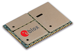
u-blox LISA u230 module. Photo: u-blox
The Impact X is CSA Class 1, Zone 1, IECEx and ATEX Zone 1 certified, explosion proof, waterproof and extremely ruggedized. At the heart of the Impact X is u-blox’ professional-grade LISA-U230 six-band 3G cellular module with 2G fallback capability. LISA modules also provide fully integrated access to u-blox GNSS receivers to enable advanced location-aware applications. Antenna diversity permits LISA-U2 modules to provide the highest data speeds.
“The Impact X is an excellent example of a high-performance mobile device that demands performance well beyond what is provided by standard mobile phones,” said Armin Boeshenz, General Manager of u‑blox sales EMEA. “We are extremely pleased to be a key module supplier to demanding customers such as Bartec Pixavi as proof of our industry-leading quality and reliability.”
u-blox LISA-U2 modules are suited for networks worldwide. Features include data-rates of up to 21.1 Mb/s (downlink), a rich set of Internet protocols, very small footprint, very low power consumption and extended operating temperature range of -40 to +85 degrees C.
LandWorks, Inc., a developer land management solutions, has added individual parcel polygons to its cloud-based offering of GIS-ready map products. Clients can now search, purchase and download digital parcel data sets with related attributes directly from the LandWorks website — in orders as small as a single parcel — at a cost of $2 per parcel.
LandWorks developed the online parcel purchase application for industries and professions that need up-to-date surface land ownership information in their GIS. Some of the sectors already taking advantage of LandWorks’ online offerings include utilities, oil and gas, pipelines, real estate, banking, departments of transportation, renewable energy and mining.
“The main benefits of buying parcel data from the LandWorks website are affordability and instant access,” said LandWorks President Jerry Bramwell. “Until now, digital map users had to order parcel polygon products by the county and then wait two to three weeks for delivery.”
On the LandWorks website, there is no minimum or maximum purchase limit. The customer simply logs onto the parcel data page and searches for the desired parcel or parcels. The user may graphically select the desired parcels by searching and clicking on a map display or by uploading a spreadsheet containing the county tax parcel ID numbers.
“The online database accessed through the LandWorks website contains parcel data for most of the United States,” said Bramwell. “This data comes from county assessor files or is manually digitized from paper plats and is updated quarterly.”
The LandWorks site keeps track of desired parcels during the search process. When the user is ready, the website reports the number of parcels that have been selected and their total cost calculated at $2 per parcel. The user can add or delete parcels as desired. The user then decides to purchase the parcel polygons in either NAD 27 or NAD 83 map datum. Prior to purchase, the site gives the user the option of receiving the digital data sets in Esri shapefile or file geodatabase format. Each parcel polygon is delivered with key attributes — parcel number, parcel address, owner name/address, and official legal description.
The digital parcel polygons come ready for download directly into Esri ArcGIS software as well as other popular mapping systems such as IHS Petra, IHS Kingdom and LMKR GeoGraphix.
Trimble announced today an addition to its Trimble Access family of field software applications: Trimble Access Pipelines. Designed for surveyors involved in oil and gas pipeline installation, Trimble Access Pipelines addresses challenges encountered by pipeline surveyors by automating common pipeline survey tasks. The software solution saves time by simplifying attribute and inventory collection and integrating all the data into one easy-to-use data collection workflow.
The announcement was made today at InterGeo 2014, the world’s largest conference on geodesy, geoinformatics and land management.
Trimble Access Pipelines, a new addition to the ever-increasing suite of applications available for Trimble Access field software, offers a streamlined workflow for pipe inventory collection and validation, weld mapping and as-built measurements. The software significantly reduces project time and redundancies by collecting pipe attribute data, recording the relationship between welds and pipes, and electronically linking the joint attributes to measured welds. Using the application, pipeline surveyors can capture the necessary data so construction can proceed without costly delays.
The complete end-to-end solution is enabled when combining the power of Trimble Access Pipelines and Trimble Business Center. Trimble Access Pipelines can quickly generate customized reports for the tally and weld map data or the surveyed pipeline directly on the controller. All field data can be seamlessly transferred into Trimble Business Center to produce rich, complete deliverables including as-built plots using the Trimble Business Center Advanced Drafting module.
“One of the most time consuming challenges pipeline surveyors face is the collection of pipe attribution detail and recording the information with weld positions,” said Benoit Mallen, business area manager of Oil and Gas for Trimble’s Geospatial Division.”With Trimble Access Pipelines, we have leveraged Trimble’s strength in positioning technology and combined it with a workflow-specific application to create a streamlined solution that can meet the needs of geospatial professionals working in the oil and gas industry.”
Trimble Access Pipelines and Trimble Business Center Software version 3.30 are available now through Trimble’s Geospatial Distribution Channel.
A free trial of the Trimble Access Pipelines application as well as other available modules for Trimble Access are available to all existing Trimble Access users, and can be activated and installed using the Trimble Access Installation Manager. For more information on Trimble Field software, visit www.trimble.com/Survey/Field-Software.