Tag: OpenStreetMap

  • Cesium adds global layer of 3D buildings

    Cesium adds global layer of 3D buildings

    Cesium users now have access to Cesium OSM Buildings, a global base layer of more than 350 million 3D buildings.

    Cesium OSM Buildings expands the suite of Cesium Global Base Layers including worldwide terrain, aerial imagery and streetmaps already available on Cesium ion.

    “As digital twins and urban mapping gain momentum in 3D geospatial, we are excited to offer a global layer of 3D buildings that can be easily visualized, styled and analyzed in an efficient and interoperable manner using 3D Tiles,” said Cesium CEO Patrick Cozzi. “Cesium OSM Buildings will help geospatial developers innovate by giving urban context to 3D applications for a broad range of use cases.”


    Take a tour of Cesium OSM Buildings.


    Cesium OSM Buildings are built for efficient visualization and are streamable to any device thanks to 3D Tiles, the OGC open standard developed by Cesium to stream massive 3D geospatial datasets. Adherence to open standards means the buildings can be used in any compatible viewer, including Cesium’s free open-source offering, CesiumJS.

    Seattle's Space Needle. (Image: Cesium)
    Seattle’s Space Needle. (Image: Cesium)

    “Cesium OSM Buildings will be useful for everyone from builders sharing planned construction projects, to government agencies seeking tools for planning, training, and simulation,” said Kevin Ring, lead developer on the project.

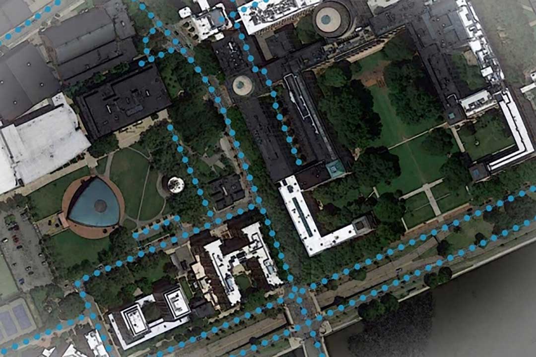
    Cesium OSM Buildings are derived from OpenStreetMap, a community-driven mapping project that welcomes anyone to improve the dataset. Buildings are also regularly updated, firmly clamped to terrain, and are individually selectable and styleable.

    “Thanks to the OpenStreetMap project, most cities contain rich metadata that is useful for on-the-fly styling, like highlighting hospitals in a certain color or filtering buildings by the year they were constructed,” Ring said.

    Cesium OSM Buildings is included in every Cesium ion subscription.

    Cesium is a complete platform that makes the world’s ever-growing collection of real-world 3D data more useful and accessible by enabling the creation of applications that visualize, analyze and share this data – all from your browser.

    Rooted in the aerospace industry, Cesium was built to track satellites orbiting the Earth with sub-millimeter accuracy. Cesium continues to aggressively develop and enhance the platform for a range of customers in government agencies, startups and Fortune 500 companies alike.

  • AI helps create street maps from satellite imagery

    AI helps create street maps from satellite imagery

    Creating detailed street maps and keeping them updated is an expensive and time-consuming task performed mostly by large companies. They ignore the many parts of the world where this task is not profitable, even though the need is high due to rapid growth and change in the street network, such as in Thailand.

    To automate the process and make accurate digital maps available in any country, researchers at the Massachusetts Institute of Technology (MIT) and the Qatar Computing Research Institute have developed an artificial intelligence (AI) model called RoadTagger. It uses satellite imagery to tag road features in digital maps, such as lane counts, which are essential for reliable navigation.

    Satellite imagery companies are constantly expanding their coverage and increasing their refresh rate, so this source of mapping data is more readily available and up to date than the data collected on the ground, such as by Google’s fleet of mapping cars. However, satellite imagery often suffers from occlusion from trees, buildings, overpasses and other obstacles.

    RoadTagger gets around this problem by using a combination of neural network architectures to predict hidden features. Testing of the model with digital maps of 20 U.S. cities showed that it predicted the number of lanes with 77% accuracy and the road type with 93% accuracy.

    An AI model developed at MIT and Qatar Computing Research Institute that uses only satellite imagery to automatically tag road features in digital maps could improve GPS navigation, especially in countries with limited map data. (Image: Google Maps/MIT News)
    An AI model developed at MIT and Qatar Computing Research Institute that uses only satellite imagery to automatically tag road features in digital maps could improve GPS navigation, especially in countries with limited map data. (Map data: Google/MIT News)

    RoadTagger, which combines a convolutional neural network (CNN) and a graph neural network (GNN) is fed only raw data and automatically produces output, without human intervention. The CNN, commonly used for image-processing tasks, takes as input raw satellite images of target roads. The GNN — widely used to model relationships between connected nodes in a graph — breaks the road into roughly 20-meter “tiles,” each of which is a separate graph node.

    For each node, the CNN extracts road features and shares that information with its immediate neighbors, thereby propagating road information along the whole graph. For example, if only two lanes of a four-lane road are visible in an image, the model uses information from nearby tiles, such as road width, to conclude that the road has four lanes.

    The researchers trained and tested RoadTagger using the OpenStreetMap data set. First, they collected confirmed road attributes from 688 square kilometers of maps of 20 U.S. cities, then they gathered the corresponding satellite images from a Google Maps dataset. The training taught the model what weight to assign to various features and node connections, and it now automatically learns which image features are useful and how to propagate those features along the graph.

    The researchers hope that RoadTagger will help humans validate the constant stream of changes in OpenStreetMap and similar datasets as well as enrich them with details that they do not already contain, such as whether a road is paved.

    Citation. He, S., Bastani, F., Jagwani, S., Park, E., Abbar, S., Alizadeh, M., Balakrishnan, H., Chawla, S., Madden, S., & Sadeghi, M. A. (Dec. 28, 2019). “RoadTagger: Robust Road Attribute Inference with Graph Neural Networks.” arXiv:1912.12408v1.

  • Diving into digital mapping history with OpenStreetMap

    Diving into digital mapping history with OpenStreetMap

    A European region in 2015. (Image: OpenStreetMap)
    A European region in 2015. (Image: OpenStreetMap)

    A tool developed by Mapbox explores “10 years of OpenStreetMap.” During that decade, hundreds of thousands of people mapped 25 million miles of roads in every country in the world.

    The internet tool uses a slider to show the data change over time. You can see additions and edits as they come online over the decade — a fascinating look at the intricate information that has been compiled. When a user drags the slider to the left, it’s easy to see how scant the information was only a few years into OpenStreetMap’s existence (the image at right shows the same European region in 2009 as the image at the top in 2015).

    The same European region in 2009 as the image at the top in 2015. (Image: OpenStreetMap)
    The same European region in 2009 as the image at the top in 2015. (Image: OpenStreetMap)

    After GPS and GNSS, OpenStreetMap ranks high in the movement to make geographic information accessible. OpenStreetMap is a community-driven project to create the most detailed, correct and current open map of the world.

    When Steve Coast began the project in 2004, map data sources were few, and largely controlled by private companies and the government. Coast changed the rules by creating a wiki-like resource of the entire globe, which everyone could use. Today, 5.2 million people use OpenStreetMap.

    OpenStreetMap democratized mapping: all a contributor needed was time and a computer connection to add data about their country or their neighborhood. Besides GNSS, contributors use aerial imagery and low-tech field maps to verify that OSM is accurate and up to date. Others dedicate their energies to humanitarian projects, including disaster response following the Haiti hurricane and aiding South Sudan and Syrian refugees.

  • GPS World survey: Capturing the world with maps

    GPS World survey: Capturing the world with maps

    New sensing and software tech spurs growth

    While UAVs are an exciting new technology for mapping, most respondents to our survey recognize the continued value of hands-on, in-the-field data collection.

    Most respondents think UAVs could be used for as much as half of data collection, but very few expect UAVs to be used for more than that. UAVs are just one mobile collection method, of course. Others include autos such as SUVs, boats and all-terrain vehicles.

    What role will UAVs play in the mapping industry over the next three years? (Source: GPS World 2018 State of the Industry survey)
    What role will UAVs play in the mapping industry over the next three years? (Source: GPS World 2018 State of the GNSS Industry survey)

    We also asked respondents how they use UAVs for data collection. RGB high-resolution still-image cameras and lidar are the most frequently used, with video cameras not far behind. Other specialty cameras collect infrared or thermal imagery, while specialty sensors collect everything from temperature to pressure and methane levels.

    Whether mounted on a UAV, a vehicle, or on the ground, these technologies are used in fields as diverse as forest management, disaster response and infrastructure planning.

    For instance, urban planners rely on mapping data for land value, topography and water and electricity resources. Meanwhile, forestry experts use infrared to detect areas of disease or die-off in the early stages.

    Software in the Cloud. Turning to software, developments in cloud storage and open-source and subscription platforms are constantly improving geographic information systems (GIS). A wealth of GIS and GPS data is available from Google Maps, Apple Maps, OpenStreetMap and other applications. Specialty applications include Esri ArcGIS, Maptitude, Surfer and more. In the coming years, expect an increase in 3D modeling, digital elevation models (DEMs) and augmented reality.

    What is the most valuable sensor to use in conjunction with GPS/GNSS aboard a UAV for mapping and data-collection purposes? What role will UAVs play in the mapping industry over the next three years? (Source: GPS World 2018 State of the Industry survey)
    What is the most valuable sensor to use in conjunction with GPS/GNSS aboard a UAV for mapping and data-collection purposes? What role will UAVs play in the mapping industry over the next three years? (Source: GPS World 2018 State of the GNSS Industry survey)

    The automotive sector has been adopting digital mapping applications for use in self-driving cars, as well as fleet management, logistics control systems, and advanced driver assistance systems (ADAS).

    Every year, more satellites are launched for mapping and GIS data collection, and they don’t all provide photo imagery. For instance, NASA’s Aqua satellite detected and mapped huge concentrations of carbon monoxide drifting east across the U.S. from western wildfires — important information for public health planning.


    For more results from the 2018 State of the GNSS Industry, see this page.

  • Esri Living Atlas updates to shed light on global change

    Esri is updating the ArcGIS Living Atlas of the World, a vast collection of geographic information from around the globe. The updates include new data and capabilities for users to gain insight for helping in decision making, as well as a more complete and dynamic picture of the world.

    The new features were introduced at this year’s Esri User Conference, held July 9–13 in San Diego, California.

    The new Earth Systems Monitor app, powered by Living Atlas data, showing Sea Surface Temperature. (Image: Esri)
    The new Earth Systems Monitor app, powered by Living Atlas data, showing Sea Surface Temperature. (Image: Esri)

    Earth Systems Monitor. This new app (currently in beta) is powered by Living Atlas data. It allows users to see — on a 2D map or a 3D globe — historical, forecasting and real-time data for depicting land, the oceans and even the human footprint.

    Users can see where events or phenomena such as marine temperature shifts are occurring at any time on the planet, or even model global population growth and its effects, the company said.

    The configurable app will be released later this year. The app can be used with Living Atlas data layers or with other layers from an organization’s own data or ArcGIS Online.

    Wayback Imagery. This digital archive of the World Imagery basemap enables users to access more than 80 different versions of world imagery captured over the past five years.

    Each record in the archive represents a version of world imagery as it existed on the date it was published. Users can move back and forth in time and choose the imagery they want to use.

    OpenStreetMap Vector Basemap. Moving to a local scale, OpenStreetMap (OSM) is an open, collaborative project to create a free editable map of the world, built by a community of mappers who contribute and maintain data about roads, trails, buildings, restaurants and more.

    Until now, OSM was only available as a raster basemap in ArcGIS Online. The new vector basemap, introduced in beta, will be available for free to all ArcGIS users and developers.

    “The Living Atlas shows how our community of users continues to contribute to the innovations that power our technology,” said Jack Dangermond, Esri founder and president. “The beauty of these new features is that they transform the data that users are supplying into valuable online services like Earth Systems Monitor.”

    Living Atlas can be used to create indexes displaying properties such as vegetation health or soil moisture and quantifying the changes over time, enabling better understanding of the environment.

    Earth Systems Monitor, OSM Vector Basemap and Wayback Imagery are all examples of how online GIS technology is transforming traditional mapping organizations into web service providers, Esri said. These innovations are just the latest steps in creating a living digital twin of the systems and processes that help run organizations, cities and even nations.

    By fostering the adoption of apps, web maps, and collaborative efforts, Living Atlas is supporting end users who face increasing geospatial data demands, enabling them to be self-sufficient with the application of location intelligence across their organizations.

    Wayback Imagery is currently accessible, while both OSM Vector Basemap and Earth Systems Monitor will be available soon in ArcGIS Online.

  • GPS.gov helps with wrong addresses on personal devices

    Members of the public often turn to GPS World and Geospatial Solutions for help when their personal device gives them incorrect mapping information.

    GPS.gov has set up a page that points users to the correct place to report problems, by walking them through a series of steps.

    As our readers know, the problem isn’t with the satellites, but in the mapping software used by the devices and apps. Links are provided to mapping companies Google, Waze, TomTom, HERE, OpenStreetMap, Garmin and Apple.

  • INRIX Traffic app learns driver’s itinerary, preferences

    INRIX Traffic app learns driver’s itinerary, preferences

    INRIX Inc., a connected car services and movement analytics company, has released a redesigned version of INRIX Traffic for iOS and Android.

    INRIX Traffic is a next-generation navigation and traffic app that learns user preferences to take the guesswork out of driving. The app integrates with a user’s calendar and learns their driving habits to create a personalized itinerary that includes automatic alerts, anticipated trips, favorite destinations and preferred routes.

    Screengrab: INRIX IncAvailable worldwide now in the Apple App Store and Google Play, INRIX Traffic learns routines and preferences as users go about their day. INRIX Traffic adds favorite places automatically instead of requiring users to spend time inputting destinations such as home, work or school.

    Based on learned activities, it creates a daily, driver-specific itinerary of anticipated trips, as well as frequent and preferred routes. By accessing calendar information on a mobile device, the app also adds events with addresses to the daily driving itinerary.

    Unlike other driving apps that can provide inaccurate traffic and incidents based purely on consumer input, INRIX Traffic uses a massive crowd-sourced network of more than 275 million connected cars and devices to offer accurate map and real-time information.

    INRIX Traffic proactively monitors road conditions to alert drivers of ideal departure times, changes to arrival times and optimal routes to frequent or scheduled destinations based on real-time traffic.

    “We designed INRIX Traffic with one specific vision: To help drivers move through their daily lives as quickly and efficiently as possible. The app uses our advanced traffic science to make even routine trips easier,” said Bryan Mistele, president and CEO, INRIX. “Users want an app that is accurate, personalized and smart enough to work proactively for them — so we’ve integrated several highly advanced technologies into one all-encompassing app.”

    INRIX Traffic uses the crowd-sourced and free OpenStreetMap (OSM) for map data. By leveraging the power of user-generated content around the world, OSM can quickly adapt to the ever-changing road network. Using OSM enables INRIX to bring a high-quality map and turn-by-turn navigation to users at no cost and without advertisements. In addition to reporting incidents along their route including accidents, police activity and road hazards, INRIX Traffic users can send map feedback directly from the app.

    INRIX Traffic is powered by the same technologies the company delivers to its automotive customers such as Audi, BMW, Lexus, Mercedes-Benz and Porsche. These connected car services include real-time and predictive traffic, off-street parking information and drive-time alerts. INRIX will continue integrating features from its product portfolio into future versions of INRIX Traffic.

    INRIX Traffic is available in eight languages in 16 countries across North America and Europe, including Canada, France, Germany, Spain, United Kingdom and United States, with additional countries coming soon.

    The app is built on Autotelligent, the company’s new software development kit and integrated cloud platform that provides machine learning and route monitoring. Autotelligent can be integrated into products in multiple industries such as automotive, enterprise and mobile.

  • Esri Hosts Info Map for Nepal Earthquake

    Esri-Nepal-Earthquake-O

    A massive 7.8 magnitude earthquake struck 77 kilometers (48 miles) northwest of Nepal’s capital Kathmandu at 0611 GMT on April 25, toppling office blocks and towers and killing thousands of people. More than two dozen people were also reported killed in neighboring India, China and Bangladesh.

    As of April 27, the Government of Nepal reported 3,351 deaths and 6,833 injured people, according to ReliefWeb. These numbers are expected to increase further as search and rescue teams reach remote areas. Most of the deaths are recorded in Bhaktapur, Kathmandu and Lalitpur. Eight million people in 39 districts have been affected, of which over 2 million people live in the 11 severely affected districts.

    The Esri disaster page is featuring news stories, video feeds, and other information about the earthquake in Nepal, on an Earthquake Public Information Map. Users can explore the locations and intensities of the various quakes that struck Nepal, along with a shakemap from the USGS. This map also includes geotagged social media from Twitter and YouTube with local content related to the quakes.

    Another Esri map, Mapping the 2015 Nepal Earthquake, provides a closer look at Nepal’s history of seismic activity, and shows how people are impacted by earthquakes. This story map also includes information about relief operations and key points of interest in the region, as well as a 3D web scene of the area affected by the avalanche on Mt. Everest.

    OpenStreetMap is also working to help with relief efforts. “Our goal is to contribute to humanitarian relief by rapidly providing a detailed and accurate map (i.e., road network, villages, buildings, etc.) to support the humanitarian organizations. These services help locate people at risk efficiently, and facilitate the delivery of goods and services to remote areas.”

    The USGS provides an earthquake map here.

    Esri-Nepal-Earthquake-map-O

  • Connect with Bluetooth GNSS Devices Using SuperSurv

    SuperSurv_measureTo meet the needs of high-accuracy field data collection and better workflow with modern GNSS technology, Supergeo’s latest SuperSurv GIS mapping app allows users to connect with and operate external Bluetooth GNSS devices. The app also elevates field-work efficiency with new averaging algorithms.

    SuperSurv is designed for field data collection on Android and iOS-powered devices. Integrating with GIS and GPS technologies, SuperSurv provides functions like Map Display, Query, Measure, and supports to overlay OpenStreetMap as the basemap. Also, users can capture point, line and polygon features and attribute data, and save the data as SHP or GEO format in both offline and online modes.

    With the new external GNSS device connection function, users can choose between internal positioning information and an outer GNSS source via Bluetooth. When pairing the GNSS receiver with an Android device, SuperSurv allows users to fully control and present detailed messages of navigation within system status. In addition, data collection via GNSS is enhanced with options such as a coordinate data averaging function or vertex collecting threshold, bringing users modernized and highly accurate field survey experience.

    The external GNSS device connection and advanced data-collecting functions are fully supported and available with the SuperSurv Pro version. For SuperSurv M3 users, the newly added functions come as an optional plug-in that users can purchase and download.

    Free trials of the software are available:
    iTunes Store
    Google Play

  • Scout Goes Global with GPS Navigation Powered by OpenStreetMap

    Telenav-OpenStreetMapTelenav’s free U.S. Scout for iPhone app will use the crowd-sourced and free OpenStreetMap (OSM) for all of its map data. OSM, the “Wikipedia of Maps,” offers users a more accurate and up-to-date map than what is available via commercial maps, the company said.

    The rollout of OSM starts today for some Scout users and will be fully implemented for all users by the end of this week. The company plans to switch to OSM for Scout for Android in the U.S. in June. Scout’s companion website, scout.me, is already using OSM.

    Telenav also announced today that through a rebrand of the popular skobbler GPS Navigation app for iOS and Android, Scout is now available in more than 50 app store markets with maps and navigation for almost 200 countries. skobbler’s GPS Navigation app was the first OSM navigation app in the world. Telenav acquired skobbler in January.

    With this launch, Scout is supporting a growing community of global OSM editors. The OSM community has doubled year over year to more than 1.6 million registered editors, with people mapping every country around the world, ranging from the U.S. to Germany and Lesotho to North Korea.

    The OSM crowd-sourced model enables edits to be published every minute, resulting in maps that are often more detailed and more up to date than commercially available maps. In addition to reporting traffic or accidents, now anyone using Scout can send mapping feedback directly from the app to Scout OSM editors who will let the person know once the data has been reviewed and updated.

    “As a mapping platform, OSM is a credible alternative to proprietary solutions, with the added advantage of instant updates, resulting in a more accurate and up-to-date map,” said Steve Coast, founder of OpenStreetMap and Telenav’s head of OSM. “Roads change, subdivisions are built, and freeways expand so, just like all other maps, it needs updates on an ongoing basis. Today’s launch has effectively added millions of editors to the OSM global community, breathing even more life into an already exploding free and open-sourced project. Compare this to the billions of dollars that Google has spent — and will have to continue to spend — on keeping its maps updated and I think you can understand why we have switched to OSM.”

    “This is a turning point for the mapping industry,” continued Coast. “The amount of effort and investment needed in order to provide high-quality turn-by-turn navigation using OSM crowd-sourced map data cannot be understated. We expect a significant return on our investments to create a better map platform for navigation using the free OSM. It took Telenav years of OSM community engagement, advanced algorithms, technology development, and road testing to reach a point where we felt it was ready for consumers. Now that we are here, we can’t wait for the world to try Scout with OSM. As for the global community of editors, this is true validation that their enthusiasm and passion for making a free, editable map of the world has made a dramatic impact on the evolution of maps and navigation.”

    The OSM rollout is automatic for Scout users and does not require an app update. Separately, Telenav also announced today that it has launched a Scout Maps and Navigation SDK, the first GPS navigation SDK that allows mobile app and developers to integrate OpenStreetMap-based GPS navigation and maps within their own products. The new Scout for Developers program also includes a new Scout Maps API for desktop and mobile websites using OSM, allowing developers to replace Google Maps. More information is available at developer.scout.me.

    Telenav is also sharing in the celebration of its OSM launch by kicking off a map-editing contest at scout.me/osmcontest where map editors have a chance to win various prizes including cash and tablets.

  • Blue Marble Releases Global Mapper v15.2 with New Automation

    A flattened terrain surface model with 3D Vector features using Global Mapper.
    A flattened terrain surface model with 3D Vector features using Global Mapper.

    Blue Marble Geographics has released Global Mapper version 15.2, a minor release that adds functionality to automate the New Feature Creation process, as well as the addition of new online datasources, including OpenStreetMap vector data links via Web Mapping Services (WMS).

    Blue Marble’s geospatial data manipulation, visualization and conversion solutions are used worldwide by GIS analysts at software, oil and gas, mining, civil engineering, surveying, and technology companies, as well as governmental and university organizations.

    The minor release features updates to both the Global Mapper base product and the Global Mapper LiDAR Module. In particular, new functionality has been added to allow the user to automate the New Feature Creation process. Users can now create a series of features that share the same attribute structure, target layer, and other characteristics without having to repeatedly confirm these settings in the Modify Feature Info dialog box. This release also features the addition of free online datasources including full access to the Maine GIS catalog, as well as access to Aviation Charts and OpenStreetMap vector data via WMS.

    Other enhancements include support for creating buffer areas around line features with variable width from beginning to end and for creating buffers on just one side of a selected line feature. New scripting functionality has been added to allow conditional (IF/THEN/ELSE) processing within a script file. 3D models from Collada DAE files have been updated with the option to load BMP, JPG, PNG, and TIFF images with no geo-position information directly, improved 3DPDF support, and enhancements to CityGML.

    “These great new features and functions will streamline the user’s workflow, as well as save them time and money with the ease-of-access to a growing list of cloud based publicly available data,” stated Blue Marble President, Patrick Cunningham “This release is another great example of our mission to deliver a low-cost and easy-to-use GIS solution for everyone.”

    Enhancements to the LiDAR Module in v15.2 include added support for the transformation (shift/rotate/scale) of LiDAR point clouds and the option to filter selected LiDAR points to a certain elevation range and/or set of colors. A new LIDAR_CLASSIFY script command for classifying ground points in a script has been added. Users now have the option to keep the original file offset/scale, or to specify a new one when exporting to LiDAR LAS/LAZ files. They also now have the ability to crop to a selected area when specifying the bounds to import from a LiDAR point cloud and the ability to export point cloud to Esri File Geodatabases (GDB) as normal 3D point features. These LiDAR enhancements are a great addition to an already powerful module for those interested in adding advanced LiDAR functionality to Global Mapper.

  • Telenav Acquires skobbler to Tap into ‘Wikipedia of Maps’

    Telenav Acquires skobbler to Tap into ‘Wikipedia of Maps’

    skobbler_logoTelenav, Inc., announced today that it has acquired skobbler GmbH, the European-based navigation company with the highest rated OpenStreetMap (OSM)-based GPS navigation apps in the world. With this acquisition, Telenav brings the most successful OSM navigation experts in the world together as one team — including the founder of OSM, Steve Coast, who joined Telenav in 2013 — and becomes a major contributor to the creation of the open-sourced and most comprehensive map of the world, according to the announcement.

    The acquisition closed on January 29 for consideration of approximately $19.2 million in cash and $4.6 million of company common stock.

    “Crowdsourced OSM can power personalized navigation services like Scout — with highly detailed maps on a global scale,” said HP Jin, Telenav’s chairman and CEO. “We plan to offer Scout with OSM for much of the world. We have already made significant headway toward this goal in the U.S., including using OSM for our HTML5 version of Scout.”

    OSM is the only crowdsourced and open-sourced map of the globe and, for many developers, it has become a clear alternative to Google Maps.

    “Waze and Google — or, just Google now — provide similar mechanisms to improve their maps, based mostly on OSM’s innovations. With one big catch. It is very much their map. Not yours,” said Coast in his blog commentary today regarding the acquisition. “OpenStreetMap is different. All of the quality data contributed is openly available — just like Wikipedia. So, anyone can download, experiment and play with it freely. It’s not locked up beyond your reach.”

    Since Coast founded OSM, the community has doubled year over year to more than 1.5 million registered editors, becoming a global community of local editors in every corner of the world. Its crowdsourced model publishes edits every minute on openstreetmap.org, resulting in maps that are detailed and up to date. For example, newly laid streets and newly developed areas can be updated on a regular basis and in real time. In addition, OSM allows for greater map detail for pedestrians such as alleys, sidewalks, parks, hiking trails, zoos, and even city trees.

    Telenav has been an active contributor to OSM for more than three years, working closely with the community to enhance specific features needed for navigation, traffic and other future location-based services.

    With offices in Germany and Romania, skobbler was the first company to launch a commercial navigation app using OSM (in 2010) for both Android and iOS devices and is available in app stores in 49 regions with worldwide map coverage. In order to do this, skobbler developed sophisticated algorithms that evolved OSM data from a display map to a navigable map.

    skobbler’s apps are top ranked and highly rated in multiple countries including Germany, the Netherlands, and Sweden. skobbler’s CEO, Peter Scheufen, previously served as the CEO of Navigon, which became a leading GPS device manufacturer in Europe and was eventually purchased by Garmin. The other skobbler founders also held senior roles at Navigon before founding skobbler. Telenav expects that all skobbler employees will join Telenav as part of its OSM team, bringing significant industry-leading software expertise in location-based services, navigation and mapping.

    “By joining our efforts with skobbler, we will build on our combined successes to bring the best mapping and navigation services to our customers around the world,” said Jin. “The benefits of an open source model will provide an enormous opportunity to change the economic models of navigation and other location-based services.”

    “OSM is currently one of the most active and dynamic crowdsourcing communities and is growing at an explosive rate,” said Scheufen. “Our team lives and breathes OSM and so we are excited to join forces with Telenav to create the largest, most sophisticated, and smartest OSM navigation team in the world.”

    In connection with the acquisition and in accordance with NASDAQ Marketplace Rule 5635(c), Telenav granted four employees of skobbler and its subsidiaries, upon the closing of the acquisition, restricted stock units for an aggregate of 634,920 shares of common stock.

    These RSUs were granted outside of the existing Telenav stock plans and without stockholder approval pursuant to NASDAQ Marketplace Rule 5635(c)(4) with the following terms: each RSU vests as to 50% of the award on the anniversary of Acquisition and as to 50% of the award on the second anniversary of the Acquisition, subject to continued employment through each relevant date.