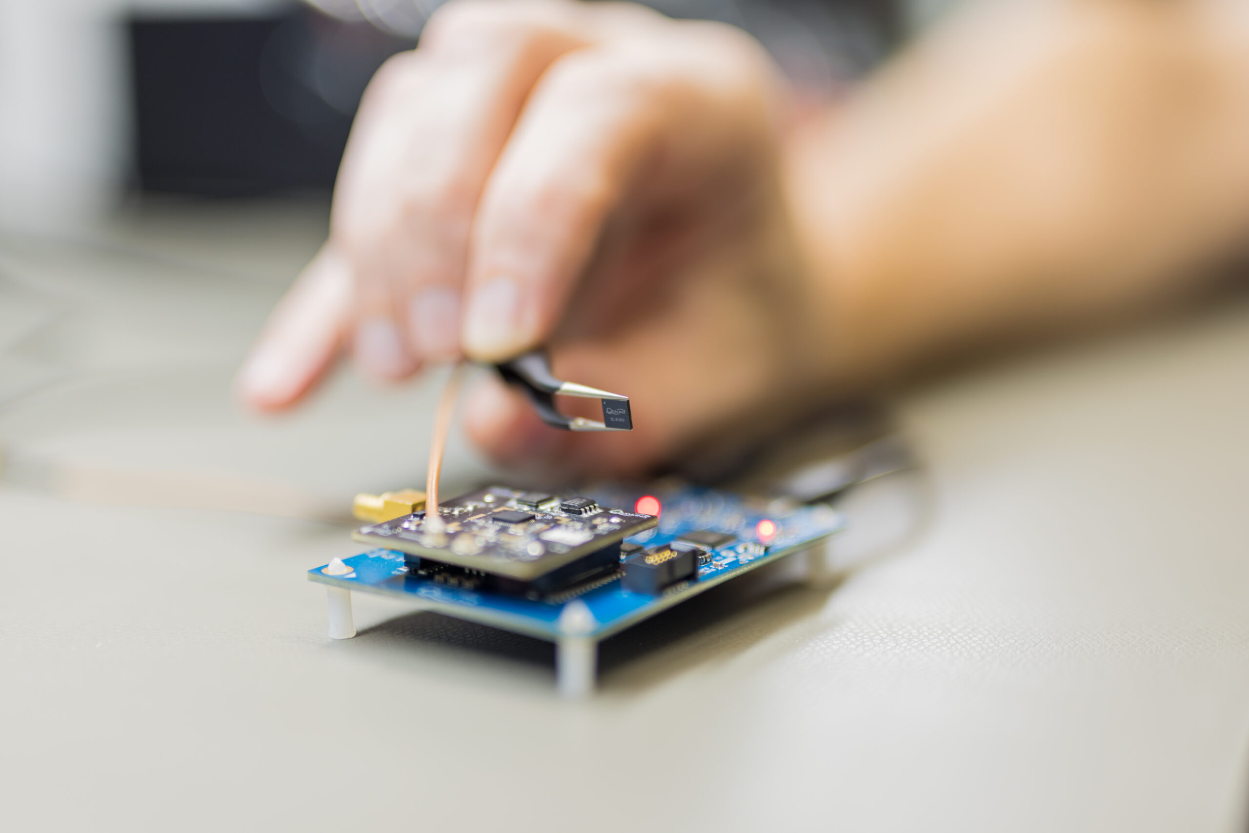
The QLX3Gx chip makes secure, authenticated positioning a standard feature
Qualinx has integrated support for the Galileo OSNMA (Open Service Navigation Message Authentication) on its QLX3Gx Series ultra-low-power GNSS receiver.
Developed with the support of the European Union Agency for the Space Programme (EUSPA), the integration makes the QLX3Gx a GNSS receiver purpose-built for ultra-low-power markets to deliver hardware-native OSNMA support as a standard feature across the entire product family.
Qualinx has embedded OSNMA support directly into the QLX3Gx hardware architecture from the ground up, enabling a fully optimized design with zero trade-offs in power consumption, cost or performance.
“Authenticated positioning has for too long been out of reach for the devices that need it most,” said Qualinx CEO Tom Trill. “By building OSNMA support into the QLX3Gx at the hardware level from day one, we’re making trusted positioning the default — not a premium option — for the wearables, asset trackers and IoT devices that make up the bulk of the GNSS market.”
The partnership with EUSPA reflects a shared commitment to disseminating Galileo’s advanced security capabilities across the widest possible range of applications and markets. EUSPA identifies OSNMA as a strategic priority for improving resilience against spoofing and signal manipulation
According to the EU Space Market Report 2026, global GNSS revenues are projected to grow from €300 billion in 2024 to €580 billion by 2034 with mass-market devices accounting for the largest share of shipments and representing the greatest growth potential.
Through Qualinx’s digital radio-frequency technology, the QLX3Gx delivers up to 10× lower power consumption than conventional GNSS solutions. By integrating OSNMA natively in hardware, the chip eliminates the processing overhead typically associated with authentication, ensuring security adds no meaningful cost to the power budget.
The chip’s reconfigurable digital RF architecture enables capabilities to be updated over time without hardware replacement — extending device lifecycles, cutting electronic waste, and lowering overall energy consumption. The result is a platform that makes connected devices more secure and sustainable.
The QLX3Gx chip is available for sampling, with mass production planned for the second half of this year. Developers and OEMs can register interest in the Qualinx QLX3Gx Evaluation Kit to secure hands-on evaluation of the QLX3Gx for upcoming consumer, industrial and mobility applications. Contact [email protected] to register interest and request a sample, or learn more at Qualinx.io.
Adtran‘s Oscilloquartz synchronization platforms now support Galileo’s Open Service Navigation Message Authentication (OSNMA). OSNMA is a GNSS authentication service designed for civilian use.
By verifying that timing data originates from genuine Galileo satellites, OSNMA ensures authenticity and integrity at the point of reception. The new feature, available via firmware update for supported multi-band GNSS receivers, adds an extra layer of protection against spoofing and manipulation, empowering existing deployments to strengthen security without hardware changes or service disruption.
OSNMA support from Adtran brings a new level of GNSS security to critical infrastructure. Available for multi-band GNSS receivers in the OSA 5412, OSA 5422, OSA 5430 and OSA 5440 product lines, the feature integrates with Galileo’s Open Service, using digital signatures and TESLA chain keys to authenticate navigation data. This ensures that timing and positioning information is verified as authentic and protected against spoofing or manipulation.
Adtran’s Oscilloquartz Syncjack probing adds a second layer of defense, detecting record-and-replay attacks – also known as meaconing – by comparing GNSS signals against trusted PTP sources. This dual-layer approach helps identify subtle timing manipulations and delay attacks that traditional receivers may miss.
“From 5G and smart power grids to financial networks and data centers, bringing authentication to GNSS is a game changer for critical infrastructure,” said Gil Biran, GM of Oscilloquartz, Adtran. “By enabling our customers to defend against sophisticated threats, including meaconing, we’re helping them achieve greater timing integrity for their networks. Existing customers can access this new GNSS security feature with a simple firmware update, helping them stay protected as threats continue to evolve.”
The European Union Agency for the Space Programme (EUSPA) has officially declared its Galileo Open Service Navigation Message Authentication (OSNMA) initial service operational. OSNMA introduces a data authentication mechanism for Galileo Open Service users and is available free of charge to Galileo users worldwide.
Spoofing is the transmission of counterfeit satellite signals that deceive GNSS receivers, causing false, unreliable positioning that can disrupt critical sectors including transportation, finance, telecommunications, energy, manufacturing, healthcare, emergency services and law enforcement. In safety-critical domains such as aviation and maritime, spoofing risks can lead to serious safety hazards.
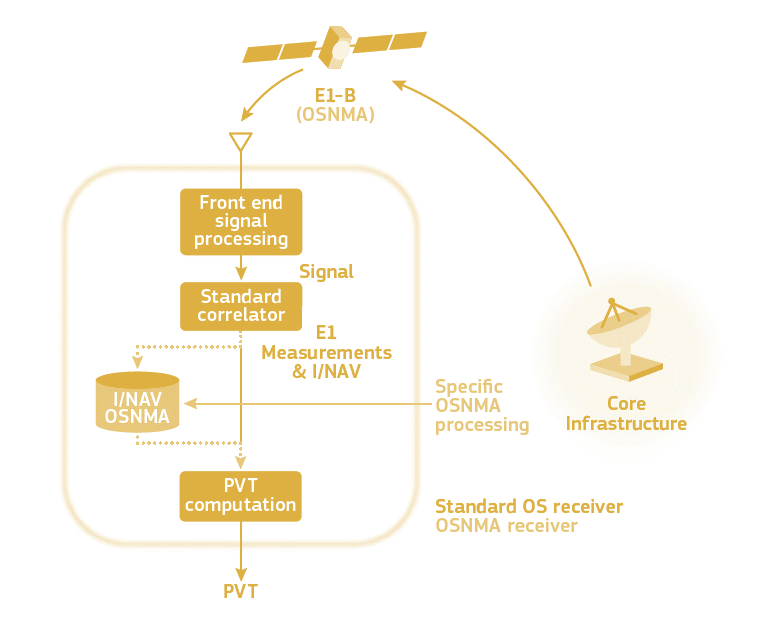
OSNMA addresses these threats by embedding a cryptographic digital signature within the Galileo navigation message (I/NAV) broadcast on the E1-B signal. This digital signature allows receivers equipped with OSNMA to verify that the signal truly originates from Galileo and has not been tampered with or spoofed.
OSNMA is integrated into the Galileo Open Service signal, which is already used by most GNSS devices. This means no change to existing Galileo signal structure or navigation performance, preserving full backward compatibility. Non-OSNMA receivers continue to function normally, while OSNMA-capable receivers decode and authenticate the digital signature.
The European GNSS Service Centre (GSC), located at the National Institute for Aerospace Technology (INTA) in Torrejón de Ardoz, Spain, manages the generation and transmission of authentication messages to Galileo’s ground segment. The OSNMA service was developed in collaboration with industrial partners, including GMV and INDRA, who also contributed to Galileo’s High Accuracy Service (HAS), operational since January 2023.
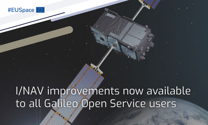
I/NAV improvements for all Galileo Open Service users is a part of the new Galileo services portfolio. (Image: EUSPA)
In 2023, Galileo continues to provide the world’s most precise satellite navigation information, to more than four billion users worldwide. Galileo services have expanded with many new capabilities that are unique with respect to other GNSS.
EUSPA and ESA continue to enjoy an effective collaboration on the many development, deployment and evolution activities of the Galileo Program, each according to its responsibilities for service provision and system development with the European Commission acting as the program manager.
Stable service performance
The service delivery operations, and the maintenance of the operational systems, are managed by EUSPA, who supervises several contracts that carry-out the day-to-day activities from dedicated control and monitoring centers throughout Europe. The Galileo timing, navigation and SAR/Galileo services provided in 2023 have been delivered with excellent performances that continue to exceed the formal declarations for minimum performance levels (MPL), both in terms of absolute accuracy and overall service availability.
Expansion of service portfolio
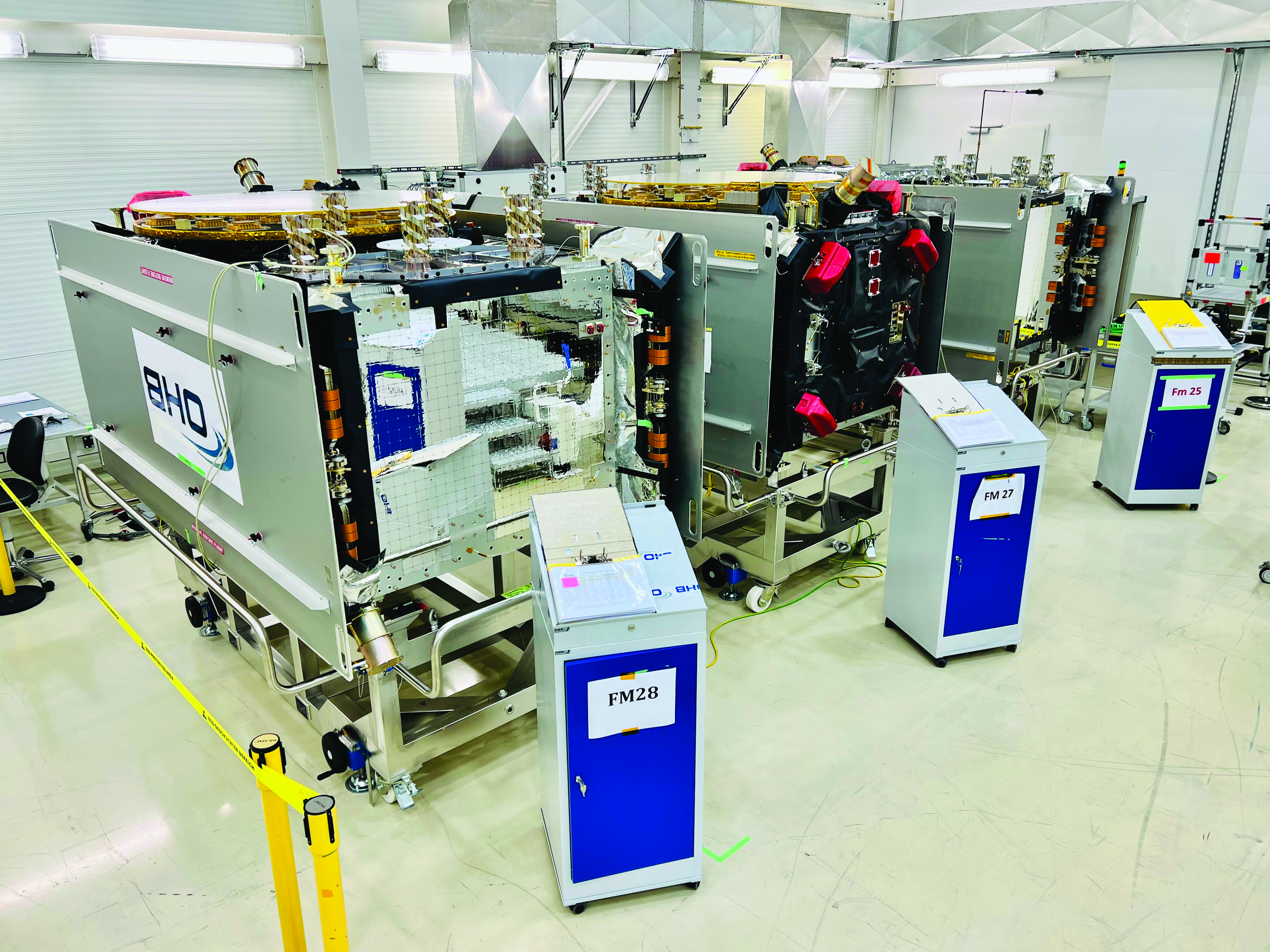
Galileo FOC batch three satellites in storage at OHB Systems. (Image: ESA)
The service provision teams have been able to focus on improvements to, and expansion of, the Galileo service portfolio.
OS and I/NAV improvement
Galileo Open Service (OS) users can already benefit from an improved navigation message, being broadcast by the Galileo constellation since mid-2023, which considerably boosts their performance in terms of robustness and time to first fix.
An update of the Galileo OS service definition document (SDD) is planned for the end of this year. This fourth issue of the OS SDD will bring to the users new MPLs (e.g., ranging rate accuracy and ranging accuracy at high percentiles) and improvements of existing MPLs, such as the timeliness of certain notice advisories to Galileo users. This updated OS SDD will also introduce the OS extended operation mode, which is characterized by a gradually degrading ranging accuracy with respect to the nominal operational mode, including outages of the Galileo ground segment, thus increasing the robustness of the OS.
High Accuracy Service
As of the HAS initial service declaration on January 24, Galileo became the first GNSS constellation ever to enable a decimetre-level accuracy, free of charge on a 24/7 basis over most parts of the globe in nominal conditions. The HAS corrections are transmitted directly via the Galileo signal in space (E6-B) and through the internet with the corresponding performance levels systematically met since the declaration. All documentation available here.
OS-NMA
The OS Navigation Message Authentication (OSNMA) will be a free and open access service allowing the users to confirm that received Galileo navigation data has not been modified and originates from the Galileo system, thus increasing the likelihood of detecting spoofing attacks at the data level and significantly contributing to the security of the solution. The OSNMA public observation phase is currently ongoing (gsc-europa.eu/support-to-developers/osnma-public-observation-test-phase). As part of that, the final OSNMA signal in space (SiS) interface control document (ICD) was published in December 2022, while the broadcast of a compliant SiS together with test certificates for the public key infrastructure started in August, marking the start of the OSNMA initial operational capability. The OSNMA initial service declaration will be achieved after the completion of the service validation activities and is targeted for early 2024.
Safety of life
The Galileo contribution to safety of life services (GoSoL) will cover the provision of Galileo signals and of service guarantees to enable the implementation of horizontal ARAIM service supporting aviation users. The service roadmap is currently under definition with a stepwise approach that will include the broadcast of a test ISM before the operational service is provided.
SAR
SAR/Galileo provides accurate, timely, and reliable distress alert data to help rescue authorities assist in distress situations (forward link service). It also acknowledges the receipt of the distress forward link alert to the beacon in distress via the Galileo navigation SiS (return link service). SAR/Galileo is a geographically distributed system, which was extended with a fourth European MEOLUT installed in La Reunion, in operation since November 2022.
The combination of SAR/Galileo space and ground assets provides excellent performance levels with a mean location accuracy of less than 800 m and a return link delivery latency of less than 1 min, which assisted in the rescue of approximately 1,400 people within EU territories in 2022.
Utilizing the return link service capabilities brings new innovations that further contribute to the global emergency space operations as Galileo moves forward to the implementation phase of the emergency warning satellite service (EWSS). The EWSS will provide national civil protection authorities with a satellite broadcasting capability to broadcast on-demand authenticated alerts to a precise target area and its population directly to any device capable of processing Galileo signals.
Reference documents for each of the above services can be found at the EUSPA European GNSS Service Center website, including technical notes, interface control documents and service declaration documents.
Image: European Space Agency (ESA)
Full operational capability infrastructure development toward completion
Space segment
The production of the third batch of Galileo FOC satellites, by the satellite manufacturer OHB Systems, has been completed for an overall amount of 12 satellites. The acceptance review for the last couple of spacecraft took place in June.
This amounts to an overall production by OHB Systems of 34 Galileo FOC Satellites (14 satellites in batch one, eight satellites in batch two and 12 satellites in batch three) of which 24 are in orbit. The remaining 10 satellites are in storage waiting for the next launch opportunity in 2024.
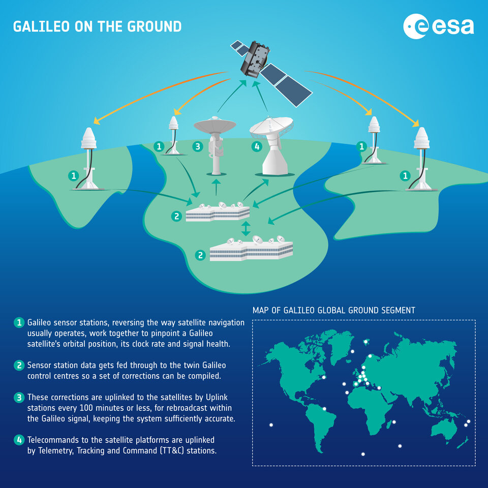
Ground segment
G2SB1 engineering model payload testing at ESA ESTEC. (Image: ESA)
The ground segment is going through a major upgrade with the roll-out of the new System Build 2.0 infrastructure in support of public regulated service IOC and open service FOC.
The new version of the ground mission segment developed by Thales Alenia Space France will be oriented to increase service robustness and resilience, besides high performance. It will provide virtualized hardware and software infrastructure at the Galileo Control Centers, triple receiver chain redundancy in the sensor stations’ remote sites and two additional sites located in Wallis (Pacific Ocean) and Bonaire (Caribbean Sea) to increase global coverage with 15 sites overall. A new mission monitoring capability has been implemented for the operators using the SAFE/Agile methodology. Furthermore, a system extended contingency mode will be implemented to cope with outages lasting up to seven days with smooth navigation performance degradation.
A new version of the Galileo Security Facility will be deployed at the Galileo Security Monitoring Centers offering an evolution of the public regulated service (PRS) capabilities through new enhanced SiS access control. Furthermore, a new state of the art cyber security monitoring system will be implemented.
The System Build 2.0 infrastructure qualification was completed by ESA in July. Migration in operation is based on an innovative concept consisting of a replica of the operational chains to ensure seamless transition from the current system in operation to the newly deployed one. The completion of the migration into operations is planned for the beginning of 2024, with the schedule being continuously monitored at the program level.
Galileo Second Generation: a constellation of state-of-the-art procurements. (Image: ESA)
An upgrade of the ground control segment in charge of command and control of the constellation is under qualification by the industrial consortium led by GMV. It will provide additional flexibility to allow for deployment in between launches and to address resolution of hardware and software obsolescence, including cyber security, operability improvements and a security monitoring overlay. Furthermore, it will upgrade the Telemetry Tracking and Control (TTC) station in Redu, Belgium, and deploy an additional station in Fucino, Italy, co-located with the Galileo Control Center, bringing to nine the overall number of TTC stations.
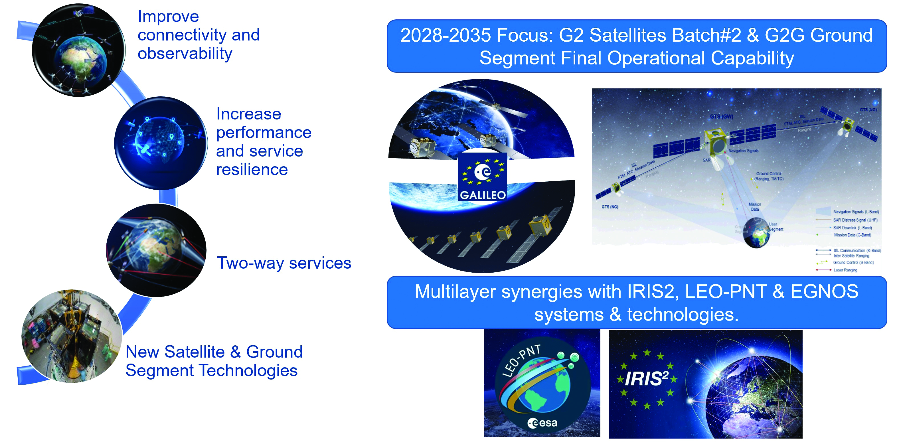
Second generation fast forward
Galileo’s second generation (G2G) will introduce many innovative technologies to offer unprecedented precision, robustness, and flexibility.
For the development of G2G activities 2023 was a key year, with the development of the first batch of G2 satellites, the start of all contracts for in-orbit validation of the ground segment and system test beds and the preparation of the initial operational capability (IOC) design, through the consolidation of the mission/service roadmaps with the EC, EUSPA, and the delegates from EU member states.
This year, Europe has taken the necessary steps to unchain the development of key GNSS features, which will exponentially enhance GNSS accuracy for the worldwide communities in the future:
New and improved services.
Unique flexibility of ground and space systems to enable 12-18 months service time to market, without the need for constellation replenishment.
Upgraded robustness of key infrastructure items.
State of the art GNSS technology leading to centimeter-level precision.
New GNSS signals, including extended data capacity for added value services.
And of course, as a key factor, a full backward compatibility with Galileo First Generation and other GNSS systems.
G2G: Incremental steps for enhanced capabilities over the next decade
The ESA completed the G2G system preliminary design review in July, focused on three key incremental phases of the G2G:
G2G In-Orbit Validation (G2GIOV): specification, design and validation activities for the sake of ensuring the full development of the first batch of G2G satellites and all the associated infrastructure for launch and early orbit phase, in-orbit testing, in-orbit validation, initial enhancement of Galileo services and addition of new Galileo service components.
G2G Initial Operational Capability (G2GIOC): design and specifications required for the complementary procurements that will ensure new Galileo services, as enabled by G2G infrastructure, including both the second batch of G2G satellites and the G2G ground segment.
G2G Full Operational Capability (G2GFOC): Identification of key technological enablers and additional capabilities required for final G2G implementation, including the bridge to future synergies with other EU and ESA programs.
G2G in-orbit validation infrastructure – satellite hardware under validation
G2SB1 acoustic testing in Rome and structural model arrival at ESA ESTEC. (Image: ESA)
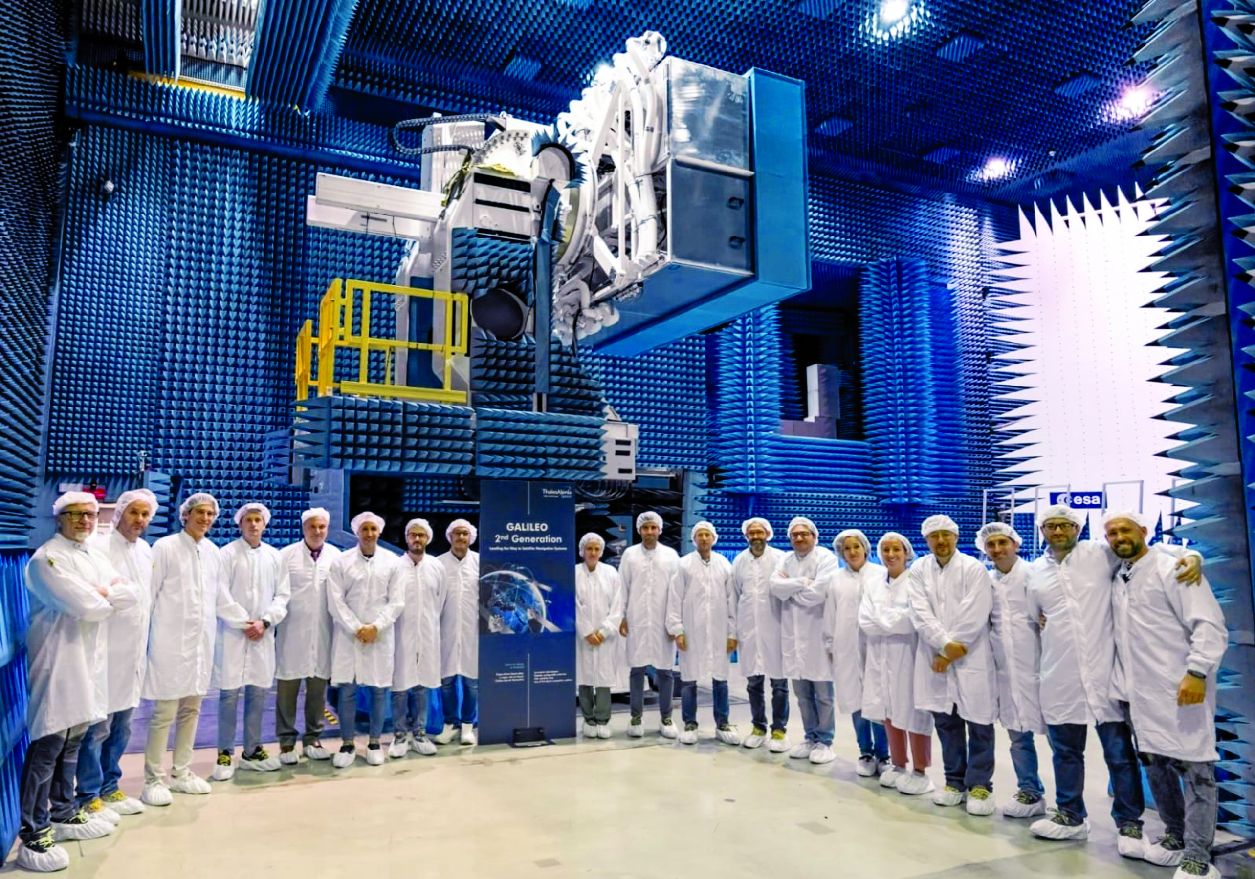
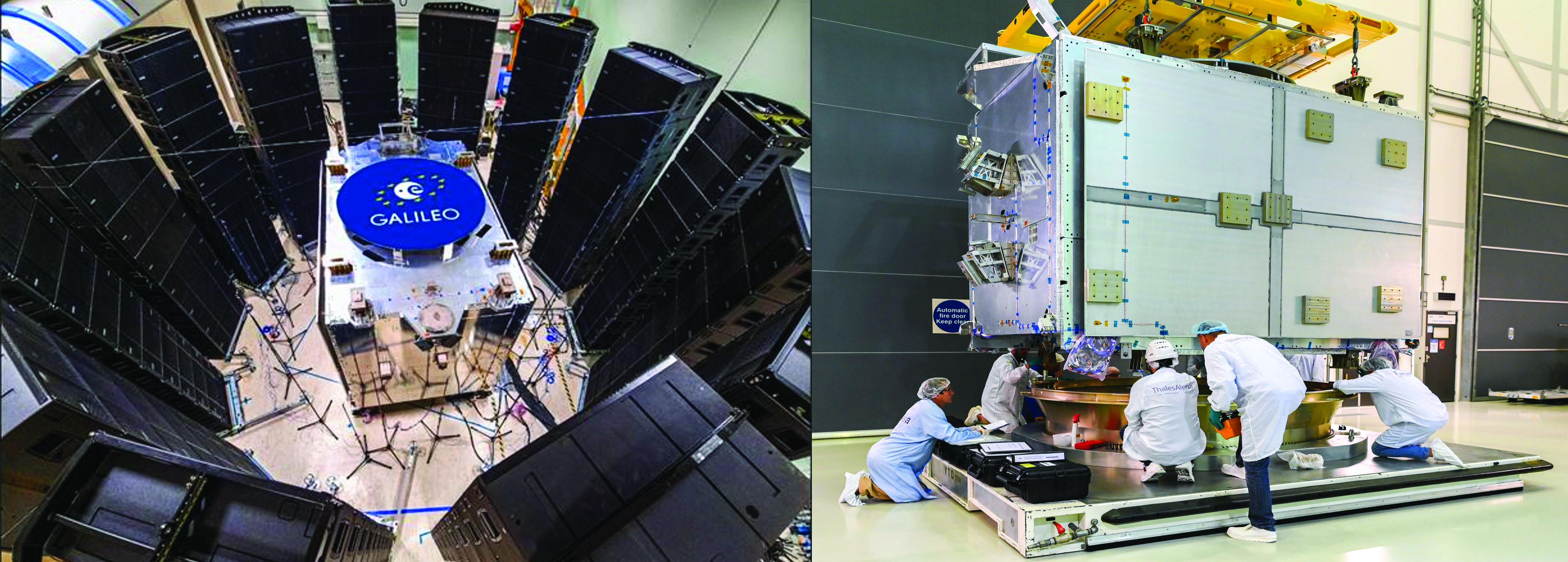
The two parallel contracts with Thales Alenia Space and Airbus to develop and manufacture each of six G2G batch one satellites (G2SB1A and B) achieved key milestones this year.
On the G2SB1 satellite A side, the prime contractor tested engineering model payloads and structural models at its premises and delivered them to ESA’s Technology Center (ESTEC). The validation of the new G2G payload capabilities and the key mechanical, vibration and acoustical testing milestones have been achieved.
These satellites will provide the following key innovations: reconfigurable fully digital navigation payload; point-to-point connection between satellites by inter-satellite-link for command and control, and ranging functionalities; electric propulsion for orbit-raising capabilities; advanced jamming and spoofing protection mechanisms; on-board authentication capabilities; increased ground-to-space data rate; and improved time reference (number of clocks and advanced clock monitoring functions).
Key mechanical and launch-related tests on the structural models stacked configurations were performed in the last quarter of this year, in order to simulate the launcher environment and satellite separation dynamics.
On the G2SB1 satellite B and the PHM and RAFS clock manufacturing sides, activities are ongoing as planned, with key HW infrastructure developed and tested in the respective Industrial Primes premises.
This included as key events in 2023 the full testing of the satellite advanced engineering model antenna and the creation of a satellite atomic clock farm in industry premises to produce the more than 70 atomic clocks required for the 12 G2 batch one satellites.
The next steps for these contracts are the completion of the equipment and satellite CDRs, expected in the coming months, in order to engage (starting at the end of 2024) with the critical system compatibility test campaigns of the G2G IOV ground segment infrastructure and system engineering test beds under development.
Galileo Second Generation batch one satellites. (Image: ESA)
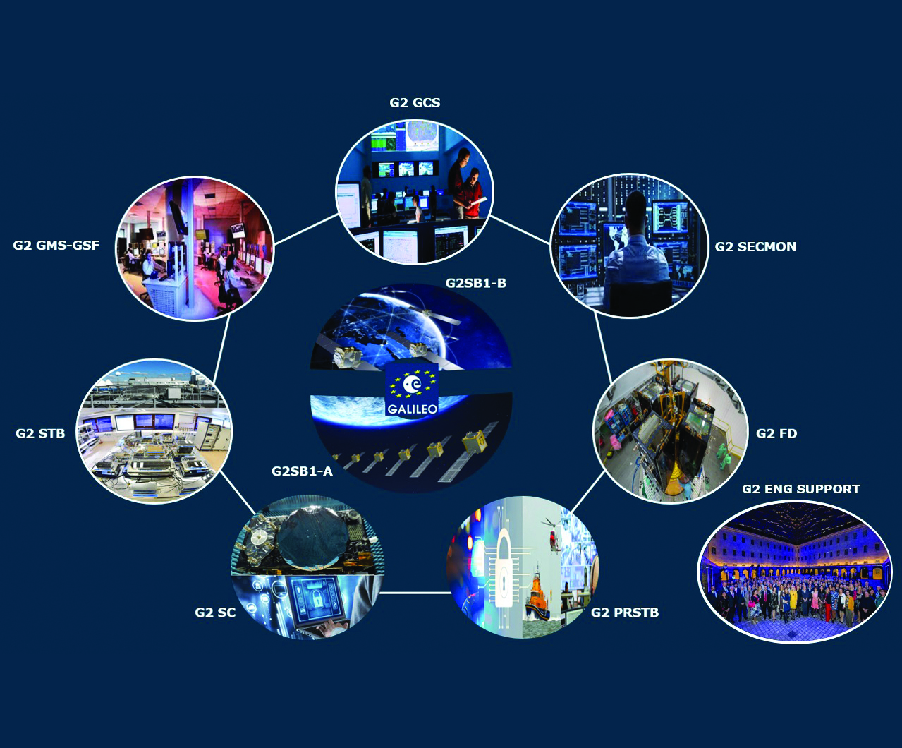
G2G in-orbit validation infrastructure – ground segment and test beds in full development
The key system engineering, ground segment and test beds infrastructure procurements were all awarded during the first semester of 2023, giving EC/EUSPA/ESA and the industrial teams a brief moment of respite and celebration.
Following a competition process that encompassed about 12 months of detailed technical, management and legal interactions, 11 industrial prime contractors were selected for a set of contracts engaging about $1 billion euros of public sector investment:
Four contracts for system engineering, signal and performance, system validation and security and PRS activities.
Four contracts for ground segment in-orbit validation infrastructure.
Three contracts for system test bed activities plus a series of technological developments in the receivers and constellation simulation side.
Once completed in the years to come, these infrastructure developments will ensure not only the launch and early orbit phasing and in-orbit validation of the novel G2G satellite’s capabilities, but also enable the provision to all world users of enhanced Galileo services.
G2G satellites stacked configuration for launcher simulated test at ESA ESTEC. (Image: ESA)
G2G initial and final operational capability moving ahead
In line with the outcomes of the system preliminary design review, two new lines of GNSS improvements are well underway at program level.
In the area of G2G initial operational capability (IOC), which will provide new G2G initial services, an extensive preparatory work has been performed by EUSPA in order to derive the mission needs (as defined by the EC and its Member States), into a set of service evolution roadmaps for the more than one dozen Galileo services.
This work has been supported by ESA dossiers providing incremental implementation of these services, in a continuous improvement ramp-up process, which guarantees backward compatibility and seamless enhancement.
The relevant procurements that will enable, in combination with the in-orbit validation infrastructure, the provision of these services are currently under consolidation:
G2G IOC ground segment, with an initial version to be procured in 2024.
G2G satellites batch two, which is expected to start its competitive procurement procedure in the second part of the EU’s 2021-2028 multi-financial framework.
In addition, work is well advanced in the definition of the key technological developments and system trade-offs that will be analyzed for inclusion in the G2G final operational capability (FOC), expected early in the 2030s.
Critical technologies being analyzed include optical inter-satellite links, advanced governmental payloads, new ground segment and signal technologies and in-space constellation monitoring, among others. ESA expects to complete the preparation of the system-critical design review by the end of 2024 or early 2025 and to submit it for in-depth review by the EC, EUSPA and European member states stakeholders.
Conclusions
Galileo keeps providing continuous and stable services to users with new enhanced capabilities offering high accuracy, authentication and faster time to first fix. The space and ground infrastructure development for the first generation is progressing toward public regulated service IOC and open service FOC.
In parallel, for G2G, hardware production of the new satellites is well under way and the ground segment development has started to maintain Galileo competitive with the other GNSS.
We continue to strive toward achieving the vision defined at the end of the previous decade: “If you can imagine a novel satellite navigation service, we will implement it in 12-18 months.”
According to Rokubun — a Spanish company that designs accurate and scalable navigation solutions based on GNSS — released a library solution for decoding and processing Galileo Open Service Navigation Message Authentication (OSNMA) for embedded platforms.
The solution is part of the Horizon Europe BANSHEE project, for which Rokubun served as the coordinating, is EU-funded, and is supported by the European Union Agency for the Space Programme (EUSPA). The goal of the project was to develop a hybrid technology that combines Wi-Fi ranging and satellite navigation (including the Galileo OSNMA) to allow for accurate and seamless indoor-outdoor navigation.
The upcoming Galileo OSNMA will provide authenticated navigation data message against data-level spoofing attacks. By delivering data authentication, the free-to-use Galileo OSNMA assures users that the received Galileo navigation message comes from the system itself and has not been modified by, for example, a spoofing attack.
To address this risk, Rokubun’s library enables the Galileo OSNMA in embedded GNSS solutions. The cross-platform, small-footprint library has undergone extensive testing using official EUSPA test vectors, and all OSNMA algorithms have been validated in real conditions at the European Commission’s Galileo testing facilities located at the Joint Research Centre in Ispra, Italy.
The library is organized to be portable, requiring only a working assembler and C compiler that supports ISO C99. To ensure optimal performance and validate user-specific enhancements, such as the utilization of cryptographic accelerators or other system-on-chip/microcontroller specific resources, Rokubun has implemented a hardware-in-the-loop continuous integration/deployment setup.
This setup continuously tests the library against several reference MCU targets, assessing its performance and guaranteeing its reliability.
The high-accuracy service (HAS) offered by Galileo is now available and provides sub-meter accuracy over most of the globe. It will help enable emerging technologies such as UAVs and autonomous vehicles, which require stringent levels of accuracy for better navigation, safety and efficient traffic management.
Other industries expected to benefit include transportation, agriculture, geodesy and entertainment.
Thierry Breton, European commissioner for Internal Market, announced that the service was now live during the annual European Space Conference in Brussels, Belgium, on Jan. 24.
The European Union Agency for the Space Programme (EUSPA) developed Galileo HAS along with the European Commission and the European Space Agency (ESA). The new service will become a pillar of government programs such as EU sectorial policies and national policies by EU Member States.
“This new service has been made possible thanks to the outstanding cooperation and team commitment of all involved partners,” said Rodrigo da Costa, EUSPA executive director.
“Galileo is not standing still,” said Javier Benedicto, ESA director of navigation. “This new High Accuracy Service offers a new dimension of precision to everyone who needs it, while the Open Service Navigation Message Authentication — already available — allows users to authenticate Galileo signals as they make use of it, to minimize any risk of spoofing. An upgraded integrity message of the signal rolled out last year reduces the time to first fix while enhancing the overall robustness of Galileo.”
Galileo HAS delivers horizontal accuracy down to 20 cm and vertical accuracy of 40 cm in nominal use conditions, according to ESA. The service is transmitted directly via the Galileo signal in space (E6-B) and through the internet.
With HAS, Galileo becomes the first constellation worldwide able to provide a high-accuracy service globally and directly through the signal in space.
The service is freely accessible to all users with a receiver capable of processing the HAS corrections broadcast in the E6-B signal and via the internet. The precise corrections provided by Galileo HAS will allow users to reduce the error associated with the orbit and clocks provided through the Galileo Open Service broadcast navigation messages and the GPS Standard Positioning Service navigation data.
“With the Galileo HAS we are ready to unleash the full potential of new technologies such as drones and bring autonomous driving closer to reality,’’ da Costa said. “At EUSPA, our role is to link space to user needs. With the launch of this new service, we met a clear market demand for accurate, robust, and reliable navigation.”
The European Union Agency for the Space Programme (EUSPA) along with the European Commission, have published guidelines that specify the baseline applicable to the Galileo Open Service Navigation Message Authentication (OSNMA) receiver service provision phase. The new documents include the OSNMA Signal-in-Space (SIS) Interface Control Document (ICD), and OSNMA Receiver Guidelines.
The OSNMA SIS ICD specifies, among other things, the interface between the Galileo Space Segment and the Galileo User Segment. This document is an addition to the Galileo Open Service (OS) SIS ICD.
The OSNMA Receiver Guidelines provide generic instructions for the user segment implementation of the OSNMA functionality and complement the OSNMA SIS ICD. Additionally, the guidelines explain user capabilities and steps to implement to verify the authenticity of the Galileo navigation message.
Both documents will be used for the upcoming OSNMA Service Provision Phase that will begin after the OSNMA Service Declaration. They have been developed as an evolution of the Galileo OSNMA User ICD for test phase (v1.0) and the Galileo OSNMA Receiver Guidelines for test phase (v1.1). Copies of the documents can be found here.
The companies will combine their experience to guarantee robust and reliable navigation thanks to the Galileo constellation
The OSNMA scheme. (Image: ESA)
UAV Navigation is participating in the OSNMAplus project consortium led by Qascom, an Italian enterprise in the domain of GNSS authentication.
The OSNMAplus project aims to develop services and technologies that make use of novel services provided by Galileo, particularly use of OSNMA and I/NAV improvements.
The OSNMA service is a data authentication function for Galileo Open Service users worldwide, freely accessible to all. OSNMA provides receivers with the assurance that the received Galileo navigation message is coming from the system itself and has not been modified. The I/NAV improvements are part of a recently released update of the Galileo Interface Control Document, aiming at optimizing the navigation performance of Galileo even further.
“With the OSNMAplus project, we’re providing technological solutions that will facilitate the adoption of OSNMA in new and existing navigation systems,” said Carlo Sarto, OSNMAplus project manager. “We’re also providing cloud-based services and multiplatform SDK that can be used in consumer devices to improve the OSNMA experience and increase the robustness of the navigation solution.”
The OSNMAplus technologies will be subject to an extensive test campaign. The OSNMA-based navigation will be tested in a flying drone to assess effective resilience against potential malicious GNSS interference.
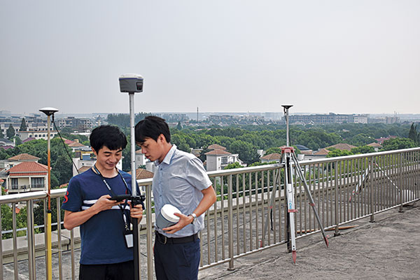
Jason Poitras (left) and Marc Veinotte of MicroSurvey test a multi-constellation OEM rover with the FieldGenius for Android field controller software. (Photo: Gavin Schrock)
It’s about more than advances in technology — peak times demand peak productivity
Trusty legacy rovers have served surveyors well. Under the right conditions and with proper procedures, a 20-year-old rover might still deliver precisions that could match the latest and greatest.
We’ve become so used to the limitations of legacy gear that we’ve built our workflows, expectations, and job estimates around them. However, in the past few years, the state of GNSS rovers has experienced a sea change, with gains in productivity, the ability to work in mixed environments, ease of use, and increased speed, repeatability and reliability — these developments have come at an opportune time.
Peak Times
Surveying always has been a feast-or-famine prospect; the rises and dips in economics are felt sharply within the profession.
In many places, there is more work than surveyors can accommodate, with competition to recruit and retain enough field personnel to meet demand. It is unclear how long this peak will last. Surveying firms recognize this and do their best to take on as many projects as they can.
Staffing is an acute challenge. Firms have had to dip into incentives beyond the usual pay and benefits packages to attract and retain qualified field personnel. Having the latest gear is a definite plus. Experienced surveyors know much they struggled with legacy gear: GPS-only or GPS + GLONASS only, slow processors, poor multipath performance, and field-data-collector operating systems and software that are obsolete or no longer supported.
Despite the immediate need, it’s generally less desirable to hire people with no surveying experience and train them from scratch. However, newer rovers and field software often do not have the same steep learning curve posed by legacy systems and methods.
Productivity Now
It is hard to say how much of the productivity gains, stated by various manufacturers for their newest systems, will be realized for your specific workflows, but simple testing can give you an idea.
When surveyors try out new rovers, they tend to find themselves so impressed by the first unit tried, they conclude it must be “the best” and eschew due diligence in the selection process. That aside, I believe it is safe to say that there is a near across-the-board productivity improvement with the latest generation of rovers.
Most rovers now provide no-calibration tilt compensation. (Photo: Gavin Schrock)
A Confluence of Factors
We haven’t seen such a sea change in GNSS rover technology in decades; most gains have been incremental. Similar jumps in the past included going from the static-only world to real-time and the first additional constellation beyond GPS.
While the early days of GLONASS were rocky, and most manufacturers were hesitant to productize an unreliable and noisy solution, it did eventually improve. The effect of nearly doubling satellites in view translated to productivity gains. But that was two decades ago.
The recent advent of true, multi-constellation GNSS has had a profound impact on the state of rovers. In 2020, both the Galileo and BeiDou constellations reached a full level of global coverage and signal integration.
Many rovers were already equipped to utilize some (but not all) of the newest satellites and signals. Interface control documents (ICD) for some of the signals have only been released by the constellation providers in the past few years. ICDs provide signal specifics that manufacturers need to integrate them into GNSS solutions.
Some rovers (and base receivers) developed four or more years ago may not be able to take advantage of the full complement of signals. And many did not have the processing power to utilize so many signals from so many satellites in real-time solutions.
By contrast, nearly every new GNSS board released in the past few years has greatly increased processing power, often double that of legacy gear.
Newer rovers are able to work better in sky-view-challenged and multipath hazard-prone places than rovers from only a few short years ago. And it is not just about the total number of channels on a rover datasheet, it is about how many are actually being utilized, how much of that data the processors and real-time kinematic (RTK) engine can handle, and how modernized signals are being leveraged.
Modernized signals are yielding additional advantages. The expected benefits of L5 for the GPS constellation have been widely promoted. L5 was designed to be robust enough for certain safety-of-life applications. The L5 signal is being deployed incrementally to the GPS constellation and should be broadcast from 24 satellites by 2027.
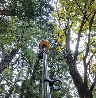
Modern receivers incorporate multi-GNSS signals that can improve performance under tree canopy. (Photo: Gavin Schrock)
I have heard surveyors say they won’t bother upgrading until L5 is complete. But wait — two other constellations already have third-signal capabilities. Indeed, there are 3, 4, 5, even 6 usable signals (in the case of Galileo) already available — modernized, robust signals.
Although L5 will only make this better, you can reap the benefits of signal modernization right now. Some of the innovation put into these modernized signals contributes to reducing certain sources of error. For instance, the Galileo E5a-E5b AltBOC — multiplexing signals in a wide band — is particularly beneficial for dealing with multipath.
Rovers have evolved in other ways besides multi-constellation integration. The decades between these sea changes brought developments such as electronic bubbles, better operating systems, and automation of some functions, but essentially the form factor and functionality of a surveying rover has not changed much. There have been some gadgets and gimmicks along the way, but otherwise rovers had remained pretty much standard in those intervening years.
Real-time precise-point positioning (PPP) has matured to the point that it could be viewed as survey-grade (at least in the horizontal). The delivery of clock, orbit and other data broadcast from geostationary communications satellites (as a service) for PPP means that, for many applications, high-precision positions can be processed by a rover over much of the globe — no base, no radio, no network and no cell phone connection required.
Once research and development removed the lengthy convergence times that plagued legacy PPP, it became commercially viable for many applications. Commercial providers such as Trimble (RTX), Hexagon | Leica (SmartLink), Hemisphere GNSS (Atlas) and others provide subscription services for surveying, construction, agriculture and the growing autonomy market. Most new survey rovers have a PPP option.
Multi-sensor integration, particularly of inertial measurement units (IMU), is becoming standard on new rovers. While there was some value from magnetometer-oriented tilt compensation in the past (though it could be cumbersome and somewhat unreliable), it served as a precursor to modern-day integrated GNSS/IMU no-calibration tilt.
The first no-calibration tilt system hit the market as recently as 2017; now it is hard to find a rover without it. Accessing hard-to-reach points and improved stakeout workflows are some of the benefits of tilt compensation. The development of reliable IMU/GNSS processing was also the key to fully integrating camera-based offset point capture — and soon other sensors such as lidar might be incorporated.
Market Choices
Another set of changes in the high-precision GNSS industry coincided with the above developments, growing a more competitive marketplace. This equates to more choice. The secret sauce of high-precision GNSS is no longer in the hands of the few. The glass floor has been broken, with more rovers than ever available.
Many tiers for choice have emerged.
The Top End. The manufacturers traditionally considered to be the top end continue to innovate and are usually the first to productize developments such as multi-sensor integration and PPP. They continue to lead in integrated surveying solutions, track record, performance, quality, service, support and peer user networks — which continues to appeal to many users. However, they also have second-tier offerings to suit various markets, regions and value propositions.
Whether to Use OEM Devices. For many users, there are compelling reasons to stick with top-end solutions, but there always has been room for other price point options. Until recently, most lesser-known rover brands exclusively integrated GNSS boards from a handful of well-known original equipment manufacturers (OEMs) such as Trimble and NovAtel. Sometimes new developments hit the OEM market quite rapidly — for instance, IMU integration. These third-party manufacturers may add their own touches, but in effect, nearly every rover out there offered a narrow set of DNA — until recently.
Rolling Their Own. Globally, technical universities are graduating GNSS engineers at an unprecedented rate; the prospect of mass applications such as vehicular autonomy and robotics are driving demand. With this expanding pool of engineers, it is now much more practical to develop GNSS solutions from scratch and to fully leverage multiple constellations.
Some third-party manufacturers began working with OEMs but have started developing their own boards and related technologies. I’ve tried several, and performance is, in most cases, as good as that of new boards from traditional sources..
The Rise of Mid-Price Rovers. There are a growing number of breakout rovers from lesser-known brands or rebranded models. These are about half the price of some of the top-end models, yet performance is in most cases nearly par. Some include OEM boards, or the new wave of independent boards.
I’ve seen a sharp rise in the popularity of mid-level rovers among small and mid-sized firms. However, there has not been a corresponding drop in sales of top-end rovers. It seems that surveyors are simply buying more rovers during this peak time.
Receivers-as-a-Service. Another approach for surveying and asset-mapping rovers is pay-as-you-go. This means you do not have to make large up-front investments in hardware. Instead, you pay for high-precision capabilities through subscriptions or tokens when you need it. This can be a good choice for occasional or seasonal users.
One example is Trimble’s Catalyst system. For Catalyst, the hardware investment is an inexpensive antenna, and then you access a subscription service via your mobile field data collector, tablet or smartphone to activate the software-defined receiver (SDR).
Another such model is Flex. With Flex, you have the option to pay full price for the full receiver/antenna to operate as a conventional rover. Alternatively, you can choose to pay a lower up-front price for the rover and use tokens to activate the high-precision capabilities.
Surveyors should put new rovers through their paces before choosing. (Photo: Gavin Schrock)
Low-Priced Rovers. Two external factors have fostered a mini boom in low-cost rovers: R&D for mass markets such as autonomy, and RTK/post-processed kinematic (PPK) solutions for drones, which are often used to reduce the need to set ground control points.
In both segments, inexpensive and often small GNSS boards have been developed. For drone applications where a base was needed for RTK/PPK methods, developers sometimes took the same GNSS board in the drone and packaged it as a base. It did not take long for some of these developers to package the rover for surveying or asset mapping (with geographic information system, or GIS).
While these rovers can perform just as well as top-end or mid-priced rovers in optimal conditions, they may struggle in mixed environments. I’ve tried some, and I can see why every surveyor I’ve asked about performance adds “for the price” to their assessment.
Other developers have taken this a step further, selling a bare-bones rover for less than $1,000, though these can take a lot of tinkering and extra attention to fit into a production workflow. There are even folks creating do-it-yourself rovers. I am not seeing many large firms, who have high-ticket projects and need to conduct integrated surveying, opting for lower priced systems.
We are riding a new wave of GNSS rovers, awash with more choices than ever. In this period of increased demand for surveying services, it might be a great time to upgrade and boost productivity.
New Players
A “roll your own” example is Tersus GNSS, which has designed and manufactured in-house GNSS boards and RTK engines since its inception in 2014. I asked Winston Wen, founder and CEO of Tersus, why they chose this strategy.
“I’m a hardware guy; electronics, computer science, signal processing, etc.,” Wen said. “In 2014, I took a look at the price and portfolios for high-precision, and for equipment for surveyors — the price point looked exceptionally high. From my point of view, it looked like there was room for a new player, and I felt we could do better. There are also growing markets for applications for high-precision GNSS, such as the internet of things (IoT) and autonomy.”
Tersus has experienced solid reception for its products globally. I asked Wen if he felt GNSS for surveying has reached a new level of performance. “Yes, nowadays with 50 satellites, that is huge. Surveyors will be very happy with performance, especially in environments with limited sky view. At this time, there don’t appear to be any new signals announced, so rovers bought today should be top performers to, say, 2025 and beyond.”
Industry Insights
GNSS executives told Gavin Schrock about recent developments in their companies.
Neil Gerein, Senior Director of Marketing,
Autonomy & Positioning Division, Hexagon
As satellite constellations were modernized, GNSS receivers kept pace to offer multi-constellation and multi-frequency capabilities to culminate in the latest technologies in PPP corrections.
For example, Hexagon’s RTK From the Sky technology is able to achieve highly available corrections with centimeter-level accuracy globally. However, modern GNSS receivers also offer other benefits, such as interference mitigation and spoofing detection for improved positioning robustness, multipath mitigation, and more powerful sensor fusion.
Miles Ware, Vice President,
Marketing & Global Customer Care, Hemisphere GNSS
Much like the constantly evolving world of smartphones, tablets, and computers, the improvements in multi-constellation GNSS receiver performance have been significant, even over just the past few years.
Many legacy rovers, bases and reference stations that are older than four years cannot track some of the newest signals, such as from BeiDou Phase 3 satellites. This means some of the highest performing signals available are now accessible to many users. As fewer BeiDou Phase 2 satellites continue to transmit, many legacy receivers will no longer have the performance they once did.
With upcoming services such as OSNMA (the Galileo GNSS data authentication service) and global PPP signals, many receivers from a few years ago do not have the CPU capacity to employ them. Today’s GNSS engines track more satellites, more signals per satellite, and have more CPU to perform advanced operations, all while consuming the same or less power than previous generations.
Francois Martin, Vice General Manager,
CHC Navigation
The latest GNSS RTK rover technology evolutions are based on the maturity and enhancement of satellite navigation systems, as well as the integration of IMU sensors into the receivers.
The most recent generation of our GNSS rovers, such as the CHCNAV i83, is based on the sophisticated iStar algorithm that significantly improves the efficiency of GNSS satellite signals tracking for unmatched performance in GPS, GLONASS, BeiDou, Galileo and QZSS constellations, utilizing all available frequencies, including BeiDou 3.
Moreover, the fusion of GNSS and IMU technologies enables centimeter-level positioning, maintains fixed and reliable RTK accuracy, and collects points faster than ever before, even in challenging conditions. GNSS survey productivity is increased by up to 30%, and the user base expands from experienced users to new users such as construction site foremen.
Gavin Schrock, PLS, is a practicing land surveyor, the operator of a cooperative real-time GNSS network in Washington state, and a technology writer.
The EU Agency for the Space Programme (EUSPA) is set to launch a new Fundamental Elements call, with a dedicated online workshop June 30. The workshop is an opportunity to learn about the new call and hear from successful projects funded during the last call.
Fundamental Elements is a research and development funding mechanism designed to support the development of innovative chipset, antenna and receiver technologies in which industry would not yet invest on its own initiative. In doing so, the program helps accelerate the integration of European GNSS (EGNSS) into market-ready devices and solutions.
Projects funded by Fundamental Elements play a key role in EUSPA’s mission of driving the development and market uptake of Galileo-enabled receivers. For example, the GEARS project, which was funded during the initial call, developed a super accurate and highly robust Galileo-enabled receiver capable of providing both time and frequency data for critical infrastructure.
The new Fundamental Elements call builds on success of projects by:
integrating Galileo’s key differentiators into receiver technologies, including OSNMA, high-accuracy frequency, triple frequency, Early Warning Service, CAS and ARAIM
leveraging disruptive technologies such as machine learning and artificial intelligence
exploring potential synergies with Copernicus and the forthcoming GovSatCom.
More details about these points and the call in general will be made available during EUSPA’s upcoming Fundamental Elements online Workshop via Webex. Scheduled for June 30, the workshop will include in-depth information on the funding program and the application process.
The event will also feature project teams funded during the first Fundamental Elements call, who will share their experiences, best practices and advice for putting together a successful project.
Septentrio will demonstrate how simple it is to spoof or jam unprotected GPS receivers at the upcoming ION Joint Navigation Conference, which takes place June 6-9 in San Diego. The company will showcase how its resilient technology makes a difference for overall security and availability of positioning, navigation and timing (PNT) .
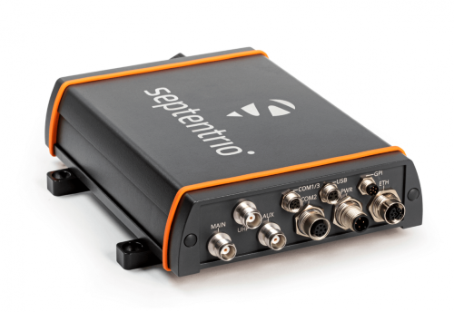
The AsteRx-U3 receiver. (Photo: Septentrio)
Septentrio will hold a GPS spoofing demonstration, as well as a detailed comparison of jamming solutions from various high-end receivers. The integration of the latest anti-spoofing authentication mechanism, Galileo’s Open Service Navigation Message Authentication (OSNMA), will also be shown.
“With our growing dependence on GPS technology, resilience of PNT is an important point of attention, especially for mission-critical applications, tactical ground or aerial vehicles as well as autonomous systems,” said Gustavo Lopez, market access manager, Septentrio. “Since the number of malicious jamming and spoofing attacks is on the rise, it is crucial to understand how various GPS receivers can be affected. We are pleased to explain and display this with specific examples at JNC this year.”
Advance Interference Mitigation (AIM+) is an interconnected set of sophisticated anti-jamming and anti-spoofing technology components, securing GPS/GNSS receivers against various forms of interference.
AIM+ is an interconnected set of anti-jamming and anti-spoofing technology components comprising a robust defense system against various forms of GPS/GNSS interference. Such resilience to jamming combined with anti-spoofing measures ensures the safety of autonomous machines, improves the security of GNSS-based infrastructure, and increases efficiency with extended PNT availability.
OSNMA anti-spoofing authentication from Galileo is available on Septentrio receivers such as the mosaic module as well as the recently released AsteRx-U3 boxed receiver. Other products such as AsteRx-SBi3 also add inertial sensors for increased protection against spoofing.
Septentrio will be at booth 220 in the ION JNC exhibit hall.
Septentrio has released Open Service Navigation Message Authentication (OSNMA) functionality on its mosaic GNSS receiver modules. OSNMA offers end-to-end authentication on Galileo’s civilian signals, protecting receivers from OSNMA attacks.
Spoofing is a malicious form of radio interference, where faulty positioning information is sent to a receiver. For the last two years Septentrio has been working closely with the European Space Agency (ESA) during the test phases of OSNMA deployment. The know-how gained during this period is what allowed Septentrio to be one of the first to market with this advanced security feature.
OSNMA’s anti-spoofing capability complements Septentrio’s Advanced Interference Mitigation technology, AIM+, and further strengthens the overall security of Septentrio GNSS receivers, making them suitable for assured PNT solutions as well as critical infrastructure, such as 5G network synchronization.
“We are excited to start offering the OSNMA anti-spoofing technology in our industrial GNSS receivers. Our close collaboration with ESA enabled us to get the expertise needed to implement and validate this functionality in a timely manner,” said François Freulon, head of Product Management at Septentrio. “The addition of OSNMA to Septentrio’s already strong anti-jamming and anti-spoofing technology takes our receivers to a new level as the market leader of resilient positioning and timing solutions for industrial applications and critical infrastructure.”
OSNMA is now supported by the complete mosaic receiver family including GNSS RTK positioning modules, timing modules and heading receiver modules. It will also be rolled out on Septentrio’s latest generation of OEM receiver boards, AsteRx-m3, and subsequently on the ruggedized boxed receivers. Read more here.