Tag: EUSPA

  • With EUSPA support, Qualinx integrates Galileo OSNMA to receiver

    With EUSPA support, Qualinx integrates Galileo OSNMA to receiver

    The QLX3Gx chip makes secure, authenticated positioning a standard feature

    Qualinx has integrated support for the Galileo OSNMA (Open Service Navigation Message Authentication) on its QLX3Gx Series ultra-low-power GNSS receiver.

    Developed with the support of the European Union Agency for the Space Programme (EUSPA), the integration makes the QLX3Gx a GNSS receiver purpose-built for ultra-low-power markets to deliver hardware-native OSNMA support as a standard feature across the entire product family.

    Qualinx has embedded OSNMA support directly into the QLX3Gx hardware architecture from the ground up, enabling a fully optimized design with zero trade-offs in power consumption, cost or performance. 

    “Authenticated positioning has for too long been out of reach for the devices that need it most,” said Qualinx CEO Tom Trill. “By building OSNMA support into the QLX3Gx at the hardware level from day one, we’re making trusted positioning the default — not a premium option — for the wearables, asset trackers and IoT devices that make up the bulk of the GNSS market.” 

    The partnership with EUSPA reflects a shared commitment to disseminating Galileo’s advanced security capabilities across the widest possible range of applications and markets. EUSPA identifies OSNMA as a strategic priority for improving resilience against spoofing and signal manipulation

    According to the EU Space Market Report 2026, global GNSS revenues are projected to grow from €300 billion in 2024 to €580 billion by 2034 with mass-market devices accounting for the largest share of shipments and representing the greatest growth potential.

    Through Qualinx’s digital radio-frequency technology, the QLX3Gx delivers up to 10× lower power consumption than conventional GNSS solutions. By integrating OSNMA natively in hardware, the chip eliminates the processing overhead typically associated with authentication, ensuring security adds no meaningful cost to the power budget.

    The chip’s reconfigurable digital RF architecture enables capabilities to be updated over time without hardware replacement — extending device lifecycles, cutting electronic waste, and lowering overall energy consumption. The result is a platform that makes connected devices more secure and sustainable. 

    The QLX3Gx chip is available for sampling, with mass production planned for the second half of this year. Developers and OEMs can register interest in the Qualinx QLX3Gx Evaluation Kit to secure hands-on evaluation of the QLX3Gx for upcoming consumer, industrial and mobility applications. Contact [email protected] to register interest and request a sample, or learn more at Qualinx.io

  • EUSPA launches new EU Space Market Report, strong GNSS growth predicted

    EUSPA launches new EU Space Market Report, strong GNSS growth predicted

    A new edition of the European Union’s Space Market Report is now available. According to the EU’s Agency for the Space Programme (EUSPA), it offers a comprehensive overview of the latest developments, emerging trends, and market dynamics shaping the global space downstream sector.

    The report provides a comprehensive overview of the latest developments and trends in GNSS, as well as Earth observation (EO), secure satellite communications (Secure SATCOM), and space situational awareness (SSA) in one place for the first time. It also highlights the evolution of user technologies and the growing synergies between these domains.

    “As Europe’s space capabilities become increasingly interconnected, it is essential to move beyond viewing them as standalone technologies,” explained Rodrigo da Costa, EUSPA executive director. The publication “reflects the growing synergies between these domains and their strategic importance for Europe’s economy, resilience and autonomy.

    “By providing a comprehensive view of the evolving space ecosystem, EUSPA aims to foster innovation, strengthen collaboration across the sector, and support the development of a more competitive, agile and responsive European Union space economy,” da Costa said.

    GNSS and EO

    The report highlights sustained growth for both the GNSS and EO markets across all 16 analyzed market segments. The current €3.5 billion of EO market revenue in 2024 is expected to grow to €7.9 billion by 2034 with agriculture representing the largest share.

    GNSS revenues are forecast to rise from €300 billion in 2024 to €580 billion by 2034. GNSS service revenues outpace device revenues and confirm the increasing role of digital ecosystems and value-added services in the space economy, the report said.

    Revenues are mainly driven by consumer solutions, and road and automotive, with a global installed base of GNSS-enabled devices that will reach almost 10 billion by 2034.

    Secure SATCOM

    The Secure SATCOM market addresses the needs of surveillance, key infrastructure and crisis management. In this sector, data service revenues generated by EU users are forecast to grow significantly, increasing from more than €200 million in 2025 to nearly €1.2 billion by 2040.

    While maritime surveillance drives demand in 2025, by 2040 the market is expected to be led by law enforcement interventions, civil protection and force deployment, fueled by growing security and resilience needs, demand for reliable connectivity, and stronger crisis-response capabilities.

    Existing and future synergies

    The report also examines how major macroeconomic trends —including climate change, geopolitical instability and rapid urbanization — are reshaping space markets and strengthening synergies between EO, GNSS and Secure SATCOM technologies. Together, these capabilities are becoming increasingly important for security, resilience, disaster response, environmental monitoring, and smarter urban and infrastructure management.

    Download the EU Space Market Report.

  • EUSPA tests prove suitability of Galileo HAS for precision agriculture

    EUSPA tests prove suitability of Galileo HAS for precision agriculture

    The Galileo High Accuracy Service (HAS) was tested under real farming conditions to assess its performance and suitability for precision agriculture

    The European GNSS Service Centre (GSC) of the European Union Agency for the Space Programme (EUSPA) partnered with Hemisphere GNSS and Case New Holland to test the suitability of the Galileo HAS service for precision agriculture.

    The tests were performed at the New Holland campus in Peñarrubias del Pirón, Segovia, Spain.

    The working width used for the test was 2.55 m, while the test area covered approximately 20,000 m² with a perimeter of about 740 meters. During the three-hour test, the teams collected GNSS data to analyze the pass-to-pass and absolute accuracy metrics. Pass-to-pass accuracy is the relative precision of a guidance system to maintain a consistent distance between adjacent, parallel machine passes within a short timeframe (usually 15 minutes). It is crucial for reducing gaps and overlaps during planting, spraying, and harvesting.

    Test campaign

    The test campaign aimed at proving that the tractor consistently maintained the specified path accuracy during consecutive passes. This would show that HAS can optimize agricultural operations by reducing costs associated with overlaps (reworking the same area), leading to savings such as reduced fuel consumption, minimal input waste, and improved crop yield.

    For the test setup, in addition to the onboard guidance system, an independent antenna was mounted on the tractor cab. This antenna was connected to two positioning solutions: one based on the Galileo HAS and another based on an RTK solution.

    An RTK base station deployed for the occasion provided the rover with precise RTK corrections and enabled generating a “reference path” against which to compare the tested Galileo HAS, in this case based on corrections obtained directly from the signal in space (SIS) via the Galileo E6 band.

    The driving was performed in automatic mode, with manual intervention required only for turning at the end of each pass. The autosteering system of the tractor would then automatically reconnect with the following path, as calculated at start-up.

    Test results

    The test began with the GNSS receiver in Cold Start mode, requiring it to obtain ephemerides and process satellite data before achieving precise positioning. The convergence time was calculated and is shown as the red area in the image below. The green area shows when the tractor started along the predefined paths and hence when the data was used for the pass-to-pass accuracy calculation.

    Converge time and data set during the test. (Credit: EUSPA)
    Converge time and data set during the test. (Credit: EUSPA)

    The data analysis showed that the Galileo HAS system consistently maintained horizontal errors of 3-6 cm.

    With a 95% horizontal error of 5.9 cm and its maximum value below 8 cm, the error remains well below the 20 cm HAS accuracy target.

    As regards the vertical axis, the 95% vertical error was 12.4 cm, with its maximum value below 25 cm, (remaining well below the 40 cm HAS accuracy target).

    Galileo HAS signal vertical error. (Credit: EUSPA)
    Galileo HAS signal vertical error. (Credit: EUSPA)


    The horizontal error of the HAS service relative to the RTK reference baseline is shown in the following figure.

    Galileo HAS signal horizontal error. (Credit: EUSPA)
    Galileo HAS signal horizontal error. (Credit: EUSPA)

    Regarding the pass-to-pass accuracy, the analysis shows an overall pass-to-pass accuracy of 1.18 cm, demonstrating highly stable performance throughout the test period.

    Year-to-Year accuracy was not part of this testing campaign but will be analysed in the next testing campaign.

    Galileo HAS potential confirmed

    The Galileo HAS service is an open, standardized correction service distributed directly via Galileo E6 or the internet (with global coverage) and the test campaign results confirm its potential to generate savings to farmers in terms of fuel consumption, fertilizers, seeds and other inputs, by reducing overlap in field operations.

  • EUSPA and EIOPA harness Copernicus data to guide disaster response

    EUSPA and EIOPA harness Copernicus data to guide disaster response

    Using data from satellites to predict and resond to climate-related disasters is considered in a new white paper.

    The EU Agency for the Space Programme (EUSPA) and the European Insurance and Occupational Pensions Authority (EIOPA) published the joint white paper

    It explores how Earth observation (EO) data could be harnessed to enhance the supervision of natural catastrophes and assess the impact of extreme weather events on Europe’s insurance sector.

    As Europe faces escalating climate-related disasters and rising economic losses related to them, the need for more effective risk management and greater resilience against natural catastrophes is paramount — not least through the deployment of innovative solutions.

    The white paper is the result of a joint pilot project between EIOPA and EUSPA — highlights the benefits of using open-access Earth observation data from Copernicus to improve the tracking and management of natural hazards.

    The project demonstrates that satellite-based EO data offers independent, objective and near real-time geospatial insights that can meaningfully improve risk assessment and risk management practices for insurers, communities and supervisors.

    Earth observation technology — especially the open, traceable data that Copernicus provides — can sharpen risk identification, reinforce scenario design and accelerate loss estimates in the aftermath of shocks. Financial supervisors can leverage the technology to:

    • rapidly identify affected areas and exposed insurance undertakings: Satellite imagery makes it possible to map disaster-affected areas (for example, the extent and trajectory of floods) as events unfold. This granular geospatial data can be matched with Solvency II regulatory reporting to estimate the potential impact of natural catastrophe events on individual insurers (micro-prudential perspective);
    • estimate overall loss-magnitudes early on by scaling up the micro-level analysis to the sector as a whole (macro-level perspective); and
    • improve benchmarking, model validation and scenario and stress test design by providing objective, data-driven reference points against which model outputs and reported or calculated losses can be compared.

    The collaboration between EIOPA and EUSPA showcases the value of innovation in addressing the challenges posed by climate-related disasters: when used effectively, Earth observation data can contribute to a more resilient and sustainable insurance sector — one that better protects European citizens and businesses from the damaging effects of a warming climate.

  • EUSPA grants Thales Alenia Space framework contract to build European GNSS Demonstrator

    EUSPA grants Thales Alenia Space framework contract to build European GNSS Demonstrator

    EUSPA has signed a Framework Contract with Thales Alenia Space to build the European GNSS Service Demonstrator (ESD), a centralized modular platform advancing EU Space services like EGNOSGalileoCopernicus, and GOVSATCOM/IRIS2.

    This EGNSS Service Demonstrator is a key innovation accelerator for EUSPA, paving the way for large-scale end-to-end testing future Galileo and EGNOS augmentation services through both geostationary satellite and internet-based dissemination.

    The system will serve as the backbone of pre-operational EGNSS service validation, anticipating future positioning, navigation and timing (PNT) user needs across critical markets, support standardization activities, and sustain EUSPA’s commitment to service excellence.

    Building on Thales Alenia Space’s track record in PNT satellite-based services, the EGNSS Service Demonstrator project inherently anchors Thales Alenia Space at the forefront of the new generation of GNSS-based applications and services for millions of European and global users.

    Capabilities

    The ESD will comprise modular and flexible ground and support segments to handle a diverse number of reference stations and data. It will be able to compute corrections, messages or data that will be disseminated in real-time via different means such as GEO SiS and the internet.

    It centralizes EGNSS demonstrations, incorporating future services like high accuracy (HAS), authentication (OSNMA, SAS), maritime/rail DFMC safety, space weather and emergency warning via scalable infrastructure.

    Strategic role

    The ESD will facilitate the seamless rollout of new/improved services without disrupting operations of current EGNSS services, emulating signals for realistic testing to support future prototyping and standarization of receivers (such as for rail safety or automotive high-accuracy units), and app development. It will refine user needs across sectors while engaging users and developers.

    Key use cases

    The main use cases that the ESD will cover are:

    • Early Open Service signals, such as pre-operational EGNOS DFMC SBAS or Galileo HAS integrity, to accelerate user readiness.
    • Service consolidation for evolutions like enhanced HAS via E-GSC interface, OS-NMA/SAS testing, and sector-specific apps (maritime, rail).
    • Standardization support for receivers like MUGG, EDG2E and Fundamental Elements projects; SBAS promotions and demos.

    With the European GNSS Service Demonstrator, EUSPA strengthens Europe’s ability to test, evolve and deploy future EU Space services, supporting innovation, standardization and market uptake while ensuring service continuity and resilience.

  • SES extends EGNOS GEO-1 satellite service to power precise navigation across Europe

    SES extends EGNOS GEO-1 satellite service to power precise navigation across Europe

    The agreement ensures Europe’s satellite-based augmentation continues enhancing navigation for aviation and other critical users and lowering emissions.

    SES, a space solutions company, and the European Union Agency for the Space Programme (EUSPA) have announced an extension of the European Geostationary Navigation Overlay Service (EGNOS) GEO-1 satellite service agreement through 2030, with an option to extend until 2032, helping maintain high-precision navigation services for aviation and other critical users across Europe.

    By improving the accuracy and integrity of satellite positioning signals, EGNOS supports aircraft in landing in low-visibility conditions, as well as planning more efficient routes, reducing fuel burn and CO₂ emissions.

    At the core of the EGNOS service is Europe’s regional satellite-based augmentation system (SBAS) that improves the accuracy and reliability of GNSS signals, such as GPS. Beyond aviation, EGNOS supports maritime navigation and precision-driven agriculture, contributing to efficient operations and sustainability by reducing fuel consumption and emissions.

    Under the extended GEO-1 contract, SES will continue operating an EGNOS-hosted payload on its SES-5 satellite, as well as the ground segment from its facilities in Europe.

    “This extension ensures a robust EGNOS space segment, ready for the transition towards its next version and the development of new services, while safeguarding high-precision navigation for aviation and other critical users across Europe,” said Rodrigo da Costa, EUSPA executive director.

    “EGNOS is a cornerstone of Europe’s aviation and broader navigation applications. The agreement underscores SES’ and EUSPA’s joint commitment to advancing satellite-based services that enable secure, reliable, and sustainable navigation solutions,” said Philippe Glaesener, senior vice president, Global Government at SES. “Thanks to the service, millions of users and operators will benefit from efficient and more reliable air transportation services across all of Europe. This commitment reflects our broader mission of delivering resilient satellite solutions for critical infrastructures.”

  • Thales Alenia Space secures contract to extend EGNOS service life

    Thales Alenia Space secures contract to extend EGNOS service life

    Thales Alenia Space — a joint venture between Thales and Leonardo — has secured a €51 million ($56 million) contract from the European Union Agency for the Space Programme (EUSPA) to extend the operational life of the European Satellite-Based Augmentation System (EGNOS).

    Named Life Extension Phase 1 (LIFEX), this contract will ensure that EGNOS V2 continues to provide reliable, secure and high-performance navigation services for Europe’s aviation, maritime, land transport, mapping and agricultural sectors beyond 2028.

    EGNOS system is designed to enhance the accuracy, reliability and integrity of positioning signals by improving the performance of GNSS, such as GPS and, in the future, Galileo. As part of this contract, Thales Alenia Space will address EGNOS V2 critical system upgrades and infrastructure improvements, reinforcing the system’s resilience and operational durability. These updates will focus on enhancing security measures, modernizing components, and ensuring the ongoing reliability of EGNOS’s Safety of Life Service, which plays a key role in aviation, enabling accurate approaches at European airports without requiring ground guidance systems. Operational since 2011, this service has significantly improved operational safety and efficiency for the greater benefit of European operators.

  • GMV to support the advancement of the Galileo Reference Centre

    GMV to support the advancement of the Galileo Reference Centre

    The European Union Agency for the Space Programme (EUSPA) has awarded GMV a framework contract to advance the Galileo Reference Centre (GRC), a key facility for monitoring and evaluating the performance of the Galileo satellite navigation system. Located in Noordwijk, the Netherlands, the GRC independently assesses Galileo’s operations, signal quality, and user-level service performance and compares its performance with that of other GNSS.

    The upcoming GRC V2 version will introduce real-time monitoring capabilities, enhancing EUSPA’s ability to oversee GNSS services. This evolution will support additional Galileo services, including:

    • Signal Authentication Service (SAS): Strengthening trust in Galileo signals.
    • Time Dissemination Service: Enabling precise synchronization for critical infrastructure.
    • Search and Rescue (SAR): Improving emergency response operations.
    • Emergency Warning Satellite Service (EWSS): Facilitating public alerts for natural disasters and emergencies.

    Key operational improvements in GRC V2 include:

    • Enhanced monitoring using data from multiple institutions.
    • Real-time processing for faster user notifications.
    • Seamless system upgrades without disrupting operations.
    • Advanced cybersecurity measures integrated into a platform-as-a-service model.

    The upgraded GRC is expected to be operational by 2026 without impacting ongoing functions.

  • More on EUSPA’s first ever GNSS and Secure SATCOM User Technology Report

    More on EUSPA’s first ever GNSS and Secure SATCOM User Technology Report

    In case you missed it, the European Union Agency for the Space Program (EUSPA) recently issued its first ever User Technology Report addressing both GNSS and Secure SATCOM. Though they seem to be different and distinct topics, EUSPA does a reasonable job of drawing them together with an “Editor’s Special — Synergies from Space” at the end of the document.  

    The first half of the report deals with GNSS and is an exploration and celebration of how far we have come with GNSS. While the report is aimed at “users” and is designed to be “technical,” it is written to be accessible by most who are generally familiar with the topic.

    Also, a careful reading reveals several messages for policymakers.  

    Protecting Frequencies

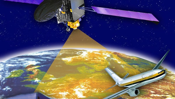
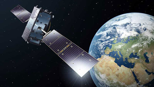
    The report opens with a celebration of what has now become a multi-constellation, multi-frequency, open positioning, navigation and timing (PNT) system with 110 satellites, two regional augmentation systems (Japan’s QZSS and India’s NavIC), and Satellite Based Augmentation Systems (SBAS). All of this depends, of course, on clear and uninterrupted signals. 

    One of the first cautions policy makers should note is a subheading in the section that reads “Frequencies: a scarce resource to be protected.” This is the first of many mentions of the need to protect signals and users from accidental and malicious interference. 

    From 2016 to 2019, the European Union’s STRIKE3 project deployed equipment to monitor L1/E1 signals in 23 countries across the globe. They found more than 450,000 signals that could interfere with GNSS, 59,000 of which were assessed to be intentional jamming or spoofing. 

    This was well before the current wars in Ukraine and the Middle East and before Russia’s malicious ongoing electronic warfare in the Baltic. So, even in the absence of aggressive nation-state actions, which could flare up at any time, STRIKE3 showed that GNSS interference was a significant problem threatening users’ reliance on GNSS.

    Both the European Union and the United States have undertaken projects in response to widespread jamming and spoofing.

    In Europe, EUSPA has begun the EGIPRON project, or European Global Interference PROtection Network. It aims to develop and deploy “…an interference monitoring system covering all European territories and worldwide areas of European interest” working with contractors Qascom and Leonardo.

    The U.S. Department of Transportation (DOT) announced the “GNSS Situational Awareness Common Operational Picture GovCloud Environment” at the December 2024 National PNT Advisory Board meeting. The government version was described as operational, with a public version to be available in mid-2025.

    These detection — and hopefully geolocation — systems will be great tools. Policy makers must remember, though, that better understanding the scope of the problem will not solve it. 

    Better laws and regulations to empower enforcement, along with improved enforcement capability, will both be needed if even a dent is to be made in the problem. Getting these in place will be significant legislative and budgetary challenges. Even then, the problem of accidental and malicious GNSS interference will not be solved. Authorities will just be able to manage it a bit better.  

    Toughen Receivers 

    A great majority of the GNSS portion of the document is appropriately devoted to receivers. They are, after all, the only part of the GNSS system over which users have any discretion and control. 

    Receiver design, signal processing, antennas and PNT processing are all discussed. The most attention is paid to describing the characteristics and appropriate uses of five different families of GNSS receivers:

    • Mass Market Entry-Level
    • Mass Market Premium
    • Professional Non-Regulated
    • Professional Regulated
    • Special Applications

    Using the right kind of GNSS receiver for a given application is essential for safety and effectiveness. 

    The question for policymakers, though, is not whether the right technology exists to mitigate risks — it does. Rather, the issue is whether that technology is being used appropriately. 

    Most GNSS users are uninformed about GNSS issues and tend to purchase equipment based upon price rather than resilience. Policymakers must consider how to motivate users, especially in critical applications, to purchase and use more expensive equipment. Government leaders have many levers of influence at their disposal, from education to regulation and requirements. As of yet, however, we have seen few in use.

    Alternative & Complementary PNT

    The booklet devotes a page to “Complementary PNT Technologies” with the subhead “Complementary PNT technologies are redefining navigation solutions.” Saying “one size does not fit all” — which can also be said for GNSS — includes a graphic from the most recent European Radionavigation Plan of a conceptual, system of systems PNT architecture.

    Perhaps more significantly, other pages have mentions of the desirability of “diversifying” PNT sources and “hybridizing” PNT sources. 

    Safety-Critical Applications 

    Overall, the GNSS section of the User Technical Report is an excellent general overview and reference document.

    Its description of SBAS, however, might give a misimpression to the uninformed reader. 

    The title on page 12 reads “SBAS enhance GNSS performance and enable safety critical operations.” 

    SBAS improves GNSS accuracy with corrections and ionospheric models and helps with integrity. However, it does little to prevent service disruptions due to interference.

    The title for SBAS conflict on page 12, with a comment on page 17, discusses “GNSS Vulnerabilities and Mitigation Measures.” The very last note on the page and in the tiniest type reads, “For critical applications, implement alternative (non-GNSS) technologies as a backup to ensure continuous PNT information.”

    This latter statement is very much in keeping with the most current, 2023 version of the European Radionavigation Plan, which says:

    “Thus, for critical applications or critical infrastructure protection, it is broadly accepted that GNSS, even in a multi-constellation and multi-frequency environment, should not be the unique source of  PNT information. For those applications, an alternative PNT solution (back-up but also complementary) should be developed and maintained, not necessarily based on radio frequency technologies.”

    To a certain extent, this has been echoed in the United States as well. 

    In 2020, a Presidential Executive Order warned against over-reliance on GPS/GNSS, saying the government “must ensure critical infrastructure can withstand disruption or manipulation of PNT services.”

    Following this, in its January 2021 report on a PNT demonstration project, the DOT said:

    “Promoting critical infrastructure owner/operator use of those technologies that show strong performance, operational diversity, operational readiness, and cost-effectiveness is worthwhile. Based on this demonstration, those technologies are LF and UHF terrestrial and L-band satellite broadcasts for PNT functions with supporting fiber optic time services to transmitters/control segments.”

    Additionally, a 2023 presentation to an international group by the Office of the Assistant Secretary of the Air Force was titled “Alt. PNT — the Pathway to Resilience.” 

    GNSS are great systems, but we cannot let our understandable enthusiasm for what are truly miracles of technology unintentionally mislead others. Policymakers must be constantly on the lookout for such missteps and help us all maintain a broader, user-focused perspective. 

  • EUSPA launches GNSS and secure SATCOM user technology report

    EUSPA launches GNSS and secure SATCOM user technology report

    The European Union Agency for Space Programme (EUSPA) has released its first GNSS and secure satellite communications (SATCOM) user technology report, offering an overview of recent developments in GNSS and SATCOM. This publication combines and expands upon previous GNSS user technology and secure SATCOM market and user technology reports, offering a comprehensive look at current trends and advancements in user technology.

    The report examines the satellite industry’s ongoing transformation, influenced by evolving security concerns, increased digitalization efforts, rapid progress in artificial intelligence (AI) and the emergence of the New Space sector. By addressing these topics, the report aims to provide stakeholders with up-to-date information on the state of satellite-based technologies.

    Focusing on both GNSS and Secure SATCOM, the publication explores recent innovations in user technology, such as terminals and receivers. It also investigates potential synergies between these two fields. This approach allows readers to gain insights into how these technologies are developing in parallel and potentially converging in certain applications.

    Developments and trends in GNSS technology

    The report opens with a summary of the recent developments and future trends in GNSS technology that are relevant to end users. As new GNSS frequencies and signals become available for civilian applications, receiver manufacturers have been upgrading their products to accommodate satellites in medium-Earth orbit (MEO). The international coordination among GNSS supports this advancement, Radio Navigation Satellite Service, and Satellite-Based Augmentation System providers, resulting in the adoption of open access signals with compatible frequency plans, common multiple access schemes and modulation schemes.

    The report states that a service-oriented approach to GNSS is emerging, building upon existing infrastructure to offer users enhanced performance and security. The European GNSS program has made significant strides in this area, backed by the recent implementation of the Galileo High Accuracy Service (HAS) and Open Service Navigation Message Authentication (OSNMA) feature. The Report gives insight into emerging technologies and upcoming innovations, focusing on key trends in receiver electronics design and signal processing aimed at improving performance or reducing power consumption. Multi-frequency capabilities, PNT processing strategies and advances in antenna design are identified as key drivers shaping the future of GNSS receiver technology, according to EUSPA.

    Among other topics selected, the spoofing and jamming threats are becoming a priority to be addressed both at the system and user level. Solutions such as Galileo OSNMA authentication and more resilient receivers with multiple antennas and sensor hybridization are being explored and are starting to be implemented.

    Developing secure SATCOM systems

    The secure SATCOM section of the Report outlines trends in the secure SATCOM domain by emphasizing enhanced performance and system management optimization. It specifically highlights how digitalization processes, cloud environments and AI techniques are enhancing performance and system management optimization in the secure SATCOM domain. It also notes the ongoing efforts to standardize the integration of non-terrestrial networks into the 5G ecosystem.

    According to EUSPA, the deployment of large Non-Geostationary Orbit (NGSO) constellations aims to improve performance, particularly in reducing transmission latency. These systems rely on advanced user terminals capable of tracking and switching between multiple fast-moving satellites across the sky.

    The report also emphasizes security in SATCOM transmissions, recognizing that satellite communications encounter similar threats from malicious signals as terrestrial communications. Consequently, both governmental and commercial SATCOM systems are being developed with a rising focus on enhancing the confidentiality, integrity, and availability of both governmental and commercial SATCOM systems links.

    It also describes a shift in SATCOM systems from legacy hardware-centric designs to modern software-oriented solutions. This digital transition allows user terminals to utilize multiple constellations and frequencies, which significantly improves the availability of communication links. This can help mitigate disruptions caused by natural factors or intentional interference.

    Exploring potential and existing synergies

    The report concludes with an examination of existing synergies between GNSS, secure SATCOM, and Earth observation (EO). Notable examples include the transmission of EO data through SATCOM systems, utilizing GNSS for operating NGSO SATCOM terminals, the complementary use of GNSS and secure SATCOM in transport and emergency management, remote sensors used by Copernicus — a European EO program — that rely on both GNSS and SATCOM and high-accuracy GNSS positioning in remote areas enabled by SATCOM.

  • New services and capabilities for Galileo

    New services and capabilities for Galileo

    Galileo is Europe’s civil global navigation satellite constellation and a major success of the European Union (EU). It provides the world’s most precise satellite navigation performance. Galileo services began in December 2016 and are currently supplied to more than 3 billion users. They offer several high-performance services worldwide, featuring various levels of accuracy, robustness, authentication and security.

    Galileo is a key component of mass-market applications for such areas as transport, agriculture and timing but also for security-critical applications, such as health services, emergency and rescue services and law enforcement. Galileo services continue to expand with many new capabilities that are unique with respect to other GNSS. 

    The European Union Agency for the Space Programme (EUSPA) and the European Space Agency (ESA) continue to collaborate effectively on the many developments, deployments and evolution activities of the Galileo Programme, each according to their respective responsibilities for exploitation and system development, with the European Commission acting as the program manager. 

    Photo: (All images/figures provided by the authors)

    Stable Service Performance

    Galileo services continue to deliver excellent performance every month in a safe, secured and seamless manner, managed by EUSPA. The performance parameters of the Galileo services are independently monitored by the Galileo Reference Centre (GRC) and are regularly published on the web portal of the GNSS Service Centre (GSC): gsc-europa.eu. 

    The performance of the Open Service (OS) remains “Best in Class” among the GNSS providers. Timing users also continue to receive accurate (in the order of 5 ns) access to Galileo System Time, which they can trace to Universal Coordinated Time (UTC) through the corresponding offset parameters transmitted by the satellites.

    The Search and Rescue (SAR) service was delivered well beyond the commitment to the users, for both forward and return link services, while the High Accuracy Service (HAS) and the Public Regulated Service (PRS) continue being provided as planned in the corresponding Service Definition Document (SDD).

    Benchmark with respect to other GNSS. Photo: (All images/figures provided by the authors)
    Benchmark with respect to other GNSS.

    Pages: 1 2 3 4 5

  • GMV to upgrade Galileo’s European GNSS Service Centre

    GMV to upgrade Galileo’s European GNSS Service Centre

    The European Union Agency for the Space Programme (EUSPA) has awarded GMV a six-year framework contract to upgrade the European GNSS Service Centre (E-GSC) infrastructure. The contract is valued at €35 million ($39 million).

    The E-GSC is critical to the European Union satellite navigation program’s infrastructure. Its primary mission is to provide a unified interface for users of the Galileo and EGNOS systems, offer supporting services, and contribute to delivering new Galileo services. The E-GSC’s various functions include distributing data from the European Union navigation satellite services to the user community and supporting the growth of the global Galileo applications market.

    Originally designed to be part of the European GNSS infrastructure and to provide a unified interface between the Galileo system and its users, the E-GSC has expanded its role over the years to become a key component in delivering services enabled by the European Union Space Programme.

    The new framework contract aims to advance the E-GSC’s capabilities, enabling it to take on increased responsibilities. This includes creating new services for users, enhancing their experience, integrating service delivery aspects of Galileo and EGNOS, and supporting the development of additional services.

    GMV is leading a consortium that features Indra as the main industrial partner, along with prominent companies such as Spaceopal, ESSP, Alten, the Universitat Politècnica de Catalunya (UPC) and the Universidad Autónoma de Barcelona (UAB).

    Under the supervision of EUSPA as Contracting Authority, GMV will oversee project management and IT infrastructure development through all stages, including definition, implementation, validation and integration into the Galileo ground segment. GMV will also develop the software components necessary for delivering new data and signal authentication services for Galileo satellites.