Septentrio, a provider of high-precision GNSS positioning solutions, has partnered with Digi-Key Electronics, a global electronic components distributor. Digi-Key now offers mosaic-X5 globally for customers who need secure and reliable high-accuracy positioning in a compact and low-power form factor.
Image: Septentrio
Septentrio’s mosaic-X5 features complete multi-frequency multi-constellation technology and tracks every existing and future signal from all GNSS constellations.
Such signal diversity coupled with advanced anti-jamming technology allows mosaic-X5 to deliver centimeter-level positioning with maximum availability even in challenging industrial environments. This makes mosaic-X5 an ideal positioning solution for applications such as robotics, automation, telematics and many more.
“Our mosaic-X5 is an advanced GNSS receiver module without performance compromises. With its small form factor and low-power design, mosaic-X5 brings high-performance positioning to volume applications,” said Francois Freulon, head of product management for Septentrio. “Having Digi-Key as a distributor enables us to scale and reach out to find new markets and applications where secure high-accuracy positioning is required.”
“Digi-Key is excited about the new partnership with Septentrio,” said David Stein, vice president of global supplier management for Digi-Key. “Demand for high-accuracy GNSS receivers with secure and robust positioning is growing strongly, as they continue to be implemented into new applications and devices. Digi-Key offers customers an easy path to order, develop and deploy with the latest technologies available, including Septentrio’s robust and precise GNSS devices, which have the latest anti-jamming and anti-spoofing technology.”
Representatives from Fuyao Glass visited Harxon’s Shenzhen, China, headquarters on July 1. (Photo: Harxon)
Fuyao Glass Industry Group Co. Ltd. and Harxon Corporation have established a partnership to develop an advanced smart conformal antenna with automotive glass. Representatives from Fuyao Glass visited Harxon’s Shenzhen, China, headquarters on July 1.
According to the agreement, Harxon will specifically study the pass-through characteristics of high-frequency signals, and develop revolutionary automotive antennas based on the material and manufacturing craftsmanship of Fuyao Group automotive glass.
Both parties will establish a joint innovation team to research and develop a smart, multi-band conformal automotive antenna that integrates radio services with Fuyao’s smart automotive glass technology.
By combining the automotive glass and the antennas into one package, automakers capture immediate benefits of cost reduction, reduced installation complexity, and improved reliability.
Founded in 2008, Harxon Corporation (a BDstar company) is a customer-focused enterprise carrying out innovative research, manufacturing and marketing in high-precision GNSS antennas, ultra-reliable wireless data transmission radio modems, and smart antennas. Applications include surveying, precision agriculture, UAVs and automotive vehicles.
Fuyao Glass was founded in Fuzhou, China, in 1987. It is a multinational company specializing in the manufacture of automobile safety glass and industrial technical glass.
GNSS Underground Coverage for Tunnels, Stations, Car Parks, Bus Stations and Airports in the U.K.
Syntony GNSS and Chronos Technology have formed a partnership to deliver underground GNSS positioning, navigation and timing (PNT) solutions for critical infrastructure applications in the United Kingdom.
Syntony GNSS is a leader and expert in the design and manufacture of GNSS systems, and Chronos Technology is a resilient GNSS system integrator.
GNSS coverage has become fundamental to many services from emergency services to asset tracking for example. Yet when entering an underground area such as a metro/subway, tunnel, car park, airport, or bus station for example, the GNSS signal is lost.
Syntony’s SubWAVE solution expands the GNSS coverage to underground areas, enabling the localization of any equipment with a standard GNSS chipset. Examples include standard smartphones and the TETRA Emergency Services Network handset used for security and services. Security and services applications include locating emergency calls, keeping track of staff, locating faults in tunnels, managing assets, locating trains and providing guidance.
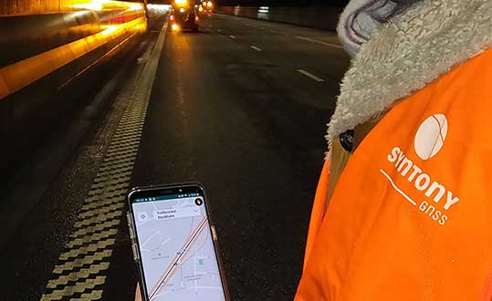
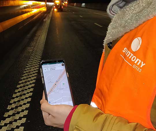
A Syntony team member in a Swedish road tunnel during SubWAVE testing shows the positioning in an underground environment on a smartphone. (Photo: Syntony GNSS)
By emitting a perfect emulation of the “real” GNSS signal, SubWAVE offers underground operators, their staff, emergency services and the general public the benefit of full GNSS coverage in all underground areas for both operational and safety reasons.
One fundamental aspect is the user only needs a standard GNSS receiver (a smartphone or TETRA radio) — no new handsets, receivers or apps are required. The system operates by broadcasting synthetic location specific GNSS signals through existing or new leaky feeder cables in the tunnels.
Accuracy levels vary with leaky feeder and system complexity options; however, 2-meter accuracy is possible with a standard smartphone. The system is widely installed in the Stockholm metro and is in active trials throughout Europe and America.
“We are pleased to form a partnership with GNSS specialists Chronos,” said Joel Korsakissok, president of Syntony GNSS. “Their knowledge and experience, together with their dedicated installation, commissioning and support teams complement our sophisticated solutions.”
“Since its first general availability, one of the well-known shortcomings of the GPS system was lack of indoor or underground coverage,” said Charles Curry, managing director with Chronos. “Many have tried to solve this with various technologies over the years. Syntony’s innovative technology offers underground GNSS coverage for PNT applications. We are very excited by the possibilities and pleased to be partnering with them to offer their solution for critical infrastructure applications in the UK.”
In addition, Chronos will also supply Syntony’s sophisticated GNSS simulators used in the aerospace and defence industries for product testing.
Orolia and Seven Solutions have partnered to deliver resilient, accurate, and stable time and frequency for global military, commercial and critical infrastructure applications.
According to the companies, the partnership will address the ultra-precise, resilient timing and frequency requirements of industries such as defense, aerospace, data centers, telecom, financial services, smart grids and other critical infrastructure.
Through the partnership, Orolia will offer a modular approach to resilient PNT, which includes a combination of GNSS signals protected with interference detection and mitigation technology, together with low Earth orbit secure alternative signals. The Orolia-Seven Solutions partnership also will offer terrestrial sub-nanosecond time distribution from distant and potentially redundant locations.
“This partnership is a key example of Orolia’s commitment to combining best-in-class technologies into more robust resilient PNT solutions for our customers,” said Orolia CEO Jean-Yves Courtois. “Those who require the most accurate, extremely precise time and frequency technology will now also benefit from an unprecedented level of resilience to protect critical PNT data sources, for more confidence and peace of mind.”
This new partnership between Seven Solutions and Orolia will facilitate global operations and naturally integrate with reliable time sources. Seven Solutions will focus on bringing the best-in-class time and frequency distribution, the companies said.
At Intergeo 2019, Torsten Müller, general manager at eEntwicklung.net GmbH, discusses how eEntwicklung.net and Sokkia have partnered for a stake-out solution.
To explore new investment support for the European space-based economy, the EIB and GSA are bringing together their expertise and experience. The common objective is to create high-skill jobs in the EU and improve the day-to-day lives of Europeans by supporting innovative companies and accelerating the development of new applications that use European global navigation satellite systems and earth observation data. These applications could be used to ensure smooth navigation, such as in search-and-rescue operations to save lives, for observing crops, and in precision farming to reduce the need for fertilizers and pesticides.
“Space is the final frontier, and there is a new worldwide ambition in reaching it. The EU’s global competitors and new private actors are investing heavily in the space sector. At the same time, new disruptive technologies and business models are emerging and changing the playing field,” said EIB Vice-President Ambroise Fayolle, who is responsible for innovation. “We need to make sure that Europe stays in the game. That is why we are particularly enthusiastic about this agreement with GSA. It is an important step to develop further support for European space entrepreneurs and businesses to eventually give them and the EU a competitive edge in this new space race.”
“Our expertise in market intelligence for satellite navigation and in supporting new business opportunities — thanks to EGNOS and Galileo — is the basis of our agreement with the EIB,” said Carlo des Dorides, GSA Executive Director. “We are confident that our cooperation will bring the extra added value required by entrepreneurs to transform their application businesses into globally successful companies.”
A changing space sector
The global space economy has been evolving rapidly in recent years. On average it has grown by 6.7% per year over the last 10 years, which is almost twice the 3.5% average yearly growth of the global economy. This growth has been partially driven by the US, China and other countries that have developed new ambitious space missions.
The main driver, however, has been the “New Space” phenomenon: a number of technological and business model innovations that have introduced new products and services and reduced the cost of accessing and using space.
The transformation of the space economy has seen new space companies investing over EUR 14.8 billion since 2000, with a fast accelerating trend: total investment in space companies grew by a factor of 3.5 in 2012–2017 compared with the previous six-year period. Moreover, US-based investors dominate the field accounting for around two thirds of the 400+ worldwide investors in space companies.
Historically, Europe has always been at the forefront of publicly-funded space exploration, investing massively in space infrastructures such as the Copernicus and Galileo satellite programmes. Europe still boasts academic and scientific excellence but risks missing the next wave of space innovation unless it seizes the opportunity to stimulate more private investment in the new space sector.
According to a recent EIB and European Commission study on the future of the European space sector, European space entrepreneurs feel there is a lack of private financing sources, particularly for late-stage investments. They therefore tend to keep an eye on private capital outside the EU, especially in the US.
In this context, European public innovation instruments play an essential role in unlocking private capital for the space sector. 40% of the European companies surveyed seek public funding, which serves as a seal of approval in the market, as a precondition for further private investment.
Teledyne Optech’s new compact lidar sensor, the CL-90, is available for purchase through its first integration partnership with Lidar USA.
For more than 20 years, Lidar USA has been building UAV sensor systems and has sold thousands of systems worldwide. Its ability to support numerous industries with cutting-edge integration makes them an ideal partner for Teledyne Optech’s compact lidar sensors, Teledyne stated in a press release.
Lidar USA’s products are used for surveying-related tasks ranging from topography work, to highways and land development. They are also used for agricultural work for forestry and plant growth, and have applications in archeology as well.
Teledyne Optech’s CL-90 sensor features exceptional canopy penetration for excellent ground coverage, higher downward point density for superior results in corridor/power line projects, long-range performance for maximum productivity at UAS ceilings and best-in-class data precision for tight-tolerance applications, the company said.
“Our customers face many challenging projects and they need tools that can deliver,” said Lidar USA CEO Jeff Fagerman. “Whether it’s greater range, more accuracy or better penetration of vegetation, using the new Optech CL-90 gives us the means of providing the tool to get the job done.”
Teledyne Optech Executive Vice President and General Manager Michel Stanier believes the partnership will help expand both companies’ global presence.
“Teledyne Optech is pleased to partner with Lidar USA to bring our compact lidar sensors to market,” Stanier said. “Lidar USA is a premier UAV solution provider. As a result, we are confident that their integration expertise and strong global market presence will provide the ideal platform to deploy the CL-90’s rich, unique feature set into the UAV marketplace.”
Lidar USA will be at Intergeo this year and can be found at ICS Foyer Stand 2 featuring a fully integrated CL-90 solution. Teledyne Optech will be featuring some of its new Compact Lidar suite of products this year at Intergeo Booth B3. 042 from September 17-19 in Stuttgart, Germany.
Esri is partnering with the Jane Goodall Institute to develop a set of tools that will help communities map and manage the ecosystems around them through a collaborative design and planning approach, aided by GIS software.
According to the partners, these tools will help communities map, monitor, and better manage their natural resources from community forests and wildlife reserves, to water catchment and flood control areas, as well as human settlement, agriculture and agroforestry spaces.
The Jane Goodall Institute’s community-centered conservation approach — Tacare — partners local communities and governments to create sustainable livelihoods while planning for and advancing environmental protection. The Tacare approach also achieves conservation results and addresses environmental threats — including incompatible expansion of agriculture, human settlements, harvesting forest products, disease, wildlife trafficking and illegal bushmeat trade — by consulting communities about their needs and priorities, and working together to collaboratively plan for and implement land use practices that enable their own development.
“A key component of our success is that we work to help villagers find ways to make livelihoods that do not destroy the environment, and help them understand that protecting the environment not only conserves wildlife, but their own future,” said Dr. Jane Goodall, DBE, founder of the Jane Goodall Institute and United Nations Messenger of Peace.
The Jane Goodall Institute uses Esri’s ArcGIS platform and Survey123 mobile app to help communities and governments in western Tanzania, Uganda and other countries in Africa to plan, monitor and protect chimpanzee populations in local protected forests outside designated national parks.
“Conservation at the community level is essential to sustaining our natural world,” said Jack Dangermond, Esri founder and president. “Protecting global ecosystems cannot work on a global scale unless it starts locally, which is why we are honored to work with our friend and partner, the Jane Goodall Institute, on this collaboration, leveraging their years of experience working at the local scale in pursuit of conservation, balanced with the needs of human communities.”
Safran and Orolia are partnering to offer the latest resilient positioning, navigation and timing (PNT) solutions for military forces, especially in GNSS-denied environments.
This partnership will provide mission-critical equipment for air, land, sea and space programs in environments where GNSS signals are not available or degraded. Whether the outage is unintentional or intentional (jamming, meaconing or spoofing), the Safran-Orolia partnership will provide an alternative to GNSS-dependent military systems.
The Safran-Orolia team will offer military forces an unparalleled convergence of PNT capabilities, including Orolia’s portfolio of precise timing references and PNT sensor-fusion technology, as well as Safran’s proven defense inertial navigation solutions. Initial program priorities include navigation warfare (NAVWAR), along with mobile and fixed PNT solutions.
“Today’s military operations are increasingly mobile and global, with mission priorities that often bring them into territories where GNSS jamming and spoofing are becoming common threats,” said Orolia CEO Jean-Yves Courtois. “We’re proud to introduce this unique resilient PNT military partnership to better protect and enable mobile operations for NATO and allied countries worldwide.”
“In a world full of uncertainty, our partnership will provide autonomous and sovereign PNT solutions to Armed Forces facing harsh GNSS denied environments,” said Safran Electronics & Defense Chief Executive Officer Martin Sion.
Orolia’s PNT solutions improve the reliability, performance and safety of critical, remote or high-risk operations. With locations in more than 100 countries, Orolia provides virtually failsafe GNSS and PNT solutions to support military and commercial applications worldwide.
Safran is an international high-technology group, operating in the aircraft propulsion and equipment, space and defense markets. Safran has a global presence, with more than 92,000 employees and sales of 21 billion euros in 2018.
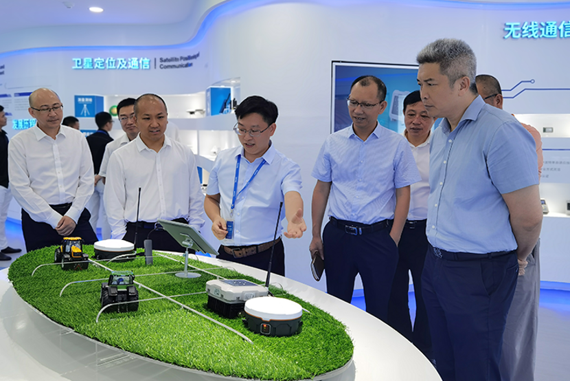
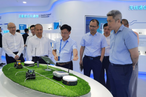
Harxon’s Winnie Yang and Skycatch’s Jackie Guilbault discuss the companies’ partnership, which has resulted in a high-precision package offering, at Xponential 2019.
Drone company PrecisionHawk has announced a partnership with EagleView, a provider of aerial imagery and data analytics for government, insurance and commercial sectors.
PrecisionHawk also announced that it has purchased both HAZON Inc. and InspecTools Inc., businesses that specialize in the delivery of inspection services and technology for the energy industry.
Both companies bring demonstrated expertise to enable tighter integration between the collection and the analysis of drone data, PrecisionHawk said. Paul Bingaman, CEO of InspecTools, and David Culler, CEO of HAZON, will join PrecisionHawk’s executive leadership team.
EagleView partnership for insurance claims
EagleView’s partnership with PrecisionHawk enables drone insurance inspections. (Photo: PrecisionHawk)
Through the partnership with PrecisionHawk, EagleView will collect at-scale insurance claims imagery via drones by leveraging PrecisionHawk’s global network of drone pilots, Droners.io.
The addition of PrecisionHawk’s drone pilot network will benefit EagleView OnSite Solutions for remote claims inspection. EagleView OnSite virtual desk adjustment combines imagery from multiple sources, including drones, with a variety of data analytics and reports to enable adjusters to efficiently triage claims, virtually inspect properties from their desk, and ultimately close property and casualty (P&C) claims faster.
“EagleView OnSite provides insurance customers with all the tools necessary to settle claims without ever going into the field,” said Rishi Daga, CEO of EagleView. “As drones transform the way the insurance industry operates, making inspections safer, easier and more cost effective, EagleView reinforces its commitment to drone technology to digitize manual workflows.”
Virtual drone inspections for insurance claims address a challenging trend in the P&C insurance industry. Over the past 20 years, the number of experienced insurance adjusters has dropped dramatically, causing labor shortages — especially after major storms hit. The demand for insurance adjusters is high, yet drone pilots add a new, untapped “labor force” to the equation.
Combining the EagleView OnSite virtual desk adjustment solution with PrecisionHawk will offer the insurance industry thousands of certified, trained drone pilots to perform high-quality insurance inspections at a competitive cost. With more than 25,000 claims processed by EagleView OnSite in the last 18 months, EagleView can help insurance carriers transform their property claim workflows and decrease cycle time by at least 40 percent to best serve their customers after a catastrophic natural disaster.
Drone technology and analytics for the energy market
HAZON brings extensive aviation experience, standards-based operating procedures, certified drone flight operations and inspection services, widely regarded as the best in the energy industry, to the PrecisionHawk team. The company has delivered more than 13,000 inspections totaling over 8,000 hours of flight time, with a majority focused in energy markets for Fortune 500 utilities.
InspecTools brings high-fidelity machine vision software and data analysis tools built for the renewable energy market. Their market-leading software for both solar-panel and wind-turbine inspection is utilized by some of the largest equipment manufacturers and service providers in the world. Customers like Vestas, PG&E and SMA Solar rely on InspecTools’ sophisticated reporting, analytics and machine learning capabilities.
“We’re very pleased to bring together the established technology and multi-market reputation of HAZON and InspecTools with PrecisionHawk’s experience, team and expanded portfolio,” said Michael Chasen, CEO of PrecisionHawk. “By combining these offerings, our customers will have access to extensive and leading-edge energy products and services, regulatory expertise and a record of safe, secure and compliant operations.”
Thanks to advances in technology and regulations, the energy market has quickly moved from experimenting with pilot projects to large scale deployment of drone solutions, PrecisionHawk said. Across distribution lines, transmission lines, solar panels, wind turbines, oil and gas and utility infrastructure, and emergency response, energy presents a current global market opportunity of $9.7 billion.
According to IDC, worldwide spending on robotics and drones will accelerate over the next four years reaching $201.3 billion in 2022. While the value is clear across time, safety improvements and operational efficiency, scaling and managing a drone program can be complex.
“HAZON is excited to bring our world-class best practices and reputation for standards-based operations and safety to the PrecisionHawk team,” said Culler. “By joining PrecisionHawk, our customers gain access to the next level of technological sophistication for more scalable, predictive and cost-efficient drone solutions that drive better business intelligence.”
“InspecTools brings years of experience, analytics tools and machine vision software for renewable energy that is an immediate value-add to PrecisionHawk’s software analytics platform,” Bingaman said. “This relationship further enhances the technologies and services that are fundamental to advancing the economic potential of drones in the energy market.”
The acquisition of HAZON and InspecTools underscores PrecisionHawk’s strategy to operate in high-growth markets and accelerate the adoption of commercial drones.
The acquisitions, which are subject to customary closing conditions, are expected to close later this month.
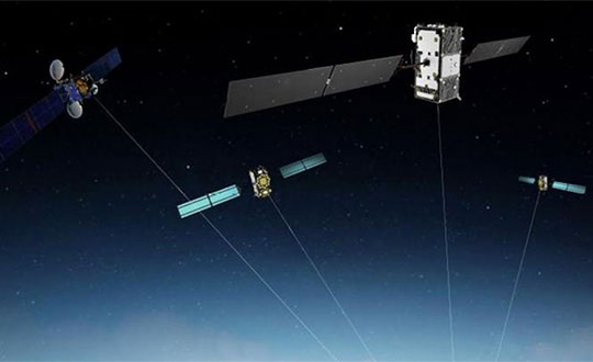
GMV, Tecnobit and Skydel are aiming to provide corporations, universities and research labs with a reliable, advanced simulation system that closely follows the latest Galileo capabilities.
“Together with our partners at Tecnobit, and taking advantage of SDX’s unique software-defined architecture, we are currently working to add Public Regulated Service (PRS) support to Skydel SDX,” said Manuel Toledo, head of the GNSS Advanced User Segment Solutions Division at GMV. PRS provides position and timing data for sensitive applications that require the highest level of service continuity.
Skydel and GMV are also joining efforts on developing SDX’s capabilities for signal authentication with Galileo Commercial Service and Open Service. The goal of such authentication is to increase the safety level of signals and to avert their falsification or fraud. It is currently a unique feature that only the Galileo constellation can provide, the companies said.
Skydel and GMV are also collaborating on projects that aim to provide signal simulation solutions for Galileo’s second generation (G2G). Galileo’s second-generation satellites are scheduled to be launched in 2025 and beyond.
“With Galileo’s full operational capabilities approaching soon, we must focus on the system’s upcoming G2G services,” said Pierre-Marie Le Véel, business development director at Skydel. “Skydel’s top priority for the European market is to provide simulation tools for the design of these next-generation GNSS devices.”
The partnership among the three companies unites the unique strengths of each organization, GMV said. While GMV brings its expert knowledge of both the European market and the Galileo system and Tecnobit brings its expertise as developer of cryptographic systems, Skydel adds its versatile and extensible GNSS simulator, resulting in a solid technical and commercial synergy for establishing an improved GNSS service offering for Europe.