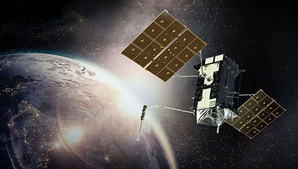
The U.S. Space Force’s Space Systems Command (SSC) has awarded Raytheon a $196.7 million contract extension for the GPS Next Generation Operational Control System (OCX) program — despite being years behind schedule. This latest award brings the total OCX contract value to nearly $4.5 billion since its inception in 2010. However, according to the U.S. Government Accountability Office (GAO), the total amount is approaching $8 billion.
The OCX program, designed to enhance GPS infrastructure, has faced significant setbacks. It is currently about seven years behind the original schedule, with the GAO reporting that the system of 17 ground stations was not ready by its October 2024 deadline. Further testing is required for the system to be operational by December 2025.
Despite these challenges, OCX remains critical for modernizing GPS capabilities. The system will enable full M-Code capabilities, providing jamming-resistant GPS signals for military operations in contested environments. OCX is also designed to improve cybersecurity for both military and civilian applications significantly. Once operational, OCX will command all modernized and legacy GPS satellites, managing all civil and military navigation signals.
The program has faced scrutiny due to its delays and cost overruns. The GAO has flagged the program’s delays as a risk to the GPS enterprise, while lawmakers have expressed frustration over the delays and budget increases. Despite this, the Space Force continues investing in the program to enhance GPS capabilities for military and civilian users. OCX is expected to provide improved accuracy, availability and resistance to jamming compared to the previous ground control segment. The system will also support the launch and operation of GPS III satellites.
WingXpand, a U.S. provider of autonomous smart planes with artificial intelligence (AI) threat detection capabilities, has collaborated with RTX’s Raytheon. The partnership aims to enhance the capabilities of WingXpand’s smart planes, which already feature a library of AI algorithms designed to provide soldiers with real-time threat identification.
Enhanced threat detection
The smart planes’ open systems architecture allows for the seamless integration of organic and third-party applications and payloads, designed for mission flexibility as threats and tactics evolve. Raytheon’s advanced infrared technology seeks to enhance the capabilities of WingXpand’s smart planes by improving their ability to detect and identify potential threats at greater distances. This integration allows tactical ground units and command leadership to receive more precise, real-time information about their surroundings, facilitating faster and more informed decision-making in the field.
New VTOL capability
In addition to the Raytheon collaboration, WingXpand has introduced a new vertical takeoff and landing (VTOL) capability for its xRAI smart plane. This feature expands the operational versatility of the aircraft, which is designed to be compact enough to fit in a backpack. The VTOL option allows the xRAI to take off and land vertically, making it ideal for operations in tight spaces and challenging environments. WingXpand’s smart planes can be used in both defense and civil missions.
New GPS ground stations that are contracted by Raytheon Technologies to replace the current ground stations have been delayed until July 2025, the Pentagon’s testing office reported.
The Next Generation Operational Control System (OCX) is facing a new delay of 16 months, according to the 2023 Annual Report of the Director of Operational Test & Evaluation (DOT&E).
More than seven years behind schedule, the continuous delays have caused the U.S. Department of Defense (DOD) to go over its yearly budget and have sparked discussions as to future budget allocations for the U.S. Space Force (USSF) to continue to control and enhance the GPS constellation.
“These delays increase the risk that U.S. and allied warfighters will be unable to conduct successful operations in future contested environments due to the lack of access to modernized GPS position, navigation, and timing (PNT) information,” the Pentagon’s testing office said in a statement.
The M-Code can now be broadcast on 21 of the 31 GPS satellites in orbit. However, it is only available to a small number of military personnel due to both the OCX issue and a lack of radios and receivers equipped to access it.
The Space Force has a Military GPS User Equipment (MGUE) program underway to develop new computer chip-carrying cards to retrofit existing platforms, such as aircraft and ships, so they can ingest M-code signals, as well as to develop a new handheld receiver. This effort has also experienced delays, according to a June 2023 report by the Government Accountability Office.
The 2024 DOT&E report notes that because of the delays in the development of the MGUE receiver cards, the Army and Marine Corps are now buying commercially developed receivers capable of ingesting the M-Code for fielding with ground vehicles.
Additionally, the DOT&E report cautions that because the OCX software is designed to be the basis for an upgraded system, OCX Block 3F, designed to control the planned next generation of GPS satellites called GPS IIIF, that effort also is likely to be delayed. The Space Force intends to launch the first GPS IIIF satellite in 2027.
The U.S. Air Force Research Laboratory (AFRL) and RTX, formerly Raytheon, have successfully completed a three-week field test of the CHIMERA high-power microwave (HPM) weapon at White Sands Missile Range in New Mexico. During the test, CHIMERA applied directed energy to multiple static target variations and demonstrated end-to-end fire control by acquiring and tracking UAVs and maintaining tracking for the entire flight path.
The Counter-Electronic High-Power Microwave Extended-Range Air Base Defense system, known as CHIMERA, was built to fire highly concentrated radio energy at multiple middle-to-long-range targets. The ground-based demonstration system wields more power than other HPM systems to defeat airborne threats at the speed of light, according to Raytheon.
CHIMERA is part of the Directed Energy Front-line Electromagnetic Neutralization and Defeat (DEFEND) program, which is a joint service effort to design, build and test HPM systems for front-line deployment. Raytheon is partnering with experts at the AFRL, Naval Surface Warfare Center Dahlgren Division, and the Undersecretary of Defense for Research and Engineering to complete this project.
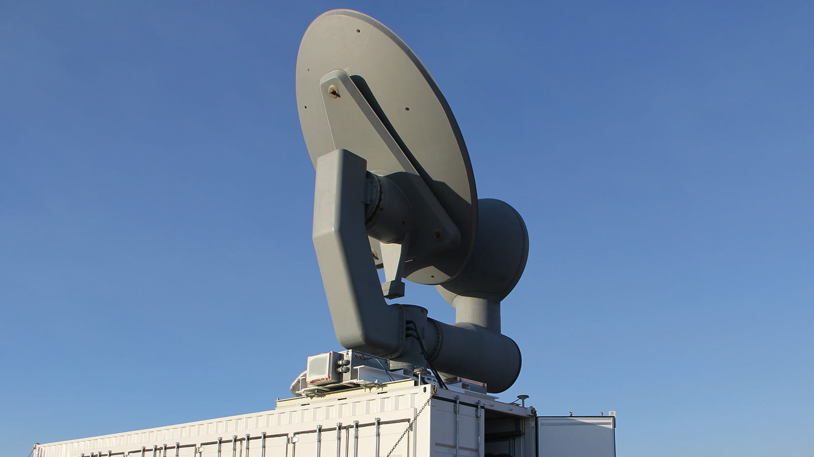
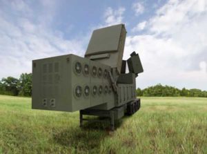
Ground antenna at Schriever Air Force Base, home of the 50th Space Wing. (Photo: Raytheon)
GPS ground stations that are contracted by Raytheon Technologies to replace the current ground stations are more than seven years behind schedule and lawmakers are not happy, reported Defense One. This delay has caused the U.S. Department of Defense (DOD) to go over its yearly budget and has sparked discussions as to future budget allocations for the U.S. Space Force (USSF) to continue to control and enhance the GPS constellation.
The USSF has been working to replace the current GPS ground stations with the GPS Next Generation Operational Control Segment (OCX) program since 2016. The operation was first delayed when the COVID-19 pandemic swept the world.
The additional delay was caused by efforts to replace IBM as the OCX hardware supplier after IBM sold its server product line to the Chinese company, Lenovo. The Pentagon believed the OCX program would be at a high risk for Chinese hacking after the sale to Lenovo, and in response, the contract with Raytheon was modified to replace the hardware with HP in 2020.
All of the delays have come at a cost, as the replacement of ground control stations has increased from $4 billion to $7 billion — a 73% increase over the original estimate — which was reported by a Government Accountability Office report in June.
Lawmakers wrote in the 2024 DOD appropriations bill, “[t]he fiscal year 2024 President’s budget request for the Space Force is $30,197,634,000, an increase of $3,907,806,000 or 15[%] over last year’s enacted level, continuing a trend of double digit growth over the past several years… [h]owever, despite these significant increases, the budget request continues to include serious shortfalls and disconnects.”
The USSF operates 32 GPS satellites, including six of the expected 10 next-generation GPS III satellites. However, some of the new satellites’ capabilities, including increased jamming resistance, can only be used once OCX comes online.
The lawmakers shared their displeasure with the OCX program delay, “[t]his is unacceptable and demands senior leader attention to ensure the program has the appropriate resources to complete OCX development and deliver the capability as soon as possible. The Committee remains concerned by other poor performing programs including Space Command and Control, Family of Advanced Beyond-line-of-site Terminals, Military GPS User Equipment Increment 1, and Enterprise Ground Services.”
Image: U.S. Department of Defense / Raytheon Technologies
Raytheon Technologies has delivered all 23 contracted Joint Precision Approach and Landing Systems (JPALS) low-rate production units to the U.S. Navy to ship to Japan. Raytheon announced the contract with the Navy back in February to provide JPALS to the Japan Maritime Self-Defense Force (JMSDF), which will be deployed on the JMSDF JS Izumo carrier in 2024.
JPALS is a software-based GPS navigation and precision approach landing system that guides aircraft onto carriers and amphibious assault ships regardless of sea state or weather conditions, bolstering safety and operational capability.
JPALS is deployed on all U.S. Navy aircraft carriers and amphibious assault ships, as well as all F-35 aircraft. In addition, JPALS are deployed on platforms from two countries: the UK Royal Navy’s HMS Queen Elizabeth, and the ITS Cavour, an Italian aircraft carrier, to support their F-35 squadrons.
Raytheon has also developed an expeditionary variant of JPALS called eJPALS, which is a smaller, portable system that could be packaged in ruggedized cases, mounted on small vehicles, and deployed in austere, remote locations for precision landings. The system could establish up to 50 different landing points within a 20-nautical-mile radius.
Raytheon Intelligence and Space has been awarded a contract from the United States Navy’s Naval Air Traffic Management Systems Program Office to deliver the Joint Precision Approach and Landing Systems (JPALS) to the Japan Maritime Self-Defense Force (JMSDF). The GPS navigation and precision landing system will be deployed on the JMSDF JS Izumo carrier.
The JPALS system guides aircraft onto carriers and assault ships in all weather and surface conditions and is integrated on all F-35 aircraft. JPALS is also being deployed on all U.S. Navy aircraft and assault ships.
In addition, JPALS will be deployed on two international platforms, including the United Kingdom Royal Navy’s HMS Queen Elizabeth, and an Italian aircraft carrier, the ITS Cavour, to support its F-35 squadron.
The primary work locations for JPALS are in Largo, Florida and Fullerton, California.
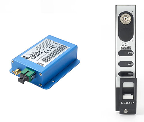
ViaLite GPS Link: Blue OEM module and rack chassis card hardware formats shown. (Photos: ViaLite)
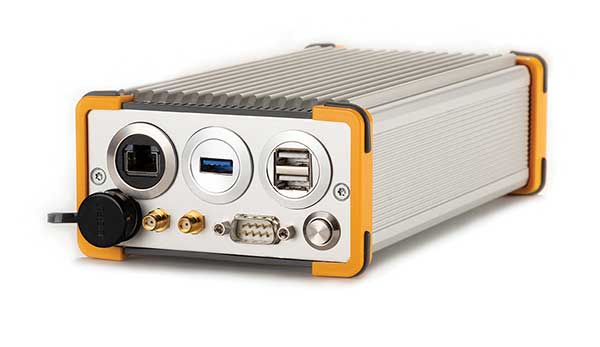
ViaLite is supplying Raytheon Technologies with its GPS over Fiber Extension Kit for Microchip GPS servers. The kit provides mission-critical GPS timing and synchronization for systems requiring extremely accurate clock signals.
Standard transmission distances for the extension kit can be up to 10 km, while solutions are available for distances as long as 50 km.
“The ViaLite kit was chosen for its unique performance with Microsemi’s S650 timing server, along with our best-in-class quality, reliability and support,” said Craig Somach, ViaLite director of Sales North America.
The ViaLite GPS link is designed to provide a remote GPS/GNSS signal or derived timing reference to equipment located where no signal is available, such as inside buildings or tunnels. By using optical fiber instead of traditional coaxial cable, extreme distances are possible with no radio frequency loss and zero introduction of noise.
integration with inertial measurement units (IMUs) and other sensors
positioning using cell phones and other consumer devices
any other areas or challenges they find particularly significant.
All four respondents in this issue, like to those in the January issue, report that they are making full use of the new GNSS signals available, taking hardware and software measures to counter jamming and spoofing, and integrating IMUs and other sensors with their GNSS receivers to help achieve continuous navigation and positioning in obstructed environments. In addition, they are continuing to develop mass-market applications, because high-precision positioning is becoming increasingly important for cellphones and wearable devices. For a fuller review of these trends, see my introduction to the first installment.
Notably, two of the companies featured in this issue, ComNav Technology and Unicore, are Chinese.
With Chad Pillsbury, Senior Director, Raytheon Intelligence & Space’s Resilient Navigation and Reconnaissance Solutions
Utilizing Galileo and BeiDou
Integration and fusion of multiple space position services is a key element in achieving assured positioning, navigation and timing (PNT). A combination of commercial and military-code navigation signals, when coupled with evolving sensors, provide more resilient methods of navigation and enable new concepts of operations related to PNT. Over the next two years, RI&S will customize these concepts of operation (CONOPS) for our United States and international allies to harness the power of fusion in resilience.
Dealing with jamming and spoofing
As threats to GPS continue to evolve and mature, RI&S continues to develop alternative navigation solutions, as well as GPS-capable receivers and antennas, aimed at defending against a variety of spoofing and jamming technologies. Our latest anti-jam, anti-spoof and high-precision solutions leverage a recent technology breakthrough that lowers size, weight, power and cost while boosting performance in the new M-code and alternative navigation applications.
Integration with IMUs and other sensors
IMUs are the cornerstone of high-performance navigation systems and will continue to be in the future. Recent innovations allow some systems to become more IMU agnostic, or even to consider microelectromechanical systems (MEMS) IMUs depending on performance, which can allow the customer greater flexibility and a more open architecture.
Positioning with consumer devices
RI&S sees 5G as a game-changing technology, with a lot of possibilities in the assured navigation market. We also look to cellphones as a great area of interest — especially for exploring unforeseen signals, considering human international models, and learning how the next generation of GPS users expect to see PNT information displayed.
Other significant challenges and opportunities
The future of GPS lies in a system-of-systems approach. Using time as a backbone, navigation systems can securely share time, data, position and intent across the network. Broadly, this approach can be used in civil, commercial and military environments. RI&S is fully focused on developing capabilities to achieve this ideal state.
Unicore Communications
With Gao Jingbo, Marketing Director
Utilizing Galileo and BeiDou
Most of Unicore’s high-precision products support all constellations and multiple frequencies. The new BeiDou 3 provides precise point positioning (PPP) service from three geostationary satellites via the B2b frequency, while Galileo offers up to five frequencies — E1, E5a, E5b, E5 AltBOC and E6. End users will benefit from improved PNT availability, reliability and continuity as access to those signals greatly reduces multipath effects and allows faster PPP convergence times.
Dealing with jamming and spoofing
To effectively deal with signal jamming and spoofing, it is important to know their sources. GNSS receivers also are susceptible to electronic interference and vulnerable to complex electromagnetic environments. Unicore integrates GNSS RF, baseband and algorithms into a single GNSS system-on-chip (SoC) that mitigates external interference. Joint time-frequency domain interference mitigation technology also is adopted in chip design.
Photo: Unicore Communications
Integration with IMUs and other sensors
Demand for seamless, accurate indoor-outdoor location is increasing. The integration of GNSS with IMUs, lidar, cameras and other sensors helps achieve continuous navigation and positioning in obstructed environments such as urban canyons and tunnels. Unicore offers receivers integrated with both high-end IMUs and affordable MEMS-based devices. Dual-frequency GNSS plus MEMS provides an ideal positioning solution for automotive applications.
Positioning with consumer devices
High-precision positioning is becoming increasingly important for cellphones and wearable devices, and multi-scenario adaptation is necessary. Instead of integrating standalone GNSS chips with smartphone processors, cellphone manufacturers prefer to cooperate with GNSS manufacturers through GNSS intellectual property (IP) licensing. To ensure high-precision service, better cellphone antennas are also important.
Other significant challenges and opportunities
We strive to deliver reliable, timely and smart positioning for anything, anywhere, anytime. Next-generation GNSS location products and services should be more end-user-friendly. The hardware interface will be more universal, flexible, configurable and adaptable with different algorithms for a diverse range of applications.
Teleorbit
With Daniel Seybold, CEO
Utilizing Galileo and BeiDou
Our GOOSE receiver has been able to use Galileo since its beginning and BeiDou since the forth quarter of 2020. Signals from both can be used individually or with other signals (GPS, Galileo, GLONASS and BeiDou, plus SBAS).
Dealing with jamming and spoofing
Open Service Navigation Message Authentication (OSNMA) is now implemented on the GOOSE, which helps mitigate spoofing attacks. GOOSE’s recording function enables users to record simulated jamming/spoofing attacks, and then analyze the behavior of the GOOSE and the received signals. We are developing various GNSS antenna arrays for nulling and beamforming, as well as a left- and right-hand circular polarized (LHCP/RHCP) antenna with GOOSE adaption for signal processing.
Signal conditioning on the GOOSE platform is based on a high-rate discrete Fourier transform (DFT)-based data manipulator algorithm, known as an HDDM algorithm, that fulfills multiple roles. The HDDM algorithm removes a wide range of interference signals, equalizes the spectrum, or restructures the spectrum.
Image: Teleorbit
Integration with IMUs and other sensors
We offer a GNSS antenna with an integrated IMU. Thanks to its open software interface, fusing IMU or other sensor data with GNSS data is easily done with GOOSE. Vector tracking, deep coupling and other sensor fusions (for example, 5G) are on the GOOSE roadmap.
Positioning with consumer devices
Our ongoing AMELIE project will study advanced techniques for the miniaturization and radiation enhancement of GNSS mass-market antennas to be applied in the design, manufacturing and testing of a multi-frequency, low-cost, high-gain dual circularly polarized antenna for the next generation of consumer devices. In 2021, we will build the following antenna demonstrators: single-frequency (L1/E1), dual-frequency (L1/G1/E1, L5/E5a/E5b) and multi-frequency (L1/G1/E1, L5/E5a/E5b, L2, E6).
Other significant challenges and opportunities
GOOSE can track the Galileo E5AltBOC (wideband) signal, which provides code-range variances below a few decimeters. This offers a significant increase in the accuracy of code measurements in terms of reduced noise and mitigation of multipath effects, compared to conventional signals. GOOSE will provide two different approaches for robust tracking: vector tracking for dealing with challenging environments where multipath occurs or buildings block signals, and adaptive tracking to allow the receiver to acclimate to its surroundings by adapting the bandwidth in the loop depending on movement, such as high dynamics.
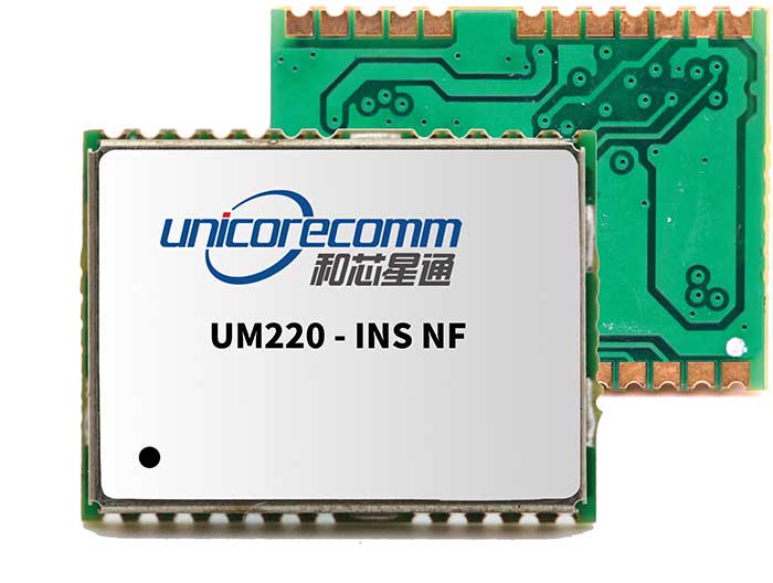
ComNav Technology
With Min Xu, Director of GNSS Technology R&D Department
Utilizing Galileo and BeiDou
We keep up with the development of GNSS. Our new K8 series of high-precision GNSS modules support the recently completed BDS-3 and Galileo constellations concurrently, significantly improving positioning accuracy especially when signals are partially obstructed. Despite their complex design, the size of K8 modules decreased by almost 36% from their precursors and power consumption dropped to 1.0W, making them easier to integrate.
Dealing with jamming and spoofing
We have developed algorithms to eliminate specific forms of jamming and spoofing, with a focus on narrowband interference. The newly released Quantum III SoC chip — integrated with wideband signal-receiving technology, wideband and narrowband anti-interference technology, and anti-continuous wave interference technology — can provide high-quality observation information in a complex electromagnetic environment.
Photo: ComNav Technology
Integration with IMUs and other sensors
There is an increasing need to add IMUs to supplement obstructed GNSS signals. Empowered by a high-precision IMU, our N5 receiver supports tilt survey with accuracy of less than 2.5 cm. Users can survey without a centering bubble as its calibration-free tilt compensation protects it from magnetic disturbances. We are also focusing on image sensors, such as cameras and radars, to make data collection more flexible and reliable.
Positioning with consumer devices
Our high-precision products are mainly used in professional fields such as land surveying, deformation monitoring, and UAVs. We are continuing to explore GNSS products for consumer markets, which are sensitive to power consumption and cost. The upcoming M10 GNSS is a compact and portable receiver for mass-market applications, such as person or vehicle tracking and fleet management.
Other significant challenges and opportunities
GNSS technology can be widely applied in agriculture, transportation and infrastructure construction. We developed the AG360/AG360 Pro Agricultural Automatic Driving system, which drives autonomously without damaging crops. We collaborated with China Mobile to build more than 2,000 CORS stations to provide high-precision positioning services in support of smart-city construction, IoT and location-based services.
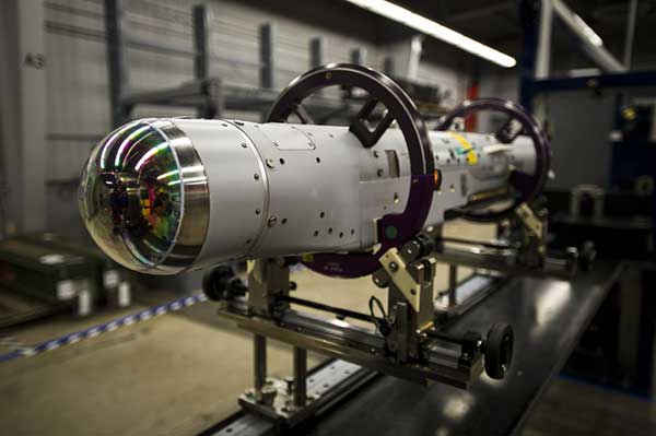
Raytheon Missiles & Defense, a Raytheon Technologies business, completed the first guided release of a StormBreaker smart weapon from an F/A-18E/F Super Hornet, which will become the second fighter jet to add the weapon when the program reaches initial operational capability later this year.
StormBreaker features a try-mode seeker that uses imaging infrared and millimeter wave radar in its normal mode. It can also deploy its semi-active laser or GPS guidance to hit targets.
During the U.S. Navy flight test, StormBreaker safely separated from the jet and successfully received guidance data from the plane, enabling it to be directed to its target while in flight, the company said.
“StormBreaker is the only weapon that enables pilots to hit moving targets during bad weather or if dust and smoke are in the area,” said Cristy Stagg, StormBreaker program director. “Super Hornet pilots will be able to use poor visibility to their advantage when StormBreaker integration is complete.”
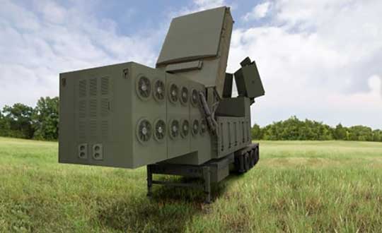
Orolia, through its Orolia Government Systems business, has been selected by Raytheon Missiles & Defense to support the U.S. Lower Tier Air and Missile Defense Sensor (LTAMDS) radar program with its low SWaP (size, weight and power), rugged time and frequency system.
Defeating hypersonic weapons
An artist’s rendering of the Lower Tier Air and Missile Defense Sensor (LTAMDS), a next-generation radar meant to help defeat advanced threats like hypersonic weapons. (Image: Raytheon/Orolia)
The LTAMDS system — an advanced air and missile defense radar — will help the U.S. Army defeat advanced threats, including hypersonic weapons. It is a radar designed to defeat advanced and next-generation threats including hypersonic weapons, or those that fly faster than a mile a second.
LTAMDS has three antenna arrays — a primary array on the front, and two secondary arrays on the back. They work together, detecting and engaging multiple threats from any direction at the same time. This results in a battlefield without blind spots, according to Raytheon.
LTAMDS’ primary array is about the same size as the array for the Patriot Air and Missile Defense System, but it has more than twice the power. It is designed for the U.S. Army’s Integrated Air and Missile Defense system, but it will also preserve existing military customers’ investment in the Patriot system.
Raytheon Missiles & Defense was selected by the United States Army in October 2019 to provide the next-generation LTAMDS.
Timing from Orolia
Orolia was chosen for the LTAMDS program based on its core expertise in resilient timing and configurable ruggedized PNT systems for challenging environments, together with its proven track record of successfully delivering time and frequency platforms for other Raytheon Programs of Record.
Orolia was the first company to receive approval for a time and frequency reference system on the Defense Information Systems Agency (DISA) Department of Defense Information Network (DoDIN) Approved Products List for network interoperability, with its flagship SecureSync system.
“Ultra-precise mission timing and sync technology are fundamental building blocks for the Resilient PNT systems that warfighters rely on for continuous operations in contested environments,” said Hironori Sasaki, president of Orolia Defense & Security. “We are proud to be a Raytheon Missiles & Defense partner on LTAMDS and other programs that utilize GPS signals for timing, frequency and network synchronization across critical military systems.”
From critical timing solutions to GPS/GNSS simulation, interference detection, and mitigation, Orolia is an industry leader in end-to-end NAVWAR and Resilient PNT solutions to protect, augment and strengthen military systems for GPS-denied environments.
Orolia Defense & Security provides resilient PNT solutions and custom engineering services to U.S. government agencies, defense organizations, and their contractors, and is authorized to work on the full spectrum of U.S. government classified and unclassified projects.
In 2019, the U.S. Air Force certified the security architecture of Raytheon Intelligence & Space’s M-code modules and receivers as providers of secure and reliable access to modernized GPS. The resilient receivers are designed for high anti-jam performance.
Raytheon’s M-code application-specific integrated circuit (ASIC) chip is either integrated into a ground-based receiver card optimized for low dynamic applications, or used as an avionics/naval receiver card to support multiple end users.
“Our focus is on taking a comprehensive approach to resilient navigation,” explained Chad Pillsbury, director for Raytheon’s Secure Sensor Solutions. “We provide the complete family of PNT solutions. We start with the fundamental components, like the ASIC chip, and tailor our solution for the platform and mission requirements.”
Open Architecture. Raytheon successfully completed testing of the first M-code receiver onboard the U.S. Air Force’s B-2 bomber in 2017. “Since then, we’ve undergone a number of tests internally and with third-parties. Our M-code receivers have standard interfaces and open architecture protocols, enabling them to work with both U.S. and allied systems. By pairing our M-code receiver with our anti-jam electronics and antenna, our systems enable warfighters to combat the most advanced threats seen in the world today,” Pilsbury said.
The receiver is planned to be incorporated into many fighters, bombers and weapons systems across the U.S. Department of Defense. “We provide enhanced anti-jam, anti-spoof GPS capabilities, as well as alternate navigation and multi-constellation support that represent a significant improvement over the systems currently used by today’s warfighters,” Pillsbury said.
Meeting Advancing Threats. “The hardest part is meeting a changing threat target,” Pillsbury explained. “The fact is the threat is advancing at a rapid rate. Because of that, challenges are constantly evolving.
“That means we had to design solutions that were simultaneously robust and secure, but also flexible and open so we can continually upgrade them. That’s not an easy thing to do.
“But, by taking a comprehensive approach that looked at the whole problem rather than just part of it, we’ve developed systems that address these challenges and have the flexibility to address future challenges.”
Raytheon’s M-code products are now available to the U.S. military and its allies in accordance with International Traffic in Arms Regulations and the U.S. State Department.