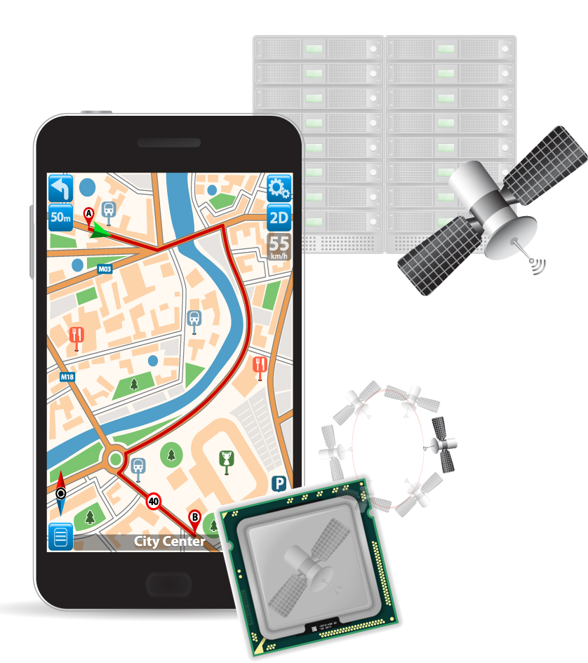
Rx Networks Inc., a mobile location technology and services company, has announced an update of its location.io platform to provide GNSS assistance data to enable better positioning in internet of things (IoT) devices.
The company has updated its location.io HTTP interface to provide real-time GNSS ephemeris data with a reduced payload, a smaller predicted GNSS ephemeris client while maintaining full featured accuracy.
Rx Networks is demonstrating location.io at its booth at ION GNSS+, being held this week in Miami.
The location.io HTTP interface is now leaner and requires fewer requests and less data. In providing an interface for IoT devices, specifically, Rx Networks extends the delivery of their reliable and accurate assistance data to new and emerging use cases.
“Rx Networks is a proactive company endeavoring to provide excellent solutions and services for our customers,” said John Carley, director of sales and product strategy at Rx Networks. “By adding another use-case focused interface, we are able help customers create top-quality solutions targeted for their customer needs. By adding another interface designed for specific use cases, we help our customers create top-quality solutions targeted for their customer needs. Especially in the areas of smaller processors, longer product life time and lower battery consumption.”
location.io includes technologies already used by more than 1 billion smartphones, laptops and wearables worldwide. Specific components are:
Real-time GNSS assistance. The real-time assistance service is designed to work with all popular location servers such as Ericsson, TCS, ZTE, and Qualcomm. Rx Networks also offers RINEX files and a generic HTTP interface for independent access to the assistance data. It supports over five constellations, including GPS, GLONASS, Beidou, Galileo, QZSS and SBAS. RT-GNSS assistance can now be filtered by location or Cell ID to provide only Satellites in View.
Predicted GNSS assistance. The predicted service provide seed data that enable client devices such as smartphones, laptops, and wearables, to generate up to 14 days of extended ephemeris for fast and sensitive GNSS fixes. Predicted GNSS assistance support GPS, GLONASS, BeiDou and Galileo, and has been updated to have a smaller footprint, use less resources and support OSs and RTOSs.
All location.io services are delivered from Rx Networks’ geo-redundant and cloud-based service delivery network, via a lean API ensuring a 99.999 percent service level availability.
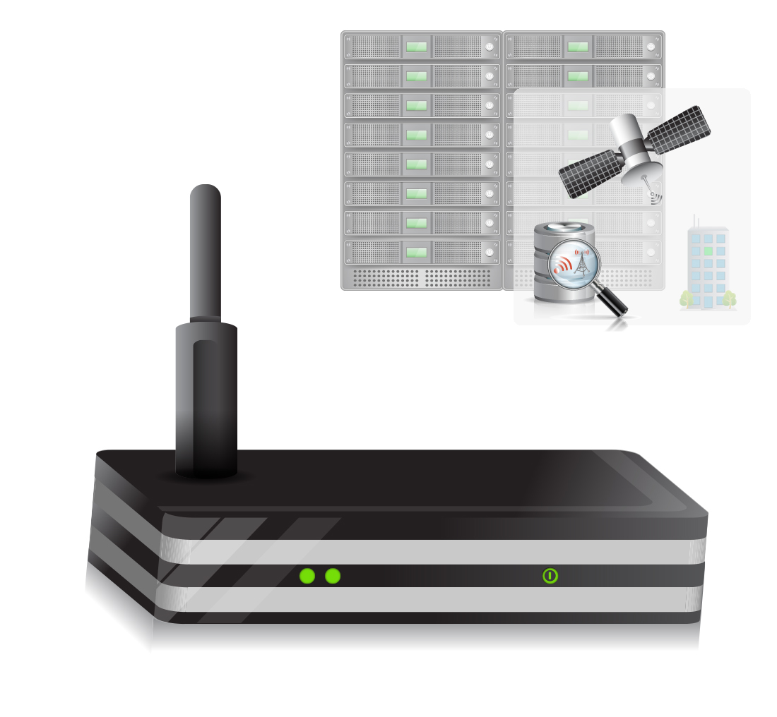
NTRIP Data. Rx Networks has also added NTRIP-formatted data services to location.io. Customers can now choose from a variety of data formats, including Rx Networks proprietary format, NTRIP, LPP, RRLP, proprietary real-time, IoT-optimized and a few custom formats.
Observation data from our multiband multi-constellation global reference network is now available in NTRIP format, and customers are already on board.
High availability is assured with geographically redundant secure NTRIP casters, the company said. The innovative High Accuracy Assistance Service (HAAS) product will also be available in RTCM format via NTRIP casters.
With the addition of RTCM formatted data via an NTRIP data feed, Rx Networks continues to expand its constellation support with the largest variety of terrestrial delivery mechanisms. The solution architecture includes an NTRIP server, caster and client, providing a complete solution.
“Our customers love the reliability and plug-and-play convenience of our NTRIP service,” said Brian Marciniak, head of business development at Rx Networks. “With Rx Networks’ expanded reference network, secure NTRIP observations and real-time data, we are enabling our customers to expand their businesses in exciting new ways.”
location.io includes technologies already in use by more than 1 billion smartphones, laptops and wearables worldwide.
All location.io services are delivered from Rx Networks’ geo-redundant and cloud based service delivery network.
Rx Networks Inc., a mobile location technology and services company, announced the upcoming release of its GPStream PGPS v8 extended ephemeris solution at Mobile World Congress 2015, taking place this week in Barcelona, Spain.
The patented technology, being used in hundreds of millions of devices, is designed to speed up the time-to-first-fix (TTFF) of any GNSS chipset while improving acquisition sensitivity in challenging environments.
Compared to the previous version, GPStream PGPS v8 effectively doubles accuracy performance while supporting all four global GNSS constellations. GPStream PGPS v8 will be available for integration testing in the second quarter of 2015, with commercial release in the fourth quarter of 2015. (Full commercial support for Galileo will remain subject to the readiness of the constellation).
All major GNSS semiconductor vendors are now offering or developing multi-constellation support to improve availability in challenging environments. Quad-constellation support also enables OEMs and GNSS chipset manufacturers to meet any national or regional market requirement. Availability of extended ephemeris across the four constellations is required to ensure fast TTFF and optimal sensitivity. Early lab access to the latest GPStream PGPS v8 solution from Rx Networks can help chipset manufacturers validate performance early in the development cycle and thus accelerate the time to market for their new multi-constellation chipsets.
A key component of any extended ephemeris solution is the accuracy of the orbit and clock predictions. This accuracy is often presented as an error in meters compared to the native broadcast ephemeris transmitted by the satellites. The latest version of GPStream PGPS improves this accuracy by a factor of two, compared to its previous release. For example, day 1, 7 and 14 accuracies for GPS are now 2.8 m, 4.5 m and 11.4 m compared to 6.3 m, 12.5 m and 30.2 m previously. BeiDou and Galileo will experience similar performance. GLONASS is also significantly improved, with day 1, 7 and 14 accuracies of 1.8 m, 6.5 m and 13.7 m compared to 7.3 m, 13.4 m and 27.2 m previously.
“Rx Networks continues to expand its relationships with major OEMs and GNSS chipset manufacturers to help them deliver innovative, multi-constellation and highly accurate GNSS performance,” said John Carley, senior product manager at Rx Networks. “This latest release reaffirms our commitment to provide best in class Assisted-GNSS solutions for the mobile market.”
Rx Networks is exhibiting in Booth 5H75 at Mobile World Congress.
In the time since my first article on indoor location, I’ve learned that there is a whole lot to this indoor location technology and business. A number of companies are taking on the indoor challenge, but few have so far successfully cracked this nut.
Rx Networks in Vancouver, Canada, is one of those few who have not only found solutions that work and work reliably, but it has also found a way to commercialize their solutions and make money.
Its embedded software and services are used daily in more than 1 billion devices — mostly smartphones, some machine-to-machine (M2M) installations, tablets, laptops, and wearables. That is some claim!
Daily transactions are primarily requests for A-GNSS assistance data, but also include requests for location based on Wi-Fi and Cell-IDs. Devices are using various Rx software and/or services, which include any or all data from a four-constellation reference network (GPStream GRN), extended ephemeris (GPStream PGPS), and Wi-Fi/Cell-ID positioning (XYBRID RT).
Founded in 2006, and still privately held, Rx is currently profitable. The head office is in Vancouver, and the company has a remote office in Atlanta, Georgia. Rx Network provides GNSS assistance-data to nearly all North American mobile operators and to several international carriers, helping those customers comply with current E-911 requirements and also offer other location-based services (LBS). In anticipation of a potential FCC “indoor” E-911 mandate, Rx’s offerings have been expanded to provide the location of devices where GNSS is not available. Its patented IP is also licensed through major GNSS semiconductor vendors and, in several cases, directly to the smartphone manufacturers.
Rx’s global reference network (GPStream GRN) is the foundation of many Rx solutions, including real-time assistance data and predictions. The service supports GPS and GLONASS, and will soon incorporate BeiDou and Galileo — the data is used by mobile operators and service providers and as an input to other products like XYBRID Cloud, where assistance data is supplied to a cloud-based positioning engine. And GPStream PGPS supplies data from the reference network to create seed files that generate extended ephemeris on smartphones.
The Rx worldwide network of GNSS reference stations. Photo: Rx Networks
There may be growing concerns about the status of the nascent Galileo constellation, but back in May, there was good signal coverage at times in Vancouver, Naples, and Prague. This enabled Rx to conduct testing on behalf of the European GNSS Agency (GSA) in challenging signal environments. The tests confirmed that Galileo significantly improved the accuracy of location-based services in urban canyons and indoors. Galileo signals were incorporated in the positioning solution with various combinations of GPS and GLONASS.
A new product known as XYBRID Cloud — a “cloud-based software receiver” — is going to trial shortly with a major U.S. carrier interested in using Rx’s indoor GNSS capability to locate small cells, home phone units, and other assets that carriers have to manage. The latest release of Cloud is providing an acquisition sensitivity of –166 dBm, which is claimed to be the best in the industry.
The XYBRID Cloud system. Photo: Rx Networks
XYBRID Cloud captures I & Q data transmitted by satellites and sends it to a cloud-based positioning engine to determine location. This is in contrast to sending it to a receiver engine on a chip within the device. This is automatic, but is not really done for a “user” as much as for an asset such as a Wi-Fi access point, small cell, or other device that someone wants to locate.
Because these devices are often deep indoors, they may only see a few milliseconds of GNSS signals every now and then, so a real-time GNSS chip receiver would never get a fix. However, XYBRID Cloud assembles the captured data over time and is eventually able to record the location of the asset. This may take a few minutes or a few days, but a fix comes together eventually. Given that these assets are normally in fixed locations and seldom if ever move, such delays are not an issue, but knowing their location or if they’ve been moved can be quite valuable.
XYBRID RT/Synchro. Photo: Rx Networks
Another Rx product, XYBRID RT/Synchro,provides Wi-Fi and Cell-ID indoor and outdoor positioning using observed Wi-Fi and -tower signals, both with and without an active network connection. The systems works in real time (RT), and Synchro uses local datasets (regions) for Wi-Fi and other radio beacons that are downloaded into the user device whenever their signal is detected. Each “region” can be tailored to best suit a user’s general location, such as a metro area, city or other venue. The system is capable of a fast GNSS fix with improved sensitivity, or can fall back to basic Cell-ID/Wi-Fi positioning. Location is available indoors with an accuracy of 5-10 meters, depending on the quality of the regional datasets.
Zed provides floor-level detection based on barometric pressure data. Photo: Rx Networks
Zed is able to provide floor-level detection based on barometric pressure data to within a vertical accuracy of 1-3 meters. Zed combines a global pressure reference with crowd-sourced data for fine-grained performance. This improves Wi-Fi location accuracy and supports Wi-Fi crowd sourcing with altitude geo-tagging.
So, Rx indoor solutions can use various combinations of these three products depending on the capabilities of the user devices. XYBRID RT provides location indoors using Cell-IDs, but more often uses Wi-Fi for more accurate positioning. XYBRID Cloud provides location of assets by sending any observed satellite signals to Rx servers for processing. Zed provides a calibration and ground-level reference pressure for a device, typically a smartphone equipped with a barometric sensor. Applications include location determination for smartphones, tablets, and wearables, and XYBRID Cloud finds assets like access points, small cells, Bluetooth beacon gateways, and home phone systems. Three companies are currently using Rx technology in the wearables space — a sports watch, augmented reality glasses, and heads-up display cycling glasses.
Other services supplied by Rx include worldwide Assisted GNSS (A-GNSS):
GPStream GRN – Relies on data collected from the Rx worldwide grid of reference receivers for GPS, GLONASS, BeiDou and Galileo. Data is compatible with all popular positioning servers from leading vendors such as Ericsson, NEC, NSN, Qualcomm, and TCS.
GPStream PGPS – Predicted GPS is an efficient handset-based extended ephemeris A-GNSS solution which supports GPS and GLONASS, for both connected and autonomous operation. Galileo is slated to be demonstrated at the Naviteq conference in December and to be available in 2015 along with BeiDou.Each device equipped with the PGPS client accesses Rx servers at least once every 14 days and downloads a small seed file that is used to create extended ephemeris for each constellation for the following 14 days.
The GPStream PGPS software. Photo: Rx Networks
Rx claims that its A-GNSS services have “carrier-level reliability” — that is to say, 99.999% availability per year.
Rx semi-conductor customers use an IP package that is embedded in processor chips for cell phones. They typically go on to supply Rx software (GPStream PGPS) with their GNSS chips, which is then run on a phone’s host processor — designed in at the factory as part of the phone.
OEM customers buy Rx GPStream PGPS software either directly or from the GNSS chip manufacturer and design it into the smartphone at the factory.
Mobile operators and service providers buy A-GNSS data that is delivered to mobile phones using location-based services for 911 caller location and LBS. Rx also supplies these customers with data containing the locations of Cell-IDs and Wi-Fi access points.
It’s good to hear that someone is already making a living with indoor location. And with so many signals of opportunity, inertial and pressure sensors now being used to “help” or actually completely replace GNSS, the era of indoor testing seems to be giving way to everyday consumer use. The average consumer will likely not realize when they seamlessly transition from outdoors GNSS guidance to “indoor” signals driving their smartphone map inside the mall. Or how really difficult it is for GNSS guidance to work in downtown when they automatically get A-GNSS assistance data that keeps their car map guidance on the correct street. Good for consumers, good for the telecoms guys, and good for the GNSS industry.
Rx Networks, Inc., has licensed its GPStream PGPS GNSS assistance technology to Recon Instruments, a Canadian technology company that brings heads-up display products to the consumer market. GPStream PGPS will tightly integrate with the GPS chip inside of Recon’s upcoming Jet smart glasses, an advanced wearable computer planned for the first quarter of 2015.
Through its location and GNSS assistance software and services, Rx Networks empowers fast positioning in more than a billion mobile devices every day, the company said. Its GPStream PGPS solution, licensed and deployed in more than 100 million smartphones and personal navigation devices, accurately predicts the future orbits of satellites for up to two weeks in advance. It then stands by, ready to deliver this assistance data into a GNSS chipset when it powers up. This not only speeds up initial time to first fix (TTFF) from 45 seconds down to less than 3 seconds, it also improves the receiver sensitivity and reduces power consumption. From a user perspective, this translates into longer battery life and faster initialization of apps that depend on location, even in difficult environments.
According to IDC, the wearable devices market is expected to grow from 19.2M units in 2014 to 111.9M units in 2018. Most form factors today rely on the presence of a smartphone as a hub for core functions like Internet access or location. “We are seeing an exciting new trend in the mobile location market,” said Guylain Roy-MacHabée, CEO of Rx Networks Inc. “From smartwatches to smart glasses, we are helping OEMs optimally implement satellite navigation and other means of positioning directly in this new class of smart wearables devices.”
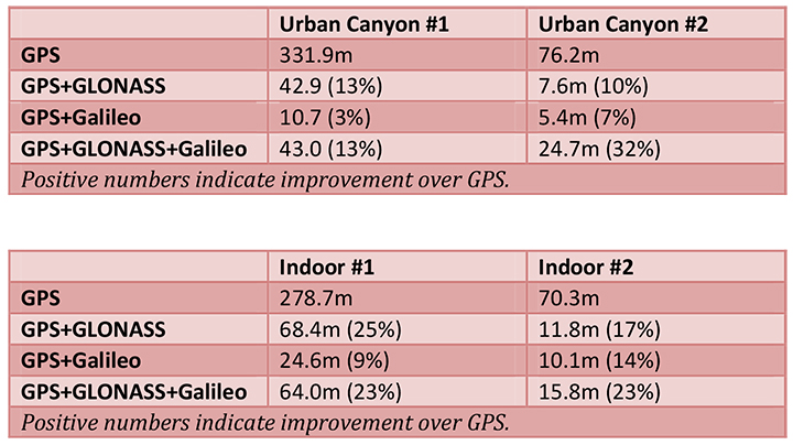
The European GNSS Agency (GSA) and Rx Networks Inc., a mobile location technology and services company, announced the results of tests conducted by the company measuring the performance of Galileo when used in various combinations with GPS and GLONASS.
Tests were conducted in real-world environments, including urban canyons and indoors. These environments pose significant challenges to location accuracy due to multipath and obstructed views of satellites. Each test consisted of a three-hour data capture of GNSS signals, which was later replayed to produce hundreds of fixes using a multi-constellation GNSS receiver from STMicroelectronics.
The results showed that using Galileo with one or more other GNSS constellations provides significantly more accurate location fixes compared to GPS alone, when indoors or in urban canyons. As expected, the GPS+Galileo combination did not exceed the performance of GPS+GLONASS, due primarily to there only being four Galileo satellites available at the time of the testing. It is expected that, as more Galileo satellites are launched, the combination of Galileo with GPS will show further improvements in performance, GSA and RX Networks said.
According to Gian-Gherado Calini, head of Market Development at the GSA, “Dual-constellation GNSS designs are the standard for many smartphones and other devices. The combination of GPS and Galileo provides a robust solution and is expected to offer performance that will meet or exceed end-user expectations.”
“The results should be encouraging to any GNSS chipset manufacturer who is considering adding Galileo as a competitive differentiator,” said Adrian Stimpson, senior vice president of Sales and Marketing, Rx Networks.
Test Results
Recent test results confirm that Galileo significantly improves accuracy in challenging environments:
The tables above show the summary results for various scenarios and constellation combinations. The GPS row shows the absolute 2D errors in meters. All other rows show the improvement (+) or degradation (-) in meters and percentages relative to GPS-only fixes. All measurements are within the 95th percentile.
Rx Networks, Inc., a mobile location technology and services company, has completed the upgrade of its GPStream Global Reference Network (GRN) to include the BeiDou constellation. A top-tier GNSS semiconductor vendor has already incorporated this new feature so its platform can take advantage of the extra satellites now available in the BeiDou constellation, the company said.
Global real-time assistance and high-accuracy long-term orbit and clock prediction products are now uniformly available across the GPS, GLONASS and BeiDou constellations. In the second quarter of 2014, BeiDou support will also extend to GPStream PGPS — Rx Networks’ popular synthetic A-GNSS software that has been deployed in more than 100 million smartphones and personal navigation devices worldwide.
In commercial service since 2006, the GPStream GRN is a collection of 26 highly reliable earth stations deployed in 21 countries. It forms the foundation underneath many of Rx Networks’ products, on which nearly a billion devices rely for their GNSS performance. The network is highly redundant and, combined with a carrier-grade service delivery network, is provided with a 99.999 percent service-level availability (SLA). A further upgrade, to support the European-run Galileo constellation, will be available later this year.
From network operators’ commercial and E911 location servers to GNSS chipset vendors and device OEMs, the addition of BeiDou means faster and higher availability GNSS location fixes.
“The addition of BeiDou to our existing GPStream GRN service meant a complete overhaul of our reference network and service delivery architecture while maintaining the 99.999 percent SLA we’re well known for,” commented Guylain Roy-MacHabee, CEO of Rx Networks. “As multi-GNSS chipsets come to market, there is commensurate requirement for a uniform, reliable and device-independent assistance data service like our GPStream GRN.”
This year, ION GNSS+ was once again in Nashville, Tennessee — with around 1,050 attendees and 63 exhibitors, show attendance was down from last year, maybe because of a reduced military presence and more constrained government budgets. But the conference was a good one. The CGSIC (Civil GPS Service Interface Committee) ran just before the ION conference, and provided an opportunity for better visibility of the ins and outs of the GPS program and enabled a degree of U.S. military-commercial exchange.
On Tuesday, CGSIC gave us an overview of the Navigation & Timing exhibit at the National Aerospace Museum in Washington, D.C., an insight into news of the evolving U.S. government’s PNT policy, State Department international activities (including estimates of GPS contributing $68-122 billion and 3.3 million jobs to the U.S. economy), a Homeland Security update on interference detection and enforcement, and of course the regular GPS Directorate program updates from the Air Force. Then we had subcommittee reports from various sectors, including timing, survey, and from the Federal Aviation Administration (Distance Measuring Equipment, or DME, is apparently the FAA’s chosen back-up for GPS in the National Airspace System). Finally, the GPS Directorate chief engineer provided an overview of GPS R&D activities and an opportunity for civilian attendee feedback and input.
The lone commercial presenter — Eric Gakstatter, a fellow contributor to GPS World — proposed that the Air Force make “PRED” (predicted ephemeris, regularly produced by the Air Force GPS system, but not available to commercial users) be unclassified and released for civilian use.
Both Broadcom and Rx Networks commented that they provide predicted ephemeris to their users, and post conference I let Eric know that Baseband Technologies has a software product providing predicted ephemeris which is good for 28 days without any intermediate updates. The Air Force said it would think about releasing PRED, but there seemed to be significant issues to doing that.
The ION GNSS+ conference got going on the Wednesday morning, with a whole slew of technical papers, panel sessions, and the opening of the exhibition floor. The papers tend to be quite technical and sometimes quite academic — for example, “Approaches to Obtaining Beidou Hazardous Bias with Ordered Weighted Aggregation Operators” — but these quite detailed presentations is what a subset of ION GNSS+ attendees come for, and they want to hear the results of the very latest research. One “technical session” allowed manufacturers to provide announcements and summaries of their new products and systems — a welcome opportunity for commercial and technical attendees alike. ION has also instituted panel sessions, which deal with more global subjects — for example, Program Updates or High Integrity Systems (such as WAAS), which tend to draw equal attention from a good number of attendees.
The ION GNSS+ 2013 show floor.
The show floor always seems to be the highlight of the conference, however, and its often packed at times when papers or panels are not running. With around 63 exhibitors this year, it seemed a little smaller than last year, but there were also a number of new companies with booths.
Panel Sessions
Panel sessions I sat in on included Program Updates, some of New Products, and High Integrity Systems. Program updates were provided by GPS, GLONASS, Galileo, Beidou, and QZSS:
GPS URE (pseudorange inaccuracy due to ephemeris and clock errors) is running around 80 cm and was 47 cm at one time recently, versus a “promise” of 4 meters for civil users. The average age of the older IIA satellites (SVs) is currently running around 2-2.5 time design life, and as the newer generation of satellites (SVs) comes on line, URE is expected to continue to drop.
GLONASS is performing up to expectations and is relatively stable, despite the odd jump in URE which is apparently due mostly to ground control issues. The loss of three SVs in the July Proton launch failure was a setback, but with several SVs built and in storage, Russia anticipates resuming the replenishment schedule soon. They will get to orbit mostly using Soyuz launchers, and a few Protons. There is a commitment to launch new SVs with CDMA (time division format, as per all other GNSS) on L3, while maintaining existing FDMA (unique GLONASS frequency format) signals and, indeed, one GEO SV is apparently already on orbit transmitting an L3 CDMA test signal. GLONASS has the objective of achieving 60 cm URE by 2020.
Galileo is moving along with four SVs on orbit and initial fixes achieved with both commercial and government PRS signals; 22 FOC (production) SVs are now ordered, and 16 ground reference stations and five uplink stations stations are up and running. Significant effort is anticipated on the next phases of Galileo and EGNOS, and a €6 billion budget for this work has been approved.
Beidou apparently has 14 operational SVs right now, which is adequate for regional coverage of China, but work is intended to continue towards a global constellation of five GEOs and 30 non-GEO SVs. Work is also shortly intended on a Wide Area Differential Service, chipsets are already available for receivers, and site surveys are planned for offshore reference stations. A five-year plan has been approved, and the next launch is possibly in 2014 for testing of the global (MEO) constellation.
Michibiki cartoon.
QZSS has successfully proven the concepts of operation with the first Michibiki satellite, and Japan has ordered the remaining three SVs for the constellation. The ground network contact was also let in March 2012.The intention is to achieve sub-meter service on L1 C/A, and the CLAS augmentation system is targeted to provide a ~10 cm service.
The New Products panel had way too much academic and agency content for me and virtually no commercial new products content, so quite disappointing.
The High-Integrity (WAAS-systems) panel was much more interesting for a guy who used to live in this space:
WAAS has achieved LPV-200 (aircraft landing ~200ft decisions height) across the U.S., including Alaska in 2013, and RNP 0.3 (positioning within 0.3 nautical miles) across the whole of North America and a good portion of South America. Plans are moving forward with the introduction of L5 into WAAS. If Initial Operational Capability (IOC) for GPS L5 is 2021, then WAAS IOC for L1/L5 capability should be two years later — also replacement of obsolescent elements, and doubling the comms network bandwidth.
EGNOS has another Version 3 future evolutionary stage planned, with more RIMS (reference stations) planned, and possible expansion into Africa is on the table.
MSAS has not got to the operational accuracy it wanted yet, but with the current two MTSAT GEOS, RNP 0.3 is available over Japan and area. Ten more reference sites are needed to get to LPV-200, but there is no budget yet allocated.
Gagan now has two GEOs (GSAT-8 and 10) and achieves RNP 0.1 over India and anticipates operational certification by 2014.
SDCM (Russia) is anticipated to be in place by 2016 for L1, and by 2018 expects to add L5. Currently working some interference issues between the second SDCM GEO (Luch-5B) and an Inmarsat GEO at 15.5 ̊ West, the contact for the SDCM ground network is anticipated before the end of this year, and a heavier (five-ton) GEO (called Enisey) is planned for the 95 ̊ Eastslot in 2017/18. This will carry not only L1, but also L5 and L3, both CDMA signals. There was a lot of interest at ION in when the GLONASS CDMA L3 signal would be fielded in the GLONASS constellation — no real predictions for when, but the L3 ICD release should be “before the next GLONASS K launch.”
Exhibit Hall
The exhibition was indeed a little smaller than last year, but there was plenty of activity on the floor. Most people I talked with had new products at the show, or had new information they were eager to discuss:
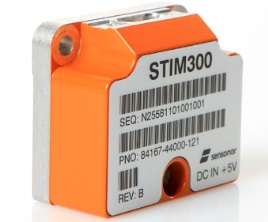
STIM300 MEMS Sensor.
Sensonor (Norway)has joined up with NovAtel,who is now offering its STIM300 MEMS inertial sensor as part of the NovAtel SPAN family. Sensonor apparently has a number of installs on unmanned aerial vehicles (UAVs).
Sysnav (France) has a sensor that cleverly uses Magnetic Variation with MEMS to do fairly accurate positioning in the absence of GNSS signals. Sysnav was looking for partners in North America.
Javad had his usual extensive line of surveying instruments, but his latest OEM receiver showed up with 864 channels! With three processors, program memory, multi-constellation (everything!) and monster channel tracking (100 of which scan for GNSS interference), this by far had the greatest receiver capacity at the show.
Trimble announced its latest tiny BD930 RTK capable OEM receiver — supporting both triple-frequency GPS and GLONASS, plus dual-frequency Beidou and Galileo. And it’s completely enclosed in an RF screening “can.”
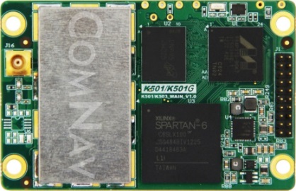
ComNav (China) showed up with a series of multi-frequency, GPS/Beidou/GLONASS RTK-capable OEM receivers, packaged receivers, and antennas. With 100 people based in Shanghai, ComNav claims to have captured 30% of the Chinese market, selling 15,000 receivers — derived from technology developed by Dr. Wong Yong Quan. Impressive capability on display — also seeking distribution in North America.
Surrey Satellite (UK) are apparently working on a number of R&D projects alongside building the nav payloads for the Galileo FOC SVs. TechDemoSat-1 is an innovative UK technology platform that includes a GPS reflectometry experiment to measure wave intensity for marine weather services. Apparently there is little weather information for large areas of the world’s oceans, and this may help to solve a major marine nav issue.
Nottingham University (UK) is working on predictive integrity for UAVs. GNSS signal outage/degradation in flight, caused by antenna obscuration, multipath, fading due to adverse geometry and Doppler shift, are critical for UAVs. Nottingham modeling is aimed at real-time avoidance of safety-critical flight conditions and fast recovery of navigation performance following GNSS data losses.
Trusted Positioning (Canada) is moving quickly down the indoor location path and has some neat software integration solutions for cell phones using signals of opportunity, pressure sensors and MEMS. The company sees the initial market being for things like mapping indoor locations, iteratively improving positioning, and location-based advertising.
Spirent GSS6425 record and playback system.
Spirent has released the GSS6425, which is a highly portable simulation system for recording live GPS L1/L2/L5, GLONASS L1/L2/L3, BeiDou-2 B1/B2, Galileo E1/E5, QZSS L1/L2/L5 and SBAS signals in the field — for repeated replay in the lab. BeiDou has been introduced across the Spirent simulation product line, and Spirent released information on sophisticated spoofing simulation.
IFEN (Germany) is also working on spoofing, has added BeiDou B1 and B2 signals, has added a four multi-RF output capability, and is working on automotive gyro and odometer testing capability.
R&S DDF007 Portable I/F Direction Finder.
Rohde & Schwarz had an extensive display of capability alongside its SMBV 100A GNSS simulator. An impressive array of spectrum analyzers and generators, with one set-up catching my eye — the DDF007 portable interference detection system used by government agencies for tracking down jammers.
I didn’t get to everyone’s booth, and I just didn’t have the space to cover everything, but I’d call this a reasonable cross section of the exhibitors; to some degree its a summary of the panels and includes some of the corridor discussions typical of ION.
So, I would call this another successful ION show, and I’m looking forward to next year’s ION GNSS+ conference in my neck of the woods in Tampa, Florida, in September. It would seem that the interest level remains high across academia, agencies and industry — but those of us who may still want to see new business as payback for the investment of attending and/or exhibiting, I think we would have preferred still more commercial content.
ION remains a place to meet and greet customers and people working across multiple market segments, where system providers can brief us and mix with users, and the intensity of technology development and research can be shared and sampled. It’s still an invaluable place to visit once a year if you are connected in any way to the GNSS industry and community.
Rx Networks, Inc., a mobile location technology and services company, today announced a new z-axis determination capability called Zed. This new solution, comprised of a client software library and associated cloud-based data services, is targeted at chipset vendors, device OEMs and application developers seeking to integrate reliable floor-level detection. The announcement came at ION GNSS 2013 in Nashville, Tennessee.
Whether for emergency or consumer applications, the determination of a mobile device’s vertical position while indoors presents unique challenges. Given the environment, even when a GNSS receiver attains a fix, a mobile device cannot reliably use the reported altitude. Beacon-based techniques, such as those derived from Wi-Fi or Bluetooth, remain challenging as they often rely on GNSS-based crowd sourcing or costly venue characterization. The built-in barometric pressure sensors in recent smartphones bring a new ability to estimate altitude, but they have unique and variable characteristics that prevent floor-level accuracy without further assistance.
Rx Networks’ new Zed solution combines accurate geo-reference barometric pressure data (from Custom Weather, a global provider of real-time weather information), automatic device characterization, and pressure crowdsourcing along with existing location services to determine a device’s altitude within 1 to 3 meters.
The Zed solution will be commercially available at the start of 2014 and will be available either on its own, or as an optional feature alongside Rx Networks’ GPStream Assisted-GNSS and XYBRID hybrid location solutions.
For more information a demonstration of Zed, visit Rx Networks booth at ION GNSS+ 2013.
Rx Networks, Inc., a mobile location technology and services company, today announced that it is upgrading its GPStream GRN (Global Reference Network) to include support for the BeiDou and Galileo constellations alongside its GPS and GLONASS assistance services. The upgrade will be completed by the end of this year with commercial service starting in 2014. The announcement came at ION GNSS 2013 in Nashville, Tennessee.
With the official release of the Chinese BeiDou specifications in late 2012 and the rollout plans for Galileo, several semiconductor vendors will soon be introducing chipsets capable of supporting these new GNSS constellations. Multi-constellation devices receiving GNSS assistance data from GPStream GRN will have much greater success in areas where satellite visibility is severely limited, such as urban canyons or indoors, the company said.
GPStream GRN is the foundation on which Rx Networks’ and third-party real-time and predictive Assisted-GNSS products operate, as used by more than 700 million smartphones worldwide. Backed by a 99.999% Service Level Agreement, GPStream GRN is already a proven source of real-time assistance data for most North American mobile operators for their E911 location platforms.
“Our reference network will be the first to commercially support all four constellations,” said Ryan Reilly, Product Manager, “reaffirming our leadership position on Assisted GNSS solutions for the mobile market.”
For more information, visit the Rx Networks booth at ION GNSS+ 2013.
 Rx Networks Inc., a mobile location technology and services company, has announced an update of its location.io platform to provide GNSS assistance data to enable better positioning in internet of things (IoT) devices.