Air Force Space Command began its 10th Schriever Wargame May 19 at Maxwell AFB, Montgomery, Ala.
The Schriever Wargame (SW 16), set in the year 2026, explores critical space issues and investigates the integration activities of multiple agencies associated with space systems and services.
The objectives of SW 16 center on identifying ways to increase the resilience of space that includes our intelligence community, civil, commercial and Allied partners; exploring how to provide optimized effects to the warfighter in support of coalition operations; and examining how to apply future capabilities to protect the space enterprise in a multi-domain conflict.
The Air Force announcement did not include specific mention of GPS jamming and spoofing, but these and related cyberthreats could reasonably be expected to appear in the pantheon of cyberspace competition.
The SW 16 scenario depicts a peer space and cyberspace competitor seeking to achieve strategic goals by exploiting those domains. Scenarios will focus on the European Command Area of Responsibility. They will also include a full spectrum of threats across diverse operating environments to challenge civilian and military leaders, planners and space system operators, as well as the capabilities they employ.
The Schriever Wargame team will conduct SW 16 on behalf of Air Force Space Command, headquartered in Colorado Springs, Colorado. Approximately 200 military and civilian experts from more than 27 commands and agencies around the country will participate in the Wargame.
U.S. commands and agencies participating in SW 2016 include: Air Force Space Command, Army Space and Missile Defense Command, Naval Fleet Cyber Command, the National Reconnaissance Office, Executive Agent for Space Staff, Air Combat Command, Office of the Secretary of Defense, U.S. European Command, U.S. Strategic Command, Defense Information Systems Agency, the Intelligence Community, National Aeronautics and Space Administration, Office of Homeland Security, Department of Transportation, Department of State and Department of Commerce.
By 50th Space Wing Public Affairs, Schriever Air Force Base
Throughout the years, GPS has achieved historic milestones and garnered recognition for its contributions to the betterment of humanity.
2015 was no different.
Photo: 50th Space Wing Public Affairs, Schriever Air Force Base
GPS, operated by the dedicated men and women of the 2nd and 19th Space Operations Squadrons at Schriever Air Force Base, Colorado, is also the world’s largest military satellite constellation. Uses of GPS include precise timing for financial transactions, search and rescue, communications, farming, recreation and both military and commercial aviation.
The 2 and 19 SOPS, referred to as Team Black Jack, hosted GPS Week Feb. 15-20 to honor their heritage and interact directly with the Colorado Springs community. The week included a community geo-caching event, GPS/base tours for dozens of middle and high school students, 2 SOPS educational outreach events at local schools and culminated with a GPS heritage celebration.
“We wanted to touch the different facets of our community and that’s why we planned these events,” said Tech. Sgt. Abifarin Scott, 2 SOPS GPS maintenance flight chief.
GPS received historic recognition from the city of Colorado Springs a few months later.
Colorado Springs City Council members presented a proclamation declaring July 17, 2015, GPS Day during a ceremony July 15.
“It’s a great time, a significant milestone that [GPS] has been active this long,” said Andy Pico, Colorado Springs City Council member. “GPS has grown to be such a tremendous part of everybody’s lives, it runs everything…it’s so much into the fabric of everybody’s life.”
The proclamation came as the Air Force celebrated GPS’s 20 years of full operational capability, confirmed July 17, 1995. During the last 20 years, GPS has become an integral part of technology that affects the lives of billions of people around the world.
The men and women of GPS stayed busy supporting many operations throughout the year.
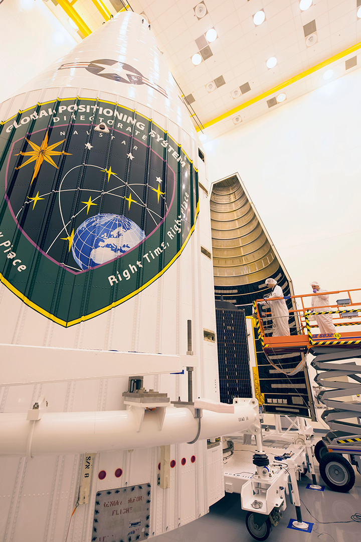
GPS IIF-10. (Photo: ULA)
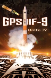
The Air Force and the 45th Space Wing supported the successful launch of a United Launch Alliance Delta IV rocket that roared to life March 25, carrying the Air Force’s ninth Block IIF-09 navigation satellite for the GPS.
2 and 19 SOPS accepted satellite control authority of GPS IIF-9 Satellite Vehicle Number-71 April 3.
2 SOPS successfully completed a transfer operation of GPS satellite control authority to the Alternate Master Control Site at a backup location on June 6.
2 and 19 SOPS accepted command and control of the 10th GPS Block IIF satellite July 24.
After 15 years of launch operations for the GPS, 19 SOPS completed their 26th launch as a squadron Oct. 31, performing checkout operations on the 11th GPS IIF satellite.
On Nov. 6, Team Black Jack accepted SCA just six days after the Halloween launch of satellite vehicle number-73 – in record time. Members of Team Black Jack prepped for the launch and subsequent SCA acceptance of SVN-73 for approximately three months.
The Command’s GPS operations were showcased in multiple venues this year, engaging with communities and making the mission known all over the world.
CBS featured the 50th Space Wing and GPS on an episode of 60 Minutes, and BLUE, the Air Force’s flagship TV show, also featured GPS — both of which displayed the capabilities it offers to humanity.
Beyond its essential capability for the military, GPS is a worldwide utility that provides the highest accuracy data available to people all around the world and enables such vital activities as weather forecasting, transportation, global commerce and farming/agriculture.
“2 SOPS’s continuing objective is to ensure GPS remains the gold standard for global space-based navigation and timing by providing highly reliable and accurate GPS signals to users around the world,” said Lt. Col. Todd Benson, 2 SOPS Commander. “We look forward to continuing to provide our mission partners and global users with the most accurate position, navigation and timing signal available in the history of GPS.”
Raytheon has installed the first operational hardware for the GPS Next Generation Operational Control System, known as GPS OCX. The new ground command and control system will significantly modernize U.S. GPS capabilities and manage the next generation of GPS satellites. Installation of the Launch and Checkout System (LCS) hardware was completed in early July at Schriever Air Force Base in Colorado, the eventual home for the new GPS OCX Master Control Station.
“Installation of the initial OCX hardware at Schriever AFB represents a key milestone for the program, demonstrating further progress toward next year’s acceptance of the OCX Launch and Checkout System for the GPS III satellites,” said Matt Gilligan, vice president of Navigation and Environmental Solutions at Raytheon Intelligence, Information and Services. “Raytheon is committed to delivering a modernized, secure GPS ground system to support the millions of U.S. military, civil and commercial users of GPS worldwide,” added Gilligan.
GPS OCX will deliver a host of new capabilities, including automation for operational efficiencies, improved accuracy, interoperability with geo-positioning and navigation systems of other nations for better global coverage, and a cybersecurity architecture that provides unprecedented levels of protection. The Launch and Checkout System delivers a large subset of the full OCX ground system capabilities, and establishes the OCX cyber-hardened infrastructure for additional mission applications that will be added to complete the Block 1 capability.
U.S. warfighters use GPS services to support air, land, sea and space missions. GPS is also used by millions of people to enhance daily life activities, including personal navigation. It’s also required for industry and businesses and is essential to support safety-of-life missions for air traffic controllers and emergency responders. The modernized ground system will bring new capabilities and precision to the GPS enterprise.
On June 3, Raytheon demonstrated the advanced capabilities of the GPS Next Generation Operational Control System (GPS OCX) to key U.S. Department of Defense (DoD) and other stakeholders through a series of realistic operational demonstrations.
The demonstrations, which incorporated software that will be delivered with the Launch and Checkout System, validated how automation will improve system efficiency and effectiveness.
GPS OCX is the ground-based command and control system that will manage GPS satellites with significantly improved accuracy and precision, while providing unprecedented levels of cyber protection.
“These successful demonstrations incorporating actual GPS OCX software reflect Raytheon’s significant and continuing progress on this program and the growing maturity of this very complex system,” said Dave Wajsgras, president of Raytheon’s Intelligence, Information and Services. “Once delivered, this pathfinding, cyber-hardened ground system will significantly enhance the capabilities GPS brings to military, civil and commercial users worldwide,” said Wajsgras.
The demonstration provided DoD and other stakeholders with a look at how OCX will automate many tasks currently performed manually, resulting in reduced opportunities for error and increased operational tempo for delivering military and other applications, Raytheon said.
Raytheon demonstrated the benefits of OCX in providing new high-power, jam-resistant military signal known as M-code, as well as the system’s unprecedented cyber automation, detection and response capabilities.
Raytheon is installing the Block 0 Launch and Checkout System (LCS) hardware at Schriever Air Force Base. LCS software, which includes the cyber-hardened infrastructure for OCX Block 1, is in the qualification test phase and is on track for delivery in mid-2016.
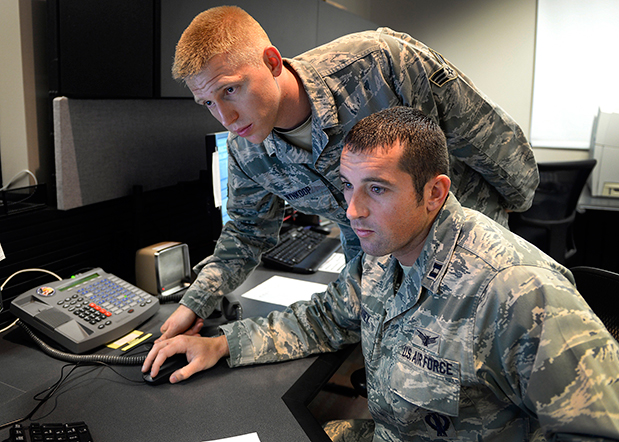
Capt. Jared Delaney, 19th Space Operations Squadron satellite vehicle operator, right, and Senior Airman Bryan Wynkoop, 19 SOPS satellite system operator, monitor telemetry during the GPS SVN-69 launch Oct. 29, 2014 at Schriever Air Force Base, Colo. (U.S. Air Force photo/Dennis Rogers).
The following story by Scott Prater appeared in the Schriever Sentinel, a weekly newspaper published by the Colorado Springs Military Newspaper Group. See http://www.schriever.af.mil/units/publicaffairs/ for further information.
By Scott Prater Schriever Sentinel
11/19/2014 – SCHRIEVER AIR FORCE BASE, Colo. — It’s been a busy year for members of the 19th Space Operations Squadron. As operators of the GPS launch and early orbit, anomaly-resolution and disposal system, 19 SOPS members executed a historically high number of satellite launches (four), and disposed of a legacy GPS vehicle, all within the past 10 months.
“The last time we launched four vehicles in one year was 1993,” said Maj. Kimberly Adams, 19 SOPS LADO flight commander. “We’re looking forward to a more normal [operations] tempo, in the coming year.”
Tensions were high Oct. 29 during the lift-off and early-orbit of SVN-69, a GPS Block IIF vehicle, when a CBS news crew captured film footage of the event on the operations floor here.
“That was out of the ordinary for sure,” Adams said. “Compound that anxiety with the knowledge that we had just completed final configuration of a GPS vehicle disposal not 48 hours prior and you can understand the type of month October was for us and our 2nd Space Operations Squadron teammates.”
Senior Airman Bryan Wynkoop, 19 SOPS satellite system operator, wouldn’t change a thing about the past few months of 2014.
“It’s exciting,” he said. “This sure beats working a regular job. The drama and importance of what’s taking place here is exactly what I signed up for.”
Adams and Wynkoop are Air Force Reservists, as are all 19 SOPS members. The squadron falls under the Air Force’s 310th Space Wing, headquartered at Schriever AFB, and works in partnership with 2 SOPS, the 50th Space Wing unit responsible for commanding and controlling the GPS constellation.
Adams says 19 SOPS was stood up precisely to conduct GPS launches, manage anomalies and process disposals.
“We start preparing for launch about 90 days out,” Adams said. “With so many launches so close together, we often began preparations for one launch before the previous one was off the pad.”
Their partnership with 2 SOPS has proved beneficial for both squadrons.
“This most recent launch was my seventh and Airman Wynkoop’s sixth,” said Adams, who is in her fifth year at 19 SOPS. “Active-duty Airmen typically reside on station for roughly three years, so oftentimes our 2 SOPS teammates are looking to us to provide continuity and experience.”
That continuity became crucial during disposal operations for SVN-33. It had been more than two years since the two squadrons had disposed of a vehicle and Wynkoop was one of the few Airmen at Schriever who was familiar with the operation’s intricacies.
“These events don’t happen often, so to have played a role in two huge events was something special for all of us who were here,” he said.
Less than 48 hours after SVN-33 had been fully configured for disposal, SVN-69 was standing on the launch pad at Cape Canaveral, Florida.
Adams, Wynkoop and their fellow 19 SOPS operators’ day started eight hours prior to the launch.
“Wynkoop had to set up communications links with our antenna at the Cape so we could get telemetry data from the satellite,” Adams said. “Once the rocket lifted off, I was performing communications checks and verifying that we were meeting all of our requirements.”
Then they waited.
Three and half hours after launch, SVN-69 separated from its booster rocket.
“At that point we obtained an initial state of health from the satellite to ensure everything was OK and then we started commanding,” Adams said.
Wynkoop explained that though he and his teammates are actually studying telemetry data through their monitors on the operations floor, it’s easy to envision what’s happening in space.
“The vehicle is spinning once it separates from the booster,” he said. “We then issue commands to slow the spin and deploy the vehicle’s solar arrays, antennas and other critical components. Later, we get the vehicle in a condition known as sun safe. Shortly after, the vehicle acquires Earth and is in a stable orbit in the GPS slot where it’s supposed to be.”
Now, it’s up to 2 SOPS to command and control the satellite, one of 39 on orbit. The squadron expects to receive satellite control authority of the spacecraft later this month and the next GPS launch is scheduled for March 2015.
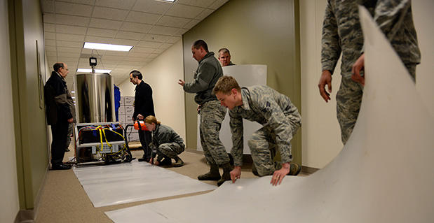
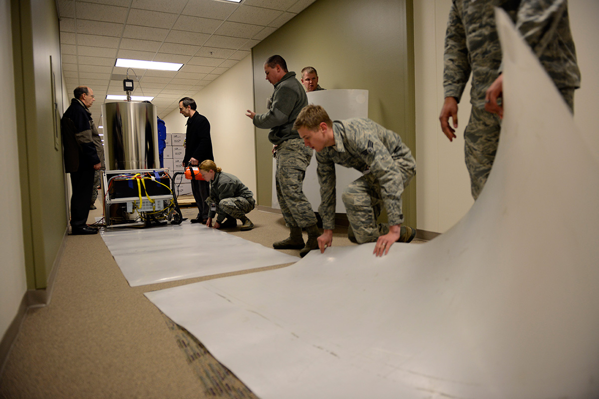
Personnel with the U.S. Naval Observatory-Detachment Colorado and 2nd Space Operations Squadron move the rubidium fountain clock into its new home Tuesday at Schriever Air Force Base. The USNO monitors the GPS constellation and provides time offsets to the 2nd Space Operations Squadron for their daily navigation uploads to each individual GPS satellite. (U.S. Air Force photo/Christopher DeWitt).
The U.S. Naval Observatory’s Alternate Master Clock on Schriever Air Force Base received its second rubidium fountain clock February 4 to ensure it has the most precise time in the world.
Both the USNO’s Washington D.C.-based primary and its local Alternate Master Clock facility serve as the Department of Defense’s common time reference. Additionally, the USNO monitors the GPS constellation and provides time offsets to the 2nd Space Operations Squadron for its daily navigation uploads to each individual GPS satellite.
“With the new rubidium fountain clock, we are going from the time standard of 1 to 2 nanoseconds down to 300 picoseconds,” said Bill Bollwerk, Head of USNO Detachment Colorado.
One nanosecond is equivalent to one billionth of a second, while a picosecond is equal to one trillionth of a second. Though these small slices of time may not sound important, every nth of a second is significant, especially in GPS operations.
“A nanosecond matters because it is equivalent to a 1-foot of error for GPS,” Bollwerk said. “If the GPS satellite clocks were off by 3 nanoseconds, you have 1-meter of error introduced into GPS.”
Designed and produced by physicists at the USNO laboratory in Washington D.C., the powered rubidium fountain clock traveled by dedicated truck to Schriever. Once the fountain clock arrived at Colorado base, with the help of members of the 2nd Space Operations Squadron, the 50th Security Forces Squadron and 50th Civil Engineering Squadron, the USNO team moved it to a climate controlled chamber in the USNO’s laboratory via an airsled hover lifter.
“The 2 SOPS men and women are able to operate and provide accurate instantaneous reliable support to U.S. military forces around the world, thanks to our partnership with the U.S. Naval Observatory,” said Lt. Col. Thomas Ste. Marie, 2 SOPS commander. “We are happy to be able to work together to support their upgrade. Our relationship allows 2 SOPS to continually reach our goal of record breaking time-transfer performance and navigation accuracies.”
Although 2 SOPS was happy to support the move, it’s not as easy as one might think.
“The process of moving the rubidium fountain was very complicated,” said Ken Dreiling, USNO Detachment Colorado. “We had to ensure the fountain clock was not actually in contact with the floor or the walls as we moved it from the loading dock through the hallways and elevator into our facility.”
The careful transport of the fountain was essential to prevent damage that could affect the clock’s performance.
“The fountain clock collects billions of rubidium atoms, encased in a spherical vacuum chamber and laser-cooled to a millionth of a degree above absolute zero degrees Kelvin, approaching the coldest temperature anything can be,” Bollwerk said. “The reason we do that is because we want to observe and measure the atoms for long time in an environment that minimizes unwanted noise like the Doppler Shift.”
Though the Alternate Master Clock provides precise timing for several communication and space systems, Missile Defense Agency, DOD facilities and several civilian infrastructures around the world, the new system was installed primarily to support GPS operations.
“It is great to have the most precise time standard in the world but it is useless unless you can get it to the user, not everyone can come to the facility and set their watch,” said Bollwerk. “GPS is USNO’s primary means of providing global precise time to the warfighter. It is a great partnership between the Navy and the Air Force.”
Dreiling said the new fountain clock will help improve GPS operations.
“The new rubidium fountain clock is the next-generation new frequency standard,” Dreiling said. “This will boost the GPS’s timing by 10-fold.”
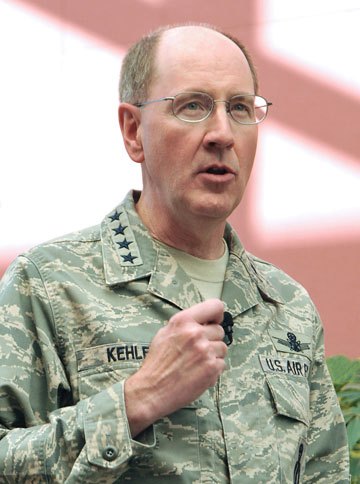
General C. Robert Kehler, Commander of the U.S. Air Force Space Command
Editor Don Jewell Talks with the Air Force General Heading Space Command: His Views, Use, and Plans for GPS
Defense editor Don Jewell is a retired Air Force officer who served for 30 years; many of his former peers and contemporaries are currently senior officers in today’s U.S. Air Force. Don sat down recently with General C. Robert Kehler, Commander of the U.S. Air Force Space Command, whom he has known and worked with for more than 20 years, to discuss GPS from the four-star point of view.
Don Jewell (DJ): General Kehler, thanks for taking the time to have this discussion today. I would like to keep this very informal, more of a conversation, like the days when you and I and Willie Shelton [now Lt. Gen. Shelton, USAF] sat around on your lanai, sharing a brew, telling war stories, and solving the world’s problems.
General Kehler (GK): Believe me, Don, there are days when I wish we were still doing that. I appreciate the opportunity to have a conversation with you.
DJ:Great. Sir, to get to the crux of the matter, as the senior warfighter for space, how do you see GPS in the future, and how does it contribute to the joint fight?
GK: Don, you know this, as may many of your readers at GPS World, but I don’t believe we can say it often enough: GPS is the primary source of position, navigation, and timing (PNT) information for the Department of Defense, and it will remain that way at least until the year 2030. This has been a remarkably successful program, supporting the joint warfighter in nearly every aspect of joint operations. How GPS supports joint operations, whether it’s the individual soldier, sailor, airman, Marine, or Coast Guardsman, who is on the ground or inflight or who happens to be in the dark in a mountainous region somewhere or in the flat expanse of the desert — it doesn’t much matter. GPS has been their constant companion now for many years. They have come to rely on GPS in ways that help them do their job better, and it allows them to perform missions that in the past they would not have been able to perform in this kind of a manner, with this kind of perfectness.
GPS is going to remain the foundation of the PNT strategy. And with the modernization effort that we have underway in GPS, we are going to make sure that it remains the world’s premier source of position, navigation, and timing information, and in particular that it remains woven through the fabric of the joint warfighting network.
DJ:This portends an excellent future for GPS, despite comments by the Air Force Chief of Staff and Gen. “Hoss” Cartwright, vice chairman of the Joint Chiefs of Staff, that we should move away from GPS. Do the Chief’s comments cause you any concern?
GK:They do not cause me any concern. We are committed to keeping GPS the gold standard. We have a commitment in that regard. I understand exactly what the Chief of Staff said and why. I will be happy to discuss that more.
DJ: We’ll table that for now, and get to it later if we have the time. I have often heard you say in your GPS update and status briefings that GPS is one of your good systems. Indeed, you have described it as one of the systems you don’t have to worry about too much, because it works. It would be interesting to ascertain how you know when you are doing a good job with GPS. How do you know it works? For example, do you receive comments, e-mails, or letters from warfighters?
GK: I think there are really two big ways that we know we are doing a good job with GPS. First of all, we measure our performance against the standard. What the users see, of course, is accuracy and satellite availability. Those have become our two primary standards. We make sure we are performing up to those standards. And in fact, as you know, we continually outperform those documented standards and the requirements that we have.
We also look, not only at the satellites, but at the ground command and control (C2) system and the ground support network. We make sure those elements are always up and running as well. From a numbers standpoint, from a “how well are we meeting the standards we have set for ourselves” standpoint, we exceed those standards. We exceed in terms of accuracy and availability, both the satellite system and the ground-supporting infrastructure as well.
But these days, I will tell you, I think the numbers are interesting, but what I think we look at just as hard is how the public talks about GPS.
And if you look today, GPS, at least in my opinion, is everywhere in the public conscience. I was saying earlier today, you really don’t have to go much farther than your television set. Almost any evening you turn the TV on you’ll hear something about GPS. You’ll either hear people who are equating their product to GPS, or you’ll hear in a television show someone mention GPS or their GPS device. And that is without it being a program about the satellites themselves, or the U.S. Air Force, or the things we do at Schriever Air Force Base to make it all work.
My view is that the fact that we get this informal public feedback constantly, and that it’s positive, says a lot about how good a job we are doing as well. When your program becomes a new word in the English language, I think that says something about success. Any more, if you say GPS to people they might not point to a satellite, they might point to the little device they are holding in their hand, but they understand somebody is providing that for them and that it is working well.
The final piece to that is also our civil partners. You know we have a GPS Executive Committee (PNT ExCom) inside the government that meets periodically to have conversations about the way ahead on GPS for the entire government, and by extension for the United States. The feedback that we get at those meetings, and unfortunately I can’t get to every one of them, but in those that I have attended, the feedback has been universally positive.
We just had a Civil Focus Day recently, and the feedback we got was universally positive. Are there things we can do better? Yes, of course there are, there are always things you can do better, but I can tell that we are doing a good job with GPS, not only because of the numbers that we look at but because of the feedback that we get, and the way GPS has been accepted and adopted, if you will, as part of the lexicon.
DJ: You’re absolutely right about the positive feedback. I attended Civil Focus Day, wearing a different hat, as you know, and I agree, everybody was onboard and positive about GPS.
The next topic revolves around how your scorecard is graded by the joint community, and do you have a way of actually getting feedback from the warfighter?
GK: Yes, as I said, we are graded or we grade ourselves primarily on accuracy and availability as they are documented for us in the performance standards. In watching those numbers, we know that we are exceeding the performance standards that we set for ourselves. But we also receive feedback directly from the warfighters. We receive feedback from the military users through the GPS Operations Center (GPSOC). You know, and I think most of your readers know, that there is a way that you can directly contact what we call the GPSOC 24 hours a day, seven days a week, and we find that both our military and civilian users do that.
Another way that we receive feedback is through the Coa
st Guard Navigation Center (NAVCEN), where they are specifically watching and helping us watch the performance of GPS. We get feedback directly from them as well. But much like the prior topic, there are also other ways that we get feedback.
For example, in each of our theaters of operations, for each of our combatant commanders, the joint or combined force air component commander is also designated as the space coordinating authority. And working for that space coordinating authority in the AOC (Air Operations Center) is someone called the director of space forces, an Air Force officer who is responsible for making sure that the space support is there when it needs to be and in the fashion that it needs to be. Those directors of space forces also have a small staff working with the combined force air component commanders.
They are getting direct feedback from the warfighters as well. They are either getting it as a normal course of business, on a day-in day-out basis, or they are asking for it specifically as well. We are also getting direct feedback from the units themselves. We have made contact through a number of our forward space people. We work with Army Space and Missile Defense Command and as a matter of fact we have talked with the Marines and others directly. We don’t wait for their feedback, we go out and solicit it also, and we actually help them solve some very difficult problems that we had early on in the conflict with some of our weapons systems that we have now fixed.
We are mindful, we know when certain operations are underway, we deconflict that with activities in the [GPS] constellation, making sure that we are providing the very best service all the time. We are embedded through the planning process in the theaters with military operations and with space professionals who are in the planning cells and Air Operations Centers. We are very comfortable. We are getting constant feedback from the warfighters in addition to the scoring we do ourselves and against the performance standards.
DJ: As you know, in many of my articles I frequently comment that where GPS is concerned, geometry and numbers matter. In that regard you recently approved a 24+3 GPS constellation change. Now we get a good many letters from warfighters at GPS World, and some letters are all about GPS accuracy as you spoke of earlier, but actually more letters mention GPS availability as being critical. Where do you stand on the debate of what is more critical, accuracy or availability, as far as the warfighters are concerned?
GK: We don’t separate the two children here, availability and accuracy. Obviously, it doesn’t mean a lot to us if you have high availability and not high accuracy, or if you have high accuracy and not high availability. They go together, and we work both of those issues. We try to make sure that we have the highest availability and accuracy. The accuracy numbers have been very good, as you know. We have been trying to improve availability, particularly for users in impeded environments. We are doing that by taking advantage of the largest constellation of operational GPS satellites we have ever had on orbit. We have begun to adjust the way we have configured the on-orbit constellation.
You called it 24+3, and we were all calling it 24+3 for a while. Now we are calling it Expandable 24, because those are the words that are actually in the Standard Positioning Service Performance Standard. We are expanding the available operational useful slots from 24 in the constellation to 27, and that movement is underway. This should result in improved availability for users in challenged areas like mountainous terrain, deep canyons, and in some cases urban terrain. It improves those kinds of availability numbers worldwide for everyone, for all users. This is not just for warfighters, it’s for all users.
We have begun the movement of the satellites (SVs), and because we are trying to balance on-orbit longevity with movement, it will take us a period of months to move the satellites to the new locations. That movement is underway, and the availability numbers should begin to improve as the movement begins; you don’t have to wait until they are all in their final locations.
By the way, as an aside, just last night, I was driving in Washington [D.C.] and I was using the navigation feature in my cell phone. One of the things it tells you is how many satellites are in view as you are driving along. Now, just to be clear, I was not driving, I was a passenger in the car, so I was not distracted by trying to drive. But I sat there with the thing in my lap, watching it while we were driving through the streets of Washington, D.C., and there were never less than nine satellites in view. At best I noticed that there were 12.
So I thought about that for a minute. Half of the constellation was occasionally in view as we were driving around the streets of Washington. This is pretty powerful, and we are talking about availability. I sat there thinking to myself, yo, if we can help somebody out there — turn that availability when they need it into the right number of satellites — this is a pretty powerful movement that we’ve got going.
DJ: It is, and what you just said about being in the back of the car reminds me about what General Chuck Horner (USAF, ret.) said after he retired as commander in chief, Space Command. He said you know you are truly retired as a four-star general when you go out and get in the back of the car in the morning, and nothing happens.
GK: You’re exactly right. I have a new officer aide who had never been stationed in Washington, and can’t survive in Washington without some kind of a GPS navigation device. He had one going in the front seat, and I had mine going in the backseat, and we were comparing notes as we drove along. It really is pretty remarkable.
DJ: Our readers will he happy to hear that you also have dueling GPSs. I have readers write and say they have up to three or four going at one time on long trips, comparing different GPS device accuracies and interfaces.
GPS has truly been a life-changing event for many of our users, especially the warfighters. I receive hundreds of letters and e-mails from warfighters and this move to Expandable 24 is meeting with unanimous approval.
GK: That’s good to know, and I must say that originated here. Actually, that originated with the IRT [GPS Independent Review Team], as you well know. We then took that to Strategic Command, and Strategic Command embraced it. General Chilton embraced it immediately, and I think that we have done the right thing here. The downside risk here did not outweigh the positive impact that we think we can have on people who need expanded availability.
DJ: Sir, as I said before, wearing a different hat, I attended your Civil Focus Day and I thought it was outstanding. Do you have any comments you would like to make concerning that event, and do you think you achieved your goals?
GK: We did achieve our goals, because our primary goal is improving communication and cooperation, as well as making sure we’ve got a stronger working relationship between the civil and military GPS communities. In that regard I think our goal was achieved. We addressed a lot of crucial concerns that impact both communities. We emphasized that the ongoing GPS modernization and enhancement efforts are going to be transparent to the civil users, and in fact will result in pretty dramatic improvements for civil users:more signals and other enhancements that I think are going to be useful as time goes by. In that regard I was very pleased.
We had a number of very senior people throughout the government who expressed their interest in GPS with their attendance. We had seen, as you know, additional commitment from some of the other [U.S.] government agencies to be supportive in helping to invest in GPS, which I think is very positive. I just think that in general terms we want to make ourselves more transparent in terms of how we are dealing with the constellation and the future of the constellation.
We recognize in Air Force Space Command the unique role that we have for this global utility that the United States of America provides free of charge for everyone else on planet Earth. We recognize that with the use of this and the increasing impact it has on all our lives, comes a unique responsibility for stewardship. We have embraced that responsibility, and that means we have to be transparent and we have to have a collaborative team that we work with, and that was a large part of the Civil Focus Day.
DJ: Many of the proposed systems that may or will one day compete with or complement the GPS are on hold, delayed, or still not at full operational capability. What is your viewpoint on where we stand in relationship to these systems, such as GLONASS, Galileo, and Beidou, for example?
GK: Our objective from an Air Force standpoint has been to support the U.S. government’s goal of wanting to engage in cooperative activities related to space-based PNT, and I think the focus of that cooperation has been to try and ensure that we have compatibility between GPS and other space-based PNT systems. There is a goal on our part to make sure we can be compatible and interoperable. There is a goal on our part to make sure we are protecting our national security interests and that we are maintaining a level playing field in the global market for space-based PNT goods and services.
Those are our objectives, those are the national objectives of the U.S., and the Air Force is supporting those objectives through our management and operation of the GPS constellation. That will continue to be our posture: to make sure, as best we can, to have fostered successful relationships on space-based PNT.
DJ: You certainly can’t ask for more than that. The objectives are laudable, but on the surface they don’t necessarily fit well with the recent comments by the chief of staff of the USAF, and I guess that brings us to the topic we briefly discussed earlier. Do you fully understand where the chief was going with his comments concerning GPS at Tufts University last month, and do you have any comments that might help our readers put the chief’s remarks in the proper perspective?
GK: I do. I was present when General Schwartz made his comments, and honestly I understood what he was saying and why. I think that he was misunderstood in implication. I think what he said was misapplied by some. In my view, General Schwartz fully supports GPS. What he was doing, though, is he was talking about GPS and its value for military operations.
What we know is that, like any other military capability that we rely on for important pieces of our warfighting force, GPS will be challenged by a determined enemy that is interested in trying to defeat U.S. forces on the field of battle somewhere. He was reminding us that we need to be mindful of that:adversaries could potentially exploit GPS as a vulnerability because of the way we have come to rely on our GPS for our own American way of warfare. And because it is such a critical system to the warfighter, it will be an attractive target to any would-be enemy.
Having said that, his point was, with which I fully agree, we have to be diligent in finding ways to operate with the same accuracy and precision in the event that GPS is degraded. That’s exactly what the GPS Modernization Program is designed to do. But this goes beyond GPS as well, it goes into other things, for example, missiles are guided to targets or munitions are guided to targets in some cases by GPS, in some cases by inertial systems, and in some cases by a combination of both. It would be foolish for us to not have provided for the eventuality where GPS will be jammed. But again he was talking about a military environment here; he was not talking about the global environment, he was talking about the military environment.
I recommend to people sometimes that they should go look at, well, pick your search engine of choice on your home computer, and type in “GPS jammers” and see what you get. There is a proliferation of GPS jammers around the world, everything from the sizes that will plug into the cigarette lighter in your car to large devices that are sold internationally for military purposes. We know that GPS will be contested when or if we are involved in any military conflict. The chief was warning us that we need to take that into account, and I believe he was exactly right to do it.
DJ: Thank you, sir, that helps clarify the Chief’s remarks considerably. I just wish he had said what you said versus what he said. Sometimes senior leaders are just too close to the problem and they erroneously assume their audience has information, knowledge, or insights that they in fact just do not possess, and it skews their perception of the senior leader’s remarks.
The last topic I would like to discuss concerns the infamous AEP 5.5C update that did not go quite as well as planned. Again in this instance, the public perception may be skewed by a lack of information and a lack of communication. I know you are fully up to speed on this issue; what are your thoughts?
GK: I would make a couple of points about upgrading the ground software. First, with this latest version of the ground software, AEP 5.5 and all of its iterations, we learned a lot about the complexity of the GPS system, how complex it has become. We learned a lot about standards, and what happens if you make receivers and you don’t follow the standards, because there was nothing wrong with the [AEP] 5.5 software in this case. The issue was in the receivers — a very small percentage of our military receivers — where the manufacturers did not comply with the standards. We hold ourselves to a set of standards, we publish those standards, as you well know, and it is important for people who are making GPS devices to follow those standards.
Now here’s what we learned, though. We learned that not only is it important to follow the standards, but we learned that we can do better in how extensively we test prior to installing software. By that I mean — not that we didn’t test extensively before — increase the population of receivers that we test against and the rigor with which we test them, would be a better way to say this.
The other thing we learned is that collaboration and cooperation needs to be more robust, such that we are doing these upgrades on an active basis, not a passive basis. What we had been doing before is we would publish a NANU and say that we were about to do an upgrade to the ground software. We would then do the upgrade. We would wait to find out what was happening. What we learned this time was, that is probably too passive as we go to the future. Not only will we test more extensively across a broader range of GPS devices, but we will also put [receivers] in place, in a series of predetermined locations, if you will, where we will contact them actively to find out as we are progressing whether they are encountering any difficulties. We did learn a lot here.
We also learned that these upgrades need to be done in a fashion that is repeatable, so that every time we do this we will have a process in place that allows us to treat them roughly the same, depending on the magnitude and risk associated with the change, if you will, in terms of how we intend to go forward. I think we learned a lot about vetting and we learned a lot about execution. We
reminded ourselves again why standards are so important, and we reminded ourselves why partnerships are so important and why rapid feedback is important: so that we can deal with problems as they emerge.
We also learned something for the longer term, Don. We learned that we probably need better simulation tools as we look to the future, because you know there is only one active system, and it is the active system. It has become so complicated that there are hundreds of millions of receivers out there, as you well know, and the likelihood that we can characterize all of them in advance of a software drop is pretty low. We are going to have to get better at following a simulation as we go forward.
The most significant piece of data, though, from all this was there was nothing wrong with AEP 5.5. It performed exactly the way it was designed. The issues that were encountered were anomalies in user equipment, and that user equipment was identified because it did not follow the standards.
DJ: General Kehler, do you have any closing remarks for our readers, a message you want to make sure gets heard?
GK: Don, we understand the unique position that we are in as stewards of GPS. This is unusual, I believe, throughout the U.S. military, that a military service would have this type of responsibility for a system that has this kind of global impact. And it has that global impact 24 hours a day, seven days a week, 365 days a year. We recognize that unique responsibility that we have.
We know that means we have to be transparent about the way we conduct our business. We think that we are doing much better at that, and we will get better at that even more as we look to the future.
Our bottom line is that we believe that GPS is the gold standard today for the world. We intend to keep it that way as we look to the future, and we will allow the performance of the GPS system to speak for itself. We are very, very proud of the job that we do regarding GPS.
The young — many very young — men and women who operate and fly that constellation everyday, the outstanding technical people we have who design and build the satellites, the phenomenal launch team that we have that gets them to the Cape and gets them successfully on orbit — all of these pieces that are taken together along with, by the way, a civil group of participants from across the government who work very hard at all of this, along with independent folks who are on our review teams and elsewhere as well as the industry, the broader industry —this is a remarkable success story that has now influenced virtually everything we do, everywhere on the face of the planet. I think we ought to be very proud of that, and I can tell you that this Command is extraordinarily proud of it and recognizes that this puts a unique burden on us to deliver. We are going to continue to do just that.
DJ: That’s a great message and a very important one. In closing, might I ask you about your future? Rumor has it that there are plans afoot for you to move onward and upward.
GK: Don, my wife keeps saying that we go to Myrna — she is the dry cleaner and tailor down the street here — to find out where we are going.
I don’t know. I have been here two and a half years, Don, and typically this assignment will last about three years. That will take us into late summer, early fall, and I honestly, honestly do not know what happens with us next. We are going to have to wait and see what the pleasure is of my superiors and how all the pieces sort of fit together.
I think you know, when you get to be a four-star, there are a lot of factors that come to bear. At this point we will just have to wait and see. The only thing that I am worried about right now is the job that I’ve got, and I will be very, very pleased to stay here. We could stay here for 10 more years, and I would be delighted to stay here because this is a magnificent command.
We are doing phenomenally important work, and I am very proud of the people in Air Force Space Command. This is a wonderful, wonderful group of people.
DJ: You should be proud of them, sir. We get a lot of mail about what a great job the Air Force is doing as the steward of GPS. Our mail is always very positive concerning Air Force Space Command. I want you to know, sir, in closing, that working with Colonel Ford and Colonel Buckman has been a real pleasure. Your folks have been just super.
GK: I think so, too, and I don’t tell them that enough, really. We’ve got a great team here at headquarters, and we’ve got a great team across this command. We are delighted to have cyber responsibilities now, and there is clearly a relationship between space and cyberspace, and we see it. Every time I get a chance to commend the people in the Command, I like to take the opportunity to do so.
DJ: Thank you for your time today, sir. I know how busy you are, and I think we should find the time soon to sit down and have another discussion, possibly on cyberspace.