Tag: search and rescue

  • RoGO partners with AugSense on edge AI analytics for first responders and military

    RoGO partners with AugSense on edge AI analytics for first responders and military

    RoGO Communications, the creator of the DropBlock satellite communications platform for cellular-denied environments, is partnering with Augmented Sense Technologies (AugSense) to integrate artificial intelligence capabilities into RoGO’s communications infrastructure.

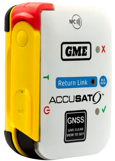
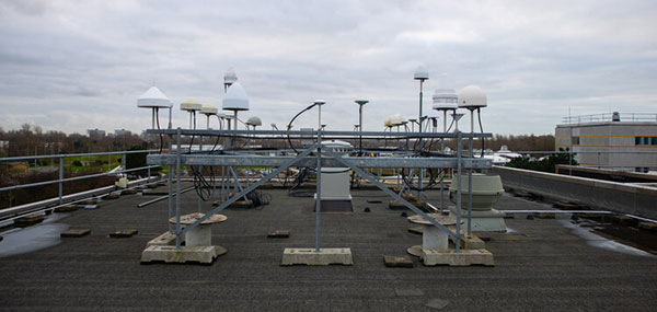
    RoGO was founded to develop lifesaving technology for wildland firefighters and first responders. It’s product DropBlock is a ruggedized, portable satellite communications platform that provides real-time GPS tracking, weather telemetry, IoT sensor data, and tactical messaging in cellular-denied and remote environments.

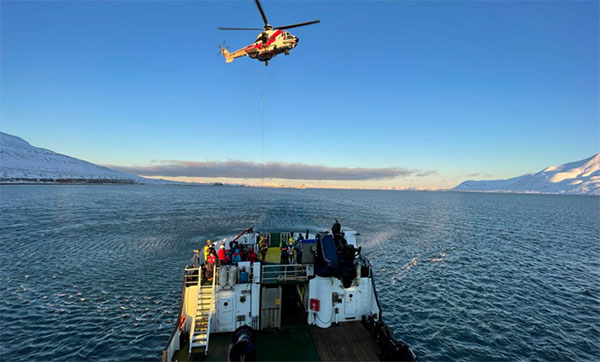
    The partnership will develop edge AI-powered sensor fusion, Team Awareness Kit (TAK) ecosystem development, and predictive analytics to firefighters, disaster recovery, military and other first responders and remote operators, including All Hazards emergencies such as hurricanes, earthquakes and floods. Last month, RoGO and AugSense presented the combined capabilities at the annual convention for Special Operation Forces (SOF Week) in Tampa.

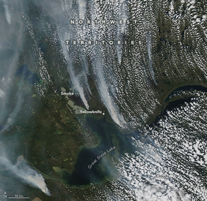
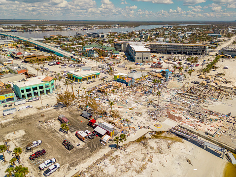
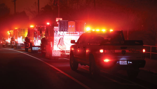
    Wildland firefighters, search-and-rescue teams, and military personnel routinely operate in remote terrain where conventional communications infrastructure does not exist. RoGO’s DropBlock technology has proven its ability to deliver real-time GPS tracking, weather data, IoT sensor telemetry, and tactical messaging over satellite links in these environments—deployed today by wildland fire agencies. As missions grow more complex and sensor-rich, operators increasingly need more than raw data. AI can deliver intelligence at the edge, delivered in real time, without dependence on connectivity.

    Through this partnership, RoGO will enhance its platform with AugSense’s edge AI engine, a modular, platform-agnostic system that processes and fuses multi-modal sensor data directly on devices, without requiring a cloud connection. The AI-enriched intelligence products will  transform raw sensor feeds into actionable decisions, such as predictions for the spread of a wildfire or other threats to safety.

    Edge AI Capabilities

    Edge AI Processing: AugSense’s engine runs AI workloads directly on edge devices using neuromorphic and spiking neural network architectures, achieving greater energy efficiency than conventional approaches. This means intelligence processing in power-constrained environments — no cloud, no data center, no latency.

    Multi-Modal Sensor Fusion: AugSense’s fusion engine synthesizes data from diverse sensors (RF, weather, geospatial, physiological, and chemical/biological) into a single actionable intelligence picture at the edge.

    TAK Integration & Development: Purpose-built plugins for the Android Team Awareness Kit (ATAK) and broader TAK ecosystem that overlay AI-fused intelligence onto the common operating picture, enhancing coordination across distributed teams connected through RoGO’s DropBlock network.

    Predictive Analytics: Machine learning models that transform raw sensor telemetry into forward-looking predictions such as anticipating weather shifts, equipment failures, threat patterns, and fire behavior.

    Immediate Applications

    The combined solution targets several high-impact use cases.

    • In wildland firefighting, the integration enables AI-predicted wind shifts and fire behavior models to reach incident commanders via RoGO’s satellite network—critical for crew safety decisions.
    • For search-and-rescue operations, fused sensor data and intelligent mapping overlays allow distributed teams to coordinate effectively through the DropBlock network without relying on cellular infrastructure.
    • In defense and special operations, the partnership delivers fused multi-sensor intelligence and TAK-integrated common operating pictures over satellite backhaul in contested and communications-degraded environments.

    A new RoGO mobile phone app coming in the third quarter enables point-to-point communications among DropBlocks and firefighter crews and displays the location of firefighting assets along with fire weather data.

  • Next-gen GPS IIIF satellites take shape

    Next-gen GPS IIIF satellites take shape

    Lockheed Martin has successfully completed the core mate phase of GPS IIIF Space Vehicle 11 ( SV11), a critical production milestone that marks the satellite’s formal “birth.”  

    Continued manufacturing and deployment of these next-generation GPS spacecraft is essential to maintaining reliable global coverage, with the GPS IIIF block introducing a suite of new capabilities that further strengthens the constellation’s resilience. GPS IIIF satellites are equipped with Regional Military Protection, improving anti-jamming capability by more than sixty times, giving warfighters a decisive edge against sophisticated electronic warfare threats. 

    GPS IIIF SV11 is the third GPS IIIF satellite to complete the core mate phase, after SV13 and SV14 completed core mate last year. GPS IIIF SV11 will be the first IIIF satellite to launch. 

    “Core mate of SV11 showcases the production momentum behind the next-generation GPS IIIF satellites as we continue to invest in advanced manufacturing,” said Christina Mancinelli, vice president of Global Communications & Navigation at Lockheed Martin. “With three GPS IIIF satellites past core mate, we’ve taken pivotal steps toward accelerating production, ensuring we’re delivering critical next-generation resiliency capabilities to the GPS constellation at the pace warfighters need to protect our nation.” 

    The SV11 satellite is also M-code-enabled, providing an encrypted, anti-spoofing signal that strengthens positioning, navigation and timing (PNT) capabilities for military users globally. Additionally, SV11 is equipped with a new search-and-rescue payload that will allow first responders to navigate to emergencies in remote locations.  

    With an eye on strengthening GPS, all GPS IIIF satellites starting with SV13 will be built on the evolved LM2100 Combat Bus, which adds additional cyber-hardening and improved spacecraft power, propulsion and electronics. These vehicles are equipped with extra size, weight and power, providing flexibility to integrate additional payloads quickly onto future space vehicles.

    GPS IIIF satellites are manufactured at Lockheed Martin’s Denver, Colorado, facility, where the company is accelerating production through the use of augmented reality and digital twins. Lockheed Martin is currently under contract through GPS IIIF SV22 and recently completed all launches of GPS III space vehicles. 

  • TU Graz develops navigation system for underground rescue teams

    TU Graz develops navigation system for underground rescue teams

    Using a wide range of sensors and an ultra-broadband network created by team members, emergency services can orientate themselves and coordinate effectively even without GNSS, light or external communication.

    In the NIKE MATE project, the focus is on navigating tunnels in difficult circumstances — collapse of infrastructure, GNSS outages, presence of smoke and debris, all of which make orientation challenging.

    NIKE MATE is funded by the Austrian Research Promotion Agency (FFG), a research team consisting of Graz University of Technology (TU Graz), the University of Leoben, the Federal Ministry of Defence, OHB Austria and the Laabmayr Engineering Office.

    The NIKE MATE team has developed a system for tough tunnel missions that combines sensor data from robots and rescue teams with a self-built UWB (ultra-wideband) network. The result is a dynamic map of the environment in which the team can locate and coordinate itself.

    A human/robot team

    The central innovation of the project is “teaming”. A robot with highly developed sensor technology first explores the surroundings and creates the dynamic map. The position information obtained is exchanged via a UWB transmitter with emergency personnel following behind or working in parallel, who are themselves equipped with UWB tags and who place UWB anchors along their route.

    In addition to stable data transmission, the anchors also enable distance measurements between all participants even without a direct line of sight. This creates a network of distance measurements in which the positions of robots and people can be determined with an accuracy of closer than one meter.

    “This precise localization is a decisive safety factor, for example if there is an open lift door or a precipice in front of a person,” said project manager Philipp Berglez, Institute of Geodesy, TU Graz.

    Sensor technology plays an important role in localization. The robot uses a laser scanner, a camera, and wheel sensors to create a map of its surroundings. This means emergency services do not have to rely on plans that may be outdated or no longer correct due to damage.

    The rescue workers who follow have inertial sensors (accelerometers and angular rate sensors) on their shoes. Using AI-based analysis, the system recognizes various movement patterns such as walking, crawling on all fours, or belly crawling. 

    Drone data to be included

    To ensure that the position calculations are not only accurate but also reliable, the project team uses factor graph optimization methods. These originate from robotics and make it possible to take past measurements into account again, and thus better determine the current position. If robots or people pass the same place at different times, their data can be linked and the map continuously improved.

    “The prototype we developed proved its suitability for use during our tests at Zentrum am Berg at the University of Leoben,” Berglez said. “For real-life use, we now need to make the individual components even more robust so that they can withstand real-life conditions and function reliably.

    “We would also like to expand the system to include mini-drones in order to obtain additional data from a slightly higher position in the event of an emergency, which could significantly help emergency services in their work.”

  • India approves indigenous high-altitude rescue UAV for IAF

    India approves indigenous high-altitude rescue UAV for IAF

    The Indian government has approved development of an indigenous, runway-independent combat search-and-rescue UAV for the Indian Air Force.

    The drone will be used to rescue pilots and crew, and deliver supplies in extreme terrains, tasks to be accomplished without risking manned aircraft. For instance, snowbound heights are difficult for helicopters to traverse.

    The UAV will be developed under the government’s Make-I category with 70% funding, and will operate up to 16,000 feet in the air. It will carry payloads up to 400 kg and support autonomous missions within a range of 200 km and a 45-minute loiter time.

  • Garmin unveils Xero L60i laser rangefinder with GPS and onboard mapping

    Garmin unveils Xero L60i laser rangefinder with GPS and onboard mapping

    Garmin has released the Xero L60i, a GNSS-enabled rangefinding monocular. The rangefinder’s optics providea sharp, bright view through augmented reality technology that overlays graphics in full color, including distance, maps and navigation and more — all while ranging targets out to 3600 meters through 7X magnification.

    Integrated navigation features include Laser Locate, Sensor Locate and Visual Recall, giving wildlife enthusiasts, researchers, search-and-rescue teams tools they can depend on, the company said.

    Xero L60i features

    • Digital mapping. View current and ranged locations marked on topographic mapping and use the Xero L60i to navigate to them.
    • Smart Integration. Waypoints can be shared to the Garmin Explore App on a compatible smartphone, then shared to a compatible Garmin handheld or wearable device using the Garmin Share functionality.
    • Laser Locate. Leverage the range taken, along with compass heading and GPS coordinates, to project a waypoint on the display, then navigate to the waypoint through directional cues.
    • Sensor Locate. When the desired object is too far to range, built-in GPS, compass, inclinometer and mapping can calculate and project a waypoint of the intended target, allowing estimated ranges to targets several miles away.
    • Visual Recall. When moving to a new vantage point after ranging, on-screen cues steer the visual field back to a previously marked waypoint.

    The rangefinder features fully multicoated, low-dispersion glass, which provides sharp optics with a flat field of view, accurate color fidelity, and superior light transmission. During dawn or dusk use, an ambient light sensor automatically controls display brightness, ensuring the visual scene remains clear.

    Range animals to 2,775 meters and trees to 3,600. In optimal low-light conditions, the Xero L60i makes it possible to reach as far as 7,000 meters to retro reflective objects while achieving accuracy of +/- .25 meters under 1,000 meters and +/- 1 meter out to maximum laser-ranged distances.

  • Australia’s GME offers emergency beacon with RLS

    Australia’s GME offers emergency beacon with RLS

    Austtralian company GME is offering its first emergency beacon with Return Link Service (RLS). RLS confirms the distress signal has reached a rescue coordination centre (RCC), providing critical reassurance in an emergency.

    The MT620GR personal locator beacon (PLB), with integrated RLS and a mobile app, is a compact safety companion for outdoor and marine adventure enthusiasts.

    Enhanced with GNSS for precise global positioning and a 121.5 MHz homing signal, it ensures efficient SAR operations. It is approved for worldwide Cospas-Sarsat operation.

    The companion mobile app monitors the beacon’s operational status. With a seven-year battery life and a six-year warranty, it offers dependable performance and peace of mind, according to GME.

  • Mapping marvel: Mapping Earth’s wildfires

    Mapping marvel: Mapping Earth’s wildfires

    Image: FrankRamspott/E+/Getty Images
    Image: FrankRamspott/E+/Getty Images

    It is no secret that the world has been burning for months. Devastating wildfires have encompassed Greece, Canada, the United States, and other parts of the world. These wildfires have incinerated entire communities, taken lives, and has had disastrous environmental effects. This wildfire outbreak can be attributed to several factors, but mainly the global climate crisis.

    Why are these wildfires a monumental problem?  

    Widespread wildfires displace of thousands of people from their homes, raze entire communities and cities, wipe out farmland and other essential resources, create horrific air pollution that causes inflammation of lung tissue and increases vulnerability to infectionsand many other devastating effects. 

    Image: NASA
    Image: NASA

    As reported by NASA, July has been the hottest month on record since the 1880’s. This has caused extreme dry conditions that are ideal for wildfire outbreaks, among other natural disasters. 

    Image: Screenshot of BBC video
    Image: NASA

    Flames engulfed parts of Hawaii the morning of Wednesday, August 9, which destroyed a centuries-old town and killing at least 106 people as of August 16. The wildfires took natives and tourists on the island by surprise. Residents and tourists were forced to evacuate the area – including some who reportedly jumped into the ocean to escape the flames. The National Weather Service stated the combination of high winds and low humidity is what caused the dangerous fire conditions across the island. The devastating fire left behind burned-out cars on once busy streets and smoking piles of debris where historic buildings once stood.  

    Image: Screenshot of BBC video
    Image: Screenshot of BBC video

    The Greece wildfires swept across the island of Rhodes, Corfu and Evia in July, creating thick clouds of smoke and forcing thousands of people the evacuate. These fires were caused by several human imposed factors such as campfires, arson and sheer negligence. However, the deadly heatwave that scorched Europe this summer — caused by carbon emissions — has not helped prevent the start and spread of these wildfires.  

    Image: VichienPetchmai/iStock/Getty Images Plus/Getty Images
    Image: VichienPetchmai/iStock/Getty Images Plus/Getty Images

    The Air Quality Index (AQI) measures the density of five pollutants: ground-level ozone, particulates, carbon monoxide, nitrogen dioxide, and sulfur dioxide. It was originally established by the Environmental Protection Agency to communicate the cleanliness of the air Americans are breathing every day. The index runs from zero to 500 — the higher the number the more polluted the air is. Effects of air pollution can range from mild symptoms, such as eye and throat irritation, to serious ones such as heart and respiratory issues. Pollution can cause inflammation of the lung tissue and increase the vulnerability to infections. 

    During wildfires, fine particles in the soot, ash and dust can fill the air. The AQI identifies the concentration of particles smaller in diameter than 2.5 μM. When these particles are inhaled, the tiny specks can increase the risk of heart attacks, cancer, and respiratory infections — especially in children and older adults. 

    Image: NASA
    Image: NASA

    Based on data from the Canadian Interagency Forest Fire Centre, there are 1037 active fires in Canada: 652 are out of control, 161 are being held in place, and 224 are under control as of August 23. Many of these fires were caused by lightning; however, with above-average temperatures this year and dry conditions, wildfires have been breaking out in Canada since May.  

  • Sentient vidar sensors successfully integrated on Edge Autonomy UAV

    Sentient vidar sensors successfully integrated on Edge Autonomy UAV

    Image: Sentient
    Image: Sentient

    Sentient Vision Systems has completed live demonstrations of its visual detection and ranging (vidar) payload enabled by artificial intelligence (AI) on Edge Autonomy’s VXE30 unmanned aerial vehicle (UAV).

    The VXE30 is the latest version of the Stalker series of small UAVs from Edge Autonomy. When coupled with vidar, the VXE30 offers a passive, wide-area search capability, enabling it to serve a variety of maritime operations.

    Vidar, developed by Sentient, uses AI, computer vision, and machine learning integrated with electro-optic and infrared (EO/IR) sensors to passively detect objects that are difficult for the human eye to spot or to recognize on a conventional radar.

    This technology has been deployed on intelligence, surveillance, and reconnaissance missions (ISR), maritime patrol and border protection, as well as search and rescue missions since 2015. It is proven in conditions up to Sea State 6, which is defined as very rough with waves of 4m to 6m.

  • Another Orolia ELT receives Cospas-Sarsat certification

    Another Orolia ELT receives Cospas-Sarsat certification

    New-generation aircraft ELT meets new European Union Aviation Safety Agency (EASA) and U.S. Federal Aviation Administration (FAA) requirements

    Photo: Orolia
    Photo: Orolia

    Orolia has received certifications for yet another survival emergency locator transmitter (ELT), the Ultima-S.

    The news follows Orolia’s announcement that it had received certification for the Ultima-DT model, as well as a personal locator now shipping to the U.S. Army.

    The Ultima-S is a new generation ELT installed in either the cabins or liferafts of aircraft. It relays accurate aircraft location information to search-and-rescue teams.

    Once activated, a 406-MHz distress signal is transmitted and includes the ELT’s location thanks to the Ultima-S internal GNSS receiver. This built-in GNSS capability increases both probability and speed of detection of the distress signal.

    “With these key certifications for the Ultima-S, Orolia brings a long-awaited solution to the industry,” said Jérôme Ramé, Orolia’s Aviation & Military Product Line Director. “We have developed strong partnerships with several of the leading aircraft manufacturers that will enable operators worldwide to benefit from the Ultima-S for both their linefit and retrofit needs, allowing fleet standardization.”

    The Ultima-S provides free, global coverage service through the dedicated Cospas-Sarsat infrastructure while meeting the highest aviation safety standards. Orolia offers non-rechargeable lithium batteries compliant with the latest FAA and EASA special conditions standards, also known under TSO-C142b/DO227A. The Ultima-S also meets the most recent ELT performance and environmental standards through TSO-C126c.

    “What makes the Ultima-S unique is a new feature called the Return Link Service (RLS),” said Ramé. “Through this capability, the user is automatically notified when the distress signal is detected and located by the Cospas-Sarsat ground infrastructure. The Ultima-S links directly to the European Galileo GNSS satellite constellation, providing the most reliable and timely information for reaching aircraft crew members in distress.”

    In addition to being available on a linefit basis on major aircraft programs, Orolia has launched an exchange program to make retrofit activities easier for airlines, especially those upgrading to safer battery technology.

  • Drones key to Hurricane Ian response

    Drones key to Hurricane Ian response

    A photo taken in the aftermath of Hurricane Ian shows the massive destruction on Fort Myers Beach. (Photo: felixmizioznikov/iStock/Getty Images Plus/Getty Images)
    A photo taken in the aftermath of Hurricane Ian shows the massive destruction on Fort Myers beach. (Photo: felixmizioznikov/iStock/Getty Images Plus/Getty Images)

    Not to harp on an event that’s already passed out of the headlines and national coverage, but Hurricane Ian — a Category 4 storm that hit Florida in September — was full of destructive winds and caused major damage that could be with us for years before things get fixed. One source also indicated that so far we have lost 157 people, mostly from drowning — nothing will ever fix those losses.

    So harp on I will, especially about the role drones and drone pilots played in rescuing survivors, and determining and mitigating effects of the storm.

    The place that took the hurricane hardest was Fort Myers on the southwest Florida coast. The following video is from a security camera.

    While Hurricane Ian was making a mess of Cuba and crawling over the Caribbean and into the Gulf of Mexico, drones were already flying over areas where the storm could cross from the Gulf onto land — initially forecast around Tampa. But the forecast landfall continued to drift south, over where I live in Venice and 150 miles south of Tampa to Fort Myers.

    Before landfall, drone operators in Fort Myers were gathering video/geolocation information on buildings and streets in the path that the forecast 14-foot storm surge might take. They identified areas of potential damage and places people might need rescue.

    Map plotting the storm's track and intensity using data from the National Hurricane Center and a NASA image. (Image: public domain/FleurDeOdile/Wikipedia)/
    Map plotting the storm’s track and intensity using data from the National Hurricane Center and a NASA image. (Image: public domain/FleurDeOdile/Wikipedia)/

    After the storm hit, first responders began searching more than 400 destroyed houses in Fort Myers, some using the pre-storm drone video to rescue any trapped survivors.

    The need was not only for access in difficult conditions, but also for communications. AT&T reportedly got cell coverage up quickly in a couple of areas, and Verizon flew tethered drones (capable of flying for up to 1,000 hours) to restore phone coverage over a circular radius area of five to seven miles. Verizon also hooked up generators and engaged satellite internet coverage for local use, and took a portable cell-site on a barge out to Sanabel Island, which had been cut off from the mainland. T-Mobile put generators at cell-sites that lost power and deployed satellite and ground-based portable cell coverage.

    Photo: Verizon
    Verizon tethered drones provided cellular service for first responders. (Photo: Verizon)

    Powerful Drone

    Loss of power was another issue. Florida Power and Light (FPL) flew its recently acquired fixed-wing FPLAir One drone to assess damage to its power distribution infrastructure, which supplies about 12 million people on Florida’s west coast.

    FPL drone used in power loss assessment (Photo: FPL)
    FPL drone used in power loss assessment. (Photo: FPL)

    Using the drone in damage assessment efforts enabled FPL to get suitable crews to the right places early in the recovery effort.

    FPLAir One is a group 4/5 large UAV. It appears to be a Navmar Applied Sciences Corporation (NASC)/Sonex Aerospace TEROS unmanned aircraft, which is based on an earlier Sonex-powered glider design introduced in 2003. Because of this heritage and its rugged airframe, the TEROS is ideally suited for flights in high wind conditions — great for FPL’s long-range pre- and post-storm assessment application using FLIR and video cameras.

    The drone’s extensive prior airframe proving is assisting NASC/Sonex in its quest for certification of TEROS by the Federal Aviation Administration (FAA). FAA certification will ultimately support its integration into the National Airspace System (NAS) and allow operators to move on from the individual FAA approvals required for each operational drone scenario.

    Drones to the Rescue

    The principal application for hundreds of drone flights by several organizations was search and rescue for missing residents, mostly in the flooded area in and around Fort Myers. Drones also helped rescue people in North Port, where floodwater was as high as four feet, collapsing roofs and trapping people in their homes.

    Skydio provided drones for several search-and-rescue programs by police and other agencies, as well as coaching personnel who might lack experience in flying them. More than 500 drone flights were accomplished in the first days after the storm, a large number using autonomous flight capability, greatly assisting rescue efforts to locate trapped people. First responders were also able to determine whether access was possible, or what steps were initially needed to even enable access.

    Insurance companies are also using drone assessment video, determining the level of damage to homes and vehicles, in an effort to put assistance where it was most needed early on. Using artificial intelligence to align food-stamp users with badly damaged homes identified on satellite images in Lee, Collier and Charlotte counties, GiveDirectly offered immediate $700-assistance to many survivors. If all these offers were accepted, the cost could be as much as $2.4 million in no-strings-attached immediate aid for those worst hit.

    In the aftermath of the largest, most damaging hurricane to hit the United States since 1935, volunteers, first responders, drone pilots, aid agencies, and power, communication and insurance companies all made use of drones. These agencies and companies are still helping many thousands of people to survive and start the long task of picking up the pieces of their lives.

  • Orolia receives Cospas-Sarsat certification for distress locator

    Orolia receives Cospas-Sarsat certification for distress locator

    The approval paves the way for Orolia’s ELT-DT to play essential roles in meeting the aviation industry’s advanced safety mandates worldwide

    The Ultima-DT emergency locator. (Photo: Orolia)
    The Ultima-DT emergency locator. (Photo: Orolia)

    Orolia is the first company to receive certification from Cospas-Sarsat and the European Union Safety Agency for its new-generation distress tracking emergency locator transmitter, the Ultima-DT.

    The approval verifies Orolia’s continuous advancements in global beacon technology, including securing a single source, multi-year program contract to supply ELT-DTs for all Airbus aircraft programs.

    Cospas-Sarsat is an international, humanitarian search-and-rescue system that uses space-based technology to detect and locate model 406 emergency beacons carried by ships, aircraft or individuals venturing into remote areas, often inaccessible by GNSS signals. The system consists of a network of satellites, ground stations, mission control centers (MCCs), and rescue coordination centers (RCCs) that work together when a 406 beacon is activated.

    “Being the first company to certify a distress tracking ELT shows again Orolia’s unique ability to provide the industry with the most innovative safety solutions,” said Jérôme Ramé, Orolia’s aviation and military product line director. “With Ultima-DT, we address the EASA-mandated requirement for the location of aircraft in distress, but also the market need for an ELT meeting the most recent safety standards.”

    Orolia developed the Ultima-DT in response to aviation safety mandates to improve global aircraft tracking. As per the ICAO Global Aeronautical Distress and Safety Systems (GADSS) recommendation and European Union mandate, all new aircraft delivered from January 2024 shall be able to autonomously report their location anywhere in the world and determine the end-of-flight location to help rescue teams rapidly locate the aircraft and recover flight recorders.

    Unlike traditional automatic fixed ELTs and stand-alone units, the Ultima-DT is tightly connected to the avionics system. It activates upon detecting a potential distress condition and starts transmitting automatically while the aircraft is still in flight. This next-generation ELT autonomously acquires the aircraft’s location and sends a 406-MHz message in real-time, including the accurate location, to the Cospas-Sarsat distress alert organization.

    The Ultima-DT is also the first ELT to fully comply with the latest EASA/FAA safety requirements for non-rechargeable lithium battery-powered equipment through (E)TSO-C142b. As part of its efforts to support airlines in their regulatory compliance projects, Orolia is also offering its portable Ultima-S ELT, which aims to meet these special conditions.

  • Galileo Second Generation technology tested in ESA labs

    Galileo Second Generation technology tested in ESA labs

    News from the European Space Agency (ESA). Europe’s first generation Galileo constellation is already the world’s most precise satellite navigation system — delivering meter-scale positioning to more than 3.5 billion users worldwide. The Galileo Second Generation will enable even better performance and an expanded range of services.

    Essential elements of the G2 system are being evaluated in ESA laboratories, including key algorithms to synchronize satellite timing and determine orbits, as well as test versions of a GNSS receiver and emergency beacon.

    Two independent families of satellites, totaling 12 G2 satellites, are being procured by Thales Alenia Space in Italy and Airbus Defence & Space in Germany. With their first launches due in the middle of this decade, G2 satellites will be much larger than existing Galileo satellites, and they represent a major technical step forward.

    Backwards-compatible with the current constellation, the G2 satellites will incorporate numerous technology upgrades, developed through EU and ESA research and development programs. They will employ electric propulsion for the first time and host an enhanced navigation antenna. Their fully digital payloads are being designed to be easily reconfigured in orbit, enabling them to actively respond to the evolving needs of users with novel signals and services.

    The GNSS antenna farm on the ESTEC roof for live signal reception. (Photo: ESA)
    The GNSS antenna farm on the ESTEC roof for live signal reception. (Photo: ESA)

    Algorithms at the heart of G2

    At the heart of satellite navigation is the ability of the satellites to determine where they are in space and the precise time down to a few billionths of a second as they transmit their navigation signals. The greater the precision of these factors, the greater the accuracy of the positioning for users, because Galileo receivers take the time between the signals being transmitted and received and turn it into a measurement of distance. Signals from four or more satellites are used to pinpoint the receiver’s location.

    The Advanced Orbit Determination and Time Synchronisation (ODTS) Algorithms Test Platform evaluates the advanced software that will perform these calculations for G2. Developed by Thales Alenia Space through an EU Horizon 2020 project coordinated by ESA, the platform is now installed and running in ESA’s Navigation Laboratory. The laboratory is based at ESA’s technical heart, the ESTEC establishment in the Netherlands, where it is helping simulate how the G2 satellites will operate in practice.

    “This platform represents a dynamic, highly-performing environment for algorithm experimentation in both real-time and post-processing modes, using either real or simulated data,” said Francisco González, the project’s technical officer. “It contains the algorithmic core of Navigation for Earth Orbit Determination and Identification Segment, NEODIS, which is the suite of algorithms developed by Thales Alenia Space for precise orbit determination of the satellite constellation. These algorithms allow the real-time estimation of orbits and clocks, as well as the generation of Galileo navigation messages, with an estimated accuracy in the tens of centimeters.”

    “Important evolutions aimed at improving the estimation of clocks and orbits are being incorporated,” said Gustavo Lopez-Risueno, head of ESA’s Galileo G2 System Engineering Unit. These improvements include:

    • integration of composite clock algorithms for a stable and robust reference timescale
    • the dynamic modeling of satellite and station clocks based on their known behavior
    • the processing of auxiliary measurements such as laser range measurements, in which lasers are reflected off of satellites to measure their orbital position, delivering a ranging accuracy down to under a centimeter —significantly better than the half-meter or so available from radio ranging
    • intersatellite links.

    The first G2 receiver prototype "breadboard" is now running in ESTEC's Navigation Lab. (Photo: ESA)
    The first G2 receiver prototype “breadboard” is now running in ESTEC’s Navigation Lab. (Photo: ESA)

    First G2 receiver up and running

    Another outcome of ESA-led H2020 research is also up and running in the lab: the first G2 receiver prototype “breadboard,” developed by GMV.

    “Its development has been key to supporting the fine-tuning and assessment of some signal design options we are considering,” said Jose A. Garcia-Molina, who leads the G2 signal-in-space design at ESA. “Representative mass-market receiver processing architectures and techniques have been considered to assess the final benefits a user would receive.”

    “This first G2 receiver breadboard allows us to better understand the performance G2 can achieve in different user conditions, such as the urban environments in which many Galileo users are based today,” said Miguel Manteiga Bautista, who leads ESA’s G2 Programme.

    Meanwhile, two parallel activities have been started for development of the G2 test user receiver. The receiver will be taken outside the lab for various test activities ahead of the first G2 launches, and then again for in-orbit testing and validation.

    Arctic Mass Rescue Operation in 2021 tested the rescue of 200 cruise-ship passengers using Galileo SAR. (Photo: EUSPA)
    Arctic Mass Rescue Operation in 2021 tested the rescue of 200 cruise-ship passengers using Galileo SAR. (Photo: EUSPA)

    Search-and-rescue system also being updated

    Nearby, in ESTEC’s Telecommunications Lab, is the G2 search and rescue test beacon simulator, now operational following site acceptance testing.

    Like their first-generation predecessors, the G2 satellites will pick up emergency signals from beacons on Earth and relay them to a ground station, which will forward them to local emergency services. This contributes to emergency response saving more than 2,000 lives annually.

    Emergency position-indicating radio beacon (EPIRB). (Photo: ESA)
    Emergency position-indicating radio beacon (EPIRB). (Photo: ESA)

    The new simulator to model the performance of these emergency beacons was developed over three years by Thales Alenia Space, under ESA leadership through a G2G System Engineering Technical Assistance Activity.

    “Equipped with state-of-the-art signal generation and processing capabilities, coupled with a 200 W amplifier, this new simulator offers several enhanced functionalities over first-generation simulators, including the transmission of the new G2 beacons developed by the Cospas-SARSAT organization and the simulation of complex operational scenarios of up to 15 parallel distress beacons,” said Eric Bouton, ESA’s Galileo search and rescue engineer.

    “Its development is really a crucial step to gaining a better understanding of the in-orbit behavior of Galileo’s First and Second Generation search-and-rescue payloads with the new waveforms of the G2 beacons and with the growing beacon population and associated alert traffic,” Bouton said. “It will be used for an initial test campaign already in preparation, and in the future to support the commissioning of all new Galileo search-and-rescue systems.”