Sponsored by: Hemisphere GPS
Broadcast Date: June 21, 2012
Moderator: Eric Gakstatter,GPS World contributing editor for Survey & GIS
Speaker: Craig Greenwald, GeoMobile Innovations. Craig Greenwald is the technical director at GeoMobile Innovations and a Mobile Technology Specialist. He has worked in the Mobile GIS industry for over 10 years, including seven years for GIS software leader at Esri. He is a highly experienced software developer (C++, C#, JavaScript, VB, and VBScript), consultant, and trainer, specializing in Mobile GIS and field data collection applications and technology. Craig is well known for his work on the ESRI ArcPad team.
Summary: The market for mobile devices; smartphones, handhelds, and tablets is exploding. When Microsoft Windows Mobile used to be the dominant operating system on mobile devices, purchasing apps didn’t require a second thought. However, that isn’t the case any longer. Google’s Android and Apple’s iOS operating systems are now the dominate operating systems on mobile devices. This is a challenge because virtually all high-precision GPS/GIS/Surveying data collection apps are still written for Windows Mobile. Will vendors port their apps to Android and/or iOS? Will they use a cross-platform software environment like Java or HTML5?
Tag: smartphones
-
Mobile GIS: What’s the New Normal? Windows, Android, iOS, Open Source?
-
Synergizing smartphones’ onboard GPS capability with KML files
By Jay Satalich, P.L.S., GISP
At Caltrans District 7 in Los Angeles, we use the onboard GPS capability of smartphones to navigate in real time to the locations of proposed aerial targets and National Geodetic Survey (NGS) control stations.
Keyhole markup language (KML) files are created in the office using desktop GIS, then downloaded to smartphones for use in the field. We create KML files specifically for use by our surveyors during every aerial mapping project within Los Angeles and Ventura counties.

FIGURE 1. Highway Interchange displayed on a smartphone using Google Earth App for Android, (ground targets in blue, flight information for pilots in red and green). Airborne GPS positioning aids in controlling aerial photography as the pilot navigates from exposure to exposure. A flight management system automatically triggers the camera or sensor once it reaches the exposure station in the air. KML is an extensive markup language (XML) notation for expressing geographic annotation and visualization within Internet-based, two-dimensional maps and three-dimensional Earth browsers. KML was developed for use with Google Earth — originally named Keyhole Earth Viewer.
The aerial target layer also shows the proposed locations of stereo model limits on the smartphone. A stereo model is the overlapping portion of two adjacent aerial images. Each typically has a 60 percent overlap with its adjacent image, so it can be viewed and mapped in stereo. The ground control is combined with the airborne GPS to provide the orientation of the individual exposures, and it establishes the coordinate space of that imagery for any subsequent products.
Having the stereo model limits as a data layer becomes a handy piece of information in the event an aerial target must be relocated because of unfavorable field conditions. The heads-up capabilities of GPS aboard the smartphones and KML files can also show the easiest path to reach either target location or control stations. The NGS control station layer hyperlinks to the NGS website, so the field surveyor always has the recovery note available in an electronic format.
The field surveyors are also given hardcopy maps of the target locations and control stations, but those are now only used as a backup to the KML files loaded onto the smartphones.

FIGURE 2. Phone Screen with station description from NGS database (above). 
FIGURE 3. The user arrives here via a hyperlink from another screen (FIGURE 2). We have found that leveraging the onboard GPS capability of smartphones with GIS-based data layers in the field has increased production. Using smartphones provides the surveyors with information more concisely and clearly. This information enables surveyors to make better decisions in the field.
One example is identifying inaccessible areas. If the field surveyor sees that an aerial target can be moved to a different location that provides easier access, it can save time and guesswork.
This information is also valuable in rugged areas because the field surveyor may need to identify the location of hiking trails or while surveying in the desert, or identify the location of aerial targets in areas that are either lightly inhabited or have few landmarks. The project surveyor can tailor datasets specifically to project needed by the field surveyors.
Once the aerial targets have been placed and the NGS control stations recovered, the field surveyors then position the aerial targets and control stations using carrier-phase GNSS. This gives us the centimeter-level accuracy needed to control the aerial photography during our mapping projects.
-
CES 2016: Bosch Sensortec unveils intelligent accelerometers and high-performance gyroscopes
Bosch Sensortec is unveiling new generations of intelligent accelerometers and high-performance gyroscopes at the 2016 International CES in Las Vegas.
Aimed at smartphones, tablets and wearables, the new devices cover a wide range of requirements, from low-power consumption for always-on applications such as step counting, to high-performance optical image stabilization (OIS).
Intelligent three-axis accelerometers — BMA422 and BMA455
Today’s applications running on modern mobile devices place many demands on motion sensors. These sensors are required to continuously sense motion, such as for step counting operations, while at the same time delivering a high level of performance without compromising battery lifetime.
To meet these challenges, the new sensors from Bosch Sensortec integrate embedded intelligence functionality into standalone accelerometers. Adding intelligent features to an accelerometer enables innovative applications, while minimizing power consumption by eliminating the need to wake up an application processor or an additional discrete sensor hub. Overall system power management and user experience can be improved by the accelerometer detecting and processing motions such as glance, pick-up and tilt.
Current consumption of the new accelerometers is kept very low to extend battery life. The integrated Android 6.0 “Marshmallow” features minimize programming effort for customers. Each device delivers outstanding accelerometer performance for low offset, low temperature coefficient offset (TCO) and low noise levels, the company said.
Two new accelerometers are being launched: the BMA422 “all-rounder” is suitable for standard applications, and the BMA455 provides high performance for gaming and immersive activity tracking. In addition, the high level of performance enables demanding applications covering augmented reality, virtual reality, image stabilization and industrial measurement applications such as spirit leveling and inclination measurement.
High-performance gyroscopes — BMG250 and BMG280
Mobile devices require gyroscopes for many applications, including gaming, augmented reality, virtual reality and OIS. To provide the necessary performance, Bosch Sensortec’s new gyroscopes combine the most important parameters in a single device: low noise, low TCO and high bias stability.
Although delivering high performance, they do both feature the lowest power consumption of any standalone gyroscope in the market, thus helping to extend battery lifetime in mobile devices.
Today’s announcement includes two three-axis gyroscopes: the BMG250 provides low noise, low TCO and high bias stability, while the BMG280 delivers ultra-low noise optimized for OIS and includes a secondary interface for OIS, making it fit for use in camera modules. The BMG280’s secondary interface can be used in parallel with the primary user application interface, for example for simultaneous panorama creation and OIS.
Packages and availability
The new devices are provided in small packages. The BMA422 measures 2.0 x 2.0 x 0.95 mm³, while the BMA455 is 2.0 x 2.0 x 0.65 mm³. The BMG250 and BMG280 gyroscopes both measure 3.0 x 2.5 x 0.83 mm³.
Samples of the all sensors are available now, with mass production of the gyroscopes to commence in Q1 2016 and mass production of the accelerometers starting in mid-2016. For pricing, contact Bosch Sensortec.
-
Signed budget includes full GPS funding, except for $2M IIF reduction
On Nov. 25, 2015, President Obama signed the National Defense Authorization Act (NDAA) for Fiscal Year 2016, after vetoing a previous version. The enacted NDAA complies with the two-year budget agreement, which called for a reduction in defense spending.
The act reduces the GPS IIF line item by $2 million, citing “unjustified support growth” from the U.S. House of Representatives Committee on Appropriations, but otherwise recommends full funding for the Air Force GPS program ($936.775 million).
The NDAA also includes three GPS-related policy provisions: Reporting Requirement (Section 1621), Oversight Council (Section 1603), and M-Code Equipage (Section 1605).
New Space Law Mentions PNT Coordination Office
On Nov. 25, the president also signed the U.S. Commercial Space Launch Competitiveness Act. Title III of the act codifies the support that the Department of Commerce (DOC) provides to the National Coordination Office for Space-Based PNT.
Specifically, it tasks DOC’s Office of Space Commerce “to provide support to federal government organizations working on Space-Based Positioning, Navigation, and Timing policy, including the National Coordination Office for Space-Based Position, Navigation, and Timing.”
Senator Franken Reintroduces GPS Data Privacy Bill
On Nov. 10, Sen. Al Franken (D-MN) reintroduced the Location Privacy Protection Act, which he also introduced during the 112th and 113th Congresses. According to the Senator, “The Location Privacy Protection Act of 2015 closes legal loopholes that allow stalking applications to exist on smartphones.
Sen. Franken’s bill fixes this problem by requiring companies to get customers’ permission before collecting their location data or sharing it with third parties.” The bill joins several others in the 114th Congress that address geolocation privacy issues, including the Geolocation Privacy and Surveillance Act (“GPS Act”) and the Online Communications and Geolocation Protection Act.
The summaries here are from the GPS Bulletin, which is available through the gps.gov website.
-
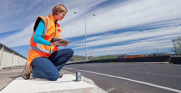
Have Accuracy, Will Travel
Photo courtesy of Trimble. BYOD Sub-Meter Positioning for Mapping and GIS Professionals
Employees bringing their own mobile phones and tablets to their jobs in the field enables them to complete more tasks using fewer devices. However, this practice introduces operational and security vulnerabilities.
By Matt van Doorn
In the mapping and GIS industries, mobile devices such as smart phones and tablets have a growing presence in the field; they enable businesses to work smarter and more efficiently. The Bring Your Own Device (BYOD) trend — essentially the use of commercial-grade devices for work purposes — will likely not slow down. BYOD is not without its pain points. Organizations face many security vulnerabilities when commercial-grade devices access critical data via corporate IT networks. Additionally, there are applications where a mobile device’s location capabilities are not accurate enough for GIS professionals to efficiently and effectively locate an asset and collect data.
Company IT departments have multiple options that control and monitor access to combat BYOD security issues; however these options do not resolve the accuracy issue. Traditional company-issued handheld integrated receivers for data collection are designed to meet accuracy demands in almost any physical environment condition. While these devices are the most appropriate technology option for some applications, they tend to be expensive for the positioning tasks where a smart phone or mobile device is “good enough.”
What to do when better accuracy on a mobile device is required, but it doesn’t make sense to invest thousands of dollars in a traditional receiver? With proper research, field professionals will find professional solutions that pair with consumer-grade smart devices to produce the requisite accuracy for a fraction of the cost of a traditional receiver.
Requirements and Accuracy
At a minimum, handheld receivers destined to work in conjunction with mobile devices must meet the following requirements:
- The device must have moisture ingress protection to function properly in snow, ice, rain or dust environments.
- The device must survive falls in hard terrain. It should have shock, drop and vibration protection.
- The device must last the full workday for the professional to complete all workflows on a single battery charge.
Legacy company-owned receivers typically meet the requirements above and have had a long-term reputation for accurately providing positioning data. These devices are still the appropriate solution for environments where it does not make sense to take a smart device, such as a remote location in rough terrain where the smart device may not perform.
However, a smart device can in many cases enable the employee to be more efficient. Thanks to the accessory market, many of the above-listed requirements can be easily addressed. For example, smart-phone juice packs can fix the battery longevity issue; cases can protect against weather, shock or dropping; and screen covers can address the sunlight screen visibility issue. With a smart device in hand, GIS and mapping professionals not only have access to GPS data, but they are able to access and complete other work-related tasks from the same device such as email, internet access and voicemail. Plus, a smart phone is only a fraction of the cost of traditional receivers.
The most critical component that smart devices still cannot address is sub-meter accuracy, which many mapping and GIS professionals require to successfully do their job.
Accuracy Drives Cost. Mapping and GIS businesses are acutely aware of the efficiencies created by greater accuracy. With poor information, errors become increasingly costly. When robust, accurate data is collected, there is a direct correlation to improved workflows and operations. This allows professionals to be more strategic in ensuring that applications are effective and efficient across operations.
Aerial and satellite imagery made initial steps toward generating more accurate data collection, bringing mapping and GIS professionals to within a 50-centimeter range of the assets. Subsequently, high-speed lidar collection tools, designed to capture large areas at 5–10 cm accuracy, came to the market. While these tools significantly improved data collection, precise measurement typically requires more time, more expense and highly specific instruments in order to generate more data.
Today, handheld receivers can achieve high accuracy without using survey-grade tools, in applications that include:
- Mapping: Any application, including locations, quantities, densities, specific areas and map change.
- Aquatic monitoring
- Buried utility infrastructure/cable location
- Water/wastewater disposal
- Location and elevation measurements: for example, elevation data on manholes or trunk lines.
Requirements vary across applications and industries. The mapping/GIS professional must determine the level of accuracy their workflow requires.
Accuracy Evaluation
A typical smart device, properly assisted, can achieve an accuracy range of up to 5–6 meters when used to locate an asset. In many cases this is good enough. To obtain positioning data, iOS devices use the application “Location Services,” which is available on multiple mobile platforms. Location Services enables location-based apps and other applications to use information from GPS and cellular and Wi-Fi networks to determine location information. The location provided by a hybrid system with cellular-assisted GPS (A-GPS) allows the device to identify location within a 5–6 meter range of an asset. Wi-Fi positioning alone can determine a location with an accuracy of about 74 meters, and cellular positioning alone offers about a 600-meter range for location, according to industry sources (www.windowscentral.com/gps-vs-agps-quick-tutorial).
However, cellular positioning can be limited when there is no network available. In remote or industrial settings, this could create difficulties in asset location. In water/wastewater, for example, when a GIS professional is in a ditch looking for a valve or a meter and there isn’t a network connection, the accuracy level provided without GPS may not be sufficient for that application. When A-GPS is not available due to a lack of cellular network, GIS professionals also have to deal with convergence time.
Another example involves searching for a manhole cover when the ground is covered by a couple feet of snow. In this case, the 5-6 meter range is quite large and could lead to a lot of time spent digging until the manhole is uncovered. This wastes time and energy, and leads to higher costs. Some receivers have the sub-meter capability and can provide the location data directly to the professional’s consumer-grade smart device through Bluetooth. By simply pairing the receiver with a cellphone, the GIS professional can quickly locate the asset, collect data and move on to the next task.
Accuracy Solutions
Location shortcomings in consumer-grade devices generally boil down to antenna performance. Consumer-grade smart devices are designed for exactly that: consumers. With antennas for Wi-Fi, Bluetooth and GPS built into the small device, there will be compromises in location accuracy. When location must be pinpointed, an integrated handheld receiver can enhance accuracy. Receivers are readily available with 12 channels parallel tracking. Some receivers can also support multiple satellite constellations, including GPS, GLONASS, Galileo, Beidou, and QZSS with up to 44 channels of parallel tracking. The accuracy of these devices is further supported by augmentation: WAAS, EGNOS, MSAS and GAGAN. These receivers can provide sub-meter accuracy, with asset location with as close as 60 centimeters. Some devices also support Virtual Reference Stations (VRS) and Trimble’s Real Time eXtended (RTX) correction service for sub-meter accuracy. Some RTX services achieve real-time sub-meter accuracy with IP and cellular connectivity, or over satellite L-band.
A receiver that integrates with the workflows of various mapping and GIS softwares as well as third-party applications will pair up nicely with a mobile device. The computations are all done for the professional, and will transmit signals via Bluetooth into the host devices using NMEA protocol. On iOS and Android devices, the location is available through the Location Services API. Third-party applications are also able to work with the receiver through consumer-grade devices that utilize the location services API. Some receivers are available across operating systems including iOS, Android and Windows, and are available to upgrade to the latest smart device whenever needed.
Important Device Attributes
Receivers designed to be compatible with a variety of smart devices can be shared among multiple devices. When it is time for a smart device upgrade, the new device can easily integrate with the receiver. Additional features that make these receivers especially convenient to use in the field include:
- Small size: Mapping and GIS professionals don’t always have an extra hand available to carry an extra device. If it can fit in a vest, jacket pocket, pouch, clipped onto a belt, or pole mounted it will function in many scenarios.
- Lightweight.
- Rugged: Some receivers comply with MIL-STD-810 ruggedness with IP65 rating for shock, drop and vibration.
- Battery life: for field performance for a full work day.
- External antenna port: An accessory port for external data if the collecor needs to be mounted on top of a vehicle, or in a hard hat situation; a bonus feature worth consideration.
BYOD Trend and Limitations
The smart-device market will not cool down anytime soon. Gartner Research predicts that in 2015, almost 2.3 billion devices will be shipped worldwide. Whether these smart devices are provided by the company or truly BYOD, they will need to be augmented to effectively serve the applications they are intended to support. Solving the security issue can have a bearing on whether a company chooses to let employees use their own device or provide one; either way, enhancing the location capabilities of the device can be easily achieved with accurate receivers.
Matt van Doorn is a product management, product marketing, market management and business development professional at Trimble Navigation. He has years of experience in the data communication and telecommunication industry with deep knowledge of international markets.
-
Tiny Zano Drone Takes Flight
Zano is a portable aerial photography and video platform designed for consumers that measures 65 x 65 millimeters and weighs 55 grams. Torquing Group, who is developing Zano with the help of a successful Kickstarter campaign, said that Zano’s ability to fly autonomously will provide new possibilities for users seeking to capture images and videos. The drones can even be programmed to swarm. -
OriginGPS Nano Module Powers Tiny Zano Drone
What flies, takes selfies and fits in the palm of your hand? The tiny Zano drone.
Zano is a portable aerial photography and video platform designed for consumers that measures 65 x 65 millimeters and weighs 55 grams. Torquing Group, who is developing Zano with the help of a successful Kickstarter campaign, said that Zano’s ability to fly autonomously will provide new possibilities for users seeking to capture images and videos. The drones can even be programmed to swarm.
Zano’s location capabilities are powered by OriginGPS’ Nano Hornet, a tiny GPS module with an integrated antenna. Measuring just 10 x 10 x 3.44 millimeters, the Nano Hornet delivers performance and sensitivity with low power consumption. It achieves a rapid time to first fix of less than one second, with approximately one meter accuracy and -163 dBm tracking sensitivity. Because it detects changes in context, temperature, and satellite signals, it achieves a state of near continuous availability, while consuming mere microwatts of battery power.
The Zano connects directly with smart devices (iOS or Android) via onboard Wi-Fi to upload and share images or videos instantly. With the help of OriginGPS, Zano is able to know exactly where it is in relation to a smart device, even when powered off. Through a virtual tether, Zano will echo any movement made by the smart device it is synced to, with simple gesture control. A user will be able to control multiple Zanos from one device, enabling photographs and video of the same event from multiple vantage points.
Zano is also able to function in a “free flight” mode, which uses on-screen joysticks for an experience similar to a regular RC-operated UAV. OriginGPS’ location capabilities allow Zano to know if it is getting too far from its corresponding smart device and automatically return. Likewise, it is able to recognize its distance from the smart device and maintain that distance in “follow me” mode.
Since 2008, Torquing Group has developed small unmanned aerial vehicles (UAVs) for the military and defense industry.
To further push the boundaries of GPS modules designed to be small, agile and light weight, OriginGPS introduced the Nano Spider integrated GPS receiver in November. The Nano Spider module is designed to support ultra-compact applications where size is at a premium, such as smart watches, wearable devices, trackers and digital cameras. Like the Nano Hornet, it packs a wide range of functionality into its small form factor, including dual-stage LNA, RF LDO, SAW filter, TCXO, RTC crystal and RF shield with market-leading SiRFstarIV GPS SoC.
-
Broadcom Launches Location Hub with Galileo Support for Smartphones
Broadcom Corporation has announced a GNSS location hub that supports Galileo. Along with Galileo, the Broadcom BCM4774 simultaneously supports GPS, GLONASS, SBAS, QZSS and the BeiDou satellite systems.
With a planned deployment of up to 30 additional satellites for Galileo, smartphones with built-in support for this new system will experience an even higher level of accuracy and better positioning with faster times to first fix, Broadcom said. The architecture of the location hub enables the main AP on the smartphone to reduce computation load and stay in sleep mode for extended periods of time by offloading data calculations to the BCM4774. In certain modes, Broadcom’s advanced hardware design and increased memory can reduce power consumption by up to 95 percent over traditional architectures, significantly conserving battery life in mobile devices.
“Today’s announcement represents yet another navigation benchmark for Broadcom with the industry’s first GNSS location hub for smartphones to support the Galileo satellite system,” said Rahul Patel, senior vice president, wireless connectivity. “We are committed to pushing the limits on location technology by delivering premium performance and enhanced device intelligence while consuming minimal power.”
Additionally, Broadcom’s new solution recognizes various context states, adding more value to the data that is gathered from mobile devices. For example, a smartphone with the BCM4774 can tell the difference between a user that is walking, running or cycling and provides positioning updates that match the identified state for more precise data results. By processing the data directly on the BCM4774 versus the main AP, Broadcom reduces battery drain and creates opportunities for developers and original equipment manufacturers (OEMs) to determine how this information is analyzed and delivered to consumers, the company said.
Key Features:
- Additional on-chip memory delivers complex on-chip positioning and sensor hub capabilities.
- Easy-to-use API allows OEMs to port their specific sensor fusion code onto BCM4774.
- Additional hardware optimization further increases AP power savings through offloading of sensor fusion, on-chip positioning, geofencing and location batching.
- Integration of GNSS receiver and sensor hub reduces board area by 30 percent.
- Ultra-low power on-chip positioning enables background and foreground location using GNSS.
- On-chip Wi-Fi positioning using a direct connect communication protocol to Broadcom’s family of connectivity combo chips.
- Enhanced Batching support with the largest batch space in a sensor hub for all devices connected to the location hub, including Wi-Fi, MEMS and GNSS.
-

CSR Launches SDK for Precise Indoor Location Apps
SiRFusion SDK brings plug-and-play simplicity to Android app developers. Photo: CSR CSR plc today announced the launch of its SiRFusion Software Development Kit (SDK) for Android application developers. The solution enables indoor positioning for Android developers looking to create next-generation apps.
Developers can now leverage the SiRFusion library to rapidly integrate new location-based capabilities and services such as indoor location tagging and analytics for social networking applications, indoor navigation, lone worker efficiency and safety capabilities, as well as indoor asset tracking and targeted e-commerce services.
CSR is being acquired by Qualcomm, with the transaction expected to close by the end of the summer of 2015.
Mobile applications with integrated SiRFusion can now deliver the ubiquity of outdoor navigation to indoor environments without costly surveys or infrastructure upgrades. SiRFusion combines real-time Wi-Fi signals, satellite positioning information, pedestrian dead reckoning, and the company’s cloud-based CSR Positioning Center to calculate accurate indoor location. SiRFusion technology provides the accurate indoor position fixes needed to make continuous indoor navigation a part of everyday life. The system automatically crowd-sources a venue’s indoor Wi-Fi signatures as consumers walk through the location, and it has also been architected to accommodate future proximity and location technologies such as Bluetooth Smart beacons, Wi-Fi Round Trip Time (RTT), and Indoor Messaging System (IMES).
“Offering indoor positioning accurate enough to be useful has been a challenge that the industry has been trying to solve for many years,” said Anthony Murray, Senior Vice President, Business Group at CSR. “But with consumers coming to expect anytime-anywhere positioning wherever they are, our customers have continued to express a growing interest for accurate indoor positioning without the need for additional infrastructure. With our SiRFusion Software Development Kit, we have, for the first time, made indoor location a reality for developers who want to deliver innovative location-based products and services without proprietary infrastructure.”
SiRFusion for Android can be integrated into any app running on Android version 4.4 or later. The SDK will be available for download from www.csr.com in Q1 2015, and will include the SiRFusion library, API descriptions, and a Developer’s Guide. CSR will demonstrate SiRFusion for Android at the Location and Context World conference December 2-3, held at the JW Marriott in San Francisco, and at Consumer Electronics Show (CES) in Las Vegas January 6-9, 2015. To schedule a private briefing and demo at either event, contact [email protected]
-
Rx Networks Enables Fast GNSS Positioning in Recon Jet Smart Glasses
Photo: Rx Networks, Inc Rx Networks, Inc., has licensed its GPStream PGPS GNSS assistance technology to Recon Instruments, a Canadian technology company that brings heads-up display products to the consumer market. GPStream PGPS will tightly integrate with the GPS chip inside of Recon’s upcoming Jet smart glasses, an advanced wearable computer planned for the first quarter of 2015.
Through its location and GNSS assistance software and services, Rx Networks empowers fast positioning in more than a billion mobile devices every day, the company said. Its GPStream PGPS solution, licensed and deployed in more than 100 million smartphones and personal navigation devices, accurately predicts the future orbits of satellites for up to two weeks in advance. It then stands by, ready to deliver this assistance data into a GNSS chipset when it powers up. This not only speeds up initial time to first fix (TTFF) from 45 seconds down to less than 3 seconds, it also improves the receiver sensitivity and reduces power consumption. From a user perspective, this translates into longer battery life and faster initialization of apps that depend on location, even in difficult environments.
According to IDC, the wearable devices market is expected to grow from 19.2M units in 2014 to 111.9M units in 2018. Most form factors today rely on the presence of a smartphone as a hub for core functions like Internet access or location. “We are seeing an exciting new trend in the mobile location market,” said Guylain Roy-MacHabée, CEO of Rx Networks Inc. “From smartwatches to smart glasses, we are helping OEMs optimally implement satellite navigation and other means of positioning directly in this new class of smart wearables devices.”
-
New Geospatial Computing Book Penned by Ruizhi Chen
 A new text and reference book, Geospatial Computing in Mobile Devices, has been published by Artech House. Recent developments in smartphones enable them to meet many of the demanding requirements for geospatial computing, in terms of computation power, data storage capacity, and memory space. This book, written by Ruizhi Chen and Robert E. Guinness, addresses and instructs in geospatial data acquisition, processing, visualization, context detection, and context intelligence.
Chapters of the 209-page book include:
- Fundamentals of Mobile Positioning
- GNSS, Wireless, and Hybrid Positioning in Mobile Devices (three separate chapters)
- Mobile GIS and LBSs (two separate chapters)
- Context Awareness and Reasoning (two chapters), and
- Future Directions in Mobile Geospatial Computing.
Co-author Ruizhi Chen previously published a cover story in GPS World magazine, 3D Smartphone Navigation Using Geocoded Images and another technical article, Multi-Sensor, Multi-Network Positioning, also in GPS World. He is a professor and head of the Department of Navigation and Positioning at the Finnish Geodetic Institute. He holds a Ph.D. in geophysics from University of Helsinki. He is the general chair of the IEEE conferences Ubiquitous Positioning, Indoor Navigation and Location-Based Services held in 2010 and 2012, and scheduled this year for November 20–21 at Texas A&M University, Corpus Christi.