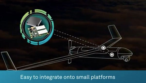
The newest member of the proven GAJT team means you can protect all your platforms from jamming. Light and small, it’s the best protection per gram you can get. You can even get it as an integrated enclosure (one piece) or a federated solution (separated anti-jam electronics and CRPA), so it is ideal for small platforms, like UAVs.
Tag: sponsored video
-
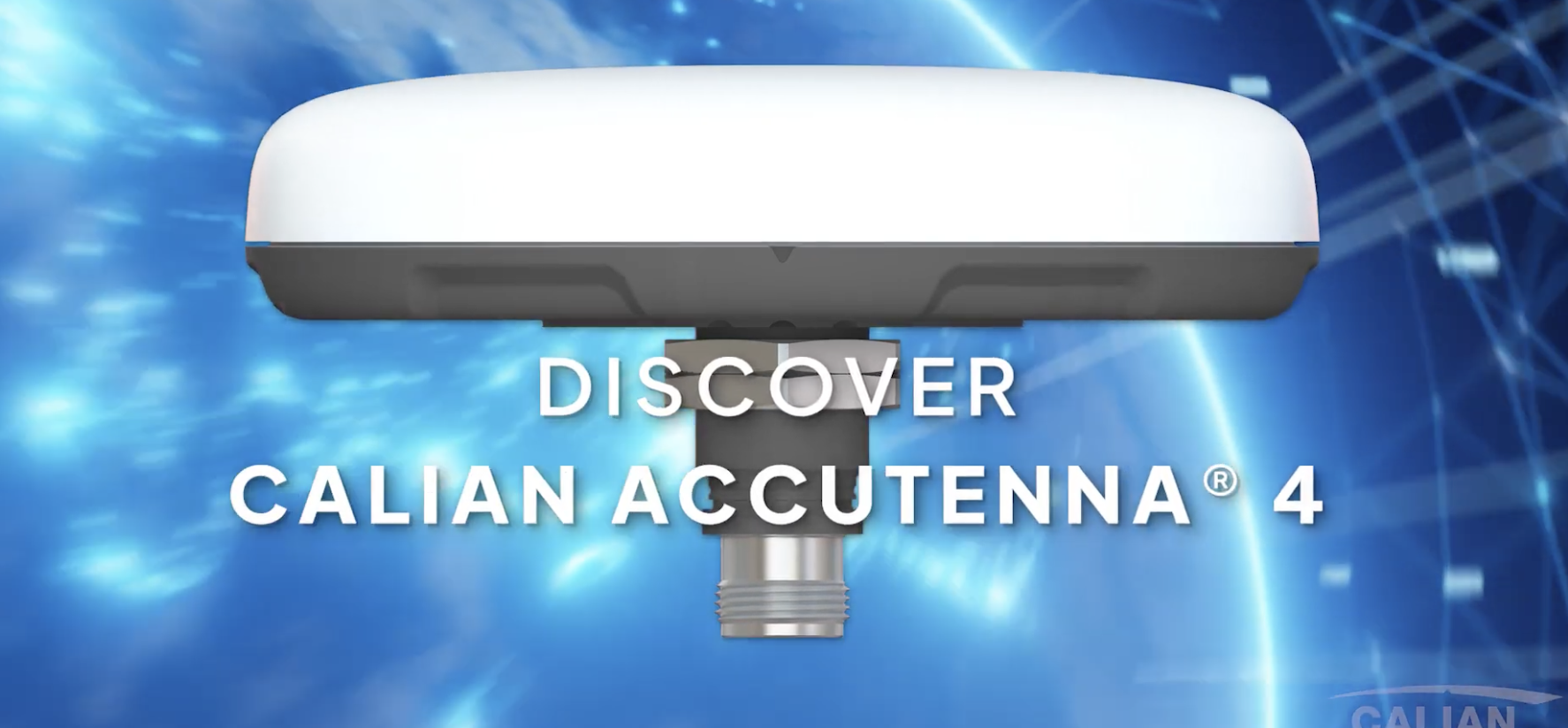
Redefining high-precision GNSS – meet Accutenna 4
The Accutenna 4 features:
- Low-profile 4-feed composite patch
- Full GNSS + L-Band coverage
- Superior interference mitigation (XF)
- Housed and embedded models available
- Lightweight, rugged industrial design
-
Waypoint post-processing software
Waypoint software is an industry-leading, professional post-processing portfolio trusted by the companies building maps for the world. Waypoint software leverages Global Navigation Satellite Systems (GNSS) and inertial navigation systems (INS) data to generate a source of truth for post-mission trajectories and mapping.
Built on Hexagon | NovAtel’s decades-long legacy in post-processing algorithm development, Waypoint software refines GNSS-only or GNSS+INS data by processing forward and reverse in time, then combining and smoothing the results to maximise accuracy and signal availability for applications across land, air and sea.
-
Huge anti-jam protection in a tiny package
[SPONSORED CONTENT] The newest member of the proven GAJT team means you can protect all your platforms from jamming. Light and small, it’s the best protection per gram you can get. You can even get it as an integrated enclosure (one piece) or a federated solution (separated anti-jam electronics and CRPA), so it is ideal for small platforms, such as UAVs.
This video is sponsored content by NovAtel.
-

NovAtel Application Suite: Get the most out of your receivers
[SPONSORED CONTENT] With the NovAtel Application Suite, you can monitor the status of all your receivers during operations, including GNSS satellite tracking, positioning and even interference detection – all in one integrated software suite.
Whether you are integrating our GNSS receivers with your system, undertaking post-operation analysis, or monitoring real-time output from your receivers, the NovAtel Application Suite lets you make the most of our industry-leading technology.
This video is sponsored content by Novatel.
-

United States Congress wakes up to DePIN – GEODNET testimony
[SPONSORED CONTENT] On April 10, 2025, Mike Horton, project creator of GEODNET, testified before the U.S. Congress on behalf of both GEODNET and the broader DePIN (Decentralized Physical Infrastructure Networks) ecosystem. The testimony showcased how blockchain-powered DePINs are already delivering scalable, cost-effective infrastructure across essential sectors such as internet connectivity, precision navigation, and renewable energy.
This milestone reflects growing recognition from U.S. policymakers and affirms the real-world value and momentum behind decentralized technologies. A proud moment—and a powerful motivator for everyone working to build the future of infrastructure.
This video is sponsored content by GEODNET.
-
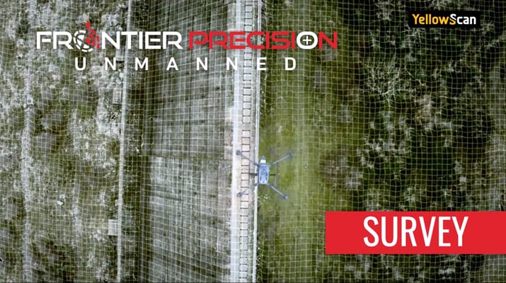
See How Drones Are Transforming Surveying
[SPONSORED CONTENT] Frontier Precision Unmanned is revolutionizing geospatial surveying by integrating advanced drone technology into various industries such as mining, construction, and agriculture. Their innovative unmanned aerial systems (UAS) enable professionals to conduct high-precision aerial surveys efficiently and safely. By offering industry-leading products and software from manufacturers like DJI Enterprise, Quantum-Systems, and YellowScan, Frontier Precision Unmanned ensures that clients receive tailored solutions for their specific applications. These applications encompass geospatial surveying, mapping, infrastructure inspection, and environmental monitoring.
In their promotional video, Frontier Precision Unmanned showcases the transformative impact of drone technology on traditional surveying methods. The video highlights how drones facilitate rapid data collection, producing deliverables such as point clouds, digital surface models, and orthomosaic imagery. These advancements not only enhance accuracy but also significantly reduce the time and costs associated with conventional surveying techniques. Frontier Precision Unmanned’s commitment to providing cutting-edge UAS solutions empowers surveyors and GIS professionals to embrace modern technology, ensuring projects are completed with greater precision and efficiency.
This video is sponsored content by Frontier Precision Unmanned.
-
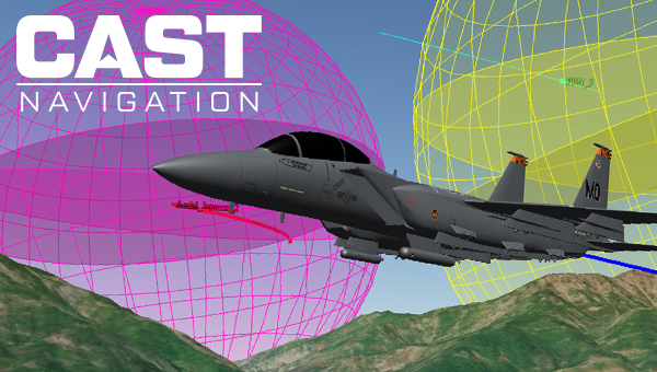
Ensuring Accuracy: How CAST Navigation Minimizes GNSS/INS Simulation Errors
[SPONSORED CONTENT] Ensure accurate navigation by avoiding errors in simulated GNSS and INS output. Discover how CAST Navigation’s advanced configurability and synchronization deliver reliable, high-fidelity simulations for precise performance in diverse scenarios.
-

Introducing the LabSat 4 GNSS Simulator
[SPONSORED CONTENT] LabSat has announced the launch of the LabSat 4 GNSS Simulator, a cutting-edge solution for modern GNSS signal testing. With three configurable RF channels, up to 12-bit I&Q quantization, and variable 10-60 MHz bandwidth, it offers exceptional customization and precision. Synchronized record and replay of external data sources such as CAN FD and RS232 further enhance complex test scenarios.
LabSat 4 has been engineered to deliver ease of use, with saveable custom record settings and a web-based interface for effortless configuration. Its impressive file management capabilities, featuring 7.6TB internal storage and fast data transfer via Gigabit Ethernet and USB 3.0, meet high-volume data demands efficiently. Maintaining the compact size, portability, and cost efficiency of its predecessors, LabSat 4 is ideal for use both in the field and laboratory. Additionally, it integrates seamlessly with SatGen Simulation Software, enabling the creation of detailed GNSS RF I&Q scenario files based on custom trajectories, enhancing its utility for sophisticated GNSS signal testing.
This video is sponsored content by Racelogic.
-
Introducing Spirent PNT X simulation system
[SPONSORED CONTENT] As developers look beyond GNSS alone to address increasingly complex positioning challenges, PNT X brings together signals including L-band, S-band, and alternative navigation signals, as well as industry-first Regional Military Protection (RMP) support, into one innovative, compact, and flexible system.
PNT X brings together the broadest set of features and capabilities needed to protect future systems. These include the patented I/Q spatial awareness capability, an enhanced controlled reception pattern antenna (CRPA) testing interface, the highest available continuous dynamic range for jamming evaluation, and a standard update rate of 2 kHz for hardware-in-the-loop (HIL) and high-dynamics vehicle testing. Along with a host of other groundbreaking enhancements, these make PNT X the world’s most advanced test solution for NAVWAR robustness. Most importantly, it can do all this with simulation integrity delivering trusted results.
This video is sponsored content by Spirent.
-
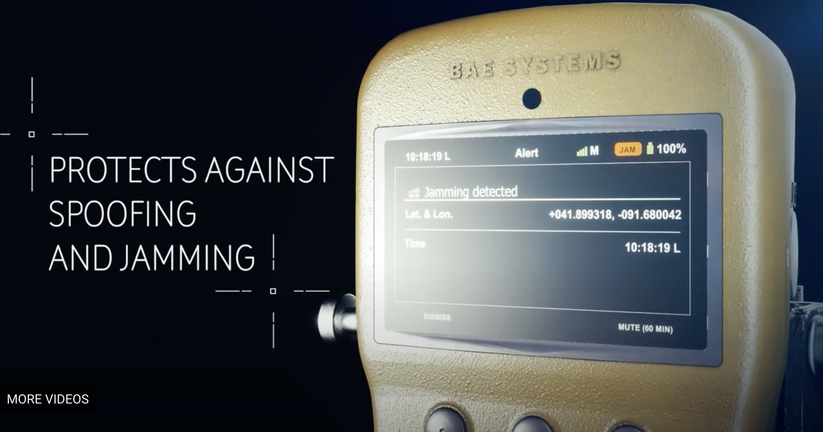
The power to outpace the threat
[SPONSORED CONTENT] What if the biggest receiver upgrade came with the smallest mission interruption and impact to your budget? BAE Systems is delivering the latest in portable M-Code GPS technology. The NavGuide™ receiver is a portable, secure GPS receiver made for handheld and vehicular operations with the added protection of anti-spoofing. Future-proofed with a modular open system architecture, the NavGuide receiver gives you the power to outpace the threat.
Get the proof in your palm here.
This video is sponsored content by BAE Systems.
-
The NavGuide receiver gives you the power to outpace the threat
Now the most impactful GPS receiver upgrade comes with the smallest mission interruption. Learn how the portable NavGuide GPS receiver delivers secure M-Code PNT data.
Explore more at www.baesystems.com/navguide.
This video is sponsored content by BAE Systems.