Advanced Navigation’s Certus Evo enabled Nextcore to fly at 100 metres AGL, exceeding their goal. Nextcore required a MEMS INS that would enable their UAV-LiDAR to fly at 80 metres above ground level (AGL).
[SPONSORED CONTENT] GPS jamming has become the #1 threat to defense and commercial drones. Therefore we developed GPSdome: a GPS protection solution tailored for defending drones and vehicles from jamming attacks. GPSdome provides a robust cyber shield, allowing the protected platform to safely and continuously operate and complete missions in a GPS-challenged environment. At its minimal size weight and power, there is no other solution that offers such protection as small, light, affordable or as easily installed as GPSdome.
[SPONSORED CONTENT] It’s time to enable advanced action in any environment.
Our autonomy-ready solutions enable greater safety, productivity and efficiency. With interoperable, cross-industry capabilities built to meet your toughest challenges head-on, we’ll meet you where you are—to take you where you’re going. Leverage our decades of intelligence and experience to reach your autonomous potential.
[SPONSORED CONTENT] VBOX NTRIP Modem allows you to receive RTK correction data via internet, without having to operate your own base station. By accessing public or commercial RTK networks, correction messages from a grid of permanent base stations can be received by either Wi-Fi or 4G cellular connection. Utilizing Network RTK overcomes the range restrictions of a single base station, allowing for centimeter-level RTK accuracy to be achieved over significant distances. Additionally, receiving corrections via internet rather than radio provides a more reliable signal reception as interference from changes in elevation or topographical obstacles are minimized.
If your use of RTK corrections is localized, then you can still gain the benefits of increased range and signal reliability offered by utilizing internet-based correction messages. Simply connect your base station to a computer with internet access and cast the correction messages from your base station directly to the VBOX NTRIP Modem.
Racelogic, the company behind VBOX and LabSat GNSS simulators, has recently launched the VBOX Indoor Positioning System (VIPS) in response to customers’ developing demand to use GPS embedded technology in GPS-denied environments. VIPS delivers <2cm accuracy with an update rate of 100 times a second, making it ideal for dynamic applications, and this accuracy is maintained with seamless transition from GPS to VIPS with reacquisition in less than 0.2 seconds.
In line with Racelogic’s automotive heritage, VIPS was initially developed for the automotive testing market; however, this has been closely followed by expansion into virtual production motion capture in the film and gaming industry, autonomous robotics, construction, mining and logistics. In fact, this accurate and affordable indoor positioning solution is ideal for almost any application which would normally rely on GPS.
The Topcon GTL-1000 transforms construction layout and as-built verification from infrequent spot checking to a digital real-time reality capture solution enabling layout, scanning and verification with daily frequency. A scanner integrated with a fully featured robotic total station, it provides quick layout and scanning with a single instrument and only one operator that drives increased productivity and cost savings.
Topcon Positioning Group’s Dave Henderson offers a rundown on the company’s latest products, including the Falcon 8+ drone, Sirius Pro, MR-2 modular receiver, and B210 and B125 receiver boards, at Xponential 2019.
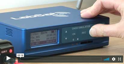
LabSat 3 Wideband captures and replays more GNSS signals at much higher resolution than before.
With three channels, a bandwidth of the 56Mhz and 6-bit sampling (3-bit I & 3-bit Q), LabSat 3 Wideband can handle almost any combination of constellation and signal that exists today, with plenty of spare capacity for future planned signals.
Averna’s David Brace offers a rundown on the company’s RP-6500 RF Record and Playback platform at ION GNSS+ 2018, which took place Sept. 24-28 in Miami. According to the company, real-time GNSS simulation and SATCOM signal generator toolkits will now be available for its RP-6500 RF Record and Playback platform, making it an all-in-one solution to support advanced satellite navigation applications.
A video featuring a South African veteran surveyor, telling his story of achieving 2 cm horizontal accuracy with Trimble CenterPoint RTX. Satellite-delivered, survey grade accuracy and no base station required!
Spirent Federal Systems‘ Kalani Needham discusses the company’s GSS6450 RF record and playback system and GSS7000 signal generator at Xponential 2017 in Dallas, Texas.
End-users can achieve even better accuracy with NavCom’s StarFire Network by integrating the company’s Onyx GNSS OEM board. StarFire is a global satellite-based augmentation system (GSBAS) that provides precise point positioning (PPP). Onyx, a multi-constellation OEM board, has three separate channels for StarFire signal processing.