Tag: surveyors

  • Surveyors and GNSS in 2018 — A look ahead to 2019

    Surveyors and GNSS in 2018 — A look ahead to 2019

    Calendar pages allows seem to fly by quickly, and 2018 was no different. While many of the items discussed in last year’s review continued to be topics of advancement, there are several new sources of technology, data collection and potential issues for surveyors going into the new year.

    Let’s look back at the stories that affected the surveyor and their use of GNSS technology in 2018.

    FCC broadband accuracy

    The race across America to provide better broadband coverage hit a snag late in 2018 when critics of the Federal Communications Commission (FCC) voiced their displeasure with the accuracy of maps produced to depict the coverage of broadband access.

    These critics are pressuring the FCC to verify internet coverage and speed of data availability in rural areas as reported by the broadband companies.

    The FCC unveiled a new broadband map in February 2018. (Image: FCC)
    The FCC unveiled a new broadband map in February 2018. (Image: FCC)

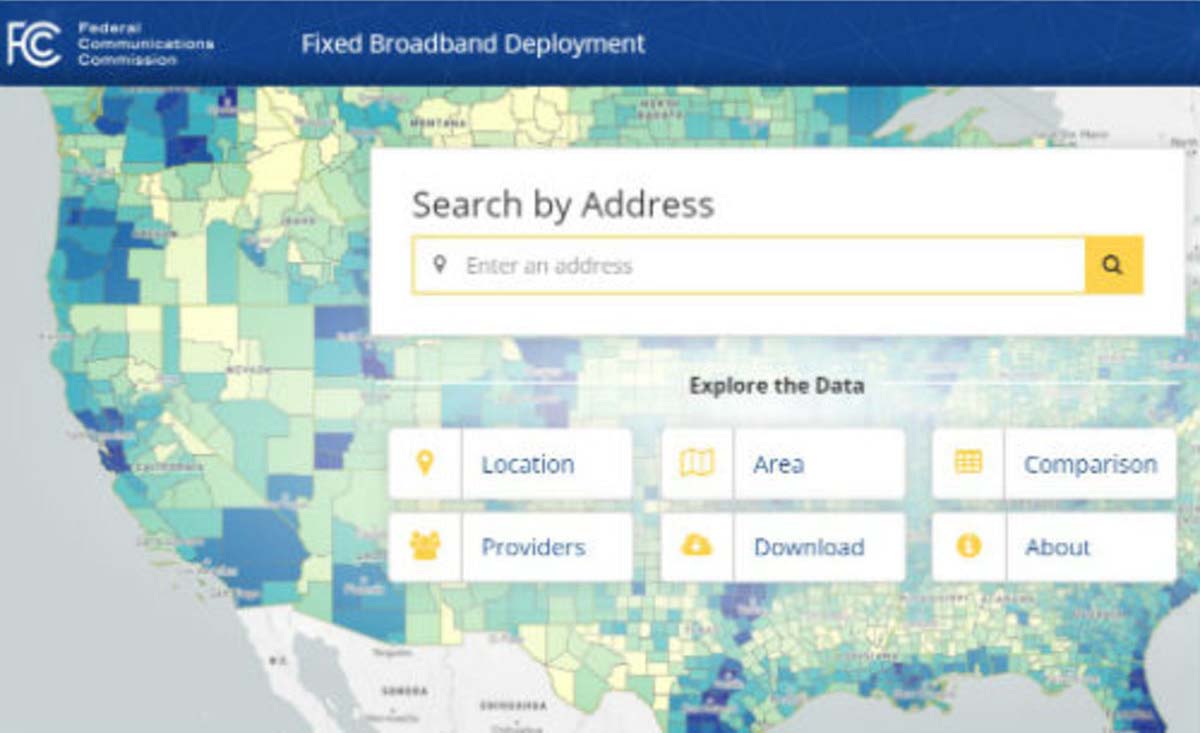
    These broadband companies are only required to report on the advertised availability and data speeds and not the actual coverage/speed of the installed networks. Critics of the FCC have found that information used from the broadband providers overstates the available speeds and number of internet service providers, thus allowing the FCC to produce mapping of broadband that is not correct.

    Because of this incorrect reporting, it is estimated that almost 40 percent of rural America doesn’t have access to broadband data with no formal plan of rectifying this situation. The FCC has stated that they will investigate these coverage maps in order to determine if monies distributed to broadband providers were not used in accordance with the promised delivery of coverage and data speed.

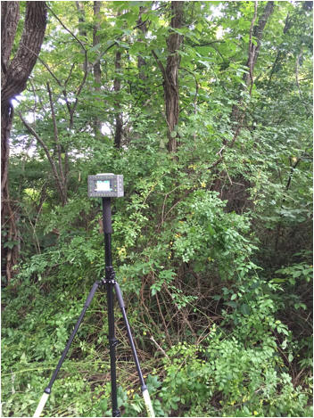
    Why does this matter to surveyors? As previously discussed in past columns, the reliance on the real-time network capability of GNSS is one of the biggest time and production savers for the surveyor and for those working in rural America is no exception.

    Not just in small towns but out in the open where large parcels are being surveyed for many different reasons, including pipelines, wind and solar installations and title conveyances. By having broadband available use by surveyors, these tasks can be accomplished with shorter timeframes and less steps to keep critical data in compliance with established coordinate systems.

    Geospatial Data Act

    On Oct. 5, 2018, the Geospatial Data Act (GDA) was signed into law as part of the FAA Reauthorization Act (see Geospatial Solutions, “Geospatial Data Act will bring huge changes to America, and the world“).

    While this bill received lots of attention because of the FAA implications, the portion of the bill concentrating on geospatial oversight will have a lasting effect on the governance and development of the national mapping industry.

    For many years, the ever-developing amount and sources of geospatial data has been growing within several different agencies of the United States government. This bill was established to help streamline the efforts and availability of geospatial data by assigning specific agencies to oversee the development and introduction of new technologies.

    The biggest takeaway from this bill will be the reduction of agencies working on concurrent data sets for public and private use and therefore streamlining the opportunities to introduce newly acquired information into critical programs, (such as FEMA floodplain mapping, GAO asset management, etc.).

    Part of the reason I wish to highlight this bill was the efforts of the National Society of Professional Surveyors (NSPS) to keep the state professional licensing laws intact, the use of private sector businesses for providing surveying services, and to keep quality-based selection (QBS) as the primary tool for awarding contracts for procurement services.

    Because of the actions and reasoning by NSPS, the authors of the bill withdrew the language that would allow “low bid” opportunities within these contract awards. This influence by NSPS is a prime example of how a profession can influence legislation through our democratic process.

    Galileo implementation, Beidou installation, GPS Block III launches

    SpaceX’s Falcon 9 rocket orbited the first GPS III satellite on Dec. 23, 2018. (Photo: SpaceX)
    SpaceX’s Falcon 9 rocket orbited the first GPS III satellite on Dec. 23, 2018. (Photo: SpaceX)

    In November 2018, the FCC opened a new chapter in GNSS observation by approving a waiver to allow GNSS receivers to utilize Galileo transmissions for location determination without a specific FCC license. Traditionally, the FCC would require licensing of public, receive-only GNSS equipment used with any foreign-based systems but worked with several US agencies to create a waiver to allow faster implementation to use the Galileo signals.

    It should also be noted that the Chinese government has been rapidly building the latest stage of their own GNSS constellation, the BeiDou system. The United States and China have been promoting cooperation to allow each side to better understand the current workings of GPS and BeiDou, (GPS-BeiDou Statement). China is currently completing its third phase of the navigation system that potentially will surpass the United States GPS constellation in data availability and accuracy, (See GPS World “Directions 2019: BeiDou accelerates global deployment,” December 2018).

    Not to be outdone, the U.S. has begun its implementation of their next wave of satellites, the GPS III containing the latest technology, the L1C civil signal, with improved accuracy and anti-jamming programming. On Dec. 23, the SpaceX Falcon 9 rocket delivered the GPS III SV01 into its intended orbit (SpaceX Launch) with more launches scheduled for additional satellite vehicles in 2019.

    These efforts to increase satellite coverage and accuracy will only improve the use of GNSS receivers by surveyors. While I look forward to software and receiver upgrades to take advantage of the newer birds, we still need a backup plan in case of international conflicts and a reduction/discontinuation of GNSS service.

    GPS and terrestrial backup

    Image: @SENTEDCRUZ
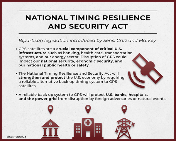
The Frank LoBiondo U.S. Coast Guard Authorization Act of 2018, which also included the National Timing Security and Resilience Act, was signed into law on Dec. 4 and directs the Secretary of Transportation to establish a terrestrial back system for the U.S. satellite navigation system within a two-year period (see  “GPS to get terrestrial backup system”).

    The bill lays out specific conditions for the backup plan:

    • terrestrial
    • wireless
    • synchronized to UTC
    • difficult to disrupt
    • able to penetrate underground and inside buildings
    • capable of deployment to remote locations
    • expandable to provide position, navigation and timing (PNT), and
    • able to work in concert with similar systems such as eLoran.

    However, this bill did not provide any funding for the creation of this system but now allows the introduction of appropriations in future bills and acts. As I have written in past columns (see “The day GPS went away,” September 2017), it won’t be a matter of if but when something happens to our current GNSS capabilities and we need to develop this backup plan yesterday.

    Dual-band GNSS cellphones as the new norm

    My last submission featured the latest in chipset for cellphones and utilizing dual-frequency GNSS signal reception. Xiaomi, based in Beijing, China, introduced the Mi 8 phone with a dual-frequency GNSS chip in the Spring of 2018 to rave reviews.

    This chip frequency reception (E1/L1+E5/L5) is targeted to embrace the Galileo and GPS constellations for increased accuracies (within a decimeter) well beyond the current norm for smartphones (typically 1-3 meters +/-).

    Since then, Xiaomi has released the Mi Mix 3 and Huawei has released the Mate 20, Mate 20 Pro and Mate 20 X, all with dual-frequency chipsets. However, all of these phones are not available in the U.S., and the security issues with Huawei has been well documented (CNBC Report, February 2018).

    The reason I still bring these up for the surveyor is because soon we will have dual-frequency capability on the phone in our pockets here in the U.S. Such phones can greatly increase efficiencies, especially when used during reconnaissance efforts. I believe many more phone manufacturers will begin to incorporate dual-frequency chips in their future models to increase location accuracies for the users and take advantage of upcoming network enhancements (see GPS World “Dual-frequency GNSS smartphone hits the market,” June 2018.)

    Surveyors vs. technology disruptors

    The Mi 8 smartphone offers dual-frequency capability. (Image: Xiaomi)
    The Mi 8 smartphone offers dual-frequency capability. (Image: Xiaomi)

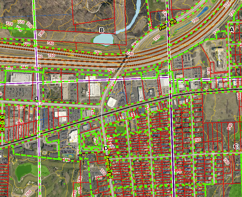
    One of the biggest stories in the surveying world made national headlines after a start-up “GEO-spatial” consultant created by retired bankers was sued by the Mississippi Board of Licensure for Professional Engineer and Surveyors for having “engaged, and continues to engage in the practice of surveying while not licensed by the Board.” (Madison County, Mississippi, Chancery Court.) While the initial suit remained under the national radar, the countersuit by the consultant and subsequent articles in national websites brought the situation to the front page.

    The issue at hand is the creation of “plats” combining a legal description for a parcel with a high-resolution photo (captured by various means, including UAV) and depicting said legal description on the photo for use by banks and other financial institutions for risk evaluation. Their argument is that they have “First Amendment rights” to provide public information (the legal description) on a recent aerial photograph in order to provide an exhibit for lenders to review and make loan decisions. Banks are now paying much less in fees to this company for an exhibit instead of a Plat of Survey provided by a licensed surveyor, yet the exhibit provides no assurance (or certification) to its validity and/or any metadata for the represented information.

    The subsequent articles by both Bloomberg and Ars Technica writers liken the situation to Airbnb versus hotels and Uber/Lyft versus taxi drivers as a new “disruption in technology” brings forth change to previously licensed professions. In fact, the author of the Bloomberg article stated, “the clients are sophisticated, and they’re not complaining.”

    Using this mentality, we could apply it to any licensed profession and allow services normally regulated by laws to be administered by non-professionals, as long as the client “is sophisticated and not complaining.” This means anyone can provide accounting, medical, dental or even law services if the client is satisfied. As previously published here, (see GPS World “Accuracy, precision and boundary retracement in surveying” July 2017), a boundary survey is not simply a mathematical figure from a legal description. It takes a trained person to know how to properly relate a legal description to a physical parcel and professional licensing provides that assurance (and protection) to the public.

    This situation falls squarely in the GNSS wheelhouse for surveyors, especially as technology advances and accuracies become smaller with progress, (i.e. GPS Block III, BeiDuo, Galileo, etc.) and the ability to measure with higher positional accuracy, (i.e. Xiaomi Mi 8 and other to follow).

    The surveying profession has joked for years that when these technologies do come forward, many unlicensed “professionals” will come forward with their measuring devices (phones) and locate property lines as part of their service.

    But for now, it isn’t just the physical location by GNSS measurement we should worry about; it is the high-resolution photo software, GIS data sources and those folks enterprising enough to put all this information together. The surveying profession will need to ramp up its message to public to help better define what the licensed surveyor provides versus the “we can do it much cheaper and faster” stories. More often than not, you get what you pay for.

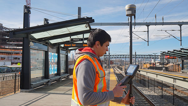
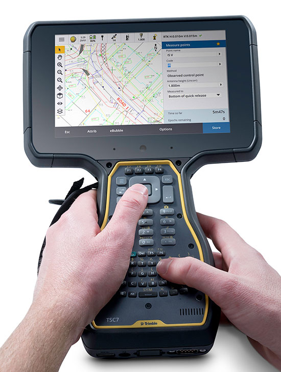
    Data collection advancements

    Emlid Reach RS w/ iPad Photo: Tim Burch (SPACECO Inc
    Emlid Reach RS with iPad. (Photo: Tim Burch)

    While 2018 didn’t see any revolutionary changes to GNSS data collection, several small advances are noteworthy. Besides the previously mentioned dual-frequency cellphones, we are also seeing more integration with the cellphones themselves as data collectors in conjunction with stand-alone GNSS receivers (see GPS World “University research uses smartphones for precision GNSS,” September 2018).

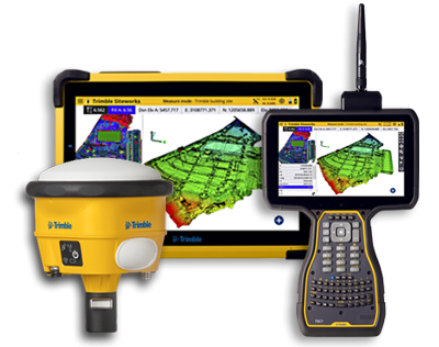
    Several of the major survey equipment manufacturers are joining a group of small GNSS start-ups by introducing single- and dual-frequency receivers to work with both Android- and iOS-based phones and tablets for more cost-effective positional solutions.

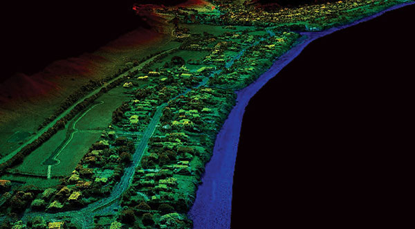
    Another trend that is becoming very popular is the use of post-processing kinematic (PPK) solutions with many of the newest models of multi-rotor and fixed wing UAVs. The early (and expensive) trend of aerial vehicles produced by the major surveying equipment manufacturers insisted on installation of a dual-frequency RTK receiver in order to provide a more robust control system for the orthometric photo process. Because there is still a need to combine the still photos from the UAV flight via various “stitching” software, the need (and expense) of RTK within the receiver, while a nice feature, has become overkill for most aerial needs. However, there are times and applications when a fixed-RTK location could be useful, especially during emergency situations when needing to utilize the UAV for live streaming purposes.

    Propeller Aeropoint w/ DJI Inspire 2. Photo: Brian Kravets (SPACECO Inc.)
    Propeller Aeropoint w/ DJI Inspire 2. (Photo: Brian Kravets, SPACECO Inc.)

    The last big trend to gain popularity comes from Propeller, a young tech company from Australia that provides both a control point product and data reduction/reporting service. Their revolutionary ground control point (GCP) target, the Aeropoint, is becoming a very popular item for UAV pilots worldwide. These 24-inch (61-CM) square foam targets contain a single-frequency GNSS receiver that collects RINEX data while performing your UAV flight. Spread these targets around your site, setup and perform your survey, then download the target data to the Propeller app on your phone/tablet. The app automatically uploads the data to the company’s site and processes the geographical location for each target into your chosen coordinate system. It truly is that simple and the Propeller folks have made it easy to use. Their online software, Propeller Platform, is also available for photo/data processing and site analysis/visualization/volume computations. They, too, are now teaming with DJI to offer PPK solutions combining Aeropoint data along with Phantom 4 RTK photo data in a convenient, streamlined process.

    For 2018, our firm (SPACECO Inc) expanded our UAV program in several ways to take advantage of these trends. First, we been using the Emlid Reach RS single-frequency GNSS receiver utilizing a Bluetooth connection to an iOS-based tablet to GCP’s for our UAV program. The receiver’s low cost and ease of use with an RTN network has been a pleasant change from typical surveying equipment. We also use Propeller’s Aeropoints in locations where the RTN coverage is not readily available. For sites that are substantial (typically 300 acres+), we often send our data to the Propeller Platform for photo stitching and data reduction to take advantage of their computing power.

    WingtraOne. Photo: Brian Kravets (SPACECO Inc.)
    WingtraOne. (Photo: Brian Kravets, SPACECO Inc.)

    Lastly, we wanted to expand our fleet of quad-rotor UAV’s to include a fixed wing model for larger sites. A visit with the Wingtra crew at InterGeo 2017 in Berlin convinced me that a vertical take-off and land (VTOL) model would be a great addition, so we took delivery of our WingtraOne this past summer. The ease of use and amount of project space the Wingtra can cover was already great but we’ve added the PPK module to reduce the amount of GCP’s necessary, especially in inaccessible areas. All these additions to our survey department (carefully vetted and purchased; no freebies from any of the manufacturers!) have provided new ways to expand our services to our clients and allows us the opportunity to enjoy what we do along the way. It is my pleasure to report from personal experience that these trends are solid and will continue to increase our abilities and productivity for days to come.

    What’s next for 2019?

    Some of the items I see gaining traction in 2019 will include additional sensors for UAV’s (LiDAR, hyperspectral, infrared), continued improvement in cost effectiveness of laser scanners and LiDAR, increased interest in SLAM (simultaneous localization and mapping) technology and, of course, more geolocation services tied into autonomous vehicles/delivery. Will 2019 be the year Amazon drops my packages by UAV at my front door? As fast as these technologies are developing, I wouldn’t bet against it.

  • Expanded GNSS and 5G: A gift for the surveyor

    Expanded GNSS and 5G: A gift for the surveyor

    Regular readers of GPS World are aware of many of the rapidly developing technologies and navigational systems being created around the world, but often the everyday surveyor shows up late to the party.

    While smartphones get the most mainstream media coverage, other navigational devices and measurement systems are adapting to evolving technical breakthroughs and new methods of transmitting a variety of data wirelessly.

    This month’s article looks at the increase in satellite navigation networks along with the rollout of 5G cellular technology. Both advancements will benefit the surveying community; to start, I’ll explain what this means for accuracy and precision of survey measurements as well as productivity.

    Everybody gets a constellation! (with apologies to Oprah)

    I’ve been known to wax poetic in this column about my admiration of GNSS technology, and I continue to marvel at the “accidental” civilian use of a military tool. This method of measurement and navigation continues to expand, refine and transcend everyday life, and surveying is no exception.

    The satellite constellation is the mainstay of this navigational system. The United States began the charge several decades ago, but other nations are quickly catching up. Let’s look at the current constellations and their status.

    Operational Systems

    • GPS (United States)
    • GLONASS (Russia)
    • Galileo (European Union)
    • Beidou (China)
    • QZSS (Japan)
    • IRNSS (India)
    Chart: GPS World
    Chart: GPS World

    There are now more satellites. What’s the big deal?

    The addition of these constellations provides large gains for the surveying community in several different ways.

    First, the additional satellites mean more signals to help with the mathematical equations necessary for positional determination. While traditional surveying in the general public’s eye is associated with measurements on the ground, our expansion of services into the air and water relies heavily on GNSS determined positions.

    No matter what type of remote sensing equipment is being used (lidar, photogrammetric, sonar, etc.), positional determination for most of those sensors are derived from GNSS-based receivers. Add to these measuring methods the ability to perform operations via remote-controlled or autonomous vehicles in both air and water, and the availability of additional satellite signals enhances the reliability of GNSS-derived data and attributes.

    Second, by having more satellite signals to utilize, GNSS receiver manufacturers can improve the software for processing the positional information with greater certainty of accuracy.

    Before the introduction of additional constellations and receivers with expanded signal reception, GNSS users relied on less sophisticated software to identify potential “bad” signals that would lead to incorrect positions. While the software generally provided reasonable reliability, it was not foolproof and occasionally would allow bad data to be accepted.

    Like most everything tech-related, however, the GNSS industry has benefited from increased computing power to go along with the additional satellite constellations. The latest GNSS receivers can accept well over 500+ signals from a variety of sources (including land-based transmitters). The software used to reduce all that data has increased in complexity along with number of those data sets.

    Complex computations that were once limited to mini-computers or even mainframes are now being completed on handheld data collectors in minuscule timeframes compared to their predecessors.

    The software has also been enhanced to analyze the data in real-time, compute the likely position of the receiver and notify the user of potential incorrect or “spoofed” data from any number of satellites.

    Considering that many of the remote-sensing sources now collect millions of points based upon one GNSS-based position, the need for increased positional verification has become a critical issue. By having many more constellations to provide signals for positional data, the percentage of establishing a correct location for each data point has increase significantly.

    The improved computing power and verification ability of today’s GNSS software is helping to eliminate errors in positional accuracy and instill more confidence in the surveyor’s data collection activities.

    Add to these additional constellations the planned installation of more land-based signal providers to augment or provide a backup plan for satellite systems, and it’s clear that the future is quite bright for GNSS-based receivers and data collection for everyone — especially the surveying community.

    The history of wireless communication

    While surveyors marvel at the advancements of GNSS-based measurement, it pales in comparison to the rapid growth of modern technology with cellular devices. Notice I didn’t write cellular phones, as the technology has quickly established itself as much more than voice communication. Before we lay out the future of cellular data networks, let’s take a step back and see how this type of communication has revolutionized GNSS-derived data collection for surveyors and others.

    Two-way, CB and shortwave ham radio

    1947 two-way radio advertisement. (Image: Motorola)
    1947 two-way radio advertisement. (Image: Motorola)

    The technology behind wireless communication goes back several decades, but didn’t become a mainstream system until the late 1970s and early 1980s. Motorola is known as the early force behind the two-way radio system, but the base and remote transmitters were not cost effective for small businesses. This type of system was also limited to single-purpose radios with individual crystals wired within that only allowed specific frequencies to be transmitted.

    Another type of communication used by some was the citizens band radio, affectionately referred to as CB radio. This radio was limited to 40 channels and didn’t allow for private transmission between two parties. During the 1970s, the use of the CB radio was not limited to long-haul truck drivers — many people used the medium for basic communication.

    Vintage CB radio ad from Radio Shack. (radioshackcatalogs.com)
    Vintage CB radio ad from Radio Shack. (radioshackcatalogs.com)

    Telephone service during these times was still costly and long-distance calls were not cost-effective, so many found the CB radio as an alternative to conventional phone service. Looking back now, it is not a stretch to classify this type of broadcasting as a primitive social media precursor to today’s methods but limited to live chats and no visuals.

    Another method of transmission was short-wave radio. This system was like two-way radios with an established base transmitter, but broadcast on public frequencies over greater distances than CB radios. One of the big drawbacks was the upfront costs, which were much more significant than the other radios. Even more expensive was outfitting a vehicle with a shortwave system, so cost was the biggest limiting factor for this mode of communication.

    Pagers of all shapes and sizes

    Motorola's Pageboy pager. (Photo: Motorola)
    Motorola’s Pageboy pager. (Photo: Motorola)

    The popularity of telephone-based pagers didn’t hit its zenith until the early 1990s, but the technology and actual use dates to the early 1960s. The first commercial pager was produced by Motorola in 1964 and called the Pageboy. There was no screen or display; the user was notified by a variety of tones preset for distinct situations or needs. As this technology advanced, variations in screens, message types and even two-way communication became possible.

    By 1994, there were more than 60 million pagers in use, but a change was in the technological wind; cellular phones were marching toward the mainstream.

    Cellphones on every street corner

    Motorola DynaTAC 8000X portable cellular phone, 1984. (Photo: Motorola)
    Motorola DynaTAC 8000X portable cellular phone, 1984. (Photo: Motorola)

    While the concept of wireless telephone communication existed in several laboratories around the world for years, the first big breakthrough was made by researcher Martin Cooper, who developed a prototype cellular device for Motorola in the early 1970s. He famously made the first public cellular phone call on April 3, 1973, to Joel Engel, head of research at Bell Labs, during a walk in New York City. Cooper and Engel were engaged in a rivalry to develop the first commercially available cellular phone with the Motorola DynaTAC prototype being the first to make a successful call.

    However, the rush to get cellular phones to market took longer than anticipated. It wasn’t until the introduction of the Motorola DynaTAC 8000 in 1983 (available to the public in March 1984) that the reality of wireless phones came to life. The cost of wireless freedom came at a price: $3,500 for a brick-sized phone that took 10 hours to charge for 30 minutes of use. The cost of the service was also expensive due to the limited cellular infrastructure.

    The next decade brought us expanded cellular coverage along with miniaturization of phone; each subsequent model provided more features and longer battery life. From the Nokia “candy bar” to the Motorola Razr, the cellphone era had engulfed the mainstream, but more changes were ahead for mobile communications.

    The late 1990s saw the introduction of the cellphone as a computer modem, with limited email connectivity and primitive internet browsers built into the operating systems. But like many electronic technologies that came before, the cellphone would begin a radically different life in the mid-2000s.

    Enter the smartphone to help us dummies

    The IBM Simon Personal Communicator and charging base. (Photo: IBM/public domain)
    The IBM Simon Personal Communicator and charging base. (Photo: IBM/public domain)

    Officially, the smartphone has been in existence since 1992 with the creation of the Simon Personal Communicator from IBM. At a cost of $1,100, with a monochrome screen that was 4 ½ x 1 ½ inches, the Simon allowed the user access to email and faxes (remember those?) along with the phone function — but users had to make it fast; the battery only lasted an hour. IBM sold 50,000 of these units before pulling the plug on the project, but it started the trend toward mobile telephones with a graphical interface and extended uses beyond the standard verbal communications.

    Just like the Apple Newton was the failed precursor to the Palm Pilot, various tablets and eventually today’s smartphone platform, the Simon broke ground and established new directions for future communication.

    The early 2000s introduced us to the Blackberry personal digital assistant (PDA) and phones from Research in Motion (RIM), a small electronic communications company from Ontario, Canada. RIM started small with a two-way paging system that became popular in Europe and quickly morphed into cellular devices that worked on the DynaTAC network used by Motorola.

    A recent model Blackberry PDA. (Photo: Blackberry)
    A recent model Blackberry PDA. (Photo: Blackberry)

    By the mid 2000s, their devices became affectionately known as the “Crackberry” as users became addicted to the functions and capability of this communication tool. These devices were popular with business users as the security encryption was considered more effective than any of the other communication apparatuses of the day.

    By 2009, Blackberry had reached the zenith of the mobile device market (second only to the conventional mobile-phone platform dominated by Nokia) but began a rapid decline due to proliferation of the next big thing — the touchscreen smartphone.

    After Apple’s introduction of the iPhone in 2007, followed by a crowd of Android-powered phones in 2008 and beyond, Blackberry’s market share has been reduced to a small niche group.

    And now, why this relates to the surveyor…

    The rollout of Steve Job’s dream of combining Apple’s industry-defining iPod with mobile phone capability revolutionized not only the way we communicate — it has redefined our everyday environment. Many of the tasks we accomplish every day have been incorporated into a smartphone application, which brings us back to the reason this article is directed at surveyors: the device that hangs on your belt or rests in your pocket is revolutionizing the way today’s surveyors work.

    Not that long ago, the only navigational devices available were large, expensive and difficult to use. Now, nearly everyone owns a device with GNSS capability. When we combine the ever-expanding number of devices along with the increased coverage of GNSS satellite constellations, the ability to georeference any piece of data to greater precision and accuracy is improving.

    Surveyors need to embrace this technology within their smartphones to increase their efficiencies. At the same time, we need to help educate the public on why having better smartphone location capability doesn’t mean the masses can perform their own boundary analyses. For more information on this subject, see the GPS World July 2017 article.

    Surveyors should embrace the smartphone as an important tool; the introduction of new survey-grade GNSS receivers that use an app for the user interface will soon become commonplace.

    Several GNSS manufacturers have introduced receivers that exclusively use a smartphone and app for data collection, eliminating the need for a dedicated (and usually proprietary) data collector for obtaining centimeter-level location data. I’m not advocating that the surveying community throw their existing systems in the trash in favor of these newer receivers, but the data-collection techniques utilized by smartphones can increase efficiency and reduce equipment costs.

    The Mi 8 smartphone offers dual-frequency capability. (Image: Xiaomi)
    The Mi 8 smartphone offers dual-frequency capability. (Image: Xiaomi)

    Another reason to pay attention to the smartphone as a location tool will be the expanded use of dual-frequency chipsets to provide even higher accuracies. One of the fastest growing phone makers worldwide is Xiaomi, based in Beijing, China, which introduced the Mi 8 phone with a dual-frequency GNSS chip. This chip frequency reception (E1/L1+E5/L5) is targeted to embrace the Galileo and GPS constellations for increased accuracies (within a decimeter),  well beyond the current norm for smartphones (typically 1-3 meters, plus or minus). For the surveyor, having this capability in their pocket can greatly increase efficiencies, especially when used during reconnaissance efforts. I believe many more phone manufacturers will begin to incorporate dual-frequency chips in their future models to increase location accuracies for users and take advantage of upcoming network enhancements.

    Speaking of network enhancements, let’s talk 5G as a gamechanger.

    The latest buzz in the general population’s lexicon is 5G and how it will push high-speed internet to all corners of the world. While this is a possibility, it means much more to the surveyor than meets the eye. Yes, there will be increased cellular coverage in places that previously lacked it, or only had limited access, but 5G means much more than that.

    Image: NTT DOCOMO Inc. 5G white paper.
    Image: NTT DOCOMO Inc. 5G white paper.

    Let’s refresh our view of what cellphone coverage currently means to the surveyor. The use of cellular-based RTK receivers has been greatly expanded due to the increased coverage of 4G LTE signals throughout the world, but it’s still scarce is some parts. This is mostly due to the transmission of cellular signals being required from towers and higher placed antennas with powerful transmitters. These transmitters are costly and typically owned and installed by the larger telecom companies, so placement is traditionally in more populated areas.

    Enter 5G — while it will provide enhancements for all users, it will be revolutionary for the surveyor. 4G cell coverage was a broad and powerful signal from large transmitters; 5G cellular service consists of smaller cell signals placed in a tight grid of broadcast positions. These transmitters will be more cost effective for many telecom providers and will increase data reception for many users. For surveyors, the additional coverage of 5G will make possible the use of cellular-based RTK GNSS data collection in places not previously possible.

    Besides the extended coverage of 5G, the 10-fold speed of the new data transmission protocol compared old 4G LTE creates many possibilities for information collection growth. Soon it will be possible for a field personnel and the office staff to be linked in real time during the data collection process.

    From boundary-point recovery to complex topographic surveys, a field crew’s work can be supervised and reviewed while being completed, allowing for instantaneous analysis and guidance from senior staff. This process will allow for more oversight, quality control and mentoring of field staff than is possible for today’s remote crew operations. The new technology will also allow for reduced timeframes when crews are required to provide field data for tight deadline requests and gives us a method of instant feedback on the amount and quality of the data collection.

    Some may see this improvement in connectivity as an avenue for office staff to be intrusive on their field activities, but I see this as an opportunity for improved quality control and increased team interaction. More connected teams can lead to improved efficiencies and overall increases in productivity, profitability and morale among team members.

    From outside to inside

    Another breakthrough created by 5G will be the enhancement of indoor georeferenced location services. By having several transmitters placed throughout a facility, trilateration will be possible to provide more accurate location information for places not typically available to surveyors.

    Depending on the accuracy needed and placement of the cell providers, it will possible for surveyors to use devices designed for remote sensing (laser scanners, lidar, SLAM, etc.) and collect georeferenced data with greater accuracy in relation to a known coordinate system. This by-product will also aid rescue and medical providers during emergencies to help pinpoint individuals through their cellphone connection more accurately than before.

    5G is more than just bringing YouTube videos to your phone faster; it will improve the data collection process of all shapes and sizes. Surveyors will not get left out, but we will need to be ready to take advantage when it comes online. For more on the 5G revolution, see the GPS World February 2018 article on this topic.

    As surveyors, just when we think that technology can’t take us further, we blink and change happens. Moore’s law stated (depending on which revision) that technology would double the number of transistors every one to two years. While some may say that technology is making Moore’s law obsolete, I believe the creativity being used to invent new processes based upon the technology is holding strong.

    I, for one, look forward to many more enhancements to follow in the coming years. Surveyors be ready; the future is here.

  • The surveyor’s role when natural disaster strikes

    The surveyor’s role when natural disaster strikes

    No, this is not a drill or a major motion picture event.

    During my lifetime, many natural disasters that have taken place around the globe. These unfortunate events have created mass destruction and caused many deaths by a variety of environmental elements, ranging from earthquakes and volcanic eruptions to hurricanes and snowstorms.

    Disasters in the United States. (Image: FEMA)
    Disasters in the United States. (Image: FEMA)

    Once Mother Nature decides to unleash her wrath, rarely anything stands in her way. Some types of disasters create situations worse than others, but all have a reputation of leaving a trail of death and destruction.

    Search and rescue is the first and foremost priority when it comes to these disasters, with cleanup and rebuilding to soon follow.

    The role of the land surveyor, however, doesn’t usually enter the discussion when it comes to these situations. It has always been considered an occupation that fills an important role in development, construction and parcel ownership, but rarely is discussed in the same terms as a fireman, policeman or doctor.

    We will take a closer examination at how the surveyor uses skills developed through education, technical training and practical application of geographical data to quietly assist those in need through these difficult bouts with Mother Nature.

    First, however, we will discuss various types of the deadliest natural disasters, the amount of destruction that has been caused and types of problems (besides deaths) that were left because of these tragedies.

    Disasters throughout history

    When describing natural disasters, the obvious ones come to mind: earthquake, hurricane/typhoon/cyclone, tornado, wildfire, flooding/monsoon, drought/famine, volcanic eruption, tsunami, sandstorm, avalanche, and snowstorm.

    All of these have wreaked havoc on mankind for centuries, with more physical destruction taking place in the past few centuries.

    Some of the factors leading to an increase in this devastation are gains overall population and amount of buildings and improvements in populated areas. Let’s look at how each disaster impacts the areas in which it occurs:

    Flooding/Monsoon

    Historically the deadliest type of natural disaster, rainfall through storms and monsoons cause flood events that have caused millions of deaths in several instances around the world. Most of the deaths caused by flooding situations are due to drowning in floodwaters that inundate areas not normally affected by normal amounts of rain.

    The largest flood in recorded history took place in China during 1931, combining melting snow and ice with ongoing rain events to create a continuous flooding event that lasted most of the year. Death toll estimates range from 400,000 to almost 4 million, as many of the victims either died or moved to other regions with no trace.

    Hurricane/Typhoon/Cyclone

    This is another type of flooding disaster, but it combines large amounts of rain gathered from ocean storms with high winds to batter shoreline and inland areas. These storms can often stall in place, causing significant damage by both wind and rain.

    Tornado

    Most weather systems associated with creating tornadoes are believed to occur in the United States, but they happen all over the world. Many of the deadliest tornadoes have taken place in the Middle East, including Bangladesh, Russia and Pakistan. These storms can include torrential rain, but most of the damage caused by tornadoes is wind-related.

    Earthquake

    Shifting tectonic plates and earth-shaking tremors are a significant cause of damage and deaths throughout the world. Most of the highest death tolls have taken place in Asia, with the biggest loss of life occurring in Shaanxi, China, on Jan. 23, 1556, with more than 830,000 deaths.

    Indian Ocean (Jan. 2, 2005): A village near the coast of Sumatra lays in ruin after the Tsunami that struck South East Asia. (Photo: U.S. Navy/Photographer's Mate 2nd Class Philip A. McDaniel)
    Indian Ocean (Jan. 2, 2005): A village near the coast of Sumatra lays in ruin after the Tsunami that struck South East Asia. (Photo: U.S. Navy/Photographer’s Mate 2nd Class Philip A. McDaniel)

    Tsunami

    Often a secondary disaster generally associated with earthquakes in coastal areas, tsunamis kill thousands by inundating shorelines with huge waves and sending vast amounts of water into low-lying areas and poorly constructed seaside villages. The largest tsunami in recent memory was on Dec. 26, 2004, in the Indian Ocean off the coast of Indonesia, with the death toll reaching 280,000 people.

    Volcano

    The biggest cause of earthquakes is typically molten lava expanding to shift tectonic plates, but volcanoes are formed with the lava and associated gases finding an escape in the Earth’s crust.

    Once a volcano has formed, an eruption can lead to significant damage from lava flow onto adjacent land and hot ash spewed into the atmosphere. Many volcanic eruptions throughout history have buried local cities and villages, making them virtually disappear.

    Wildfire

    Grabbing the headlines more recently has been the proliferation of wildfires. While not causing the substantial loss-of-life associated with many other natural disasters, wildfires are responsible for scorching hundreds of thousands of acres of forest and brush areas, as well as decimating neighborhoods.

    Avalanche

    This disaster only takes place in locations with significant snow pack and elevation changes. After large amounts of snowfall, various factors lead to movement of large areas of snow and ice down mountainous slopes. Often these events take place near cities and villages in mountainous regions and can leave the inhabitants buried and unreachable.

    Other Types of Natural Disasters

    While the varieties of events listed above can create large-scale destruction, there are others that, while smaller in nature, can collectively cause great damage and loss of life. Thunderstorms, snowstorms and sandstorms are wind-related and can be devastating to the areas being affected.

    Other natural disasters that often don’t get the same recognition as those listed above include drought and famine. These environmental tragedies ruin thousands of lives, and it take years to recover from the damage caused by these inflictions.

    Disaster hits. Now what?

    June 28, 2008: A house in Parkersburg, Iowa, is being rebuilt while debris from a deadly EF5 tornado still covers the ground. (Photo: FEMA/Richard O’Reilly)
    June 28, 2008: A house in Parkersburg, Iowa, is being rebuilt while debris from a deadly EF5 tornado still covers the ground. (Photo: FEMA/Richard O’Reilly)

    All of these disaster types have led to a great number of fatalities and total devastation of cities and roadways. To help us understand what type of assistance the surveyor can provide, we first need to identify the conditions left by each of these events.

    Most of the disasters simply wipe out whatever is in its path; from tornadoes, hurricanes, and wildfires to earthquakes, avalanches and tsunamis, the regions affected are left in shambles after the occurrence.

    The initial search and rescue through the rubble takes manpower and careful identification of areas where people are known to inhabit, either as residences, places of employment or public spaces. These areas require retracement of existing mapping and atlases to accurately identify those places for timely recovery.

    Once the search-and-rescue efforts have ceased and cleanup/rebuilding commences, the destroyed areas will need to be remapped based upon existing parcels and ownership rights. Reconciliation of existing parcels, subdivisions and rights-of-way will be required to properly return the injured areas to a habitable state.

    The one disaster that’s a big wildcard, however, is the earthquake. The devastation is like the others and generally will need rebuilding like the others, but with one large difference; putting everything back where it belongs.

    When large tremors cause significant shifts in inhabited and/or complex parcels, the ability to retrace existing parcels, subdivisions and rights-of-way to place them in their original location becomes a nightmare.

    How surveyors and GNSS help before and after disasters

    As expert measurers and establishers of boundaries, the surveyor provides guidance for the creation of parcels and rights-of-way. Through extensive education, training and experience, the surveyor combines field reconnaissance, legal definitions of parcels and high-level mathematics to provide direction for the creation and retracement of real property.

    After experiencing a devastating event like the ones described above, the surveyor becomes a key position in rebuilding the affected area.

    Prior to the invention and proliferation of GNSS technology, however, the use of state plane coordinate data was a tedious and time-consuming task (see my January 2017 article at GPS World).

    Establishing coordinate values across a large region and/or utility system was not practical from a time or cost viewpoint. The arrival of GNSS technology in the 1990s changed that situation with the ability to determine coordinate values in real-time and create large databases of infrastructure and utility information. Government agencies (and surveyors) now could replicate, with acceptable accuracy and precision, locations of improvements and utilities throughout their jurisdiction.

    2015 Fairdale, Illinois, tornado recovery. (Photo: NIU Today)
    2015 Fairdale, Illinois, tornado recovery. (Photo: NIU Today)

    Surveyors are now being called upon to assist with search and rescue efforts when these disasters hit to help locate and turn off existing utilities (i.e. electricity, gas, water), and to provide mapping assistance for retracing where people may be in the rubble. Because lives are at stake, timely location is essential for these services and GNSS technology use by the surveyor provides a much-needed service.

    Once these disaster events being a rebuilding mode, the surveyor steps in to find the existing parcel and right-of-way lines to assist the respective owners where a deed or roadway was previously located. Most times, the surveyor can retrace existing line by locating buried monuments and recreating existing deed descriptions and/or roadway locations.

    Where there becomes a problem is when the devastation is large enough to destroy all existing monuments and leave no trace of any occupied land. The surveyor must expand the search area, as far as needed, to find the closest available monuments in which to begin rebuilding the parcel descriptions.

    Depending on the site conditions, GNSS equipment is used to locate the positions of the nearest monuments so the surveyor can perform retracement calculations for the disturbed area.

    Once the area to be re-established to calculated, the surveyor can return to the site and place markers signifying parcels and rights-of-way for the rebuilding of roads, utilities and buildings. GNSS receivers are again utilized to increase the proficiency of the field crew by allowing the installation of the markers over a large area in a short amount of time.

    How surveyors can prepare for future events

    Image: DuPage County, Illinois, GIS
    Image: DuPage County, Illinois, GIS

    As previously written in my January 2017 column, GNSS technology has helped expand geographic information systems (GIS) into a database beast, containing everything from voter districts, zoning regions and floodplain maps to locations of most municipal utility maps and databases.

    When these databases have included a geodetic layer of survey information overseen by the licensed land surveyor, the GIS is now more than a glorified digital Etch-A-Sketch. These entities within the database have geolocation as part of its dataset, with varying accuracy depending on the source of the data.

    By having all this information available in a digital format, typically saved in a cloud-computing location, the ability to replicate these entities becomes a simple exercise. As more information becomes available, it needs to be included into the database for future mapping consideration.

    All relevant data, together with a geolocation tag, becomes valuable for future retracement. This information could be used to locate possible survivors during a disaster event.

    Upcoming technology to assist surveyors with disaster relief planning

    Image: Esri
    Image: Esri

    Many of the tools being utilized by surveyors have the capability of helping with mapping and data collection of municipal and public facilities for GIS database inclusion.

    We currently use laser and lidar scanners both terrestrially and aerially to collect point-cloud data for establishing existing conditions of various sites. This point cloud, along with high-resolution photography, can be used to augment and enhance new and existing GIS databases with extensive datasets.

    By having this additional information collected and available digitally, qualified experts can perform disaster simulation tests to depict various environmental events and determine what strategies will be necessary for search-and-rescue efforts.

    These experts can also use this data to predict potential flood paths, conduct seismic modeling to determine building shift, and combine weather conditions with conceivable wildfire-capable areas. All these potential life-saving exercises can utilize the surveyor as a significant data-collection source.

    Coming to a theater near you…

    Whether one believes in climate change or just being affected by an active environmental cycle of natural disasters, the entire world is prone to have an occurrence of at least one of these events.

    Since these events are not going away, remember to help your fellow man, woman or child in their time of need. It is the duty of the surveyor to provide a service that is intended to protect the public, and being there for disaster planning, prevention and recovery is part of our mission.

    Think of us like the Avengers; now there’s a sequel I’d pay to see.

  • Trimble launches new model of R10 GNSS system for land surveyors

    Trimble launches new model of R10 GNSS system for land surveyors

    Photo: Trimble
    Photo: Trimble

    Trimble has launched a new model of its premium GNSS receiver, the Trimble R10 Model 2 GNSS System. Designed to help surveyors in a wide range of industries work more effectively and productively, the Model 2 enables reliable, fast and accurate collection of survey data in the field, the company said.

    Enhancements in Model 2:

    • The latest and most advanced custom Trimble survey GNSS ASIC with 672 GNSS channels for unrivaled GNSS constellation tracking, including GPS, GLONASS, BeiDou, Galileo, QZSS and IRNSS as well as the full range of SBAS. The Trimble R10 Model 2 tracks and processes all of today’s available GNSS signals and is designed to support planned GNSS signals and systems that may be launched in the future.
    • Improved reliability against sources of interference and spoofed signals.
    • Improved power management to increase battery life and operating time in the field on average by 33 percent.
    • Increased internal memory (6 GB) to store more than 10 years of raw observations.
    • Support for Android and iOS platforms to allow organizations with Bring Your Own Device (BYOD) environments to benefit from a premium survey GNSS receiver by using the mobile devices their field crews already have in their pockets.

    The new features build on the Trimble R10’s core technologies, which include the Trimble HD-GNSS processing engine that enables points to be quickly measured with confidence, Trimble SurePoint technology for precise positioning capture and full tilt compensation, Trimble xFill technology for centimeter-level positioning during GNSS outages, and support for Trimble CenterPoint RTX corrections for RTK level precision worldwide.

    Advanced GNSS rover system

    The Trimble R10 Model 2 supports the recently released Trimble TSC7 controller and Trimble Access 2018 field software. The Trimble R10, in combination with the TSC7’s large 7-inch screen and faster processing power plus Trimble Access 2018’s new user interface and graphics capabilities, gives surveyors a superior, comprehensive solution for collecting and computing data in the field.

    “These improvements ensure the Trimble R10 remains one of the most current and relevant GNSS survey solutions on the market today,” said Olivier Casabianca, director of global marketing for Trimble Geospatial. “By providing a powerful rover system such as the R10 Model 2, TSC7 controller and Access 2018 field software, Trimble continues its legacy of unmatched GNSS expertise and knowledge to advance the capabilities of surveyors around the world.”

  • Free ‘Cooking with GIS’ class shows how to serve up high-res imagery

    Free ‘Cooking with GIS’ class shows how to serve up high-res imagery

    A capture of the Buffalo and Erie County Botanical Gardens in Buffalo, New York, taken in May 2018. (Image: Nearmap)
    A capture of the Buffalo and Erie County Botanical Gardens in Buffalo, New York, taken in May 2018. (Image: Nearmap)

    Fresh off an eye-grabbing appearance showcasing its new 3D products at last week’s Esri User Conference, Nearmap will deliver a free “Cooking with GIS” webinar Thursday, July 26.

    The hour-long session will highlight ways that the company’s vertical, oblique and 3D aerial imagery can bring competitive advantage to surveyors, construction managers, telecomm engineers, city planners, realtors and investors, building contractors, property and natural resource managers, and many others. Using their geographic information systems (GIS) skills, these professionals can perform deep analysis and make decisions with confidence using detailed and up-to-date visual insights.

    Nearmap won 2017 Esri’s Best New Content Partner Award in 2017, and the free webinar, subtitled “Esri + Nearmap,” focuses on the key advantages of seamlessly integration the company’s high-resolution aerial imagery into Esri mapping and software products.

    Esri is an international supplier of geospatial information systems with more than one million users in 200 countries around the world. Nearmap’s ArcGIS Image Service Online provides users an easy and efficient way to incorporate high-resolution PhotoMaps within Esri ArcGIS Online. ArcGIS users can instantly access current 2.8” imagery within days of capture while also showing change over time using Nearmap’s historical archive.

    A New York City building site with temporary covered pedestrian walkway. (Photo: Nearmap)
    A New York City building site with temporary covered pedestrian walkway. (Photo: Nearmap)

    As an integral partner in the ArcGIS ecosystem, Nearmap helped integrate their imagery with a wide range of Esri software solutions—both off the shelf and bespoke. Coupled with Portal for ArcGIS, the Nearmap ImageServer can be used in any application that is able to talk to ArcGIS Server, delivering power to the platform.

    3D.  Nearmap recently brought dramatic change to the aerial imagery market, announcing a national survey program providing high-resolution oblique imagery and derivative 3D products from its patented HyperCamera2 technology. The new camera system provides a high degree of overlap from different angles, so Nearmap can reconstruct the real world in detail, producing not only high-resolution orthomosaic and oblique imagery, but also surface and terrain models, natural color point clouds and textured 3-D meshes.

    Users can immerse themselves in 3D textured mesh models, improving analysis and design activities. They can see different elevations and line of sight using the 3-D information. These features become important in many use cases, including airport or utility planning, or to determine the best location for a crane before a construction project.

    Other applications include wireless telecommunications network modeling, solar panel design, tactical resource deployment, real estate development promotion, property valuation, insurance underwriting and smart cities.

    Delivery.  Nearmap is delivered through a user-friendly interface called MapBrowser or accessed via Esri, Autodesk and other third-party solutions.

    Nearmap captures urban U.S. imagery multiple times per year, processes massive amounts of visual data, and uploads up-to-date aerial maps to the cloud within days. Patented imaging and processing technology delivery at speed of high-resolution aerial imagery as a service: orthographic (vertical) maps, multi-perspective panoramas and oblique aerial views.

    The fully cloud-based PhotoMaps are accessible instantly via desktop and mobile, with 70% of the U.S. covered in major metros.

    Clarity, color and 2.8″ GSD detail help users identify and accurately measure ground features with ease, detect change over time or monitor progress through the company’s library of precisely georeferenced historical imagery.

    Nearmap imagery is refreshed up to three times per year principal coverage areas, with three orthomosaic captures incorporating one oblique capture. Nearmap’s orthomosaic imagery already covers nearly 70 percent of the U.S. population dating back to 2014.

    Speakers on the July 26 webinar include Kevin Kwok, Nearmap technical product manager; Chuck Dostal, Nearmap geospatial technical engineer; and customer Mike Otillio, director of research for Colliers International, servicing the commercial real estate industry.

    Register now for the free webinar at env-gpsworld-integration.kinsta.cloud/webinar.

  • Trimble launches TSC7 controller and apps for surveyors

    Trimble has released the Trimble TSC7 controller, a new field solution for land and civil construction surveyors. The TSC7 brings powerful enhancements to the field and was designed based on customer feedback, the company said. It provides a tablet experience with a physical keyboard and a sunlight readable 7-inch touchscreen that supports pinch, tap and slide gestures.

    Users can interact with the TSC7 intuitively, easily zooming, panning and selecting items on the large touchscreen. Front- and rear-facing cameras allow users to video conference their office from the field for on-the-job support, and capture high-definition videos and images that provide valuable context to their data and clients.

    Trimble TSC7 controller.

    The TSC7 also leverages the power of Windows 10 Professional, driven by an Intel Pentium 64-bit quad-core processor. The processor and operating system make it easy to process data in spreadsheets and run office software programs. An ergonomic form factor, IP68-certified rugged design and optional, user-interchangeable modules make the TSC7 a flexible solution for all surveying applications.

    Trimble also announced a new version of its field software, Trimble Access 2018. The software features a new user interface and powerful graphics capabilities to deliver enhanced workflows for field surveyors.

    Access 2018 has been redesigned with even more intuitive menus and screen navigation to take advantage of the TSC7’s 7-inch touchscreen and computing power, while leveraging software workflows, which include applications for general survey, roading, tunnels and pipelines.

    Access 2018 also integrates with the Trimble Sync Manager application to enable cloud-based data management between the office and the field. Surveyors can quickly start working by downloading preconfigured jobs in the field with DXF maps and CSV files linked ready to start surveying. Sync Manager also integrates seamlessly with Trimble Business Center software and is compatible with other industry office software platforms.

    https://youtu.be/I2oMLIvu3Ck

    “Today’s surveyors are managers of geospatial intelligence,” said Ron Bisio, vice president of Trimble Geospatial. “Data has more depth and complexity than ever before, and surveyors’ reputations depend on transforming that data into valuable, reliable information for their clients. The TSC7 and Access 2018 form the new backbone of our field solutions ecosystem, and give our users a leading edge to be data experts.”

    Rover Systems

    Trimble is also releasing two new rover systems for civil engineering and construction applications — the Trimble Siteworks Positioning System for Construction Surveyors and the Trimble Siteworks Positioning System for Supervisors.

    Both systems feature new Siteworks Software, next-generation survey software tailored for construction workflows. Completely redesigned from the ground up, Siteworks Software features a new interface that is optimized for ease-of-use and productivity. Configurable views, colorful graphics and natural interactions and gestures make Siteworks software intuitive and easy to learn.

    Siteworks Positioning System for Construction Surveyors is comprised of the Trimble SPS986 GNSS smart antenna, the TSC7 controller and Siteworks software. It enables construction surveyors to work with complex 3D models, collect large data sets faster, visualize complex 3D models more easily and work day or night efficiently.

    Siteworks Positioning System for Supervisors is comprised of the SPS986 GNSS smart antenna, the Trimble T10 Tablet and Siteworks software. It enables construction supervisors to run full office software packages, including Business Center – HCE and Microsoft Office, and to work easily with data and 3D models in the field without carrying a laptop.

    The Trimble TSC7 Controller running the current version of Trimble Access field software will be available worldwide in May through Trimble’s Geospatial distribution partners.

    The Access 2018 beta program will open to applicants in early May.

  • GPS, surveyors and politics — a 2018 refresher

    GPS, surveyors and politics — a 2018 refresher

    While not as glamorous as mild-mannered Clark Kent holding down a day job while Superman comes to the rescue in time of crisis, there are professional surveyors who work day jobs to perform our duties as practitioners to make a living and participate in association activities in their off-hours to help promote and protect their profession as well as the public they serve.

    Many of the hours spent to protect the profession are in the political arena, where the battle for budget dollars and service rights are fought on nearly a daily basis. Because of the reliance of the surveyor on technological advances, the profession has been thrust into the political arena at all legislative levels. The surveyor has been tasked with leading the discussion and help the public understand why significant dollars are needed for funding many different programs to continue with our high-tech trends and lifestyles.

    Three of the four presidents on Mount Rushmore started as surveyors — George Washington, Thomas Jefferson and Abraham Lincoln. (Photo: National Park Service)

    The role of the surveyor has not been considered political even though several significant U.S. presidents were surveyors in their early careers. Surveyors aren’t particularly known for their public personas, much less their political prowess. Other than states that still have county surveyors, rarely do practitioners stray beyond local municipal government. One is more likely to see a professional engineer or architect as an elected official than a surveyor, but that doesn’t mean the issues we face are any less important.

    My current position is a professional land surveyor with a full-time job overseeing a department in a multi-discipline office in a major metropolitan area. Besides being a contributing editor to GPS World through these articles, I also voluntarily wear many hats within our state association and the national surveying society. Several of these hats are government affairs positions at both state and federal levels, as it has become a full-time operation to keep a watchful eye at all governmental levels. From changes in regulations, budgetary revisions and threats to our professionl by outside entities, government affairs take a small army of people to keep abreast of all situations.

    This month’s submission is just a snapshot of the current National Society of Professional Surveyors (NSPS) Joint Government Affairs Committee action item list being addressed and monitored through its committee members and a governmental lobbyist. The importance of this list is to give the reader a sampling of the seemingly endless battles being waged on Capitol Hill by NSPS and its members nationwide.

    All these issues have GNSS at their heart and will have dire consequences if any of these subjects fall short of their intended marks.

    This is not just about the GNSS and how we collect data; it’s also about the necessity of large scale data collection to provide better and safer services to the citizens of the United States and its territories.

    Our current datasets and standards for data collection, like our infrastructure, is aging and lacking in detail. Serious upgrades are overdue, so several actions have been put forth to try to rectify the shortcomings.

    3DEP

    Formally known as the 3D Elevation Program, this language was introduced as part of S. 1460 (“Energy and Natural Resources Act of 2017”) by Senator Lisa Murkowski of Alaska. This program is being created so that consistent elevation data, cultivated through many surveying and mapping sources including lidar, will be available for efficient design use throughout the American infrastructure.

    While it currently does not have a single line item in any budget, the USGS Budget Summary lists its necessity in the Core Science Systems Program as part of the National Geospatial Program. This program is intended to provide high-quality topographic, geologic and hydrographic data nationwide to assist with further development of energy, transportation, drainage, emergency response and hazard mitigation.

    As part of the 2019 President’s Budget, the USGS Green Book also lists having the entire nation covered by an ongoing lidar program by 2033, along with completing a significant amount of data collection by various means in Alaska by 2022, including high-resolution interferometric synthetic aperture radar (IfSAR) necessary for data collection in more difficult terrain.

    The Green Book also lists high-resolution hydrographic data to support flood risk management studies, as the frequency of large scale flooding seems to be increasing substantially in more places than ever before. It also includes additional mapping data, programming and functionality for emergency personnel charged with oversight of public safety in times of crisis.

    FAA reauthorization

    The current FAA authorization bill expires on March 31. The biggest hang up holding up getting the bill reauthorized is privatization of the air traffic controllers, but there are rumors of tightening of UAV rules due to the rapidly growing use of the vehicles for business and personal use.

    Surveyors are working with federal and state officials to help implement reasonable rules for use and coverage of the UAV as the field of surveying has been drastically affected by use of aerial vehicles. Many tasks that used to take days now take hours with increase accuracy, so the effects of the UAV will be seen for many years to come.

    Digital Coast Act

    One of the legislative acts that NSPS was a big part of in 2017 was Senate Bill 110, “The Digital Coast Act” which led to the introduction of the companion bill in the House as H.R. 4062. This Act will allow NOAA to perform the necessary actions to actively and effectively monitor all coasts (including the Great Lakes) by various means, including bathymetric and conventional survey methods. This will require services to be performed by public and private surveyors primarily with GNSS capability to provide NOAA with standardized information based upon established datum.

    FLAIR Act

    The Federal Land Asset Inventory Reform (FLAIR) Act of 2017 was introduced as House Resolution 2199 to help with creating a database of government property nationwide. The Government Accountability Office (GAO) has stated that the management of federal real property has become a “high-risk” item on its list of duties. Management of the number and value of properties has increased to a point that an overall dollar amount of federal buildings and land cannot be accurately determined.

    How does the surveyor fit in with this issue? Simple. The U.S. government will need to upgrade its database of existing facilities through having them surveyed for asset management. Part of the requirements for providing these surveys will be completing the work in datums that will be following the geographical databases being designed to contain the parcel and building information. All this data will have geospatial information regarding parcel, address, utilities and functionality of the inventory, so providing the data with the sufficient attributes will become a key role for the surveyor. GNSS data collection will be at the heart of this monumental task.

    Geospatial Data Act

    As introduced in May 2017, the Geospatial Data Act (GDA) of 2017 is intended to jumpstart the nationwide initiative to develop and coordinate efforts to collect and maintain new datasets of elevation and infrastructure information. It is intended to improve and enhance federal geospatial activities to encourage state and local agencies to participate at the local level.

    It is interesting to note, however, that the revised Geospatial Data Act was introduced by the same sponsors that did not include procurement procedures that follow the typical Brooks Act of quality-based selection, and instead relied on bid-based selection commonly found with suppliers. Both bills are being vetted by their sponsors and potential geospatial providers for clarity with ongoing debate going forward.

    Hydrographic Services Improvement Act

    H.R. 211 bring us the Hydrographic Services Improvement Act to provide NOAA with incentive and funding to standardize surveys desperately needed in waterway areas. Ongoing discussion continues this spring to determine sources of funding and priority of projects.

    Infrastructure bill

    February brought us the introduction of a significant infrastructure program aimed at improving roads, airports and bridges, with other major improvements across the country. This program is noteworthy in recognizing the need of current geospatial data and inventory of major infrastructure needs. The program sets forth the need for surveying, mapping and geospatial data for planning, design, construction, operations and maintenance for a multitude of projects nationwide. Much more will be discussed regarding the funding and priority of projects as the political year moves on.

    LightSquared/Ligado

    Readers may remember when the original confrontation with LightSquared began in 2011, and the subsequent battle over the frequency ranges adjacent to the GPS bandwidth. The FCC gave LightSquared initial but conditional approval to move forward with terrestrial-based transmission for 4G cellular transmission for up to 40,000 land-based stations. Testing by private and governmental agencies through 2011 and 2012 proved that LightSquared would greatly harm GPS activity for both public and private use. Once exposed, the conditional FCC approval was rescinded and LightSquared retreated into the shadows…until now.

    Reformed as Ligado, it has fresh investors and is making a charge into 5G technology with a revised game plan. While it is also looking to use other spectrums for communication, it once again is dangerously close to other current uses. Couple the proximity of adjacent bandwidth with the intense land-based signal versus a very weak satellite signal, there will be significant overriding by the new user. All of this is still being worked out through the FCC and the Department of Defense, so final resolution is yet to be seen.

    IMAGES Act

    The National Flood Insurance Program (NFIP), as part of FEMA, is looking to move forward with legislation introduced as Improvement of Mapping, Addresses, Geography, Elevations and Structures (IMAGES) Act (H.R 4905). This act intends to reform the NFIP program by utilizing new elevation data collected through the 3DEP program, which will be combined with other parcel attributes including addresses and structure types. This data will then be combined with refined floodway information to identify parcels that are more susceptible to damage caused by storms and flooding.

    New legislation can be a good thing, but only if funding can be provided. This bill could provide a major upgrade to the flood mapping and insurance program, but it will hit a big snag with lack of monetary support. The proposed funding for FY2019 is $100 million, yet the project costs for the FY2018 budget is $178 million. This significant difference will make a large impact on the effectiveness of the program and proposed revamp.

    Railroad reauthorization

    NSPS has spent several years working with various legislators trying to find the right bill to insert language to require railroads to monument their routes before removing tracks. But with the recent accidents of various rail lines, the spotlight has been put on various factors that cause the incidents and how to eliminate their occurrence.

    Positive train control (PTC) systems incorporate geospatial data collected through GNSS, lidar and conventional surveying means to work with operational systems to assess dangerous situations. Surveyors will need to be at the forefront of the necessary data collection so our efforts to continue lobbying for railroad funding will continue.

    Net Neutrality Act

    A political hot topic the surveyor doesn’t typically think about is net neutrality. Most people think they will be affected by lack of neutrality slowing down their home internet or streaming service, but for surveyors it will be a much bigger deal.

    A remarkable number of surveyors and mappers use cellular data streaming to provide a connection to a positional correction service. The throttling of this data will effectively slow down the performance and quality of the positional data, leading to less reliability and productivity. It will also slow down the data interaction of office and field staff exchanging data and image files critical to project productivity and success.

    So, when the call goes out to contact your federal representative to protect net neutrality, remember how it will affect your surveying business model and make that call.

    How professional land surveying associations get it done

    Many thanks to the countless hours put in by the NSPS Joint Government Affairs team, consisting of Committee Chair Pat Smith, NSPS Government Consultant John Palatiello, NSPS Federal Lobbyist John “JB” Byrd and NSPS Executive Director Curt Sumner. This group is constantly monitoring legislative action across the country as well as in D.C. and is quick to respond when action is needed on legislative issues. They do a tremendous job, yet not many see them in action. Hopefully all surveyors will continue to see and feel the benefits of their results.

    As simple as the process is, the political world has gotten much more complicated as time marches on. From local municipal offices to Washington, D.C., getting things done through legislation has become a long process that takes patience and plenty of money to get your voice heard. Surveyors are no different than any other profession in that we must stay out in front of issues that affect our physical and business world. The important part is to stay informed and have a voice.

    Let’s also remember those three fine individuals, memorialized on Mount Rushmore, who accomplished great things after their stints as  surveyors, so anything is possible if we keep our voice in government.

    Surveying has evolved into a highly technical professional with GNSS as a backbone method of data collection. With the U.S. government at the center of that technology, we need to make sure we, as the surveying practitioner, stays engaged.


    Featured photo: National Park Service

  • The day GPS went away

    The day started like any other day. The land surveying crew loaded up their vehicle, equipment and marching orders to tackle the next project on the list.

    This field party is like most surveyors across the globe — they are equipped with the latest surveying technology including GPS base and receivers, robotic total station and a UAS for aerial photography. These tools are necessary to be competitive in today’s surveying arena as speed and productivity are paramount to the success of the project and the company.

    But on this day, any device with the ability to determine geographic location via satellite reception was rendered useless.

    Today became known as the day that GPS went away.

    How we  became dependent on GPS

    Let’s back up the story to the introduction of GPS and how our dependency on this technology came to be. With the invention of satellites culminating with the Russian effort to launch Sputnik, the United States became involved in a “race to space.” Our early efforts to use satellites were proven worthy with the successful ability to track submarines by reception of radio signals and trilateration.

    Further enhancements through research resulted in the development and creation of the NAVSTAR satellite in 1978. By 1993, 24 satellites were in orbit to make the GPS system fully functional (NASA.gov).


    Meanwhile, the Russians were committed to a satellite network for navigational purposes during the same time period. The first satellite, Kosmos-1413, was launched in 1982 with the full 24 satellite constellation becoming operational in 1995.

    Together, these systems (known as global network satellite systems or GNSS) allowed for location and navigation abilities never thought possible, and the surveying community began its adoption of the technology.

    Early survey adopters of GPS were usually large engineering firms, state departments of transportation (DOTs) and federal agencies that could afford the large financial commitment to the equipment (both GPS and computers), software and computing costs required to use the technology.

    The data-collection times were long, and the software analysis required enormous patience and extensive mathematical knowledge, but the results were beyond what the everyday surveyor had ever before accomplished.

    Significant distances could now be measured with the same or better accuracy than taping or using an electronic distance meter could have provided. The true revolution came when real-time kinematic (RTK) GPS was invented and was affordable to the everyday surveyor (GPS World, May 2016).

    S/A and A-S

    Most GPS users, especially operators of survey-grade receivers, are not aware of the early days of satellite navigation and the military’s use of selective availability, otherwise known as S/A (GPS World, Sept/Oct 1990). This methodology was implemented by the Department of Defense (DoD) on May 25, 1990 to limit accuracies for non-military GPS users.

    This procedure was created to allow erroneous timing at random occurrences throughout transmission of satellite radio signals. These variations in timing more than negatively tripled the normal precision of an autonomous GPS position calculation, all in the name of introducing uncertainty to potential enemy users.

    And if S/A wasn’t enough, the DoD also could implement another deterrent called anti-spoofing (A-S) and encrypt the precision or P-code of the satellite signal. The big factor here is that the general public (in our case, the surveying community) didn’t know if or when A-S was turned on. These factors were frustrating to the GPS user, so data collection and coordinate determination became a tedious operation.

    Early receiver use by surveyors relied on differential GPS data collection for high-accuracy location (<10 cm or better). This method consisted of placing one or more receivers on known positional points (usually on monuments published through the National Geodetic Survey) while simultaneously performing data collection on new points for positional establishment.

    Prior to S/A, the software utilized to analyze and reduce the data collection provided feedback on “bad” data, but there were usually environmental issues causing the problem (such as cycle slips and radio interference.) The software would highlight the suspect data for the reviewer to determine validity and acceptance.

    Because of the nature of differential GPS data collection, error checking remained the same once S/A was implemented. If the software calculated an incorrect coordinate at a known point, the same measurements to the new survey point were dismissed as a false reading.

    Surveyors were mostly left unfazed by S/A as real-time kinematic (RTK) and real-time network (RTN) follow a similar procedure utilizing a correction from a known terrestrial point. Even with the anti-spoofing activated, the surveying profession continued to use this high-tech location system that revolutionized long distance measurement. Things have been running along smoothly with steady improvement of receivers, data collectors, and data coverage until…

    The day it goes away

    …the unthinkable happens. Our national satellite system is no longer available.

    It doesn’t matter why GPS has gone away on this day. It could be for many different reasons: federal budgets; enemy interference such as geomagnetic disturbances (GMD) or electromagnetic pulse (EMP);
    conventional or nuclear war; interference from solar storms, asteroids, or comets; or the system just simply breaks.

    Artist’s rendering of a cross-section of the Earth’s magnetosphere. (IMAGE: NASA)

    Another thing for all users of GNSS to consider in these tumultuous times is how newer systems are integrating other countries’ satellite networks into their navigational observations.

    Our relationship with the Russian government can be on unsteady ground from time to time, so our use of their GLONASS signals must be reviewed for accuracy as well (See GPS World, August 2017).

    It won’t matter whether a spoofed satellite signal originates from a private Russian hacker or from their actual government; it will still lead to incorrect information and bad data. Imagine having to revise a plat because the GLONASS data was purposely corrupted!

    Obviously, the main reason they would allow transmittal of misinformation would be for military reasons, but I can only imagine their joy of messing with professional navigation and the recreational users in the U.S. These opportunities will also apply to the Chinese and Indian constellations, too.

    We’re not ready

    The bottom line is that we, the U.S., aren’t ready for it. Whatever may be the reason for the failure, we do not have a backup plan and have relied much too heavily on satellite navigation. Gone is our ability to navigate through our electronic devices, including smartphones, fitness trackers, in-car mapping and, yes, high-precision surveying equipment. These items have now become door stops and space wasters.

    This new conundrum doesn’t just stop with the surveyor and recreational GPS equipment. A significant amount of construction equipment relies on machine control, from bulldozers and road graders to high-rise cranes.

    This will also affect a large amount of agricultural equipment and processes. Those high-tech tractors with autosteer and computer-guided planters? Back to the drawing boards. So many things in our lives today are guided or controlled by navigational systems designed around GPS use, and the surveyor is squarely in this mix.

    What’s a surveyor to do?

    The first thought on the surveyor’s mind is now having to perform all surveying tasks with instruments that are not based on satellite navigation. Yes, the reason for this GPS shutdown isn’t widespread enough to affect cellphone signals and other radio communications, but it killed off the one navigation system more people rely on than any other.

    Because of this unfortunate shutdown, all GPS-based equipment is now worthless. This means your trusty RTN receiver with cellphone connection, your old base unit for those times when cellphone coverage is lacking, the fancy new UAV for taking orthophotography, and your cellphone or handheld GPS receiver for tracking down NGS monuments — all of them are done. Only your conventional equipment will complete the job.

    Is the surveying profession finished? How do we locate those remote section corners in the middle of nowhere?

    Don’t throw in the towel just yet. Surveyors have been measuring land using these types of instruments for centuries, with today’s versions being electronic and sophisticated. Robotic servos, mini computer-data collectors, efficient radio links and active tracking prisms have turned our forefathers’ simple transit into a sophisticated topographic or construction staking machine.

    Data collection is much easier than writing everything in a field book, and have graphical interfaces and remote connection capability to keep you in touch with the office from nearly anywhere. The reality, however, is that the surveyor will now have to use methods and equipment for traversing, data collections and all staking tasks that will greatly reduce our productivity and profitability.

    Experience could also end up being a big factor here as well. The average age of the professional land surveyor in the United States is 58 and climbing. This means most of these practitioners have been in the business well before GPS technology, so there is still the potential of surveying without the electronic birds in the sky.

    Surveyors can still hang their shingle and practice their craft, but we’ve now lost a big component of our world: geographical location. The key to the success of GPS was the ability to determine geographic location and subsequently convert that information into a data format compatible with one’s local system. From UTM coordinates to State Plane, the world became smaller with this technology.

    The surveyor can still determine latitude and longitude using manual surveying methods for specifically observing the sun and Polaris. The mathematics and procedures are complicated, but they still allow for determining a geographical location with high accuracy.

    We can also utilize the extensive geodetic monumentation networks established nationwide, all started around the formidable effort by the Coastal and Geodetic Survey. This key federal agency, later to become the National Geodetic Survey, laid the groundwork and set the monuments for the backbone of our national horizontal network system. This system has been augmented over the years by their own programs, as well as state and local authorities, to expand our coverage to all portions of the United States.

    By incorporating these monuments into a survey, a relationship to geographical datums is still easily obtained. While these methods of establishing geographical coordinates through use of conventional equipment sounds time consuming, without GPS and other satellite-based navigational aids, it will become much more cumbersome.

    So, what do we do next?

    Depending on which industry you are in or your necessary level of accuracy, several alternatives are being developed. For those in the shipping industry (including the trucking sector, which numbers more than 15 million vehicles), accuracy may only need to be nominal — for instance, 5 meters, give or take.

    Several systems are in development with the biggest priority on enhanced loran (short for “long range navigation”) or eLoran (also see GPS World April 2014 and GPS World Nov 2015). Several bills are currently being reviewed in the U.S. House and Senate for consideration of funding this technology.

    Differential eLoran operation concept (graphic courtesy Ursanav).

    Another government agency, the U.S.Defense Advanced Research Projects Agency (DARPA) has been exploring backup technologies for GPS for many years. Among the systems being considered are Adaptable Navigation Systems (ANS), Microtechnology for Positioning, Navigation, and Timing (Micro-PNT), Quantum-Assisted Sensing and Readout (QuASAR), Program in Ultrafast Laser Science and Engineering (PULSE) and Spatial, Temporal and Orientation Information in Contested Environments (STOIC) (love the government and their overuse of acronyms).

    These programs are still under development, but DARPA has been tasked with finding another system so our dependence on GPS will not cripple our defense in a time of war.

    Abraham Lincoln, the county surveyor — a statue at Lincoln’s New Salem State Historic Site, Illinois.

    Another alternative will be private satellite networks. With programs like SpaceX and Blue Origin, vehicles to carry new satellites into orbit are now a viable option. It will be possible for companies to create their own networks for private or commercial use.

    With the large number of construction, shipping and automobile sales, the day may come when the navigation system within each of these is proprietary. However, if we are faced with geomagnetic disturbances (GMD) or an electromagnetic pulse (EMP) as mentioned earlier, it won’t matter whose network it is — they will all be rendered useless.

    Until another viable option is created, the surveyor will be forced to take a step back in productivity and technology with conventional instruments. While not the most ideal thing, it will force the profession to retrain its entire workforce on procedures and methods that haven’t been regularly utilized for many years.

    For some, it will be like throwing away the computer for a typewriter or the remote control for the television set. For others, it will be an opportunity to truly “follow in the footsteps” of past surveyors. They will understand exactly how their predecessors went about “running the lines” and completing a true boundary survey.

    I, however, hope we don’t find ourselves in this situation, and that a suitable backup system or even a more advanced replacement for our antiquated GPS is invented soon.

    But if the day comes and our GPS goes away, I’m guessing that surveyors not having their favorite locating device will be the least of our society’s worries. It will truly be a day that will live in infamy.

  • Data is the crop: GNSS used by surveyors and farmers

    Data is the crop: GNSS used by surveyors and farmers

    As technology continues to march forward, and storage and data evaluation use grows, the surveyor and the farmer will begin to use each other’s skillsets to increase their own productivity. So how do we get there? First, we must establish how each side uses their prospective GPS tools.

    As a child, I spent several summer vacations at my relatives’ farms in central Illinois. My early impression of working on a farm was one of long hours and hard work. Work and chores completed by my family members was very physical with no set hours to look forward to. My uncles didn’t get to set the schedules for rain and sun and had no say in whether or not a piece of equipment would break down.

    What I encountered as a child taught me that there was no technology in farming; it was nothing but hard work. The thought of using something as high-tech as GPS would have made most old-time farmers laugh you right out of the coffee shop.

    My career as a land surveyor has had its share of hard work at times, but it has been the technology that has always fascinated me. When I began as a rodman, the electronic distance meter allowed surveyors to measure distances more than a mile instead of hand taping the entire way, and with much more accuracy. Along the way, I’ve watched computer technology grow, with total stations that incorporate cameras and video and GPS receivers that provide accurate locations instantaneously.

    That brings us to our modern-day crossroads. As surveyors, we are constantly trying to find ways to incorporate our skills into other occupations to increase productivity. We also see the modern farmer moving away from small family operations with only several hundred acres, morphing into farm management corporations with tens of thousands of acres as well as millions of dollars of equipment.

    Efficiency is what they are after, and they are spending significant amounts of money on technology to make it happen. My own curiosity and research has opened my eyes to how far the farming profession has grown, and in many ways surpassed the land surveyor with technology. But I think there is still common ground that needs to be explored, so let’s start at the root of each profession.

    The Farmer and the Surveyor

    As different as the two professions may seem, farming and surveying have one large common link: data. More specifically, the tools, methods and procedures they operate to acquire the data used in their everyday jobs and projects.

    The implementation of GPS equipment and the ability to collect location data has greatly improved the productivity of both professions, but for drastically different reasons. However, as technology continues to march forward, and storage and data evaluation use grows, the surveyor and the farmer will begin to use each other’s skillsets to increase their own usefulness.

    So, how do we get there? First, we must establish how each side uses their respective GPS tools.

    The Land Surveyor

    The land surveyor and his or her staff use GPS daily, with varying degrees of accuracy. Here are a few examples:

    Mapping-Grade GPS Device (>= 3 meters)

    This handheld unit is primarily used for mapping utilities and improvements that don’t require high accuracy. The data and attributes acquired by this unit will be inserted into geographic information system (GIS) databases for inventory, and maintenance logs for future review and upgrade needs. Surveyors use these units for mapping items that require additional attributes and information necessary to improve the overall usefulness of a GIS database.

    Differential GPS (<= 1 meter)

    Differential GPS provides live positional solutions for applications that require more accuracy than mapping-grade GPS, at a reasonable equipment and operational price. These systems are used by aeronautical companies for mapping assistance, logistics companies for asset tracking, and emergency operations for 911 systems. These systems are also used by hydrographic surveyors for use in mapping lake and river bottoms as well as surveyors working in open pit mines, producing existing condition maps and volumetric surveys.

    Survey-Grade GPS

    Surveyors began implementing GPS equipment into their measuring repertoire in the mid 1980s with the introduction of data collection by static methods. This technique allowed for long-distance measurements with good accuracy and precision, but it came at an incredibly expensive cost.

    By the mid 1990s, real-time kinematic (RTK) equipment was introduced, and gave the land surveyor a new gateway into long-distance measurement with shorter occupation time and less cost. Additional enhancements to RTK systems included on-the-fly initialization, increased data-collector capability, and cellular/long-distance radio networks.

    These improvements allowed increased data-collection productivity, including mobile collection on all-terrain and survey vehicles. A topographic survey of a 40-acre parcel that would take several days of walking now is completed in less than 6 hours on an ATV. Boundary retracements of large parcels that used to take weeks of traversing the perimeter can now be done in a few days.

    Many credit GPS technology and functionality for greatly improving land surveying production as well as increasing accuracy and precision of the work.

    The Farmer

    Photo credit: ViaMoi via Foter.com / CC BY-NC-ND
    Photo credit: ViaMoi via Foter.com / CC BY-NC-ND

    Farming has been passed down from generation to generation for hundreds of years. History tells us this has been a hard life for many of these families as manual labor was at the root of the occupation. Livestock and family members were used to pull the necessary implements for planting each year’s crop, with most harvesting being done by hand.

    The Industrial Revolution brought the tractor and planting and harvesting equipment. After World War II, equipment manufacturers retooled their factories to increase the size and capacity of tractors. Even with the reduced manual labor that a farm tractor allowed, it was still a physical burden on the farmer planting crops and driving the miles of rows necessary to plant fields.

    Also, many agricultural areas became more organized, with local farm bureaus and associations being formed to help the farmer. These organizations provided information on how to increase yields in their crops; this data became the basic form of a GIS database for soils and drainage mapping well before digital mapping. These databases provided the initiative for the farmer to analyze planting methods and rates; herbicide, pesticide and fertilizer applications; and to review crop yields for notable increases and deficiencies.

    In the 1980s, yield monitoring equipment became a new tool for the forward-thinking farmer to invest in, analyzing how well his crops were producing. The only negative was the inability to accurately map the location of the various yield rates that would occur in the harvest. The farmer was forced to spend more time reading the yield analyzations in smaller parts of his fields in order to identify where adjustments were needed for increasing the output. Many farmers didn’t see the return on investment for this system, and those who did purchase such a system soon gave up.

    In the early 1990s, Rockwell International debuted the Vision System, a GPS unit using a U.S. Coast Guard correction system paired with a yield monitoring unit to map the location of yield rates during field operations. Trimble, John Deere and others were soon developing their own systems. All of these systems were expensive, delicate and too complex for most farmers to justify installing in their tractors.

    However, new discoveries in GPS technology during the late 1990s brought sweeping changes to this new tool for the farmer. While the term “precision agriculture” had floated around for a while, it wasn’t until the introduction of high-accuracy GPS that the statement reflected correctly on the industry.

    Differential GPS (<= 1 meter)

    John Deere began its pursuit of GPS technology in the early 1990s along with many others, but the company’s decision to continue pursuing this competitive edge is what led to several advancements for the farming industry. Deere’s work with Stanford University and NASA led to the revision of differential corrections for GPS locations to gain additional accuracy for a guidance system for Deere equipment.

    By 1998, John Deere presented a differential GPS system that provided 1-2 meter accuracy to assist farmers with smaller tolerances of precision field planting and harvesting. Innovations such as this led to many more advancements in the farming industry.

    Real-Time Kinematic (<= 2.5 centimeters)

    Today’s precision farming is more accurate than ever, with RTK networks providing a bulk of the coverage necessary to supply the farmer with corrections. In places where a local correction provider is not available, the farmer has choices of setting up his own base for correction or subscribing to other real-time networks via cellphone coverage. These systems allow for highly accurate mapping and guidance systems so the farmer has more control and information on his field and crops than ever before. Farmers now using GPS control in precise methods have more tools for increasing yields and production, including crop planning, soil sampling, pesticide/herbicide/fertilizer application and harvest analyzation.

    Crop planning used to be strictly in the hands of the farmer who drove his tractor in his field in an effort to follow the lay of the land. Today’s farmer uses topographic maps, aerial photography and mapping software to create planting patterns that make farming more efficient. By maximizing the planting configuration, this is also an opportunity to minimize fuel consumption. Soil sampling and weed mapping are now staples of many farmers’ activities.

    The farmer uses these methods to reduce the number of contaminants within the crop. He can also analyze the field’s health in order to apply the appropriate amount of necessary chemicals. These procedures are now computer controlled to vary the rate of application depending on the location within the field.

    Harvest analyzation has become the biggest source of data collected. Yield monitoring equipment was the first tool introduced into the electronic farming age. Now, coupled with GPS mapping of yield rates and volumes, farmers can accurately predict spot, regional and overall crop production from their fields. This data, along with soil mapping, is reviewed after the harvest and is used to determine a strategic plan for the next year’s planting.

    The biggest improvement, in most farmers’ opinions, is the implementation of steering-guidance systems. Initially produced to be strictly a guide to the driver, systems are now automated into the steering system to follow a predetermined path within a 1-inch tolerance. This frees the driver to monitor planting, spray application and harvesting operations.

    By turning the driving over to an automated system, field row overlap is reduced by up to 30 percent. This decreases double coverage of seed and spray application and it minimizes fuel consumption. This system also allows for less driver fatigue with the ability to work around the clock as needed or conditions dictate. Coupling this steering system with variable rate planters and sprayers, the farmer has a system that allows him to be more effective in managing and monitoring operations.

    Bringing the Two Occupations Together

    Both of these noble professions are using a highly accurate form of measurement and data recording, but we must review further how they can help each other. To do that, we must analyze what each is doing with the technology.

    Surveyors and GPS Use

    Roles of the surveyor are to measure land, provide his professional knowledge regarding parcel boundaries, and collect data for engineering and drainage purposes. A majority of this data is now collected by GPS methods and is in NAD83 state plane coordinates with NAVD88 elevations. This information can be supplemented by county and state GIS data as well. Surveyors also have knowledge of existing monuments by local, state and federal authorities tied to these coordinate systems/datums so all future surveys can be related to each other geographically.

    Farmers and GPS Use

    Farmers who have embraced GPS technology now have the power not only to map and collect data, but to also utilize previous data for crop efficiency. This ability to run a more efficient farming system is happening now for many farmers. The farmer is educated in regard to seed germination, weed and bug prevention, and maximizing crop yields so collecting this data has become a necessary task.

    The Farmer and the Surveyor — Harvesting Data

    The farmer and the surveyor can use their knowledge in many ways for the mutual benefit of increasing crop yields, efficiently working the land, and maximizing production.

    The surveyor’s knowledge of topography and drainage can assist the farmer with shaping of land to minimize water runoff and loss of key nutrients in the soil. This loss is estimated to be an average of two to three tons of soil per acre per year. Installation of drainage tile in addition to grading can be a critical part of minimizing soil loss, and the surveyor can help with this analysis.

    Accurate boundaries allow the farmer to know the limits of his property. The surveyor can provide this information so the farmer can maximize his planting configuration, yet not encroach on the adjacent property. The surveyor can also help with the creation of land-management systems to help farmland owners plan for financial decisions and tax strategies.

    The biggest opportunity for the surveyor is to offer assistance to the farmer who has little or no knowledge of data collection. This geospatial data can be confusing to those not familiar with this information. Farmers who become educated in analyzing and reading crop data can increase production and yields.

    Surveyors have the math skills and background to assist with the management of the data from a location standpoint. This effort will help the farmer know soil conditions, germination, spray application and harvesting to maximize the cost effectiveness of his investment in the land.

    Together, the farmer and the surveyor can create a successful partnership that can increase crop production worldwide. Data is the crop that brings them together, and planted with the right amount of care and nurturing, this data can become more valuable than ever.

  • OPUS Unavailable this Weekend for Station Upgrade

    The Continuously Operating Reference Station network’s Silver Spring facility will be go offline starting at about 2 p.m. Eastern time Friday, but is expected to be back online by noon Sunday. “Our alternate facility will have full data holdings,” the National Geodetic Survey says on its CORS website.

    The shutdown is for a building-wide upgrade. The Online Positioning User Service (OPUS) will be unavailable during the entire shutdown period.

    Eric Gakstatter, GPS World’s Survey/GIS editor, has outlined alternatives that surveyors and GIS professionals can use during a shutdown.

  • Collecting Points in Difficult Environments with the JAVAD TRIUMPH-LS

    Collecting Points in Difficult Environments with the JAVAD TRIUMPH-LS

    By Matt Johnson

    Fundamental in the determination of GNSS solutions is resolving the correct number of full cycles of the carrier signal (so-called fixing ambiguities) in order to resolve the ambiguity differences between the base and the rover. Distances measured from GNSS receivers contain errors caused by inaccuracies in the satellite and receiver clocks, the satellite orbits, and by the ionosphere and troposphere. When a base station is used, these errors are nearly identical to both the rover and base station receivers when the baseline distance is short. By removing these common errors through RTK processing, centimeter-level accurate vectors can be calculated between the base station and the rover.

    Multipath, the reflection of GNSS signals from nearby objects and structures, creates its own indirect measurements from the satellites to the GNSS receiver and is the most critical source of inaccuracy in precision GNSS applications. The worst case is when the receiver doesn’t see the direct signal at all, such as when satellite is behind a building but is still receiving the signal reflected off of the nearby structure. Such indirect signals are usually strong, unhelpful and misleading.

    A TRIUMPH-LS collecting a point under tree canopy.
    A TRIUMPH-LS collecting a point under tree canopy.

    The other aspect impacting the veracity of a fixed solution is when there are weak GNSS signals. Frequently, weak signals are due to their penetration directly through tree canopy. While the TRIUMPH-LS can’t move the obstacles that are creating multipath out of the way, its sophisticated engineering is designed to handle even the weakest signals like no other system with its RTK Verification System (patent pending).

    When located in difficult environments and under tree canopy, all GNSS receivers are prone to give bad fixed solutions that may appear to be acceptable if they are not verified. Existing methods to verify GNSS solutions include “dumping” the receiver, turning it upside down to cause the RTK engines to reset, and re-observing the point at a later time.

    The TRIUMPH-LS automates these processes with its built-in software features of Verify and Validate. Verify automatically resets the RTK engines after every fixed epoch is collected in the first step of its process. Epochs are sorted by distance and placed into groups during the first step. Once a group has built up a set level of confidence, the RTK engines are allowed to collect the remaining epochs without resetting. If epochs fall too far away from the best selected group from the first step, they are rejected and the RTK engines are reset.

    Validation is the final step of the process. With this feature enabled, the RTK engines will reset one final time at the end of the observation and collect 10 additional epochs. Allowing sufficient time between the first step and the final validation step will guarantee a bad solution is not allowed to be accepted. From extensive testing of these features in the worst of multipath environments, a bad solution has yet to be accepted when the Verify and Validate features are used and 120 epochs are collected.

    After using a TRIUMPH-LS system, many land surveyors who have used other GNSS receivers in the past without preforming any type of verification are starting to realize that they may have accepted many bad fixed solutions over the years. If you are not using a receiver like the TRIUMPH-LS that has the ability to automatically reset the RTK engines and verify the results, it is essential that you manually “dump” the receiver or re-observe the point at a later time so that you don’t make this same mistake.

    More information about the TRIUMPH-LS is available at www.javad.com/jgnss.

  • Form Factor and Portability of Triumph LS: As High as Your Pole Can Reach

    By  Matt Sibole

    I follow the surveyor connect message board and have seen some general discussion of the form factor of the Javad Triumph LS. I wanted to go into a little more detail on the form factor and portability of a couple of the receivers in the Javad GNSS lineup.

    Most surveyors that have been using RTK GPS equipment have been trained to keep their rod height at 2 meters to reduce error in rod height adjustment and to be able to get above general multipath hardships. This is not required with the Javad Triumph LS. The advanced multipath reduction of the Triumph LS gives the surveyor the flexibility to have the receiver anywhere from just over 1-foot high to as high as your pole may reach. The Triumph LS comes standard with a collapsible monopod pictured here.

    Photo: Triumph LS

    With the Triumph LS being an advanced GNSS receiver and data-collection system all in one, you may ask. “But what if I have to raise the pole above an obstruction to get a shot?” The Triumph LS is equipped with an audible tone and time-delayed shot setting, an internal level, an internal compass and a flashing LED light on the bottom of the receiver that all work together to allow the surveyor to collect points on objects with the receiver high above the surveyor’s head (out of sight). The LS is also equipped with a proximity sensor that will allow you to take a shot even if you cannot reach the receiver’s screen. For instance, you are out in a swamp and you can reach out and get the pole generally level (with internal tilt compensation turned on), but you cannot reach up and start collecting the shot. Wave your hand or a lath in front of the LS, and it will start recording your shot. So no matter your height or the height of the obstructions, you can still get the shot that you need.

    The form factor of the LS, while it is much different than what we are used to using, works extremely well. The LS rover paired with a Triumph 2 base is one of the most portable systems on the market as well. The Triumph LS, Triumph 2, 4-watt external UHF radio and UHF power cable all fit into a small camera bag.

    Photo: Javad

    This is the system that I personally use on a regular basis. I find that the ability to collapse the monopod allows me to easily use both hands while riding on a four-wheeler along with the ability to easily pack up the system on the four-wheeler to set up the base in more remote locations. With nearly two years of using this system, the form factor has not once been an issue. Quite the contrary — the form factor makes it much easier to navigate dense brush and have more control over the equipment.

    For more information on Javad’s J-Field software, the Triumph LS or other Javad GNSS solutions, please feel free to visit www.javad.com, email [email protected] or call 1-888-550-5301 or 1-408-770-1770.