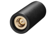
Ethertronics has unveiled EtherHelix GPS, a small, stand-alone, Right Hand Circularly Polarized (RHCP) external GPS antenna. Measuring 35 mm in length, the EtherHelix GPS is 27 percent shorter than other antennas on the market with no performance trade-offs, the company said. It is designed for high-performance, mission-critical devices such as walkie-talkies, tough books, tough tablets, first responders, public safety, military applications and more.
EtherHelix can be tuned for various satcom frequencies and various polarizations (RHCP or LHCP). EtherHelix GPS is designed using Ethertronics’ patented Isolated Magnetic Dipole (IMD) technology providing high performance and efficiency in a small form factor.
EtherHelix GPS has a high tolerance to frequency shifts given the technology’s high RF isolation, which is designed to resist antenna detuning that can otherwise impair reception. EtherHelix GPS provides exceptional coverage inside buildings, vehicles or other areas where weak signals and signal reflection occur, the company said.
“GPS capabilities are critical for first responders and military applications. It is imperative that the antennas used in these devices are high-performance, small and rugged,” said Olivier Robin, general manager Americas and Europe at Ethertronics. “EtherHelix GPS is the most recent example of Ethertronics’ leadership in developing industry-first RF solutions to provide manufacturers with a way to differentiate their products and stand out in a competitive market. Already we have seen interest in our new EtherHelix GPS antenna given its best-in-class performance coupled with its smallest occupied volume.”
Given its reduced weight and size — 11.8 g and 35 mm long by 15 mm in diameter — manufacturers benefit from simpler integration for an array of GPS devices, Ethertronics said. In addition, the new GPS antenna’s capabilities include high selectivity, which minimizes the need for additional filters. EtherHelix GPS’s ruggedized design includes IP-68 protection from dust and water, as well as a standard SMA male connector for easy integration. The RoHS Compliant antenna is designed and manufactured in the United States.
EtherHelix GPS is commercially available now and is the first in a series of antennas for mission-critical applications.
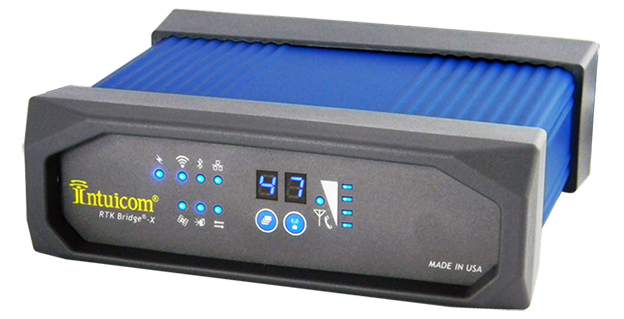
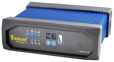
Intuicom, Inc., a wireless data solutions provider for the survey, machine control and precision agriculture industries, has added to its line of RTK Bridge solutions with the Intuicom RTK Bridge-X.
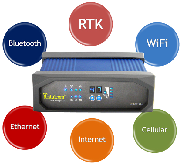
Along with providing reliable access to RTK corrections, the RTK Bridge-X features a Wi-Fi hotspot. Users can connect other Wi-Fi devices such as laptops, tablets and smartphones and access the Internet via the RTK Bridge-X’s cellular connection. Also new with the RTK Bridge-X is cable-free configuration. Configuration can now be accomplished through a wireless connection using any web browser.
Users can then access email, send files, and perform other Internet-based tasks using the connection provided by the RTK Bridge-X. With new Remote Access, the RTK Bridge-X can be reached over the Internet from anywhere.
The RTK Bridge-X also comes with internal GPS. Users can choose between an internal license-free 900-MHz radio, industry-standard UHF radio, or no radio.
Other improvements include a real-time cellular signal strength indicator on the re-designed front panel, as well as an Ethernet port that can be used for configuration or Internet connectivity. A numerical LED display now shows which of the four configurable profiles is active as well as which radio channel is selected. Bluetooth connections are also supported.
Like all Intuicom Bridge Products, The RTK Bridge-X is designed for easy setup and operation and is compatible with all major cellular carriers and equipment manufacturers including Leica Geosystems, Trimble, and others.
Disy Informationssysteme GmbH, a provider of GIS and reporting solutions for spatial and non-spatial data, is offering a new app and service for offline maps for tablets.
GIS 2go allows users to save Esri’s ArcGIS Desktop maps to their tablets (iPad or Android). The GIS 2go add-in for ArcGIS Desktop supports data selection, map export and re-import via the cloud. With the app Cadenza Mobile GIS 2go installed on a tablet, users have immediate access to their maps, including all attribute data and media — even if they are offline in the field. Graphic notes and media created on the go can also be imported back into ArcGIS Desktop.
Users can interactively navigate on the map while on the go. Moreover, it is possible to show attribute data and use the graphic notebook to add points, lines and areas or track them via GPS. This information can be complemented with photos and audio/video recordings or text notes. Data captured on the go can be imported into ArcGIS Desktop and stored to the local database or file system.
How to save and use mobile maps on a tablet is described in 4 easy steps is at www.gis2go.com. The website also provides information on features and pricing, as well as tutorials and an FAQ.
A personal demo account is offered for interested users interesting in testing GIS 2go their mobile devices. The demo account is free of charge and without any obligation.
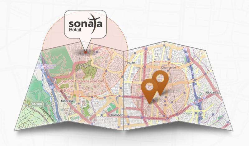
Sonata is a self-service advertising platform for the retail world.
Currently, 96 percent of world trade takes place through traditional brick and mortar stores. Add almost 1,000 million smartphones with integrated GPS to that retailing picture and a whole range of advertising opportunities, with high added value for advertisers and consumers, opens up. Sonata was begun l to drive foot traffic to local retailers’ point of sale via potential customers’ smartphones.
Sonata divides the world into 90-square-metre plots. The plots are uploaded with local business adverts, which then appear on smartphones and tablets that come in range of the advertiser according to the smartphone’s geolocation. Sonata has been developed by TAPTAP Networks, a Spanish mobile advertising market leader based in Madrid.
The process of uploading an advertising campaign is very simple for the retailer and takes no more than three minutes, according to Sonata. A retailer doesn’t need a website or even a mobile app; all that’s required is a minimum investment of £50. Advertisers follow three steps:
registration using an email address;
adding the store details (just one or a whole network);
choosing the ad’s geographical area and the design of the ad from one of Sonata’s creative templates (or advertisers can create their own design).
“Any local business, including those without technical know-how, can create an advertising campaign,” says Alvaro del Castillo, CEO of TAPTAP Networks and the developers of Sonata.
“An added attraction of Sonata is that local businesses only pay for actual results-calls, registrations, clicks, purchases in the store… whatever form of contact a customer makes-and can choose how much to pay for them,” says del Castillo.
“The Sonata platform is focused on meeting the need of the local small-business sector, which views the online world as a major threat with the ever-growing pressure it exerts from ‘showrooming’ and the selling of cost price goods by major e-commerce players,” explained de Castillo.
Moving to stake a claim in the burgeoning location-based services and applications market, mobile systems developer AirPatrol Corporation has announced a pair of new offerings designed to let organizations and 3rd software developers enable app and information delivery to mobile devices in zones as small as six feet across.
The first product, ZoneAware, is a locationing and delivery platform made up of passive sensors and a software-based locationing engine that gives organizations the ability to identify both 802.11 Wi-Fi and 2G/3G/4G cellular devices and enable different applications, information delivery, and mobile services as the device moves through monitored zones within a facility. AirPatrol’s other new offering is third-party access to its AirPatrol Zone Engine, which will allow software developers to leverage AirPatrol’s device locationing technologies to enable mobile apps and information delivery based on zones up to 30 times more precise than other locationing tools.
“We’re heading into a post-PC world where smartphones, tablets and wearable computing will be changing their behavior and the information they provide based on where the user is and what she is doing at the time,” said Cleve Adams, CEO of AirPatrol. “Most locationing technologies can provide a general area of where a device is — within 100 to 1,000 feet — which is fine for generalized activities like finding restaurants within a mile of you, but it’s not particularly useful when you want real precision. AirPatrol’s Zone technologies can notify the maître d’ to prepare a table when a VIP steps into the restaurant, tell an emergency responder exactly what floor and room an E911 caller is in, even securely deliver patient records to a doctor’s tablet when he enters the patient’s hospital room.”
Key to AirPatrol’s Zone technologies are a combination of passive sensors that detect and identify radio signals emanating from devices on both cellular and WiFi networks, and a software platform that does the heavy work of measuring those signals and adjusting for obstructions like wood, metal, stone and glass, to deliver pinpoint locationing and the triggers to apps and information based on the zone through which the device is traveling.
“The ability to provide precision locationing in all building types using cellular/Wi-Fi detection and not just WiFi is a major benefit of AirPatrol’s technology,” Adams said. “Wi-Fi coverage is notoriously difficult in indoor locations with lots of obstructions such as walls. Many people are also simply turning mobile’s Wi-Fi off to reduce security risks and, increasingly, because 4G cellular is faster and more reliable. Because we use both, AirPatrol’s Zone technology can provide far more consistent and accurate locationing no matter whether the device is moving or stationary, indoors or outdoors. In short, we’re detecting the other half of the cellular users no other Wi-Fi-only solution can see,” he said.
AirPatrol’s locationing technologies were originally developed for government and military security applications where precision locationing and forensic tracking of all mobile devices was a requirement. In 2012, the company released an enterprise version of its ZoneDefense mobile security platform which augmented the device monitoring features with the ability to connect to and trigger 3rd party mobile device and application management tools (MDM/MAM), policy managers, network and endpoint security tools based on location. It was the 3rd party connectors that spawned AirPatrol’s new offerings.
“The moment companies realized we could add a location-based component to all of the mobile apps and tools they were using we started getting inquiries about connecting healthcare applications, retail services, marketing tools, and a whole list of other non-security-related systems to our ZoneDefense platform,” Adams said. “Given how much people use and depend on their mobile devices for work, home and entertainment these days, it only made sense to open the platform up to other applications and developers.”
AirPatrol’s ZoneAware platform will be available in early Q4 of 2013. Application developers, information providers and other third parties who would like to connect their products to the AirPatrol Zone Engine can apply to join the AirPatrol developer partners program via the AirPatrol website.
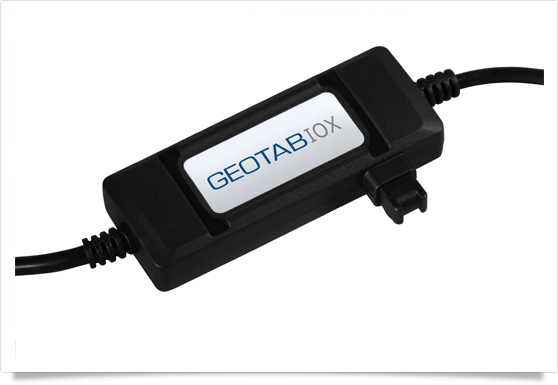
Geotab has launched a telematics Near Field Communications (NFC) Driver ID solution using an Input-Output-Expander (IOX) that allows for simultaneous connections and communications to occur with multiple devices, such as Garmin, Iridium, and HOS.
As an addition to its comprehensive fleet management platform, the technology will now help managers keep better track of each driver’s productivity and on-road safety — no matter which vehicle they are in, Geotab said.
With one touch of the NFC fob, vehicle operators can quickly, easily, and securely transfer their driver identification information to the cloud. Since Geotab’s GO6 device allows for multiple plug-and-play connections, the NFC Driver ID solution can be setup in minutes, the company said. Associating drivers with the vehicles they are in also allows for the software to generate driver-based score reports.
“The newly launched NFC Driver ID is a telematics industry game-changer that provides a reliable and accurate solution for businesses which pool their vehicles,” said Colin Sutherland, Geotab VP.
“NFC is seeing rapid application expansion across smartphones, tablets, and laptops. We fully expect to leverage this technology for future applications,” added Neil Cawse, Geotab CEO.
Although Geotab is launching a new Driver ID solution based on NFC, Geotab’s web-based software, MyGeotab, has been reporting both driver and vehicle summary value reports for over 10 years. The NFC Driver ID solution is now available for purchase through Geotab’s extensive Authorized Reseller network.
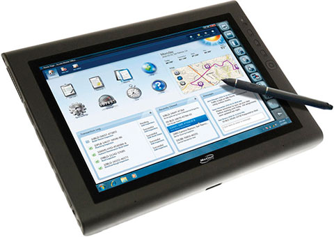
The Motion J3600 by Motion Computing is a rugged and powerful tablet PC for field professionals who need a tough device for working in harsh mobile conditions such as construction, field services, and healthcare. With third-generation Intel Core processors, the Motion J3600 offers high processing power while reducing power draw to deliver uninterrupted performance throughout the workday.
Running Microsoft Windows, the J3600 can be operated with touch navigation or a stylus. It has integrated Wi-Fi 802.11 a/b/g/n, Bluetooth, and enhanced Gobi connectivity with integrated GPS. Geotagging and date stamping with the integrated digital camera can document work in seconds.
Three-fifths of all smartphones, tablets, and notebooks shipped worldwide during the first quarter of 2013 run Google’s Android mobile operating system, independent analyst firm Canalys reports.
Manufacturers shipped 308.7 million smart mobile devices between January and March, Canalys states. Android powers 59.5 percent of all shipments. Apple’s iOS ranks a distant second at 19.3 percent, fueled by its strength in the smartphone and tablet markets, followed by Microsoft at 18.1 percent, buoyed by its relative strength in the notebook segment. Rival platforms including BlackBerry account for the remaining 3.1 percent.
Among the three device categories under the microscope, the tablet market continues to experience the fastest growth: Worldwide tablet shipments grew 106.1 percent year-over-year to 41.9 million units. Apple continues to lead tablet shipments with a 46.4 percent share, but Android-based rivals narrowed the iPad’s lead for the third consecutive quarter.
“Spearheaded by Google and Amazon, the commoditization of the tablet market has happened far quicker than that of the wider PC market,” said Tim Coulling of Canalys. “Profit margins are being squeezed and vendors without a low cost structure will find it hard to compete. A solid range of must-have accessories and a software and services strategy are vital as vendors will increasingly need to make revenue around their devices.”
Smartphone shipments eclipsed 216.3 million during the first quarter, up 47.9 percent over year-ago totals. Android accounted for 75.6 percent of all smartphone shipments, led by Samsung Electronics, which increased its volume 64.3 percent year-over-year to capture 32 percent market share. Apple’s iPhone shipment volume grew just 6.7 percent over the first quarter of 2012, the smallest increase since the launch of the original iPhone back in mid-2007.
The biggest mobile show, the Mobile World Congress, starts next week in Barcelona, Spain. It comes at an interesting time. Attendees will find it no longer makes sense to think about which device, or screen, is of primary importance to users. Google reports findings that 90 percent of users move sequentially between several screens (TV, phone, desktop computer and tablet) to accomplish tasks.
Google, wanting to more fully exploit ad opportunities on all devices, has revamped AdWords to require that all ad campaigns include mobile. The GPS-based fitness watch market looks like it is on a steep curve upward, and feasible smartphone GPS watches are available. Rumor says Facebook is going to start tracking users’ locations at all times to be able to cull more ad revenue from individual’s preferences and geo life.
Analytics firm Flurry tracked mobile app usage during the Super Bowl and found that overall app usage declined by less than 5 percent during the Super Bowl, compared to same time period on the prior Sunday. A large amount of consumers’ attention was spent in apps, even as they sat in front of their TVs on the biggest football day of the year. Surprisingly, app usage did not greatly differ between commercials and game play. Mobile app usage peaked during the game’s power outage and declined during Beyonce’s apparently riveting half-time show.
Google Requires Mobile Advertising. Citing concerns that the shift from desktop to smartphones and tablets is damaging its bottom line, Google is revamping its AdWords advertising platform to integrate ad campaigns across all device screens. In fact, Google indicated that it will require all advertisers to pay for mobile ads even if they only wish to reach consumers on desktops. The revamp will allow customers to use contextual factors like location, time of day and device type to control integrated campaigns.
Google provides an example of how a user’s location and device type could change the advertising message. “For example, a pizza restaurant probably wants to show one ad to someone searching for ‘pizza’ at 1 p.m. on their PC at work (perhaps a link to an online order form or menu), and a different ad to someone searching for ‘pizza’ at 8 p.m. on a smartphone a half-mile from the restaurant (perhaps a click-to-call phone number and restaurant locator),” reads Google’s blog.
Will Apple Take Control of Your Wrist? Rumors continue that Apple will release a GPS-based fitness watch in 2013. Whether Apple enters the market or not, the GPS fitness market is huge and growing. The GPS fitness watch market is set to reach $1.07 billion in 2013, predicts ABI Research. Cellular connected GPS fitness watches like the I’m Watch may further speed this market. “There have already been unfounded rumors around Apple in 2013, so let’s wait and see. If an Apple watch did feature integrated GPS, it would no doubt significantly boost shipment forecasts in 2013,” asserts Dominique Bonte of ABI. Some start-ups in the GPS watch category have joined the action including Leikr, Pebble, Basis and others.
Facebook Is Watching. Is it possible that the relationship between Facebook and Google can get even more tense? According to a Bloomberg article, Facebook is developing a smartphone application that will track the location of its users. The app is said to be scheduled for release by mid-March, and would run on handsets in the background even when the Facebook app or the phone isn’t open or in use. The location data would help Facebook capture more advertising revenue as ads can be more targeted with information about a user’s location and habits. The project is said to be headed by an ex-Googler and talent from Glancee and Gowalla, both of whom were purchased by Google.
Privacy concerns with Facebook location tracking will undoubtedly be raised. Currently, Facebook records the GPS coordinates of users when they post status updates or photos from their phones, or check into a venue. Tracking users 24/7 is another thing. Facebook’s current location-sharing policy seems to cover them carte blanche. It allows the use of data “to serve you ads that might be more relevant,” and “to tell you and your friends about people or events nearby, or offer deals to you that you might be interested in.”
Will Windows and BlackBerry Smartphones Succeed? Will there be a crack, even a tiny one, in the duopoly of iOS and Android? The biggest worry for Microsoft and BlackBerry is if initial sales of their smartphones are too small to excite developer interest. Without abundant applications, consumers won’t continue to buy these phones. ABI Research is predicting that the demand will be strong enough, and is forecasting a BlackBerry installed base of 20 million and Windows smartphone base of 45 million by year-end.
Open Geospatial Consortium Location Standards for Next-Generation LBS. The Open Geospatial Consortium (OGC) is having a free session and reception at the Mobile World Congress for mobile developers, location data providers, network operators and LBS service users. Attendees will learn the latest in open standards development. The event is being held on February 27, 2013 in Barcelona. Register for free.
Mobile application storefronts had collectively distributed a cumulative total of 81 billion smartphone and tablet apps as of the end of September 2012, according to a recent market study from ABI Research. Of these, 89 percent were downloaded from native storefronts that come with the device’s operating system.
“The current status quo is based on storefronts that the operating system vendors provide as part of the OS experience, and there is no evidence that this would change in the future,” said ABI Research senior analyst Aapo Markkanen. “A year ago it still looked like that, for example, mobile operators could find a viable business case in the curation of Android apps, but that opportunity evaporated once Google got its storefront act together. Today, it makes sense for operators to distribute apps only under special circumstances, such as the ones that we’re seeing in China.”
Similarly, it’s unlikely that the universal, catch-all nature of app distribution would start breaking up into smaller niche storefronts. There is a certain demand for specialist stores, but even then the niche players should position themselves as recommendation channels driving traffic to native storefronts and not actual distributors. Markkanen explains, “Running a user-friendly app distribution channel is expensive. Besides the adequate hosting and billing systems it takes quite a lot of human labor, since successful app discovery requires some form of editorial approach. The opportunity for smaller storefronts built around selected categories is therefore limited.”
Practically the only exceptions are B2B apps and the consumer categories that the universal storefronts don’t want to be associated with — most notably adult content. Mikandi is a real-life storefront example that has built a business out of the distribution of such outcast apps and content.
These findings are from ABI Research’s Mobile Application Markets Research Service which focuses on the distribution and the economics of mobile apps, providing data-driven insights on areas such as download volumes, revenues and business models, plus trends within different applications categories.
Despite relatively stunted growth thus far, the tablet and camera markets are forecast to be the next major market for location-based services and GPS IC penetration.
ABI Research’s latest Report, “Location Applications for Tablets, eReaders, Digital Cameras & Handheld Gaming,” forecasts the uptake of LBS and how it will affect the adoption of location technologies. The tablet market has largely been dominated by Apple and its GPS/Modem strategy. GPS shipments are forecast to reach 37 million in 2012, yet it is still much less than had been previously anticipated. There has been mixed news of late, with the launch of Google’s Nexus 7 and Apple’s iPad mini. Wi-Fi location is a standard feature across all major tablets and while it is complementary, it does act as a barrier to GPS integration.
Senior analyst Patrick Connolly said, “When we look at the adoption of applications on tablets, it is forecast to largely mirror that of smartphones, with a focus on local search, social, enterprise, navigation, and ambient intelligence.” Android will lead the way, as ubiquitous location becomes a necessary component.
The camera market has huge potential, with geotagging a clear driver. With more than 30 GPS-enabled cameras on the market, shipments are expected to break 10 million in 2013, and a second wave of new applications emerging around tracking, maps and points of interest, and dead-reckoning. As an industry, there needs to be a complete overhaul of how cameras are designed, to find a way to leverage the photography revolution occurring on smartphones. ABI Research has forecast that this will open the door to GPS, alternative location, and LBS in future.
The launch of the Sony Vita was expected to kick-start the location-based gaming (LBG) industry, featuring Wi-Fi location as standard, and an optional GPS/modem module. Practice director Dominique Bonte said, “Irrespective of limited device sales, location-based gaming and community applications still have fundamental barriers concerning critical mass and where and how the device is used. As a result, LBG is expected to initially flourish on smartphones, with GPS forecast to remain subdued on gaming devices.”
These findings are part of ABI Research’s Location Based Services which includes Research Reports, Market Data, and Insights.
Google’s much-anticipated tablet computer has been revealed. The Google Nexus 7 is a 7-inch tablet powered by a Nvidia Tegra 3 quad-core processor that runs Android 4.1 Jelly Bean, 1.3-GHz quad-core Nvidia Tegra 3 processor, 1 GB of RAM, and come in 8 GB ($199) and 16 GB versions ($249). Asus built the tablet, but it will be Google branded.
The display is high-definition at 1280 x 800, and there’s a front-facing 1.2-megapixel camera and microphone for video chatting. It has a micro USB port, GPS, near-field communication and both Wi-Fi and Bluetooth.
At its size an price point, the tablet is expected to compete with the Kindle Fire and the Barnes & Noble Nook tablets, rather than the 9.7-inch iPad or the 10.6-inch Microsoft Surface.
Google is offering a $25 credit for the Google Play store in an introductory offer.