Tag: The System

  • The System: Fregat Design Ambiguity Steered Galileo Wrong

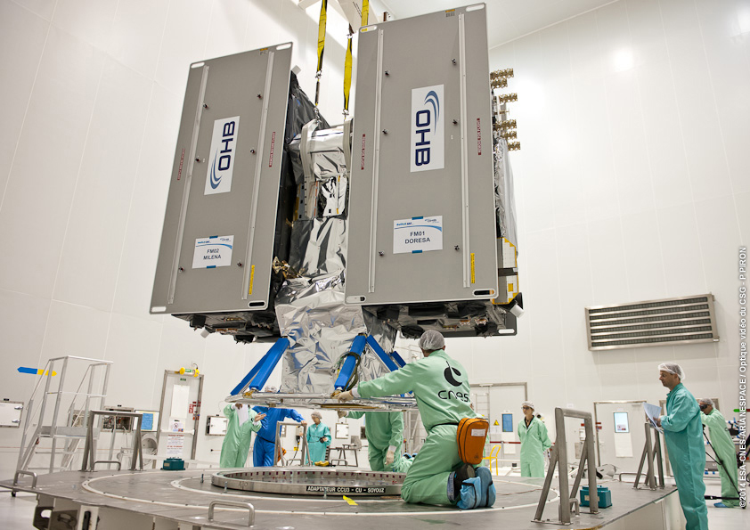
    Cross-Installed Hydrazine, Helium Lines Froze Thrusters

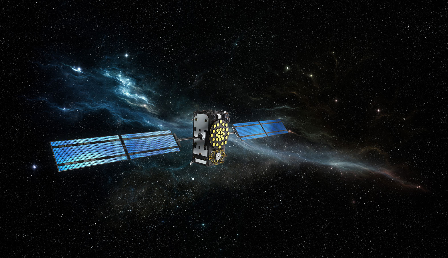
    The root cause of the anomaly that sent two Galileo satellites into the wrong orbit on August 22 was a shortcoming in the system thermal analysis performed during stage design, and not an operator error during stage assembly, according to findings by an independent inquiry board.

    The independent inquiry board was created by Arianespace, in conjunction with the European Space Agency and the European Commission. Its conclusions draw on data supplied by Russian partners in the program, and are consistent with the final conclusions of the inquiry board appointed by the Russian space agency Roscosmos.

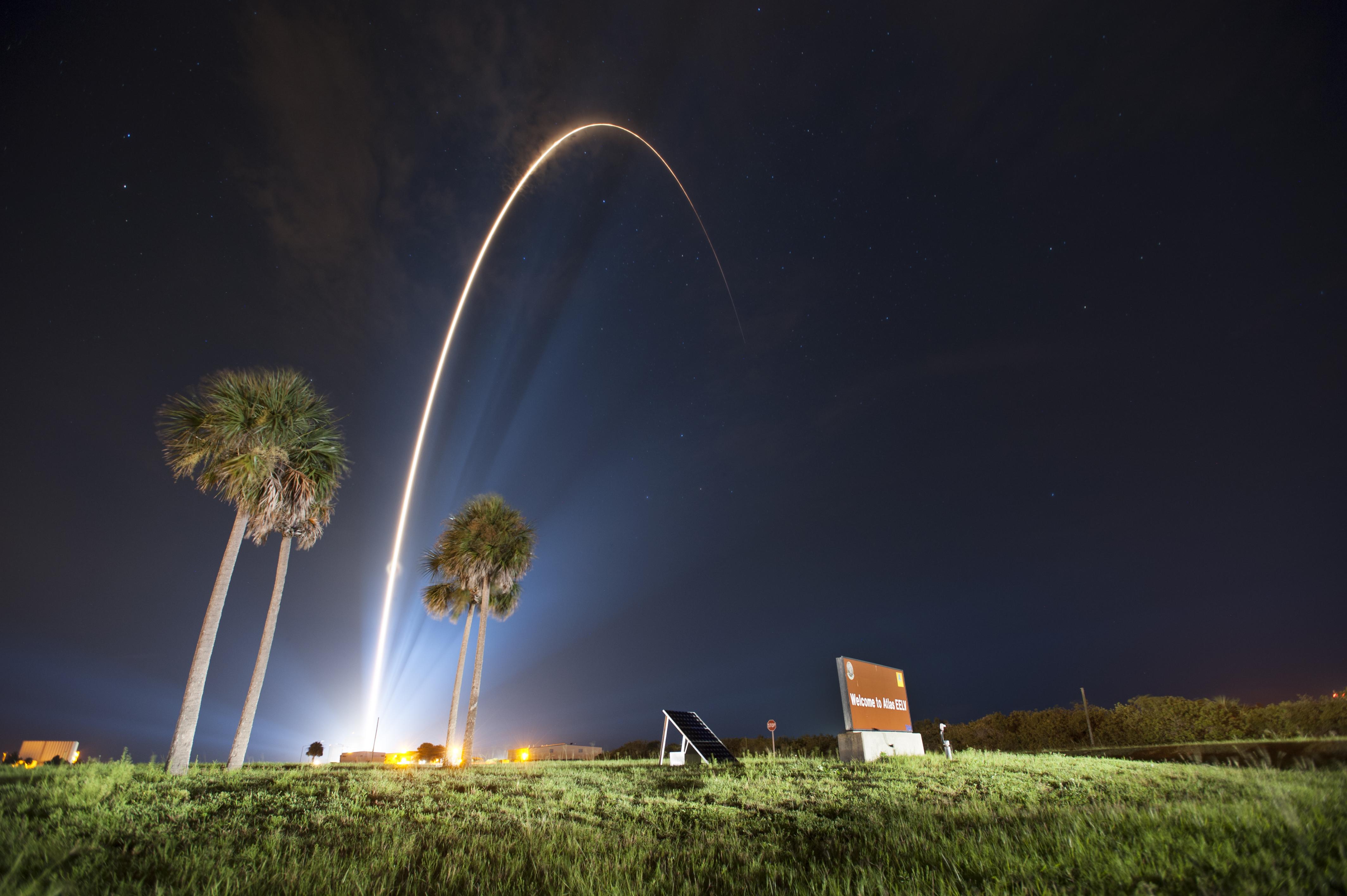
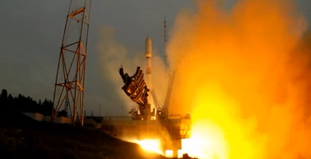
    The anomaly occurred during the flight of the launcher’s fourth stage, Fregat, designed and produced by NPO Lavochkin. It occurred about 35 minutes after liftoff, at the beginning of the ballistic phase preceding the second ignition of this stage.

    The board’s conclusions confirm that the first part of the mission proceeded nominally, which means that the three-stage Soyuz launcher was not at fault. The inquiry board also eliminated the hypothesis that the anomaly could have been caused by the abnormal behavior of the Galileo satellites.

    The scenario that led to an anomaly in the orbital injection of the satellites was precisely reconstructed, as follows:

    The orbital error resulted from an error in the thrust orientation of the main engine on the Fregat stage during its second powered phase.

    This orientation error was the result of the loss of inertial reference for the stage.

    This loss occurred when the stage’s inertial system operated outside its authorized operating envelope, an excursion that was caused by the failure of two of Fregat’s attitude-control thrusters during the preceding ballistic phase.

    This failure was due to a temporary interruption of the joint hydrazine propellant supply to these thrusters. The interruption in the flow was caused by freezing of the hydrazine.

    The freezing resulted from the proximity of hydrazine and cold helium feed lines, these lines being connected by the same support structure, which acted as a thermal bridge.

    Ambiguities in the design documents allowed the installation of this type of thermal “bridge” between the two lines. In fact, such bridges have also been seen on other Fregat stages now under production at NPO Lavochkin.

    The design ambiguity is the result of not taking into account the relevant thermal transfers during the thermal analyses of the stage system design.

    The system thermal analyses have been reexamined in depth to identify all areas concerned by this issue. The board has chosen these corrective actions for the return to flight.

    • Revamp of the system thermal analysis.
    • Associated corrections in the design documents.
    • Modification of the documents for the manufacture, assembly, integration, and inspection procedures of the supply lines.

    Arianespace said these measures can immediately be applied by NPO Lavochkin to the stages already produced, meaning that the Soyuz launcher could be available for its next mission from the Guiana Space Center in December.

    “We are looking at the resumption of Soyuz launches from the Guiana Space Center, as early as December 2014,” stated the Arianespace CEO. “The resolution of this anomaly will enable a consolidation of the reliability of Fregat, which had experienced 45 consecutive successes until this mission.” 

    Galileo Service Controls Handed to GNSS Agency

    Full Operability Set for 2020

    The European GNSS Agency (GSA) and the European Commission have concluded an agreement that delegates a range of exploitation tasks for Galileo to the GSA, providing a framework and budget for the development of services and operations through 2021.

    The signing of the Galileo Exploitation Delegation Agreement serves as an initial step towards the full Galileo Exploitation Phase. According to the governance structure set out in the agreement, the European Commission is responsible for the overall programme supervision, the European Space Agency (ESA) is entrusted with the deployment phase, while the GSA is responsible for the exploitation phase. The GSA’s responsibilities include:

    • provision and marketing of the services
    • management, maintenance, continuous improvement, evolution and protection of the space and ground infrastructure
    • research and development of receiver platforms with innovative features in different application domains
    • development of future generations of the system
    • cooperation with other GNSS
    • all other required activities to ensure the development and smooth running of the system.

    “With Galileo, we aim to provide a tangible service to European citizens, and this Delegation Agreement ensures we have the tools and funding necessary to achieve this,” said GSA Executive Director Carlo des Dorides.

    Full operability of Galileo is now scheduled for 2020, a slight revision of the previous 2018 projection.

    The agreement specifically sets the actions to be implemented, the amount of funding provided, and the conditions for the overall management. The maximum current EU contribution amounts to EUR 490 million, which will cover procurement and grant activities, including the GSA-ESA working arrangements and a programme management reserve, along with related research and development activities. The financing of the full exploitation phase will be confirmed during a mid-term review before the end of 2016.

    India Launches Third Satellite and ICD

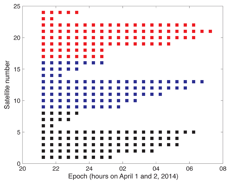
    India successfully launched IRNSS-1C, the third satellite in the Indian Regional Navigation Satellite System (IRNSS), on October 16. The satellite was injected to an elliptical orbit of 282.56 x 20,670 kilometers, very close to its intended final geostationary orbit at 83 degrees East longitude. 

    IRNSS-1C is the third of the seven satellites constituting the space segment of the Indian Regional Navigation Satellite System. Tthe first two were launched in July 2013 and April of this year. Both are functioning satisfactorily from their designated geosynchronous orbital positions. 

    IRNSS is an independent regional navigation satellite system designed to provide position information in the Indian region and 1,500 kilometers around the Indian mainland. IRNSS will provide two types of services: Standard Positioning Services (SPS), provided to all users, and Restricted Services (RS), provided to authorized users. Ground stations have been established in at least 15 locations across India.

    The next satellite of the constellation, IRNSS-1D, is scheduled to be launched in the coming months. The full IRNSS constellation of seven satellites is planned to be completed by 2015.

    IRNSS ICD Released. In late September, the Indian Space Research Organization (ISRO) released version 1 of the IRNSS Signal in Space Interface Control Document (ICD) for the Standard Positioning Service.

    The document provides information on the signals and structures of the IRNSS system, including signal modulations, frequency bands, received power levels, the data structures and their interpretations, and user algorithms.

    Registration is required for ICD download access at a new IRNSS website

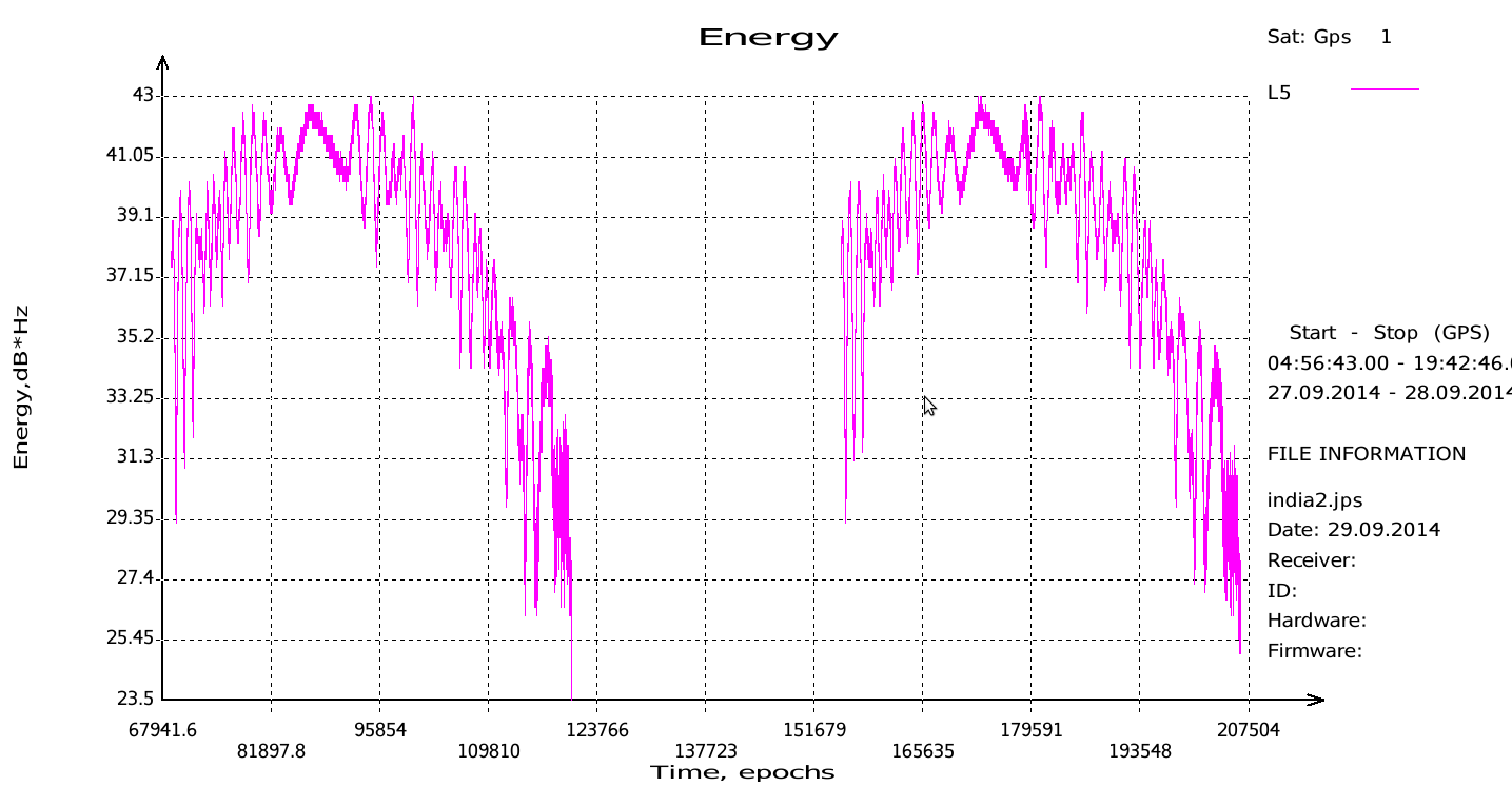
    JAVAD Tracks Signal. JAVAD GNSS published a chart showing that it has tracked the IRNSS L5 signal.

    Shortly after ISRO released its IRNSS Signal in Space Interface Control Document (ICD), JAVAD GNSS tracked the L5 BPSK signal from both 1A and 1B satellites. Ability to track IRNSS L5 will be added to all JAVAD L5-capable receivers in the near future, the company said.

    SNR of two passes of 1A satellite (IGSO) over Moscow.
    SNR of two passes of 1A satellite (IGSO) over Moscow.

    Let’s All Be GPS III for Halloween

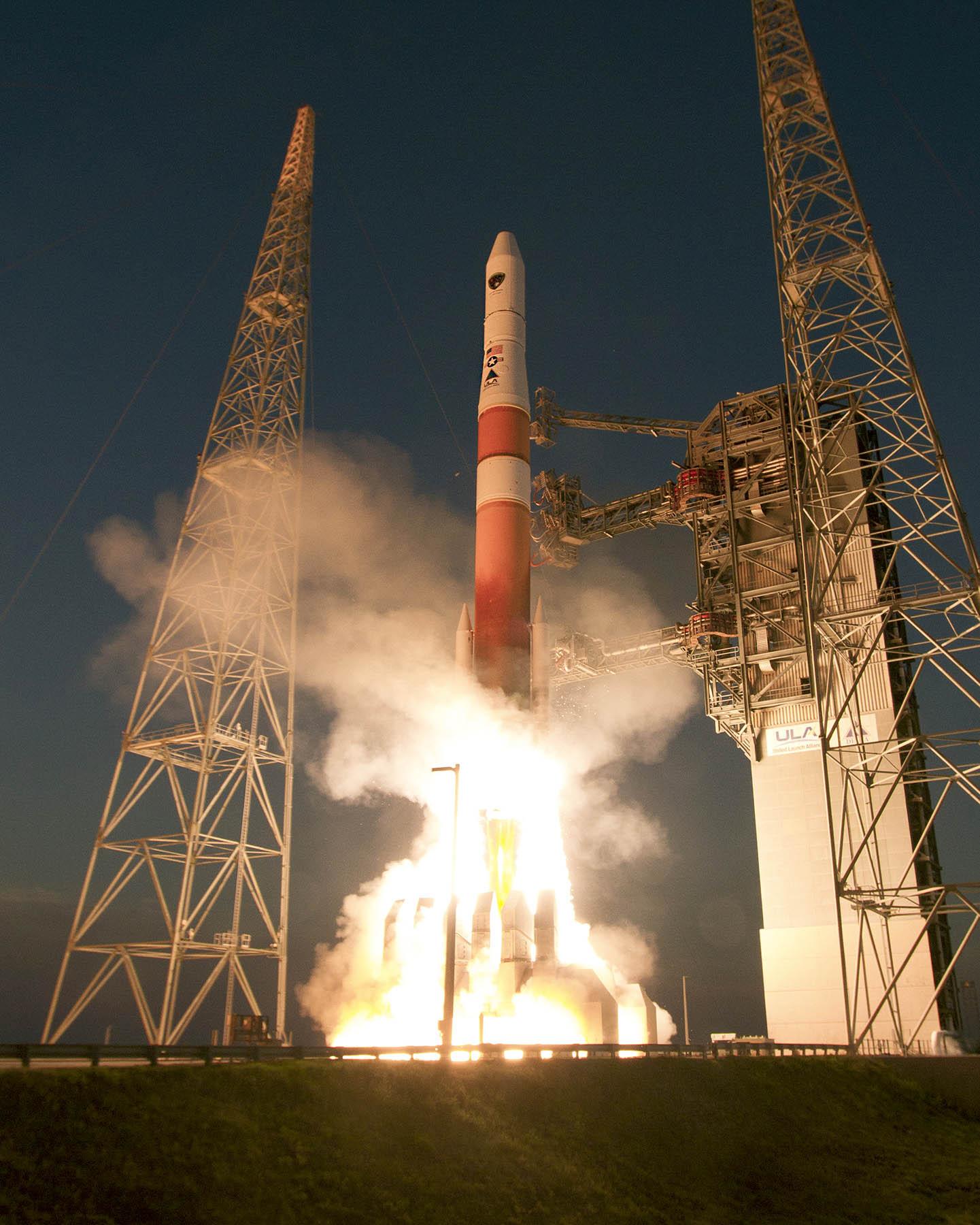
    As this magazine goes to press on October 23, the U.S. Air Force is set to launch the eighth GPS IIF satellite from Cape Canaveral Air Force Station on Wednesday, October 29.  An 18-minute launch window will open at 1:21 p.m. U.S. Eastern time. If all goes well, the satellite will be accomplishing its early-orbit checkouts and beginning maneuvers towards its final orbital plane as U.S. children make their costumed Halloween rounds, collecting candy. Other Western countries celebrate All Hallows’ Eve followed by All Saints’ Day on November 1.

  • The System: One Step Back, Three Steps Forward

    The System: One Step Back, Three Steps Forward

    Galileo-MASTER-2014-W

    Galileo IOV Bird Mute; New Draft ICD; CS Proved; Late August Launch

    Orbiting in silence since an onboard power mishap on May 27, troubled E20 emitted cheeps from space on August 6, 7,  and 8, broadcasting on the L1 frequency. Nothing has been heard since. 

    Meanwhile, the European Commission (EC) published a new draft version of the Galileo Open Service Signal in Space Interface Control Document (OS SIS ICD), issue 1, revision 2, on June 30. It is available for download and comment, the latter period extending to September 22. The EC’s open public consultation process seeks  to ensure that any further development of the Galileo OS SIS ICD takes into account the views of key GNSS stakeholders. An online form for submitting comments is available.

    Galileo E20, also known as GSAT0104, the fourth in-orbit validation (IOV) satellite, has been set “unavailable until further notice” according to the European GNSS Service Centre because of a sudden, unexpected loss of power on May 27.

    Based on a selected set of IGS MGEX stations and all CONGO stations, the first signals were tracked at AREG, AUT0, LLAG, and UNB3 at 23:13:00. No E5 signals and no navigation messages are currently transmitted. Some JAVAD GNSS receivers report from time to time false E5a locks with zero or extremely small C/N0.

    Galileo’s Early Proof of Concept (EPOC) team has successfully tracked the encrypted Galileo E6-B and E6-C signals broadcast by Galileo satellites. As a result, the Commercial Service loop has been closed using both encrypted and non-encrypted signals.

    The completed dispenser unit is ready to be transferred from the S5 payload preparation facility for its integration atop Soyuz’ Fregat upper stage.
    The completed dispenser unit is ready to be transferred from the S5 payload preparation facility for its integration atop Soyuz’ Fregat upper stage.

    During a 10-day testing period, receivers in Tres Cantos, Spain and Poing, Germany, showed the successful tracking and data demodulation of the encrypted signals from the available Galileo satellites, with periods where all satellites transmitting E6 encrypted signals were tracked simultaneously. The tests verified the Galileo Commercial Service (CS) signal’s encryption functionalities, with the data received containing authentication and high accuracy information previously generated outside the Galileo system. This is an essential feature to ensuring Galileo’s high accuracy and authentication services.

    The Galileo Commercial Service will deliver a range of added-value features, including positioning accurate to decimeter level and an authentication element. The Galileo CS demonstrator began its proof of concept earlier this year, with early service expected to start in 2016.

    Once operational, the CS will provide access to two additional encrypted signals on the E6 band, delivering a higher data throughput rate and increased accuracy. The tests are the result of a collective effort involving teams and projects of AALECS (Authentication and Accurate Location Experimentation with the Commercial Service), supported by the European Commission, the GSA, the European Space Agency (ESA), and the Galileo operator Spaceopal.

    The AALECS project is building a platform to connect to the European GNSS Service Centre (GSC) and transmit real-time CS data through the Galileo satellites. This platform will be operational by 2015 and will demonstrate the real performance of future high-accuracy and authentication services of Galileo prior to early service availability.

    The European Commission launched AALECS in January 2014, and it was awarded to a consortium led by GMV including CGI, Qascom, IFEN, Veripos, and KU Leuven. 

    New Launch. At press time, the next Galileo satellites were set to launch on August 21, ushering in the system deployment phase and paving the way for the start of initial services. Galileo SATs 5 and 6 were scheduled to lift off from Europe’s Spaceport in French Guiana on top of a Soyuz rocket. They are expected to become operational, after initial in-orbit testing, in autumn.

    The two satellites will join the four Galileo in-orbit validation satellites already in space. Launched in pairs in October 2011 and October 2012, these four — the minimum required to obtain a position fix — demonstrated and validated the system’s space and ground segments.

    SATs 7 and 8 are scheduled to follow by end of year 2014.  Then the constellation will be gradually deployed with six to eight satellites launched per year, along with addition of remaining elements of the ground network.

    Adjacent-Band Compatibility Workshop Set for D.C.

    The U.S. Department of Transportation is holding a “GPS Adjacent Band Compatibility Assessment Workshop” on September 18, 10 a.m.–5 p.m. Eastern Daylight Time. Registration for the workshop is required, and closes September 4. The general public can either attend in person or via WebEx.

    The workshop is being held to discuss implementation of a GPS Adjacent Band Compatibility Assessment. Discussion will focus on the various implementation steps of the assessment, including development of GPS receiver use cases, identification of representative GPS receivers, and development of a test and analysis program. “In particular, emphasis will be placed on the information needed from GPS receiver and antenna manufacturers, and the logistics of procuring and handling that information to safeguard manufacturer proprietary data,” according to the Federal Register.

    The sponsoring agency is the Office of the Assistant Secretary for Research and Technology, Department of Transportation.

    To register, send the following information to [email protected]:

    • Name
    • Organization
    • Telephone number
    • Mailing and email addresses
    • Attendance method (WebEx or on site)
    • Country of citizenship

    The meeting will be held at the U.S. Department of Transportation, John A. Volpe National Transportation Systems Center, 55 Broadway, Cambridge, MA 02142. ID is required to enter the building. For details, see the Federal Register notice.

    av_gpsiif7_l282201473335AM63

    GPS IIF-7 Successfully Launched

    Last USAF Launch to Rely on Radar as GPS Tracking Takes Over

    A United Launch Alliance (ULA) Atlas V rocket carrying the seventh GPS IIF satellite for the U.S. Air Force launched at 11:23 p.m. EDT Friday, August 1 (03:23 UTC, August 2), from Space Launch Complex-41 at Cape Canaveral, Florida.The Boeing-built satellite has sent the signals to controllers that confirm it is currently operating properly within the constellation.

    Boeing and the Air Force will complete the full on-orbit checkout of the satellite in August. The GPS IIFs offer improved signal accuracy, better anti-jamming capability, longer design life and the new civilian L5 signal.

    “We are providing our Air Force partner and GPS users with a steady supply of advanced GPS IIFs,” said Craig Cooning, president of Boeing Network & Space Systems. “Our robust launch tempo requires vigilance and attention to detail, and mission success is our top priority. We continue to partner with the Air Force and ULA to effectively execute the launch schedule.”

    GPS IIF-7 is the seventh of 12 such satellites Boeing has built for the U.S. Air Force, and the third on-orbit delivery this year. GPS IIF-8, slated for launch during the fourth quarter, arrived at Cape Canaveral on July 16 to undergo final launch preparations. GPS IIF-7 will join a worldwide timing and navigation system utilizing 24 satellites in six different planes, with a minimum of four satellites per plane positioned in orbit approximately 11,000 miles above the Earth’s surface.

    “Congratulations to the U.S. Air Force and all of our mission partners on the successful launch of the Atlas V carrying the GPS IIF-7 satellite,” said Jim Sponnick, ULA vice president, Atlas and Delta Programs. “ULA launch vehicles have delivered all of the current generation of GPS satellites, which are providing ever-improving capabilities for users around the world.”

    This mission was launched aboard an Atlas V Evolved Expendable Launch Vehicle (EELV) 401 configuration vehicle, which includes a 4-meter-diameter payload fairing. The Atlas booster for this mission was powered by the RD AMROSS RD-180 engine, and the Centaur upper stage was powered by a single Aerojet Rocketdyne RL10A engine.

    The EELV program was established by the United States Air Force to provide assured access to space for Department of Defense and other government payloads. The commercially developed EELV program supports the full range of government mission requirements, while delivering on schedule and providing significant cost savings over the heritage launch systems.

    C-Band Radar. The launch August 1 marked the final time the Air Force is expected to rely on C-band radars to track rockets immediately following liftoff.

    Future Air Force launches, both from the Cape and from Vandenberg Air Force Base in California, will rely on GPS signals for post-liftoff tracking, service officials said. The Air Force and its primary launch services provider, ULA, have been working for years on the capability, which features rocket-mounted GPS receivers that transmit position-location data to controllers on the ground.  

    “It’s something that’s been a long time coming,” Walt Lauderdale, GPS IIF-7 mission director, said during a July 25 conference call with reporters. The new technique has been tested and proven at both at Cape Canaveral and Vandenberg over the last few years, he said.

  • The System: GPS III, Always a New Horizon

    First, Lockheed Martin began investigating options for its GPS III payload supply line last year.  Then in June of this year, the U.S. Air Force opened a “sources sought”  initiative for a production-ready GPS space vehicle, equipped with an alternate payload, for consideration alongside the Lockheed Martin-built GPS III vehicle. Grumman and Boeing have responded to the U.S. Air Force call. Now the U.S. Senate has jumped into the act, with a 2015 defense spending bill that directs the Air Force to allocate at least $20 million for work on a space-based “digital navigation instrument” as a possible alternative to the payload developed for the GPS III satellites.

    The Senate Appropriations defense subcommittee stated that it “believes that early Air Force investment, when combined with industry investment, into the development of a digital navigation payload will significantly reduce cost and schedule risk for the future GPS constellation.” What exactly is meant by a “digital navigation payload” — as opposed to the current payload under construction — is unclear. The systems on earlier GPS satellites probably used some analog components. Even modern receivers have an analog front end before the analog-to-digital converter. Perhaps the Senate Appropriations subcommittee wants more digitization in the nav unit.

    Disaggregation. Further, the committee “firmly believes that movement away from large satellites, where possible, will result in significant cost savings and reduce the schedule to deliver payloads into orbit.”

    This idea calls for dispersing space capabilities away from large platforms and into smaller ones.It would require, at the very least, a new constellation architecture for GPS III, an as-yet unexplored concept. 

    Status. Lockheed Martin is under contract to deliver the first eight GPS III satellites, but the award for up to 22 further IIIs remains open. Difficulties with the payload for the first batch of satellites mean that although Lockheed has three space vehicles ready, it has no signal payload to put aboard them. Subcontractor Exelis is at work on that. 

    Lockheed Martin spokesperson Chip Eschenfelder has stated that “signal cross talk issues are resolved. The SV01 navigation payload forecast delivery to Lockheed Martin is fall 2014. Once the first navigation payload is delivered, we are into the production phase.”

    General John E. Hyten
    General John E. Hyten

    General Support. At June’s ION Joint Navigation Conference, General John E. Hyten, currently vice and soon to be commander of USAF Space Command, while evincing unqalified support for the system operators, did not address the GPS III manufacturing and supply issue. He confined his industry-related remarks to warning commercial PNT vendors and government program managers to cease placing commercial GPS receivers in critical government systems that support warfighters, government users, and critical national infrastructure. 

    He strongly advocated for Selective Availability Anti-Spoofing Modules and M-Code to help secure these critical systems against interference, jamming and spoofing, and urged manufacturers to build their devices in strict adherence to the U.S. government’s ICD process. 

    FCC Seeks Spectrum but Supports GPS

    In a June 20 workshop on “GPS Protection and Receiver Performance,”  the U.S. Federal Communications Commission (FCC) reiterated the need to safeguard critical infrastructure and public safety — two key uses of GPS.

    Despite fears that the FCC would call for new GPS receiver standards, the meeting took a protective and conciliatory tone, even as the FCC continues to seek more frequencies for mobile broadband, citing the need “get more out of the radio spectrum.”

    FCC Chairman Tom Wheeler stated, “Today is not about FCC-mandated receiver standards. Rather it is about the best way to protect GPS operations in the context of evolving technology and adjacent spectrum activities.”

    The specter of adjacent spectrum use hovered through the day, fully appearing in LightSquared and administration presentations. Otherwise, scant mention was made of the 2012 notion that GPS receivers should be modified to stop alleged “peeking” into adjacent spectrum.

    Panel discussions focused on GPS in critical infrastructure and public safety, with presentations by Qualcomm, Motorola, and AT&T. Speakers from T-Mobile, Spirent, Garmin, NovAtel, and John Deere covered GPS’s role in timing and the power grid, financial markets, telecommunication network, and precision agriculture. Paul Galyean of Deere said that “Certainty on the spectrum environment is needed. It’s difficult to design for the future without it.” If GPS receivers had to filter out cellular activity, this “might impact sensitivity, involve excessive size or cost, and might cause distortion of GPS measurements.” 

    Chris Hegarty, MITRE Corporation, gave a compelling argument for not overhauling receiver methodology: the extremely long lead times for commercial passenger aircraft. “Until 2022 every new Boeing and Airbus is going to fly off with $250,000 worth of navigation equipment that has three $50,000 GPS receivers and antennas and everything else, and they are going to want to use that for 20 to 25 years. So, you have a timing issue. Even if we all decided today that we wanted to do that, some communities simply aren’t going to be able to get it into place until we’re all dead.”

    Power Loss Strikes Galileo Satellite

    In-Orbit Validation Vehicle May Be Lost to Further Use

    The disappearance of signals from Galileo GSAT0104, the fourth in-orbit (IOV) Galileo satellite, arose from a sudden, unexpected loss of power aboard the space vehicle. The exact cause is unknown, or at least unreported as of press time. Some have speculated that the cause could lie in a failure of components around the solid-state power amplifier, including the output multiplexer, cables, or antenna.

    If such proves to be the case, ground operators may be powerless to repair the problem. The satellite would be a total loss.

    The power outage flashed on May 27, shutting down the satellite’s E1 signal. The signal “re-established itself almost immediately. But as soon as it was back in service, the two other channels’ power dropped and did not recover. The full satellite then was shut down by ground teams,” reported correspondent Peter de Selding.

    Looking for a Fix. European Space Agency (ESA) officials stated on July 3 that they would power-on the satellite again during the week of July 7–11 to continue an investigation into the problem, but there have been no subsequent reports. Investigation has been ongoing since the shutdown but has not identified a cause; officials state they have established that it is not related to the onboard atomic clocks.

    The four IOV satellites currently aloft differ in both technology and manufacturer from the next phase of Galileo satellites to be launched. The GSAT0104 satellite now in silent orbit was built by Astrium. The newer, operational satellites are produced by OHB-System, following a different payload design. Two of the newer generation are at the Guyana spaceport awaiting a possible late August lift date.

    Reporting History. The possibility of a satellite failure was first floated in the June 30 EAGER newsletter (European GNSS and Earth Observation Report), by contributing editor Tim Reynolds. He wrote: 

    “Has anyone heard anything from Galileo GSAT0104 recently? According to the European GNSS Service Centre, the fourth IOV satellite is ‘unavailable until further notice.’ The setting of unavailability may be due to in-orbit validation testing, as the website implies may be the case, but no further official statement has appeared, nor active user notifications (NAGUs) at http://www.gsc-europa.eu/system-status/user-notifications.”

    Two days later, GPSWorld.com posted a follow-up story“According to reports, the root cause of the outage is under investigation. Some unofficial sources have gone so far as to speculate that GSAT0104’s useful transmission life may be over.”

    Then, on July 3, correspondent Peter de Selding (who also contributes to EAGER) reported in Space News, after questioning sources at ESA, that the trouble aboard the fourth IOV Galileo satellite arose from a sudden, unexpected loss of power, as stated in the first paragraph of this article.

    GalileoStatus-W2

    Largest Fine in FCC History — $35M — for Chinese Jammer

    The Federal Communications Commission (FCC) plans to issue the largest fine in its history against C.T.S. Technology Co., Limited, a Chinese electronics manufacturer and online retailer, for allegedly marketing 285 models of signal jamming devices to U.S. consumers for more than two years.

    The FCC applied the maximum fine allowed to each jammer model allegedly marketed by C.T.S., resulting in a planned fine of $34,912,500.

    “All companies, whether domestic or foreign, are banned from marketing illegal jammers in the U.S.,” said Travis LeBlanc, acting chief of the Enforcement Bureau. “Signal jammers present a direct danger to public safety, potentially blocking the communications of first responders. Operating a jammer is also illegal, and consumers who do so face significant civil and criminal penalties.”

    C.T.S. operates a website that markets consumer electronics to individuals in the United States, where it allegedly misled U.S. consumers by falsely claiming that certain signal jammers were approved by the FCC. In fact, the use of such devices by U.S. consumers is illegal under any circumstance. C.T.S. also sold 10 high-powered signal jammers to undercover FCC personnel.

    The FCC also is ordering C.T.S. to cease marketing illegal signal jammers to U.S. consumers and provide information to the FCC about any persons and entities in the United Sates that purchased its devices.

    Signal jammers are radio frequency transmitters that intentionally block, jam, or interfere with authorized communications, such as cellphone calls, GPS systems, Wi-Fi networks, and first responder communications. It is a violation of federal law to market, sell, import, or use a signal jammer in the United States and its territories, except in very limited circumstances involving federal law enforcement.

    The FCC asks people to report the sale or use of an illegal jammer by contacting the FCC Enforcement Bureau through the FCC online complaint portal, or by calling 1-888-CALL-FCC (or 1-888-225-5322). To voluntarily relinquish a signal jammer, e-mail [email protected]. Additional information, including a Consumer Alert and Enforcement Advisory to retailers, is available at www.fcc.gov/jammers.

    The FCC enforcement action against C.T.S. is available.

  • The System: GLONASS in April, What Went Wrong

    The System: GLONASS in April, What Went Wrong

    By Gerhard Beutler, Rolf Dach, Urs Hugentobler, Oliver Montenbruck, Georg Weber, and Elmar Brockmann

    What Happened: On April 1, 2014, at 21:15 UTC, all GLONASS satellites started to transmit wrong Broadcast Messages (BM) as previously reported by GPS World. The satellite positions derived from these BM were wrong by up to ± 200 kilometers in each of the three coordinates x, y, and z of the Earth-fixed, geocentric, equatorial coordinate system. The problem disappeared after an hour (after two erroneous BM) for two GLONASS satellites; for other satellites, the problem lasted much longer: up to 10 hours. By about 07:30 UTC on April 2, the April Fools’  “joke” was over.

    Effect on GPS/GLONASS Receivers

    Essentially, we can distinguish two classes of receivers: those using the GLONASS BM for tracking and those not using them. The first class of receivers “became aware” of problems in real time, because GPS and GLONASS observations did not result in a consistent position estimation. In the best case, all affected GLONASS observations were flagged (and removed from further consideration) and the positioning worked properly with a reduced number of satellites. In the worst case, the receivers stopped tracking GPS and GLONASS satellites completely. The second class of receivers tracked GPS and GLONASS normally. The tracking problems created a major uproar in the user community of combined GPS and GLONASS receivers.

    On June 3, 2014, at the 13th meeting of the U.S. National Space-based Positioning, Navigation, and Timing (PNT) Advisory Board, Gerhard Beutler, representing the authors of this article, delivered a presentation including an example of a permanent network of GPS and GLONASS dual-system receivers in Switzerland and neighboring countries, where about 40 percent of the approximately 60 receivers stopped tracking both GLONASS and GPS satellites. The malfunctioning receivers had to be reset manually on the morning of April 2 (for more information, see: www.gps.gov/governance/advisory/meetings/2014-06/beutler1.pdf).

    Event as Viewed by the IGS

    At first sight, the GLONASS April 1 and 2 event was actually a non-event for the International GNSS Service (IGS). The IGS is a voluntary federation of more than 200 worldwide agencies that pool resources and data from about 400 permanent GPS and GLONASS stations to generate precise GPS and GLONASS products.

    The IGS product series, including precise GPS and GLONASS ephemerides, were generated as usual before, during, and after the event.  On April 4, a quick analysis by Urs Hugentobler revealed that only the GLONASS BM were affected; the GLONASS code (pseudorange) and phase observations and the GLONASS satellite clock corrections, were not affected.

    Figure 1 shows that the GLONASS event started simultaneously for all satellites (for stationary receivers, the first wrong positions were calculated for 21:00 UTC, based on the BM with Time of Clock (ToC) at 21:15 UTC). The problem was fixed for the first two satellites (the GLONASS satellites in orbital slots 6 and 23) one hour later; the last satellite wasn’t fixed until 07:30 on April 2 (using the correct BM at 07:45).

    Figure 1. Affected broadcast messages for each GLONASS satellite. Colors indicate the different orbit planes.
    Figure 1. Affected broadcast messages for each GLONASS satellite. Colors indicate the different orbit planes.

    More than 60 percent of the more than 200 combined GPS and GLONASS receivers in the IGS network tracked the GLONASS satellites normally. Fewer than 40 percent of the combined-constellation receivers had serious data outages (for GLONASS or even for both GLONASS and GPS). The number of GLONASS observations used in the daily work of the IGS analysis centers (ACs) was, however, only reduced by about 10 percent on April 2 (and even to a lesser extent on April 1). The small reduction is explained by the fact that only the last three and the first seven hours of April 1 and 2, respectively, were affected.

    As the IGS ACs do not need the BM (neither for GPS nor for GLONASS), but may rather use their predicted orbits derived from the precise ephemerides of the preceding days, the number of good observations was still amply sufficient to calculate precise GLONASS orbits for April 1 and 2, essentially at the expected accuracy level.

    Detailed Analysis

    To further explore the structure of the problem, the BM-derived satellite positions were used as pseudo-observations in an orbit determination process. Orbit determination was successful when analyzing only “good” positions (prior to April 1, 21:00 or after April 2, 07:30). Orbit determination was successful, as well, when using only positions from “bad” BM. Successful means that the root-mean-square (RMS) error of the orbit determination process was of the order of about 0.5 meters per satellite coordinate — the expected order of magnitude.

    As the bad satellite positions are now known to obey the laws of orbital motion, one may further investigate the nature of the differences between the “good” and the “bad” orbital positions. For that purpose, the precise GLONASS orbits of the IGS Center for Orbit Determination in Europe Analysis Center served as a reference. Its orbital positions were compared in the inertial coordinate system (one not rotating with the Earth) to the erroneous BM-derived positions by means of an orthogonal transformation, where only the three rotation angles around the x-, y-, and z-axes of the inertial equatorial coordinate system were estimated.

    Table 1 shows that the positions derived from the normal (“good”) GLONASS BM compare very well to the IGS precise orbits. Except for a minor rotation about the z-axis, one obtains zero-rotations about the orthogonal axes in the inertial coordinate system.

    Table 1. Rotation of the entire system of good orbit positions (April 1, 0:00 – 20:45 UTC) with respect to precise IGS reference orbits (“good” BM) and rotation of the entire system of bad orbit positions (April 1, 21:00 – April 2, 07:00 UTC) with respect to precise IGS reference orbits (“bad” BM).
    Table 1. Rotation of the entire system of good orbit positions (April 1, 0:00 – 20:45 UTC) with respect to precise IGS reference orbits (“good” BM) and rotation of the entire system of bad orbit positions (April 1, 21:00 – April 2, 07:00 UTC) with respect to precise IGS reference orbits (“bad” BM).

    Table 1 also shows that the “bad” positions were obtained from the reference positions by a rotation of about 0.5 degrees around the inertial x-axis. The RMS of 71 meters should be compared to the entire effect of up to 200 kilometers per coordinate. Comparing this RMS of 71 meters with the RMS of the orbit determination of about 0.5 meters per coordinate also says, however, that the “true” transformation is more complicated than one represented by just a series of three rotations.

    We did not further investigate how this more or less consistent rotation could enter into the GLONASS BM. It seems to be clear, however, that a systematic error slipped into the realization of the GLONASS BM, which were activated at a common reference epoch for all satellites (but uploaded to individual satellites at different times).

    Figure 1 suggests that the problem was almost immediately recognized by GLONASS operators: already an hour later the first two satellites started to transmit BM with the usual accuracy level.

    Figure 1 also supports the idea that the problem was remedied satellite-by-satellite. A back-of-the envelope calculation revealed that the satellites were above the horizon of at least one of the Russian uplink sites at the times of switching back to the correct BM.

    Summary and Conclusions

    The GLONASS event was one that we might have described by the phrase “such a thing can never happen.” For the user community, the situation was aggravated by the fact that the event was not reported through the official Russian channel by issuing a Notice Advisory to GLONASS Users (NAGU). This definitely should have happened in the interest of transparency.

    The above analysis was based on information available through the IGS. It was performed weeks after the event. It is worth noting, however, that the information needed for the analysis was available in real time. The reference orbit used in the analyses could have been replaced by the IGS predicted orbits generated in the ultra-rapid series.

    In view of the importance of BM for all users and in particular for the users of IGS real-time products, the IGS might consider monitoring the quality of BM for all GNSS.

    Fixing the GLONASS Bug: Report from Moscow

    In a May 23 conversation with journalists, Javad Ashjaee, president of JAVAD GNSS, decried the recent controversy about monitoring stations on both U.S. and Russian soil, saying it was based in misinformation and misinterpretations, inflated by a political crisis. He also supplied a different perspective on the GLONASS signal outage than has been reported in other media outlets.

    “There was speculation in early April that it took GLONASS 11 hours to correct a software bug because it took that long for all the satellites to pass over a control station on Russian soil. This was not the case, I have learned from conversations with their engineers and with the head person responsible for all of this. One engineer made a mistake and uploaded the wrong software. Until they could find it and debug it — and it took them 11 hours to do so — they could not upload correct software to the satellites.

    “The 11-hour outage was not due to a wait for all satellites to pass over ground control stations on Russian soil to receive a fresh upload of data,” continued Ashjaee. “GLONASS has the capability, like GPS, to make updates via inter-satellite communication. The delay was caused by the time it took to find the bug in the erroneous software that had been uploaded and correct it.”

    Ashjaee addressed the monitoring station controversy, saying that Russia had sought GLONASS monitoring stations in the United States, not for uploading any data, but for monitoring GLONASS satellites to provide more accurate orbit and clock information, for the free benefit of all users.

    Click here for Ashjaee’s full discussion of the U.S.–Russian monitoring station controversy. For news updates on the situation, see http://stage.globalpositioningnews.com/tag/russian-monitoring-stations/.

    Russian Launch

    A single GLONASS-M satellite was launched from the Plesetsk Cosmodrome on June 14. GLONASS-M 55 (with designation 755 once operational and also known as Kosmos 2500), was inserted into the constellation’s Plane 3 and will occupy orbital slot 21.

    Manufacturer Reshetnev reported that the satellite is equipped with an experimental payload capable of transmitting signals in the L3 frequency band. The L3 signal, centered at 1202.025 MHz , is CDMA unlike the GLONASS legacy FDMA signals. The experiment will include flight testing of the new equipment and evaluation of its accuracy characteristics. The GLONASS-K1 test satellite also transmits an L3 signal.

    GLONASS-launch-O

    European Space Symposium: Digest

    Copernicus, “the younger brother of Galileo,” will be the main implementation of Galileo and other GNSS technologies going forward in Europe, according to to Paul Weissenberg, EC deputy director general for enterprise and industry. An Earth-observation satellite program administered by the European Space Agency to provide accurate and timely information to improve the management of the environment, understand and mitigate the effects of climate change, and ensure civil security, Copernicus was previously known as the Global Monitoring for Environment and Security (GMES).

    Sliding to the Right. Galileo will make its “early-service declaration in the first half of next year,” said Matthias Patschke, director of EU satnav programs. This appears to back off slightly from previous dogged determination to declare services before the end of 2014.

    The EC may propose legislation to make mandatory the use of GNSS technology in different areas: as with eCall, starting in 2015, including Galileo in the receivers inside cars, according to Marian-Jean Marinescu, member of the European Parliament.

    Peter Large of Trimble spoke out against the mandating of a specific GNSS use in any market: “A bad policy outcome that moves backward into regionalization.”

    For an expanded report, see the June GNSS Design & Test e-newsletter.

  • The System: Sixth GPS IIF Launched into Orbit

    The System: Sixth GPS IIF Launched into Orbit

    Photo credit: United Launch Alliance.
    Photo credit: United Launch Alliance.

    A sixth GPS IIF satellite was launched aboard a United Launch Alliance Delta 4 rocket from Cape Canaveral at 8:08 p.m. EDT May 16.

    The satellite, designated GPS IIF-6 and built by Boeing, is one of the next-generation GPS satellites, incorporating improvements to provide greater accuracy, increased signals, and enhanced performance for users.

    According to Boeing, each GPS IIF satellite has greater navigational accuracy through improvements in atomic clock technology and a new civilian L5 signal to aid commercial aviation and search and rescue operations.
    Interestingly, the rocket is the first to be tracked via GPS instead of by radar.

    United Launch Alliance’s Atlas and Delta rockets are transitioning to GPS metric tracking for range safety functions, which protect the public and property should a launch vehicle veer off course. The move is a money-saving upgrade to the military’s aging range infrastructure.

    A special avionics system on the launcher transmitted the location. For decades, most rockets launching from Cape Canaveral, Florida, and Vandenberg Air Force Base, California, have been tracked by C-band radar.

    Two more GPS IIF satellites are scheduled to launch before the end of the year.

    Galileo FOC Satellites Reach Spaceport

    Galileo’s first two full operational capability (FOC) satellites arrived in Kourou, French Guiana, on May 7, in preparation for launch this summer.

    Manufactured by OHB in Bremen, Germany, with navigation payloads contributed by Surrey Satellite Technology Ltd. in Guildford, UK, these satellites — the first of 22 full-capability models — had spent several months at ESA’s Technical Centre, ESTEC, in Noordwijk, the Netherlands, where they underwent exhaustive testing in simulated space conditions.

    The Galileo satellites are named for the children who won a painting competition organized by the European Commission in 2011. Doresa and Milena, the first two FOC satellites, will be launched together aboard a Soyuz rocket, joining the four Galileos already in orbit. Adam, the third Galileo FOC satellite, is now undergoing testing under space conditions at ESTEC. Anastacia, the fourth Galileo FOC satellite, will begin final testing at OHB in Bremen before being shipped to ESTEC.

    “A steady stream of satellites is foreseen, coming from OHB to ESTEC for acceptance testing and then on to French Guiana,” said an ESA official.

    GPS World reported in its March enewsletter EAGER that Galileo may have already fallen off its planned three-launch schedule for 2014.

    Arianespace is already facing an exceptionally crowded launch manifest in 2014. A well-informed source opined, “If one were to hazard a guess, here is the most likely scenario: O3b  arrives ready for launch several weeks ahead of Galileo and secures the June launch. Galileo moves to August and is promised a second launch in the autumn. O3b’s planned second launch in 2014 is moved to early 2015, as is the planned third launch of Galileo.

    “The effect of these schedule slips on the cost of the Galileo program, which is about a year late — cost overruns that Tajani has vowed will not be paid by the commission — is a subject for another day.”

    New Loran at 5 Meters

    the red track  is based on raw eLoran data without any corrections. The transparent blue line is made by GPS-RTK and is widened to 10 meters, giving the required ± 5-meter limits of eDLoran. The white line is output from the eDLoran receiver, which stays within the borders of the 10-meter-wide transparent blue line.
    The red track is based on raw eLoran data without any corrections. The transparent blue line is made by GPS-RTK and is widened to 10 meters, giving the required ± 5-meter limits of eDLoran. The white line is output from the eDLoran receiver, which stays within the borders of the 10-meter-wide transparent blue line.

    Dutch consultants Reelektronika showed results from a prototype enhanced differential Loran (eDLoran) system, extensively tested in the Europort (Rotterdam) area, at the European Navigation Conference held in April. The tests achieved accuracies of 5 meters. A full technical article describing the equipment, methodology, and test results will appear in the July issue of GPS World.

    Harbor pilots require accuracies of 5 meters and some form of robustness or back-up for GNSS systems in case of jamming, unintentional interference, system failure, or other disruption.

    The current eLoran system cannot get better than 10-meter accuracy. The new eDLoran opens up new possibilities for multiple applications:

    • Installing eDLoran reference stations is fast, simple, and cost effective.
    • As there is no data channel bandwidth limitation, multiple reference stations can be installed, which offers increased reliability and makes the system more robust against terrorism and lightning damage.
    • A single or multiple eDLoran servers can be installed in a protected area. There is hardly a practical limit in the number of differential reference stations to serve.

    CNAV on L2C and L5 Initiated

    On April 28, U.S. Air Force Space Command began broadcasting civil navigation (CNAV) messages on all operational GPS satellites capable of transmitting the L2C and L5 signals. L2C is designed for commercial needs and L5 meets safety-of-life transportation requirements.

    “These new CNAV messages will enable manufacturers to develop and test advanced civil receivers and make for a more robust position, navigation, and timing (PNT) solution available to the civilian public,” said Maj. Gen. Robert E. Wheeler. “We do not anticipate any GPS satellite outages or legacy degradations as a result of the pre-operational deployment of these frequencies, and those currently using the GPS Standard Positioning Service should not be impacted.”

    Initial CNAV broadcast occurs at a reduced data accuracy and update frequency compared to GPS signals in use today. In December 2014, CNAV data updates will increase to a daily rate, bringing L2C and L5 signal-in-space accuracy on par with legacy signals. However, derived position accuracy cannot be guaranteed during the pre-operational deployment. These  signals are primarily used to test various equipment and should be employed at the users’ own risk; not used for safety-of-life or other critical purposes.

    The Air Force will broadcast L2C messages with the health bit set “healthy,” as was the case during a June 2013 test. L5 messages will be set “unhealthy,” but as experience grows with L5 broadcast and implementation of signal monitoring is achieved, this status may change upon review.

  • GPS/GLONASS Dispute: CEO Clarifies Misunderstandings

    GPS/GLONASS Dispute: CEO Clarifies Misunderstandings

    Javad Ashjaee
    Javad Ashjaee

    “Use any opportunity to create friendship and peace,” urged Javad Ashjaee, president and CEO of JAVAD GNSS, in a May 23 conversation with journalists. He decried the recent controversy about monitoring stations on both U.S. and Russian soil, saying it was based in misinformation and misinterpretations, inflated by a political crisis in a completely different area. “This [GNSS] is a good thing, that for 25 years kept us together. And if you see, there are lots of high-level meetings between U.S. and Russian officials, they are all very friendly meetings.”

    A transcription of his remarks appears here, below the following main points and clarifications that he wished to make:

    • Earlier this year, Russia sought GLONASS monitoring stations in the United States, not for uploading any data, but for monitoring GLONASS satellites to provide more accurate orbit and clock information, for the free and open benefit of all users.

    • The Russian general who threatened to close down monitoring stations on Russian soil that contribute data to the International GNSS Service was immediately and roundly criticized by Russian scientists and surveyors.  The general subsequently retracted his remarks.

    • The 11-hour GLONASS outage on April 1 was not due to a wait for all satellites to pass over ground control stations on Russian soil to receive a fresh upload of data.  GLONASS has the capability (as does GPS) to make such updates via inter-satellite communication. The delay was caused by the time it took to find the bug in the erroneous software that had been uploaded, and to correct it.

    • Ashjaee also noted that “No military activity requires millimeter accuracy. It is only scientific applications for humanitarian tasks that require millimeter accuracy.  Needing more monitoring stations, such as the IGS stations, is only for that purpose.”

    The Background

    Javad Ashjaee, founder and CEO of JAVAD GNSS, contacted GPS World on May 20 with a message: “I had a discussion today with the head of the GLONASS program in RosKosmos regarding the tracking sites that they wanted to establish in the United States, and the subsequent events. What has been published in most U.S. media is far from the truth. It is time that we contribute to defusing problems rather than putting more fuel on the fire. The world has enough problems already.”

    The Full Statement

    This is the story of GPS/GLONASS. It also gives some insight as to how things get out of control, and much, much bigger issues like war and things like Ukraine  get created. It is just a tiny, simple example.

    When I first heard the issue of GLONASS about 25 years ago and was invited by RosKosmos to Moscow, I didn’t think of Communism or anything political, I thought “30 satellites free, that they’re willing to give to the world, free of charge.” That’s how I got excited. Recently, GPS World published a wonderful history of the growing development of GLONASS and GPS.

    What bothers me now is some negative reactions that I see towards GLONASS. It seems that when they see something negative about GLONASS, they enjoy it. In the reports, read between the lines. When there is a problem with GLONASS, you sense some sort of happiness. There is something of “them versus us.”

    There was the question, “Why do they need things in our country? Don’t they have them in their country?”

    When people don’t know each other, they fear and they create fear.

    One thing we should look at: GLONASS is good for all of us. As President Reagan offered GPS free of charge to the world, and everybody applauded him — the Russians have done the same thing. In Oklahoma, California, everywhere, farmers and surveyors are using GLONASS free of charge, the same as GPS.  And GLONASS has been better, and I emphasize, it has been better because they didn’t encrypt their code so that we had to go behind and decipher and decrypt and all the trouble that we went to during the past 20 years, because GPS didn’t think that we need carrier phase.

    GLONASS is good for America, for the world, as is GPS. If there is a problem with GLONASS, we must be unhappy, as we are unhappy when there is a problem with GPS. And if we can help GLONASS, we must help GLONASS. There is nothing to fear about war, nobody needs [millimeter-level] accuracy of GPS or GLONASS if there is a war between super-powers.

    We should all want GLONASS to give precise information. We care about centimeter-level accuracy, the military doesn’t. Five-meter accuracy is good enough for them. To improve the precise-orbit information of GLONASS is the concern of surveyors and those that need precision GPS.

    Now, what’s the issue? GLONASS needs 50 reference stations all around the world to monitor the orbits of its satellites, to make the precise-orbit information [furnished to users] better. Not to upload information to the satellites. For this, one station is enough, for both GPS and GLONASS, because both have inter-satellite connections that can do this.

    There was speculation in early April that it took GLONASS 11 hours to correct a software bug because it took that long for all the satellites to pass over a control station on Russian soil. This was not the case, I have learned from conversations with their engineers and with the head person responsible for all of this. One engineer made a mistake and uploaded the wrong software. Until they could find it and debug it — and it took them 11 hours to do so — they could not upload correct software to the satellites.

    What they are asking for from the United States is not an upload station. They need as many [globally-distributed] monitoring stations as possible; 50 is good.

    The International GNSS Service (IGS) has 300. To have a good orbit determination for scientific work, to get to the depth of centimeter- or millimeter-level accuracy, the objectives of IGS reports is to have 200 or 300 monitoring stations.  For military work, three or four is enough.

    Russia already has more than 50 monitoring stations. They use IGS stations. They didn’t need to ask for anything. Even [data from] the units we have in our San Jose office is available to everybody.

    So I asked the GLONASS people, “Why did you ask? You have [access to more than] 200 monitoring stations!”

    This was the issue: it was only political. When RosKosmos made internal presentations in Russia to their [government and military] decision-makers, they were asked, “OK, these stations are controlled by who?” By the IGS, they answered. They were told “You must have stations under Russian control.”

    I explained to them that IGS stations, for them, are more convenient and more secure. If President Obama told the IGS, told Stanford University and 200 other universities, to turn off their IGS stations, there would be a lot of disagreement!  President Obama could turn off Russian stations on U.S. soil.  I told them, IGS stations are more convenient and more secure for you than your own stations, and they understood.  They are not pushing for it, they said those officials on the top, they know nothing. They were asking that we must have five stations under our control.

    If you understand this: that the issue was [Russian internal] political, that they don’t need anything.  They already get the precise orbit data from IGS stations.

    Now, the second part or episode of this problem: when a Russian general heard that the United States said “No” to the request for Russian-controlled monitoring stations on U.S. soil, he said “Oh, now they don’t let us do this? We will turn off their stations in Russia.” All surveyors and all scientists in Russia jumped at that general, and he retracted what he had said.

    But people who didn’t understand this [that IGS-participating stations in Russia have nothing to do with controlling GPS satellites or supplying GPS data to users], they put their own statements in the press, they added fuel to the fire.

    The Q&A

    When asked how surveyors in Oklahoma could help GLONASS, as he had urged, Ashjaee replied “They can write to their senators and ask, why didn’t you let monitoring stations be in the heart of Oklahoma too?”

    Afterthought

    Once the first version of this online story was posted, Javad Ashjaee sent in this further comment:

    “Part of my admiration for the GLONASS team is that they managed to pull this project off amidst their worst economical, social, and political times. Compare their situation with GPS that had a huge budget (and still ran way over budget) and with Galileo that took several rich countries to put the budgets and technology together. GLONASS also offered this free and unrestricted service to the world without making any political gestures. No encryption of codes and no selective availability either.

    “There is an abundance of opportunities to create hostility, and there are enough people to promote it. Situations like this are rare that we can grasp the opportunity to promote friendship.”


  • The System: GLONASS Fumbles Forward

    The System: GLONASS Fumbles Forward

    GLONASS PLOT from the Roscosmos GLONASS Information-Analytical Centre, showing the 12-hour outage, with full service eventually restored on April 2.
    GLONASS PLOT from the Roscosmos GLONASS Information-Analytical Centre, showing the 12-hour outage, with full service eventually restored on April 2.

    Two April Disruptions Furnish Fodder for Multi-GNSS Receivers and Alternative PNT

    In an unprecedented total disruption of a fully operational GNSS constellation, all satellites in the Russian GLONASS broadcast corrupt information for 11 hours, from just past midnight until noon Russian time (UTC+4) on April 2 (or 5 p.m. on April 1 to 4  a.m. April 2, U.S. Eastern time). This rendered the system completely unusable to all worldwide GLONASS receivers. Full service was subsequently restored.

    “Bad ephemerides were uploaded to satellites. Those bad ephemerides became active at 1:00 a.m. Moscow time,” reported one knowledgeable source. GLONASS navigation messages contain, as they do for every GNSS in orbit, ephemeris data used to calculate the position of each satellite in orbit, and information about the time and status of the entire satellite constellation (almanac); user receivers on the ground processed this data to compute their precise position.

    The GLONASS fix could not take effect until each satellite in turn could be reset, during its pass over control stations in Russian territory, in the Northern Hemisphere, thus taking nearly 12 hours.

    During the outage, CEO Neil Vancans of Altus Positioning Systems reported “We are currently experiencing calls from customers all over the world who are experiencing GLONASS ‘outages’ and we have advised customers to switch GLONASS tracking off on our receivers.”

    Such a — possibly human, possibly computer-generated — error could conceivably occur with GPS, Galileo, or BeiDou. “Another reason to have backups,” mused Richard Langley of the University of New Brunswick. “And not just other GNSS.”

    Trouble Chronolog. The constellation suffered a second failure two weeks later. On April 14, eight GLONASS satellites were simultaneously set unhealthy for about half an hour, meaning that most GLONASS or multi-constellation receivers would have ignored those satellites in positioning computations. In addition, one other satellite in the fleet was out of commission undergoing maintenance. This might have left too few healthy satellites to compute GLONASS-only receiver positions in some locations.

    The two blackouts followed two other high-profile disasters: the destruction-upon-launch of three new GLONASS satellites in July 2013, and the Pacific drowning-upon-launch of three satellites in December 2010.

    Internal Dialog. The semi-official Russian news daily Izvestia (“Truth”) reported that the loss of service was inconsequential for Russian users. Loose translation courtesy of Google:

    “Temporary GLONASS failure has not led to tangible consequences for consumers of services because chip manufacturing exclusively with GLONASS for the mass market is practically nil: there are chips that work only with the GPS signals, and there are those that see both GPS and GLONASS.”

    In other words, there are practically no mass-market devices, even in Russia, that use exclusively GLONASS.

    “In any case, the failure of the entire system for a long period is a serious blow to the image of GLONASS, especially in a situation where Russia has made efforts to promote domestic navigation system to external markets. Plus in 2012, the Russian government officially promised to maintain the characteristics of the international community GLONASS at the proper level for 15 years.”

    Industry View, Multi-GNSS. During the first outage, chip company Broadcom was conicidentally conducting multi-constellation receiver tests in Asia. Frank van Diggelen, the company’s chief GNSS scientist, stated, “We have definitive data to show how a multi-constellation receiver survives such an outage. Test data coincident with the GLONASS ephemeris disruption show how a GPS/GLONASS/QZSS/BeiDou receiver survives the complete disruption of one of the constellations.”

    A Broadcom 47531receiver tracking GPS/GLONASS/QZSS/BeiDou signals simultaneously and using logic to analyze redundant measurements to check the validity of all measurements successfully identified and removed the bad GLONASS ephemeris, maintaining position continuity and accuracy. Another receiver under test at the same time, tracking only GPS and GLONASS, wandered significantly in its position reports.

    Industry View, Back Up PNT. Calling it an “unprecedented and deeply worrying total disruption…[that] shook the industry,” Locata Corporation reiterated its call for redundant terrestrial systems to back up GNSS in the wake of the outage.

    Nunzio Gambale, Locata CEO, said “We have been telling the industry for years that you cannot have a critically important capability like GPS without also having a backup! What is Plan B if the satellite systems fail? What replaces the space signal when there is a problem? This event should terrify every nation, government, and company that depends on navigation satellites for their business or, in some cases, their very lives.”

    GNSS navigation and timing functions underpin the world’s banking systems, stock exchanges, digital TV and Internet, cell-phone networks, and, in some cases, the national electricity supply, Locata pointed out. GPS, in particular, plays a crucial role in transportation, shipping, and logistics, serving as the enabling technology for critical functions like air traffic control. Reliability is therefore not just important; it is essential across all applications.

    “We ignore the possibility of these ‘Black Swan’ events at our own peril,” added Chris Rizos of the University of New South Wales.

    eLoran Authorization in Progress

    Russia’s April 1 GLONASS blackout occurred, ironically, only hours after the U.S. House of Representatives passed legislation to preserve infrastructure that could support a backup system for GPS that could be used for critical infrastructure and applications in the event of a similar disaster occurring in the United States.

    The 2014 Coast Guard Authorization Act requires the Department of Homeland Security (DHS) to halt dismantling and disposal of infrastructure that could be used for a terrestrial system during times and in places where GPS is not available.

    DHS had announced in 2008 that it would build such a backup system, but it never did so, and actually began dismantling, destroying, and divesting itself of Loran equipment and properties. The equipment, facilities, and sites could be used to implement a new generation eLoran system for GPS backup, among other applications. Despite strong recommendations to the contrary by its own panel of experts, the Obama administration, DHS, and the Coast Guard moved in 2009 to kill the Loran program.

    Watchdogs. Congress has lately become more visibly concerned about the vulnerability of the nation’s space systems. The 2014 National Defense Authorization Act tasked the administration with reporting on how it was going to provide necessary national security capabilities when space systems were disrupted. More recently, Congressmen Duncan Hunter (Republican, California), chair of the House Coast Guard and Marine Transportation Subcommittee, held a hearing at which he expressed his concern that the nation has no backup for GPS. He also expressed his frustration with the Department of Homeland Security, reporting that “They said they need to do a study about their study.”

    Congressman John Garamendi (Democrat, California), commented “GPS will go down one day. The question is, is there a backup?”

    The legislation passed by the House authorizes DHS to partner with public or private entities to build a system that would not only back up GPS, but also work indoors, underground and underwater — all characteristics of long-wave Loran technology.

    Resilient PNT. Dana Goward, president of the Resilient Navigation and Timing Foundation, said such a project would be relatively inexpensive. “If the existing equipment and infrastructure are preserved and reused, the system could be restored and put into operation for less than half the cost to dispose of it.”

    “It isn’t an issue of money,” Goward continued. “It is a question of the government taking this problem seriously and acting on it.”

    The foundation has as offered to partner with the government to build the system.

    “Our government has known about this issue for a long time,” Goward said. “At least since 2001. And there has been a standing presidential direction to obtain backup capability since 2004. But for some reason, it hasn’t yet happened.”

    The government’s official website about GPS (www.gps.gov) has recently updated its page on eLoran and Loran-C with a tracking log for Coast Guard and Maritime Transportation Act of 2014, which now goes to the Senate.

    IRNSS’s Second of Seven

    India’s Space Research Organisation launched a navigation satellite on April 4. IRNSS-1B is the second of seven that will comprise the first-generation Indian Regional Navigation Satellite System (IRNSS). It joins IRNSS-1A, already in orbit.

    IRNSS will consist of three geostationary satellites and two pairs in inclined geosynchronous orbits. Each IRNSS satellite uses a rubidium-based atomic clock to keep time, transmitting signals on L and S-band frequencies at 1176.45 and 2492.028 megahertz respectively.

    Lag in Recent GPS IIF’s Health Status

    By Richard Langley

    The GPS Block IIF satellite, IIF-5 or SVN64 (PRN30), launched on February 21, had not as of press time been set healthy. Typically, GPS satellites are checked out and made operational within about a month after launch.

    The delay is due to an extended navigation test being performed by the GPS master control station. A navigation upload for SVN64 was performed in March with ephemeris and clock data as usual streching weeks in advance. However, unlike with operational satellites, no further updated uploads have been performed. The aging ephermis and clock data gradually becomes less and less accurate as time goes by, but should degrade gracefully.

    Some observers will have noticed that the received navigation data from SNV64 changes infrequently. Currently, the navigation data changes once per day with an epoch of 13:00 GPS Time, unlike every two hours with operational satellites. And the data fit interval is 26 hours, compared to four hours.

    The test is scheduled to run until mid-May.


  • Protect, Toughen, Augment: Words to the Wise from GPS Founder

    Protect, Toughen, Augment: Words to the Wise from GPS Founder

    “What can we do to reduce the vulnerability [of GPS] and ensure that the expectations of the public are going to be met?” asked Dr. Bradford Parkinson as he opened his presentation this morning (Tuesday, April 15) at the European Navigation Conference, ENC-GNSS 2014 in Rotterdam, The Netherlands.

    Parkinson went through his 61-slide, 50-minute briefing on what he called “PTA” — Protect, Toughen, and Augment — a proposal concerning not only GPS but PNT systems globally. An article by Parkinson based on this talk will highlight the special 25th Anniversary edition of GPS World, to appear in conjunction with this year’s July issue.

    Brad Parkinson
    Brad Parkinson

    After briefly overviewing the many worldwide applications of GPS and its penetration and participation in several vital markets, Parkinson stated “If we want to ensure the economic benefits of GPS, there are some essential needs that a user has. The first need is availability, and I’m defining availability in a certain way. It’s at the required accuracy for the application involved, and it has a bound on the random events that happen out there.

    “The second required aspect is integrity, as in ‘I know I’m getting this accuracy, the system is not lying to me.’  In many cases, it’s required that the system not lie to you more often than once in 10 to the seventh (10 million) times.”

    Parkinson developed his Protect, Toughen, and Augment proposal in part in response to a remark he heard from a high U.S. government official who opined that “GPS is much too vulnerable, we need to replace it.” While agreeing that the system is vulnerable, Parkinson has strived for a more constructive approach to the problem.

    At the end of his presentation, Parkinson introduced one of his colleagues in the audience, from his early days on the GPS Program, and stated that if it was not for Hugo Fruehauf’s expertise with atomic reference systems in 1973, there might never have been a GPS program.

    Parkinson was among attendees at an ENC event at City Hall hosted by the Mayor of Rotterdam, The Netherlands. From left are Hugo Fruehauf, Mrs. Bradford "Ginny" Parkinson, Professor Bradford Parkinson, Don Jewell — GPS World Defense Editor, Jac Spaans — Chairman of the Organizing Commitee of the ENC, and Adrianna Spaans.
    Parkinson was among attendees at an ENC event at City Hall hosted by the Mayor of Rotterdam, The Netherlands. From left are Hugo Fruehauf, Mrs. Bradford “Ginny” Parkinson, Professor Bradford Parkinson, Don Jewell — GPS World Defense Editor, Jac Spaans — Chairman of the Organizing Commitee of the ENC, and Adrianna Spaans.
  • Locata Warns: Lessons to Be Learned from GLONASS Spasm

    Locata Warns: Lessons to Be Learned from GLONASS Spasm

    Calling it an “unprecedented and deeply worrying total disruption . . . [that] shook the industry,” Locata Corporation reiterated its call for redundant terrestrial systems to back up GNSS in the wake of the April 1 11-hour GLONASS system outage.

    Nunzio Gambale, Locata CEO, said “We have been telling the industry for years that you cannot have a critically important capability like GPS without also having a backup! What is Plan B if the satellite systems fail? What replaces the space signal when there is a problem? If anyone needed a sign to understand why Locata has spent years inventing and developing the world’s first local terrestrial equivalent of the GPS system, then last week’s meltdown of a complete global satellite navigation system is it. This event should terrify every nation, government, and company that depends on navigation satellites for their business or, in some cases, their very lives.”

    The navigation and timing functions of the global positioning systems underpin the world’s banking systems, stock exchanges, digital TV and Internet, cell phone networks, and, in some cases, the national electricity supply, Locata pointed out. GPS, in particular, plays a crucial role in transportation, shipping, and logistics, serving as the enabling technology for critical functions like air traffic control. Reliability is therefore not just important; it is essential across all applications. Locata, the Resilient Navigation and Timing Foundation (RNTF) in Washington, D.C., and others have persistently called attention to the need for redundant terrestrial systems that will back up expensive, vulnerable, and aging global satellite navigation constellations while simultaneously providing the local control and resiliency that satellite-based systems cannot deliver.

    Professor Chris Rizos of the School of Civil and Environmental Engineering at the University of New South Wales stated that “This catastrophic failure of one of the world’s two global satellite navigation constellations is a wakeup call for all of us. We ignore the possibility of these ‘Black Swan’ events at our own peril.”

    The GLONASS disruption was felt around the world, immediately upon its origination, especially in professional applications, such as tractor automation for farming, machine control and robotics in mining and heavy industry, and in the national infrastructure used by surveyors and industry across many countries.

    “This shows just how interlinked the physical and cyber worlds have now become,” added Professor Brett Biddington, a space and cybersecurity expert from the School of Computer and Security Science at Edith Cowan University, Australia. “The prospect of a software glitch, whether unintentional or intentional, seems highly likely [as a cause for the failure]. If it was a deliberate attack, however, it points to a changing face of warfare where the real enemy may be impossible to detect and deter until very damaging strikes, such as an attack on the GPS system, have already taken place.

    “The vital point here is that this is no longer just a question for scientists and technologists. A locally controlled backup system for this essential signal is a national policy question of the highest order.”

    Locata Corporation and other industry authorities have long testified on global satellite navigation vulnerabilities and the need for diverse technology options to strengthen and back up GPS, GLONASS, and other systems. Locata developed a robust solution and has been awarded a sole-source contract by the U.S. Air Force (USAF) to provide its terrestrially based alternative positioning for military applications where GPS has been completely jammed. The first wide-area Locata system is being deployed now at the White Sands Missile Range in New Mexico. The USAF demonstrated that the White Sands Locata network delivers what has been extremely high accuracy over a 2,500-square mile area, positioning aircraft flying up to 35 miles away to an accuracy of better than six inches.

    A pair of LocataLite transmit antennas overlook a section of the White Sands Missile Range blanketed by the Locata high-precision ground-based positioning system.
    A pair of LocataLite transmit antennas overlook a section of the White Sands Missile Range blanketed by the Locata high-precision ground-based positioning system.

    “There is no other technology that can do this, and it’s delivered in the complete absence of GPS,” continued Gambale. “What is being demonstrated at White Sands is that Locata supplies precisely the same function as GPS, even when there is no GPS available. That’s exactly what you need if the satellites fail.

    “If this event had been a GPS failure instead of a GLONASS failure – and it could very easily have been – then the entire world would have plunged into a catastrophe. This event is the navigation equivalent of a ‘close call moment,’ and from here on out no one can even question that this is a really serious problem that must be addressed. Another industry expert recently told me, ‘If there was a sustained GPS outage, it would cause a global financial nuclear winter from which it would take us decades to recover.’”

    Gambale concluded, “We need action to develop local backups like Locata around places like airports and other strategically important areas – now! We must not wait until we are faced with another seemingly impossible event like a complete satellite constellation failure. We may not dodge this bullet a second time.”

    Locata terrestrial positioning technologies complement GPS by setting up ground-based transmitters, called LocataLites, to create a local constellation called a LocataNet. Once properly deployed, Locata’s unique nanosecond-accurate TimeLoc system synchronizes the network, which allows it to replicate the positioning capabilities of GPS, locally. LocataNets operate today in environments ranging from small warehouses to open-cut mines, wide-area aircraft approach-and-landing systems, and wider areas for aircraft and unmanned aerial vehicle (UAV) uses.

  • Altus Positioning Systems Pinpoints Cause for GLONASS Default

    Regarding the April 1–2 11-hour downtime for the full GLONASS constellation, president and CEO Neil Vancans of Altus Positioning Systems provides this additional information:

    “From the reports on GLONASS problems, we have an explanation that may be used in our technical support replies:

    “Our analysis reveals the GLONASS integration algorithms skipped an interval of around 1.5 minutes at the control centre software.

    “At 21:00 UTC April 1, all GLONASS satellites received an orbit state (ephemeris) which was clearly several minutes ahead of the current orbit shape without actually changing the applicable reference time stamp. In other words, future orbit-position, velocity and accelerations were assigned to a current reference timestamp.

    “This led to incorrect orbit positions for all GLONASS satellites and subsequent problems with receiver using GLONASS measurements.

    “In our receivers, RAIM rejected the solutions because of the large GLONASS errors, and could only work with GPS only and the recently revised RAIM settings for a Base (SRL,ON,-6,-4,-4).

    “The issue is now rectified, and the GLONASS constellation is back to normal.”

  • How to Survive a Total Constellation Outage

    How to Survive a Total Constellation Outage

    Yesterday we posted news of an 11-hour downtime for the full GLONASS constellation, due to an upload of bad ephemerides. Coincidentally, during that 11-hour period, the mass-market chip company Broadcom was conducting multi-constellation receiver tests in Asia. Frank van Diggelen, Broadcom’s chief GNSS scientist and vice president says, “We have definitive data to show how a multi-constellation receiver survives such an outage.”

    Here are the pictures, and the story they tell.

    Test data coincident with the GLONASS ephemeris disruption of April 1 and 2 showing conclusively how a GPS/GLONASS/QZSS/BEIDOU receiver survives the complete disruption of one of the constellations.

    On April 2 at 1:00 a.m. Moscow time, bad ephemeris was uploaded to all satellites (see chart at the bottom of this story).

    There are two receivers shown here, from two different manufacturers, both in smartphones. The yellow dots are for a GPS/GLONASS receiver; the blue dots are from the Broadcom 47531 receiver which tracks GPS/GLONASS/QZSS/BeiDou signals simultaneously. The 47531 receiver includes logic to use redundant measurements to check the validity of all measurements. It successfully identified and removed the bad GLONASS ephemeris 100 percent of the time, as can be seen by the continuity and accuracy of the positions.

    Broadcom2

    Here is the satellite outage chart from yesterday’s story.  All GLONASS satellites were restored to healthy state after the 11-hour interruption.

    Current plot from the Roscosmos GLONASS Information-Analytical Centre. Things are almost back to normal this morning.
    Current plot from the Roscosmos GLONASS Information-Analytical Centre. Things are almost back to normal this morning.


  • GLONASS Gone . . . Then Back

    GLONASS Gone . . . Then Back

    In an unprecedented total disruption of a fully operational GNSS constellation, all satellites in the Russian GLONASS broadcast corrupt information for 11 hours, from just past midnight until noon Russian time (UTC+4), on April 2 (or 5 p.m. on April 1 to 4 a.m. April 2, U.S. Eastern time). This rendered the system completely unusable to all worldwide GLONASS receivers. Full and correct service has now been restored.

    “Bad ephemerides were uploaded to satellites. Those bad ephemerides became active at 1:00 am Moscow time,” reported one knowledgeable source. For every GNSS in orbit, the navigation messages include ephemeris data, used to calculate the position of each satellite in orbit, and information about the time and status of the entire satellite constellation (almanac); this data is processed by user receivers on the ground to compute their precise position.

    According to another source, a GLONASS fix could not take effect until each satellite in turn passed back over  control stations in the Northern Hemisphere to be reset, thus taking nearly 12 hours.

    During the outage, CEO Neil Vancans of Altus Positioning Systems reported “We are currently experiencing calls from customers all over the world who are experiencing GLONASS ‘outages’ and we have advised customers to switch GLONASS tracking off on our receivers. We don’t have any better information on when normal service is likely to resume from GLONASS satellites. If you do, let me know!”

    Such a — possibly human, possibly computer-generated — error could conceivably occur with GPS, Galileo, or BeiDou. “Another reason to have backups,” mused Richard Langley of the University of New Brunswick. “And not just other GNSS.”

    A recent plot shows all satellites restored to normal service:

    Current plot from the Roscosmos GLONASS Information-Analytical Centre. Things are almost back to normal this morning.
    Current plot from the Roscosmos GLONASS Information-Analytical Centre. Things are almost back to normal this morning.