Tag: The System

  • The System: Galileo Countdown, PNT Advisory Board

    Galileo Countdown to 10 by Year’s End

    Signs Point Toward Early Services in December, If ESA Delivers

    Europe’s Galileo satnav system.
    Europe’s Galileo satnav system.

    A February conference on the European Union’s space policy in Brussels sought to set a course for 2020 and close official ranks behind the prospect of early Galileo services at the end of this year. Much in the business community’s perception of the new system — critical for device availability and mass- and professional-market adoption of Galileo — will depend on meeting the projected unveiling of early services in December. This is turn depends on an operational 10-satellite constellation; the fleet now stands at four.

    Among trends noted at the meeting: the growing importance of the European GNSS Agency (GSA) as Galileo service provider, with perhaps more authority — and budget — than it has had in the past to get the job done. “The GSA will gradually assume responsibility for the operational management of the programmes while ESA will remain responsible for the deployment of Galileo, and the design and development of new generation of systems,” announced the European Commision (EC).

    EC Vice President Antonio Tajani reiterated there will be three Galileo launches in 2014 to reach the requisite year-end total. “The first will come in June. Two satellites have passed the necessary tests. We need to keep this up, and continue to raise our game.”

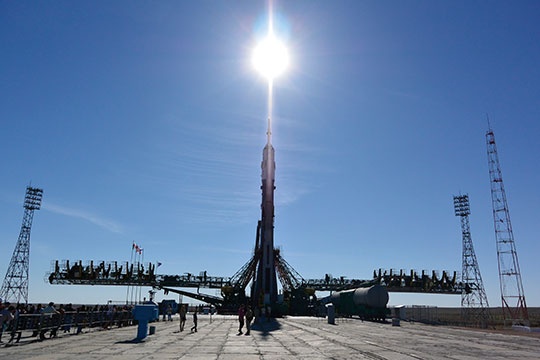
    Trouble on the Equator. The next two Galileo satellites may be ready to ship to Europe’s spaceport in South America by early April. But a large European commercial satellite customer is crowding the schedule, pressuring launch operator Arianespace to lift its satellites first. This could delay the Galileo birds, now set for June rise.

    ESA’s year-end plan calls for two more dual-satellite launches in October and December on Russian Soyuz rockets — new partners to the Galileo dance, bringing perhaps new technical connectivity issues.

    It’s Not Easy. With Galileo and EGNOS financed to the tune of €7 billion for 2014–2020, expectations are high, yet the European Commission brings a decidely conservative approach to expenditure on new ventures.

    “To take a chance, to do what no one has ever done — it’s not easy in a culture that doesn’t like risk,” said ESA director Jean-Jacques Dordain.

    Other conference speakers pointed to the securely established European Geostationary Navigation Overlay Service (EGNOS), the first generation of Europe’s GNSS, now fully operational.

    Carlo des Dorides, executive director of the GSA, responsible for operating EGNOS through the EGNOS Service Provider (ESSP), elaborated on his big job in 2014: maintaining and improving EGNOS performance and maximizing user adoption, particularly in the aviation, maritime transport, and rail transport sectors.

    “The experience we gain through our work with EGNOS will be instrumental as we move towards Galileo service delivery.”

    As well as organizational experience with EGNOS, user adoption of the GNSS precursor augurs much for Galileo. With one eye on the present and another on the future, the GSA has a big serving coming to its plate by December: management of a long-awaited, heavily invested system that has been in discussion since the 1990s and in various stages of gestation since 2000.

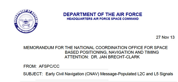
    PNT Advisory Board Hears Air Force CNAV Plan

    The U.S. National Space-Based Positioning, Navigation, and Timing (PNT) Advisory Board published the minutes of its December 2013, detailing a report from  Air Force Space Command on the road ahead for implementation of the GPS Civil Navigation (CNAV) message on L2C and L5. The subject has stirred some controversy of late, particularly between the U.S. Departments of Transportation (DoT) and Defense (DoD), and DoT is currently seeking public comments on the plan.

    The minutes relay the gist of General Whelan’s CNAV remarks as follows: “CNAV has been under discussion for a considerable time. Currently, L2C and L5 signals are being transmitted, but without a navigation message. AFSPC is working hard to activate these messages as soon as possible. One of the reasons for the delay is that additional time was needed to complete testing prior to activation. Testing began in late summer 2013 and, based on initial test results, a ‘way ahead’ has been plotted. . . . Current plans are to begin initial broadcasting in the spring of 2014. CNAV uploads will occur twice weekly. The signal will meet GPS Standard Positioning System (SPS) standards, but may not achieve current accuracy levels until full implementation in late 2014.

    “CNAV live-sky testing occurred in June [2013] and was conducted in cooperation with civil, industry, and international partners. The two-week test series included independent assessment and verification. The tests identified four errors that required action. The first, which was addressed in real time, related to implementation of the test series. The second required improvement to the tools suite, which should be totally integrated into the ground segment by December 2014. The third and fourth errors required patches to satellite software. All four issues are now regarded as closed.”

    DOT Speaks. A subsequent presentation from the Department of Transportation did not directly mention CNAV, according to the meeting minutes, but did include this update on civil signal monitoring, taken from the meeting minutes:

    “DOT is responsible for performance monitoring of GPS civil signals. The International Committee on GNSS’s (ICG’s) transparency principle states that ‘Every GNSS provider should publish documentation that describes the signal and system information, the policies of provision, and the minimum levels of performance offered for its open service.’

    Currently, this is only done on GPS L1 C/A signals. Performance standards for L2C and L5 have not yet been established. The crucial function of signal/service monitoring is to verify that commitments to GNSS performance are being met. Additionally, monitoring improves the situational awareness for GNSS operators, and provides assurance that any civil service failure is detected and resolved promptly.”

    Opposing Activation. At the close of 2013, a departing DOT assistant secretary wrote a letter to the Air Force opposing activation of the CNAV signal in April 2014. In March, DOT opened a 30-day comment period on the proposed CNAV message on L2C and L5. The comment period closed on April 4, after press time for this magazine so no results are yet known.

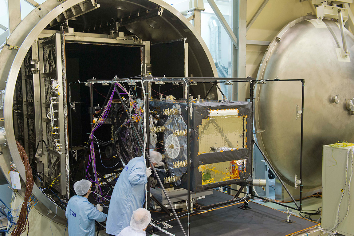
    Bright New IIF Aloft

    A United Launch Alliance Delta IV lifts off from Space Launch Complex-37 with the Air Force's Global Positioning System (GPS) IIF-5 satellite. This launch marked the 25th Delta IV flight since the first flight in 2002.
    A United Launch Alliance Delta IV lifts off from Space Launch Complex-37 with the Air Force’s Global Positioning System (GPS) IIF-5 satellite. This launch marked the 25th Delta IV flight since the first flight in 2002.

    The latest GPS IIF satellite was successfully launched into orbit on February 21. GPS IIF-5 will replace the vintage 1997 spacecraft known as GPS IIA-28 in Plane A, Slot 3 of the constellation. IIA-28 will go into a reserve role in the network for the remainder of its useful life.

    This is the first of three GPS launches planned through July to replace aging craft in the constellation. The IIF generation will form the backbone of the GPS space fleet for the next 15 years, providing greater navigational accuracy through improvements in atomic clock technology, a new, more robust, third civil signal, L5, for commercial aviation and safety-of-life applications, a second civil signal, L2C, for the dual-frequency GPS receivers, and improved anti-jam capabilities for military and civil users around the world.

    The GPS Block IIF satellites are built by Boeing. Earlier IIF satellites were launched in 2010, 2011, 2012, and 2013. All 12 satellites in the GPS IIF series have completed production. The Air Force plans to launch the remaining IIF satellites by 2016.

    Downstream Dialog, Tests in Europe

    With Galileo services set to take effect in December, the two European entities charged with the program are engaging manufacturers — the European Space Agency (ESA) in consumer markets, and the European GNSS Agency (GSA) in the government security sector, respectively.

    “We put out an open call to satnav manufacturers offering testing with our laboratory facilities,” said the head of ESA’s Radio Frequency Systems, Payload, and Technology Division. “We have gone on to work with five mass-market chipset makers and a comparable number of professional receiver manufacturers.”

    Available ESA facilities include:

    • a hybrid localization solution rack for receiver plug-in; it generates simulated constellations of multiple satnav systems along with Wi-Fi or mobile networks. It can also simulate inputs from inertial devices.
    • the octobox, a mini anechoic chamber into which phones or mobile devices can be placed, to feed them simulated satnav and cellular network signals.
    • a telecommunications and navigation testbed vehicle for field tests, carrying its own extremely accurate receivers to assess the performance of the consumer devices under test.

    “Thanks to earlier collaboration with ESA and the EU, the millions of multi-constellation satnav chips we sell annually have been equipped for Galileo signals since 2009,” stated Philip Mattos of ST Microelectronics, whose Teseo II receiver chips are used in satnavs and embedded in cars (see detailed technical article on page 36). “It will take only a software update to enable them to start using Galileo. This cooperation allows us to optimize our software based on access to actual signals and background technical information.”

    Regulated Service. The GSA invited European industries and member states’ Public Regulated Service (PRS) authorities to share views and ideas on technologies at the user segment level for the adoption of the PRS. The PRS uses encrypted signals designed to resist jamming, involuntary interference, and spoofing. GSA’s objective is to ensure that PRS service is affordable and secure for all interested users while also ensuring that European industry maintains its competitive edge in the global satellite navigation marketplace.

    GSA consultations will focus on:

    • steps transforming technologies into products competitive enough in terms of cost, power, dimension;
    • euro-manufacturing capability and capacity, especially nanotechnology;
    • how to build the manufacturing lines capable of serving PRS user segment needs;
    • main domains, elements, and interfaces that will benefit from standardization, allowing for a stronger market adoption of PRS.

    GPS III Alternative Payloads Canvassed

    GPS III prime contractor Lockheed Martin has heard from six companies concerning alternate designs for the GPS III satellite payload, according to reports. A company spokesperson said “constantly canvassing the industrial base to see what’s out there” is merely part of Lockheed’s standard business practice.

    Lockheed Martin partner Exelis Geospatial Systems currently supplies the payload, as it has for all previous GPS generations. Earlier this year, Gen. William Shelton, Air Force Space Command, said the first GPS III launch date had slipped from late 2015 into 2016, and confessed to “patience wearing thin” at a press breakfast.

    Part of the delay may have been due to signal crosstalk in the new, as yet unlaunched, payload. Crosstalk occurs when a signal broadcast on one circuit creates an undesired effect on another circuit.

    The Story So Far. In December 2013, Lockheed Martin turned on power to the bus and network communications payload of the second GPS III satellite, SV-02, at its test facility in Denver. This demonstrated the satellite’s mechanical integration, validated its interfaces, and opened the way for electrical and integrated hardware-software testing. The first GPS III satellite (SV-01) was powered on in February 2013.

    In October, the Lockheed Martin GPS III Nonflight Satellite Testbed (GNST), a full-sized, functional satellite prototype at Cape Canaveral Air Force Station, successfully communicated via cross-links to Air Force simulators of the current GPS constellation in orbit. Testing also demonstrated the ability of an Air Force receiver to track navigation signals transmitted by the GNST.

    Exelis Advances. In mid-March, Exelis announced successful completion and full testing of six transmitter assemblies, which are integral payload components for the GPS III satellites. The test program includes random vibration, pyroshock, and thermal vacuum testing, replicating space-like conditions through deployment and on-orbit environments. In January, Exelis received three rubidium atomic frequency standard clocks from Excelitas Technologies specifically designed for GPS III.

    Next-Gen SBAS Will Be a Multi-Constellation Affair

    Plans to harness Galileo and other satnav systems for next-generation satellite augmentation systems for aviation and other high-performance uses took a step forward at the 126th Satellite-Based Augmentation Systems (SBAS) Interoperability Working Group (IWG) in New Delhi, India, in February, with plans to move to a multi-constellation design adding Galileo, BeiDou, and GLONASS systems in the post-2020 era.

    International experts began converging on a standard message definition for the L5  channel of the planned second-generation SBAS systems, which will utilize dual-frequency, multi-constellation signals.

    “Two solutions had been put forward, one by ESA based on work by European industry and one from the U.S. Federal Aviation Administration and Stanford University,” explained ESA’s Didier Flament, co-chair of the IWG.

    “A single definition coordinated between both bodies has been presented, combining the benefits of both solutions. The formal IWG review and approval loop has now been started with the objective of finalizing it for September’s IWG meeting.

    “The aim is to have it ready to submit to the official international SBAS standardization bodies — the International Civil Aviation Organization and the Radio Technical Commission for Aeronautics — as soon as October.”

    GAGAN to the Mix. The meeting also marked the significant progress made by India’s own SBAS system GAGAN, which underwent its final stability test in summer 2013, followed by its safety certification in December.
    At this point GAGAN was declared certified for non-precision approach users , followed by its safety-of-life service being formally offered to civil aviation users on February 14.

    SBAS Services Worldwide

    GAGAN is the fourth certified SBAS to enter service worldwide. Europe has the European Geostationary Navigation Overlay Service (EGNOS), which was designed and built by ESA then turned over for operation by the European Satellite Service Provider, ESSP, overseen by the European GNSS Agency  (GSA) — both of whom also participated in the meeting. ESA retains responsibility for the future evolution of EGNOS.

    The U.S. has the Wide Area Augmentation System (WAAS), developed and operated by the Federal Aviation Administration, with an extension over Canada called CWAAS (Canadian WAAS). WAAS celebrated its 10th anniversary of operational life in July 2013.

    Japan has the Multi-functional Satellite Augmentation System (MSAS), developed and operated by Japan’s Civil Aviation Bureau. Japan is discussing plans to merge this capability with its new home-grown satnav system, QZSS.

    Along with GAGAN, the meeting covered the progress made by the other SBAS systems under definition or development — the Russian SDCM, Chinese SNAS, and Korean K-SBAS.

    The next IWG meeting will take place in September in Tampa, Florida.

  • GNSS Future Glimpsed at Summit in Munich

    The Munich Satellite Navigation Summit annually gathers people involved with GNSS from around the world to report on current status and progress of the multiple systems. It is a high-level briefing of significant global importance. Of course Europe, Germany, Bavaria, and the European GNSS industry, now recognized around the world, all take the opportunity to present their capabilities and successes.

    This year’s Summit covered a lot of ground, and I’ve tried to do it justice in this column. For an overview, here are the main topics covered in what follows:

    • Opening Plenary
    • Constellation Updates
    • Regional and Augmentation Updates
    • Bavarian Highlights
    • GNSS Interference
    • Legal impacts of Personal Privacy Devices (PPDs)
    • Precise Point Positioning (PPP)
    • Future of GNSS in the User Segment

    I used to spend quite a lot of time in Munich working on a multi-national, multi-role fighter aircraft program, so returning for this year’s Summit stirred some good memories for me.

    Held in the opulent Residenz Muenchen, the conference derives a special atmosphere from these historic surroundings, some dating back to 1385.  The former royal palace of Bavarian monarchs, the labyrinthine palace has ten courtyards and 130 rooms. Overall, this is a delightful setting.

    Regional Flavor. Munich is in the southern German state of Bavaria, and Bavaria has taken a real interest in the promotion and success of Galileo; witness the expansive Bavarian booth at recent European and North American GNSS conferences, and the siting of a Galileo control center in Oberpfaffenhoffen, once a sleepy village in the Bavarian countryside 20 kilometers outside Munich, but now a significant high-tech research center with many aerospace facilities. Germany has of course been one of the lead nations funding Galileo from its inception.

    Opening Plenary: A View from the Top

    The host of the Summit is actually the University of the German Federal Army in Munich, and we received a warm welcome from two leading professors – Dr. Eissfeller and Dr. Niehuss, the president.

    The theme of the Summit is to move from implementation to utilization, and in typical European form, all parties were looking to shower potential users with funded solutions to problems of which users are not yet aware — so users clearly need government-provided education, pilot projects, and funding. Not exactly a North American concept, where we tend to encourage users to buy our innovative stuff by demonstrating how it can save them money or earn them more revenue. But there’s a city called Rome over here . . .

    The opening plenary session covered GNSS, Earth Observation (EO) and Telecommunications — an extensive mandate — with a panel headed by Ilse Aigner, Bavarian State Minister of Economic Affairs and Media, Energy and Technology, an equally extensive portfolio, even for a state-certified engineer who used to work for Eurocopter.

    The European Commission, the European Space Agency (ESA), the German Aerospace Agency (DLR), the European GNSS Agency (GSA), and leading manufacturers Airbus, OHB (providers of the Galileo full-operational capability (FOC) satellites), and Telespazio were also represented. The Minister did indeed associate with and praise the local area, claimed 1,000 jobs created related to Galileo through an incubation center at Oberpfaffenhofen, and declared whole-hearted Bavarian support for satellite navigation.

    Among important matters mentioned by the plenary panel:

    • an €11 billion budget for Galileo/EGNOS and Copernicus (an EO project) under the Horizon 2020 program;
    • an intent to declare Early Service for Galileo before the end of this year with two or three dual Galileo satellite launches.

    Two Launches this Year. The first two FOC (production) SVs should go to the European launch center in Kourou in April in preparation for launch around June.  I heard in a corridor that launches may be planned for June, October and December, but an EU spokesman later said that there would only be two launches this year. OHB now has the contract to build 22 FOC Galileo SVs, each with a design life of 14 years, and they are bullish on their ability to deliver on time and budget.

    Constellation Updates

    • GPS. An estimated 2 billion GPS receivers are in use, and there may be ~10 billion by 2020. A return-on-investment (RoI) analysis is currently underway, but a rough guess is that costs are in the tens of $Billions, while annual returns are of the order of $60–100B/year. Another IIF satellite (SV) launched last month brought the total to 5 SVs transmitting L1, L2C, and L5 – with 7 more to come, and multiple launches are expected this year. There are 30 operational SVs on orbit. Signal performance significantly exceeds the specs, and consistent, dependable performance has been provided for more than 20 years.
    • Galileo. First fix achieved 12 March, 2013 with four SVs, two (maybe three?) launches of two SVs each planned for 2014 & early operational capability to be declared by end of this year. €7B funding provisioned for 2014-2020, 16-24 operational ground stations, Commercial Service (CS) planned by 2016 (more on this later), and a long-term evolution plan is being worked up during this year.
    • BeiDou. 14 SVs are on orbit: 5 geosynchronous orbit (GEO), 4 mid-Earth orbit (MEO) similar to GPS and other GNSS birds, and 5 inclined geosynchronous orbit (IGSO), together providing dual-frequency services. 30 total SVs are planned, and the intent is to provide open, compatible, interoperable signals with other GNSS, free of charge. There was not much other news to report, other than China intends to invest significantly in BeiDou to keep improving services.
    • GLONASS.  Russian delegates were notably absent, and there was much speculation that they declined to attend due to the Crimean situation. One U.S. delegate even inferred that they were ‘un-invited.’
    • United Nations ICG. Nine nations and the European Union = International Committee on GNSS (ICG), with 20 other associate and observer states.  Activities include GNSS compatibility/interoperability, GNSS enhancements, information sharing, and reference frames, timing & applications – lots of upcoming meetings and activities (see associated story).

    Regional & Augmentation Updates

    • WAAS (the U.S. Wide Area Augmentation System). Phase IV is underway with GEO replenishment begun, introduction of L5 to replace L2, and replacement of obsolete component parts. 100 GIII receivers were ordered with L1/L2C and L5 capability for delivery by September this year– and have capacity to also add Galileo. GIII receivers have already been fielded in six locations as part of initial integration testing. The Safety computer will also be upgraded starting this year.  3,912 LP/LPV approaches have been approved, of which 3,379 LPVs serve 1,667 Airports.
      GBAS CAT I is progressing with four US airport installations, system design approval began in January this year, and United Airlines has begun equipping more than 90 B737/B787 for GPS approach and landing. Alternative Positioning, Navigation and Timing (APNT) investigations are underway (as a backup to GPS) with a hybrid DME-pseudolite configuration currently favored. Stanford University subsequently presented this and other concepts.
    • EGNOS (the European Geostationary Navigation Overlay Service).  €1.58B budget approved, EGNOS V3 evolution is underway – introduction of L1/L5 and GEO (SES 5 and Astra 5B) replenishment, a requirement to expand East and West and to the North to provide full coverage to all EU States.There are ~100 EGNOS LPV approaches approved, this year it is hoped to add 150 more.
    • QZSS (Japan’s Quasi-Zenith Satellite System). Operational concept has been proven with 1st IGSO SV (Michibiki), so Japan is moving forward quickly to add another 3 SVs  (3xIGSO and 1xGEO) and ultimately would like to have a total of seven SVs in orbit providing QZSS services. L1/L1C/L2C/L5 signals are identical to GPS and L1s/L5s are augmentation signals, while L6 is proposed to be similar to Galileo E6, providing cm level PPP type service. QZSS essentially is intended to provide higher-elevation satellites to improve urban navigation in dense cities.
    • IRNSS (Indian Regional Navigation Satellite System).  Coverage extends 1500 kilometers beyond India’s land area, target is <20m accuracy, signals are in L5 and S band and can be used independently or in dual frequency combinations. A 2nd IRNSS-1B GEO satellite is scheduled to launch on April 4th.
    • GAGAN The Indian SBAS was commissioned and certified in February this year with a number of ground stations, redundant uplinks and two on-orbit GSAT 8 & 10 GEOs. Gagan is now qualified to provide RNP0.1 (navigation accuracy to 0.1 miles).

    Bavarian Highlights

    A collection of examples of Bavarian GNSS innovations followed in a very interesting session led off by an overview of Business Incubation Centers and their collaboration with government agencies and research centers. Small business start-ups are encouraged to apply during four annual time-slots, and receive two years’ incubation support and cash incentives.  This has lead to 81 new ventures and has apparently been the source of the 1,000 new jobs mentioned by the Minister of Economic Affairs.

    The annual European Satellite Navigation Competition and Galileo Masters competition have also generated a large number of ideas and concepts (8,000), some of which have found support through this incubation process.

    Airbus Defence gave a short overview of the testing work they accomplished in supporting the first Galileo fix. The company fix has prepared several vehicle test platforms, ready to take the next phase of Galileo testing to the streets in realistic, real-world environments.

    DLR provided insights into a number of their activities, namely: Iono mapping; signal distortion; multipath; jammer mitigation – adaptive antenna and processing; GNSS repeaters – how they can become unintentional jammers; spoofer and multipath investigations; antenna designs; GNSS evolution – maser and clock combination benefits.

    IFEN provided information on the activities at the GATE ground-based pseudolite range, which has enabled realistic outdoors testing of Galileo receivers, well in advance of signals from orbiting satellites. Recent testing has now been able to include the four operating Galileo SVs on orbit with GATE pseudolite signals. GATE will continue to evolve over the next few years to keep up as more Galileo orbital signals come on-line.

    Fraunhofer presented information on their 40-channel GPS/Galileo/GLONASS chip-receiver, claiming 1m accuracy, low-cost, robust reliable position solution, small form-factor and low-power. Following PRS test-bed development efforts, Fraunhofer has now received a contract to also deliver 20 pre-operational Galileo PRS receivers for use in initial pilot projects.

    GNSS Interference

    Vidal Ashkenazi, in his inimitable form, led a panel discussion on interference, jamming (in particular personal privacy devices (PPD)) and spoofing, and coaxed his panel members to provide a quantity of information on what’s being done, mitigation capabilities and potential enforcement. Unlike all the other sessions, panel members did not use presentations, instead responding to some wide-ranging questions on the subject from the session chair.

    David Turner, representing the U.S. Department of State, indicated that the ICG will meet shortly in Geneva hosted by the International Telecommunication Union (ITU) to focus on interference, jamming and mitigation. The recourse that nations have for use of PPDs by their people is the law — jammers are illegal, sale and purchase of them is illegal — however internet sales are very difficult to police. So detection and mitigation are required to find and shut them down. Dave’s presentation on the GPS.gov website indicates that the ICG is working on an education program for States to inform about GNSS sensitivity to interference and the threat to critical infrastructure if they are allowed to operate. The ICG also has a task force on detection, reporting and systems development.

    The Indian Space Research Organization (ISRO) indicated that PPD jammers in India are restricted but permitted for gatherings such as at churches where personal safety may be an issue. Ground-based detection is needed and stronger legal protection which may well prohibit use of PPDs altogether.

    Japan Aerospace Exploration Agency (JAXA) indicated that they are working on ‘signal proofing’ for QZSS.

    BeiDou said that they are building a monitor network in China which will detect jamming.

    There was a general discussion on whether receiver manufacturers should be mandated to make receivers which are resilient to jamming. Many thought that there have already been significant advances in the direction by manufacturers. The normal approach would be to develop requirements with industry, agency and user inputs, publish them and call up the requirements in equipment specifications. In the United States, the Department of Homeland Security is seeking an approach to detection and location.

    Legal impacts of Personal Privacy Devices (PPDs)

    While the audience may have had high hopes that the ‘Legal Eagles’ could come up with some magic prevention and prosecution solution, the next session was more of a legal background briefing, without any concrete conclusions (quite similar to other discussions I’ve had with some lawyers in the past, actually).

    The first briefing was from the European Commission/European Union who indicated that the EU doesn’t own the frequency rights to Galileo (uh-oh). They have to operate through a member state, which gets the rights through the International Telecommunication Union (ITU) and then licenses use to the EU – the bottom line being that EU enforcement of jamming protection laws maybe be difficult, as the legal framework only exists at the national level for each State. The EU is trying to get recognition under another class of ITU membership.

    EU regulations were presented, stating that GNSS re-transmitters can only be operated legally by governments or government contractors. Or can be used indoors for indoor navigation, but only for emergency services at fixed sites which are pre-approved. Pseudolites can only be operated indoors,and there should be no interference to other systems. Jammers are forbidden and cannot be placed on the market for sale. 

    Eurocontrol had a lot to say about the impact on aviation navigation infrastructure and receivers on aircraft. Existing ground nav aids have limitations, the world-wide equipment infrastructure is becoming quite old, aviation has generally moved away to GNSS and inertial based navigation, and uses ground navaids as backup. There is a conflict between regulating GNSS heavily for aviation and how people want to use it in the commercial world. We may have to consider a trade-off between heavily restricted GNSS operations, and wide open commercial GNSS applications.

    David Sobel from Electronic Frontier Foundation in the United States presented the contrary case for individual privacy. His argument is that sale of tracking devices is unregulated and can readily be purchased, so people may presumably use them to track others, thereby infringing their privacy. So why shouldn’t people be able to ‘defend their privacy’ by use of PPDs?

    Say an employer insists that a vehicle you are driving have a tracking device so he knows where you are, isn’t the driver also justified in trying to protect his privacy? Since U.S. police can no longer place tracking equipment on suspect vehicles without a warrant, tracking appears to be down to private individuals or companies, who it would appear, have the legal ability to attach tracking devices under most circumstances. So the argument goes that if people have a legitimate concern about privacy, there should be acceptable provisions to allow them to disrupt tracking.

    If there is a service such as road tolling, there is an incentive for people to avoid these costs. So systems should be robust enough to avoid disruption. Enforcement is a problem. Should police chase people they suspect have jammers, or should they rather chase criminals or help and protect citizens? Mitigation systems need testing, so to test these systems there has to be jamming transmission, which needs to be controlled and regulated. Restricting the import of bad devices into a country might be desired, but the manufacturing countries don’t tend to want to restrict exports, as exports help their economy. Again, the argument seems to be that of personal privacy over potential risks and damages to society.

    No solutions, but a healthy discussion of views from a legal perspective.

    Precise Point Positioning (PPP)

    The group discussing PPP options consisted of the GSA (charged with exploitation of Galileo services), several principal industry service providers of PPP, and the Federal agency which provides PPP-like services in Germany.

    The GSA presented its ideas concerning the provision of high-accuracy PPP corrections over the Galileo E6 signal – the so called Commercial Service (CS). The intent however would not be to disrupt the commercial market-place. Nevertheless, GSA is proposing a public-funded service  to be sold to users within a market that is already well served by commercial worldwide service providers who charge users for cm-level PPP service.

    While Trimble made a polite presentation on the many levels of capabilities of their TerraSat services, as did Veripos and to some extent Fugro, it was clear that the commercial providers are not eager to find competition in their market from a government entity. NovAtel also chimed in on this conflict as it will be involved in Veripos/TerraStar, following the acquisition of the latter by Hexagon, which also owns the former. Fugro appeared to be interested in acquiring rights to distribute CS on behalf of GSA.

    The German Federal agency promoted open data, source and standards from the IGS network to which they contribute: IGS is supported by numerous national agencies around the world. Orbit and Clock PPP service is available 24/7 from multiple sources. However, the service is offered on a best-efforts basis without a service guarantee and cannot achieve the accuracies or convergence times of commercial services.

    I talked subsequently with Michael Ritter, CEO of NovAtel to learn the background to the Veripos/TerraStar acquisition. It is clear that providing PPP services means added-value to NovAtel when it sells receivers with PPP capability, so it will quickly discontinue offering Omnistar subscriptions and will launch ‘NovAtel Correct’ shortly, offering Veripos (marine) and TerraStar (land) PPP subscription services. NovAtel is making significant inroads in the agriculture segment and sees PPP service as an essential element of this and other businesses. The acquisition was worth something on the order of $200 million, so there is a vested interest in making these services pay, and discouraging GSA entry into this market. Veripos will continue supplying other GNSS OEM receiver manufacturers — notably Septentrio — who use TerraStar services, now adding NovAtel, and potentially another major GNSS manufacturer.

    Future of GNSS in User Segment

    Chaired by Greg Turetzky of Intel, this session opened the third day of the Summit. The presenters offered their concepts for current and future GNSS equipment and systems.

    Stanford University outlined its work with the U.S. Federal Aviation Administratin (FAA) on an alternate PNT system to be used as a back-up to GNSS. It used to be that GNSS systems were designed to overcome ‘space-weather’ effects and faults in equipment design or manufacture. Nowadays there are ‘bad-guys’ out there and we need to ‘protect, toughen and augment’ these systems. Antennas can be built which impart a specific signature to the signals they transmit, and this may aid in finding and prosecuting the bad guys, but the main focus of work is development of a hybrid system using Distance Measuring Equipment (DME) and a pseudolite.

    Tests have demonstrated good performance and these prototype efforts could lead to aviation requirements (MOPS) development by 2018 and deployment by 2020.

    Septentrio has been involved in Galileo since it began and was the first company with Galileo receivers. Nowadays it fields receivers in multiple commercial applications including machine control, maritime, aviation, automation, and measurement, delivering accuracies from a meter down to a centimeter. It will add E6 to the AsteRx family of multiple-channel, multi-frequency, multi-constellation receivers, has developed a number of hardware and software mitigation techniques to combat jamming, interference and multipath, and integrate receivers with inertial units for aiding.

    Furuno is interested in resilient PNT for marine applications, and has examined the use of eLoran as an alternative to GPS, but has moved towards a system of radar beacons that detect radar pulses from passing ships and transmit their position, enabling position determination. In tests, accuracies of around 2 meters have been obtained with two beacons.

    Quascom adds ‘firewalls’ inside receivers which ‘toughen’ the processing and prevent distortion of position information. It believes this will be necessary until authentication can be added into the GNSS system itself, so that any data received is validated and is known to be good.

    Chris Rizos from the University of New South Wales, Australia drew attention to the ‘holes’ that exist in GNSS and reviewed a number of possible ‘band-aid’ fixes, such as WiFi especially for indoor location. However his solution seems to be to establish terrestrial networks transmitting GNSS-like signals.

    Eurocontrol indicated that aircraft currently use inertial and DME extensively as a back-up to GNSS navigation. By 2030 there will be multiple constellations, and dual-frequency use should become commonplace in aviation, so GNSS navigation should be much more robust. Aircraft approaches are required to be in conformance with Required Navigation Performance (RNP), so would it be possible to develop RNP procedures for DME and Inertial to be used as back-up during approaches in the event GNSS is disrupted?

    To conclude the session, Airbus provided a ‘starter-course’ overview on inertial systems – how they work, the range of different types available, what they can achieve, costs, strengths and weaknesses and integration with GNSS.

    The Summit continued with subsequent sessions on: space technologies and users; GNSS monitoring of Earth and disaster management; Copernicus – Earth Observation; GNSS Education. Unfortunately neither the space available here nor my deadline allowed me to attend these equally interesting presentations.

    manufacturers’ exhibit area at the Summit   fits into a couple of corridors near the main Hall, around 20 booths. I talked with several of the manufacturers, including Spirent who has launched its latest GSS9000 multi-frequency-constellation simulator, with a four-fold increase in system iteration rate over the previous model. Exhibitors appeared to be pleased to be at the Summit and the level of interest shown by the attendees.

    As this year’s Munich Summit concludes, where does it leave us? We’ve learned some new things about several GNSS topics and heard some interesting new concepts. Europe appears to be now focused on users and applications, to ensure there is market growth and use of Galileo.

    What stands out for me is the contrast between how European governments go about GNSS and how North America and the commercial world does the same thing without as much direct influence. This is nothing new of course, it is simply the European way.

    ——————–

    Tony Murfin is GPS World’s contributing editor for the Professional OEM e-newsletter.


  • Downstream Dialog, Tests in Europe

    With Galileo services set to take effect in December, the two European entities charged with the program are engaging manufacturers — the European Space Agency (ESA) in consumer markets, and the European GNSS Agency (GSA) in the government security sector, respectively.

    “We put out an open call to satnav manufacturers offering testing with our laboratory facilities,” said the head of ESA’s Radio Frequency Systems, Payload, and Technology  Division. “We have gone on to work with five mass-market chipset makers and a comparable number of professional receiver manufacturers.”

    Available ESA facilities include:

    • a hybrid localization solution rack for receiver plug-in; it generates simulated constellations of multiple satnav systems along with Wi-Fi or mobile networks. It can also simulate inputs from inertial devices.
    • the octobox, a mini anechoic chamber into which phones or mobile devices can be placed, to feed them simulated satnav and cellular network signals.
    • a telecommunications and navigation testbed vehicle for field tests, carrying its own extremely accurate receivers to assess the performance of the consumer devices under test.

    “Thanks to earlier collaboration with ESA and the EU, the millions of multi-constellation satnav chips we sell annually have been equipped for Galileo signals since 2009,” stated Philip Mattos of ST Microelectronics, whose Teseo II receiver chips are used in satnavs and embedded in cars (see detailed technical article on page 36). “It will take only a software update to enable them to start using Galileo. This cooperation allows us to optimize our software based on access to actual signals and background technical information.”

    Regulated Service. The GSA invited European industries and member states’ Public Regulated Service (PRS) authorities to share views and ideas on technologies at the user segment level for the adoption of the PRS. The PRS uses encrypted signals designed to resist jamming, involuntary interference, and spoofing. GSA’s objective is to ensure that PRS service is affordable and secure for all interested users while also ensuring that European industry maintains its competitive edge in the global satellite navigation marketplace.

    GSA consultations will focus on:

    • steps transforming technologies into products competitive enough in terms of cost, power, dimension;
    • euro-manufacturing capability and capacity, especially nanotechnology;
    • how to build the manufacturing lines capable of serving PRS user segment needs;
    • main domains, elements, and interfaces that will benefit from standardization, allowing for a stronger market adoption of PRS.


  • The System: Galileo Accomplishes In-Orbit Validation

    Galileo Accomplishes In-Orbit Validation

    Nucleus of Four Now Operational: It “Works, and Works Well”

    figure 1  Dual-frequency Galileo positioning performance during the In-Orbit Validation phase: positioning accuracy is an average 8 m horizontal and 9 m vertical (95% of the time). Its average timing accuracy is 10 nanoseconds on average. Plot courtesy of ESA.
    Dual-frequency Galileo positioning performance during the In-Orbit Validation phase: positioning accuracy is an average 8 m horizontal and 9 m vertical (95% of the time). Its average timing accuracy is 10 nanoseconds on average. Plot courtesy of ESA.

    The European Space Agency (ESA) announced fulfillment of the in-orbit validation (IOV) of Galileo on February 10. IOV was achieved with four satellites, the minimum number needed to perform navigation fixes.

    “IOV was required to demonstrate that the future performance that we want to meet when the system is deployed is effectively reachable,” said Sylvain Loddo, ESA’s Galileo Ground Segment manager. “It was an intermediate step with a reduced part of the system to effectively give evidence that we are on track.”

    Following a March 2013 first determination of a ground location, jointly by Galileo’s space and ground segments, program managers undertook  a wide variety of tests all across Europe.

    “More than 10,000 kilometers were driven by test vehicles in the process of picking up signals, along with pedestrian and fixed receiver testing. Many terabytes of IOV data were gathered in all,” said Marco Falcone, ESA’s Galileo System manager.

    According to ESA’s elaboration on the test results, the system has proved itself capable of solely performing positioning fixes across the planet.

    Galileo’s observed dual-frequency positioning accuracy is an average of 8 meters horizontal and 9 meters vertical, 95 percent of the time. Its average timing accuracy is 10 billionths of a second. Its performance is expected to improve as more satellites are launched and ground stations come on line.

    For Galileo’s search-and-rescue function — operating as part of the existing international Cospas–Sarsat programme —  77 percent of simulated distress locations can be pinpointed within 2 kilometers, and 95 percent within 5 kilometers. All alerts are detected and forwarded to the Mission Control Centre within a minute and a half, compared to a design requirement of 10 minutes.

    “Europe has proven with IOV that in terms of performance we are at a par with the best international systems of navigation in the world,” said Didier Faivre, ESA director of Galileo and Navigation-related Activities.

    Historically Speaking. In a February 2013 GPS World article, Peter Steigenberger, Urs Hugentobler, and Oliver Montenbruck discussed Galileo-only positioning. “Using an ionosphere-free dual-frequency linear combination of pseudorange measurements on the Galileo E1 and E5a frequencies, the position of the TUME reference station [at the Technische Universität München (TUM) in Munich, Germany] could be determined with a 3D position error of less than 1.5 meters,’” the authors said.

    Crystal Ball Gazing. The next two Galileo satellites, of the full operational capability (FOC) class, currently complete their testing for flight clearance at ESA’s ESTEC facility.

    Six such satellites are destined to rise into space in 2014, according to ESA’s master plan. Should all those launches occur as scheduled, Galileo’s initial services could start by the end of the year.

    GNSS Vulnerable: What to Do?

    Too Much Sensitivity, Not Enough Robustness, Says Parkinson

    Brad Parkinson, the founding architect of GPS, told a UK conference that the system needs to be made more robust to ensure worldwide availability of services to users. His concerns over GPS availability relate to threats such as the loss of authorized frequency spectrum (implicitly creating licensed jammers), space weather due to hyperactive ionospheric conditions, and deliberate or inadvertent jamming of GPS signals.

    He warned that GPS is more vulnerable to sabotage or disruption than ever before, and charged that politicians and security chiefs are ignoring the risk. Western governments are “in their infancy in recognizing the problem,” he remarked further in an interview with London’s Financial Times. “[In the United States] I don’t know anyone that is really in charge of it. The Department of Homeland Security should be [but] … they don’t have any people that understand it very well. They’ve got one person without any budget to speak of.”

    He also warned that Europe’s €5 billion Galileo system is equally at risk.

    Parkinson proposed a three-stage program to:

    • Protect (legally) the signal and physically eliminate jamming sources;
    • Toughen the GPS/Galileo receiver’s resistance to interference;
    • Augment the GPS signals with other satellites or with ground-based transmitters such as eLoran.

    To support his proposal, Parkinson stated, “The number one need for all GPS or Galileo users is availability. Over the years, manufacturers of signal receiver technologies have focused too much on sensitivity and not enough on resilience or robustness. The maritime industry is a particular concern where users have taken GPS for granted. They must increase preparedness and backups as they do in aviation or other GNSS-using industries.

    “Even today, most ships have only GPS and the vision of their crew to guide them when approaching harbors. As you can see from today’s conference, there are a wealth of solutions to toughen and back up GPS, many of which are not technologically difficult nor expensive, but still their adoption in sectors such as global shipping is certainly not adequate.”

    As part of his protection program, Parkinson urged that penalties for jamming GPS networks be coordinated worldwide. “In Australia, if you cause interference likely to cause prejudice to the safe conduct of a vessel, it’s five years in the jug [jail] and $850,000.” Contrasting this with a U.S. case that may simply impose a forfeiture of the culprit’s jamming device, Parkinson added, “I’m calling for the community of nations to move to the Aussie-type penalties.”

    In the toughening regard, Parkinson alluded to integration of GPS data with information derived from an inertial positioning system. “If you combine all of these things, a good set should be able to fly within 1 kilometer of a jammer with a 10-kilometer range,” said Parkinson. “That’s what I call toughening.”

    Parkinson made his remarks as the keynote speech at GNSS Vulnerabilities and Resilient PNT 2014, hosted by the Royal Institute of Navigation. He will also deliver the keynote address, “Assured PNT: Assured World Economic Benefits,” for the European Navigation Conference on April 15 in The Netherlands.

    GLONASS Seeks Broader Monitoring Footprint; Launch Imminent

    Russia will deploy as many as seven ground monitoring and augmentation stations for GLONASS outside its national boundaries. GLONASS/GNSS Forum Association Executive Director Vladimir Klimov stated that “It is planned to deploy about six or seven stations on foreign territories this year.” Negotiations for the stations are now taking place with foreign nations.

    Currently, there are 46 GLONASS ground stations on Russian territory, eight in neighboring countries, three in Antarctica, and one in Brazil. The United States recently spurned, with some Congressional trumpeting, a Russian tender to site one of the ground stations on U.S. soil.

    New Instrument in Space. In mid-February, the most recent GLONASS-M satellite traveled to the Plesetsk cosmodrome for a probable mid-March launch. GLONASS-M 54 will carry a high-accuracy thermal stabilization unit, installed on the spacecraft for testing and flight qualification. The next-generation K-class of GLONASS spacecraft will loft this device to provide increased positioning accuracy.

    Five GLONASS-M craft are planned for launch in 2014, in one triple and two single launches.

  • The System: Competition for the Gold Standard

    The System: Competition for the Gold Standard

    BeiDou Releases Public Service Performance Document

    In late December, director Ran Chengqi of China’s Satellite Navigation System Management Office announced the BeiDou Navigation Satellite System (BDS) Public Service Performance Standard. The document details the public service performance parameters of the BeiDou system, including service area, accuracy, integrity, continuity, and availability. It is a basic commitment to customers from BDS providers, but also an important basis for customers to choose, use, and evaluate the system performance.

    Also released is Version 2 of the BDS Interface Control Document (ICD) for the Open Service Signal. Among other changes, it includes a description of the B2I signal on 1207.140 MHz.

    The publishing of the Public Service Performance Standard, a common practice among GNSS operators, is also a prerequisite for BeiDou system involvement in international civil aviation, international maritime, 3rd Generation Mobile [phone] System, and other international standard-setting organization activities.

    The document has Chinese and English versions. Because document download from the BDS government website can be difficult, Richard Langley has made them available at the University of New Brunswick website:

    http://www2.unb.ca/gge/Resources/beidou_open_service_performance_standard_ver1.0.pdf
    http://www2.unb.ca/gge/Resources/beidou_icd_english_ver2.0.pdf

    Analysis. John Lavrakas of Advanced Research Corporation posted the following comment to the online version of this news story:

    “I took a quick look at comparing the BeiDou Open Service Performance Standard with the GPS Standard Positioning Service Performance Standard and obtained mixed results.

    “In some cases, the commitments from BeiDou were stronger (URE accuracy, the table to show green for the GNSS service committing to a more stringent standard over the other vertical position), and in other cases the commitments from GPS were stronger (continuity of service, advance notice of outages).

    “The good news is that GNSS systems are documenting the service levels that users can expect. What we will need next is monitoring to verify these service levels are being met. Here is a link to my quick look:
    http://oregonarc.com/2014/01/beidou-performance-standard-how-good-is-it/ .”

    Table 1. Coded to show green for the GNSS service committing to a more stringent standard over the other. Courtesy of Advanced Research Corporation.
    Table 1. Coded to show green for the GNSS service committing to a more stringent standard over the other. Courtesy of Advanced Research Corporation.

    Galileo to Sail, Penalty-Free

    Schedule Overruns Not a Problem, Avers Space Agency Director-General

    Athough the European Commission (EC) sternly put in place financial penalties for late delivery and arrival on orbit of Galileo satellites, the European Space Agency (ESA) that manages the process will not suffer the consequences of a one-year delay in their launch. The EC did not sign an industrial contract with the ESA for the Galileo work, according to an announcement by ESA Director-General Jean-Jacques Dordain made the announcement in mid-January 17.

    Dordain said under the agreement, the EC pays for ESA’s staff costs, while ESA acts as technical manager for the program. But the industrial contract itself to build the satellites — and specifying the penalities —  was not encompassed by this agreement.

    Galileo’s schedule is now firmly back on track, according to ESA,since the first OHB satellite passed thermal-vacuum testing in November, and the second satellite is in the test chamber. Signals are apparently “go” for their launch in June aboard Soyuz rocket from Guiana Space Center in South America. A second pair should launch in October, and a third in December.

    Meeting an Aggressive Date. The EC committed some time ago to start initial Galileo services in 2014. Delivery on this promise has become increasingly unclear after recent testing delays. Getting new Soyuz launch dates withing this year is not a sure-fire thing, either.

    The Galileo Supervisory Authority earlier announced that it had validated the four initial operating-capability (IOV) Galileo spacecraft in orbit as perform twice as well as expected in terms of signal accuracy. However, the satellites provide very limited use, about one hour per day when all are visible to the same user.

    Once six satellites become visible inthe sky, sometime after the planned June launch, testing qualification of early services can begin. With eight, actual service qualification is possible but not certain. Finally, with 10 satellites — December? — early services may be able to start.

    Earlier last year, EC Vice President Antonio Tajani had warned that financial penalties to those building Galileo would cover the cost overruns due to the delay in launching the system. His finger appeared to point at ESA as much as OHB AG of Germany and Surrey Satellite Technology Ltd. of Britain, who lead the industrial consortium building the satellites.

    The main antenna of the second Galileo Full Operational Capability (FOC) satellite being inspected with a flashlight in advance of mass property testing at the European Space Agency’s  ESTEC Test Centre in the Netherlands. Thermal-vacuum testing on the second model began in early 2014. The two FOC satellites will be launched on a Soyuz rocket from Europe’s French Guiana Spaceport in mid-2014. Whether four more can rise and begin providing initial Galileo services by the end of the year is the question of the hour.
    The main antenna of the second Galileo Full Operational Capability (FOC) satellite being inspected with a flashlight in advance of mass property testing at the European Space Agency’s ESTEC Test Centre in the Netherlands. Thermal-vacuum testing on the second model began in early 2014. The two FOC satellites will be launched on a Soyuz rocket from Europe’s French Guiana Spaceport in mid-2014. Whether four more can rise and begin providing initial Galileo services by the end of the year is the question of the hour.

    U.S.Transport DepSec Takes Potshot at CNAV

    The departing Deputy Secretary of Transportation, John Porcari, wrote a letter in the closing days of 2013 opposing the U.S. Air Force’s announced plans to begin broadcasting Civil Navigation (CNAV) message-populated L2C and L5 signals as early as April 2014. Military personnel are incensed over what they see as Porcari’s impugning, when not ignoring, the Air Force 35-year track record of broadcasting the gold standard of global navigation satellite signals — something in which Transportation has zero experience.

    Porcari alludes in his December 27 letter to “non-standard engineering tools” and “non-standard operations” that he believes would come into play for early CNAV broadcast. “These have the potential to inject human error, which may result in unacceptable GPS constellation operation.”

    What Porcari means by “non-standard” he does not specify, although he confesses to unease as “the ability to monitor these signals, [without which] the system will not know if the L2C and LS signals are within specification. Given these risks, DOT is concerned that the CNAV messages could provide hazardously misleading information, impacting GPS safety-of-life, protection of property, and economic security applications.” The full text of the Porcari letter is available here.

    OCX Delay the Cause? Because the current GPS ground control system cannot generate CNAV, and the next-generation OCX —which can — will not be ready  by April, anothercomputer will apparently develop the civil signal navigation data. However, neither the data or message is intended for actual use, nor will the FAA or any transport agency employ it. The advance project is designed to aid reciever manufaturers and developers in adpting to the new signal.

    In addition to questioning Air Force 2 SOPS ability to broadcast an accurate, compliant signal containing CNAV, the letter appears to ignore — or be ignorant of — the 17 official U.S. government/military monitoring sites for GPS distributed around the world, not to mention thousands of other monitoring sites run by government agencies such as the Jet Propulsion Laboratory, the National Aeronautics and Space Administration, and the National Geospatial-Intelligence Agency, and by many universities such as Stanford, Ohio State, Cal Tech, and many other international institutions around the world. Many of these sites collaborate under the rubric of the International GNSS Service.

    Finally, John Deere and Trimble Navigation both operate automated GPS signal monitoring systems that that report any anomaly in the navigation message for all GPS signals with an average two-second notification time.

    “This letter is so much BS,” fumed one source who wished to remain anonymous, “coming from an agency that is in arrears in its GPS payments to the tune of more than $70 million and has no clue how to represent the global GPS user. GPS is a ubiquitous system, not just a tool for the DOT and the Federal Aviation Administration. GPS needs to implement these signals for all users and as a modernization program that was promised to be in place years ago.”

    Porcari left for the private sector.

    OCX Change Order to Ensure Proper M-Code Function

    Raytheon Intelligence and Information Systems has been awarded a change order for work that costs up to $8.5 million on its existing contract to ensure that the new military signal, M-code, works with the GPS Operational Control System, according to an announcement from the Pentagon as reported by Space News.

    Raytheon is building the ground station (OCX) for a new generation of satellites that will bring more safety and precision to GPS. The contract modification is to assure implementation of M-code capabilities across OCX Block 1 and 2. M-code is the new highly secure, anti-jam signal designed for the GPS III constellation. The current GPS ground control system lacks M-code capability.

    The OCX is designed to work with the advanced GPS III positioning, navigation and timing satellites, slated to start launching in 2015, and also will be backwardly compatible with existing GPS satellites.

    Raytheon won the $886.4 million prime contract to develop the OCX in February 2010. Work will be performed at Raytheon’s facility in Aurora, Colorado, and is expected to be completed by August 31, 2016.

    The Air Force Space and Missile Systems Contracting Directorate, Los Angeles Air Force Base, California, is the contracting agency.

    Details. Raytheon Intelligence and Information Systems, Aurora, Colorado, was awarded the unpriced change order (P00112) with a not-to-exceed of $8,595,748 on an existing contract (FA8807-10-C-0001) for M-Code Implementation on the Operational Control System. The contract modification is to assure implementation of M-Code Capabilities across OCX Block 1 and 2. Work will be performed at Aurora and is expected to be completed by August 31, 2016.  Fiscal 2014 research and development funds will be obligated at definitization.

    GAGAN Certified for Aviation over India

    The Director General of Civil Aviation of India has certified the GPS-Aided Geo Augmented Navigation (GAGAN) system to Required Navigation Performance 0.1 Nautical Mile (RNP0.1) service level.

    Aircraft equipped with satellite-based augmentation system (SBAS) receivers can now use  GAGAN signals in Indian airspace for en route navigation and non-precision approaches without vertical guidance.

    Mission control centers and uplink stations now operate on Indian soil. Messages carrying corrections to GPS signals are sent to satellites in geostationary orbit carrying the GAGAN payload.

    The availability of the GAGAN signal over Indian airspace bridges the gap between European Union’s European Geostationary Navigation Overlay Service (EGNOS) and Japan’s Multi-functional Satellite Augmentation System (MSAS) coverage areas.

    The SBAS consists of 15 Indian reference stations, three uplink stations, three mission control centers, and three GAGAN payloads broadcasting in C and L bands and with all the associated software and communication links.

    GAGAN will provide augmentation service for GPS over India, the Bay of Bengal, South East Asia and the Middle East expanding up to Africa.

    Car, Nav Makers Emulate NSA: Track, Store Consumer Data

    U.S. Big Three automakers and some Japanese car companies track and store data from customers’ on-board navigation systems, according to a report from the U.S. Government Accountability Office. The document describes, in general fashion, practices at General Motors, Ford, Chrysler, Toyota, Honda, and Nissan, and further delves into data storage by GPS manufacturers Garmin and TomTom and nav app designers Google Maps and Telenav.

    The GAO said the automakers collect data at times to assist customers with traffic updates, emergency roadside assistance, and to track stolen vehicles.None of the companies currently sell the data, according to the report, but most drivers do not know what information is being tracked and cannot opt out of the data collection programs.

    The companies can “track where consumers are, which can in turn be used to steal their identity, stalk them or monitor them without their knowledge. In addition, location data can be used to infer other sensitive information about individuals such as their religious affiliation or political activities.”

    The report claims the companies’ privacy policies are sometimes unclear, making it difficult for consumers to understand the potential risks of using their GPS navigation devices.

    No federal law regulates GPS privacy; it is not illegal for private companies to collect, use, or sell personal information. Several proposals have been floated in Congress to protect the privacy of GPS data, but none enacted.

  • The System: Two More Threes for Space

    Artist's concept of a GPS III satellite in orbit, courtesy of Lockheed Martin.
    Artist’s concept of a GPS III satellite in orbit, courtesy of Lockheed Martin.

    Air Force Orders GPS III Satellites 05 and 06 from Lockheed Martin

    A December 12 contract modification provided Air Force funding to Lockheed Martin to complete the fifth and sixth GPS III space vehicles (SV 05-06).  Lockheeed originally received funding to procure long-lead parts for satellites five through eight (SV 05-08) in February 2013.

    The $200,700,415 cost-plus-incentive-fee modification (P00276) on an existing contract (FA8807-08-C-0010) for GPS III space vehicles 05 and 06 means that work will be performed at Littleton. Colorado and Clifton, New Jersey, and is expected to be completed by Dec. 14, 2017 for space vehicle 05 and June 14, 2018 for space vehicle 06.  The Air Force Space and Missile Systems Center Contracting Directorate, Los Angeles Air Force Base, California, is the contracting activity.

    Galileo Achieves First Airborne Tracking

    The European Space Agency’s Galileo satellites have achieved their first aerial fix of longitude, latitude, and altitude, enabling the inflight tracking of a test aircraft.

    ESA’s four Galileo satellites in orbit have supported months of positioning tests on the ground across Europe since the first fix in March. Now the first aerial tracking using Galileo has taken place, determining the position of an aircraft using only its own independent navigation system.

    The milestone took place on a Fairchild Metro-II above Gilze-Rijen Air Force Base in the Netherlands on November 12. It was part of an aerial campaign overseen jointly by ESA and the National Aerospace Laboratory of the Netherlands, NLR, with the support of Eurocontrol, the European Organisation for the Safety of Air Navigation, and LVNL, the Dutch Air Navigation Service Provider.

    A pair of Galileo test receivers was used aboard the aircraft, the same kind employed for Galileo testing in the field and in labs across Europe. They were connected to an aeronautical-certified triple-frequency Galileo-ready antenna mounted on top of the aircraft.

    Tests were scheduled during periods when all four Galileo satellites were visible in the sky. The receivers fixed the plane’s position, as well as determining key variables such as the position, velocity, and timing accuracy; time to first fix; signal-to-noise ratio; range error; and range–rate error.

    Testing covered both Galileo’s publicly available Open Service and the more precise, encrypted Public Regulated Service, whose availability is limited to governmental entities.

    Flights covered all major phases: take off, straight and level flight with constant speed, orbit, straight and level flight with alternating speeds, turns with a maximum bank angle of 60 degrees, pull-ups and push-overs, approaches and landings.

    The flights also allowed positioning to be carried out during a wide variety of conditions, such as vibrations, speeds up to 456 km/h, accelerations up to 2 ghorizontal and 0.5–1.5 gvertical, and rapid jerks. The maximum altitude reached during the flights was 3,000 meters.

    GPS III Prototype Proves Constellation Compatibility

    The Lockheed Martin prototype of the next-generation GPS satellite, the GPS III, has proven that it is backwardly compatible with the existing GPS satellite constellation in orbit.

    During tests concluded on October 17, Lockheed Martin’s GPS III testbed successfully communicated via cross-links to Air Force simulators of the current GPS constellation in orbit. The current GPS constellation includes GPS IIR, GPS IIR-M, and GPS IIF satellites.

    Testing also demonstrated the ability of an Air Force receiver to track navigation signals transmitted by the GPS III Nonflight Satellite Testbed (GNST). The GNST is a full-sized, functional satellite prototype at Cape Canaveral Air Force Station.

    “These tests represent the first time when the GNST’s flight-like hardware has communicated with flight-like hardware from the rest of the GPS constellation and with a navigation receiver,” explained Paul Miller, Lockheed Martin’s director for GPS III Development. “This provides early confidence in the GPS III’s design to bring advanced capabilities to our nation, while also being backward-compatible.”

    The first flight-ready GPS III satellite is expected to arrive at Cape Canaveral in 2014, for launch by the Air Force in 2015.
    GPS III satellites will be the first GPS space vehicles with a new L1C civil signal designed to make it interoperable with other international global navigation satellite systems.

    The GNST has helped to identify and resolve development issues prior to integration and test of the first GPS III flight space vehicle (SV 01). It has gone through the development, test, and production process for the GPS III program first, significantly reducing risk for the flight vehicles, improving production predictability, increasing mission assurance, and lowering overall program costs.

    The GPS III team is led by the Global Positioning Systems Directorate at the U.S. Air Force Space and Missile Systems Center.

    Lockheed Martin is the GPS III prime contractor, with teammates including ITT Exelis, General Dynamics, Infinity Systems Engineering, Honeywell, ATK, and other subcontractors.

    Good News for Users and Manufacturers

    The U.S. Air Force is directing transmission of continuous CNAV message-populated L2C and L5 signals starting in April 2014. The move is designed to help development of user equipment compatible with the civil signals. Full text of the CNAV memo appears below.

    CNAV-header

    Galileo FOC Satellites Endure Simulated Space Tests

    The European Space Agency’s newest Galileo satellite has emerged from five weeks of simulated space conditions. On November 29, a hatch slid open to end its thermal-vacuum test, a milestone on the way to orbit.

    The satellite was placed in the 4.5-meter-diameter Phenix chamber in ESA’s ESTEC Test Centre in Noordwijk, the Netherlands, in late October. Once inside, the air was pumped out to create a space-quality vacuum. Temperature extremes were also reproduced, with the six copper walls of the thermal tent cooled by liquid nitrogen down to –180°C.

    A second Galileo vehicle has  been undergoing the same rigors at the site, along with a vibration and shock test to reproduce separation from the launcher. Thermal-vacuum testing on the second model will begin in early 2014. The two satellites will be launched on a Soyuz rocket from Europe’s Spaceport in French Guiana in mid-2014.

    The next satellite is expected to arrive at ESTEC in March, with further satellites following every seven weeks or so. A total of 22 FOC satellites are being built by OHB in Germany, with navigation payloads being delivered from Surrey Satellite Technology Ltd. in the UK.

    The first Galileo Full Operational Capability satellite emerges from the Phenix test chamber after five weeks of thermal–vacuum testing.
    The first Galileo Full Operational Capability satellite emerges from the Phenix test chamber after five weeks of thermal–vacuum testing.
  • The System: Autumn Falls Back

    The System: Autumn Falls Back

    Delta IV, the current GPS launch vehicle, awaits a date with space at Cape Canaveral.
    Delta IV, the current GPS launch vehicle, awaits a date with space at Cape Canaveral.

    Launch Delays Ground GPS IIF and Galileo FOC

    The scheduled October 23 launch of GPS IIF-5, the fifth in the current “follow-on” generation of GPS satellites, has been postponed in order to complete a review of an adjustment made to the rocket’s upper stage engine. A loss of thrust by a Delta IV rocket upper stage during a GPS launch last year worried the Air Force and the United Launch Alliance (ULA), though the satellite successfully reached its intended orbit.

    A subsequent  investigation identified a fuel leak in the engine system as the culprit. Two  medium Delta IV rockets and one heavy version have launched since then, but ULA said further investigation had produced new information about the engine’s first start.

    While no new launch date has been set, the ULA released a statement:

    “The ongoing Phase II investigation has included extremely detailed characterization and reconstructions of the instrumentation signatures obtained from the October 2012 launch and these have recently resulted in some updated conclusions related to dynamic responses that occurred on the engine system during the first engine start event.

    “The GPS IIF-5 Delta IV launch is being delayed to allow the technical team time to further assess these updated conclusions and improvements already implemented and determine whether additional changes are required prior to the next Delta IV launch.

    “The Delta IV booster for the GPS IIF-5 mission has completed the standard processing and checkout on the launch pad and will be maintained in a ready state for spacecraft mate and launch pending completion of this assessment. A new launch date will be established when the assessment of the updated dynamic response information is completed in the coming weeks.”

    A Soyuz rocket (right) will carry Galileo FOC satellites, but no sooner than June 2014.
    A Soyuz rocket (right) will carry Galileo FOC satellites, but no sooner than June 2014.

    Galileo. Continuing delays in ground testing of the first two fully operational Galileo satellites have postponed their launch to June 2014 at the earliest.

    According to European officials, the European Space Research and Technology Centre (ESTEC) thermal vacuum chamber for testing satellites under orbit conditions was not ready for the two FOC satellites delivered by OHB in late summer.

    The satellites thus cannot ship to the Guiana spaceport in South America in time for a planned 2013 launch on a Soyuz rocket. The Galileo schedule is also running into bottlenecks with scheduled launches by other satellite programs aboard Guiana Soyuzes.

    A six-week test of the first Galileo satellite at ESTEC reportedly got under way in October.

    Svalbard station on Spitsbergen in the Norwegian Arctic.
    Svalbard station on Spitsbergen in the Norwegian Arctic.

    Ground Network Supports Galileo for SAR

    Completion of a pair of European Space Agency dedicated ground stations at opposite ends of that continent has enabled Galileo satellites in orbit to participate in global testing of the Cospas–Sarsat search and rescue system.

    The Maspalomas station, in mid-Atlantic Canary Islands, was activated in June. In September, the Svalbard site on Spitsbergen in the Norwegian Arctic activated. The two sites can now communicate and will soon undertake joint tests.

    The International Cospas-Sarsat Programme is a satellite-based search and rescue (SAR) distress alert detection and information distribution system, established by Canada, France, Russia, and the United States, with participation by 33 other countries.

    Activation of the two new stations enables participation of the latest two Galileo satellites in a worldwide test campaign for Cospas-Sarsat expansion.
    The program is introducing a new medium-orbit SAR system to improve coverage and response times, with the Galileo satellites in the vanguard.

    The second pair of Europe’s Galileo satellites — launched together in October 2012 — are the first of the constellation to host SAR payloads. These can pick up UHF signals from emergency beacons aboard ships or aircraft or carried by individuals, which are then relayed to ground stations. There, the source is pinpointed and automatically passed on to a control center, which then routes it to local authorities for rescue.

    “The Galileo satellites, tested in combination with the same SAR payloads on Russian GLONASS satellites as well as compatible repeaters on a pair of U.S. GPS satellites, showed an ability to pinpoint simulated emergency beacons down to an accuracy of 2–5 kilometers in a matter of minutes,” explained Igor Stojkovic, ESA Galileo SAR engineer.

    “Our in-orbit validation tests so far have been in line with expectation and beyond, giving us a lot of confidence in the performance of the final system, once completed. And using a combination of satellites is just how the upgraded system will operate in practice, in order to localize distress signals.”

    Localization test performed from Maspalomas MEOLUT as part of Galileo’s SAR in-orbit validation. Beacon locations obtained with four satellites are shown in black, while those using three satellites are shown in grey. More than 93 percent of all beacon locations, after only a single beacon burst has been received, are within the required five kilometers from actual beacon position.
    Localization test performed from Maspalomas MEOLUT as part of Galileo’s SAR in-orbit validation. Beacon locations obtained with four satellites are shown in black, while those using three satellites are shown in grey. More than 93 percent of all beacon locations, after only a single beacon burst has been received, are within the required five kilometers from actual beacon position.

    System Briefs

    GLONASS Seeks UK Ground. According to the website of the Russian magazine GLONASS Messenger, the Russian Federal Space Agency communicated its proposals for specific areas in the United Kingdom (or, more likely, its territories) to accommodate stations of the GLONASS System for Differential Correction and Monitoring (SDCM). Apparently, an offer was made by the deputy head of Roscosmos, Oleg Frolov, in discussions with David Parker, the director of the British Space Agency. The desired locations for the stations will not be disclosed until the approval of their establishment by the British side, the website reported.

    Head Rolls. After repeated satellite launch failures and rumblings about embezzlement and corruption within the Russian space program Roscosmos, Vladimir Popovkin was let go as director and replaced by Oleg Ostapenko, a colonel general in the Russian Military, deputy minister of Defence, and former commander of the Aerospace Defence Forces. The Russian government also announced formation of new agency, the United Rocket and Space Corporation, to manage satellite and rocket manufacturing facilities heretofore supervised by Roscosmos.

  • The System: Ground Control Readied for GPS III

    The System: Ground Control Readied for GPS III

    rtn_iis_gps-ocx_banner4.jpg

    Raytheon Company reached several milestones recently in its development of the GPS Next -Generation Operational Control System (GPS OCX). Lockheed Martin’s GPS III Non-flight Satellite Testbed (GNST) — a full-sized, functional satellite prototype currently residing at Cape Canaveral Air Force Station — successfully established remote connectivity and communicated with OCX during pre-flight tests.

    GNST proved that it could connect with and receive commands from Raytheon’s Launch and Check Out System (LCS), a part of OCX that supports the satellite and mitigates risks prior to launch. The GNST received commands from Lockheed Martin’s Launch and Checkout Capability (LCC) node in Newtown, Pennsylvania via the OCX servers at Raytheon’s facility in Aurora, Colorado; the system then returned satellite telemetry to the control station. The tests mirror launch and early orbit testing planned for all flight vehicles.

    “While we have connected OCX with ground-based simulators before, these tests were the first time that OCX and a GPS III satellite have actually communicated,” said Keoki Jackson, vice president for Lockheed Martin’s Navigation Systems mission area.

    Ahead of Schedule. Raytheon received Interim Authorization to Test (IATT) security certification from the U.S. Air Force for OCX LCS four months ahead of schedule. The company received a one-year certification with no liens, meaning the government does not require any changes.

    “Typically, IATT certification is given for six-month increments,” said Matthew Gilligan, Raytheon’s GPS OCX program manager and a vice president in Raytheon’s Intelligence, Information, and Services business. “The LCS one-year accreditation speaks to the quality of the information assurance design and threat protection.” The IATT not only includes the LCS, but also Lockheed Martin’s GPS III satellite support systems, Exercise and Rehearsal Training Tool, and Upload Generation Tool.

    OCX is being developed in two blocks. There are seven iterations in Block 1 and one in Block 2. LCS is the fifth Iteration of Block 1; it successfully completed Critical Design Review in June 2013.

    Early Orbit Exercises. Lockheed Martin and Raytheon also completed the third of five planned launch and early orbit exercises to demonstrate launch readiness of GPS III and OCX.

    Exercise 3 demonstrated space-ground communications; first acquisition and transfer orbit sequences; orbit-raising maneuver planning and execution; and basic anomaly detection and resolution capabilities. In addition, the industry and Air Force GPS Directorate teams jointly executed mission planning activities, such as orbit determination and the generation of upload command files.

    Two additional readiness exercises and six 24/7 launch rehearsals are planned before launch of the first GPS III satellite. The first flight GPS III space vehicle (SV-01) is expected to be available for launch in 2014, and launched by the U.S. Air Force in 2015.

    Exelis Encryptors. Exelis delivered the first three of a planned 14 ground-based encryptors to Raytheon Company for OCX. Designed to automatically code and decode GPS signals, encryptors facilitate the exchange of user information by securely transmitting navigation payload data between the OCX ground station and the orbiting constellation of satellites.

    Delivery followed successful thermal, electromagnetic interference and security verification testing. Exelis provides critical elements of software in the navigation processing subsystem that will enable controllers to better understand the exact position of GPS satellites. This helps ensure accurate navigation information is securely broadcast to users. In addition to encryptors, Exelis is building high-precision receivers for use in GPS ground monitoring stations and satellite signal simulators for testing purposes.

    Exelis is also on contract with Lockheed Martin to provide the payloads for the GPS III satellites.


    Fire_engine_galileoEurope Tests Galileo Public Regulated Service

    European Union member states began their independent testing of the Public Regulated Service (PRS) broadcast by the four Galileo navigation satellites in orbit. Transmitted on two frequency bands with enhanced protection, PRS offers a highly accurate positioning and timing service, with access strictly restricted to authorized users, such as government defense, security, and emergency services.

    PRS access was initially considered for Galileo’s Full Operational Capability phase, but it has been enabled in 2013 in response to the strong interest of member states in this service. To allow early access to PRS during the current phase, the European Commission and ESA began the joint project PRS Participants To IOV (PPTI) in July 2012.

    ESA ensured the availability of several tools developed under ESA contracts, including test receivers and other qualification equipment. ESA’s PRS Laboratory, based at the Agency’s ESTEC technical centre in Noordwijk, the Netherlands, provided training, demonstrations and sample data.

    “Belgium, France, Italy, and the UK have now performed independent PRS acquisition and positioning tests. In parallel, ESA, through collaboration with Dutch and Italian authorities, is conducting PRS fixed and mobile validation in several locations in the Netherlands and Italy,” said Miguel Manteiga Bautista, head of ESA’s Galileo Security Office.

    The PRS tests have demonstrated a current autonomous positioning accuracy of less than 10 meters when in the correct geometrical configuration. This is an impressive result considering the small number of Galileo satellites in orbit and the limited ground infrastructure so far deployed.

    Italy has developed its own PRS receiver, and tests have confirmed the feasibility of independent PRS receiver development and verification based on specifications provided by ESA.

    “The PPTI project is still ongoing to test more advanced functionalities this coming autumn and to run the first aeronautical PRS tests in collaboration with the Dutch authorities. Other member states have also expressed their willingness to join the IOV PRS experimentation campaigns soon,“ concluded Miguel Manteiga.

    The project is a first step to ensure use of the PRS as soon as it becomes operational. It will be complemented by PRS pilot projects, focused on PRS applications, which are currently under definition in a common effort between European agencies.

    The United States has submitted a request to be able to use Galileo’s PRS. Other non-EU countries have also expressed a desire to be associated with the program.


    System Briefs

    Way to Go GAO, Part II. The Air Force should come up with better cost estimates and options for new GPS satellites, according to a September 9 report from the U.S. Government Accountability Office (GAO). The GAO was responding to an Air Force study on lower-cost space solutions for GPS.

    “More information on key cost drivers and cost estimates, and broader input from stakeholders would help guide future investment decisions,” the GAO concluded. Specifically, the key cost drivers include dual-launch capability, navigation satellites (smaller GPS-type satellites yet to be developed), and a nuclear detection capability.”

    New Birds by Fall. Galileo satellite-builder OHB AG said it should know by late September whether tests of the first Full Operational Capability (FOC) Galileo satellites are proceeding well enough to permit their delivery later this year. The first FOC satellite began testing at ESA’s European Space Research and Technology Centre in May, and the second arrived August 9.

    The OHB satellites either “bear a strong resemblance” or “are identical” to the four in-orbit validation spacecraft now in medium-Earth orbit, depending on the source. However, the on-board power of the OHB spacecraft exceeds that of the validation satellites built by a different manufacturer. According to one source, Galileo managers made the modification in part to enable Galileo’s encrypted Public Regulated Service signal to overcome a signal frequency overlap issue with China’s BeiDou constellation.

  • Europe Tests Galileo Public Regulated Service

    European Union member states began their independent testing of the Public Regulated Service (PRS) broadcast by the four Galileo navigation satellites in orbit. Transmitted on two frequency bands with enhanced protection, PRS offers a highly accurate positioning and timing service, with access strictly restricted to authorized users, such as government defense, security, and emergency services.

    PRS access was initially considered for Galileo’s Full Operational Capability phase, but it has been enabled in 2013 in response to the strong interest of member states in this service. To allow early access to PRS during the current phase, the European Commission and ESA began the joint project PRS Participants To IOV (PPTI) in July 2012.

    ESA ensured the availability of several tools developed under ESA contracts, including test receivers and other qualification equipment. ESA’s PRS Laboratory, based at the Agency’s ESTEC technical centre in Noordwijk, the Netherlands, provided training, demonstrations and sample data.

    “Belgium, France, Italy, and the UK have now performed independent PRS acquisition and positioning tests. In parallel, ESA, through collaboration with Dutch and Italian authorities, is conducting PRS fixed and mobile validation in several locations in the Netherlands and Italy,” said Miguel Manteiga Bautista, head of ESA’s Galileo Security Office.

    The PRS tests have demonstrated a current autonomous positioning accuracy of less than 10 meters when in the correct geometrical configuration. This is an impressive result considering the small number of Galileo satellites in orbit and the limited ground infrastructure so far deployed.

    Italy has developed its own PRS receiver, and tests have confirmed the feasibility of independent PRS receiver development and verification based on specifications provided by ESA.

    “The PPTI project is still ongoing to test more advanced functionalities this coming autumn and to run the first aeronautical PRS tests in collaboration with the Dutch authorities. Other member states have also expressed their willingness to join the IOV PRS experimentation campaigns soon,“ concluded Miguel Manteiga.

    The project is a first step to ensure use of the PRS as soon as it becomes operational. It will be complemented by PRS pilot projects, focused on PRS applications, which are currently under definition in a common effort between European agencies.

    The United States has submitted a request to be able to use Galileo’s PRS. Other non-EU countries have also expressed a desire to be associated with the program.

  • Ground Control Readied for GPS III

    Raytheon Company reached several milestones recently in its development of the GPS Next -Generation Operational Control System (GPS OCX).  Lockheed Martin’s GPS III Non-flight Satellite Testbed (GNST) — a full-sized, functional satellite prototype currently residing at Cape Canaveral Air Force Station — successfully established remote connectivity and communicated with OCX during pre-flight tests.

    GNST proved that it could connect with and receive commands from Raytheon’s Launch and Check Out System (LCS), a part of OCX that supports the satellite and mitigates risks prior to launch. The GNST received commands from Lockheed Martin’s Launch and Checkout Capability (LCC) node in Newtown, Pennsylvania via the OCX servers at Raytheon’s facility in Aurora, Colorado; the system then returned satellite telemetry to the control station. The tests mirror launch and early orbit testing planned for all flight vehicles.

    “While we have connected OCX with ground-based simulators before, these tests were the first time that OCX and a GPS III satellite have actually communicated,” said Keoki Jackson, vice president for Lockheed Martin’s Navigation Systems mission area.

    Ahead of Schedule. Raytheon received Interim Authorization to Test (IATT) security certification from the U.S. Air Force for OCX LCS four months ahead of schedule. The company received a one-year certification with no liens, meaning the government does not require any changes.

    “Typically, IATT certification is given for six-month increments,” said Matthew Gilligan, Raytheon’s GPS OCX program manager and a vice president in Raytheon’s Intelligence, Information, and Services business. “The LCS one-year accreditation speaks to the quality of the information assurance design and threat protection.” The IATT not only includes the LCS, but also Lockheed Martin’s GPS III satellite support systems, Exercise and Rehearsal Training Tool, and Upload Generation Tool.

    OCX is being developed in two blocks. There are seven iterations in Block 1 and one in Block 2. LCS is the fifth Iteration of Block 1; it successfully completed Critical Design Review in June 2013.

    Early Orbit Exercises. Lockheed Martin and Raytheon also completed the third of five planned launch and early orbit exercises to demonstrate launch readiness of GPS III and OCX.

    Exercise 3 demonstrated space-ground communications; first acquisition and transfer orbit sequences; orbit-raising maneuver planning and execution; and basic anomaly detection and resolution capabilities. In addition, the industry and Air Force GPS Directorate teams jointly executed mission planning activities, such as orbit determination and the generation of upload command files.

    Two additional readiness exercises and six 24/7 launch rehearsals are planned before launch of the first GPS III satellite. The first flight GPS III space vehicle (SV-01) is expected to be available for launch in 2014, and launched by the U.S. Air Force in 2015.

    Exelis Encryptors. Exelis delivered the first three of a planned 14 ground-based encryptors to Raytheon Company for OCX. Designed to automatically code and decode GPS signals, encryptors facilitate the exchange of user information by securely transmitting navigation payload data between the OCX ground station and the orbiting constellation of satellites.

    Delivery followed successful thermal, electromagnetic interference and security verification testing. Exelis provides critical elements of software in the navigation processing subsystem that will enable controllers to better understand the exact position of GPS satellites. This helps ensure accurate navigation information is securely broadcast to users. In addition to encryptors, Exelis is building high-precision receivers for use in GPS ground monitoring stations and satellite signal simulators for testing purposes.

    Exelis is also on contract with Lockheed Martin to provide the payloads for the GPS III satellites.

  • The System: IRNSS Signal Close up

    IRNSS Signal Close up

    By Richard Langley, Steffen Thoelert, and Michael Meurer

    The spectrum of signals from IRNSS-1A, the first satellite in the Indian Regional Navigation Satellite System, as recorded by German Aerospace Center researchers in late July, appears to be consistent with a combination of BPSK(1) and BOC(5,2) modulation.

    Figure 1 shows that, centered at 1176.45 MHz, the signal has a single symmetrical main lobe and a number of side lobes characteristic of the signal structure that the Indian Space Research Organization (ISRO) announced would be used for IRNSS transmissions in the L-band. Figure 2 shows the corresponding IQ constellation diagram. Further analysis will be required to sleuth additional signal details as ISRO, so far, has not publicly released an IRNSS interface control document describing the signal structure in detail.

    Figure 1. Spectrum of IRNSS-1A L5 signal.
    Figure 1. Spectrum of IRNSS-1A L5 signal.
    Figure 2. IQ constellation diagram of IRNSS-1A L5 signal.
    Figure 2. IQ constellation diagram of IRNSS-1A L5 signal.

    The German scientists caution that “this is a very early snapshot of the current signal transmission and probably both the signal power and the signal quality will change and possibly improve during the in-orbit-testing phase of the satellite’s operation.

    Extra Life for IIRs, IIR-Ms

    U.S. Air Force engineers are testing on-orbit a technique to extend the life of the 19 GPS IIR and IIR-M satellites on orbit, roughly 60 percent of the current contellation.

    A new charging method may reduce the rate of satellite battery degradation, thereby extending satellite operational life. If the technique passes the test, the initiative could add a combined 20 years to the life of the satellites — saving the Air Force tens of millions of dollars in the process.

    Gen. William Shelton, commander of Air Force Space Command, credits Capt. Jacob Hempen of the Air Force’s 2nd Space Operations Squadron for the job. Capt. Hempen says in turn that Warren Hwang of the Aerospace Corporation originated the idea.

    When satellite solar panels are directly exposed to the Sun, they charge satellite batteries while continuing to power other operations onboard the space vehicle. When the satellite passes  into the Sun’s shadow behind the Earth, it runs on batteries. The batteries can be re- charged at variable rates. When some of the batteries are powered above a certain rate threshold, they can overheat, accelerating their natural rate of decay.

    Lowering battery charging rates could still enable the satellites to perform well while minimizing the rate of degradation. Hitting the optimum number called for some finely-honed calculations.

    The satellites were built by Lockheed Martin Space Systems, and the oldest still in operation was launched in 1997.

    They had an intial design life of eight years, which many have now well outlasted. If the technique proves out and is carefully applied across the board, it could conceivably fill in replenishment gaps equivalent more than two additional spacecraft — conceivably as much hundreds of millions of dollars in build and launch costs, postponed. In today’s budget environment, a postponement can be construed as equivalent to outright savings.

    System Briefs

    GLONASS Partial Make-Good. Russia will launch two GLONASS satellites later this year to make up for the loss of three satellites in the July 2 Proton rocket explosion. The first is scheduled for the beginning of September, and the second at the end of October. Both will rise aboard Soyuz carrier rockets, which have proven more reliable than the Protons. A constellation of 29 GLONASS satellites is now in orbit, with 24 spacecraft in operation, three spares, one in maintenance, and one in test flight phase.

    Meanwhile, plans to reduce GLONASS funding have alarmed at least some deputies of the Duma, the Russian state legislative body. Government officials have floated a plan to reduce funding of the space program in 2014 by 11.7 billion rubles ($355 million), by 13.5 billion rubles in 2015, and by 40 billion rubles in 2016. The federal space program of Russia for 2006-2015 already lacks 10.5 billion rubles funding, and this year there has been a 2.3-billion-ruble additional reduction in R&D. A Duma committee chairperson warned that this trend will “lead to the loss of confidence of the international community in the GLONASS system and, consequently, to a reduction in its use globally. Russia will lose a strategic global instrument of political and economic prestige.” The Duma has recommended that the government maintain funding of federal space programs.

    Galileo Satellites’ Trial By Noise. The first Galileo Full Operational Capability (FOC) satellite successfully completed acoustic testing in July, part of a full-scale test campaign at ESA’s ESTEC Test Centre in Noordwijk, the Netherlands.

    The satellite was placed in the Large European Acoustic Facility (LEAF), effectively the largest sound system in Europe. A quartet of noise horns embedded in a wall of the 11 x 9 x 16.4 meter test chamber generated an acoustic noise level of 140.7 decibels, about the same noise as standing 25 meters from a jet taking off, and intended to simulate the extreme environment experienced by a satellite atop a rocket about to fire itself off the launch pad.

    A second FOC satellite arrived at ESTEC on 9 August from manufacturer OHB in Bremen, Germany. It will undergo a similar acoustic testing and then a System Compatibility Test Campaign will linking it with the Galileo Control Centres in Germany and Italy and ground user receivers as if it were already in orbit.

    A total of 14 FOC satellites are being produced and then tested at ESTEC as an integral part of their path to orbit. A second work order of eight satellites has been given to OHB.

    GPS III Pathfinder. On July 19, Lockheed Martin delivered a full-sized, functional prototype of the next-generation GPS satellite to Cape Canaveral Air Force Station to test facilities and pre-launch processes in advance of the arrival of the first GPS III flight satellite.

    The GPS III Non-Flight Satellite Testbed (GNST) paves the way for the first flight GPS III satellite, expected to arrive at the Cape in 2014, ready for launch by in 2015.

    An innovative investment by the Air Force under the original GPS III development contract, the GNST has helped to identify and resolve development issues prior to integration and test of the first GPS III flight space vehicle (SV-01).

    Following the Air Force’s rigorous “back-to-basics” acquisition approach, the GNST has gone through the development, test and production process for the GPS III program first, significantly reducing risk for the flight vehicles, improving production predictability, increasing mission assurance and lowering overall program costs.

    Lockheed Martin is currently under contract for production of the first four GPS III satellites (SV 01–04), and has received advanced procurement funding for long-lead components for the fifth, sixth, seventh and eighth satellites (SV 05–08).

    GNSS Industry Survey. Here are the results of two questions asked about government and industry from the 2013 GNSS STATE OF THE INDUSTRY SURVEY.

    Is government committed to private industry in a time of drastic budget cuts? For more results from the 2013 GNSS STATE OF THE INDUSTRY SURVEY.
    Is government committed to private industry in a time of drastic budget cuts?
    Is industry actively making its concerns known to government?
    Is industry actively making its concerns known to government?