Tag: Topcon Positioning Systems

  • Precision agriculture market to reach $5B in 2021

    The global market for precision agriculture solutions is forecast to grow from €2.2 billion ($2.6 billion) in 2016 at a compound annual growth rate (CAGR) of 13.6 percent to reach about €4.2 billion ($5 billion) in 2021, according to a research report from the market analyst firm Berg Insight.

    A set of technologies are applied in precision farming practices that are aimed at managing variations in the field to maximize yield, raise productivity and reduce consumption of agricultural inputs. While solutions such as auto-guidance and machine monitoring and control via onboard displays are mainstream technologies in the agricultural industry, telematics and variable rate technology (VRT) are still in the early stages of adoption.

    Interoperability between hardware and software solutions remains a challenge, although standardization initiatives led by organizations such as Agricultural Industry Electronics Foundation and AgGateway are making progress.

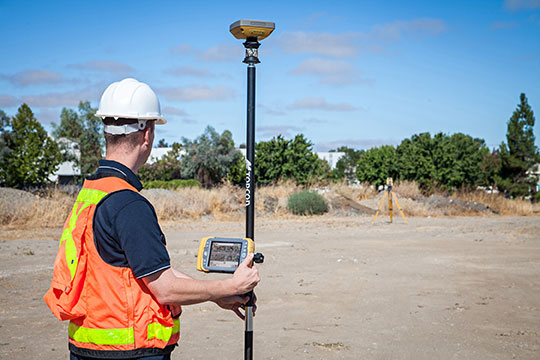
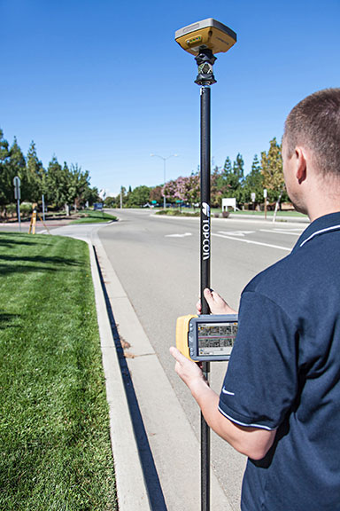
    Most major agricultural equipment manufacturers have initiatives related to precision agriculture, although strategies vary markedly. Leading vendors include agricultural equipment manufacturer Deere & Company, followed by the U.S.-based precision technology vendors Trimble, Topcon Positioning Systems, Raven Industries and Ag Leader Technology. Hexagon further holds a strong position in the positioning segment through its subsidiary NovAtel.

    A group of companies have emerged as leaders in the nascent market for in-field sensor systems. These include Davis Instruments, Pessl Instruments with its METOS brand, Semios, Hortau, AquaSpy and CropX.

  • Topcon features latest software at Intergeo 2017

    Topcon Positioning Systems’ Scott Langbein discusses the company’s Magnet Collage software at Intergeo 2017, which took place Sept. 26-28 in Berlin, Germany. According to the company, Magnet Collage provides data processing of otherwise disparate data sets into one 3D environment that can accommodate laser scanner, mobile scanning and mapping, road resurfacing scanners and photogrammetric point clouds.

  • Topcon focuses on Falcon 8 UAS at AUVSI’s Xponential 2016

    Dave Henderson of Topcon Positioning Systems details the company’s Falcon 8 rotary-wing UAS at the Association of Unmanned Vehicles International‘s Xpontential 2016 show, held May 2-5 in New Orleans. The commercial-grade UAS is designed for inspection and monitoring or survey and mapping applications.

  • Topcon Acquires Precision Ag Company Digi-Star

    Topcon Positioning GroupDigiStar_Logo_clr has acquired Digi-Star, an international provider of agricultural solutions involving weight sensors and control systems for feeding, planting, fertilizer and harvest equipment manufacturers.

    “After several years of working on development projects together, we are delighted with this acquisition,” said Ray O’Connor, president and CEO of Topcon Positioning Group. “Digi-Star and Topcon Precision Agriculture are a perfect fit, bringing complementary technologies and distribution channels to our rapidly growing precision agricultural division. At a time when many companies are decreasing their investment in agricultural markets, we are increasingly optimistic about their growth based upon our strong commitment to developing management systems and solutions that bring the power of the Internet of Things (IoT) to every farm.”

    Based in Fort Atkinson, Wis., Digi-Star supplies electronic equipment, precision sensors, optical yield and feed management sensors, displays, position verification and software used by farmers and other equipment operators to precisely measure and analyze valuable data from critical farming processes. Digi-Star has expertise in the livestock and grain equipment markets, according to a news release from Topcon.

    Mac Moore, president and CEO of Digi-Star, said, “Topcon and Digi-Star have numerous synergies with electronics, sensors, and integration of specific user interfaces for the agriculture and industrial markets that will complement each other’s customers. Both companies will benefit from the expanded product lines and solutions that progressive customers depend upon for maximum profitability.”

    In 2012 Digi-Star purchased RDS Technology, a United Kingdom-based company, which possesses similar technology for agricultural and construction applications, adding engineering, development and manufacturing facilities in Europe.

    “We are very enthusiastic about the opportunity of combining these companies. In addition to expanding our reach into the farm market segment, this will further extend our scope of field solutions to help us continue strong growth while serving an expanded customer base for Topcon Precision Agriculture, for the aftermarket and original equipment manufacturer (OEM) clients,” said Albert Zahalka, president of Topcon Precision Agriculture. “We are also excited to add the skilled employees and world-class facilities located in the Midwestern United States, the United Kingdom and the Netherlands to our global agricultural family.

    Digi-Star currently employs more than 220 employees in its three locations, with approximately half located in the United States or Europe.

  • Topcon Introduces Field Controller for Advanced Data Collection

    Topcon Positioning Group announces a new data controller — the FC-500 — with numerous features and benefits, including a large 4.3-inch touchscreen display and 5MP camera with built-in LED flash.

    The FC-500 is designed for the professional operating Topcon MAGNET Field, Site and Layout software and Topcon’s Pocket 3D.

    Ray Kerwin, director of global surveying products, said, “The FC-500 works with all Topcon GPS/GNSS receivers and total stations, and meets or exceeds all field application requirements.  Additionally, the FC-500 works with the new Topcon LN-100 instrument dedicated to BIM and one-person construction layout, simplifying workflow with the seamless integration with our MAGNET suite of software solutions.”

    Kerwin said, “With a sunlight readable screen, the controller is easy to use even in bright sunlight.  It is the ideal job site controller in any condition (waterproof up to one meter, IP68 rating) and the large camera format with built-in LED flash and built-in 8GB flash storage allows the storing of hundreds of job site photos.”

    The standard model has both Bluetooth and Wi-Fi connectivity, while the FC-500 GEO has Bluetooth, WiFi and GPS.  A third model comes with the addition of a 3.5G cellular modem that allows access to the MAGNET Enterprise Solutions suite, “making the FC-500 the perfect field instrument for sending and receiving data files to the MAGNET cloud,” Kerwin said.

    For the GIS professional using MAGNET Field software, the FC-500 has a geotagging feature that allows imprinting file information, including GPS location, directly on photos.

  • Topcon Acquires DynaRoad, Opens Technology Center

    Topcon Positioning Group has acquired DynaRoad Oy, a construction software company in Helsinki, Finland. In conjunction with the acquisition, Topcon also announced the establishment of the Topcon Helsinki Technology Center.

    In 2011, Topcon acquired a significant share of DynaRoad, a company that develops project management software specifically designed for large-scale construction projects — highway, tunnel, railway, area development and harbor.

    Ray O’Connor, Topcon president and CEO, said by acquiring 100 percent of DynaRoad, “Contractors and designers who are looking to cut construction costs through design optimization and better task management now have a strong central source for production management with DynaRoad being integrated to other Topcon systems. The new technology center in Helsinki has a strong foundation as the team has already worked with Topcon for approximately four years. We look forward to releasing new world-class products with them.”

    The DynaRoad software combined with Topcon’s Sitelink3D Enterprise, a real-time task management tool, creates “an integrated machine control solution for all phases of earthworks projects, from pre-planning to construction,” O’Connor said.

    Juuso Makinen, CEO of DynaRoad, said the acquisition “finalizes the close working relationship the two companies have had for years. This is a natural step to take as the integration of machine control and planning software enables us to automate many aspects of production management. Automating manual repetitive tasks such as task progress monitoring means our customers will have a better understanding of their site’s status and more time to spend on optimizing production.”

    “DynaRoad is a perfect fit to the Topcon organization,” said Ivan Di Federico, Topcon chief strategy officer. “The focus of their software and services is on construction economics — namely time and cost optimization. These products and experiences, together with Topcon’s machine automation and real-time communication, will bring our customers to the next level of productivity.”

    As a result of the acquisition, the DynaRoad products will be available through Topcon dealers worldwide.

    With the new Helsinki Technology Center, Topcon now has seven technology centers around the globe, including in Japan, Australia, Italy and Russia, plus two in the United States (Ohio and California).

  • Topcon’s Hybrid Positioning Combines GNSS, Optical Measurement

    Topcon’s Hybrid Positioning Combines GNSS, Optical Measurement

    Photo: Topcon Positioning Group
    Photo: Topcon Positioning Group

    Topcon Positioning Group announces a new technology — Hybrid Positioning — that increases efficiencies and improves productivity on job sites, regardless of conditions, terrain or location. Hybrid Positioning is enabled through the Topcon Magnet software suite, a Topcon enterprise solution for the geomatics industry.

    The new Topcon technology allows precise positioning professionals in the survey, construction, civil engineering and GIS industries to simultaneously connect to GNSS signals and standard robotic measurements on a single rover pole.

    “This extremely clever and unique combination of GNSS and optical measurement is aimed squarely at improving a company’s profitability by allowing the use of GNSS positioning and optical positioning data at the same time,” said Ewout Korpershoek, chief marketing officer of Topcon Positioning Group. “When used with Topcon Magnet software, Hybrid Positioning improves field measurement efficiency at every phase of a project. With Hybrid Positioning technology, the key is versatility. For example, when line-of-sight is blocked, shots can be easily and quickly measured with the GNSS receiver. Now it is so easy to combine a standard Topcon robot and GNSS receiver to guarantee an integrated solution for the highest performance and productivity.

    Photo: Topcon Positioning Group
    Photo: Topcon Positioning Group

    “Combine these two proven solutions, plus advanced Magnet Field software, and you have Hybrid Positioning technology,” Korpershoek said. “By utilizing both GNSS and optical measurement, any project can be completed faster and with unsurpassed accuracy. By adding Magnet cloud-connected data workflow, truly outstanding increases in productivity and cost savings are assured.”

    The new technological breakthrough has four key components: Hybrid Lock, Hybrid Resection, Hybrid Switch and Auto-localization.

    Hybrid Lock allows accurate prism tracking by simply turning the instrument toward the prism location. Hybrid Resection ensures quick job site setup, as well as establishing RTK and geodetic coordinates. Hybrid Switch ensures a quick changeover from GNSS to optical measurement with a single touch. Auto-localization utilizes Bing Maps background, multi-point localization and works with RTK and NMEA positioning.

    “Regardless of job site location or adverse conditions or terrain, Hybrid Positioning systems will perform faster in the field than other instruments and with more versatility than an RTK-only system,” Korpershoek said.

  • Topcon at the ESRI International Users Conference

    GPS World magazine interviews at the ESRI show, talking with Jason Hooten, the GIS Sales Manager at Topcon Positioning Systems.