The GNSS augmentation service provides real-time, verified and scalable high-precision positioning to consumer, industrial and automotive applications.
U-blox has launched its new PointPerfect location service. PointPerfect delivers an advanced GNSS augmentation data service designed from the ground up to be ultra-accurate, ultra-reliable and immediately available.
The service enables the fast-growing demand for high-precision GNSS solutions including autonomous vehicles such as unmanned aerial vehicles (UAV), service robots, machinery automation, micro-mobility and other advanced navigation applications.
Emerging automotive applications include automated driving (AD) and advanced driver assistance systems (ADAS), lane-accurate navigation and telematics.
Delivered via mobile internet or L-band satellite signals, PointPerfect broadcasts on a continental scale with homogeneous coverage in Europe and the contiguous United States, up to 12 nautical miles off coastlines to any number of end-devices, delivering sub-10-centimeter positioning accuracy and convergence of seconds. It uses the SPARTN messaging format with the lightweight, secure MQTT internet of things (IoT) delivery protocol for a real-time, bandwidth-optimized, cost-efficient solution for mass-market applications.
PointPerfect cooperates smoothly with u-blox positioning and connectivity hardware, providing a one-stop-shop solution from silicon to cloud. Because it is based on the open SPARTN GNSS correction data format, its use is not restricted to a single hardware provider, allowing customers the flexibility to optimize solutions.
PointPerfect is delivered via the Thingstream IoT service delivery platform, an enterprise-grade cloud platform that supports billions of messages. Thingstream provides a self-serve environment where users can manage their device fleet, optimizing cost and performance through flexible and predictable pricing plans.
The service is backed by a full warranty, 99.9% uptime availability and 24/7 reliability. In-house development of all the technological building blocks ensures expert technical support while eliminating any external dependencies that could otherwise lead to delays.
“PointPerfect seamlessly integrates our advanced high accuracy GNSS augmentation service with industry-leading positioning and connectivity hardware,” said Franco de Lorenzo, principal product manager services, u-blox. “Designed for increased flexibility, PointPerfect lowers barriers to adoption and supports scaled-up high precision positioning solutions, even in segments where such solutions would previously have been considered impractical. Moreover, innovative delivery options fully integrated into our easy-to-use Thingstream IoT service delivery platform eliminate complexities and allow users to engage more efficiently, reducing time-to-market.”
Leveraging Bluetooth direction finding technology, the solutions demonstrate sub-meter level position accuracy for a variety of industrial and consumer applications
Photo: U-blox
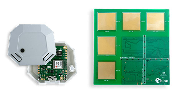
U-blox has released two explorer kits for product developers to evaluate the potential of Bluetooth direction finding and high-precision indoor positioning. Designed for low power consumption, simple deployment, and low cost of ownership, the u-blox XPLR-AOA-1 and XPLR-AOA-2 explorer kits will test the technology’s capabilities to enable a variety of applications including access control, collision detection, smart appliances, indoor positioning and asset tracking.
Recognizing the growing demand for more accurate indoor positioning solutions, the Bluetooth special interest group (SIG) released Bluetooth direction finding, offering a major improvement over previous receiver signal strength indicator (RSSI)-based solutions.
Bluetooth direction finding makes it possible to determine the direction that radio signals travel from a mobile tag to one or several fixed anchor points. Using angle-of-arrival (AoA) technology, anchor points comprising antenna arrays connected to Bluetooth receivers can detect the direction, or angle, to the mobile tag, which transmits a Bluetooth signal. When a constellation of such multi-antenna anchors is deployed, AoA technology can be used to triangulate the precise location of a mobile device or tag.
The u-blox XPLR-AOA-1 and XPLR-AOA-2 explorer kits showcase one of the first complete Bluetooth-based tracking solutions – from the tag to the cloud – to reliably offer sub-meter-level accuracy in indoor environments.
U-blox has released a firmware update for its ZED-F9R positioning module, bringing robust centimeter-level positioning to slow-moving use cases such as robotic lawnmowers, e-scooters and shared bicycles.
Based on the ZED-F9R high-precision sensor-fusion module, the u-blox ZED-F9R-02B was designed for use in autonomous and industrial applications that require simple and efficient implementation and where rapid access to highly accurate positioning data is key, even in challenging signal environments such as dense cities.
The ZED-F9R uses the u-blox F9 multi-band GNSS receiver platform to concurrently track up to four GNSS constellations. Applying real-time kinematic (RTK) techniques, the module can derive positioning data with centimeter-level accuracy.
The high-precision GNSS measurements are fused with data from the module’s inertial measurement unit (IMU), GNSS correction data, odometry information, and a vehicle dynamics model to provide high-quality positioning accuracy in situations where GNSS alone would fail. The receiver includes dynamic models for robotic lawnmowers, e-scooters and automobiles.
The ZED-F9R-02B integrates the u-blox GNSS correction data service, broadcast in the highly scalable state-space representation format, making it easier to deliver fast time-to-market precise positioning solutions.
An autonomous lawn mower trims the grass in a park in Finland. (Photo: Scharfsinn86/iStock/Getty Images Plus/Getty Images)
Robotic lawnmowers achieve further improvements in terms of their positioning accuracy from the module’s ability to calibrate its dead-reckoning system even at low speeds. The module’s highly accurate position output lets end users precisely delimit the mowing area using software rather than with boundary wires, and deploy robotic lawnmowers on complex lawn shapes while excluding trees and shrubs. Users can align each pass of the mower with the next more accurately than before, delivering a professional-looking striped lawn.
According to U-blox, combining these features allows product designers to use the module to create mowing equipment that enables “robotic mowing as a service” capable of operating in complex environments without the upfront cost and commitment of installing boundary wires.
“Our new ZED-F9R-02B high-precision module is a turnkey dead-reckoning solution that will enable designers to bring products that need dead-reckoning technology to market more quickly than if they had to implement it from scratch,” said Alex Ngi, product manager, Industrial Navigation and Robotics, Product Center Positioning at u-blox. “It will also allow companies working in niche markets to employ dead-reckoning technologies without needing to build and maintain expertise in the subject.”
The ZED-F9R-02B offers support for a range of correction services, including the SPARTN format, which will make it straightforward to distribute GNSS correction data over large geographical areas.
iGPSPort cycling computer. In another announcement, U-blox and iGPSPORT, a sports hardware and data service provider operating out of Wuhan, China, have announced the iGS320 cycling computer, which builds on the u-blox M10 positioning platform. The cycling computer leverages the U-blox M10 platform’s ultra-low power consumption, compact size, and its ability to track all four GNSS to offer endurance athletes a superior user experience.
Adopting the U-blox M10 positioning platform in its iGS320 cycling computer brought iGPSPORT an 80 percent increase the power autonomy to deliver 72 hours of continuous tracking, up from 40 hours in their previous solution. Concurrent reception of up to four GNSS constellations increases coverage and accuracy in otherwise challenging signal environments.
A roundup of recent products in the GNSS and inertial positioning industry from the May 2021 issue of GPS World magazine.
OEM
GNSS/LTE Antenna
Low profile for covert installations
Photo: Maxtena
The MEA-GNSS-LTE-MM is a two-in-one low-profile antenna solution that combines GNSS and LTE antennas in one. It is suitable for asset tracking as well as industrial and internet of things (IoT) applications. The antenna offers an ultra-low profile rugged IP67-rated design with a magnet mounting and customizable cables and connector options. The small size makes it a desirable solution for covert installations.
The NCS Nova GNSS simulator now fully supports the simulation of Galileo Open Service (OS) signal improvements based on the new Galileo OS SIS ICD V2.0. The NCS Nova GNSS simulator is a high-end, powerful and easy-to-use satellite navigation testing and R&D device, the company said. It is fully capable of multi-constellation and multi-frequency simulations for a wide range of GNSS applications. It provides multiple GNSS frequencies in one box. A key enhancement to the NCS Nova GNSS simulator is comprehensive support of new Galileo OS signal message improvements on E1B. By enabling real-time simulation of the Galileo OS message improvements, the NCS Nova GNSS Simulator expands the user’s Galileo signal capability.
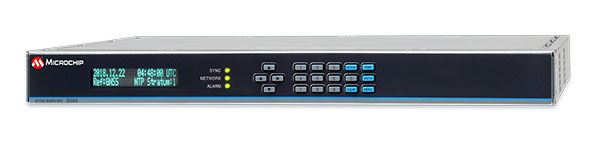
The SyncServer S600 Series network time server and instrument is now integrated with BlueSky technology signal-anomaly detection software. With the upgrade, the SyncServer S600 Series now provides GPS jamming and spoofing detection and protection, in combination with local radio-frequency data-logging and analysis. The Stratum 1 instrument continuously monitors local GPS constellation health and examines GPS and local RF signal integrity to assure validity. If an anomaly is detected, the solution sends an alarm and, if necessary, the SyncServer instrument can be shifted to alternative time sources or an internal oscillator. This protects ongoing timing outputs while ensuring only minimal, predictable timing degradation to vital network and business operations in applications ranging from banking and stock trading to electric utilities and aerospace and defense.
Microchip Technology, microchip.com
L1+L5 receiver
Provides fast updates, multipath resistance
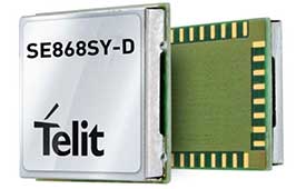
Photo: Telit
The SE868SY-D is a multi-frequency, high-precision GNSS receiver module for applications that require high accuracy, fast updates, multi-constellation support and multipath resistance. At 11 x 11 mm, the SE868SY-D accommodates ultra-compact devices and internet of things (IoT) trackers. Available now, the high-precision SE868SY-D module is Telit’s first multi-frequency, multi-constellation GNSS receiver module, featuring an ultra-sensitive -167 dBm (tracking) RF front end. By using both the L1 and L5 bands, the SE868SY-D supplies a higher location accuracy than single-frequency devices, even in high-multipath environments such as urban canyons.
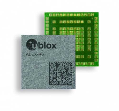
The ALEX-R5 miniature cellular module integrates low-power wide-area connectivity and GNSS technology into an ultra-small system-in-package (SiP) form factor. It is based on the secure UBX-R5 LTE-M/NB-IoT chipset platform with out-of-the-box Secure Cloud functionality and the u‑blox M8 GNSS chip for location accuracy. It has a 14 × 14-mm footprint and 23-dBm cellular transmission power, enabling devices to operate effectively in all signal conditions. A dedicated GNSS antenna interface enables independent, simultaneous operation of the u‑blox M8 GNSS chip. The ALEX-R5 is suitable for wearables and connected medical devices.
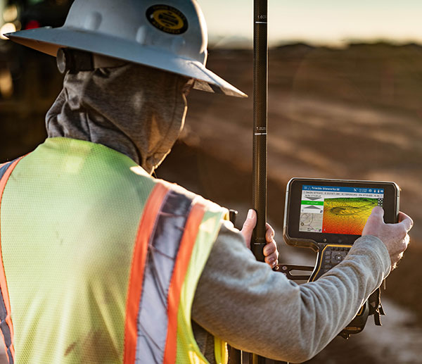
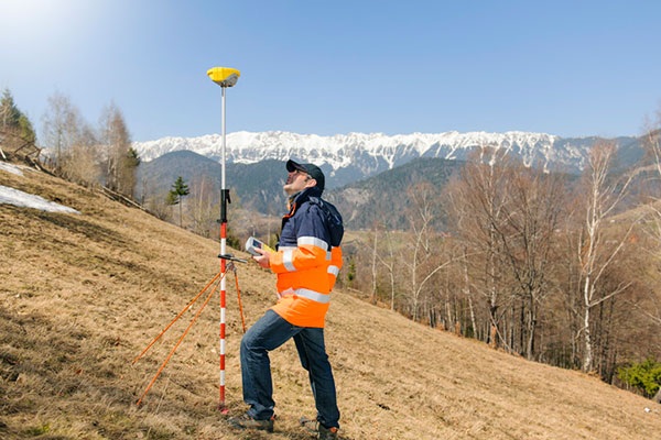
The TSC5 is a rugged, lightweight field data controller for land construction and surveying. Its backlit alphanumeric keypad is usable while wearing gloves. The battery provides all-day power on a single charge, with an optional external battery nearly doubling the power for extended use. It has a lightweight, ergonomic design and is suitable for rugged environments, with resistance to shock, dust and water. Running on the Android 10 operating system, the TSC5 is fully integrated with Trimble Access 2021 Field Software and Siteworks Software as well as Trimble Forensics Capture. The EM100 Empower module provides GNSS connectivity.
INSITE is a comprehensive cloud-based platform that enables users to more efficiently manage geospatial data, from acquisition to delivery. With applications designed for electric utilities, telecommunications and governments, INSITE provides tools to support the entire geospatial data lifecycle — project tracking, data collection and delivery, quality control, on-demand reporting, analytics and enterprise integration. INSITE enables users to import, search, analyze, manage, integrate and export all types of geospatial data and multimedia. As a cloud-based platform, INSITE improves speed and efficiency, minimizes storage expenses and supports greater collaboration.
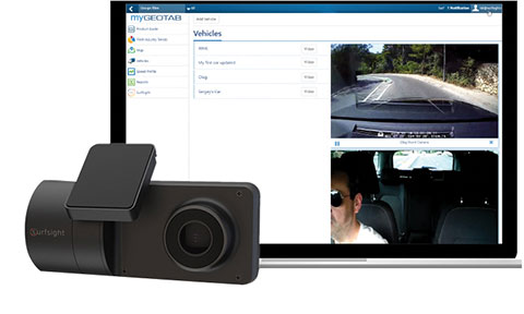
The Surfsight AI-12 camera solution is designed to help improve fleet safety through its continuous recording and advanced machine vision (MV) and artificial intelligence (AI) technology. Offered by Lytx, it integrates with Geotab’s telematics platform to provide fleets with insight into driver behavior through a combination of MV+AI, sensors, and live video streaming. The Surfsight AI-12 provides distracted driving detection, audio and visual alerts and the ability to connect auxiliary cameras. Its MV+AI technology can help identify risky driving behaviors including smoking, eating and drinking, handheld device use, unbelted driver and distracted driver. When connected with Geotab’s GO9 device, it can also capture video evidence of sudden acceleration, sharp turns and harsh braking. Through access to these insights, fleet managers can help prevent avoidable accidents and reduce the likelihood of driver or pedestrian injury, insurance claims, maintenance costs and downtime.
Suitable for rolling stock, automotive and heavy-duty applications
Photo: Eurotech
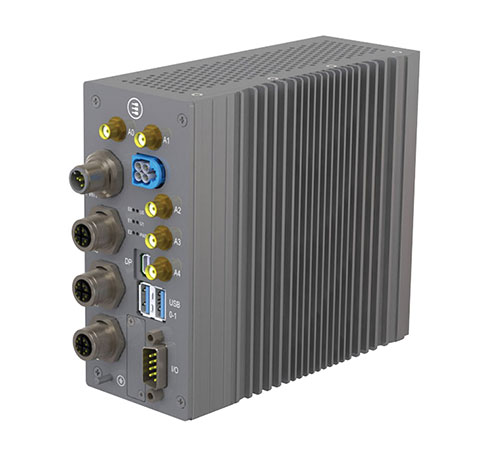
The BoltGPU 10-31 is a GPU-accelerated subsystem for machine vision and artificial intelligence (AI) applications at the edge and on vehicles. The BoltGPU 10-31 provides multi-constellation GNSS with untethered dead reckoning for geolocation. A factory option for high-precision real-time kinematic (RTK) GNSS is available. It also has Wi-Fi 6, Bluetooth 5.1 and option for LTE cellular. It is powered by NVIDIA Jetson Xavier NX and combines a 6-core, high-performance ARM CPU with a 384-core GPU and 48 Tensor Cores, offering power efficiency and accelerated computing. The rugged, fanless unit allows for simultaneous execution of neural models and the processing of multiple high-resolution, high-frame-rate sensors, even in harsh environments.
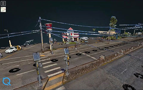
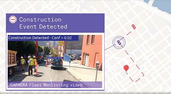
High-frequency change management for map platforms
Screenshot: Carmera
Carmera’s Change-as-a-Service (CaaS) uses consumer-grade cameras from its fleet partners and customer vehicles to detect and log changes, reducing the cost of map maintenance. With a network of commercial fleet–mounted visual probes, it overcomes the problem of GPS canyons in urban areas using a blended algorithm to localize its auto-based probes with pinpoint accuracy. CaaS is designed to be an add-on to existing map systems (both HD and SD), and will identify, analyze and localize both road inventory changes and traffic-impacting events, such as construction. A live sandbox has launched in the San Francisco-Silicon Valley area for companies to test the CaaS technology on real urban and suburban streets.
Parkopedia is designed to address challenges in navigating indoor parking facilities: system blackouts, finding a vehicle within large parking facilities, and locating services such as EV charging stations. Parkopedia provides indoor maps based on high-definition 3D models of indoor parking facilities for in-vehicle navigation. Parkopedia technology can also be used for automated valet parking. Its proprietary SLAM system integrates lidar, IMU, GNSS and high-resolution imagery.
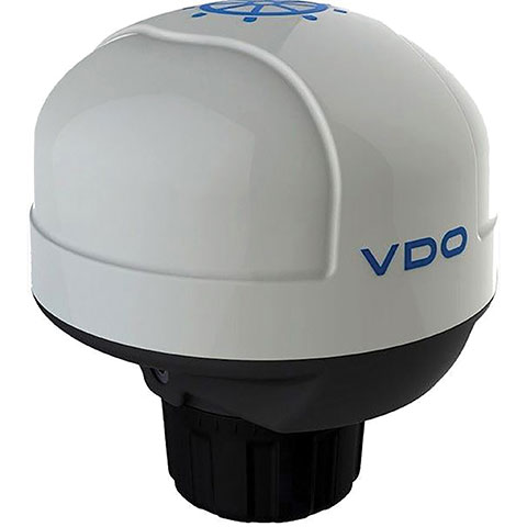
The Acqualink NavSensor can be used with any multifunction N2K-networked multifunction display. Its GPS receiver module provides position, speed and vector data, and UTC time. The inertial sensor delivers pitch and roll data. An integrated fluxgate compass with a +/- 40° tilt angle delivers course heading and the information needed by a networked autopilot to stay on course. Built-in barometer and air temperature sensors offer indicators of impending weather changes. The radome has an IPX6 extended protection rating. It is powered by the NMEA network and operates between –4° and 158° F.
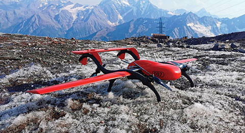
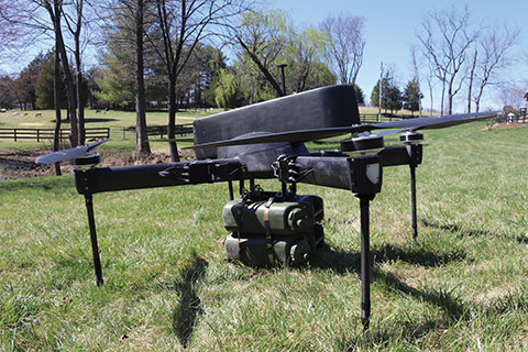
The Periscope tactical-grade UAV provides efficiencies in flight time, endurance and payload capacity. Designed for military and other federal government customers, the high-performance UAVs accomplish mission-critical tasks with speeds of up to 100 mph. They are optimized for specific mission requirements including tactical resupply, remote communications, and enhanced C4ISR. In September, Periscope Aviation won a contract to deliver prototype Tactical Resupply Unmanned Aircraft Systems (TRUAS), which the U.S. Marine Corps will field test at Yuma Proving Grounds this year. The UAVs will fly 60–90 pounds of cargo to locations 10–20 kilometers away, delivering supplies such as food, water, fuel and ammunition to marines on the front line.
The Fixar 007 is a vertical takeoff and landing commercial drone with primary application in the mapping and surveying, monitoring, mining, oil and gas, energy and agricultural sectors. The intuitive approach to working with its ground control station simplifies use (flight preparation is estimated to take only 5 minutes). With inertial orientation, the Fixar 007 can work stably under magnetic anomalies and in the event of satellite loss. A wide range of modifications is available. The Fixar 007 uses a closed, specially designed hardware and software system that guarantees security of information. The applications and UAV use a special communication protocol that eliminates control interception.
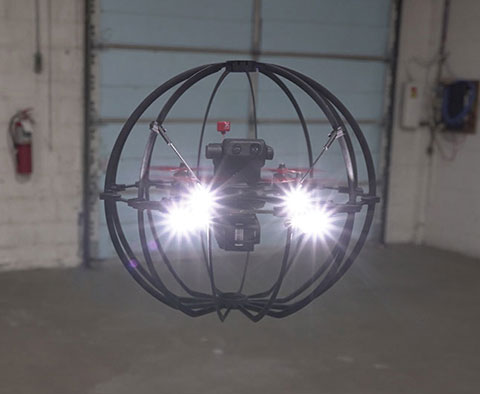
Skycopter is a ready-to-fly UAV designed to work in extreme conditions and tight spaces. The drone is enclosed and protected by an external ultra-light and ultra-resistant cage to ensure safety and avoid damage to inspected structures and to the airframe itself. The Skycopter‘s tiltable camera can record 1920 x 1080 video at 60 FPS while sending latency-free images to the ground in 5.8 GHz for first-person view on a display or (optional) high-definition goggles. It uses an ultra-bright LED system for applications in complete darkness. The Skyloc real-time location and monitoring system provides control and tracking with high accuracy in indoor scenarios or where GPS is not available.
U-blox is partnering with ArduSimple, a Spanish company seeking to facilitate the adoption of centimeter-level GNSS technology for mass-market applications.
The companies partnered to develop the SimpleRTK2B single-board computer (SBC). The device, which is built around up to three u-blox ZED-F9P high-precision GNSS receivers, simplifies the development of centimeter-level positioning solutions supporting real-time kinematics (RTK), making the technology accessible to broader audiences.
The SimpleRTK2B-SBC was developed to make RTK technology as close to plug-and-play as possible. In addition to working as a stand-alone solution, customers can program their own applications with the company’s microPython API.
The SimpleRTK2B-SBC delivers mechanical integration with centimeter position on three axes (heading, pitch and roll), outputting on NMEA, RTCM, RS232 and CANBus interfaces via Ethernet, Bluetooth, Wi-Fi and 2G/3G/4G communication. It offers configurable input/output and an inertial measurement unit.
Rokubun has launched JASON, a satellite navigation service for accurate geolocation. With JASON, users can achieve highly accurate geolocation without a base station, Rokubun said.
JASON works under a “freemium” pricing model, making it possible to use it for free or to subscribe to monthly professional or premium plans.
JASON is a post-processed kinematic (PPK) satellite positioning service in the cloud that allows users to achieve highly accurate geolocation by uploading GPS/GNSS campaign data. JASON will try to obtain the best possible positioning solution on a best-effort basis. It will use PPK with the nearest GNSS continuously operating reference station (CORS) in the service’s database or with he user’s own provided station if no close CORS are available, or precise point positioning. The data can be processed interactively by using the Rokubun website or automating the workflow via the Rokubun API.
JASON also features a free data-conversion service for GNSS raw measurements.The service is compatible with Argonaut, u-blox, Septentrio, Android GnssLogger and any receiver able to export industry standard RINEX v2 or v3 file formats.
According to Rokubun’s CEO Xavier Banqué-Casanovas, JASON cloud service allows users to get the best possible performance out of their GNSS equipment using an internet browser, without the need for special installation or updates requirements.
New modules enable users to develop high-precision solutions for heavy machinery, ground robotics, and unmanned aerial vehicles (UAVs).
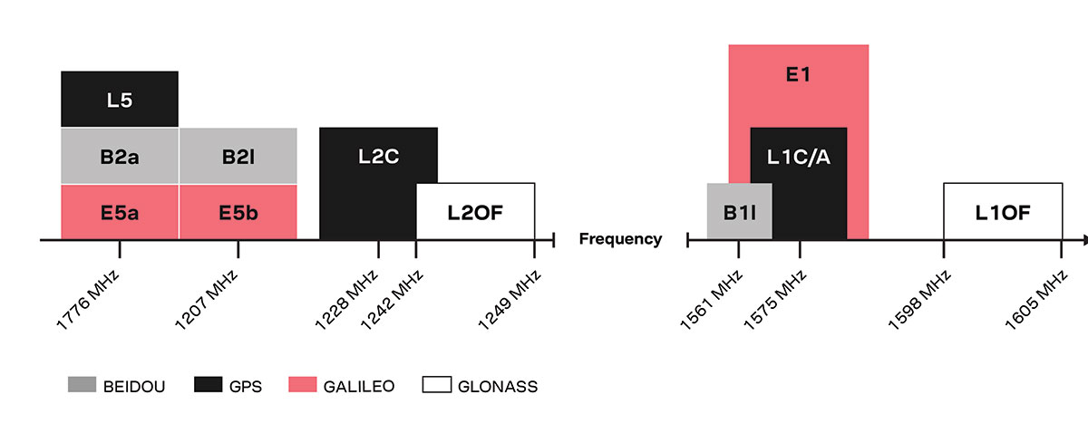
U-blox’s latest multi-band high-accuracy timing modules concurrently support L1 and L5 GNSS signals. The ZED-F9T-10B and LEA-F9T-10B timing modules, and the RCB-F9T-1 timing card, deliver nanosecond-level timing accuracies required to synchronize cellular network base stations and smart power grids. The ANN MB1 L1/L5 multi-band antenna completes the offering.
The multiband capability compensates for ionosphere error from all GNSS satellite constellations and reduces the timing error under clear skies to less than 5 ns without the need for an external GNSS correction service. To achieve maximum performance, the modules track signals from as many satellites as possible.
Image: u-blox
With satellite constellations transmitting signals on the L5 band nearing completion, the L1/L5 signal combination is becoming a viable option to complement products based on L1 and L2 signals. Modernized L5 signals are expected to deliver improved performance, especially in difficult urban conditions. Because L5 signals fall within the protected aeronautical radionavigation service (ARNS ) frequency band, they are also less subject to RF interference.
The LEA-F9T-10B provides a temperature range extended to –40 to +105° C. Both timing modules include a suite of advanced security features, including:
Improved anti-jamming and anti-spoofing technologies detect and flag malicious RF interference.
Secure boot ensures that the modules can only boot with authentic firmware.
Secure interfaces prevent intruders from tampering with the messages between the receiver and the host system.t
The ANN-MB1 L1/L5 multi-band antenna supports the GPS, GLONASS, Galileo and BeiDou, and addresses the scarcity of options in the nascent L1/L5 high-precision antenna mass-market, simplifying testing and deployment of L1/L5 multi-band GNSS solutions. Magnetic and fixed mounting options help meet diverse installation needs.
The new products targets developers in industrial navigation and robotics interested in high-precision positioning technology to locate UAVs, ground robots and agricultural equipment accurately and in real time.
Engineering samples of the u-blox ZED-F9T-10B, RCB-F9T-1 and ANN-MB1 will be available in May, followed by the LEA-F9T.
U-blox has debuted the ALEX-R5, a miniature cellular module that integrates low power wide area connectivity and GNSS technology into an ultra-small system-in-package (SiP) form factor.
According to u-blox, ALEX-R5 is based on the secure UBX-R5 LTE-M/NB-IoT chipset platform with out-of-the-box Secure Cloud functionality and the u‑blox M8 GNSS chip for world-class location accuracy.
The ALEX-R5 features a 14 x 14-mm footprint, achieved as a result of its SiP design. Its 23-dBm cellular transmission power guarantees end devices operate effectively in all signal conditions and a dedicated GNSS antenna interface that enables fully independent, simultaneous operation of the u‑blox M8 GNSS chip.
The ALEX-R5 is optimized for power-sensitive and battery-dependent applications, as well as size-constrained applications such as wearables and connected medical devices. It achieves this by leveraging the lower power modes of the u‑blox UBX-R5 and UBX-M8 chipsets and giving users options to further balance power consumption and performance using GNSS Super-E mode, u-blox said.
Its rugged SiP construction makes it a perfect fit for harsh environments, where moisture or vibration would be a concern for conventional modules. ALEX-R5 is rated at moisture sensitivity level 3, offering reduced handling and device production complexity, u-blox added.
Finally, the ALEX-R5 future-proofs IoT devices and solutions by enabling customers to software upgrade deployed devices for compatibility with 5G networks, u-blox said. This will offer a seamless transition to the next generation of cellular technology as 5G networks are rolled out by mobile operators.
Engineering samples of the ALEX-R5 SiP will be available by the first quarter of 2021.
“Seen & Heard” is a monthly feature of GPS World magazine, traveling the world to capture interesting and unusual news stories involving the GNSS/PNT industry.
The 10-minute-long drone show included a flying dove with a wingspan of 600 meters, visible from three kilometers away. (Photo: u-blox)
A swarm of bird
A massive swarm of drones created a 10-minute show over Saint Petersburg, Russia, on Sept. 3. The 2,198 miniature UAVs danced for 10 minutes, forming images such as a dove with a wingspan of 600 meters, visible from three kilometers away. Geoscan built and programmed the drones, which use u-blox positioning modules.
Mobile GIS Services (MGISS) is helping the Yorkshire Wildlife Trust (YWT) deploy rugged handhelds to capture highly accurate survey measurements with cloud-based data storage and GIS software. Trust projects include restoring the largest, continuous blanket bog system in England. Blanket bog has been damaged by excessive burning, overgrazing, man-made drainage and extreme weather events. The YWT is using Spectra SP20 handheld GNSS receivers.
Photo: Genni Brookshire/Ceto Marine Research
Drones to the rescue
Seals and sea turtles face threats from humans, such as fishing nets. Marine biologist Genni Brookshire, Ceto Marine Research, and David Thirtyacre, Embry-Riddle Aeronautical University, are researching how drones can improve animal rescue, with help from Skyward, a Verizon Company. Her team is using drones to find and help distressed marine animals. “Using a drone before we respond to an animal to determine the animal’s condition — if it’s entangled, its body condition, if it’s sick — allows us to bring the proper equipment,” Brookshire said. “Using a drone allows us to reduce the stress on the animal, and increase our efficiency in responding to their unique situation.”
Photo: dzphotovideo/E+/Getty Images
Flight mysteries tracked
GNSS tech in a smart altimeter is guiding paragliders, skydivers, wingsuit pilots and other free-flying athletes. Dekunu Technologies’ One SmartAlti body-worn altimeter offers altitude and position information similar to what pilots obtain in their cockpits, increasing safety throughout freefall. Along with a multi-constellation u-blox chip, the device includes Bluetooth, Wi-Fi and USB. A cloud service incorporates 3D visualizations of the user’s jump data.
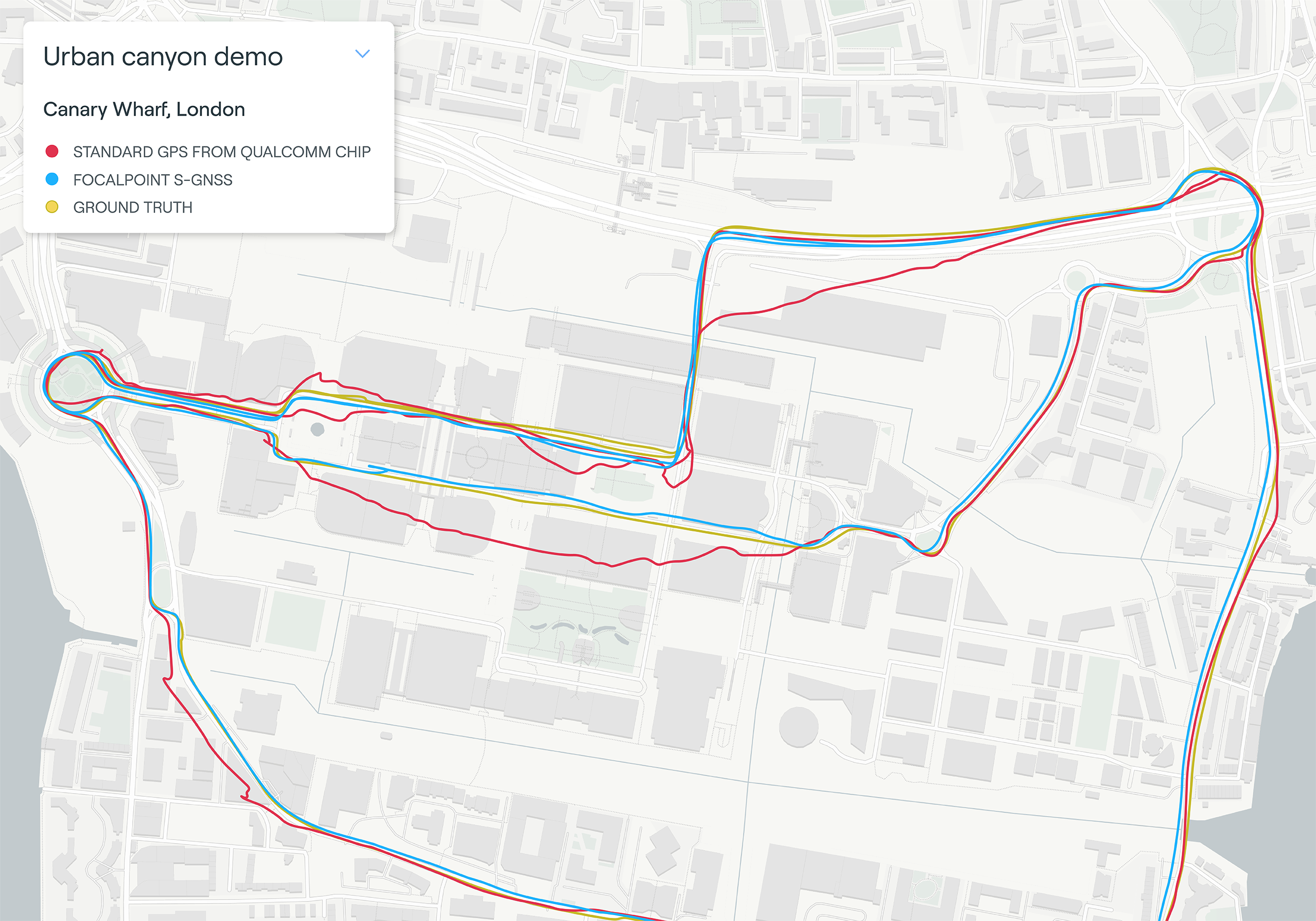
Map plot from live tests in London show the route of a vehicle driven through Canary Wharf. It shows the difference between the position provided by a standard smartphone GNSS chip (red line) and the same data run through Focal Point Positioning’s Supercorrelation software (blue line). (Image: u-blox)
U-blox has signed a deal with the award-winning U.K.-based technology company Focal Point Positioning to integrate technology that will improve the accuracy and reliability of GNSS devices. Focal Point’s Supercorrelation technology enhances positioning performance and security for applications such as smart cities, location-secure internet of things (IoT) and health and fitness wearables.
The patented Supercorrelation technology solves a critical weakness in GNSS caused by multipath interference. Multipath interference occurs when satellite signals bounce off buildings and landmarks, causing GNSS receivers to provide degraded positioning outputs.
The result for users is that the blue dot on their phone or device may be in the wrong place, moving in the wrong direction, or may have a large error ellipse. For autonomous vehicles it could lead to positioning errors that place the vehicle in the wrong lane or worse.
FocalPoint’s Supercorrelation technology uses software to detect and reject reflected signals, resulting in an improvement in the performance of GNSS devices without the need for additional hardware or applications. Supercorrelation also helps with the detection and rejection of GNSS spoofing signals — an increasing concern for autonomous vehicles, ships, and aviation.
“We are tremendously excited to be working alongside a market leader such as u-blox, our mission is to improve every positioning system on the planet and we have taken a giant step forward in that vision with this deal,” said Focal Point Positioning CEO Ramsey Faragher. “Positioning systems are so critical to our world, and we look forward to seeing the next generation of products and services that will be enabled by this higher level of accuracy, reliability and security.”
u-blox CEO Thomas Seiler commented, “The addition of Supercorrelation technology into our latest GNSS platforms is part of our continuing focus on low power consumption, higher accuracy and security for automotive, industrial, and wearable GNSS applications.”
In June, Alstom became the first railway manufacturer to integrate certified data-fusion algorithms for fail-safe train localization, using position and speed of trains based on GNSS data coming from multiple constellations, including Galileo.
The added value of Galileo and EGNOS in the European railway sector is widely known, especially when it comes to non-safety applications, such asset management and passenger information services.
In recent years, however, with multi-constellation becoming the norm and multifrequency receivers being adopted rapidly, rail stakeholders view GNSS-based solutions as game-changers for the future of European Train Control System (ETCS).
A recent example of EGNSS adoption in rail operations is the innovative odometry solution deployed by Alstom to measure the location and speed of its trains. The French rolling-stock manufacturer introduced a new sensor type, with a hybridisation of satellite information and inertial sensors. The solution is primarily using GNSS Doppler information, derived from Galileo, GPS and GLONASS constellations (configurable).
Such use allows to improve the overall confidence in the resulting speed, along with specific algorithms to master the resulting location accuracy. The GNSS receiver is an automotive grade receiver manufactured by u-blox. The inertial measurement unit (IMU) used to supplement information in case of GNSS loss is based on enhanced micro-electromechanical systems (MEMS) technology, with temperature compensation.
The new odometry system based on data fusion, which Alstom is currently implementing in Norway, is applicable to all types of trains and all environments, including the harshest weather conditions. It is estimated that by 2026, 450 trains will be equipped with this new feature across Norway.
Increased safety, lower costs for rail companies
Wheel slipping and sliding especially during demanding weather conditions can affect the odometer accuracy and the proper functioning of the different sensors involved. By incorporating Galileo signals as an extra layer of accuracy, Alstom managed to create a system that is capable of providing a more robust speed and location estimate. This space data fusion approach —certified by Belgorail — minimizes the need for the costly external radar components for localisation and speed measurement currently used.
“Industry embedding Galileo in their solutions is the proof that we are on the right path to ensure the market uptake of the EU Space Programme technology,” said Rodrigo da Costa, GSA executive director. “This is a recognition of the capability of EGNSS to reduce the need for infrastructure and related cost, while maintaining the operational safety of ETCS.”
M10 receiver platform can track four GNSS constellations, even in challenging environments
Photo: u-blox
U-blox’s new M10 GNSS platform is designed for ultra-low-power high-performance positioning applications such as sport watches and asset trackers.
The M10 positioning platform can track up to four GNSS constellations at once to deliver positioning data even in challenging environments such as deep urban canyons. The receiver’s Super-S technology helps distinguish positioning signals from background noise to capture positioning data even when satellite signals are weak.
Its high RF sensitivity also enables it to work well with small antennas, making it suitable for compact product designs. In sport watches, for instance, u-blox M10 guarantees highly dynamic positioning accuracy during a run in cities, woods or under an open sky, while preserving battery life.
Low power consumption. The u-blox M10 is designed to consume 12mW in continuous tracking mode, five times less than the power consumed by previous u-blox meter-level GNSS technology, making it beneficial for battery-powered applications.
U-blox M10’s enhanced RF sensitivity also cuts the time it takes for the platform to achieve a first position fix when initialized, further reducing systemic power consumption. And switching to the improved Super-E mode can extend battery life even more.
This new GNSS platform will be supported by AssistNow, u-blox’s assisted GNSS service, to accelerate positioning and improve accuracy. Depending on the required level of assistance, the service is available free of charge or for a recurring fee.
Jamming detection. The u-blox M10 platform benefits from u-blox’s experience in building robust GNSS receivers, incorporating proven techniques for detecting spoofed signals through the analysis of raw GNSS data, jamming-detection strategies, and embedded filters to mitigate the effects of in-band RF interference.
“U-blox can be proud of over 20 years of experience with GNSS technology, and with u-blox M10 we are setting a new benchmark in ultra-low power high performance positioning applications,” said Bernd Heidtmann, product manager, Product Center Positioning, u-blox. “We have increased concurrent reception of satellite signals by a GNSS platform from three to four constellations and improved the power consumption level five-fold compared to previous generations while shrinking the chip size by 35 percent.”