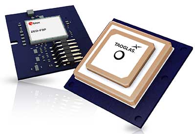
Taoglas, a provider of next-generation internet of things (IoT) solutions, has launched Edge Locate, a GNSS L1/L2/E5 module that combines antenna, RF electronics and receiver technology to deliver reliable centimeter-level positioning.
Taoglas, in partnership with u-blox, created a smart antenna that uses multi-band GNSS technology, providing between 1- to 3-centimeter-level accuracy.
With Edge Locate, manufacturers can quickly and effectively build devices with centimeter-level positioning technology, without having to invest in costly and lengthy RF design, integration and testing processes.
The device features multiband GNSS positioning that can be used in conjunction with cost-effective real-time kinematic (RTK) positioning capability.
Traditionally, most IoT devices use single-band GPS technology, delivering on average 10-meter accuracy with existing GPS modules and antennas, Taoglas said in a press release. This enables location-specific, mission-critical services such as emergency response, smart infrastructure, precision agriculture and microbility mobility applications where precise location provides critical value to the IoT application.
Taoglas can also consult and install the RTK network in any global location for any IoT use case.
“Centimeter-level positioning is absolutely key to the next-generation of IoT enabled applications,” said Ronan Quinlan, Co-CEO of Taoglas. “Take an example from the burgeoning micro-mobility industry. When granting licenses from a trial, the city authorities would like to monitor the riders of e-scooters, ensuring riders are staying off footpaths, or parking in designated areas. The problem is that today’s legacy GPS solutions don’t often know which side of the road a scooter is on. Whereas with our solution, fleet operators can pinpoint within just a few centimeters where a device is located. We do this by working with our customers to enable the whole solution and we make sure it works reliably in real life.”
Edge Locate can greatly accelerate the latest GNSS multiband product launch plans by offering a plug-and-play product that uses a common connector for integration into any electronics device. It also connects directly to the Taoglas Edge board for immediately connectivity options.
Taoglas is exhibiting at Mobile World Congress Americas, Booth 2602 in the South Hall of the Los Angeles Convention Center.
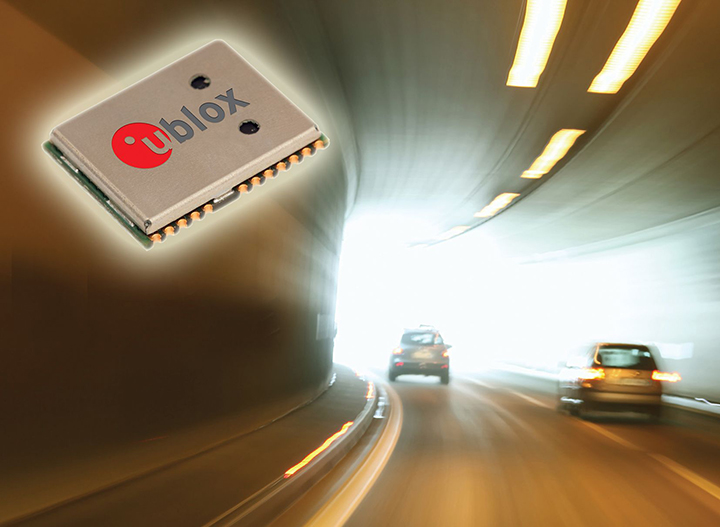
The ultra-robust M9 technology platform will suit demanding automotive and high-end telematics.
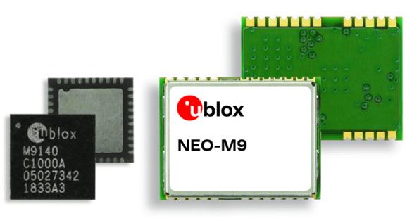
U-blox, a global provider of positioning and wireless communication technologies, has launched its new ultra-robust meter-level M9 global positioning technology platform, designed for demanding automotive, telematics and UAV applications.
Because of the high-performance GNSS UBX-M9140 chip, the M9 technology platform and the NEO-M9N (the first module based on the platform) can receive signals from up to four GNSS constellations (GPS, GLONASS, Beidou and Galileo) concurrently. It can achieve high positional accuracy even in difficult conditions such as deep urban canyons, u-blox said in a press release.
The u-blox M9 offers a position update rate of up to 25 Hz, enabling dynamic applications like UAVs to receive position information with low latency. It also features special filtering against RF interference and jamming, spoofing detection and advanced detection algorithms that enable it to report fraudulent attacks quickly so that users’ systems can react to them in a timely fashion.
A SAW (surface acoustic wave) filter combined with an LNA (low noise amplifier) in the RF path is integrated in the NEO-M9N module. This setup guarantees normal operations even under strong RF interferences, such as when a cellular modem is co-located with the NEO-M9N.
“We’ve developed the u-blox M9 as a follow-on from our very successful u-blox M8 GNSS platform, offering even more robust meter-level positioning technology and security features to protect the integrity of applications in the automotive, telematics, and UAV markets,” said Bernd Heidtmann, product manager, Product Strategy GNSS, Product Center Positioning, at u-blox.
Users of the u-blox M9 will benefit from it being part of the wider u-blox product family, which means that developers will be able to design a single PCB and then migrate to a different positioning technology — such as dead-reckoning augmenting GNSS technology — with little change to the board design.
Explorer kit released
U-blox has also released the Explorer Kit M9 (XPLR-M9), a development board for designers who want to assess the technology. The miniature plug-and-play device is supplied with user-friendly u-start software, which includes preset scenarios to enable users to explore the performance of the new device.
The u-blox M9 technology platform complies with the ISO/TS 16949, ISO 16750, AEC-Q100 standards. Engineering samples of the NEO-M9N, the first module based on the M9 platform, the UBX-M9140 high-performance chip, and the Explorer Kit are available now.
To learn more about M9, visit the u-blox booth, Hall South, S.2702, at Mobile World Congress 2019 in Los Angeles, Oct. 22-24.
u-blox’ NEO-M8L module with 3D ADR technology and integrated sensors provides accurate vehicle position regardless of satellite visibility. (Image: u-blox)
U-blox has collaborated with Molex on the Modular Automotive Connectivity (MAX) Platform for intelligent vehicles.
The NEO-M8L and TOBY-L4 modules, which are built into the MAX connectivity platform, support the reception and transmission of data over the mobile network to the backend, enabling mobile internet access, in addition to supporting positioning. The solution can determine the position not only via GPS but also via Galileo, Beidou and GLONASS.
Molex is a Tier 1 system integrator and supplier of high-speed networking, datacom, rugged industrial and automotive solutions that enable innovative architecture design and development for the intelligent vehicles.
Molex will demonstrate MAX in booth 151 at ELIV Oct. 16-17 in Bonn, Germany.
The automotive-grade GNSS module NEO-M8L supports positioning, so that the ECU knows exactly where the vehicle is at all times. The solution can determine the position not only via GPS but also via Galileo, Beidou and Glonass. As a result, MAX can be deployed globally and offers a flexible and scalable solution for worldwide mobility providers, OEMs and system suppliers.
TOBY-L4 supports the reception and transmission of data over the mobile network to the backend, enabling mobile internet access.
MAX offers high-quality vehicle networking for both traditional and new mobility providers. MAX is suitable for small series, such as vans or targeted innovative EV projects. As a central node in the vehicle, MAX enables both internal and external networking. The solution is flexible, scalable and is an open software concept, fulfilling important requirements of the dynamic mobility market, Molex said in press release.
“MAX further supports our commitment to providing next-gen connectivity in the car for the entire market, not just a luxury for premium automakers. Molex innovations and expertise are driving solutions that are changing the automotive landscape to allow our customers accessibility,” said Dietmar Schnepp, product director for vehicle communication devices, Molex.
“We are delighted to work with a world leader in the automotive market such as Molex and proud to see two u-blox modules at the core of the new MAX connectivity platform,” said Andreas Thiel, head of Product Centers and co-founder of u-blox. “This collaboration demonstrates u-blox’s dedication to providing automotive customers with best-in-class positioning and wireless communications solutions.”
MAX can be tailored to the customer’s requirements through individual configuration. The platform combines quality of state-of-the-art communication technologies with the necessary degree of standardization for cost control.
In addition, the individual modularization enables a short time-to-market compared to tailor-made solutions. This path is the ideal alternative for telematics service providers who can use MAX as the basis for a backend connection, as well as for the development of various applications.
Digital Matter’s Oyster2 4G battery-powered GPS receives PTCRB approval, AT&T certification and redesigned housing
Digital Matter’sOyster2 is now PTCRB approved and certified for use on the AT&T Network in the United States. With PTCRB certification, operators and device manufacturers are confident of a device’s interoperability with mobile networks.
Designed for tracking non-powered assets for extended periods of time, common applications of the Oyster2 include tracking trailers, bins, hire and rental equipment, shipping containers, boats, bikes, scooters and more.
The Oyster2’s u-blox SARA-R410M modem operates on all major global LTE-Cat-M1 and NB-IoT bands. The device uses concurrent GPS and GLONASS tracking with a 72-channel high sensitivity receiver, and features a 3D accelerometer for G-force detection.
Configurable adaptive-tracking parameters allow the device to sleep when stationary, resulting in industry-leading battery life: up to seven years of life at once daily updates; one year of life at once hourly updates.
The versatile asset tracker can be powered by three off-the-shelf AA lithium batteries, or lithium thionyl chloride (LTC) batteries for enhanced performance and temperature tolerance.
The Oyster2 is now also available in redesigned ultra-rugged housing. Engineered with nylon glass, the IP67 housing is considerably tougher and thicker in key areas, providing increased durability, thermal resistance (the device can reach temperatures up to 185º F/85º C without compromising performance) and chemical resistance.
The device’s mounting tabs and screw holes have also been fortified and repositioned, improving resistance to cracking.
Digital Matter is an original equipment manufacturer of award-winning GPS and internet of things (IoT) devices and tracking software. Digital Matter devices are resold through 500 channel partners across the world and deployed in more than 110 countries.
The u-blox ZED-F9P, a high-precision GNSS module that delivers centimeter-level accuracy within seconds, has been incorporated into the latest electric Tron F90+ fixed-wing unmanned aerial vehicles (UAVs).
Quantum-Systems, a German company that specializes in electric VTOL (vertical take-off and landing) aircraft for civilian use, manufactures the Tron F90+, which is employed in mission-critical logistical activities such transporting emergency blood reserves to remote locations. Other uses include mining and agriculture-related tasks.
Quantum-Systems and u-blox are both exhibiting at Intergeo in Stuttgart, Germany, Sept. 17-20. Quantum-Systems is at booth K1.074, and u-blox at booth L1.025.
The Tron F90+ has a 3.5-meter wingspan and can travel at speeds of up to 160 km/hour with a 100-km flight range. It is the latest addition to the Quantum-Systems eVTOL UAV platform designed for cargo, inspection, survey and mapping, and reconnaissance in adverse conditions. Other models include the Trinity F9, Scorpion and Vector UAVs, all of which feature u-blox F9 high-precision GNSS technology.
In developing the Tron F90+ UAV, the Quantum-Systems engineering team needed accurate enough position data to ensure that VTOL operations would always go smoothly, and the valuable payloads were protected from damage.
Through the multi-band real-time kinematic (RTK) and raw code and carrier-phase data available to the ZED-F9P, the necessary positioning correction is assured and the pilot can complete even difficult maneuvers. Absolute position accuracy can be brought down to 3-5 centimeters.
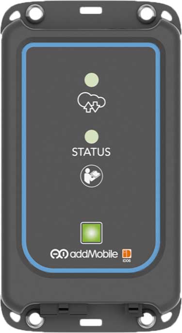
u-blox’s Bluetooth low-energy module NINA-B1 has been chosen by AddMobile, Swedish provider of devices and services for construction site management, as the basis of its short-range equipment-tracking beacons, AddTrackers.
Photo: AddMobile
In addition to NINA-B1, the AddMobile Toolbox features the u-blox MAX-M8 GNSS module and the u-blox GSM/GPRS cellular module SARA-G3.
AddTrackers is among the latest enhancements to the company’s AddMobile Toolbox platform and involves adding radio beacons to any tools or equipment that need tracking.
The AddMobile Toolbox helps site managers control mobile work orders, log fleet vehicle mileages, secure entry to work sites, register staff as they come and go, as well as handling fleet management and equipment safety.
It uses a variety of hardware to enable these Connected Construction Site’s services, including stationary hubs and entrance control units with Bluetooth low-energy and cellular connectivity, as well as an RFID reader, and mobile hubs with GNSS, Bluetooth low energy and cellular connectivity.
“The AddTracker beacons and hubs rely upon a combination of GNSS positioning, cellular connectivity, and Bluetooth low energy short-range radio interfaces,” said Bo Lyvall, business development manager at AddMobile. “U-blox was able to provide all three key technologies for our solutions, as well as providing great local support in the Malmö area.”
In use, the beacons equipping tools and equipment communicate with suitably equipped smartphones or other AddMobile hardware infrastructure. When one of these devices picks up an asset’s signal, the asset’s unique ID and GNSS coordinates are sent to AddMobile’s cloud platform, which can then show managers an image of the asset and its position on a map, list the equipment’s features, and show where it is on its planned maintenance schedule.
Trackers don’t have to be static. In one use case, a vehicle is fitted with a mobile hub that includes a GSM connection, GNSS positioning, and a Bluetooth low energy interface in the luggage area.
Tools can be tracked on-site by static hubs, and then followed as they are put into company vans for use offsite. This means that staff scheduling offsite jobs can know the location of all their mobile personnel, and whether they have the right tools with them to undertake each task.
The company was also attracted by the cost efficiency of u-blox’s offering, and what is already a vast installed base of interoperable Bluetooth low energy technology. In the future, the collaboration between AddMobile and u-blox may extend to the use of a longer-range variant of Bluetooth, to further reduce the cost of asset tracking on large and complex sites, and exploring the appropriate use of cellular technology in asset tracking.
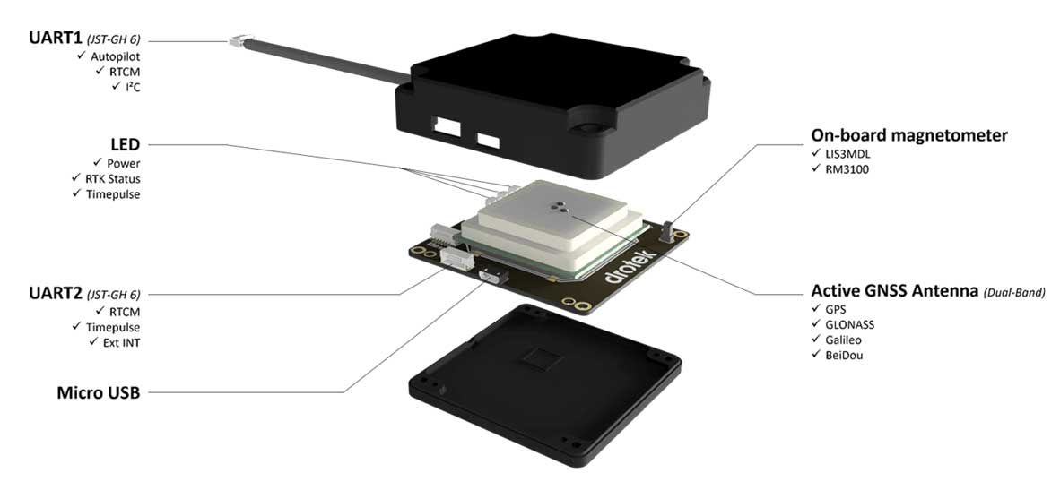
Drotek Electronics is now offering the F9P Sirius RTK GNSS Rover, which is designed to be mounted on a moving vehicle. The u-blox ZED-F9P module inside provides 1-cm position accuracy, a convergence time under 10 seconds and a navigation update rate up to 20 Hz.
The new Sirius RTK GNSS Rover F9P has a built-in active antenna patch. It receives GPS, Galileo, Beidou and GLONASS signals, providing additional accuracy. The F9 Sirius Rover is designed to fit most setup designs as well as integrate easily into a vehicle. Its six-pin JST-GH connector makes it plug-and-play with the Pixhawk Pro 3 autopilot.
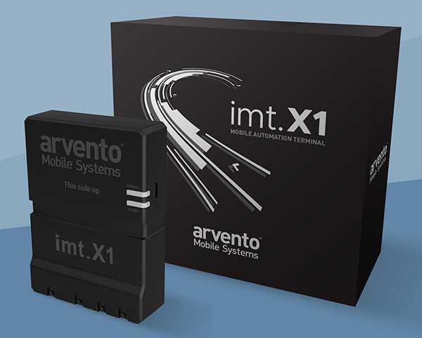
Arvento’s imt.x1 has a six-axis gyro sensor that can sense three-dimensional movement caused by emergency acceleration, panic braking and directional yaw and drift.
With connectivity options including dual CANBus and Bluetooth, the system is also eCall compatible and captures and provides data for accident analysis and other vehicle tracking functions. The system also uses the next-generation powerful Arm-based microcontroller.
This latest launch is yet another product of a successful, eight-year strategic partnership between Arvento and u-blox. “U-blox is more than a supplier,” said Özer Hıncal, Arvento’s general manager. “As a global leader in the IoT [internet of things] industry providing high-performance IoT modules, platforms and support services, u-blox is our trusted solutions partner, working closely with us to address customer demands and issues.”
As for previous Arvento products, collaboration with u-blox was a key factor in the imt.x1 product development process. The system’s high position sensitivity and accuracy are based on integration of u-blox’s 2G, 4G and 5G-ready cellular modules as well as GNSS modules.
The development of the imt.x1 aligns with Arvento’s vision and mission as a developer of advanced fleet telematics and vehicle tracking devices and will be available from August 2019.
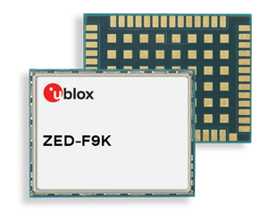
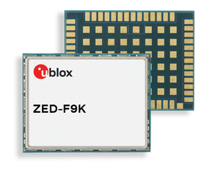
The ZED-F9K turnkey solution minimizes the effort required to achieve decimeter-level positioning accuracy in automotive applications.
Siemens has integrated the u-blox ZED-F9K high-precision dead-reckoning module into its Toyota Prius V2X (vehicle-to-everything) test fleet. Siemens carried out live demonstrations of the technology at ITS European Congress 2019 in Eindhoven, the Netherlands.
As the only available source of absolute position, GNSS-based positioning plays a crucial role in advanced driver automation systems and driverless vehicles. The same is true in V2X communication, in which vehicles continuously share their location and other information with other traffic participants — cars and pedestrians — as well as surrounding infrastructure, improving road safety and reducing traffic congestion.
V2X test vehicles typically determine their position using high-end GNSS receivers. By opting to use the ZED-F9K, Siemens was able to align the performance of their test fleet with real-world conditions while also reducing the cost and the engineering effort required to develop their vehicles.
Siemens conducted V2X tests using the u-blox ZED-F9K during ITS European Congress 2019. (Photo: u-blox)
“We’ve had a very positive experience with u-blox’s ZED-F9K high precision dead reckoning solution. The product delivered strongly from the initial design-in to the data and performance in our first tests,” said Igor Passchier, engineering fellow, Connected and Automated Driving at Siemens PLM Software.
“Our collaboration with Siemens shows the extent to which the ZED-F9K turnkey solution saves OEMs time, cost, and engineering effort while providing decimeter-level positioning performance,” said Alex Ngi, Product Strategy for Dead Reckoning, Product Center Positioning, u-blox. “For us, it has also been a welcome opportunity to contribute to solving the challenges in the autonomous driving ecosystem.”
The ZED-F9K module is designed to keep cars in their lanes. (Photo: u-blox)
The new u‑blox ZED-F9K GNSS and dead-reckoning module is designed to bring continuous lane accurate positioning to challenging urban environments.
The module offers both high-precision multi-band GNSS and inertial sensors. It combines the latest generation of GNSS receiver technology, signal processing algorithms and correction services to deliver down to decimeter-level accuracy within seconds, addressing the evolving needs of advanced driver-assistance systems (ADAS) and automated driving markets.
The ZED-F9K builds on the u‑blox F9 technology platform. Compatibility with GNSS correction services further improves positioning accuracy by compensating ionospheric and other errors.
The real-time kinematic (RTK) receiver module receives GNSS signals from all orbiting GNSS constellations. The greater number of visible satellites improves positioning performance in partially obstructed conditions, while increased satellite signals delivers faster convergence times when signals are interrupted.
Inertial sensors integrated into the module constantly monitor changes in the moving vehicle’s trajectory and continue to deliver lane accurate positioning when satellite signals are partially or completely obstructed, as is the case when the vehicle is in parking garages, tunnels, urban canyons or forested areas.
When satellite signals become available again, the module combines inertial sensor data with GNSS signals to deliver fast convergence times and high availability of the decimeter-level solution.
The result of this combination of the latest developments in GNSS technology, correction services and inertial sensing is a tenfold increase in positioning performance over standard precision solutions, according to u-blox.
By robustly providing lane accurate position information, the ZED‑F9K meets the needs of ADAS and autonomous driving applications, as well as head units and advanced navigation systems. The module’s accuracy and low latency also makes it suitable for automotive OEMs and Tier 1 automakers developing V2X (vehicle-to-everything) communication systems. By continuously sharing their location with other traffic participants, V2X systems contribute to increasing overall road safety and reducing traffic congestion.
“We designed the ZED-F9K to be a turnkey high-precision GNSS solution that caters to the needs of today’s and tomorrow’s connected cars,” said Alex Ngi, product manager, product strategy for dead reckoning, u‑blox. “The ZED-F9K is unique in that it integrates a multitude of technologies, from the GNSS receiver to the inertial measurement unit and relevant dead reckoning algorithms into a single device for which we can ensure performance throughout the customer product development cycle.”
U-blox, a global provider of positioning and wireless communication technologies, is partnering with TransSiP and Matrix Industries to create PowerWatch 2, a GPS smartwatch that doesn’t need to be charged.
The smartwatch features the ultra-small, ultra-low power u-blox ZOE-M8B GNSS receiver to track position, in addition to calories burned, activity level, and sleep, making it an ideal companion for runners, hikers, and swimmers. All this is enabled by TransSiP PI technology which ensures energy harvested is used at maximum efficiency and provides crystal clean power enabling optimum performance.
The PowerWatch 2 does away with cables and external batteries by continually topping up its battery using thermoelectric energy generated from body heat as well as solar energy. The watch also connects to smartphones and displays notifications on your wrist, tracks activities and visualizes them using dedicated iOS and Android apps, as well as with popular third party health and fitness platforms.
The PowerWatch 2 delivers location tracking using the low-power u-blox ZOE-M8B GNSS receiver module that consumes as low as 12 mW. Packaged as a (System-in-Package), the 4.5 x 4.5 x1.0 mm module helps achieve the watch’s comparatively low 16-mm thickness. And concurrent reception of up to three GNSS constellations means that it delivers high accuracy positioning in challenging situations such as urban or dense forest environments and when swimming.
Satellite-based positioning is typically the most power-hungry process on a sports watch. Providing highly efficient conversion of harvested energy into a very quiet supply of DC power, TransSiP PI enhances the ability of the ZOE-M8B GNSS receiver module incorporating u-blox Super-E technology, to strike an ideal balance between power and performance. Working on a tight power budget, the watch supports 30 minutes of continuous GNSS tracking per day, with unused time accumulating in the watch’s battery pack, such as powering two hours of location tracking every four days.
“We put a lot of effort into tailoring the ZOE-M8B to the needs of small battery powered applications. We couldn’t have wished for a better product to showcase our ZOE-M8B’s potential for wearables than the PowerWatch 2,” says Florian Bousquet, principal product manager in Standard Precision GNSS at u-blox.
Douglas Tham, CTO of Matrix Industries added, “TransSiP PI makes it possible to deliver high performance and high efficiency simultaneously by reducing system noise, eliminating time spent re-acquiring data, and minimizing the need for additional processing. This means power savings across-the-board and enables applications which can be powered solely by energy harvesting.”
“Not only were size, cost and power constrained in developing the PowerWatch 2, we also had to make sure that it met the high performance demands that athletes expect,” said Akram Boukai, CEO and co-founder of Matrix Industries. “The combination of TransSiP PI and the ZOE-M8B solved all of these pain points for us, enabling the watch to quickly lock in on its position even in weak signal environments.”
Backers of the project on Indiegogo are expected to receive their orders in June 2019.
Guest column by Peter Fairhurst, Director, Product Line Management, Product Center Positioning, u-blox
Peter Fairhurst, Director, Product Line Management, Product Center Positioning, u-blox. (Photo: u-blox)
A new generation of GNSS hardware and pioneering new correction data services are enabling cheaper, more compact and truly scalable high-precision GNSS solutions, ready for the mass market.
High-precision GNSS as employed by specialized markets for more than a decade isn’t aren’t suitable for mass-market autonomous vehicles or other mainstream use cases. As well as being big, heavy and expensive, traditional high-precision GNSS systems don’t scale, which is a critical shortcoming when you consider this capability may very soon need to be built into every car that gets built.
To overcome these challenges, we’re seeing two complementary things coming to market: a new generation of GNSS hardware, and pioneering new correction data services. These two key facets combine to enable cheaper, more compact and truly scalable high-precision GNSS solutions, ready for the mass market.
A new generation of GNSS correction service forgoes the two-way link between customer device and the correction data service that is a hallmark of traditional high-precision GNSS corrections. Instead of sending each device its own, location-specific GNSS correction data, the new-generation services create a real-time model of relevant errors across their entire territory. They broadcast this over satellite and/or the Internet for customer devices to pick up.
Transmitting modeled GNSS error data to receivers across an entire region – as opposed to maintaining a two-way link with each and every device – opens the door to large-scale, mass market applications of high-precision GNSS
The shortcomings of traditional high-precision positioning
Correction data has long been key to high-precision GNSS services. In traditional applications, the customer’s positioning device detects its approximate location and sends this information to its correction service provider. This provider uses a network of base stations to monitor GNSS errors, comparing the readings calculated from the satellite signals to the stations’ known, fixed positions. It uses these insights to send the customer’s device tailored correction data, based on its location.
The technology has successfully been used to provide centimeter-level accuracy in surveying, agriculture and machine control, but annual subscriptions of sometimes more than $1000 per device mean it’s remained confined to specialized markets.
Moreover, traditional correction data services typically only operate in one country, or even one state. While this may not be an issue in some applications (such as localized agriculture), there are other use cases where limited range is a major problem. Imagine, for example, that you regularly need to travel across a state or national boundary in your (semi-) autonomous vehicle, or carry out remote UAV-based surveying in another country: maintaining your high-precision positioning capability is likely to mean roaming contracts and other extra costs.
The other issue with these traditional services is scalability. They use two-way cellular communication to pass data back and forth between the customer device and the correction data provider. And while this works when device density is relatively low, if this number grew to thousands or even millions of end-user pieces of kit trying to access the correction data service, current cellular infrastructure would struggle to deliver the required reliability. Particularly in safety-critical applications, where losing access to the correction data service could put lives at risk, this is unacceptable.
Image: u-blox
Recent developments in high-precision positioning
The new generation of GNSS correction services, creating and broadcasting a real-time model of relevant errors across their entire territory, over satellite and/or the internet for customer devices to pick up, opens the door to large-scale, mass-market applications of high-precision GNSS. Technology using State Space Representation (SSR) is one flavor of these new-generation GNSS correction data services.
Japan has led the way in GNSS error-broadcasting, using the L6 signal of its QZSS satellite network as a proving ground for mainstream use of the approach. Although it’s currently only available within Japan, the Centimeter Level Augmentation Service (CLAS) is generating a lot of interest across the automotive, agricultural and machine-control industries. Mitsubishi Electric, for example, used the CLAS service to field-test its autonomous driving system.
In China, Qianxun Spatial Intelligence Inc. is pioneering a different technique. Instead of broadcasting the data, Qianxun SI is leveraging its special access to the Chinese GNSS reference base stations to push the boundaries of what’s possible using the traditional technique. It provides tailored correction data services to customers including individuals, system integrators and original equipment manufacturers (OEMs). While it’s been a success in China, the approach is less appealing to OEMs who ship worldwide, because it requires their clients to arrange their own, local GNSS correction data.
Another important advance has been the rise of multi-band GNSS receivers, which enhance standalone positioning accuracy, thereby delivering a better customer experience in a variety of use cases. However, even multi-band receivers can’t achieve the centimeter-level accuracy that mobile robotics and autonomous vehicles need: these devices will always need to be complemented by some form of correction service.
Continent-wide GNSS correction data
Particularly in Europe, where there’s a lot of cross-border travel and economic activity, the simplicity of continent-wide GNSS correction services would offer enormous value. Sapcorda, for example, a recently launched joint venture between Bosch, Geo++, Mitsubishi Electric and u-blox, is creating a next-generation GNSS correction data service with coverage on a global scale (Europe, North America, etc), building on the lessons learned in Japan.
Sapcorda will broadcast right across the continent, using cellular networks as well as over satellite links. Customers won’t be tied to a specific GNSS manufacturer. Data will be distributed in an open format, so that device-makers can create exactly the solutions their customers want.
Having access to GNSS correction services continent-wide has the potential to transform high-precision positioning into a mainstream offering, supporting various IoT applications, as well as drones and (semi-) autonomous vehicles.
Addressing the remaining challenges
High-precision GNSS correction services that target the mass market are still relatively new, with different suppliers pursuing different business models. Trimble’s service, for example, doesn’t use an open correction-data format, and is only compatible with devices using its own GNSS receivers. The benefit of this is that it can deliver a seamless, fully integrated solution, with complete interoperability across the Trimble product range (provided the region in question has good coverage). OEMs with customers is geographically broader markets will need to weigh this up against the benefits of global coverage provided by a range of correction-data suppliers offering open-format data.
As we touched on earlier, in safety-critical applications where location-accuracy is essential, any correction data service must be up to the task. This includes ensuring data broadcasts aren’t crowded out when cellular networks become saturated. To this end, u-blox has been working with the 3GPP body to create appropriate standards that can ensure the service meets the required service level agreements.
Lastly, although there’s now country-wide coverage in both China and Japan, Sapcorda is now attempting to provide continent-wide high-precision services. If it’s a success, it could overcome the challenges of national boundaries and country-based cellular providers. It’s as yet unclear how existing correction-data-service suppliers will respond.
Customer satisfaction is paramount
For high-precision GNSS services to achieve mainstream success, they not only need to offer wide coverage and be truly open, but must facilitate innovation and ensure they can broaden the appeal of this capability beyond being a niche specialism. Like in any industry, customer satisfaction is essential if the technology is to achieve this.
Complexity that arises as a result of state boundaries, national borders, conflicting regulations or subscriptions, must be shielded from the end user and dealt with upstream. This is already happening in some areas, where device-makers are partnering with correction data service providers, enabling them to bundle the service cost into the device cost that the end user pays.
A revolution in positioning
As well as helping to realize some of the automated navigation solutions currently under development, new-generation high-precision GNSS services are driving a seismic shift across the whole industry.
The rise of innovative, high-precision GNSS technology, combined with business models that promise to make high-precision a mass market reality, mean the coming years will be tremendously exciting. By disrupting the existing market, the new technology will mean lots of new opportunities for those ready to grasp them.
Peter Fairhurst joined the Product Strategy team in the Product Center Positioning at u-blox AG in 2015. He is responsible for the development of industrial markets, with a specific focus on unmanned systems and mapping solutions. Prior to u-blox, he was part of the Product Management group at Leica Geosystems AG, where his focus was on high-precision GNSS surveying technology.
Fairhurst holds a bachelor degree in Mathematics & Computer Sciences and doctorate degree in satellite geodesy from Newcastle University and an MBA diploma from the University of Strathclyde.