Tag: U.S. Coast Guard

  • GPS satellite SVN-77/GPS III SV04 set healthy for use

    GPS satellite SVN-77/GPS III SV04 set healthy for use

    The U.S. Coast Guard Navigation Center has issued a notice that GPS satellite SVN-77 (PRN-14) was set healthy for initial use on Dec. 2 at 0131Z. This follows the U.S. Space Force announcement that the satellite, the fourth GPS III (SV04), received Operational Acceptance approval on Dec. 1.

    SVN-77 is the 23rd satellite to broadcast L2C, the second civil GPS signal at 1227.6 MHz. L2C is not yet designated as “operational” by the U.S. Space Force.

    However, the L2C signal is set to healthy, and users can utilize this signal at their own risk.

    The U.S. Air Force’s Lockheed Martin-built next generation GPS III satellite on orbit. Rendering portrays GPS III Space Vehicles (SVs) 01-10. (Artist's Rendering: Lockheed Martin)
    The U.S. Air Force’s Lockheed Martin-built next generation GPS III satellite on orbit. Rendering portrays GPS III Space Vehicles (SVs) 01-10. (Artist’s Rendering: Lockheed Martin)

    SVN-77 is the 16th satellite to begin broadcasting the third civil GPS signal, L5, specifically designed for aviation use in an internationally protected band of spectrum designated for aeronautical navigation at 1176.45 MHz. L5 continues to broadcast an unhealthy designation.

    SVN-77 is the fourth satellite broadcasting the new L1C signal at 1575.42 MHz.

    The next GPS III satellite, SVN-78, initially scheduled to launch in January, will launch no earlier than July  1, 2021.

  • USDOT to host GPS jamming workshop Dec. 3

    USDOT to host GPS jamming workshop Dec. 3

    The U.S. Department of Transportation is sponsoring an afternoon workshop “GPS Jamming and Spoofing in the Maritime Environment” on Dec. 3.

    Speakers include Diana Furchtgott-Roth Deputy Assistant Secretary for Research and Technology; ship captains from Maersk Lines; and representatives from the National Security Council, the Maritime Administration and U.S. Coast Guard.

    While GPS jamming and spoofing is a problem in many transportation and critical infrastructure sectors, it is often most visible in maritime. This is because the Automatic Identification System (AIS) used for collision avoidance and traffic management for major vessels transmits location data based on GPS inputs.

    These transmissions are received by coastal networks and satellite systems. AIS data is often freely available to the public or easily accessed.

    Ships in Russian waters being spoofed to inland airports, vessels in Chinese ports reporting they are inland and circling government buildings, and ships in one part of the world transmitting their location as thousands of miles away and circling in the ocean off northern California are three of the highest provide examples in recent years.

    In 2019, the U.S. Coast Guard brought interference with GPS signals as an “urgent issue” to the International Maritime Organization.

    In February, President Trump issued an Executive Order on responsible use of positioning, navigation and timing. This workshop is part of the federal government’s efforts, as a part of the order, to educate the public about vulnerabilities associated with over-reliance on GPA.

    The workshop is free, but attendees must register. Advance registration is available.

    Image courtesy of Skytruth and RNTF.
    Image courtesy of Skytruth and RNTF
  • CGSIC annual meeting now streaming on Coast Guard channel

    CGSIC annual meeting now streaming on Coast Guard channel

    The U.S. Coast Guard Public Affairs YouTube channel is hosting streaming files for virtual meetings of the U.S. Government’s Civil GPS Service Interface Committee (CGSIC), held Sept. 21-22.

    This link leads to the CGSIC page of GPS.gov. On that page are additional links for the Sept. 22 morning and afternoon speakers at the CGSIC Plenary Session as well as links for the three subcommittee sessions held Sept 22. The subcommittees are:

    • International Information Subcommittee
    • Timing Subcommittee
    • Survey, Mapping and Geoscience Subcommittee

    Anyone can access the briefings, which include slides, embedded video of the speakers and comments made during the presentations.

  • GPS IIR/IIR-M satellite antenna patterns released for worldwide use

    GPS IIR/IIR-M satellite antenna patterns released for worldwide use

    Partnering with the U.S. Coast Guard Navigation Center (NAVCEN), U.S. Space Force and Lockheed Martin Space have released the GPS IIR/IIR-M satellite antenna patterns for worldwide public use.

    Additionally, the Institute of Navigation has offered a related ION journal article free to the public to accompany the antenna patterns.

    The files now available from NAVCEN include:

    The GPS Block II Replenishment (IIR) space vehicle (SV) began improving upon its baseline design in 2003 with the launch of the first Block IIR SV retrofitted with a redesigned  antenna panel. This is the Earth-facing panel providing the GPS L-band broadcast signal. The improved antenna panel includes redesigned L-band elements mounted on the SV Earth-facing structure in the same manner as the original antenna panel.

    The Earth Terrestrial Service Volume is the near-Earth region up to 3,000 km altitude. (Diagram: NAVCEN/Lockheed Martin)
    The Earth Terrestrial Service Volume is the near-Earth region up to 3,000 km altitude. (Diagram: NAVCEN/Lockheed Martin)

    Spacecraft Navigation

    The use of GPS signals for spacecraft navigation has increased in general over the last few decades. Navigation employing GPS observations for spacecraft in low-Earth orbit is now considered routine.

    However, the situation is quite different for spacecraft that fly in the Space Service Volume above the GPS constellation, including medium-Earth orbit (MEO), geostationary orbit (GEO) and high-Earth orbit (HEO) satellites, as well as missions to the Moon and beyond.

    For these spacecraft, reception of GPS transmit antenna side lobe signals is essential to improve availability and performance of on-board navigation and timing. In this context, the knowledge of the full antenna pattern (main lobe and side lobes) from the transmitting antennas of each of the GPS satellites is essential.

    These published antenna patterns and associated ION citation describe both IIR and IIR-M antenna panel versions, their broadcast signal patterns, the performance observed in factory testing, and their on-orbit performance.

    Chart: NAVCEN/Lockheed Martin
    Chart: NAVCEN/Lockheed Martin
    Chart: NAVCEN/Lockheed Martin
    Chart: NAVCEN/Lockheed Martin
    Chart: NAVCEN/Lockheed Martin
    Chart: NAVCEN/Lockheed Martin

    These patterns represent the current capability of the GPS IIR/IIR-M Space Vehicles. Receiver designers should consult the IS-GPS-200 specifications for use in receiver design and not base design on current signal performance.

    GPS technical documents are also available at the NAVCEN website and linked from the GPS.gov website.

    Legacy antenna panel on the GPS IIR satellite. (Photo: NAVCEN/Lockheed Martin)
    Legacy antenna panel on the GPS IIR satellite. (Photo: NAVCEN/Lockheed Martin)
  • COVID-19 contact tracing discussed in CGSIC meeting

    COVID-19 contact tracing discussed in CGSIC meeting

    News from NAVCEN

    CGSIC logo

    The 60th meeting of the U.S. Civil GPS Service Interface Committee was held Sept. 21-22, utilizing a virtual meeting platform. This was an opportunity for anyone in the world with access to a computer to attend these public meetings of the U.S. Civil GPS Program.

    For readers who were unable to attend, a synopsis of the meeting is provided below. The full agenda and presentations are available for download from the GPS.gov website.

    The meeting of the CGSIC is an annual event, free and open to the public, conducted to provide updates from U.S. GPS program officials and ensure effective information exchange between the U.S. government and civil GPS users. The two-day meeting is hosted by the U.S. Department of Transportation (DOT) and the Coast Guard Navigation Center (NAVCEN). DOT serves as the civil lead for GPS and chairs the CGSIC in this capacity. NAVCEN is assigned duties as Deputy Chair and Executive Secretariat for the CGSIC.

    Subcommittees of the CGSIC for Timing, International Information, and Surveying-Mapping-Geosciences held meetings on Sept. 21, and a summary of these meetings was presented during the CGSIC plenary session conducted on September 22nd.

    Major General John E. Shaw, Combined Force Space Component Commander, U.S. Space Command, and Commander, Space Operations Command, U.S. Space Force, provided the keynote for this year’s plenary session. This address was followed by comments from Colonel Curtis Hernandez, Director of National Security Space Policy on the National Space Council and briefings from a variety of other government agencies.

    This year’s meeting was replete with briefings from all over the world including an explanation in the International Information Subcommittee of COVID-19 Tracking in South Korea from the Deputy Director of the Korea Ministry of the Interior and Safety.

    Everett Hinkley from the U.S. National Forest Service spoke in the Surveying, Mapping and Geosciences Subcommittee showing how the National Remote Sensing Program supports a variety of business areas of the Forest Service including how they are tracking the spread of the Mountain Pine Beetle infestation in our nation’s forests.

    The Timing Subcommittee provided an engaging presentation on the current and future plans of the National Institute of Standards and Technology’s new Network Time Services.

    Presentations during the plenary session focused on the operational status of the GPS constellation and ground control system modernization, U.S. Space-Based PNT policy, GPS augmentation systems, U.S. engagement with other international GNSS providers, PNT resiliency efforts, as well as a variety of topics related to the status and progress of ongoing GPS programs in the U.S. government.

    If you have suggestions for topics to include in upcoming CGSIC meetings, would like to present a topic, or if you found information from past meetings useful and would like to hear more, please contact us via our Navigation Center “contact us” form. Please be sure to select “Civil GPS Service Interface Committee (CGSIC)” from the pull-down menu.

    From a GPS operational perspective, civilian non-aviation users can submit GPS-related inquiries or report signal interference or degradation to the U.S. Coast Guard Navigation Center online or to the 24-hour watch desk at 703-313-5900.

    Civil aviation users within the United States should contact the Federal Aviation Administration for GPS user support. The GPS Operations Center at Schriever Air Force Base, Colorado, is the Department of Defense lead for operational issues and questions from military users of GPS.

    Rick Hamilton
    CGSIC Executive Secretariat
    GPS Information Analysis Team Lead
    U.S. Coast Guard Navigation Center

  • New GPS SPS Performance Standard released

    New GPS SPS Performance Standard released

    CGSIC logo

    The U.S. Air Force has released the 5th Edition of the GPS Standard Positioning System (SPS) Performance Standard (PS), according to U.S. Coast Guard Navigation Center (NAVCEN) Civil GPS Service Interface Committee (CGSIC).

    With final signature by the U.S. Department of Defense, the standard was cleared for public release on April 16. This is the first update to the SPS PS since 2008 and, for the first time, includes pre-Initial Operating Capability (IOC) performance standards for new civil GPS signals L2C and L5, in addition to L1 C/A.

    The SPS PS specifies the levels of SPS performance in terms of broadcast signal parameters and GPS constellation design. According to NAVCEN, the U.S. government is committed to meeting and exceeding the minimum levels of service specified in the SPS PS.

    The document can be found at the NAVCEN website and at GPS.gov.

  • US Coast Guard protests GPS disruption to UN body: ‘urgent issue’

    US Coast Guard protests GPS disruption to UN body: ‘urgent issue’

    The International Maritime Organization headquarters in London. (Photo: Anastasia Yakovleva/iStock Editorial / Getty Images Plus/Getty Images)
    The International Maritime Organization headquarters in London. (Photo: Anastasia Yakovleva/iStock Editorial / Getty Images Plus/Getty Images)

    Responding to a plea from 14 maritime organizations in the fall of 2019, the U.S. Coast Guard has protested disruption of GPS and GNSS signals to the International Maritime Organization (IMO).

    IMO is the United Nations body that coordinates and sets standards for international maritime operations and safety.

    In a paper dated March 10, the service said that GNSS signals are “essential to safe and efficient navigation and an integral component of all maritime operations.” Interfering with them “jeopardizes the safety of life at sea.”

    Deliberate disruptions in the eastern Mediterranean and the Black Sea, the paper says, affect vessels operating in international waters and engaged in innocent passage through territorial seas.

    While nations typically have a right to do as they wish in their sovereign territory, they are also obliged to not have that intrude into other nations’ territory or international waters. This is also true for vessels passing through their waters but not calling at their ports, known as “innocent passage.”

    The International Law of the Sea Treaty stipulates that, in the absence of some clear wrongdoing such as piracy, drug smuggling or discharging oil, vessels be allowed to pass through territorial seas unmolested by the coastal state.

    The Coast Guard paper also points out that nations have other treaty obligations that prohibit this kind of activity. International Telecommunication Union Radio Regulations prohibits “All transmissions with false or misleading identification…”

    Citing a March 2019 report in GPS World, the paper also documents that GNSS disruption is a global problem not confined to just one or two areas. A study by the German Aerospace Center (DLR) found interference during every phase of a vessel’s voyage between Europe and the Far East.

    The Coast Guard paper was submitted for consideration at IMO’s Maritime Safety Committee that had been scheduled to meet on May 13, but has been postponed due to the COVID-19 emergency.

    This planned consideration at IMO follows a resolution by the UN’s International Civil Aviation Organization (ICAO) in May 2019. In a paper entitled “An Urgent Need to Address Harmful Interferences to GNSS,” the International Federation of Air Traffic Controllers’ Association (IFATCA), the International Federation of Air Line Pilots’ Associations (IFALPA), and the International Air Transport Association (IATA) had introduced the issue.

    This resulted in a resolution describing the eliminating interference as an urgent need.

    About the same time the U.S .Coast Guard paper was due to be considered, IMO was to engage in the early stages of considering rules for autonomous vessels. Its Facilitation Committee was scheduled hold a “Regulatory scoping exercise for the use of Maritime Autonomous Surface Ships (MASS)” at a meeting the end of April. This meeting has also been postponed.

    While not specifically mentioned, navigation issues will undoubtedly be part of the considerations when discussion of rules for autonomous shipping eventually takes place.

    Public input to these international meetings is always sought in advance. For example, the U.S. State Department had announced a meeting for April 6 to receive public input on U.S. positions for the various issues to be discussed at the Facilitation Committee.

    While we understand that this meeting will also be also be postponed, comments can be submitted to the points of contact listed in the Federal Register announcement as well as be raised during the eventual meeting.

    Image: IMO Headquarters Wikimedia Commons

  • Chinese GPS spoofing circles could hide Iran oil shipments

    Chinese GPS spoofing circles could hide Iran oil shipments

    “GPS spoofing circles” have been discovered at 20 locations along the Chinese coast, according to the non-profit environmental group Skytruth. Of the locations observed, 16 were oil terminals; the others were corporate and government offices.

    GPS spoofing in Shanghai that resulted in reported positions from ships, fitness trackers and other GPS enabled devices forming circles some distance from the shore was first observed by the non-profit C4ADS. Subsequently, Professor Todd Humphreys briefed the phenomena at an Institute of Navigation conference in September. The MIT Technology Review published an article about it in November.

    This caught the interest of an analyst at the environmental non-profit Skytruth.

    Evaluating a larger data set of ship AIS (Automatic Identification System) data, analyst Bjorn Bergman discovered at least 20 locations near the Chinese coast where similar spoofing had taken place in the last two years.

    Sixteen of these “spoofing circle” locations were oil terminals. The most frequent occurrences by far were at the port of Dalian in northern China, close to the border with North Korea. Based upon the timing of the spoofing, imposition of sanctions on purchase of Iranian oil by the United States, and observations by others of Iranian oil being received by China, Bergman suggests that much of the spoofing is designed to help conceal these transactions.

    Of the four locations not associated with oil terminals, three were government offices and one was the headquarters of the Qingjian industrial group, a huge engineering and construction conglomerate. These infrequent and irregular events may be related to visits by important government officials. A C4ADS report earlier this year demonstrated Russia uses GPS spoofing extensively for government VIP protection.

    Bergman suggests that the actual spoofing device is located at the center of each of the rings formed by false GPS reports. He has also observed that not all AIS/GPS receivers in the impacted area are affected, the spoofing circles tend to be about 200 meters in diameter, many false vessel positions orbit the circle counterclockwise at 21 knots or 31 knots, and some receivers are spoofed to locations other than the circle.

    Mass GPS spoofing is most easily detected and analyzed in coastal areas because of the availability of large data sets from AIS transmissions. AIS is a maritime safety system that uses GPS for location and movement information. This data is broadcast to other ships and shore stations to help prevent collisions and improve traffic management.

    The U.S. Coast Guard first experimented with receiving AIS signals by satellite in 2008. Since that time, numerous governments and commercial entities have established AIS data services using both space-based and terrestrial receivers.

    It is likely that the kinds of disruptions seen in Russian and Chinese maritime regions are occurring elsewhere. The lack of easily accessible data from non-maritime areas, though, makes this more difficult to detect.

    Confounding this problem is an apparent reluctance of many users to report disruptions. The U.S. Coast Guard Navigation Center has had only one official report a GPS problem from a user in Russian waters and one from Chinese waters, for example. Yet it is clear that thousands of vessels have been impacted in ways that must have been quite evident to their captains and crews.

    Image: Skytruth
    Image: Skytruth
  • CGSIC meeting material available for download

    CGSIC meeting material available for download

    CGSIC logo

    By Rick Hamilton, CGSIC Executive Secretariat, U.S. Coast Guard Navigation Center

    The 59th meeting of the U.S. Civil GPS Service Interface Committee was held Sept. 16-17 at the Hyatt Regency Miami hotel in Miami, Florida, in conjunction with the Institute of Navigation’s GNSS+ (ION-GNSS+) conference.

    For readers who were unable to attend, a synopsis of the meeting is provided below. The full agenda and presentations are available for download from the GPS.gov website.

    The meeting of the CGSIC is an annual event, free and open to the public, conducted to provide updates from U.S. GPS program officials and ensure effective information exchange between the U.S. government and civil GPS users.

    The two-day meeting is hosted by the U.S. Department of Transportation (DOT) and the Coast Guard Navigation Center (NAVCEN). DOT serves as the civil lead for GPS and chairs the CGSIC in this capacity. NAVCEN is assigned duties as Deputy Chair and Executive Secretariat for the CGSIC.

    Engaging sessions were conducted throughout the day of Sept. 16 for the CGSIC Timing, Surveying Mapping and Geo-Sciences, and International Information Subcommittees. The plenary session of the full committee was held on Sept. 17.

    Keynote. Diana Furchtgott-Roth, deputy assistant secretary, Office of the Assistant Secretary for Research and Technology, U.S. Department of Transportation provided the keynote for this year’s plenary session.

    She conveyed to the audience the importance of the U.S. GPS for transportation safety and numerous other civil applications and that its spectrum must be protected from harmful interference.

    However, given threats from jamming and spoofing, the U.S. is committed to leading the world in positioning, navigation and timing (PNT) and to building and using the best possible PNT solutions to maintain resiliency.

    James Platt, director at the PNT Program Management Office of the U.S. Department of Homeland Security, highlighted the need to understand cyber vulnerabilities in critical infrastructure supply-chain management.

    The meeting included many other interesting briefings related to the status of the U.S. GPS program and the use of GPS around the world, including presentations from the National Space-Based PNT Coordination Office, U.S. Air Force, State Dept., FAA, DOC and NASA.

    Presentations during the plenary session focused on the operational status of the GPS constellation and ground control system modernization, U.S. Space-Based PNT policy, GPS augmentation systems, U.S. engagement with other international GNSS providers, as well as a variety of topics related to the status and progress of ongoing GPS programs in the U.S. government.

    If you have suggestions for topics to include in upcoming CGSIC meetings, would like to present a topic, or if you found information from past meetings useful and would like to hear more, contact Hamilton via the Navigation Center “contact us” form. Be sure to select “Civil GPS Service Interface Committee (CGSIC)” from the pull-down menu.

    From a GPS operational perspective, civilian non-aviation users can submit GPS-related inquiries or report signal interference or degradation to the U.S. Coast Guard Navigation Center online or to the 24 hour watch desk at 703-313-5900.

    Civil aviation users within the United States should contact the Federal Aviation Administration for GPS user support. The GPS Operations Center at Schriever Air Force Base, Colorado, is the lead in the Department of Defense for operational issues and questions from military users of GPS.

  • FAA restricts drones over more DOJ and DOD facilities

    The Federal Aviation Administration (FAA) has issued additional drone flight restrictions over U.S. federal prisons, military bases and Pearl Harbor, effective Feb. 26.

    At the request of its federal security partners, the FAA is using its existing authority under Title 14 of the Code of Federal Regulations (14 CFR) § 99.7 — “Special Security Instructions” — to address concerns about drone operations over national security sensitive facilities by establishing temporary unmanned aircraft system (UAS) specific flight restrictions.

    This is in addition to previous restrictions over prisons, NGA facilities, DoD ships and other facilities.

    Information on the FAA Notice to Airmen (NOTAM), which defines these restrictions, and all of the currently covered locations, can be found at the FAA’s UAS Data Display System, which provides an interactive map, downloadable geospatial data, and other important details.

    A link to the restrictions is also included in the FAA’s B4UFLY mobile app.

    Additional, broader information regarding flying drones in the National Airspace System, including frequently asked questions, is available on the FAA’s UAS website.

    In cooperation with Department of Justice (DOJ) and Department of Defense (DOD), the FAA is establishing additional restrictions on drone flights up to 400 feet within the lateral boundaries of the following federal facilities:

    Federal Correctional Institution Allenwood Medium in Allenwood, PA
    Federal Correctional Institution Beaumont Medium in Beaumont, TX
    Federal Correctional Institution Butner Medium I in Butner, NC
    Federal Correctional Institution Butner Medium II in Butner, NC
    Federal Correctional Institution Coleman Medium near Sumterville, FL
    Federal Correctional Institution Florence in Florence, CO
    Federal Correctional Institution Forrest City Medium in Forrest City, AR
    Federal Correctional Institution Hazelton near Bruceton Mills, WV
    Federal Correctional Institution Lompoc in Lompoc, CA
    Federal Correctional Institution Oakdale I in Oakdale, LA
    Federal Correctional Institution Oakdale II in Oakdale, LA
    Federal Correctional Institution Petersburg near Hopewell, VA
    Federal Correctional Institution Pollock in Pollock, LA
    Federal Correctional Institution Terre Haute in Terre Haute, IN
    Federal Correctional Institution Tucson in Tucson, AZ
    Federal Correctional Institution Victorville Medium I in Victorville, CA
    Federal Correctional Institution Victorville Medium II in Victorville, CA
    Federal Correctional Institution Yazoo City Medium in Yazoo City, MS
    Federal Detention Center Honolulu in Honolulu, HI
    Federal Detention Center Houston in Houston, TX
    Federal Detention Center Miami in Miami, FL
    Federal Detention Center Philadelphia in Philadelphia, PA
    Federal Detention Center SeaTac near Seattle, WA
    Federal Medical Center Carswell near Fort Worth, TX
    Federal Medical Center Fort Worth in Fort Worth, TX
    Federal Medical Center Rochester in Rochester, MN
    Metropolitan Correctional Center Chicago in Chicago, IL
    Metropolitan Correctional Center New York in New York City, NY
    Metropolitan Correctional Center San Diego in San Diego, CA
    Medical Center for Federal Prisoners Springfield in Springfield, MO
    Metropolitan Detention Center Brooklyn in Brooklyn, NY
    Metropolitan Detention Center Guaynabo in Guaynabo, PR
    Metropolitan Detention Center Los Angeles in Los Angeles, CA
    Fort Detrick in Frederick, MD
    Fort Gordon near Augusta, GA
    Fort Lee near Richmond, VA
    Holston Army Ammunition Plant near Kingsport, TN
    McAlester Army Ammunition Plant in McAlester, OK
    Radford Army Ammunition Plant in Radford, VA
    Joint Base McGuire near Trenton, NJ
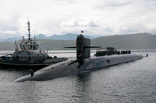
    Pearl Harbor Naval Defense Sea Area in Honolulu, HI

    These changes, which have been highlighted by FAA NOTAM FDC [9/2586], are pending until they become effective on Feb. 26. Note that there are only a few exceptions that permit drone flights within these restrictions, and they must be coordinated with the individual facility or the FAA.

    Operators who violate the flight restrictions may be subject to enforcement action, including potential civil penalties and criminal charges.

    The FAA is continuing to consider additional requests by eligible federal security agencies for UAS-specific flight restrictions using the agency’s § 99.7 authority as they are received. Additional changes to these restrictions will be announced by the FAA as appropriate.

  • FAA restricts drones near DOD and USCG ships, subs

    FAA restricts drones near DOD and USCG ships, subs

    The Federal Aviation Administration (FAA) has issued more drone flight restrictions — this time, near U.S. Navy and U.S. Coast Guard vessels operating in the vicinity of Naval Base Kitsap, Washington, and Naval Submarine Base Kings Bay, Georgia.

    Drone operations are required to maintain a distance of at least 3,000 feet laterally and 1,000 feet vertically from the ships and submarines.

    The Ohio-class ballistic-missile submarine USS Nebraska returns to Naval Base Kitsap-Bangor following sea trials. (Photo: U.S. Navy/Lt.Cmdr. Michael Smith, Commander, Submarine Group Nine)
    The Ohio-class ballistic-missile submarine USS Nebraska returns to Naval Base Kitsap-Bangor following sea trials. (Photo: U.S. Navy/Lt.Cmdr. Michael Smith, Commander, Submarine Group Nine)

    At the request of the Department of Defense (DOD) and the United States Coast Guard (USCG), the FAA is using its existing authority under Title 14 of the Code of Federal Regulations § 99.7 — “Special Security Instructions” — to address concerns about potentially malicious drone operations over certain, high-priority maritime operations.

    The special security instructions, provided in an FAA Notice to Airmen (NOTAM), are now in effect. Additional information on these special security instructions includes a visual depiction and geospatial definition of the relevant airspace.

    The FAA also warns drone operators that the USN and USCG vessels are authorized by law to take protective action against drones perceived to be safety or security threats, which could result in seizure, damage or destruction of the drones.

    Operators who don’t comply may face civil penalties and criminal charges.

    Any operator with an overriding reason of public interest or necessity (such as conducting a search-and-rescue mission) to operate their drone in close proximity to the cited USN and USCG vessels must first coordinate with the USN or USCG point of contact.

    In a separate Special Notice Advisory NOTAM, also effective today, the FAA strongly advises drone operators to remain clear of DOD and Department of Energy (DOE) facilities and mobile assets, as well as USCG vessels.

    The notice applies nationwide and alerts operators who ignore this caution and conduct drone flights perceived to be a safety or security threat to these facilities and mobile assets could face a reaction by security forces that results in the interference, disruption, seizure, damage or destruction of their drone.

    Information can be found here on these two NOTAMs, and all of the locations currently covered by § 99.7 restrictions. This website also provides an interactive map, downloadable geospatial data, and other important details. Additional information, including frequently asked questions, is available on the FAA’s UAS website.

  • FAA restricts drones over federal prisons, Coast Guard bases

    The Federal Aviation Administration (FAA) has established temporary unmanned aircraft system (UAS) flight restrictions over federal penitentiaries and U.S. Coast Guard bases.

    The restrictions, which take place June 20, are for drone flights up to 400 feet within the lateral boundaries of the facilities.

    The restrictions came at the request of federal security partners the Department of Justice (DOJ) and Department of Homeland Security (DHS).

    The FAA is using its existing authority under Title 14 of the Code of Federal Regulations (14 CFR) § 99.7 — “Special Security Instructions” — to address concerns about drone operations over these facilities,” the agency stated.

    Information on the FAA Notice to Airmen (NOTAM), which defines these restrictions, and the covered locations, can be found on the FAA’s UAS website. Broader information regarding flying drones in the National Airspace System, including frequently asked questions, is also on the FAA website.

    An interactive map, downloadable geospatial data and other important details can be found here.

    A link to the restrictions is also included in the FAA’s B4UFLY mobile app.

    This is the first time the FAA has placed specific flight restrictions for unmanned aircraft over Federal Bureau of Prisons and Coast Guard facilities. The FAA has placed similar flight restrictions over military installations that remain in place, as well as over 10 Department of Interior facilities and seven Department of Energy facilities.

    Operators who violate the flight restrictions may be subject to enforcement action, including potential civil penalties and criminal charges.

    There are a few exceptions that permit drone flights, which must be coordinated with the individual facility or the FAA.

    The FAA is considering additional requests by eligible federal security agencies for UAS-specific flight restrictions using the agency’s §99.7 authority as they are received. Additional changes to these restrictions will be announced by the FAA as appropriate.

    The following facilities will have the new restrictions:

    United States Penitentiaries (USP)

    USP Tucson near Tucson, AZ
    USP Atwater near Atwater, CA
    USP Victorville near Victorville, CA
    USP Florence High near Florence, CO
    USP Florence ADMAX near Florence, CO
    USP Coleman I near Sumterville, FL
    USP Coleman II near Sumterville, FL
    USP Marion near Marion, IL
    USP Terre Haute near Terre Haute, IN
    USP Big Sandy near Inez, KY
    USP McCreary near Pine Knot, KY
    USP Pollock near Pollock, LA
    USP Yazoo City near Yazoo City, MS
    USP Allenwood near Allenwood, PA
    USP Canaan near Waymart, PA
    USP Lewisburg near Lewisburg, PA
    USP Beaumont near Beaumont, TX
    USP Lee near Pennington Gap, VA
    USP Hazelton near Bruceton Mills, WV

    United States Coast Guard (USCG) Bases

    USCG Baltimore Yard, MD
    USCG Base Boston, MA
    USCG Base Alameda, CA
    USCG Base Los Angeles/Long Beach (LALB), CA
    USCG Base Elizabeth City, NC
    USCG Base Kodiak, AK
    USCG Base Miami, FL
    USCG Base Portsmouth, VA
    USCG Base Seattle, WA
    USCG Operations System Center (OSC) near Martinsburg, WV