Tag: UAS

  • Honeywell launches UAS navigation system

    Honeywell launches UAS navigation system

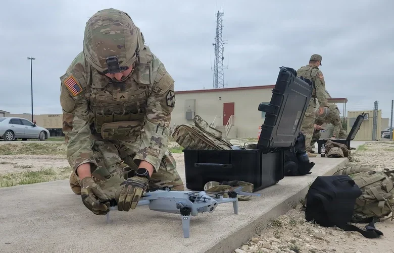
    Honeywell has launched Kestrel, a compact navigation solution designed to help uncrewed aerial systems (UAS) operate reliably in contested environments where GPS signals may be degraded, jammed or spoofed.

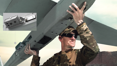
    Built to support the growing demand for smaller, more affordable and highly efficient platforms, Kestrel combines Honeywell Aerospace’s HG3900 MEMS inertial measurement unit with an M-code receiver and a multi-GNSS receiver. The platform is intended to meet the specific needs of Group 2 and 3 collaborative combat aircraft and loitering munitions platforms. It is also suitable for crewed aircraft where size, weight, power and cost are important considerations.

    “Kestrel reflects the evolving needs of today’s uncrewed operations, where operators are looking for resilient navigation technology that is smaller, lighter and more cost-effective,” said Matt Picchetti, vice president and general manager of Navigation & Sensors at Honeywell Aerospace. “This system helps operators maintain mission objectives in environments where legacy GPS systems are lagging behind.”

    Kestrel is an Embedded GNSS/INS (EGI) system for global defense and commercial operators in need of advanced inertial navigation technology with secure positioning capabilities in a smaller footprint. The system is 40 percent smaller and lighter than similar navigation products while delivering up to an 80 percent improvement in navigation accuracy for uncrewed platforms. It also reduces costs by as much as 50 percent, helping operators efficiently scale deployment across high-volume drone operations. Kestrel’s resiliency reduces UAS attrition by 60 percent, while more than doubling the capacity for mission distances.

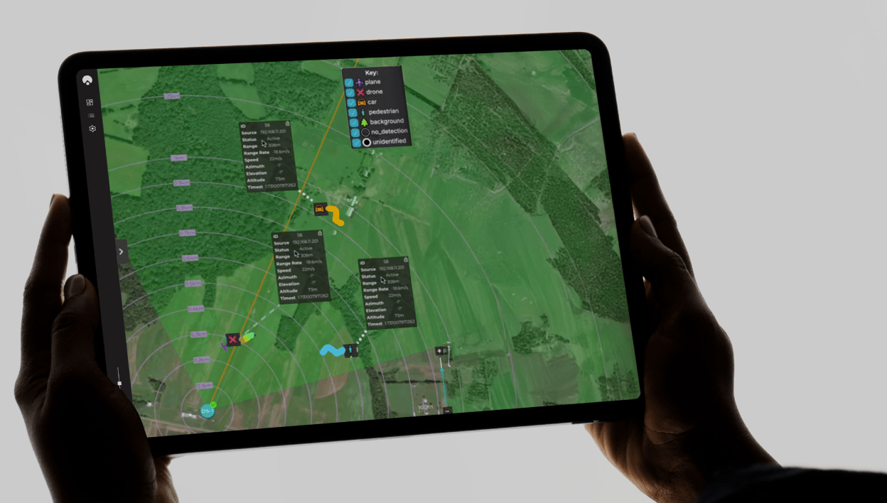
    The ability to operate without assured GNSS access is a distinct advantage for any military aircraft operating in contested or GNSS-denied environments because it provides continuous, self-contained position, velocity and attitude estimates independent of external signals.

    Kestrel is designed to support a broad range of defense and commercial applications and will be available in configurations that support international and non-ITAR deployments.

    Honeywell pioneered EGI technology and has produced more than 60,000 units since the mid-1990s to meet customers’ most challenging navigation, pointing, stabilization and flight-control applications.

  • NorthStrive acquires patented GPS-denied autonomous drone navigation tech option

    NorthStrive acquires patented GPS-denied autonomous drone navigation tech option

    Patented software visual-inertial cooperative navigation technology has potential to target defense, counter-drone (C-UAS), electronic warfare, and autonomous unmanned aircraft systems markets

    NorthStrive Defense Tech LLC has secured a license option in connection with a proprietary U.S. patented autonomous navigation technology through an exclusive option agreement with a corporation.

    The technology is designed to enable autonomous positioning and navigation for unmanned aircraft systems and drones operating in GPS-jammed, GPS-spoofed and GPS-denied environments, addressing a core capability gap identified by the U.S. Department of Defense (DoD) and allied defense programs worldwide.

    NorthStrive Defense Tech LLC is a wholly-owned subsidiary of PMGC Holdings Inc.

    The option agreement provides NorthStrive Defense Tech with an exclusive option, within the aerospace and defense technologies field, to obtain an exclusive license as to certain patent rights for U.S. Patent No. 12,277,716 B2, covering a cooperative navigation system for unmanned aircraft systems, also known as drones, operating in GPS-denied and GPS-degraded environments.

    The option is also for a non-exclusive license in the field as to certain know-how connected to these patent rights, as further set in the option agreement. On NorthStrive Defense Tech’s exercise of this option, the parties will enter into negotiations for a definitive license agreement.

    The technology has the potential to enable drones to navigate accurately without GPS by using onboard cameras and inertial sensors to estimate position relative to the local environment. The approach applies visual-inertial odometry (VIO) and sensor-fusion techniques, including an Extended Kalman Filter (EKF) for real-time state estimation and cooperative multi-vehicle data sharing, which together represent foundational building blocks of next-generation autonomous systems.

    When multiple drones operate, they share positional data in real time to collectively improve each vehicle’s accuracy, with performance formally evaluated under real-world GPS-denied conditions.

    GPS-denied navigation has emerged as one of the most urgent challenges in modern drone operations. Conflicts in recent years have demonstrated that GPS signals cannot be relied upon in contested environments, where jamming and spoofing are routinely deployed to disable unmanned systems.

    Vulnerabilities in GNSS signals have made anti-jamming and anti-spoofing capabilities a top priority within U.S. defense modernization programs, the Pentagon, the DoD and allied NATO forces. That operational reality has driven substantial investment across the defense sector, with the GPS-denied drone navigation market projected to grow at a CAGR of 31.7% through 2030, according to Technavio.

    Key potential capabilities include:

    • Vision and inertial-based navigation requiring no GPS signal (visual-inertial odometry / VIO with Extended Kalman Filter (EKF)-based state estimation)
    • Cooperative swarm localization through inter-vehicle range sharing, a foundational capability for drone swarm and counter-drone (C-UAS) operations
    • Scalable architecture supporting operations from individual drones to full swarms, with an architecture positioned for integration with AI-enabled autonomous systems
    • Technology formally evaluated for accuracy and performance under real-world GPS-denied conditions.

    The system’s modular design keeps flight-critical estimation onboard each drone while requiring minimal data exchange between vehicles, making it practical for contested environments where communications bandwidth is limited or actively degraded.

  • Trust Automation secures $490M contract from U.S. Air Force for counter-drone tech

    Trust Automation secures $490M contract from U.S. Air Force for counter-drone tech

    The U.S. Air Force has awarded Trust Automation a $490-million indefinite delivery, indefinite quantity (IDIQ) contract for the rapid research, development, prototyping, demonstration, evaluation, production and transition of unmanned and counterunmanned aircraft system (CUAS) capabilities.

    As Trust Automation looks ahead to 2026 and beyond, this program represents a pivotal step in addressing the evolving challenges of modern warfare. Work will be performed at Trust’s facility in San Luis Obispo, California, and is expected to be completed by Aug. 20, 2030.

    Image: Trust Automation
    Image: Trust Automation

    “We’re incredibly proud to have been selected for this critical C-UAS project,” said Ty Safreno, Trust’s chief executive officer. “This contract underscores our commitment to developing cutting-edge anti-drone technologies that address our most pressing security challenges, protect our armed forces and contribute to the safety of our nation.”

    Trust is a field-proven leader in defense and counter-small unmanned aircraft system (C-SUAS) technologies to directly counter UAS activity in C2 and GNSS bands. At the core of its product suite is the Small-Unmanned Air Defense System (SUADS), which delivers fixed-site, such as Air Force base defense operations centers (BDOC), and rapidly deployable protection for key facilities and units in combat zones. These systems provide layered defense with adaptable modular solutions to detect, track and defeat Group 1, 2 and 2+ aircraft threats.

    Complementing SUADS is the weapons-mountable GAT UAS Jammer, which enables personnel to directly counter UAS activity in GNSS bands. Together with a broader suite of radio frequency products, Trust equipes warfighters with scalable options to secure critical operations against evolving UAS threats.

    As Trust Automation rolls into 2026, the company remains dedicated to its mission to deliver innovative, reliable and mission-critical technologies that empower the U.S. Air Force and other defense partners to stay ahead of emerging threats.

  • Anello launches Aerial INS at CES 2026

    Anello launches Aerial INS at CES 2026

    Anello Photonics has launched the Anello Aerial inertial navigation system (INS), a compact, high-performance inertial navigation system built around the company’s Silicon Photonics Optical Gyroscope technology and integrated with multi-band GNSS receivers.

    Anello made the announcement at CES 2026, taking place this week in Las Vegas.

    The Anello Aerial INS is built for demanding aerial platforms — including BVLOS UAS, maritime/shipborne VTOL UAS, ISR/special-mission aircraft, heavy-lift and cargo drones, and other autonomous aerial vehicles. The system is powered by an advanced EKF-based sensor fusion engine and ANELLO flight-profile-tuned algorithms, consistently delivering >98% navigation accuracy without the need for cameras or fiber-optic cables.

    The Anello Aerial INS delivers <0.5 deg/hr unaided heading drift, maintaining accurate navigation and control through high-dynamics and GNSS jamming, spoofing, or occlusion. Anello’s navigation solutions are built to deliver assured performance in fully GNSS-denied environments — whether operating over water or desert corridors, in night or low-light missions, or through fog and cloud cover — maintaining precise guidance without GPS and enhancing warfighters’ effectiveness and survivability.

    “Customers flying real missions need resilient navigation when GPS isn’t reliable,” said Mario Paniccia, co-founder and CEO of Anello Photonics. “By combining our SiPhOGs with our airborne-optimized sensor-fusion algorithms and integrated multi-band GNSS, the Anello Aerial INS delivers accurate navigation solutions in a cost-effective SWaP-friendly package. This allows UAVs to hold course through GPS jamming, multipath, spoofing, or outages using only Anello without the need for cameras or fiber-optic cables and allows the warfighter to complete their mission safely and successfully.”

    ANELLO’s full product portfolio has been developed in close collaboration with customers and verified through comprehensive integration and mission-platform testing.

    The Anello Aerial INS is available for evaluation today with production shipments beginning in the second quarter of this year. Evaluation kits include the Anello Aerial INS, cabling, drivers for PX4/ArduPilot, and a quick-start integration guide.

  • MatrixSpace wins C-UAS Low-Cost Sensing Challenge

    MatrixSpace wins C-UAS Low-Cost Sensing Challenge

    Winners of the U.S. defense Counter-small Unmanned Aircraft System (C-sUAS) Low-Cost Sensing (LCS) challenge have been announced.

    MatrixSpace Inc. was selected as the overall winner and will receive the top award of $500,000. Following the overall winner, the top three performers — Guardian RF, Hidden Level and Teledyne FLIR Defense — will each receive award amounts of $100,000.

    The selected systems secured a place among the 10 finalists who advanced to live testing during USNORTHCOM’s Falcon Peak 25.2 exercise, outperforming 115 submissions. The system demonstrated capability in detection, classification, localization, scalability, cost and integration readiness.

    Sponsors of the award include Defense Innovation Unit (DIU), U.S. Northern Command (USNORTHCOM), Joint Interagency Task Force 401 (JIATF-401), U.S. Army, U.S. Navy, U.S. Marine Corps and U.S. Indo-Pacific Command.

    “Small UAS threats are evolving faster than traditional acquisition cycles, and meeting that challenge requires capabilities that can be deployed at speed and scale,” said David Payne, acting director of DIU’s Autonomy Portfolio. “The selected solutions show how commercial innovation can strengthen our layered defense — delivering affordable sensing that we can field widely, adapt quickly, and keep the warfighter ahead of the threat.”

    The MatrixSpace platform combines ultra-low SWaP-C radar, AI-driven edge intelligence, and distributed networked CUAS powered by AiCloud. During the evaluation, it successfully detected, tracked and classified every sortie flown —including RF-dark fiber FPVs, commercial drones, and custom-built UAVs.

    A scalable, distributed approach to counter-UAS sensing

    The LCS challenge, launched in May 2025, was designed to complement existing sensor systems by identifying emerging technologies that enable broad, distributed, and resilient sensing architectures. During FP 25.2, the 10 selected finalists demonstrated solutions spanning radio frequency passive detection, active radar, acoustic sensing, optical and infrared modalities, and hybrid systems.

    These technologies collectively showed potential cost savings of 50–80 percent in total cost of ownership, while still meeting key coverage and performance requirements for C-sUAS defense.

    During live testing, vendors were evaluated against a variety of small UAS flown both individually and in coordinated multiples, employing diverse communication protocols. Finalists were not informed which platforms or profiles they would be tested against, ensuring performance was measured under realistic, un-scripted, and operationally relevant conditions.

    Evaluated by experts and end-users, against a rigorous selection criteria,challenge winners differentiated themselves by demonstrating tailored technical strengthshigh performance against threat-representative UAS targets and demonstrating a cost-effective architecture enabling deployment at scale across fixed, mobile, and austere environments.

    About the LCS Challenge

    The Counter-sUAS Low-Cost Sensing (LCS) challenge sought to identify emerging sensor solutions that could:

    • expand detection coverage
    • reduce total lifecycle cost
    • integrate seamlessly into joint C2 architectures
    • provide the resilience and redundancy required to counter small UAS threats.

    Launched in May 2025, the challenge drew participation from traditional and nontraditional vendors across the country, representing the full spectrum of sensing modalities. The Falcon Peak 25.2 exercise provided a realistic environment to evaluate these capabilities under operationally relevant conditions.

    For more information about DIU’s work accelerating commercial technology into the Department of Defense, visit www.diu.mil.

  • EUROCAE seeks input on use of GNSS in UAS

    EUROCAE seeks input on use of GNSS in UAS

    The draft EUROCAE document ED-348: Guidelines for the use of multi-GNSS solutions for UAS – Medium Risk is now open for comments.

    Between 2019 and 2022, EUROCAE group SG-6 developed guidelines for low risk operations Sail I and Sail II (ED-301) to support the use of GNSS and show compliance with previously established safety objectives (SORA OSO#13).

    SORA OSO#13 is also applicable to higher SAIL operations with a different level of assurance, which may take the form of a service level agreement (SLA) with external GNSS service providers. This changes the approach with respect to low-risk operations, so a new standard will be defined instead of evolving ED-301.

    “When discussing the use of GNSS in UAS operations, the assessment cannot be limited to GNSS as an external service only, but should consider other critical aspects such as system architecture, vulnerabilities, performance analysis, receiver design or integration, among other elements,” SG-6 posted on the EUROCAE website.

    Because the requirements for medium-risk operations are more demanding than for low-risk operations, the scope of the ED-348 document not only covers compliance with OSO#13 requirements — where GNSS is considered an external service to support UAS operations — but also considers other relevant SORA OSOs where GNSS plays a relevant role.

    Based on this information, the guidelines cover the following OSOs in regard to GNSS support SAIL III operations:

    • OSO#05: UAS is designed considering system safety and reliability.
    • OSO#08: Operational procedures are defined, validated and adhered to.
    • OSO#13: External services supporting UAS operations are adequate to the operation.
    • OSO#23: Environmental conditions for safe operations are defined, measurable and adhered to.
    • OSO#24: UAS is designed and qualified to operate under adverse environmental conditions.

    Interested parties are invited to review the proposed draft on the EUROCAE Workspace and complete the comment form. Non-members of EUROCAE can register and click on “Access only to Open Consultation”). Early replies are encouraged; the deadline for comments is Feb. 2, 2026.

    The non-profit European Organisation for Civil Aviation Equipment (EUROCAE) is based in Lucerne, Switzerland, and serves as a European forum focusing on electronic equipment for air transport.

  • AeroVironment expands Puma visual navigation system kit to Puma LE

    AeroVironment expands Puma visual navigation system kit to Puma LE

    AeroVironment has integrated its visual navigation system (VNS) kit with the Puma Long Endurance (LE) small unmanned aircraft system, delivering GNSS-denied navigation capability to ensure mission success.

    First introduced in 2022 for the Puma 2 AE and Puma 3 AE, the VNS kit uses advanced computer vision and onboard processing to deliver precise, GNSS-independent navigation. Its integration into Puma LE now extends this capability across the full Puma family for greater flexibility and resilience in degraded or denied environments.

    “Assured navigation is critical to the mission, especially as GNSS becomes an increasingly vulnerable resource,” said Jason Hendrix, Vice President of Small Uncrewed Systems for AV. “By fusing visual and inertial data in real time, the system enables uninterrupted flight paths, accurate geolocation, and mission continuity in unreliable GNSS regions.”

    Using a suite of downward-facing sensors, cameras and onboard computing, the VNS kit performs visual inertial odometry (VIO) to capture and analyze terrain imagery, estimating true aircraft position in real time. The system fuses continuous visual data from the cameras with motion inputs from onboard inertial sensors to calculate precise position, velocity, and orientation — allowing the aircraft to know where it is and where it is going when GNSS is not available. It automatically transitions between GNSS-enabled and GNSS-denied modes with zero pilot input, ensuring uninterrupted mission continuity in contested environments.

    In September, AV announced several upgrades to the Puma LE platform that include the integration of a Laser Target Designator and the release of the Universal Gimbal Kit, enhancements that evolve Puma LE beyond ISR into a cutting-edge precision-engagement system.

    “Every upgrade to Puma LE, including the addition of the VNS kit and our new laser designator and gimbal capabilities, is driven by one goal: giving the warfighter greater confidence, flexibility, and capability,” said Trace Stevenson, president of Autonomous Systems at AV. “These recent releases are a great example of AV constantly evolving our platforms to ensure they are at the forefront of technology and providing best in class capability to the warfighter.”

    The VNS Kit is designed as an add-on option for new Puma 3 AE or Puma LE system orders and as a retrofit kit allowing existing Puma 2 AE, Puma 3 AE, and Puma LE customers to upgrade fielded systems. The compact two-piece add-on installs into existing Pumas with minimal impact on performance and fits within the standard Puma cases for efficient mission packout. The standard Puma LE system weighs 23.8 pounds and offers 6.5 hours of endurance, a 60-kilometer range, is inaudible at 500 feet and features tool-free payload swaps for seamless transitions between intelligence, surveillance and reconnaissance (ISR), targeting, and other mission sets.

  • UAVOS partnership to advance HAPS technology for high-altitude missions

    UAVOS partnership to advance HAPS technology for high-altitude missions

    UAVOS has successfully completed of a test flight of Mira Aerospace’s high-altitude pseudo-satellite (HAPS) ApusNeo 18, with UAVOS providing full engineering and technical support. A key objective of the flight was to evaluate the jointly developed optoelectronic, gyro-stabilized aircraft payload onboard device (POD) by obtaining imagery from altitudes between 3,000 and 12,000 meters.

    During the mission, the POD captured high-resolution imagery with precise geolocation data from an altitude of 12,000 meters, achieving a Ground Sample Distance (GSD) of up to two meters. The test took place in Abu Dhabi, UAE, and lasted continuously for 48 hours.

    “The data-relay station trials were conducted in preparation for upcoming commercial flights in Europe, planned for the coming months,” Aliaksei said.

    The optoelectronic gyro-stabilized aircraft POD is equipped with an innovative automatic temperature control system for  heating and cooling  electronic modules, ensuring reliable operation in the stratosphere at temperatures as low as -70°C under rarefied air conditions.

    The system also provides radio communication at distances exceeding 100 km. The gimbal’s optical unit allows observation within a ±90°C range with high-precision angular positioning. The payload housing features an aerodynamically optimized design, and the total payload weight is 3.6 kg.

    “The successful cooperation with Mira Aerospace reflects our commitment to continuously advancing the capabilities of both companies,” said Aliaksei Stratsilatau, founder and CEO of UAVOS. “We also continue to work toward our ultimate goal of leveraging the HAPS platform for multiple applications, including mobile connectivity, border monitoring, mapping, forest fire detection, and emergency response.”

    To extend the HAPS operational range, the test flight also incorporated a data-relay network based on ground modem repeaters. Each repeater is capable of providing a coverage area of up to 200 km.

    “The data-relay station trials were conducted in preparation for upcoming commercial flights in Europe, planned for the coming months,” Aliaksei said.

  • Osage LLC hosts tour on plans for UAV Skyway Range

    Osage LLC hosts tour on plans for UAV Skyway Range

    Osage LLC of Oklahoma welcomed members of the Osage Nation Congress for an in-depth tour and lunch briefing at Skyway Range, offering a first look at an ambitious vision to transform the area into a leading center for uncrewed aerial systems (UAS) innovation, testing and economic growth.

    The visit provided Osage leaders with a comprehensive overview of current operations and long-term development plans to position the Osage Nation at the forefront of advanced aerospace technologies.

    “The tour provided the opportunity to hear and see the potential in Osage LLC’s vision,” said Osage Nation Congressional Speaker Pam Shaw. “I’m looking forward to seeing what is next for Skyway Range. Utilizing this property for the benefit of the Osage people is what it’s all about.”

    Photo: Osage LLC
    Photo: Osage LLC

    Skyway Range is already a nationally recognized asset due to its expansive Beyond Visual Line of Sight (BVLOS) capabilities, encompassing nearly 1,200 square miles of urban and rural testing environments within 114 nautical miles of airspace. The range’s proximity to Tulsa International Airport’s Class C airspace and its unique blend of terrain make it one of the most flexible and capable UAS test ranges in the United States.

    Osage LLC is also part of the Tulsa Regional Advanced Mobility (TRAM) Cluster, a collaboration between public, private, non-profit, tribal and academic partners committed to building a thriving, inclusive advanced mobility ecosystem in northeast Oklahoma. Through this partnership, the region received a Build Back Better Regional Challenge (BBBRC) award from the U.S. Economic Development Administration.

    BBBRC investments are helping Osage LLC and partners, such as Oklahoma State University and Tulsa Innovation Labs, expand research and development capacity, build testing infrastructure, develop industrial facilities, strengthen workforce pathways, and support entrepreneurs — laying the foundation for commercial UAS testing, manufacturing, research, office development, and future mixed-use opportunities.

    Long-term plans for Skyway Range include:

    • A phased development strategy beginning with critical infrastructure north of 36th Street in Tulsa.
    • A new Command Center and enhanced operations hub to support Skyway’s growing commercial testing capabilities.
    • A 50,000 sq. ft. manufacturing facility designed for UAS assembly, prototyping, and light industrial research.
    • Infrastructure and signage improvements to increase commercial readiness and operational capacity.
    •  Future expansion opportunities for additional manufacturing, office, and mixed-use facilities tied to customer demand and Nation-driven land-use decisions.

    Phase One includes $6 million in capital investments approved by Osage Nation Congress, with anticipated completion of office and small-scale manufacturing components by late 2026 to early 2027.

    Osage LLC recently secured its first tenant, Windshape, a Swiss aerospace technology company that specializes in advanced indoor weather simulation and drone performance testing. Windshape held a demonstration for Osage Congressional members and shared how this technology is used globally to validate the safety, reliability, and durability of UAS systems.

  • See How Drones Are Transforming Surveying

    See How Drones Are Transforming Surveying

    [SPONSORED CONTENT] Frontier Precision Unmanned is revolutionizing geospatial surveying by integrating advanced drone technology into various industries such as mining, construction, and agriculture. Their innovative unmanned aerial systems (UAS) enable professionals to conduct high-precision aerial surveys efficiently and safely. By offering industry-leading products and software from manufacturers like DJI Enterprise, Quantum-Systems, and YellowScan, Frontier Precision Unmanned ensures that clients receive tailored solutions for their specific applications. These applications encompass geospatial surveying, mapping, infrastructure inspection, and environmental monitoring.

    In their promotional video, Frontier Precision Unmanned showcases the transformative impact of drone technology on traditional surveying methods. The video highlights how drones facilitate rapid data collection, producing deliverables such as point clouds, digital surface models, and orthomosaic imagery. These advancements not only enhance accuracy but also significantly reduce the time and costs associated with conventional surveying techniques. Frontier Precision Unmanned’s commitment to providing cutting-edge UAS solutions empowers surveyors and GIS professionals to embrace modern technology, ensuring projects are completed with greater precision and efficiency.

    Learn more.

    This video is sponsored content by Frontier Precision Unmanned.

  • Airbus tests UAS at sea in full operational configuration

    Airbus Helicopters and the French Armament General Directorate (DGA) tested the unmanned aerial system (UAS) VSR700 for the first time in an operational configuration from a ship at sea.

    The VSR700 performed 80 fully autonomous take-offs and landings from a civil vessel off the coast of Brittany in the west of France at the beginning of May.

    In 2022, the autonomous take-off and landing capabilities of the VSR700 were tested from the same vessel using an optionally piloted vehicle based on a modified Guimbal Cabri G2 equipped with the autonomous take-off and landing (ATOL) system, developed for the VSR700. This time the test campaign took place with the SDAM demonstrator and fully validated the capabilities of the system as part of the Système de Drone Aérien pour la Marine study that was awarded to Airbus Helicopters and Naval Group in 2017.

    Autonomous take-off and landing capabilities are a key asset of the VSR700 and are made possible with the use of the Airbus DeckFinder system. This enables autonomous launch and recovery of UAVs with an accuracy of 10cm-20cm during challenging operations in harsh environmental conditions, independently of GNSS/GPS and regardless of degraded visual conditions.

    This test campaign follows two series of trials that were conducted with the DGA in late 2022 and early 2023, from the Levant Island test center located in the south of France. During these trials, the SDAM prototype demonstrated its ability to operate in a maritime environment.

    The handling qualities of the aircraft were tested as well as the capabilities of the sensors (a maritime surveillance radar, an electro optical sensor, and an AIS receiver) alongside the mission system developed by Naval Group.

    The next development steps will see the second VSR700 prototype perform its maiden flight ahead of flight testing onboard a French Navy FREMM during the second semester of this year.

  • BVLOS flights with North Dakota drone system approved

    BVLOS flights with North Dakota drone system approved

    Photo:
    Image: uAvionix

    uAvionix has received approval by the Federal Aviation Administration (FAA) to conduct beyond-visual-line-of-sight (BVLOS) small unmanned aerial flight in North Dakota. The test flight to secure approval took place at the Northern Plains UAS Test Site in North Dakota.

    Vantis is North Dakota’s UAS network, which serves many UAS operators across different sectors. By leveraging Vantis, uAvionix demonstrated to the FAA it had established adequate risk mitigations to satisfy required safety standards for BVLOS operation within the national airspace system.

    The Northern Plains UAS Test Site partnered with Thales USA to develop and implement Vantis. The UAS system enables UAS pilots to command and control the UAS and remain clear of other aircraft when flying BVLOS. Vantis includes ground-based aviation infrastructure, which lowers the barrier of entry to BVLOS flights for multiple users.

    The FAA approval to conduct BVLOS UAS flights is another step in bringing UAS to commercial sectors. UAvionix continues to collaborate with FAA as regulations evolve to ensure Vantis meets all necessary requirements.