QinetiQ-led Team Elaris has been awarded a £6 million contract with the UK Ministry of Defence (MOD) to develop a deployable solution concept for enhanced long-range navigation (eLoran).
Work completed under the two-year Urgent Compass program will be used to inform future demonstration, production and deployment packages of work.
The UK and its allies rely heavily on position, navigation and timing (PNT) for effective military operations. PNT solutions traditionally use GNSS signals, but these can be jammed or spoofed by adversaries in battlefield environments. A jammed or spoofed satellite navigation signal, if undetected or uncorrected, can result in misdirected troop movements or incorrectly guided missile trajectories, leading to mission failure in the battlefield arena.
Militaries are increasingly looking for alternative, more resilient PNT solutions to enhance and complement traditional GNSS, such as eLoran which is a terrestrially based alternative and can operate when access to satellite PNT is denied. This program extends QinetiQ’s engagement with MOD on assured PNT solutions, which includes the Robust Global Navigation System (RGNS) program — another key component in UK MOD’s approach to resilient PNT.
Urgent Compass will explore eLoran based solutions that can be quickly deployed into contested locations worldwide.
Team Elaris is made up of QinetiQ, UrsaNav, Roke and GMV. Each organization brings technical knowledge and domain expertise in PNT technologies to the partnership, which is exploring both deployable and fixed eLoran solutions.
Reading her biography, you might not think that Jennifer Wexton, U.S. Representative for Virginia’s Tenth District, would be very connected to technology issues. As an attorney and government leader, she has spent a lot of time advocating for families, veterans and federal workers.
Yet she is also co-founder of the Congressional Task Force on Digital Citizenship and has become an advocate for protecting the nation’s vital positioning, navigation and timing (PNT) services.
“We all use GPS every day whether we know it or not, and we need to ensure it stays the gold standard for satellite navigation,” she said. “But as the National Security Council said last year, it has become a single point of failure for America. So much of our critical infrastructure depends on GPS, from the navigation apps on our phones to the military to our financial and energy sectors, and it is past time that we address its critical vulnerabilities and develop and implement reliable backup technologies.”
Wexton says that she has been aware of and concerned about the issue almost since the day she took her seat in Congress.
“I am a member of the House Appropriations subcommittee that oversees funding for the Department of Transportation, and civil GPS and PNT issues fall squarely in DOT’s jurisdiction,” she said. “In 2018, Congress passed a law requiring DOT to ensure we have a backup for GPS, and we updated that law earlier this year to ensure that all appropriate types of technologies are included in this effort. I don’t know how we can be comfortable with autonomous drones and self-driving cars if we don’t have technologies in place to support and back up GPS. They are certainly available.”
The fact that her district includes a huge swath of Virginia’s high-tech corridor has added to her knowledge of the problem and range of possible solutions. In addition to many big names in technology and government contracting, several smaller companies focusing on resilient PNT have offices in her district. These include Echo Ridge, Hellen Systems, Satelles and UrsaNav. All four participated in the Department of Transportation’s Complementary PNT and GPS Backup Technologies Demonstration.
Adding to her concern are increasing threats to GPS satellites and signals. At a recent hearing with DOT Secretary Pete Buttigieg, she mentioned Russia’s anti-satellite tests and ongoing GPS jamming in Ukraine as examples.
“And that might not even be the worst of it,” she later said. “We need to be cognizant of Chinese capabilities in cyber and in space. They have shown how they can physically grab one satellite with another and toss it out of orbit.”
At the hearing, she gently prodded Secretary Buttigieg about DOT’s progress toward protecting the nation.
“…in the FY-22 Omnibus we created a program which is housed at DOT and provided $15M to help develop the needed requirements and standards and conduct additional testing. […] How’s it going?”
Buttigieg temporized saying the department was working on the Congressional tasking in the appropriation with the funding available. That tasking focused on testing and developing standards as opposed to contracting for signals to begin making one or more alternatives to GPS widely available for adoption.
Funding for such an effort has been problematic since a 2018 law required DOT to establish a timing backup for GPS. Administrations have justified inaction by saying that Congress had not funded the effort. Yet hill staff report that for several years administration representatives vigorously opposed any funding at all during annual budget development negotiations. The $15M to establish the program within DOT this fiscal year, which Wexton supported, was the first time any allocation had been made.
Rep. Wexton is also a big supporter of GPS modernization. “GPS is the gold standard for satellite navigation and America’s gift to the world,” she said. “We have to continually modernize it to support both military and civil uses. That’s a no-brainer.”
She also sees deploying alternative timing and navigation systems a step to making GPS more secure. “Unlike the Russians and Chinese, we don’t have one or more systems widely deployed domestically if GPS is unavailable for some reason. This makes GPS satellites and signals prime targets for our adversaries, terrorists, and criminals. Having one or more alternatives will create redundancy and make GPS a much less attractive target.”
Providing one or more alternatives that could be widely adopted could be a relatively inexpensive proposition for the government, certainly when compared to the cost for GPS. More than $2 billion was appropriated for GPS operations and modernization this year. Industry sources estimate that contracts for the suite of alternative PNT sources described in the 2021 DOT report would cost a small percentage of that.
Dana A. Goward is President of the Resilient Navigation and Timing Foundation.
Russia’s recent threat that it could blow up all the GPS satellites with its new anti-satellite technology (ASAT) should come as no shock to those following space-related events. In the past, China shot down one of its own low-Earth-orbit satellites (LEOS) using a medium-range ballistic missile, and the United States used a modified antiballistic missile to shoot down one of its own spy satellites.
Blowing up satellites, solar flares, ever-increasing hazards from “space junk” and thousands of new satellites in the launch queue all make space a congested and increasingly dangerous place.
Locata Corporation and Ursa Navigation Solutions Inc. (UrsaNav) have announced a technology partnership specifically aimed at providing resilient PNT (positioning, navigation and timing) solutions to national governmental and commercial interests globally. Combining Locata’s high-accuracy local-area and UrsaNav’s very wide-area PNT produces a potent solution that lessens any nations’ dependency on easily disrupted and increasingly vulnerable space-based signals.
Locata has for many years been delivering proven centimeter-level positioning and picosecond-level timing to demanding users including the U.S. Air Force, NASA and globally significant commercial partners. Professional users in demanding industries such as ports, mining, the military, aviation, automotive, logistics, indoor positioning and high-accuracy timing depend on Locata systems every day.
UrsaNav’s eLoran and LFPhoenix technologies provide nanosecond-level timing, meter-level positioning, and short-message-service-like data transmissions at distances often exceeding 1,000 miles over land and 1,800 miles over water. Its two-way low-frequency time and frequency transfer (TWLFTFT) service is embedded in the PNT signal, providing a wireless timing synchronization conduit between any set of transmission sites.
When UTC-synchronized time is injected into any transmission site (node), such as from USNO/NIST, NPL or BIPM, it can then be securely networked to every other node in view. UrsaNav’s patented encryption techniques can be applied to the entire signal or any component.
Combining these proven technologies enables development of national-level terrestrial positioning and timing systems that are resilient, sovereign-controlled, and flexible enough to meet both long haul backbone and local high-accuracy critical infrastructure needs, the companies said, adding that over-reliance on space can be mitigated with built-in failover capability and overlapping coverage.
Many publicly available reports show both Locata and UrsaNav technologies have been tested by the United States and the United Kingdom under extreme GPS jamming and spoofing conditions, and yet they continued to provide the PNT their users require.
The MarRINav Report — funded by the European Space Agency (ESA) and researched over several years by eight top UK/EU bodies — recommended eLoran (UrsaNav) and Locata as terrestrial technologies for protection of UK shipping, ports and other key critical-infrastructure sectors.
The partners agree that a system-of-systems approach for resilient PNT must include a GNSS component, a fiber component, and a robust terrestrial wireless component that can be used to distribute solid PNT over nationally controlled radio frequencies.
The interlocking terrestrial capabilities developed by Locata and UrsaNav are unique in the PNT industry, are easily integrated with other PNT solutions, and can operate in standalone, interleaved, or layered modes — the very definition of a system-of-systems approach. Together, they can provide the core technology platform for purely national or cooperative international PNT services.
Though marvelous, GNSS are also highly vulnerable. eLoran, which has no common failure modes with GNSS, could provide continuity of essential timing and navigation services in a crisis.
GPS fits Arthur C. Clarke’s famous third law: “Any sufficiently advanced technology is indistinguishable from magic.” Yet, it also has several well-known vulnerabilities — including unintentional and intentional RF interference (the latter known as jamming), spoofing, solar flares, the accidental destruction of satellites by space debris and their intentional destruction in an act of war, system anomalies and failures, and problems with satellite launches and the ground segment.
Over the past two decades, many reports have been written on these vulnerabilities, and calls have been made to fund and develop complementary positioning, navigation and timing (PNT) systems. In recent years, as vast sectors of our economy and many of our daily activities have become dependent on GNSS, these calls have intensified.
A key component of any continent-wide complementary PNT would be a low-frequency, very high power, ground-based system, because it does not have any common failure modes with GNSS, which are high-frequency, very low power and space-based. Such a system already exists, in principle: it is Loran, which was the international PNT gold standard for almost 50 years prior to GPS becoming operational in 1995. At that point, Loran-C was scheduled for termination at the end of 2000.
However, beginning in 1997, Congress provided more than $160M to convert the U.S. portion of the North American Loran-C service to enhanced Loran (eLoran). In 2010, when the U.S. Loran-C service ended, its modernized and upgraded successor was almost completely built out in the continental United States and Alaska. During the following five years, Canada, Japan, and European countries followed the United States’ lead in terminating their Loran-C programs.
Today, however, eLoran is one of several PNT systems proposed as a backup for GPS.
The National Timing Resilience and Security Act of 2018 required the Secretary of the U.S. Department of Transportation (DOT) to “provide for the establishment, sustainment, and operation of a land-based, resilient, and reliable alternative timing system” as a backup to GPS. In January 2020, the DOT awarded contracts to 11 companies to demonstrate their technologies’ ability to act as a backup for GPS. Of these companies, two were working on eLoran projects.
Technical advisers to the federal PNT Executive Committee have been advocating and recommending that the government implement eLoran for the past 11 years. Yet, while the U.S. government announced in 2008, and again in 2015, its intention to build an eLoran system, it has not done so yet.
Not Your Grandfather’s Loran
In the 1980s, I used Loran-C to navigate on sailing trips off the U.S. East Coast. It had an accuracy of a few hundred feet and required interpreting blue, magenta, black and green lines that were overprinted on nautical charts. The system was a modernized version, launched in 1958, of a radio navigation system first deployed for U.S. ship convoys crossing the Atlantic during World War II. Its repeatability was greater than its accuracy: lobster trappers could rely on it to return to the same spots where they had been successful before, though they may have had some offset from the actual latitude and longitude.
By contrast, eLoran has an accuracy of better than 20 meters, and in many cases, better than 10 meters. It was developed by the U.S. and British governments, in collaboration with various industry and academic groups, to provide coverage over extremely wide areas using a part of the RF spectrum protected worldwide. Unlike GNSS, eLoran can penetrate to some degree indoors, under very thick canopy, underwater and underground, and it is exceptionally hard to disrupt, jam or spoof.
Unlike Loran-C, eLoran is synchronized to UTC and includes one or more data channels for low-rate data messaging, added integrity, differential corrections, navigation messages, and other communications. Additionally, modern Loran receivers allow users to mix and match signals from all eLoran transmitters and GNSS satellites in view.
Finally, eLoran can be used for integrity monitoring of GPS — and vice versa. “Think of a resiliency triad, consisting of GNSS (global), eLoran (continental), and an inertial measurement unit, a precise clock, or a fiber connection,” said Charles A. Schue, CEO of UrsaNav. “It is extremely difficult to jam or spoof all three sources at the same time, in the same direction, and to the same amount.”
For the eLoran system to cover the contiguous United States, between four and six transmission sites could provide overlapping timing coverage, and 18 transmission sites could provide overlapping positioning and navigation.
U.S. Developments
The INVEST in America Act authorizes $157 million for the Department of Homeland Security to conduct research in five separate areas, one of which is positioning, navigation and timing resiliency; however, none of this money is for eLoran per se. The regular DOT appropriation for next year has $17 million for PNT-related research, $10 million of which is for “GPS Backup/Complementary PNT Technologies Research.” However, neither of these bills has yet been finalized, let alone passed into law, so they may change.
“These are very complex systems, with five- to seven-year sales cycles,” pointed out Schue, “and the process is even slower now due to the pandemic. With adequate funding, eLoran signals could start becoming available in the contiguous United States within a year of a service contract being signed. We should recall that GPS — as, indeed all of the GNSS — was brought online gradually as satellites were developed and launched into space. There should be no expectation that any other nationwide system would be available at the flip of a switch instead of through gradual implementation.”
the former Loran-C transmission antenna at Værlandet, Norway. (Photo: UrsaNav)
International Developments
Loran-C and eLoran operate internationally. Saudi Arabia, China and Russia continue to operate Loran-C or Chayka systems. In October 2020, a Chinese paper described how the nation is expanding Loran to its west to cover the whole country to protect itself from disruptions of space-based services. A previously published report made it clear that they are upgrading or have upgraded from Loran-C to eLoran. South Korea has an ongoing project to upgrade its Loran-C to eLoran. It also seems the project will ensure that the South Korean system will be useable on its own, even if the Russian and Chinese systems with which it normally cooperates are not available for some reason, according to Dana Goward, president of the Resilient Navigation and Timing Foundation.
The United Kingdom is still committed to eLoran, and operates one station that has been used as an alternative time reference to GNSS. “However, as the sole station still transmitting in that area of Europe it’s of no use for positioning,” said Nunzio Gambale, CEO of Locata Corporation. “Unfortunately, the EU’s shutdown of their old Loran sites seems to have been completed, and no EU-based Loran sites remain operational. Their actions leave scant hope for Loran’s resurrection any time soon as an alternative to GNSS positioning in Europe. That’s a shame, because eLoran has beneficial PNT characteristics that other alternate technologies will struggle to replicate.”
A deck officer on a ship takes a relative bearing using a pelorus. Loran-C was developed in large part for maritime navigation. (Photo: aytugaskin/iStock/Getty Images Plus/Getty Images)
Advocacy
“There is fairly good agreement across the PNT community that there is no sole solution [to GPS vulnerabilities],” Schue said. “It needs to be a system of systems.”
The PNT community, he said, is working with Congress and the administration “to move ahead with actual RFPs to start the contracting process — instead of continuing to admire the problem.” UrsaNav, NextNav, OPNT and other companies and organizations “are working together as best as we can to tell the federal government that we all believe in a system-of-systems approach and that there ought to be some tangible forward motion.”
While DOT has the lead on providing PNT resiliency, it and the departments of Defense and Homeland Security need to cooperate on this, Schue argued. “Many, if not all, of the other departments — such as Commerce, Energy, State, Interior and Agriculture — also have a stake.”
GNSS will remain for a reason. “Unless a new national terrestrial PNT system moves the game forward for many markets, it’s just far too easy to remain with the GNSS system, which is fundamentally free,” Gambale said. “That’s a really difficult price point to compete with, unless you’re delivering significant new value to the market.”
The time to act is now. “This issue has been studied to death for more than 20 years,” Goward said. “There are technologies ready to deploy. It is time for action. A failure of national PNT will be catastrophic.”
UNMANNED SOLUTION, a South-Korean company based in Seoul, develops autonomous vehicles, including driverless shuttles, autonomous agricultural equipment, robots, and educational platforms. (Image: SBG Systems)
What is complementary / alternative positioning, navigation, and timing (PNT)? In this month’s cover story, five of our marketing partners share their perspective on this question and explain how their products address it.
The four global navigation satellite systems (GNSS), two regional navigation satellite systems and public and private augmentation services continue to provide exceptional levels of accuracy and reliability for positioning, navigation and timing (PNT). Yet their well-known vulnerabilities also continue to fuel the need for alternative/complementary sources of PNT data, especially for new and rapidly expanding user segments such as autonomous vehicles.
What constitutes a complementary service to GNSS for PNT and what constitutes a true alternative is partly a matter of definition and opinion. In a January report, the U.S. Department of Transportation stated
…suitable and mature technologies are available to owners and operators of critical infrastructure to access complementary PNT services as a backup to GPS. To achieve the parallel objective of resilience, as described in Executive Order (EO) 13905, that path should involve a plurality of diverse PNT technologies. Promoting critical infrastructure owner/operator use of those technologies that show strong performance, operational diversity, operational readiness, and cost-effectiveness is worthwhile. Based on this demonstration, those technologies are LF and UHF terrestrial and L-band satellite broadcasts for PNT functions with supporting fiber optic time services to transmitters/control segments. (Andrew Hansen et al., Complementary PNT and GPS Backup Technologies Demonstration Report, prepared for the Office of the Assistant Secretary for Research and Technology, Department of Transportation, January 2021, p. 195.)
A portion of the former USCG Loran Support Unit in Wildwood, New Jersey, with its iconic Loran antenna. (Image: UrsaNav, Inc)
For this year’s Q&A on complementary / alternative PNT, I asked five companies in the GNSS/PNT space to tell us how they define the issue, what solutions they prioritize, what markets they target, and which of their products specifically address the need to make PNT more resilient.
Roger Hart: The deep adoption of the state-sponsored, space-based global navigation satellite systems (GNSS) defines them as the primary PNT source at this time. Inertial navigation, long predating GNSS, does provide an independent navigation solution but does not provide time. In today’s conversation, alternative PNT generally refers to deriving position and timing from existing signals not purposed for navigation, to ground-based location systems, and also to emerging satellite systems that operate at higher power — or out of the GNSS band — to provide a diversity of PNT sources.
David Sohn: Simply put, alternative PNT is usually anything that is not GNSS. So, this includes PNT derived from low Earth orbit (LEO) satellites; vision, radar, lidar combined with inertial measurement units (IMUs) and map matching; positioning off cellular WiFi, digital TV signals and other signals of opportunity; legacy nav aids like VORTAC, ILS, DME and eLoran; and new dedicated infrastructure positioning systems like Locata, NextNav or RFID.
Matthieu Noko: Here at SBG Systems, for 15 years we have been developing navigation systems based on smart coupling of GNSS technology and inertial sensors. From our perspective, inertial sensors as well as sensors such as odometers or DVL, combined with high-end algorithms and RAIM, build consistent alternatives to GNSS-only systems in the vast majority of outdoor applications. Inertial sensors dramatically enhance GNSS-only navigation systems, making it possible to provide navigational data during GNSS outages in urban environments or to reject false GNSS measurements due to multipath effects.
As its entry into the driverless category of the Formula Student Germany car race, AMZ modified the car it has used in competition since 2015 to be driverless. (Image: SBG Systems)
The hybridization of several technologies makes it possible to reach a sufficient reliability level for the majority of commercial applications. However, in some indoor applications or in case of intentional jamming or spoofing, a higher resiliency is required. Using visual odometry can then complement quite effectively the navigation system, although this technology is still at a research level. Compared to infrastructure-based alternative PNTs — such as WiFi, Bluetooth or ultra wideband (UWB) ranging — visual odometry has the great advantage of not requiring any infrastructure.
Jacob Amacker: GNSS remains the dominant method of PNT in terms of market applicability and performance, but there are many rival technologies that have great potential and will compete with GNSS going into the future. The most important changes in PNT will be methods of position localization that are able to replace GNSS, and we will likely see these technologies integrated into huge systems, making use of ubiquitous technologies such as lidar. Whereas GNSS still provides the most accurate timing, as systems get more complex, time synchronization becomes a bigger issue, so different methods of this need to be explored.
There are many ways of improving the navigation data overall. Most commonly an IMU and a Kalman filter will be employed to stabilize any errors in the position localization method. A Kalman filter is a method of processing data from a range of sources—say, GNSS, an IMU, and a wheel speed sensor—and using them in such a way as to arrive at the position with a greater accuracy and precision than either source alone would be able to achieve. This process, however, requires precise timing for each data stream. Therefore, one area in which alternative PNT has to compete with GNSS is timing precision. GNSS makes use of atomic clocks used on satellites that are as accurate as you will get. There are also several ways of synchronizing time. A timing system can only be as precise as the most precise clock on the network, but there have been developments, such as Precision Time Protocol (PTP) that can synchronize timings across a network of clocks over Ethernet connections. Traditionally, PPS has been used and whereas this is still very precise it is not able to compete with PTP on convenience or sophistication.
Charles Schue: The common definition these days for “alternative PNT” seems to be with respect to, or as compared to, GPS or GNSS. Even the U.S. DOT’s website speaks to PNT as related to GPS.
I used alternative, complementary and backup somewhat interchangeably during my entire career with the U.S. Coast Guard. In recent years, I injected “co-primary” into the conversation as well. Prior to GNSS becoming ubiquitous, alternative, complementary and backup were not technology-based terms, but were instead operationally based. For example, “the prudent mariner” or “the prudent aviator” should use all means at their disposal to safely navigate their platform. For the navigator, this would include visual, audible and electronic signals or aids. The solution of choice obviously was the one that provided the highest accuracy, availability, integrity and continuity. However, prudence required always checking the solution of choice against other readily available alternatives, preferably that complemented each other, to ensure safety and continuity of operations. At one time, shipboard navigators might have at their disposal Loran-C, OMEGA, GPS, INS, radar, sextant, visual bearings (such as lights and landmarks), beacons, and soundings. Similar alternatives were available on aircraft.
Although always in the mix, timing was often in the background until around 2000. Then it started to become as important as positioning and, in many areas, even more important than positioning. Today’s incredible dependence on technology, and interdependence between technologies, means that knowing your “when” has become as important as knowing your “where”.
Whatever the terminology, the definition of alternative PNT should include some key features. Firstly, we should accept that the solution of choice today is GNSS, and we should define it as primary or co-primary. Next, we should acknowledge that when the primary solution is available and trustworthy, it should always be used, or at least considered. Finally, the primary solution should continually be compared with alternatives to ensure safe and secure provision of PNT to the user. Thus, an alternative PNT solution is one that is readily available; provides an easy and seamless transition to/from the primary or other alternatives; allows continuity of operation at a possibly degraded, yet usable, level of accuracy, availability, integrity or continuity; and is dissimilar enough from alternatives to withstand the effects that might be affecting the primary solution.
Do you agree with the U.S. DOT’s assessment, cited above, of what it will take to make the national PNT much more resilient and reliable? If you do, how do your offerings fit into that framework?
RH: While there are intricate differences in the signals generated by the primary PNT systems, they are all quite similar in terms of frequency and power and are all vulnerable to the same types of interference. Achieving the most resilient solutions will require the use of alternative RF bands and non-RF sources. Having a variety of alternative PNT sources will allow users to integrate the method most applicable to their platform constraints. Integration across the various PNT sources will need time synchronization to take full advantage of the alternate PNT systems. Our offerings work concurrently with GNSS, providing simulation and testing of GNSS and alternative PNT as true complements, while also offering the ability to measure timing accuracy in real time.
DS: Yes, we agree with the DOT’s assessment. However, to be clear, the DOT does not require “LF and UHF terrestrial and L-band satellite broadcasts for PNT functions with supporting fiber-optic time services to transmitters/control segments.” It stated that to achieve resilience, systems “…should involve a plurality of diverse PNT technologies…that show strong performance, operational diversity, operational readiness and cost-effectiveness.” Their demonstrations showed that those technologies they called out meet these criteria. Our solutions have been leading this resilient approach by offering several diverse, alternative PNT references.
We have fielded time-server equipment that operates from both GNSS and eLoran. Our standard offering time servers are equipped with multiple references from GNSS, network-based time services from NTP, PTP and PTP WR; internal references from disciplined atomic clocks; wireline references from IRIG, 1PPS or ASCII time code; and LEO PNT reference from the STL signal.
(Image: SimonSkafar_E+_Getty Images)
L-band or more generally the use of geostationary satellites was until very recently the only communication link for PNT augmentation services, although these signals are weak and easily disturbed or masked, especially at high latitudes. Resilient navigation will clearly need to allow multiple downlinks for corrections such as terrestrial networks (4G/5G) or satellite-based internet. In the mid-term, we expect the correction delivery over IP to become the standard, and L-band corrections to be used as a backup only. All our high-performance products already include an NTRIP client able to handle the IP corrections very easily.
JA: This is certainly one option. Largely, it is borne out of a need to compensate for the disadvantages of GNSS. This larger range of frequencies would provide a range of satellite-borne signals that have different penetration characteristics and information carrying properties but the same core purpose. Therefore, somebody making use of such a system will be better able to receive these signals even when under obstructions. Of course, some obstructions will still be impenetrable to GNSS signals and there is a long way to go to developing a comprehensive solution that can deal with timing differences when the signals travel through objects. It is likely that some other source of timing information, for example through the proposed fiber-optic services, will be necessary to smooth out these issues. Although we will see this much-needed upgrade to cover the shortfalls of GNSS employed, many other alternatives will start to take prominence. It is difficult to say which solution will win out, and it is likely that an upgraded GNSS will continue to dominate for the next decade or two at least. In terms of our offerings, we are exploring all possibilities and keep our core technology open to any position localization method. Of course, we will welcome any new technology that is a viable and improved method of PNT.
CS: I have long been an advocate of a system-of-systems approach simply because there is no PNT solution available yet that works everywhere, under all conditions, for all users, all the time. Many solutions provide only a component of PNT: an INS provides position (the “PN”), and an atomic clock provides time (the “T”). However, an INS does not know “where” it is without initialization and updates, and an atomic clock does not know “when” it is without initialization and updates. Fiber is awesome but is not wireless. Many alternatives depend upon GPS/GNSS as a necessary input. Others are augmentations that depend upon GPS/GNSS as inputs and not direct alternatives, such as space-based or land-based augmentation systems. Some are mode-dependent — such as VOR, DME, ILS, and TACAN for aviators — and thus not useful to other modes: time/frequency, maritime, land-mobile or handheld.
So, yes, we agree with the government’s assessment that low-frequency (LF), generally referring to eLoran in the United States, is the best, very wide area, terrestrial, wireless alternative, and is an essential component of any resilient PNT framework. Irrespective of whether the implementation is Loran-C, eLoran or LFPhoenix, LF is the lowest cost terrestrial PNT solution per million square miles of coverage. All our offerings are focused on the LF portion of the resilience framework. Our offerings easily integrate with any existing PNT technology and have proven in real-world government testing their ability to survive heavy jamming and spoofing environments.
What markets and applications do you target?
RH: Spirent Federal provides simulation test solutions to U.S. government and affiliated organizations. Applications range from core GNSS receiver development to real-time, hardware-in-the-loop system integrations. We have a long history of supplying the U.S. government and contractors with first-to-market products, from Y-code, SAASM, inertial and M-code, to sensor fusion of the latest alternative signals and sensors. We provide test solutions to safety-critical applications that are expected to have the same level of operational performance both in GNSS-available and GNSS-denied environments. Providing a single test platform that can help validate performance in both environments has received positive responses from users in the autonomous vehicle industry.
DS: Aerospace and defense, data-center and communication networks, public safety, industrial control, search and rescue, and space.
Autonomous self-driving mobility solutions move people and goods at appropriate speeds in urban and campus environments. (Image: SBG Systems)
MN: SBG targets a large range of applications including from a relatively small BVLOS drone for remote operation to large hydrographic vessels or airborne survey. We divide the applications into two main categories:
Surveying and mapping, where the inertial navigation system is used to stabilize the measurements from a lidar, sonar or camera to generate high-precision maps.
Control applications, where the PNT and orientation solution is used in real time to feed autopilot or to stabilize a camera. These applications include unmanned vehicles, machine control, camera pointing and more. High resilience is then critical to ensure safe navigation.
JA: Two main applications we are targeting with alternative PNT are surveying and ADAS systems. Both of these applications often make extensive use of lidar systems. We are therefore looking at lidar-based simultaneous localization and mapping (SLAM) algorithms to aid PNT or to provide relative position localization without GNSS. In cases when GNSS is totally unavailable, it is usually possible to set up ground control points. Although these cases are limited, they give much more flexibility in options. Anticipating a future where autonomous driving is the norm and not the exception, new building projects will need to be planned with the adequate systems in place to allow for them, and this will include a system such as UWB.
CS: Our employees have been involved in the design, development, deployment or sustainment of every Loran-C and eLoran system site in the world (transmission, control or monitor) since the mid-1970s, including components of the Russian Chayka system. Our service provider and end-user technologies are operationally proven in commercial and military environments. We specifically target the maintenance and upgrade of existing systems, as well as the implementation of new systems, globally.
Which of your products directly address the need for alternative PNT?
RH: In a broad sense, Spirent offers a market-proven and innovation-driven solution portfolio for the simulation of inertial sensors through the SimINERTIAL and SimSENSOR product lines, seamlessly integrated with our GNSS simulation. Spirent is actively engaged with several alternative RF vendors to incorporate signal simulation capability and will offer an alternative RF navigation product in 2021 called SimAltNav Replay. This product will allow for concurrent GNSS and alternative RF signal simulation. Additionally, Spirent offers many other alternative PNT solutions for testing resilient systems for connected vehicles and sensor-fusion algorithms for tactical and military-grade systems. We are developing new products to incorporate an open Ethernet interface allowing for open-source Ethernet-based sensor simulation.
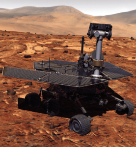
Remotely controlled rovers are used to test and practice complex tasks in Mars-like desert environments. (Artist’s Rendering: Stocktrek Images_Stocktrek Images_Getty Images)
DS: Our time servers are equipped with high-quality precise internal time references such as OCXOs or atomic clocks and then disciplined by external references such as GNSS. They are resilient because they can operate precisely for long periods in GNSS-denied situations as standalone devices in holdover mode or from multiple alternative references, such as:
network-based NTP, PTP and PTP WR time services
wireline references from IRIG, 1PPS or ASCII time code
LEO PNT reference from the STL signal
eLoran when available
They are also resilient because they detect and mitigate interference from the GNSS signal before it can corrupt the PNT solution.
Our GNSS simulators are adding alternative PNT features to provide a complete test and evaluation solution for resilient PNT systems. We have recently added INS/IMU test features and have integrated with Anritsu’s cellular test stations to evaluate and qualify combined GNSS/cellular location functions. Orolia GNSS simulators support generation of custom GNSS signals and playback of IQ waveforms, and provide complete toolsets for GNSS jamming and spoofing testing. This allows creation of the threat environment to allow evaluation of alternate PNT signals as backup or alternative to GNSS. Orolia offers an open-source framework allowing any end user to develop their own sensor plug-in leveraging the Skydel simulation engine.
Our Resilient PNT for Defense product line includes the VersaPNT, which uses alternate non-GNSS PNT sensors such as IMUs, barometers, wheel ticks, INS and non-GPS-based LEO satellites. Alternate RF navigation or non-GNSS sources of radio frequency (RF) are of interest in highly degraded or contested signal environments. Interest is focused on low-Earth-orbit (LEO) constellations. These systems offer high receiver signal power (relative to GNSS) and a secure and resilient link to augment GNSS.
MN: All our products are designed to answer to challenging GNSS conditions, starting with our Ellipse series, which includes an industrial-grade IMU capable of coping with short-term GNSS outages. Its miniature size allows integration in robotics and also makes it suitable for cost-sensitive applications. Our Apogee and Horizon series, with their navigation-grade IMUs, are the most resilient systems in the event of GNSS outages. These products reach very high-end performance in real time, but become exceptional when used with our post-processing software Qinertia. Tightly coupled algorithms make the solution capable of coping with long-term GNSS outages.
JA: We have previously created solutions using retroreflective strips for path following with driving robots. and we are also compatible with Locata’s system, a large infrastructure solution popular for automation in shipping ports. More recently, we have released an offering for UWB in an integration with Pozyx. This is perfect for GNSS-denied environments as a direct replacement for what GNSS can provide in terms of position information. We are also exploring alternative ways to synchronize clocks and get timing information. This year we have developed PTP functionality on all of our devices. Alternative PNT is going to be vital as we look to the future of navigation and thinking about how we can navigate flawlessly anywhere and address more complex environments, particularly urban areas.
CS: We are focused on the provision of terrestrial low-frequency equipment and systems for primary, co-primary, alternative, complementary and backup PNT. We provide all the products and services required to design, develop, install, certify, operate and maintain Loran-C, eLoran and LFPhoenix equipment and systems. We provide the technology to perform coverage diagrams and site surveys; all the equipment required at a transmission site; all the equipment required at a differential reference station or quality-of-service site; all the equipment required for a monitor and control site; ASF measurement and analysis equipment; and various models of end-user equipment (including receivers and antennas) for the timing/frequency, maritime, aviation, land-mobile and handheld markets.
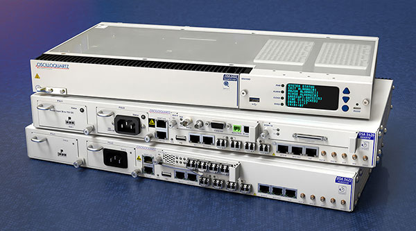
Successful eLoran field trial using ADVA’s OSA 5420 Series demonstrates same accuracy and stability as GPS with much-improved resilience
UrsaNav and ADVA have conducted an enhanced long-range navigation (eLoran) field trial using UrsaNav’s eLoran receiver and ADVA’s Oscilloquartz grandmaster clock technology. The successful demonstration shows that eLoran offers a robust and reliable backup for GPS and other GNSS, and could be used to provide an assured position, navigation and timing (PNT) service.
The trial follows U.S. PNT Executive Order 13905 aimed at strengthening national resilience through PNT services, including protecting critical infrastructure such as electrical power grid and communication networks from rising cyber threats. By harnessing ADVA’s flexible OSA 5420 series, designed with assured PNT (A-PNT) technology, UrsaNav has shown that eLoran can provide a new layer of protection and significantly boost timing resilience and security.
“The success of this field trial demonstrates how eLoran, as part of ADVA’s assured PNT solution, can serve as a crucial backup for GPS,” said Charles Schue, CEO, UrsaNav. “We have shown how our technology enables ADVA’s grandmaster clock to receive UTC timing from the eLoran system for a period of several days with the same accuracy and stability as GPS. Of course, this capability is extensible to other GNSS as well. eLoran is far less vulnerable to unintentional jamming and spoofing disruptions or intentional attacks, thereby delivering nanosecond precision with even more resilience.”
“By partnering with ADVA, we’ve been able to show that our eLoran receiver interoperates with the best network timing toolkit available,” Schue said. “The OSA 5420 Series is a great product — highly efficient and easy to operate. Together with ADVA, we’re paving the way for tomorrow’s more robust assured PNT synchronization architecture. Now that UrsaNav has demonstrated the power of our OSA 5420 Series to utilize eLoran in the event of outages, we have another very important tool to ensure the quality and availability of time-sensitive services.”
UrsaNav’s latest trial used the OSA 5420 series grandmaster clock with built-in GNSS receiver. Timing stability from GPS was measured for several days. This was then replaced with eLoran for the same period with no loss of stability.
The test was conducted indoors where GNSS signals are not usually available, potentially extending the availability of precise UTC timing to many more environments.
“Commercially available GNSS jammers and spoofers are easy and cheap for attackers to acquire,” explained Nir Laufer, VP, product line management, Oscilloquartz, ADVA. “That’s part of the reason why we’re seeing a growing number of incidents across the world of blocked or misleading signals. If power utilities, enterprises, service providers and governments continue to rely on GNSS alone, it’s only a matter of time before the consequences become very serious. That’s why we’re committed to tackling GNSS vulnerabilities with advanced technologies like our ePRTC offering, cesium atomic clocks and our optical timing channel solution. Now that UrsaNav has demonstrated the power of our OSA 5420 series to utilize eLoran in the event of outages, we have another very important tool to ensure the quality and availability of time-sensitive services.”
The demo showed how ADVA’s synchronization technology enables protection for critical infrastructure that needs ultra-reliable aPNT solutions. (Photo: Business Wire)
In separate letters to members of the House of Representatives and the Senate, seven companies and a non-profit urged Congress to support alternative positioning, navigation and timing systems (PNT) with the “necessary funds and other appropriate policy tools.”
The letters focus on and endorse the system-of-systems approach outlined in the Department of Transportation’s (DOT) recent report to Congress on the results of its GPS Backup Technology Demonstration. The report found an adequate and robust American PNT system should include space-based L-band signals, low-frequency (LF) and ultra-high-frequency (UHS) signals, and fiber connections between the terrestrial LF and UHF transmitters.
“Our country depends on GPS for critical infrastructure, and there is an urgent need for resiliency being built into our critical infrastructure. Before the report came out, some of us had different ideas of how the U.S. should go forward,” said Ganesh Pattabiraman, CEO of NextNav. “But the DOT report provided the data to make it very clear that it is a combination of technologies that need to come together to truly enable nationwide backup to GPS, and it was good to see we could get industry alignment on the findings.”
The letters describe many of the threats to GPS, both natural and malicious; its vulnerabilities; and the dire consequences of disruptions. They go on to state that robust, more reliable PNT is needed for emerging and future systems like E911, 5G, resilient electrical grids, drones and other automated systems.
Monty Johnson, CEO of OPNT, a provider of time-over-fiber services, praised the findings of the DOT report. “The key to resilience and reliability in a system-of-systems is including technologies that deliver the same information using starkly different means. It is hard to imagine a combination of technologies that are more diverse than fiber, satellites, LF and UHF.”
According to Pattabiraman, the signers of the letter agree that the DOT report made clear that there are mature technologies available today that can address the GPS backup issue. DOT and Congress now have the data to act to enable a much-needed resilient infrastructure for the country.
Dana A. Goward, president of the non-profit RNT Foundation, agreed. He also observed that deciding on the technologies and congressional funding were important, but only first steps. “The goal of this effort is not to just implement systems,” he said. “it’s to make America safer. Establishing the services quickly and efficiently will be key, as will ensuring they are widely adopted.”
“Protecting the nation from the consequences of a space-based PNT disruption will require that these systems be accessed and used by a wide variety of users from first responders and delivery services, to all forms of critical infrastructure,” Goward said. “This means the government will need to eliminate as many barriers to adoption as possible. One or more of these alternatives has to be available to every American. And a basic level of service has to be free, just like the GPS utility it is reinforcing. Fortunately, we estimate this can be done relatively inexpensively. It will be only a small fraction of the $1.7B we spent on GPS last year.”
The alternative to making this relatively modest investment, according to Goward, is unacceptable.
“There are lots of threats to GPS,” he said. “Take the sun for example. The most recent study I saw estimates a 70% chance solar activity will damage the GPS constellation in the next 30 years and a 20% chance it will destroy a big part of it. And the sun is just one of the threats we face. We can’t keep playing this kind of Russian Roulette with the fate of our nation. Especially when other countries like Russia and China have already taken steps to protect themselves with terrestrial systems.”
A copy of the letter sent to Senators can be found here, and the one to members of the House of Representatives here.
A new paper by two Qualcomm engineers imagines restructuring Loran technology to more easily incorporate timing signals into telecommunication systems.
The paper, titled simply “LORAN-5G,” was authored by Guttorm Opshaug and Dave Tuck. It envisions moving away from legacy pulsed signals to a more continuous wave form which would allow significantly lower power transmissions.
According to Opshaug, “Another big advantage that may not be as apparent, is the built-in orthogonality in the signal structure of OFDM. This means that a receiver would be able to detect very weak signals from distant towers at the same time as receiving signals from a very strong close tower. Such robustness towards near-far effects is critical for terrestrial navigation use.”
Another change would be a marked increase in the capacity of the Loran data channel to more than 2.6kbps. “This could open opportunities for additional service options and/or reduce latency of existing ones,” according to Tuck.
UrsaNav CEO, Charles Schue, expressed great interest in Qualcomm’s paper. UrsaNav is a long-time provider of Loran equipment and consulting. “The intersection of PNT and communications discussed in the Qualcomm paper is exactly what is needed to ensure that PNT systems evolve and stay relevant,” he said. “In fact, we build our software defined transmitter and receiver solutions to specifically include the ability to produce and use these types of signals.” A Cooperative Research and Development Agreement between UrsaNav and the Department of Homeland Security demonstrated these type of potential upgrades in 2012.
This paper is the first publicly released effort examining the use of Loran technology to support 5G telecommunications. The general concept was discussed in a 2016 paper by the Alliance for Telecommunications Industry Solutions’ (ATIS) Synchronization Committee. Based on the paper, ATIS in 2017 encouraged members of Congress to pass legislation that would become the National Timing Resilience and Security Act of 2018 (NTRSA).
There are tradeoffs. Opshaug and Tuck’s proposal would replace the legacy Loran standard signal with a new one.
“I was in the midst of developing proposals for the 3GPP standards organization when I first heard about the NTRSA,” said Opshaug. “5G seemed like exactly the kind of critical infrastructure that could benefit from a backup timing solution.”
“We wanted to bring some of the ideas used to develop 5G position and timing to Loran,” said Tuck. “Using Loran as the timing synch could enable 5G to improve overall infrastructure resilience.”
Yet, as with most things, there are tradeoffs. Opshaug and Tuck’s proposal would replace the legacy Loran standard signal with a new one. This would require redesign of receivers and some transmitters. The proposal could support denser deployments to further improve resiliency.
“The new signals seem incompatible with existing receivers and Loran networks,” according to Professor Jiwon Seo of South Korea’s Yonsei University. South Korea is upgrading its Loran-C network to the eLoran standard. The new South Korean system will be compatible with neighboring Russian and Chinese Loran systems, so users will be able to benefit from signals anywhere in East Asia. Until 2010 signals from the U.S. Loran system cooperated with these networks as part of the Far East Radionavigation Service (FERNS).
Navigation expert Logan Scott is intrigued by the proposal but observes that more work needs to be done. “This is an interesting waveform,” he said, though he had questions about the propagation channel, antennas, and possible distortion.
The authors acknowledge that much more needs to be done, including better determining timing and positioning accuracy.
Yet they and others see potential in combining the very different phenomenologies of low frequency, 100KHz Loran and 5G telecommunications which typically operate in the gigahertz range.
Opshaug and Tuck’s paper LORAN-5G can be accessed here.
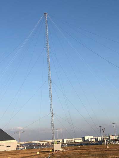
The eLoran transmission site at Incheon, South Korea. (Photo: UrsaNav)
South Korean is in the early stages of evaluating its eLoran system, but great results are expected based on the UrsaNav-supplied station in Incheon.
In August 2018, the Korea Research Institute of Ships and Oceans Engineering (KRISO) awarded UrsaNav, through its agent Dong Kang M-Tech, a contract to supply and install an eLoran transmitter testbed system in South Korea. UrsaNav is the exclusive, worldwide distributor of Nautel’s NL Series transmitters, provided eLoran transmitter technology, as well as timing, control and differential reference station equipment for the testbed. The contract represented the first phase in a broader program to upgrade Korea’s Loran-C stations to be the foundation of a sovereign Enhanced Loran (eLoran) positioning, navigation and timing (PNT) service.
“The Republic of Korea recognizes the challenges associated with relying solely on space-based signals, the relative ease with which those signals can be jammed or spoofed, and the necessity to provide trusted time and trusted position to its citizens and critical national infrastructure,” said Charles Schue, CEO of UrsaNav.
The 35-meter eLoran transmit antenna in Incheon. (Photo: UrsaNav)
Many critical infrastructure sectors rely on accurate time and position, including maritime, aviation, electrical distribution, telecommunications, finance/banking, and digital broadcast. A complementary PNT (CPNT) service provides continuity of operations through alternative and diverse timing and positioning information. CPNT is a vital element in ensuring national security and assuring trusted time and position.
KRISO, in conjunction with the Korea Ministry of Oceans and Fisheries (MOF), is developing an Initial Operating Capability eLoran system to provide complementary PNT services as a part of its Electronic Navigation (E-Navigation) mission. KRISO selected UrsaNav Inc. as its prime eLoran systems contractor through a competitive tender offer.
UrsaNav provided, installed and tested an eLoran transmission system at a temporary location near Incheon, South Korea, in November 2019. The company also provided ancillary equipment for Additional Secondary Factor (ASF) map measurements and map-generation software, as well as differential reference station equipment to KRISO. Because of land size restrictions at the temporary site at Incheon, the eLoran transmission system was paired to a small footprint 35-meter top-loaded monopole antenna.
In addition to the equipment provided by UrsaNav, MOF separately contracted a local Korean firm to provide an interim GPS receiver set to synchronize the existing Loran-C sites at Pohang and Kwangju to UTC.
KRISO is in the early stages of measuring the performance of the Korea eLoran system, but results are expected to show better than 20-meter navigational accuracy within 30 kilometers of the differential reference station at the port of Pyeongtaek.
Once the eLoran performance has been proven, MOF plans to move the Incheon eLoran equipment to a permanent site, potentially on the island of Socheongdo, and pair it with a larger “Tee” antenna to increase the output power and coverage area of the system.
MOF also plans to upgrade the existing UTC synchronized Loran-C transmission sites at Pohang and Kwangju with new eLoran transmission equipment systems. The ministry will potentially add two additional transmission sites to provide complete coverage of the land and territorial waters of South Korea.
The U.S. Department of Transportation awarded contracts to 11 companies to demonstrate their technologies’ ability to act as a backup for GPS.
We wanted to know a bit more about what each of them were going to demonstrate, so we asked each for an explanation. Most provided just that, so much of what appears here is in their own words. A couple of companies sent us a whole lot more than 100 words and two did not respond. For those, we did our best with the materials they sent us and other publicly available materials.
Wi-Fi, Cellular, Ultra-Wideband
PhasorLab plans to demonstrate its Hyper Sync Net (HSN) technology as a backup to GPS-based PNT solutions. HSN is a self-organizing mobile mesh network capable of maintaining high-precision time (<<1 ns) and frequency (<<1 ppb) synchronization throughout the whole network as well as an instantaneous 3D locational map of the whole mesh network requiring as little as a single master reference node.
The HSN can be deployed either as a set of fixed reference nodes providing time and positioning references to other mobile UE clients, which is like a terrestrial version of GPS, or as a private ad-hoc mobile mesh network where all members are expected to be mobile.
Skyhook Technology’s system is powered by an immense database — created and maintained by Skyhook — that contains more than five billion geolocated access points and 200 million cell base station IDs, enabling it to accurately locate phones and devices worldwide. The user is not required to be connected to a Wi-Fi network for the system to work. The scan will simply detect Wi-Fi access points in the local area based on signals sent periodically (or on demand) according to the IEEE 802.11 specifications. Many devices will acquire information on as many as 100 access points in the surrounding area. Skyhook’s Wi-Fi positioning system (WPS) will compute an estimated end-user location based on each of the signal sources independently, and compute an optimal hybrid location estimate from all sources.
Fiber/Network
OPNT’s Global Terrestrial Timing Service (GTTS) provides GPS-independent timing-as-a-service over global fiber-based networks. Trading off cost versus service-level agreement (SLA)-backed accuracy, standard network connectivity offerings and bidirectional fibers are combined to meet application needs. As will be demonstrated with simulations of National Institute of Standards and Technology (NIST) and the two U.S. Naval Observatory (USNO) clocks, OPNT’s fully redundant solution receives its core Coordinated Universal Time (UTC) timing directly from the non-maskable interrupts (NMIs).
The demonstration will include sub-nanosecond stability with fault detection and glitchless recovery. Using the precision-timed fiber base, OPNT will also demonstrate precision monitoring of wireless signals with continuous, real-time corrections to keep the wireless transmissions and its local timing source in sync.
Seven Solutions’ core technology is called White Rabbit and was born at CERN. In this demonstration, Seven Solutions plans to showcase the performance of this technology, both on local and wide-area deployments, and explain the capabilities in terms of interoperability (integrating multiple synchronization technologies, i.e. IEEE 1588 PTP, NTP, PPS, 10-MHz clocks), scalability and resiliency. The goal is to provide a reference technology that can provide very stable time references over fiber in GPS-denied scenarios as a backup source or to complement other PNT solutions that need timing distribution at their core.
eLoran
Hellen Systems’ team said it is excited by its recent contract award to perform a GPS back-up demonstration for the Department of Transportation. Its team plans to demonstrate advanced eLoran technologies and offer resilient PNT services. Its next-generation solution will include a solid-state eLoran transmitter from Continental Electronics Corp. integrated with advanced timing and frequency products from Microsemi, a Microchip company. Hellen Systems also plans to deploy its proprietary receiver and reference systems developed by Microsemi.
Hellen Systems and program integrator L3Harris will manage the demonstration, with Booz Allen Hamilton providing technical and engineering leadership.
UrsaNav supplies eLoran, LFPhoenix and low-frequency technology for very wide-area, GPS-independent, PNT data and frequency services. UrsaNav was selected by the Volpe Center to demonstrate wide-area UTC time synchronization and distribution utilizing the former Loran site in Wildwood, New Jersey. UrsaNav will provide innovative new eLoran technology at the site in Wildwood to broadcast a UTC-synchronized eLoran signal. The demonstration will be conducted at one of the Volpe Center demonstration sites at Joint Base Cape Cod in Massachusetts or the Langley Research Center in Langley, Virginia. Either site can be utilized in the demonstration as eLoran signal transmissions from the Wildwood site can easily cover 700 miles or more.
Serco recently acquired Alion’s Naval Systems Business unit. This included a group working in New London, Connecticut, that has previously worked with and published on eLoran. While we did not get a response from Serco to our inquiry, eLoran is likely the technology the company will demonstrate.
Satellite
Globalstar-Echo Ridge’s system is based on Augmented Positioning System (APS) technology that uses ordinary signals from communications satellites (not special positioning/navigation signals, such as those from GPS satellites) to produce accurate position and timing information in compatible user devices. No new infrastructure is needed; Globalstar’s constellation of 24 low-Earth-orbit (LEO) satellites and Echo Ridge software and compatible devices at the user end provide the building blocks for the APS-based system. APS technology has been successfully demonstrated in diverse environments and incorporates multiple features to assure accurate PNT information under circumstances that can challenge or disable GPS/GNSS technology.
Satelles provides unique timing and location solutions delivered over the Iridium constellation of 66 LEO satellites. These timing and location signals are available anywhere on Earth without the need for local infrastructure, making the system perfect for complementing GPS and other location-based technologies.
Unlike standard GPS, these high-power signals can reach into many building structures. Most importantly, Satelles has customized the Iridium signal-in-space to provide a location-specific signature that can reliably prove (or authenticate) the location of a mobile device or other equipment, while being virtually impervious to spoofing and other attacks.
TRX Systems’ NEON Personnel Tracker provides ubiquitous 3D location, tracking and mapping. (Screenshot: TRX Systems)
Other
TRX Systems is the developer of NEON GPS-denied location solutions, delivering 3D location and mapping for dismount personnel where GPS is not available or is unreliable — including indoors, underground, in dense urban areas, and where GPS is found to be erroneous. NEON delivers ubiquitous, low-cost, GPS-denied location by using advanced sensor fusion, ranging and patented dynamic mapping algorithms that improve safety and situational awareness for military, public safety and industrial personnel.
NextNav’s Metropolitan Beacon System (MBS) is a 3GPP-compliant, terrestrial network of long-range broadcast beacons, transmitting a “GPS-like” signal in licensed spectrum in the sub-GHz range. The combination of an on-board atomic clock and the ability to self-synchronize allows the system to operate independent of GPS and provide full PNT services in its footprint. The ability to integrate the MBS signal in mass-market GPS and LTE chipsets can provide a seamless ability to provide full PNT services in the presence and absence of GPS. Because of its terrestrial nature, MBS is able to work indoors, in urban environments and outdoors; for barometer-equipped devices, MBS also enables floor-level altitude determination.
The Korea Research Institute of Ships and Oceans Engineering (KRISO) has awarded UrsaNav a contract to supply an eLoran Transmitter Test Bed System in the Republic of Korea.
UrsaNav, the exclusive, worldwide distributor of Nautel’s NL Series transmitters, will provide eLoran transmitter technology, as well as timing and control equipment.
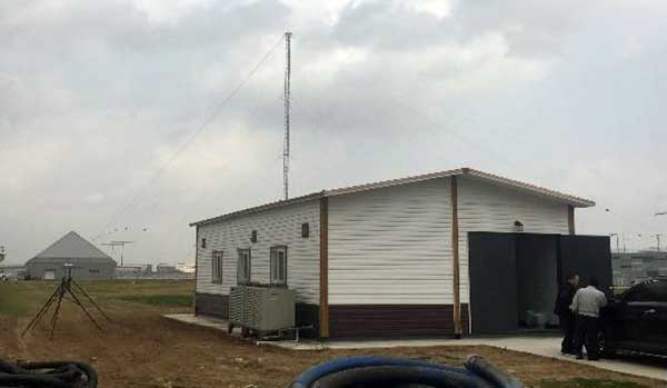
A meeting to kick off the eLoran work. (Photo: UrsaNav)
The contract, awarded through UrsaNav’s agent Dong Kang M-Tech, represents the first phase in a broader program to upgrade Korea’s Loran-C stations to be the foundation of a sovereign Enhanced Loran (eLoran) positioning, navigation and timing (PNT) service.
The Republic of Korea recognizes the challenges associated with relying solely on space-based signals, the relative ease with which those signals can be jammed or spoofed, and the necessity to provide trusted time and position to its citizens and critical national infrastructure, UrsaNav said in a press release.
The press release also included the following description of the importance of eLoran.
Accurate time and position are necessary components upon which many critical infrastructure sectors rely, including maritime, aviation, electrical distribution, telecommunications, finance/banking, and digital broadcast. A complementary PNT (CPNT) service provides continuity of operations through alternative and diverse timing and positioning information. CPNT is a vital element in ensuring national security and assuring Trusted Time and Trusted Position.
eLoran is the latest in the longstanding series of low-frequency (LF), LOng-RAnge Navigation (LORAN) systems. It meets the accuracy, availability, integrity, and continuity performance requirements for maritime harbor entrance and approach maneuvers, aviation En Route and Non-Precision Approaches, land-mobile vehicle navigation, and location-based services. It provides bearing (azimuth) information, even when the user is not moving, and has built-in integrity. Users within the coverage area can simultaneously synchronize their timing to absolute (not relative) UTC. Of equal importance is that the eLoran signal includes one or more Loran Data Channels that are available to provide one-way, low data rate, “Short Message Service” information.
eLoran is completely independent of GPS/GNSS, operates in the internationally protected 90 to 110 kHz spectrum, is built on internationally standardized Loran-C, and provides a high-power PNT service for use by all timing and navigation users. SAE International expects to release eLoran standards this year. The RTCM also has maritime-related eLoran standards underway.
eLoran is a key vertex of a Resilience Triad that would typically include space-based, terrestrial, and at least one other PNT source. It is a very-wide area (i.e., country-wide or “continental”) source of PNT that continues providing a resilient solution even when GNSS may be unavailable or untrustworthy. eLoran delivers information comparable to that of GNSS, but with completely different phenomenology. It is a very high-power, LF, pulsed transmission, whereas GNSS are low-power, UHF, multiple modulation scheme transmissions. eLoran is literally at the other end of the spectrum from GNSS, and has completely dissimilar failure modes. That is, an issue that disrupts GNSS is unlikely to disrupt eLoran. The unique characteristics of eLoran enable its use in environments where GNSS does not work very well, or at all (e.g., indoors, underwater, underground, and in mountain or urban canyons).
eLoran is exceptionally difficult to spoof or jam, and it is nearly impossible to do so at a distance. Just as equipment required to spoof and jam GNSS must mimic relatively low powered GNSS transmissions, spoofing and jamming eLoran requires very high powered transmissions. Equipment needs alone to disrupt eLoran over a significant area would be almost prohibitive for any actor other than a nation state engaged in open conflict. This is the reason that an independent assessment by researchers at Stanford University described eLoran as “for all practical purposes, unjammable” across any significant area. A MITRE paper concluded: “The analysis shows a very low probability of successfully producing operationally significant interference.”
The Wildwood transmitter is back on the air after a presumed lightning strike affected transmissions.
The transmitter stopped broadcasting at 5:35 a.m. EST on Feb. 9. Testing took place 5:35 a.m. to 8:19 EST, after which it came back on the air, reports Steve Bartlett, vice president of operations for UrsaNav Inc.
The transmitter will be taken off the air tomorrow morning (Feb. 10) so that engineers can assess and repair any damage.
The Wildwood, New Jersey, eLoran transmitter will be continuously broadcasting from 9 a.m. EST on Feb. 6 through 12 p.m. EST on March 31, announced Steve Bartlett, vice president of operations for UrsaNav Inc.
“Wildwood will be broadcasting as 8970 Master and Secondary most of the time, but occasionally may operate at other rates,” Barlett said.
The Loran Data Channel (LDC) will be undergoing testing and may be unavailable or unreliable for short periods of time Feb. 6-10, he said.